health statistics Maps
11 geographic visualizations tagged with "health statistics"
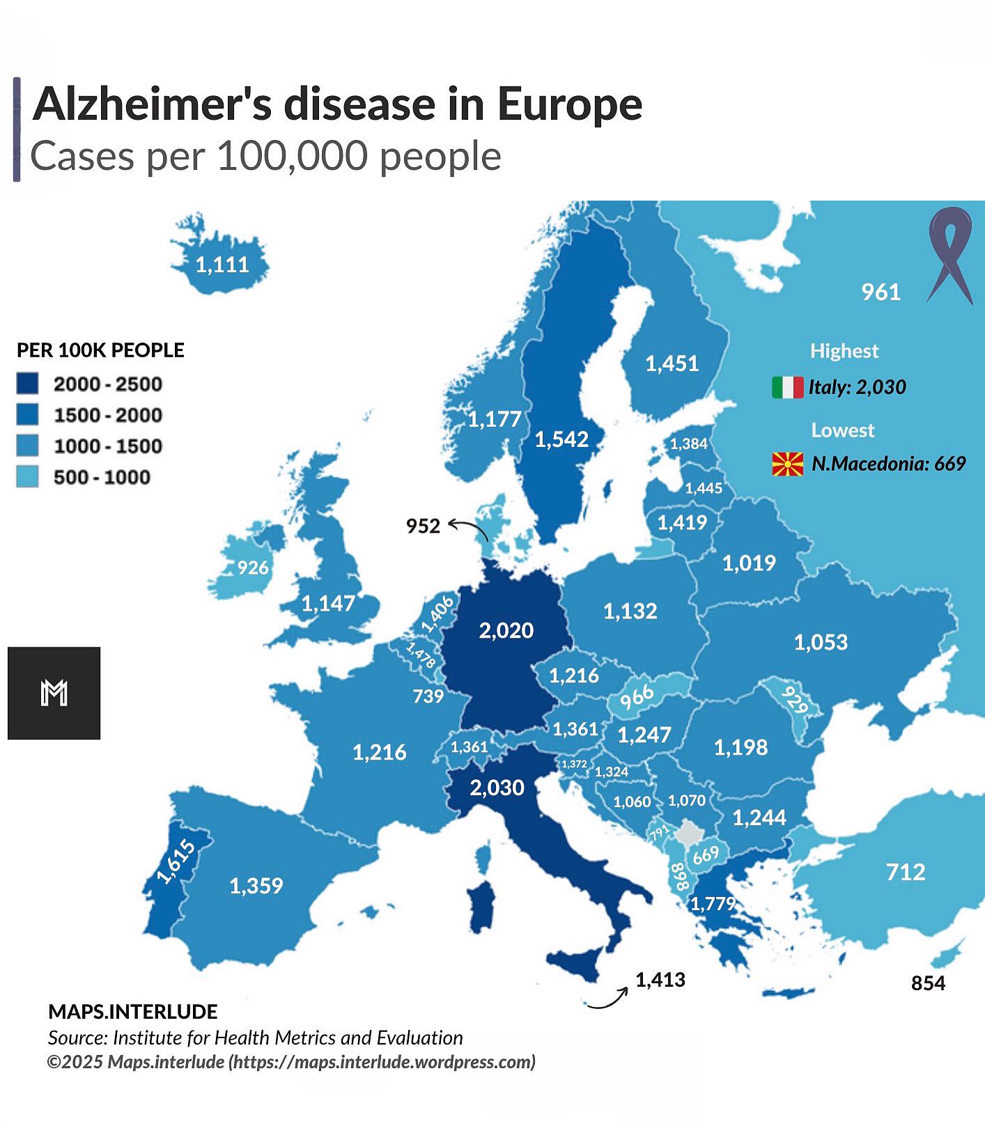
Alzheimer’s Disease Prevalence Map in Europe
The "Alzheimer’s Disease Prevalence Map in Europe" provides a visual representation of the distribution of Alzheimer’s d...
Life Expectancy in Europe Map
The "Life Expectancy in Europe Map" offers a visual representation of how life expectancy has evolved across different c...
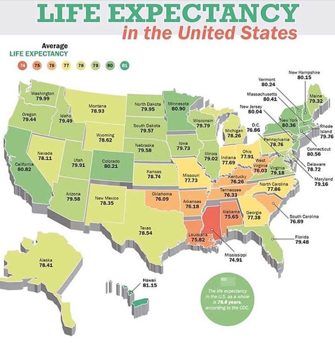
Life Expectancy by State in the USA Map
The \...
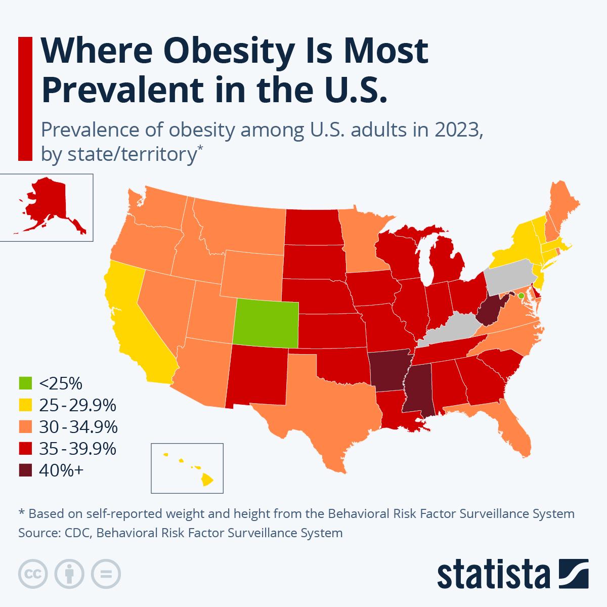
American Obesity Statistics Map
The American Obesity Statistics Map visually represents the prevalence of obesity across the United States. It highlight...
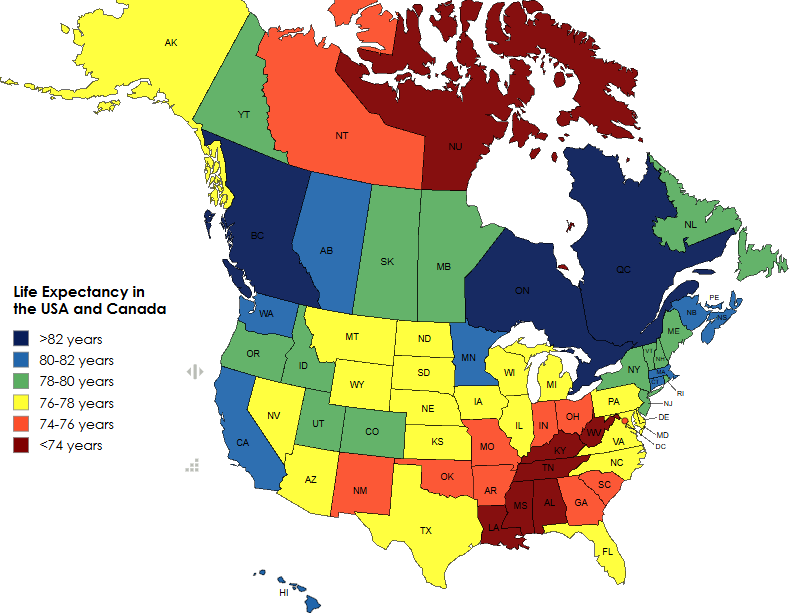
Life Expectancy in the USA and Canada Map
The 'Life Expectancy in the USA and Canada Map' provides a visual representation of the average life expectancy across v...
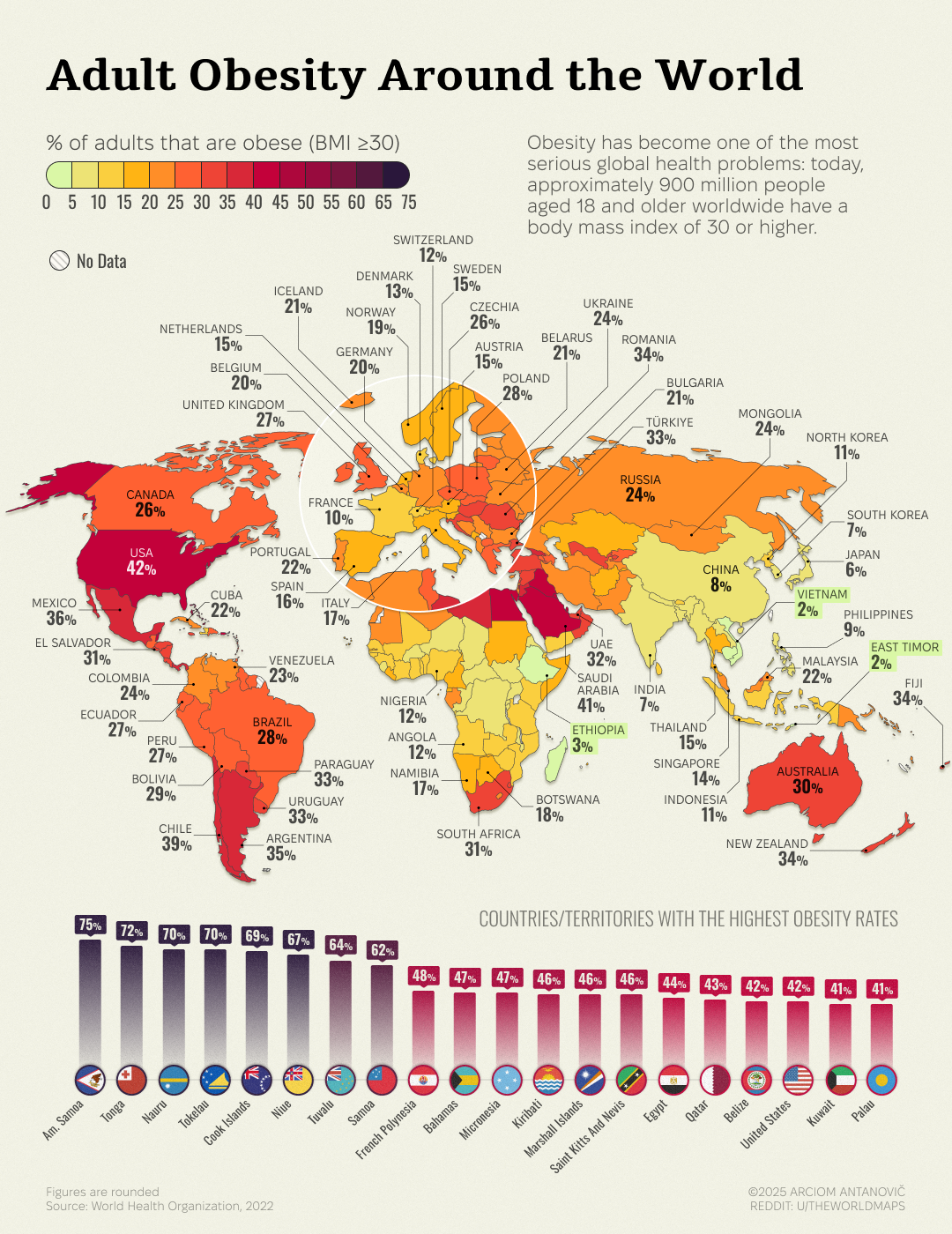
Obesity Rates Map of Adults Aged 18 and Older
This map visually represents the percentage of adults aged 18 and older who are classified as obese in various regions. ...
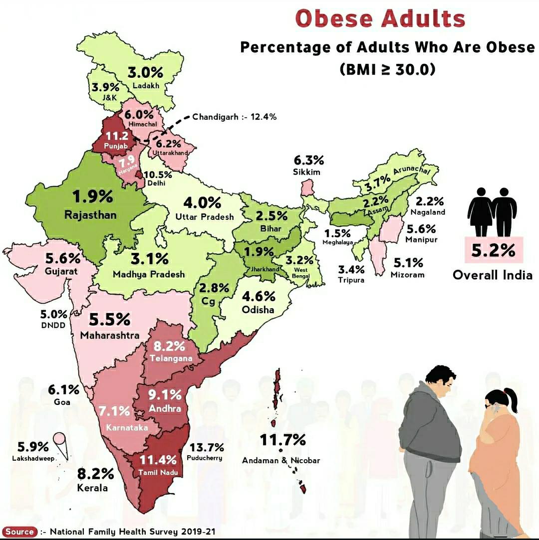
Obese Adults in India Map
The "Obese Adults in India Map" provides a visual representation of the prevalence of obesity among adults across variou...
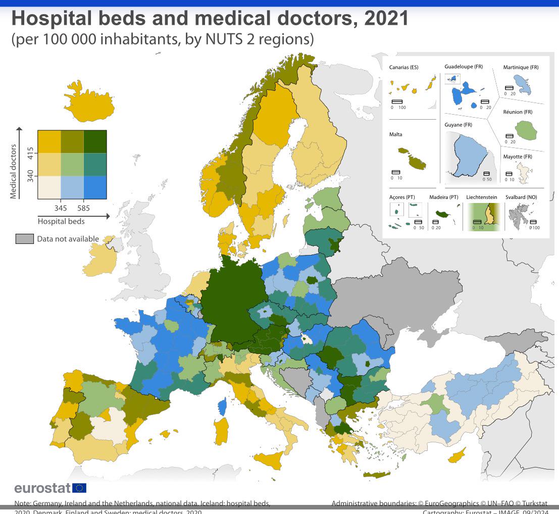
Hospital Beds and Medical Doctors per Capita Map
This map visualizes the distribution of hospital beds and medical doctors per capita across Europe, providing a crucial ...
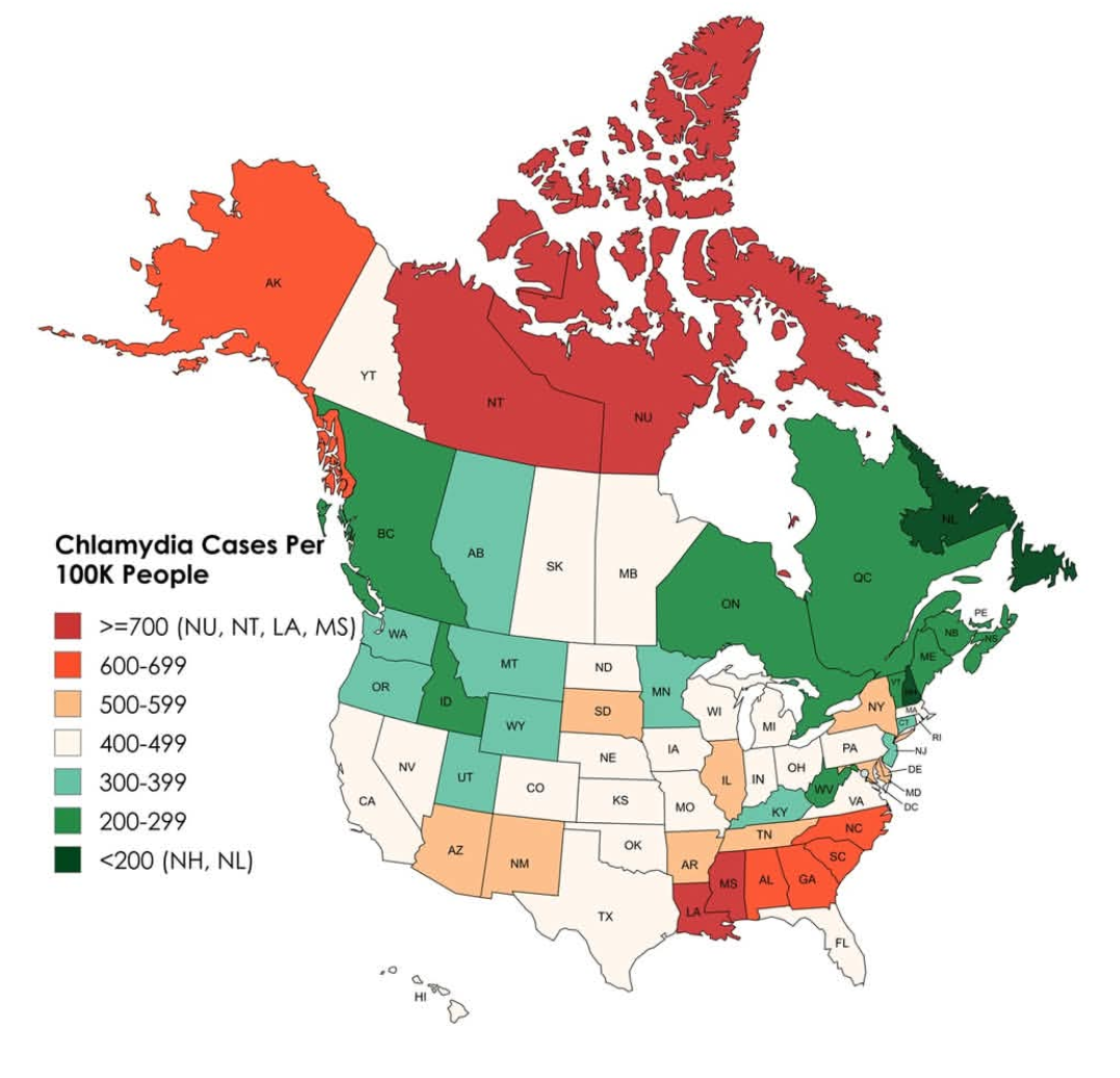
Chlamydia Cases Per 100,000 People Map
This map illustrates the incidence of chlamydia cases per 100,000 people across the United States and Canada, providing ...
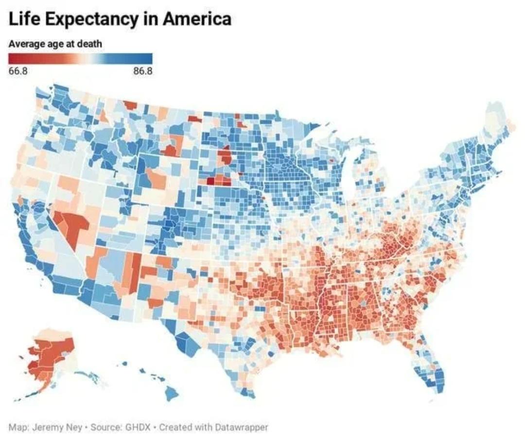
Life Expectancy in the United States Map
The "Life Expectancy in the United States Map" provides a visual representation of the average life expectancy across va...
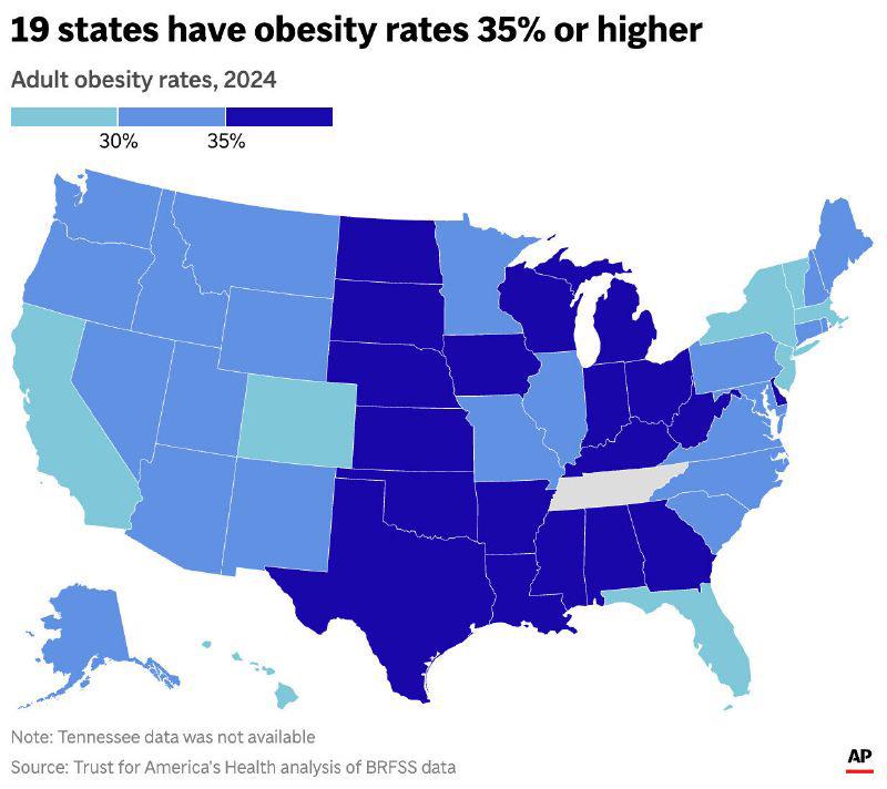
2024 US Obesity Rates Map
The "2024 US Obesity Rates Map" visualizes the prevalence of obesity across different states in the United States. This ...