germany Maps
35 geographic visualizations tagged with "germany"
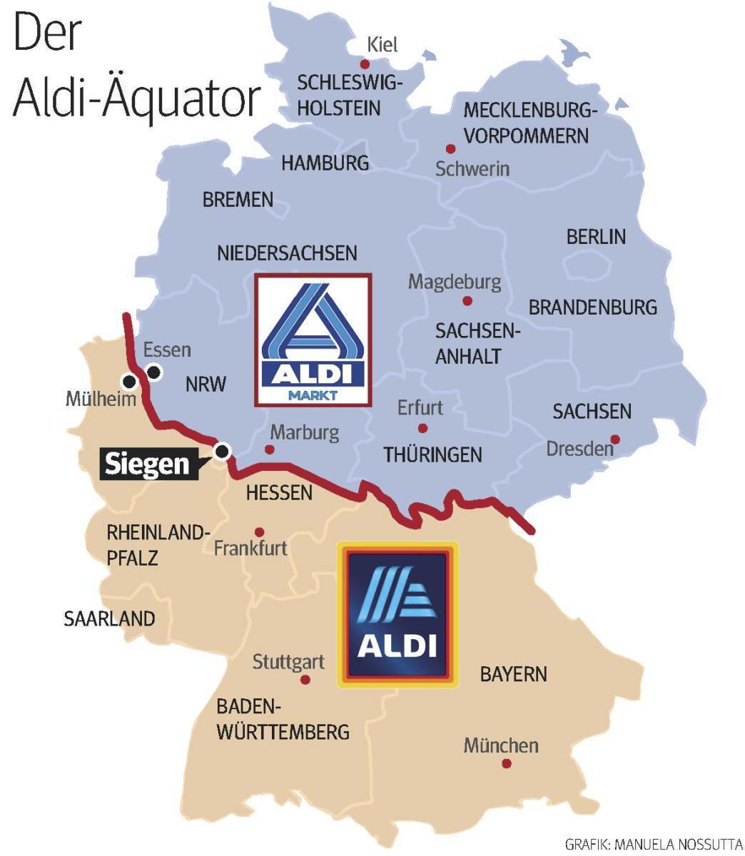
Aldi Equator Map in Germany
The "Aldi Equator in Germany" map visually represents the locations of Aldi grocery stores across Germany, highlighting ...
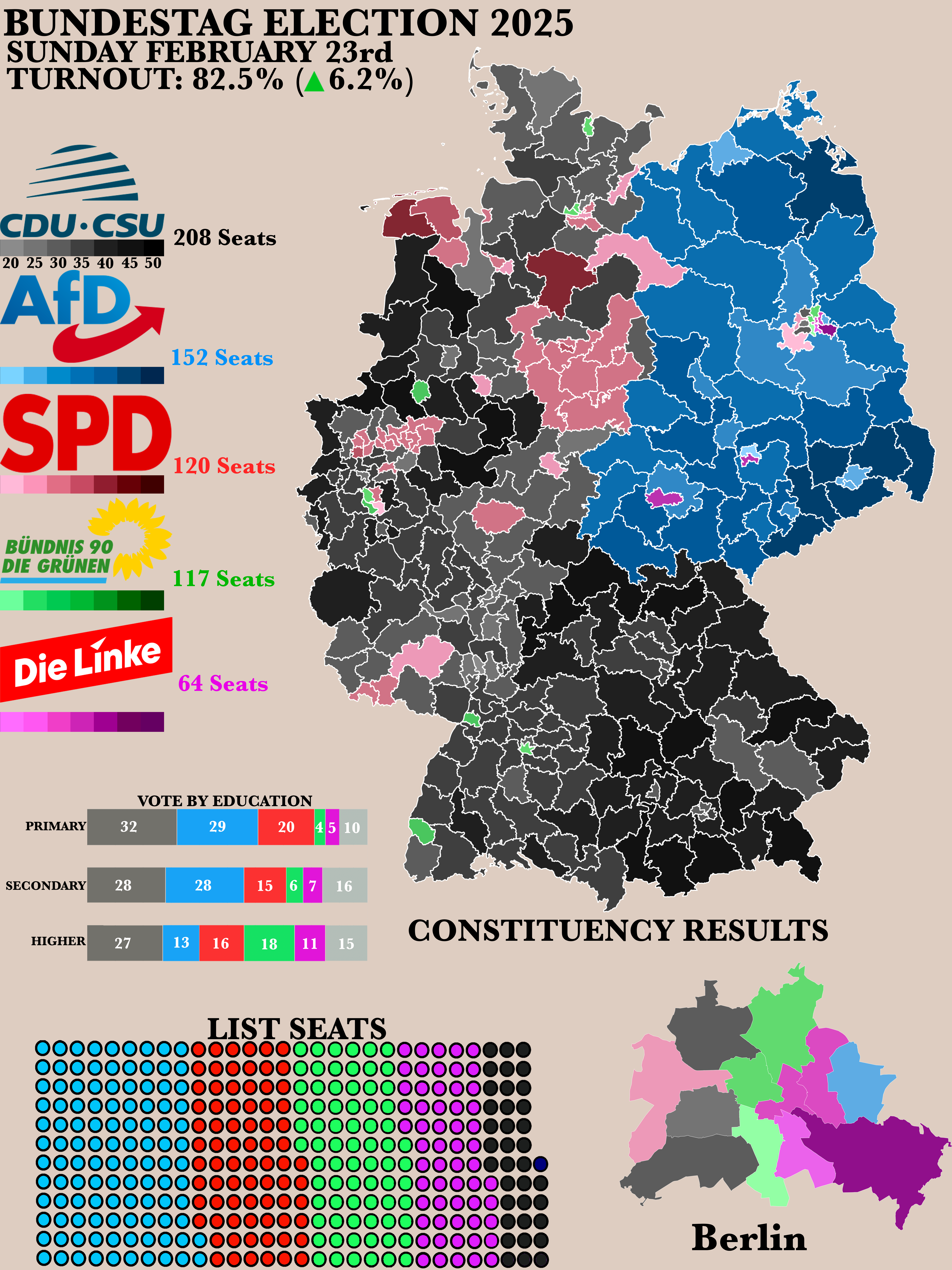
2025 German Bundestag Election Results Map
The "Poster of the 2025 German Bundestag Election Results" map provides a clear visual representation of the electoral o...
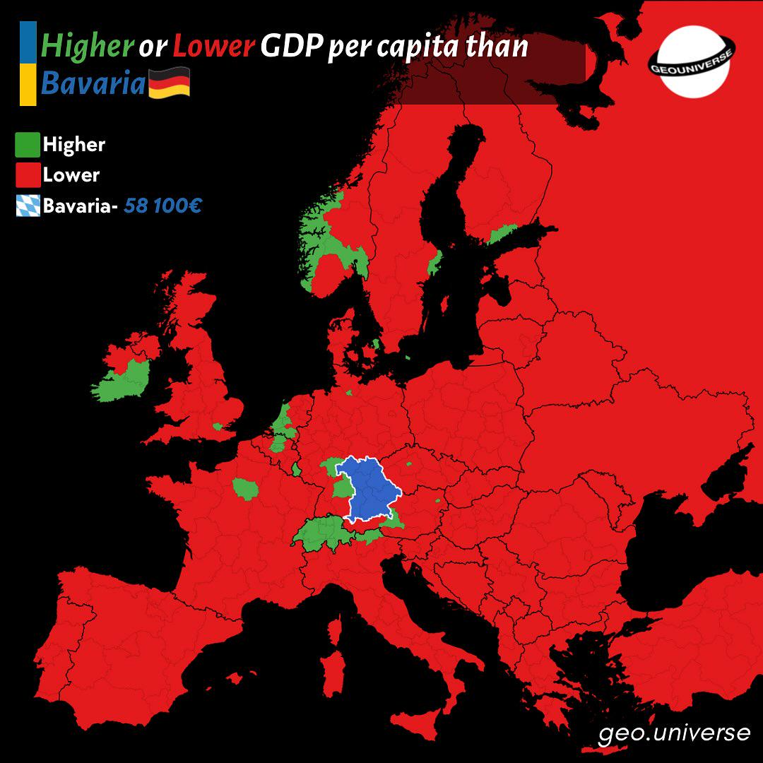
Bavaria Wealth Comparison Map to Europe
The "How Rich is Bavaria Compared to the Rest of Europe?" map provides a visual representation of the economic status of...
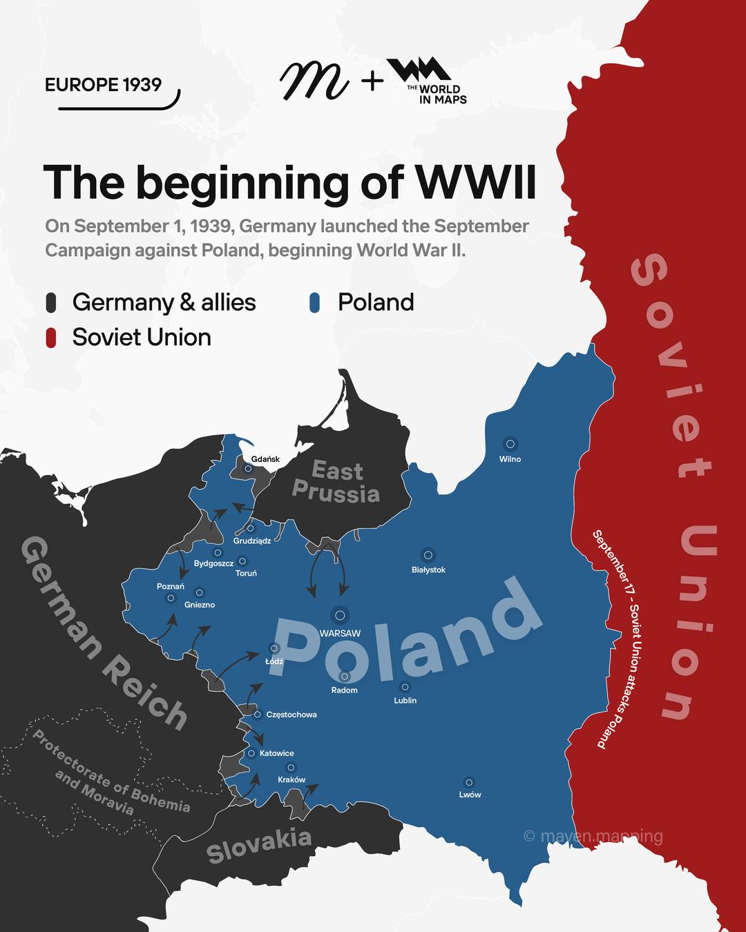
Map of Germany's September Campaign Against Poland
The map titled "On September 1, 1939, Germany launched the September campaign against Poland, beginning WW2" provides a ...

Declarations of War against Germany and Japan Map
The map titled \...
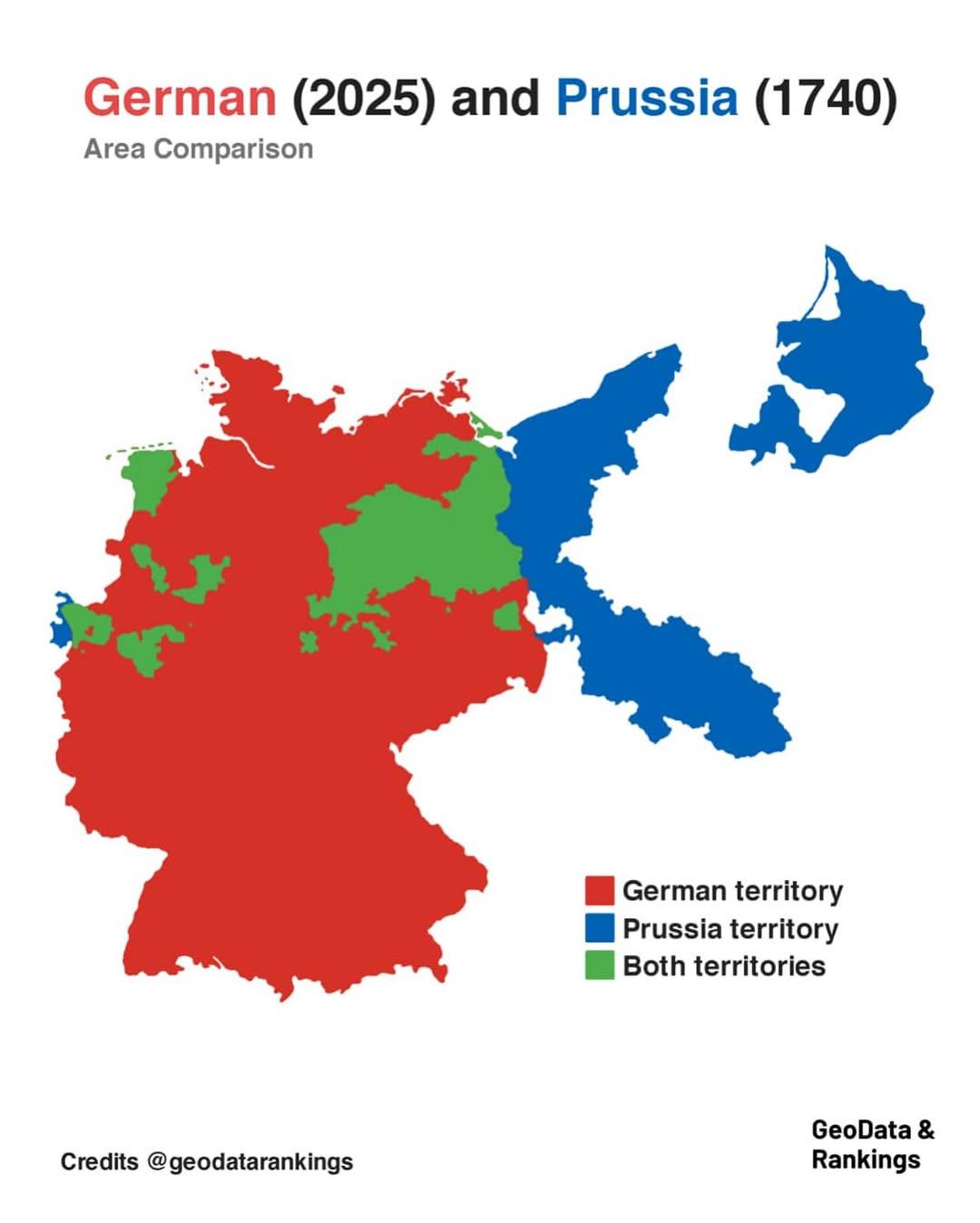
Germany and Prussia Area Comparison Map
The map titled "Germany in 2025 and Prussia in 1740 area comparison" visually represents the territorial extent of moder...
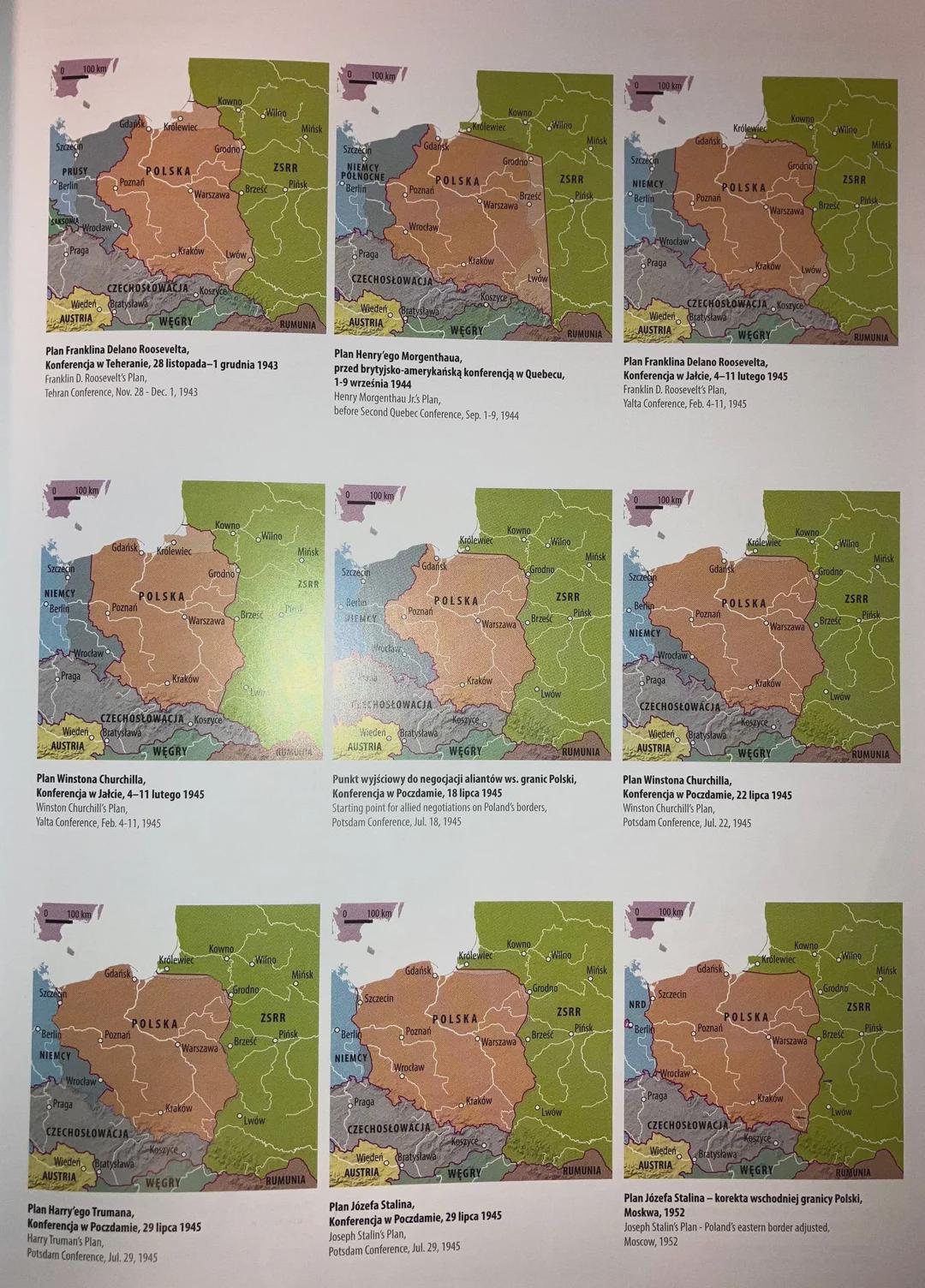
Post-War Border Proposals Map of Poland and Germany
...
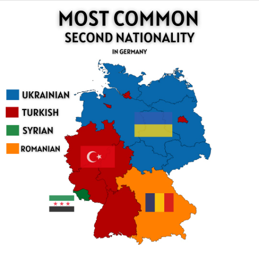
Most Common Second Nationality in Germany Map
The "Most Common Second Nationality in Germany" map provides a visual representation of the various nationalities that i...
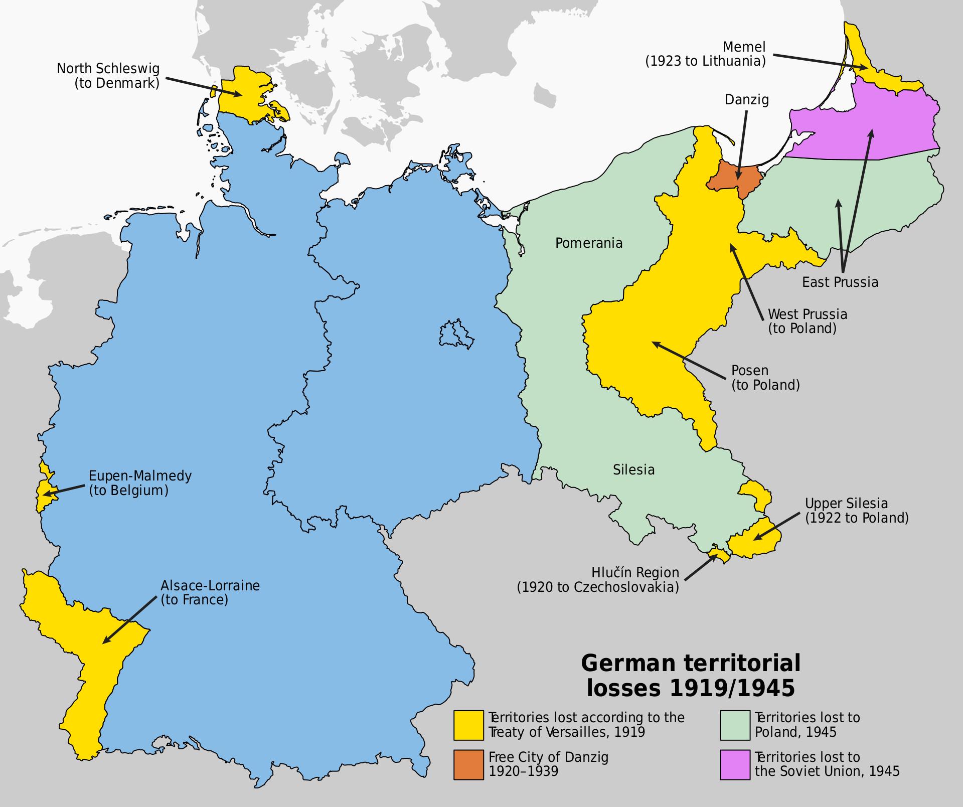
Map of Germany's Territorial Losses After World War Defeats
This map illustrates the significant territorial losses Germany faced following its defeats in both World War I and Worl...
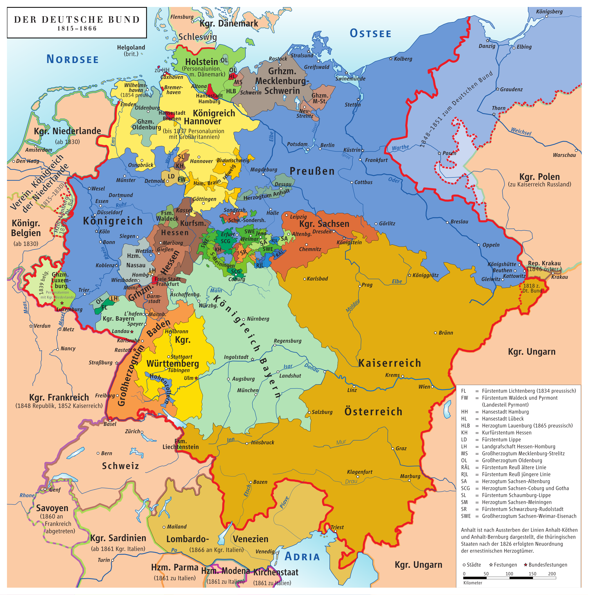
Map of Germany Before Unification (1815-1866)
This map titled "Germany Before Being Germany (1815-1866)" provides a detailed visualization of the political landscape ...
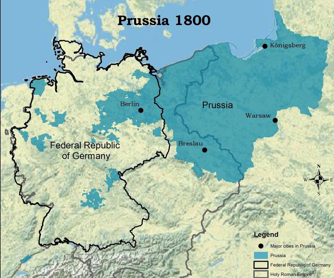
Map of Prussia in 1800 Compared to Modern Germany
The visualization titled "The Kingdom of Prussia in 1800 vs Modern Germany" presents a compelling juxtaposition of histo...
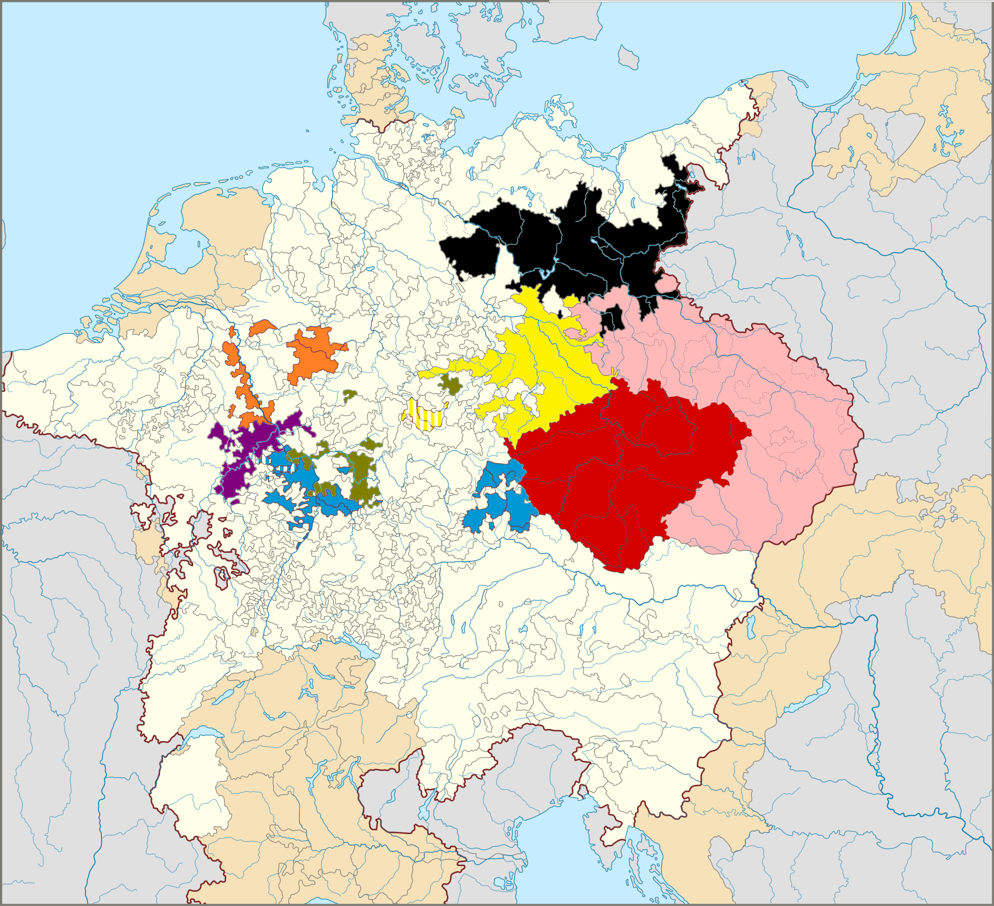
Map of The Seven Prince Electors in Germany
This map illustrates the territories of the Seven Prince Electors, who played a crucial role in the election of the Empe...
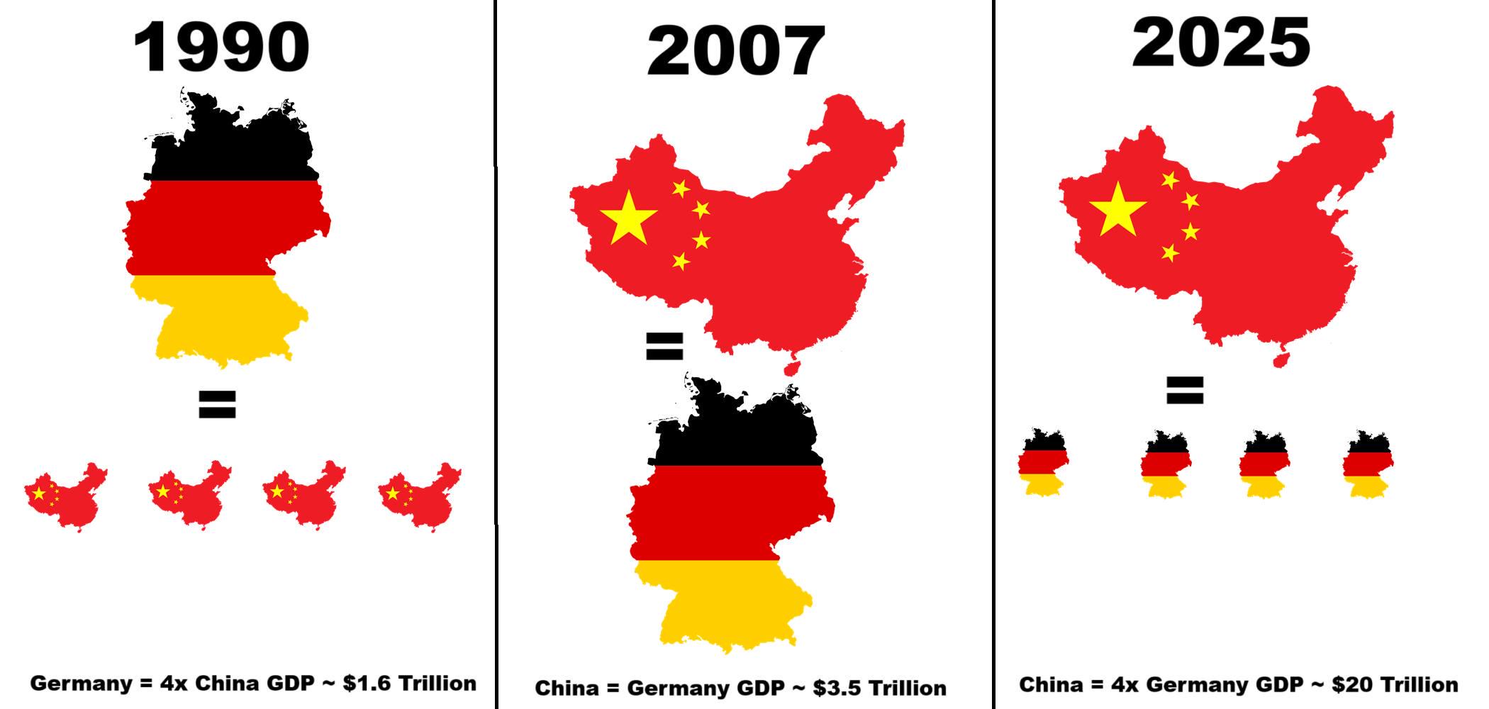
China and Germany Economy Map Comparison 1990
...
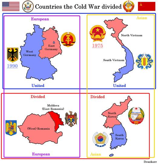
Map of Countries Divided by WW2 and Cold War
This map visually represents the geopolitical divisions of four countries—Germany, Korea, Vietnam, and Poland—resulting ...
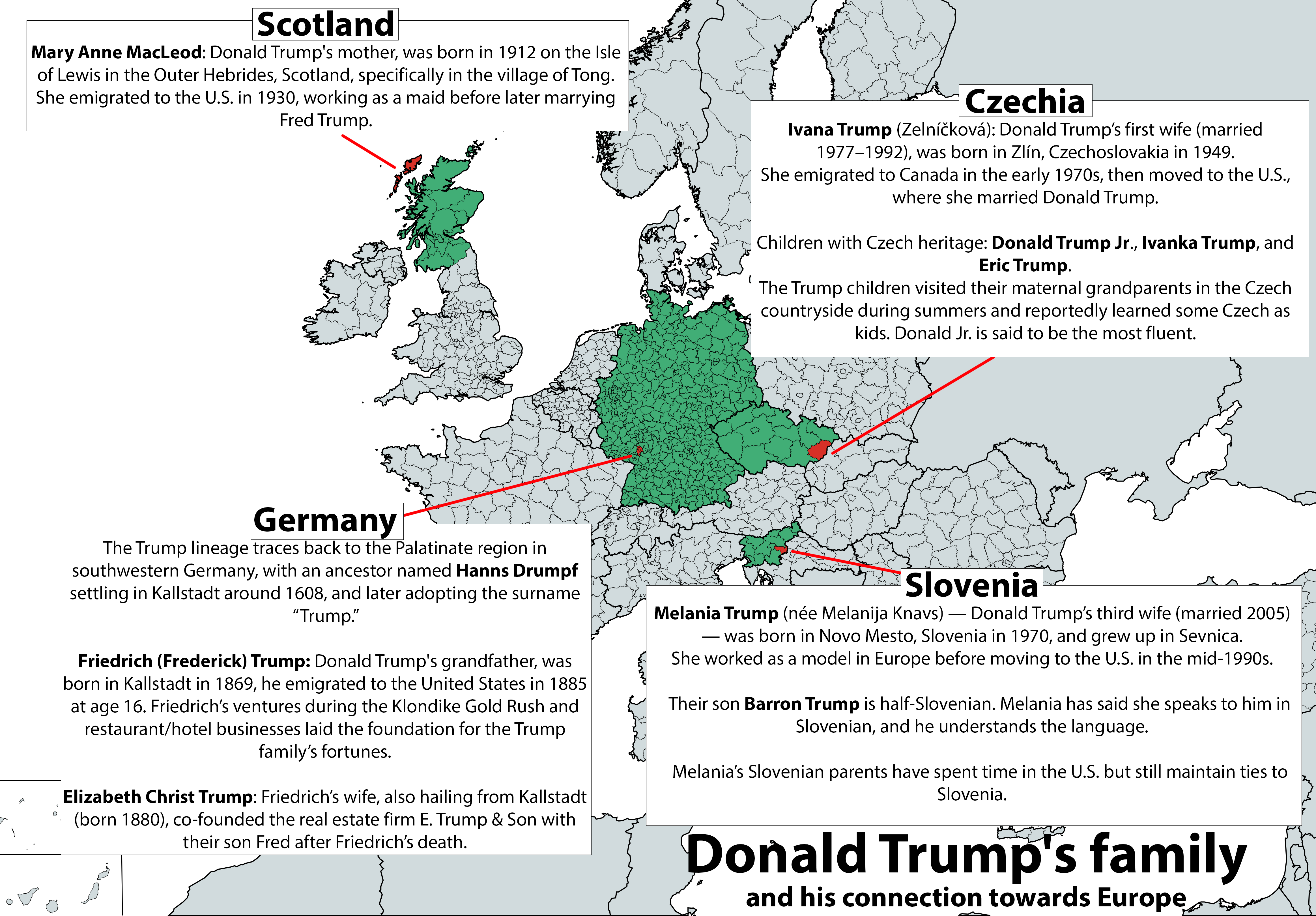
Donald Trump's Family Connections to Europe Map
The map titled "Donald Trump's Family Connections to Europe" visually illustrates the ancestral ties and familial connec...
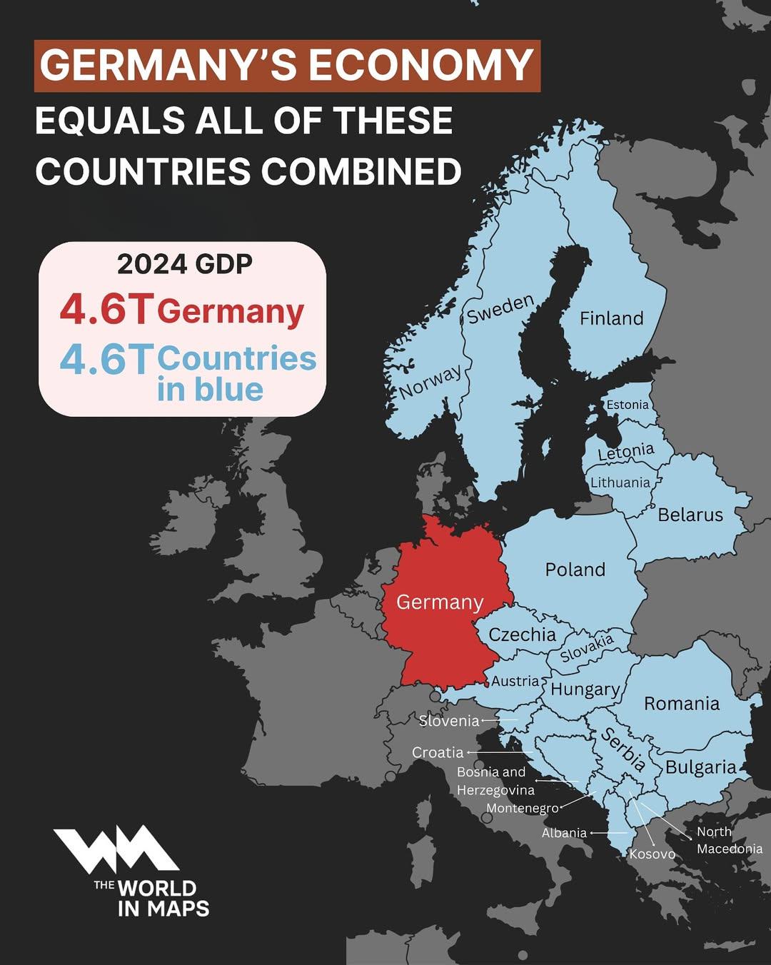
Germany's Economy Compared to Other Countries Map
This map visualizes the total economic output of Germany, showcasing how it compares to the combined economies of severa...
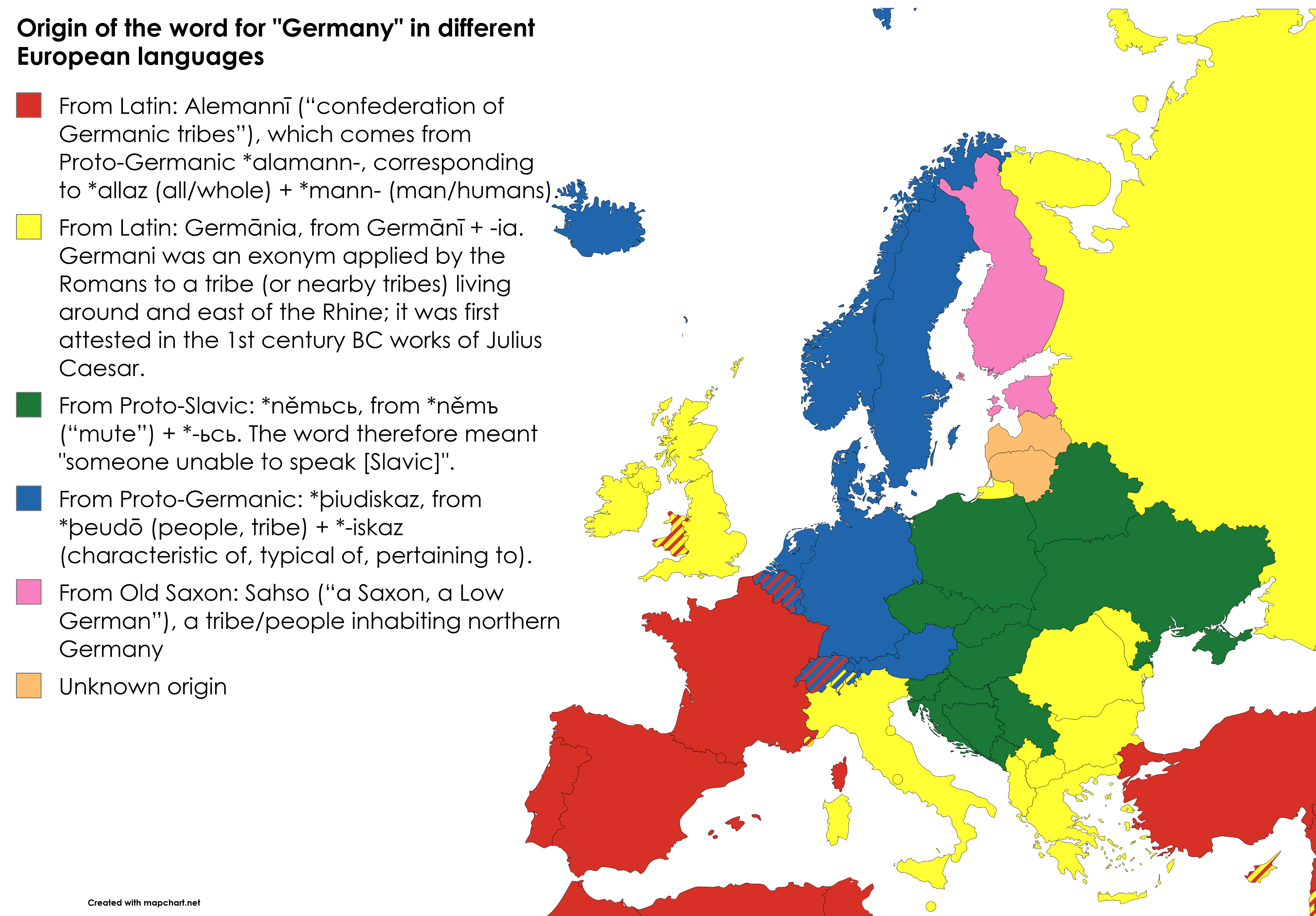
Origin of the Word for Germany in Different Languages Map
This map visualizes the origins of the word for "Germany" as it appears in various European languages. Each language dep...
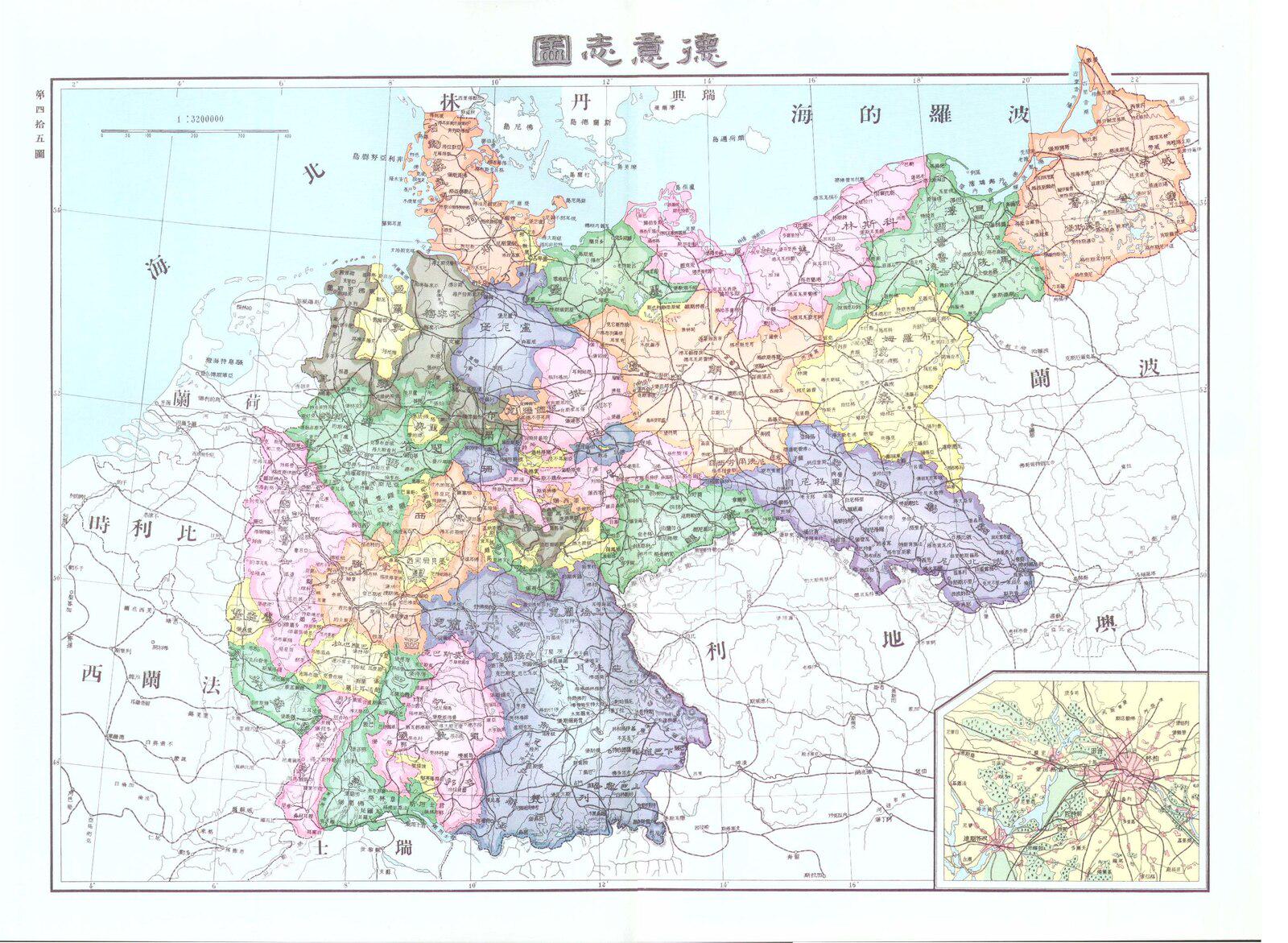
Chinese Map of Germany in 1906
...
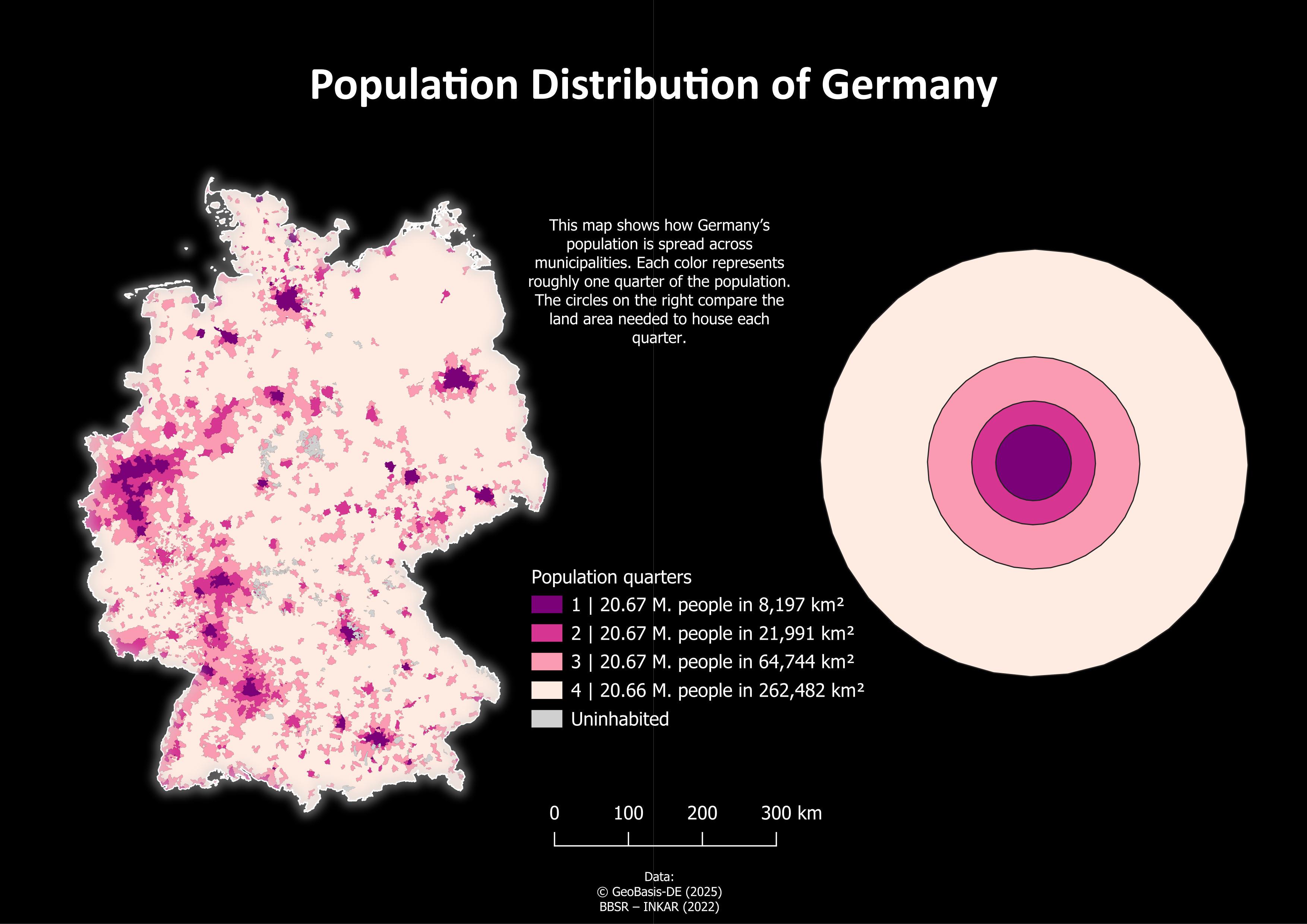
Population Distribution Map of Germany
The "Population Distribution of Germany" map provides a visual representation of how the population is spread across var...
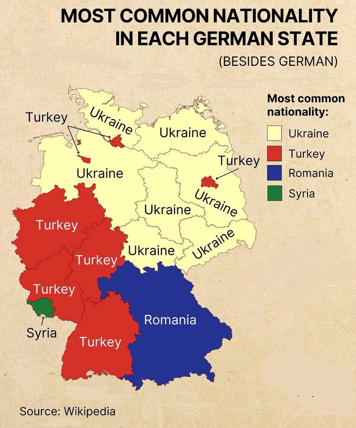
Most Common Nationality in Each German State Map
The "Most Common Nationality in Each German State" map provides a clear visual representation of the predominant foreign...
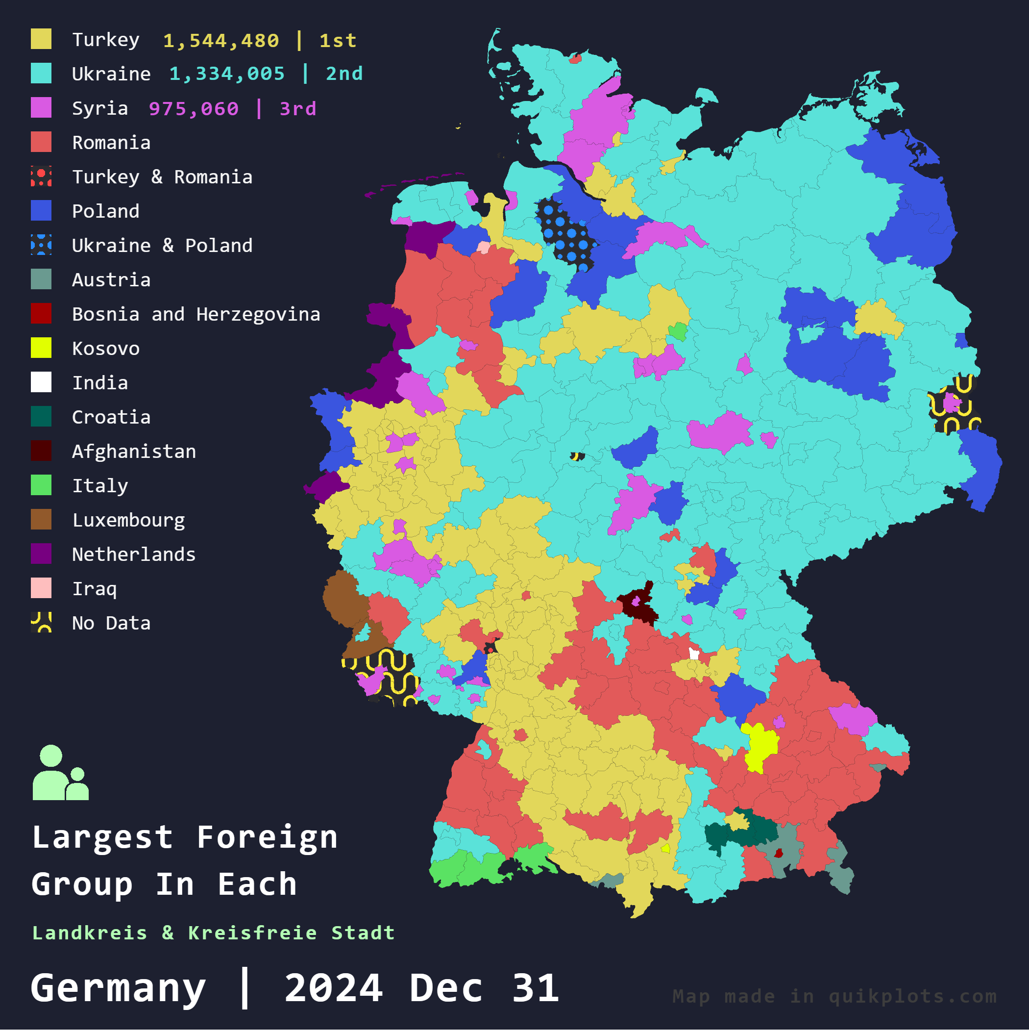
Largest Foreign Groups in Germany Map
The "Largest Foreign Groups in Germany Map" provides a comprehensive overview of the foreign population distribution acr...
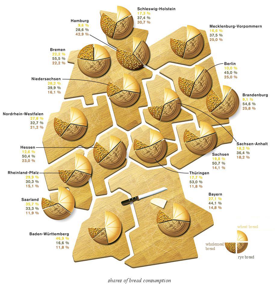
Map of Bread Types by German Bundesland
The visualization titled "Kind of Bread by German Bundesland" provides a detailed look at the diverse types of bread tha...
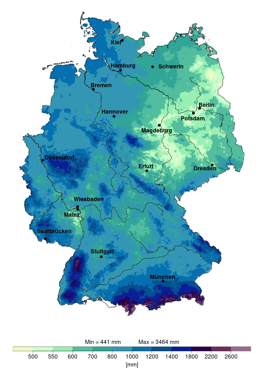
Annual Precipitation Map of Germany 2024
The "Annual Precipitation in Germany in 2024" map provides a detailed visualization of the expected rainfall distributio...
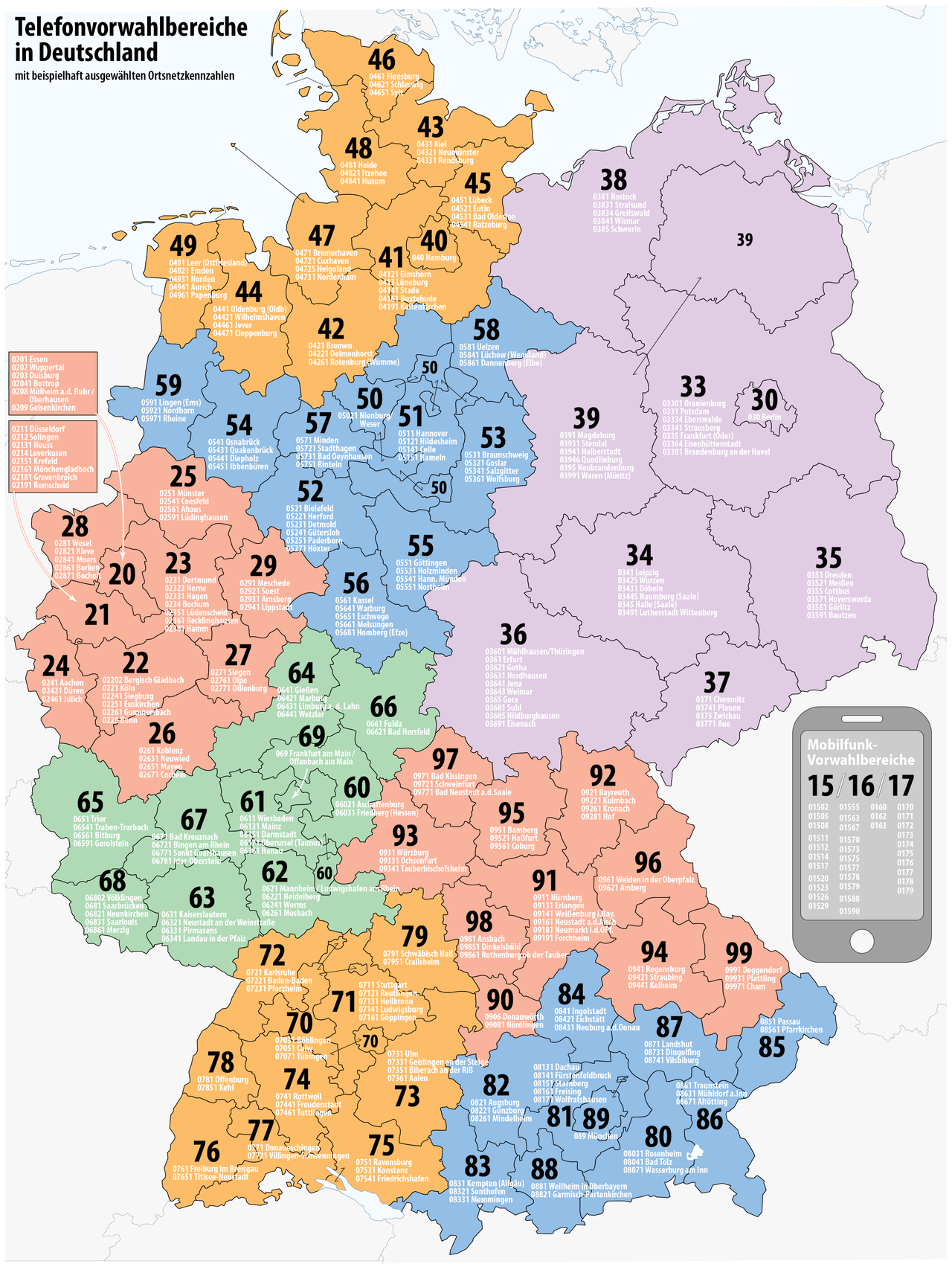
Telephone Number Area Codes in Germany Map
The "Telephone Number Area Codes in Germany Map" provides a comprehensive visual representation of the various area code...
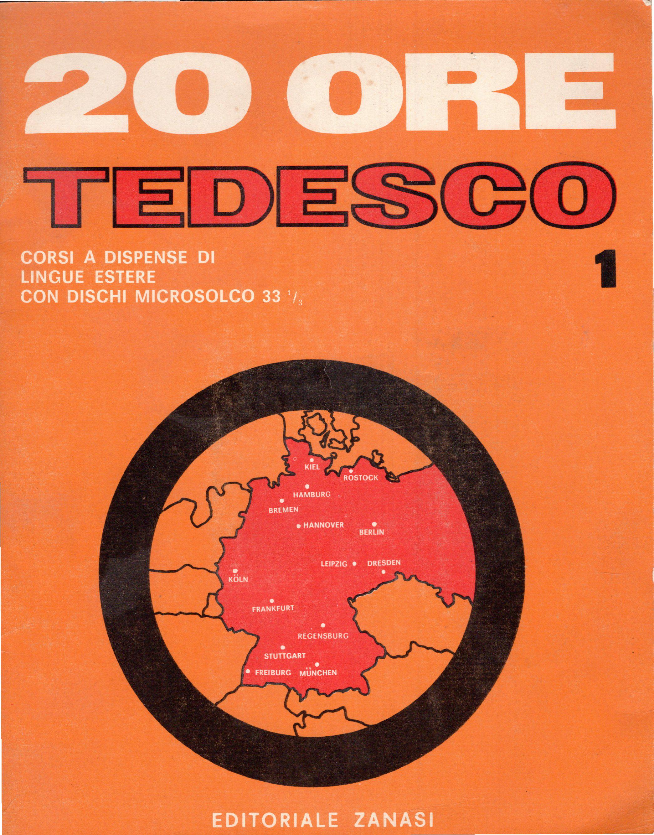
Germany Borders Map According to 1960s Italian Course
Interestingly, during the 1960s, West Germany was characterized by a flourishing economy, known as the \...
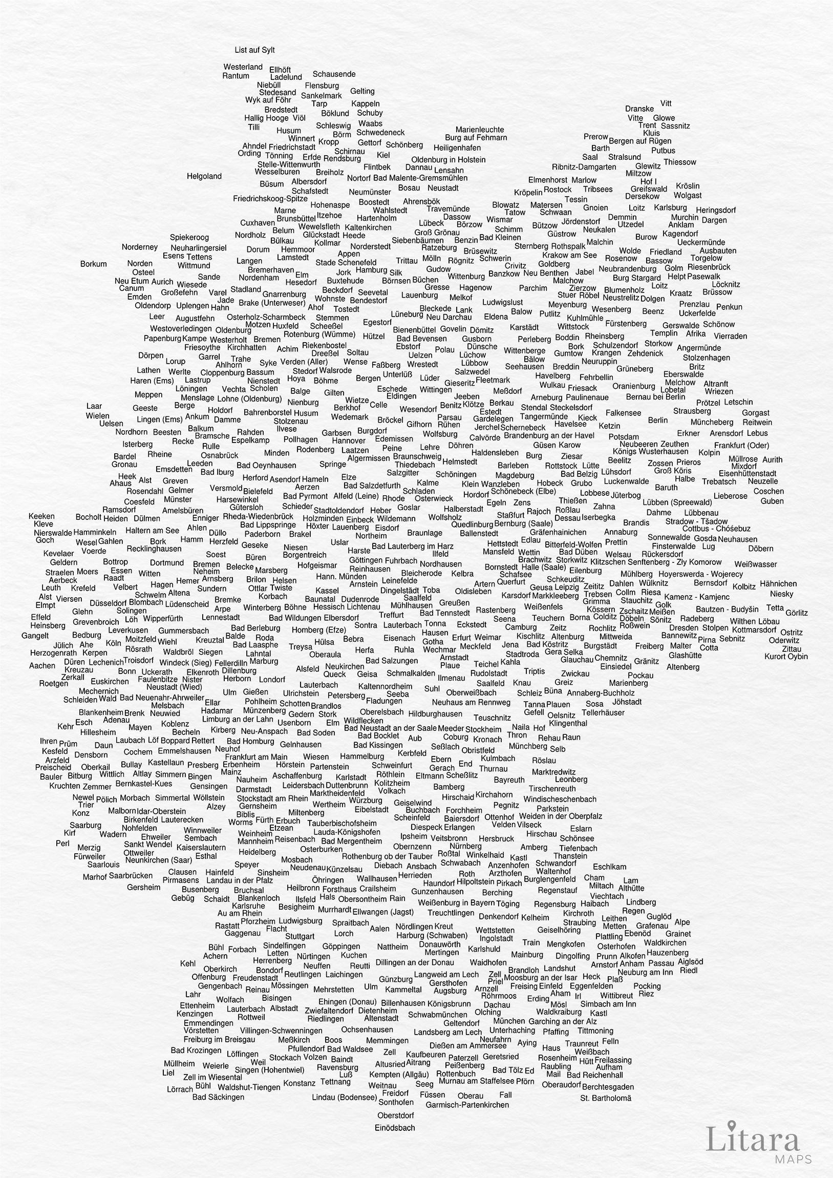
Population Density Map of Germany
The "Mapporn Germany" visualization provides an insightful overview of the population density across Germany. By display...
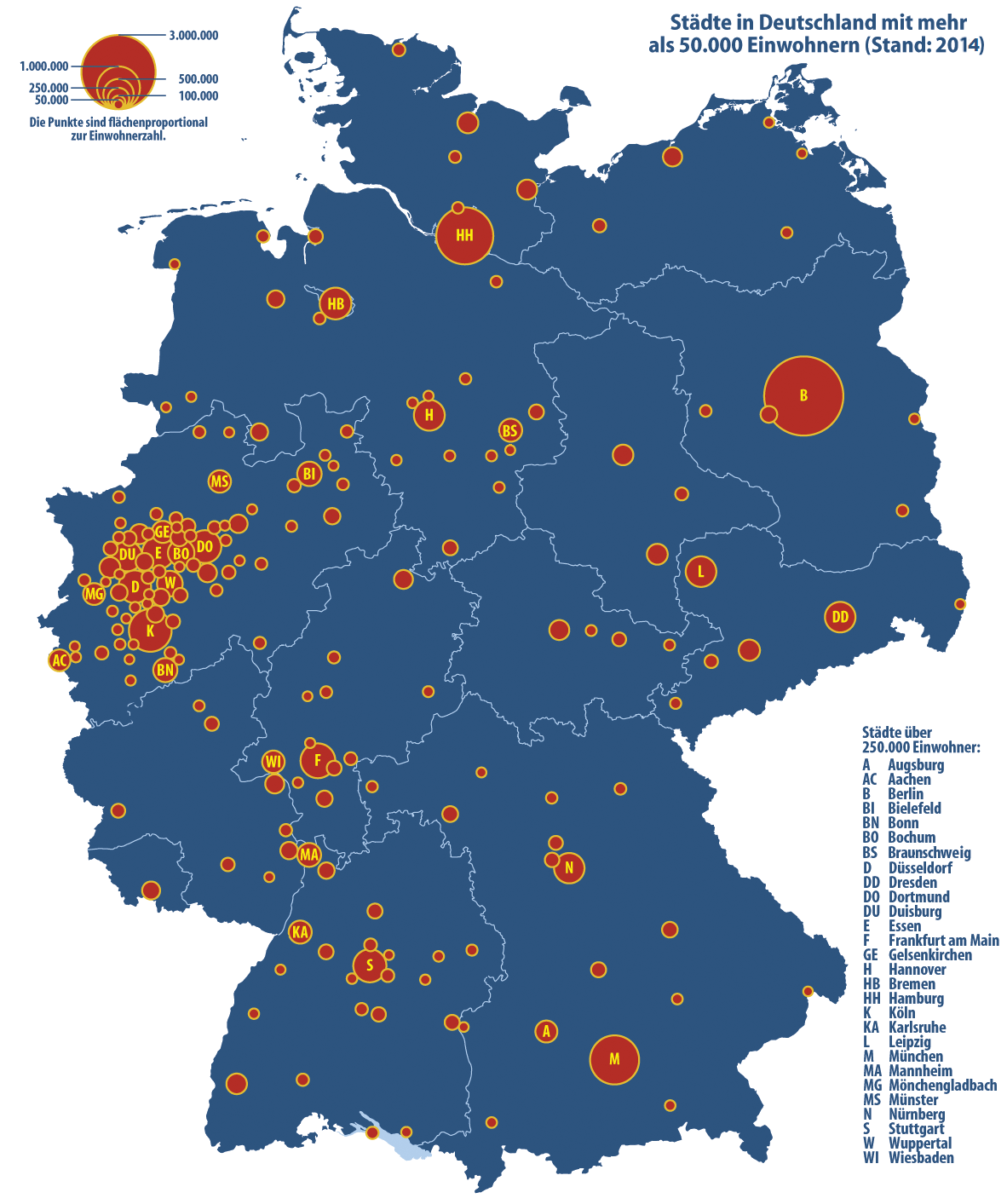
City Density Map of North Rhine-Westphalia
The map in question illustrates the striking concentrations of urban areas within North Rhine-Westphalia (NRW), highligh...
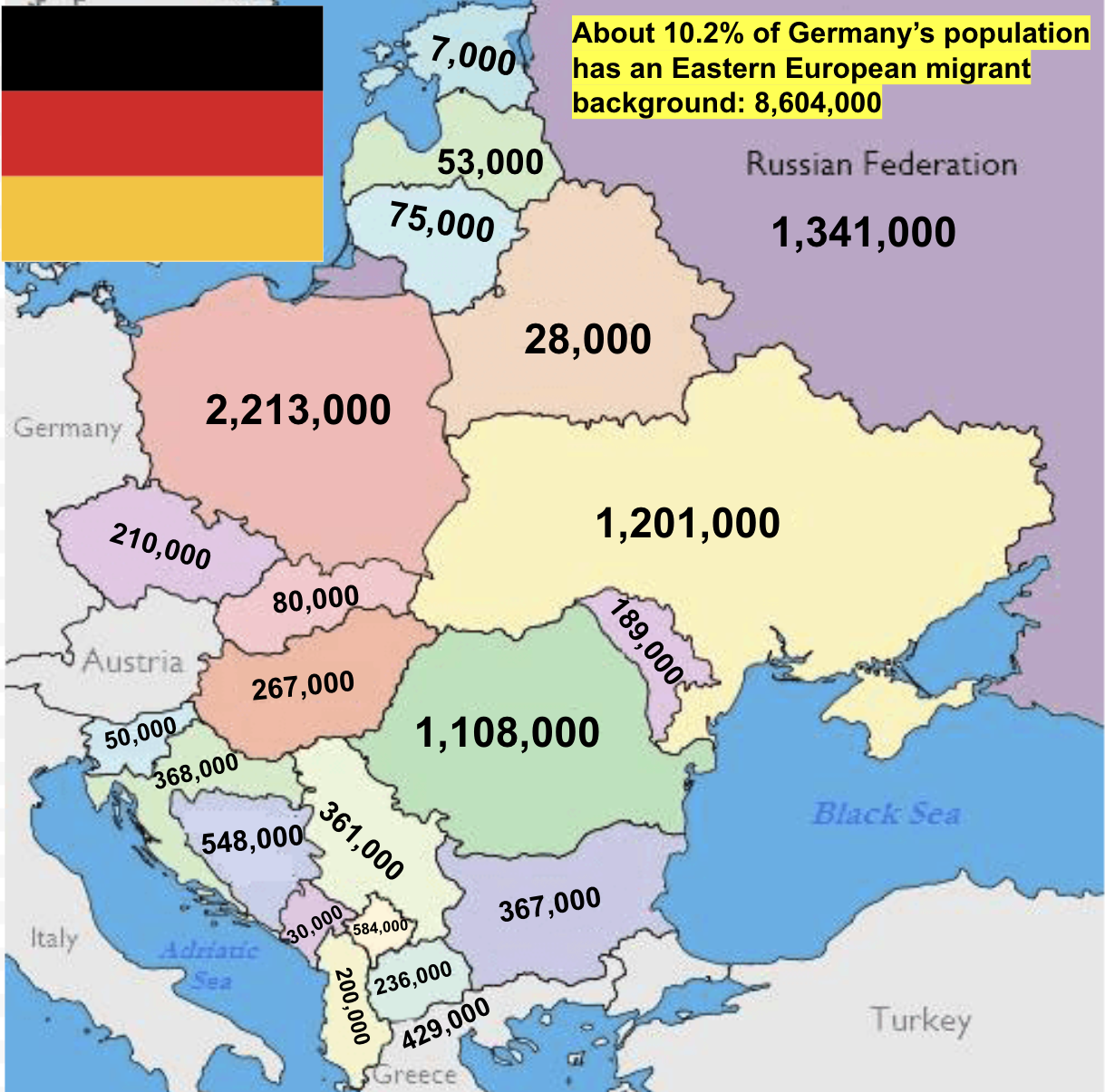
Eastern European Migrant Background in Germany Map
The map titled "Eastern European Migrant Background in Germany" illustrates a significant aspect of Germany's demographi...
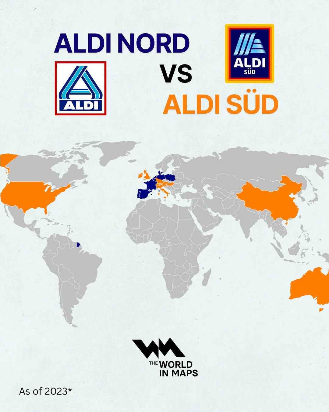
Aldi Nord vs Aldi Sud Map
...
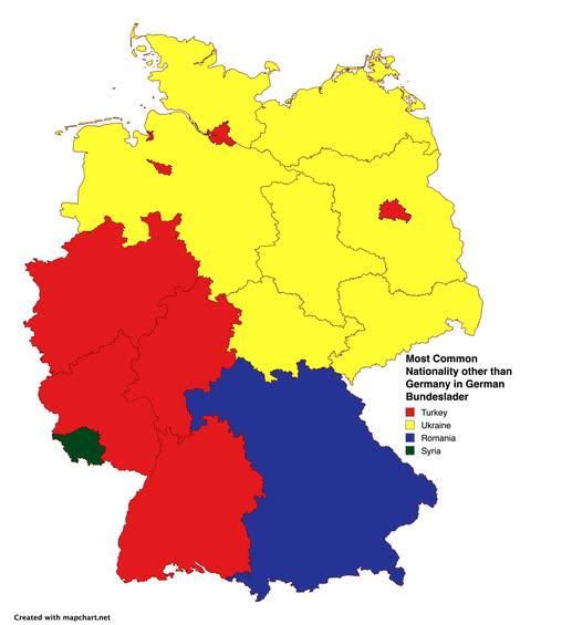
Most Common Nationality Other Than German Map
The map titled \...
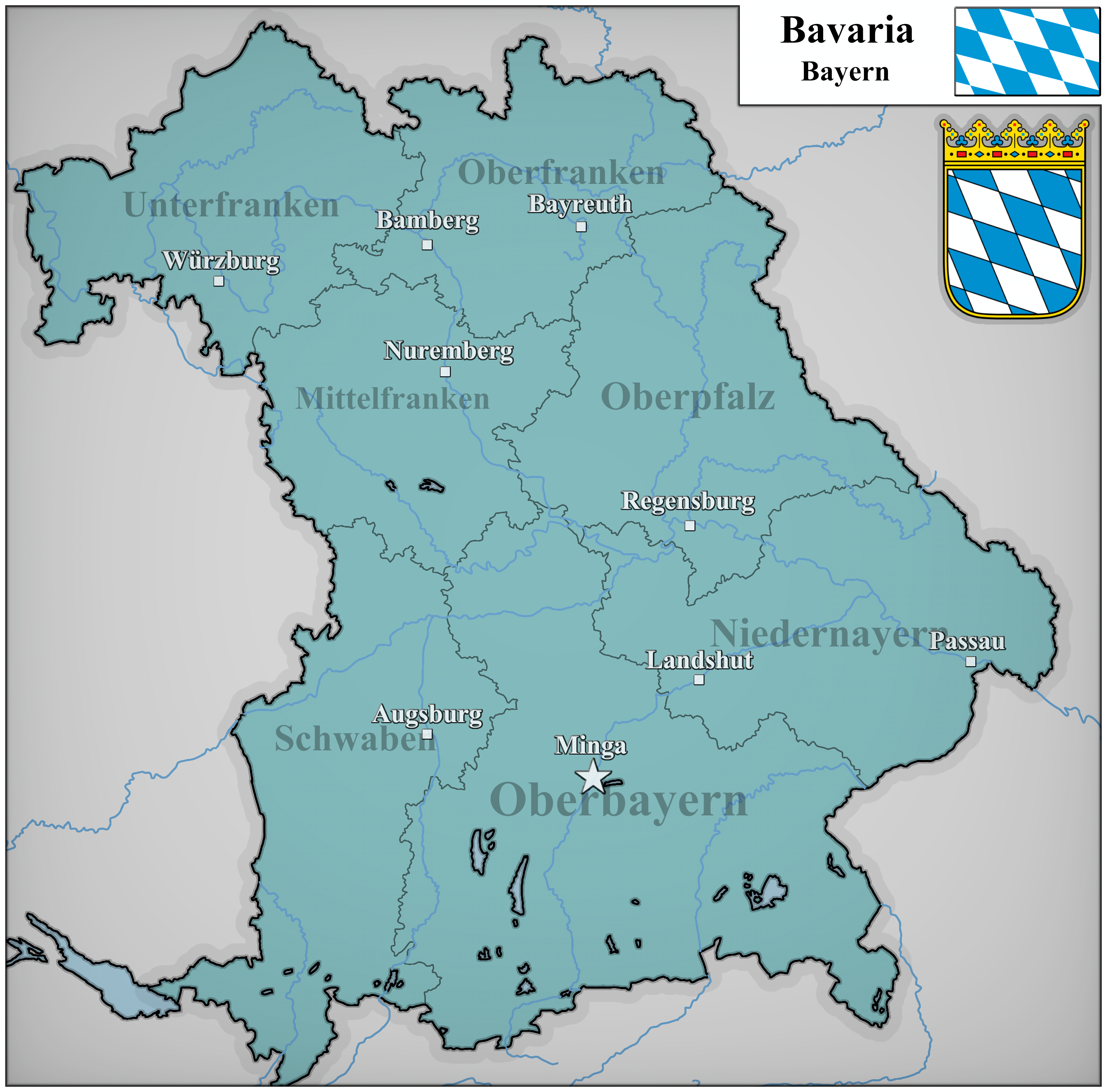
Bavaria 2025 Population Density Map
The "Bavaria 2025 Population Density Map" provides a detailed visualization of the population distribution across Bavari...
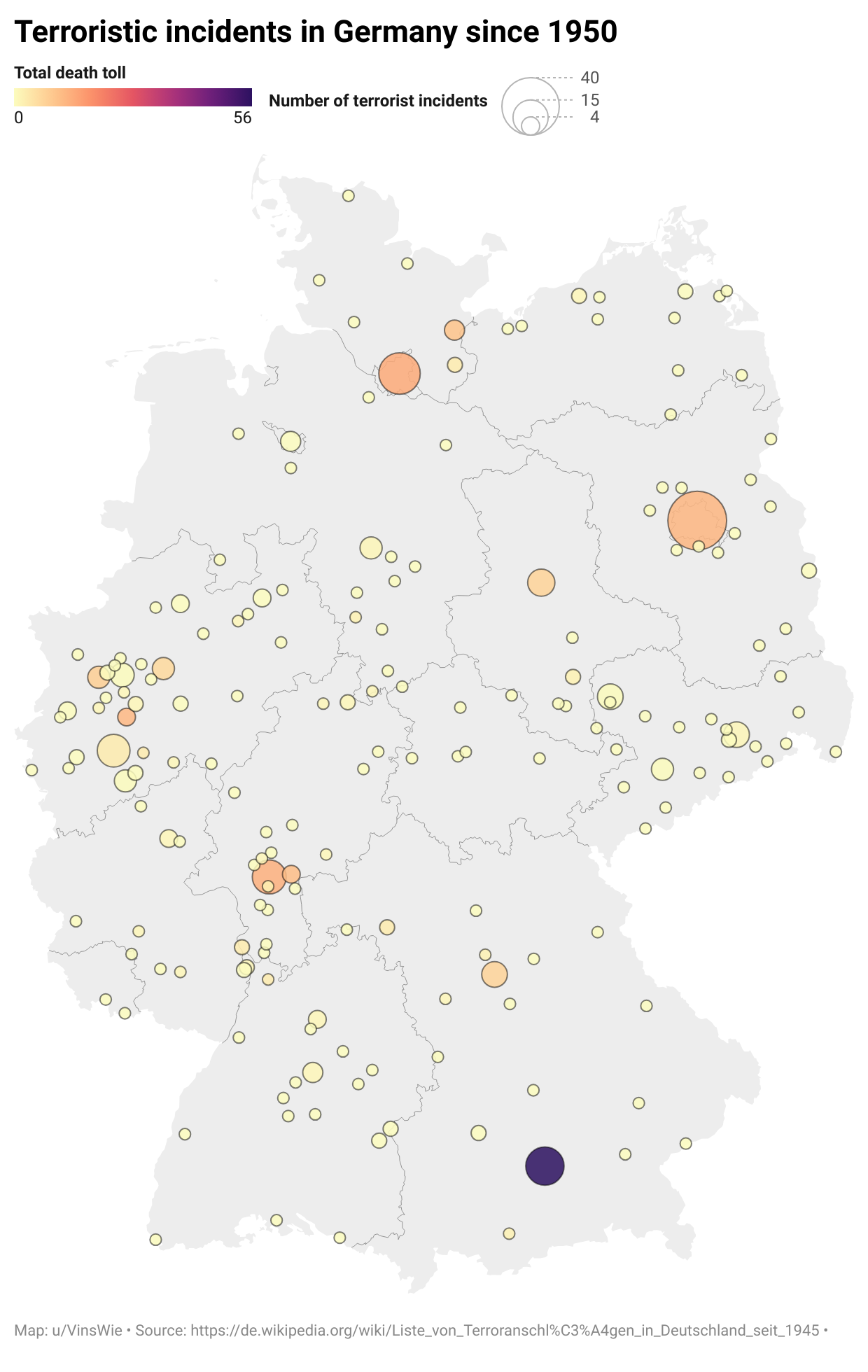
Terroristic Incidents in Germany Map
The \...
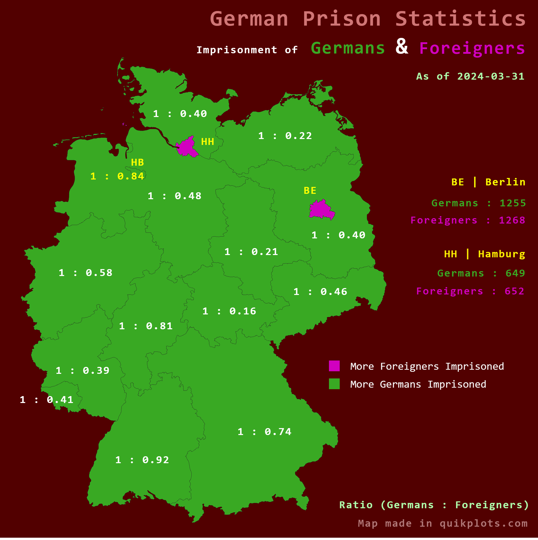
Map of Foreigners Outnumbering Germans in Prisons
Interestingly, the foreign-born population in Germany is diverse, comprising individuals from various backgrounds and co...
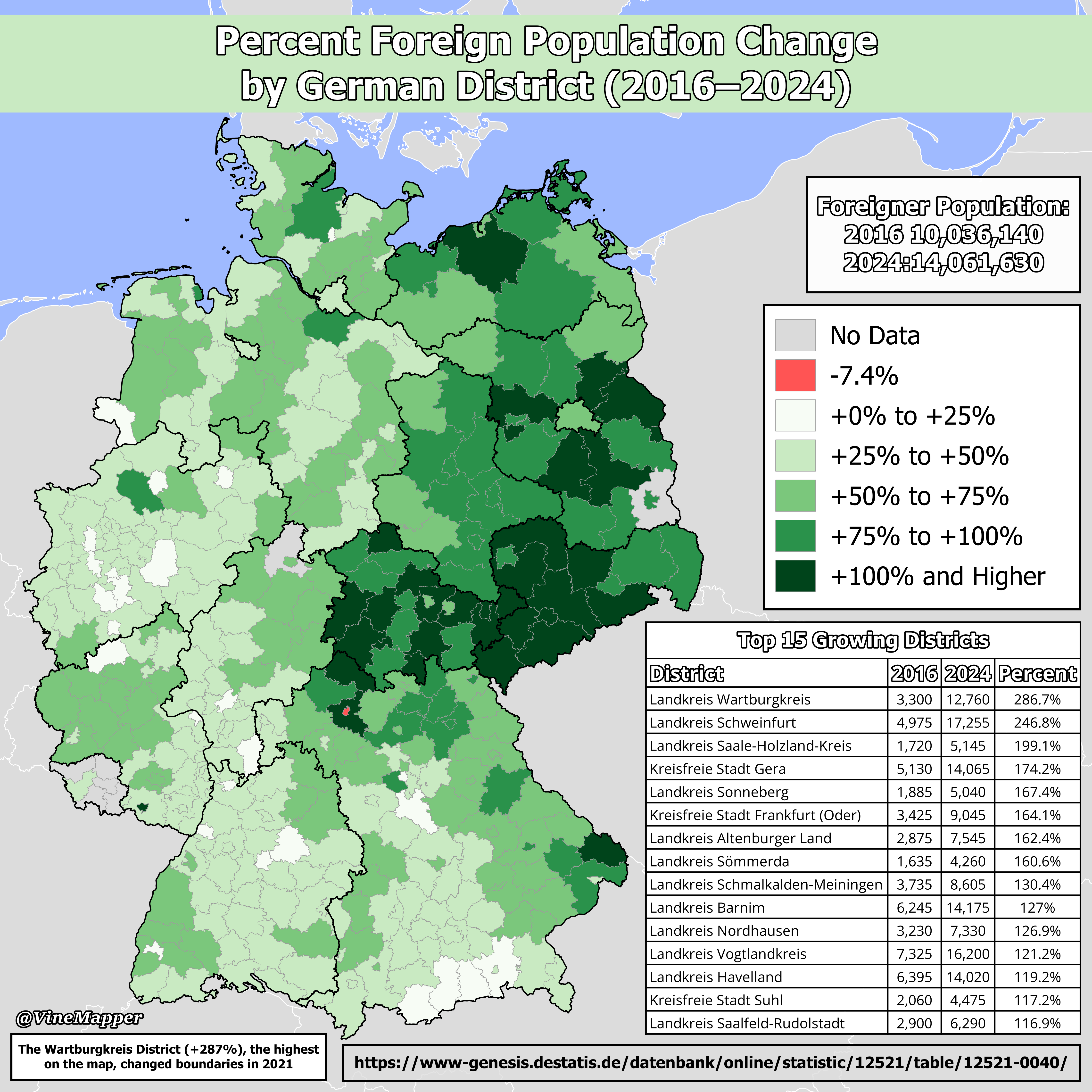
Percent Foreign Population Change by German District Map
The \...
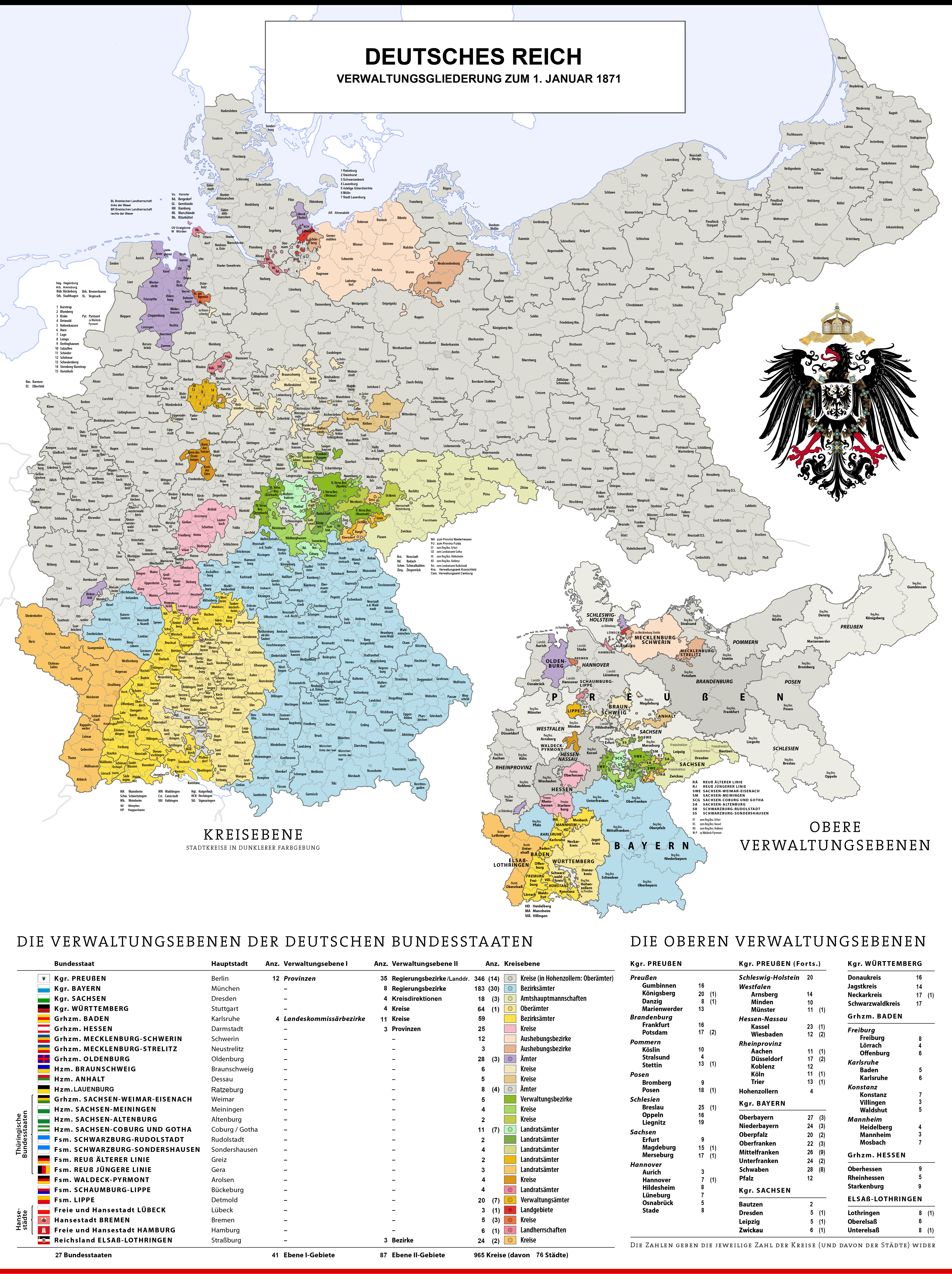
Administrative Divisions of Germany Map 1870
This historical map illustrates the administrative divisions of Germany as they existed on January 1, 1870. At this time...