borders Maps
11 geographic visualizations tagged with "borders"
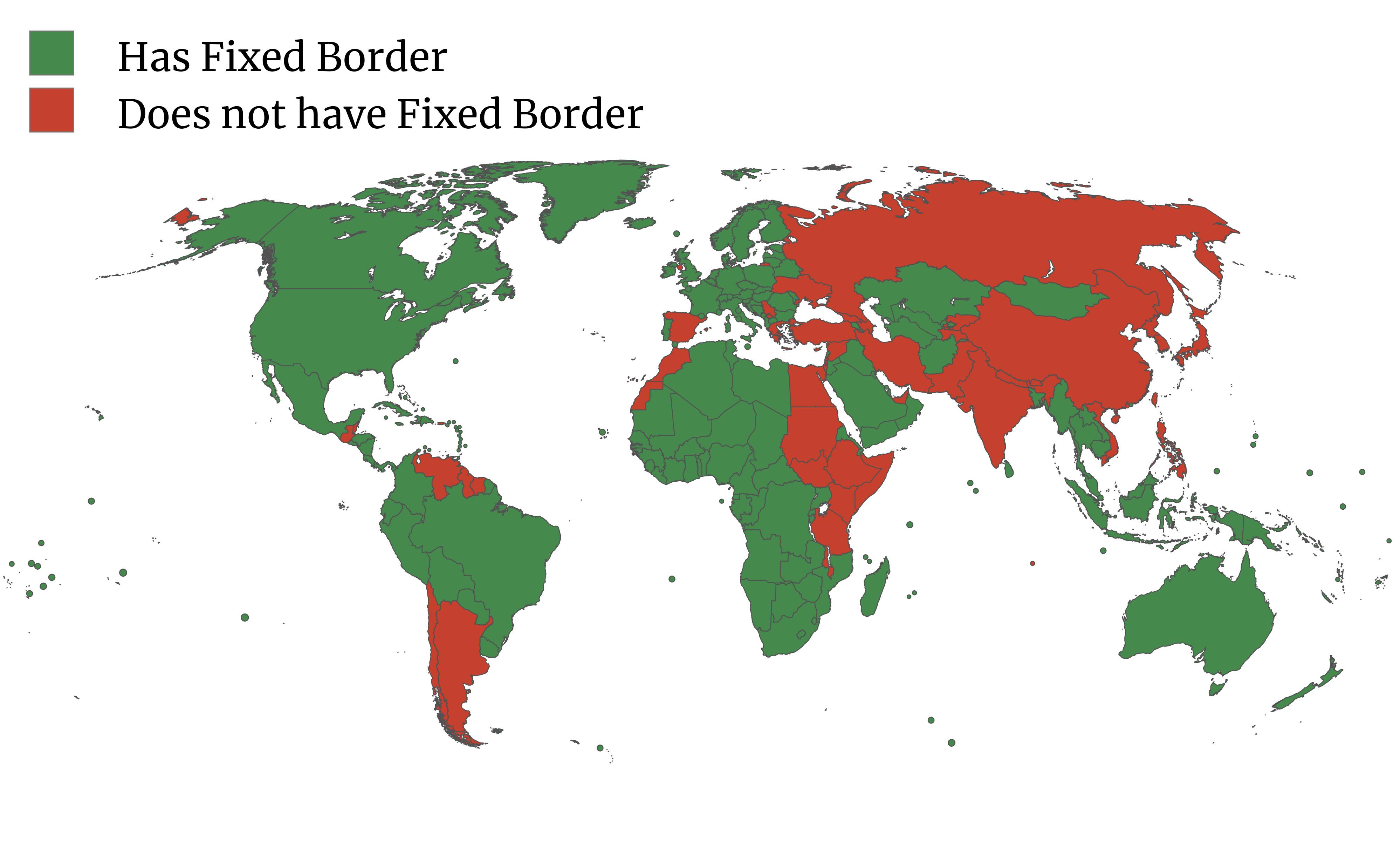
Google Maps Fixed Borders by Country Map
The map titled "Does Google Maps consider your country to have a fixed border?" highlights an interesting aspect of inte...
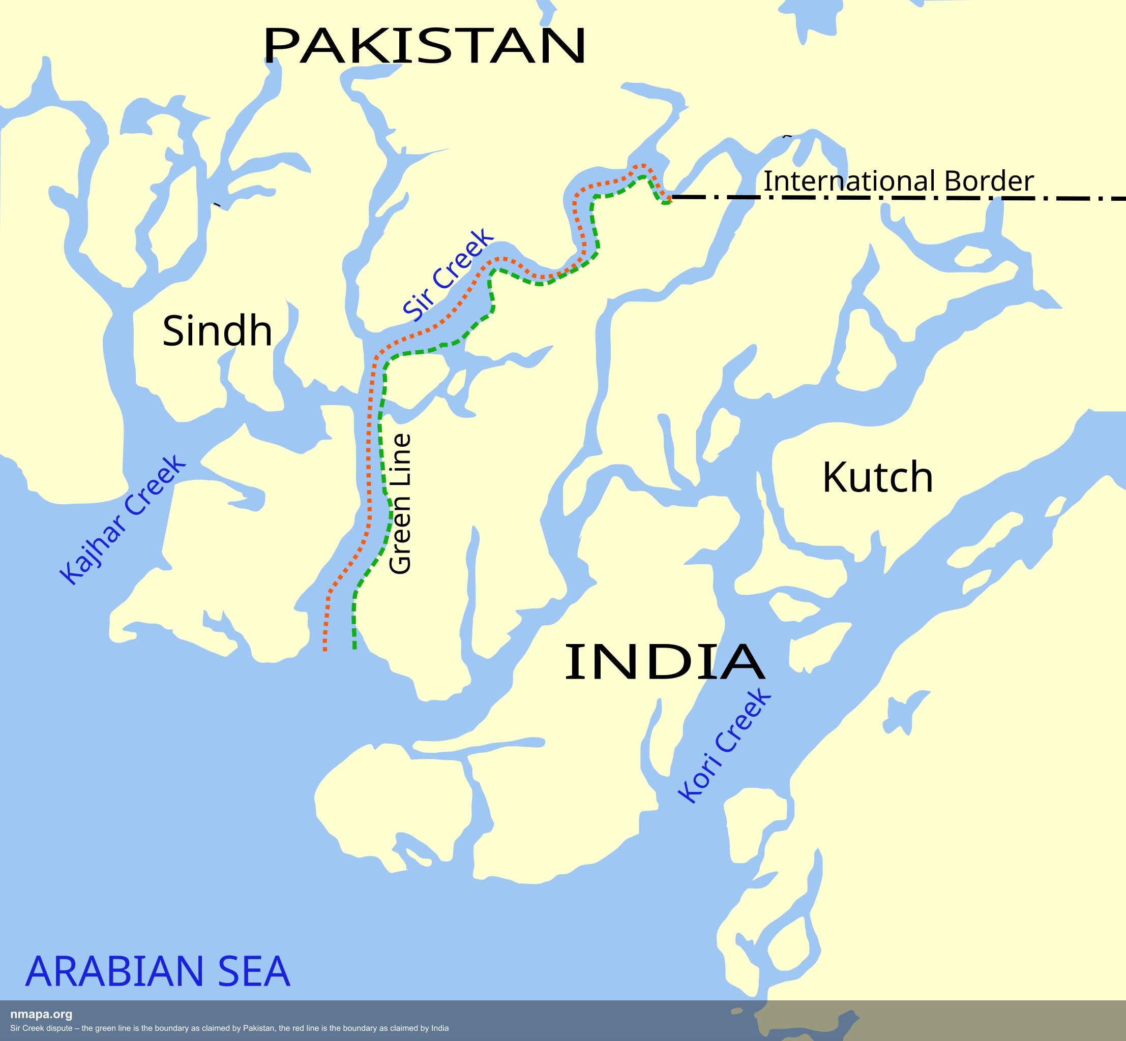
Sir Creek Dispute Boundary Map: Pakistan vs India
The Sir Creek dispute boundary map illustrates the contentious borders between Pakistan and India in the Sir Creek regio...
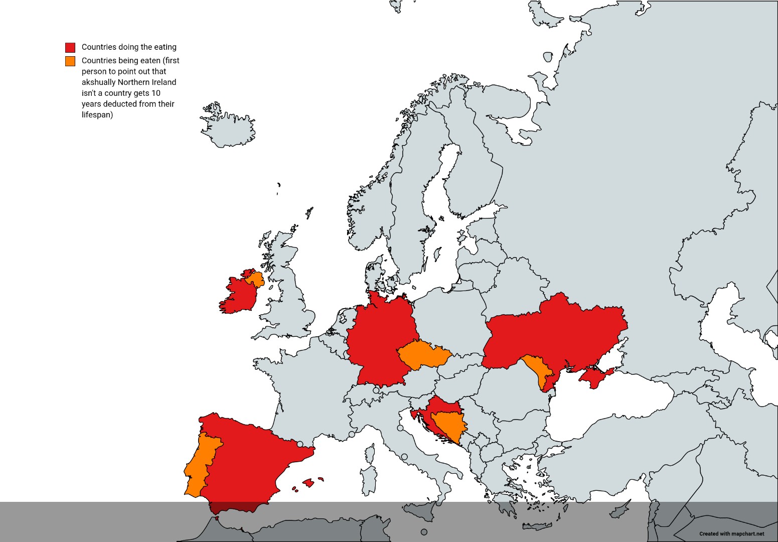
Countries That Look Like They're Eating Other Countries Map
This intriguing map visualizes countries that appear to overlap or encroach upon neighboring nations, creating a whimsic...
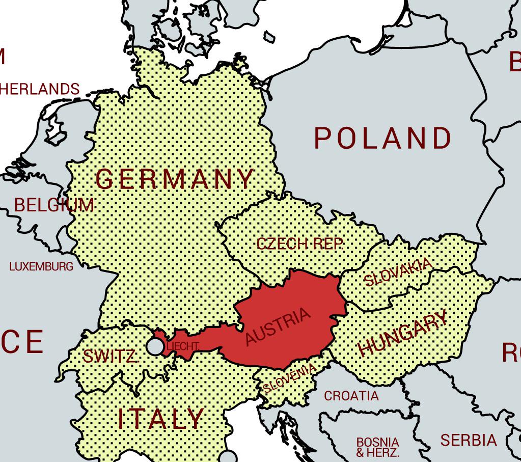
Austria Neighboring Countries Map
This map illustrates the unique geographical position of Austria as a landlocked country that shares borders with eight ...
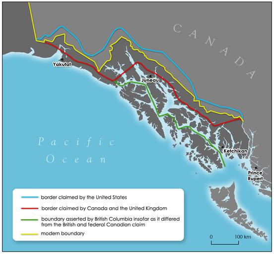
Alaska Panhandle Border History Map
The map titled "How the Alaska Panhandle border was drawn by different governments" visually represents the complex hist...
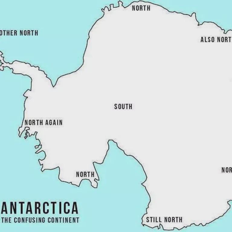
Map of Misleading Geographic Information
The visualization titled "Not so false?" reveals the prevalence of misleading geographic information across various regi...
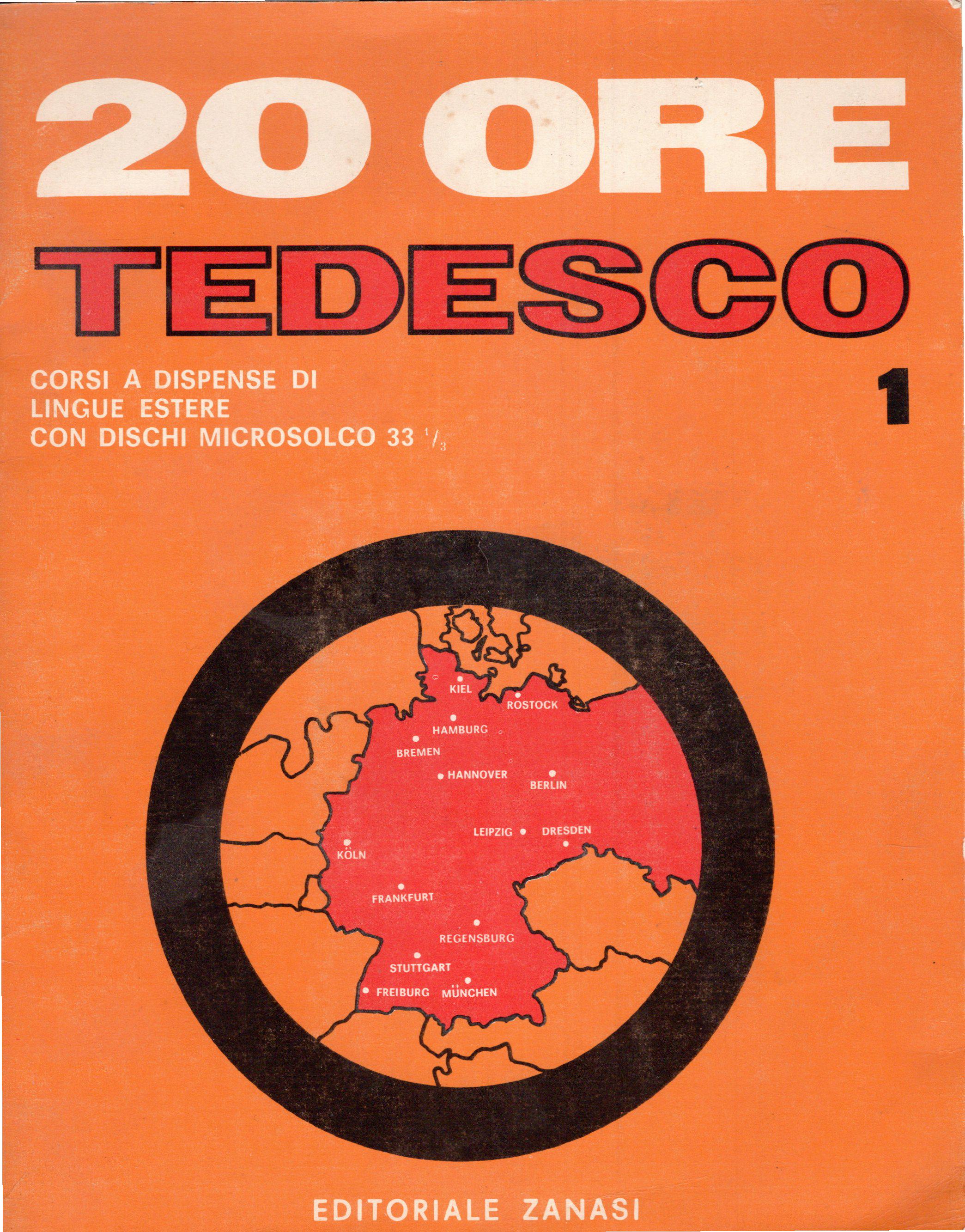
Germany Borders Map According to 1960s Italian Course
Interestingly, during the 1960s, West Germany was characterized by a flourishing economy, known as the \...
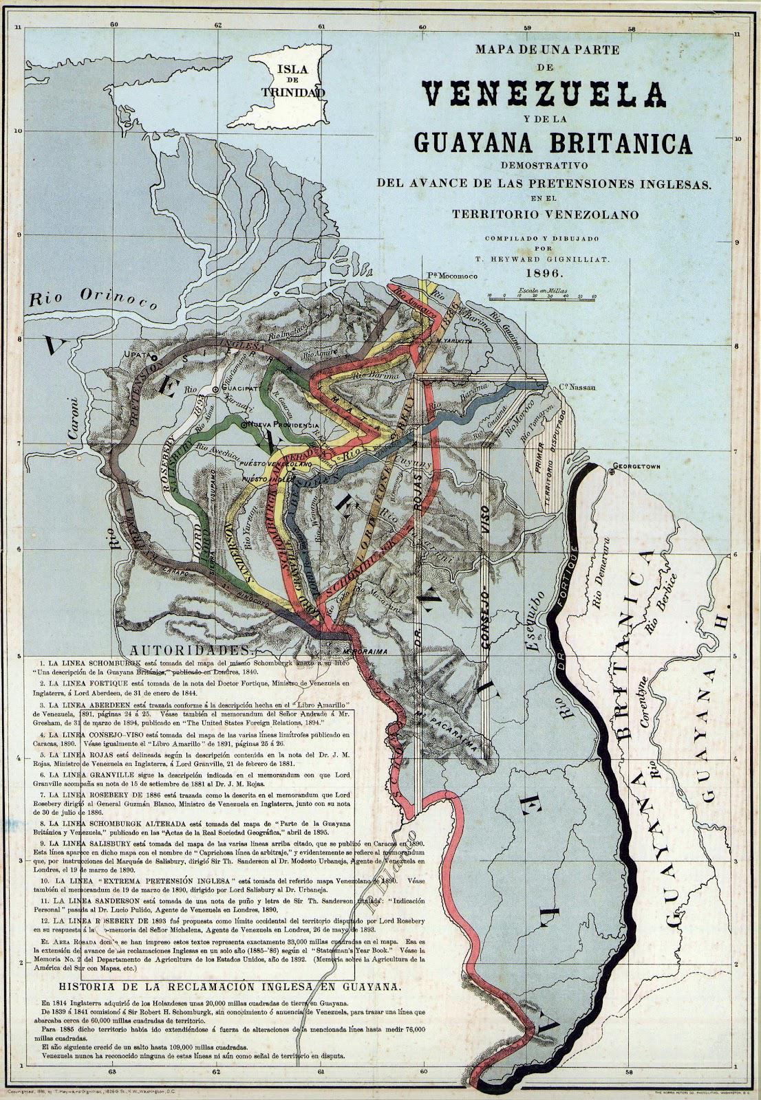
Proposed Boundaries for Guyana Map
The "Proposed Boundaries for Guyana Map" visualizes the various territorial claims and proposed administrative borders w...
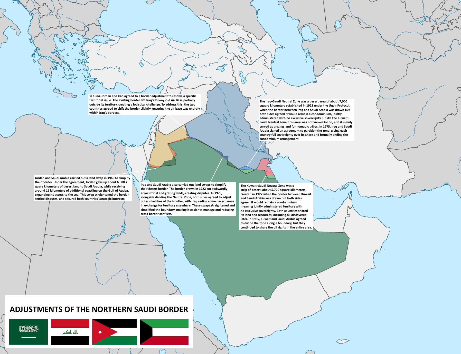
Map of Adjustments to Northern Saudi Borders
The map titled \...
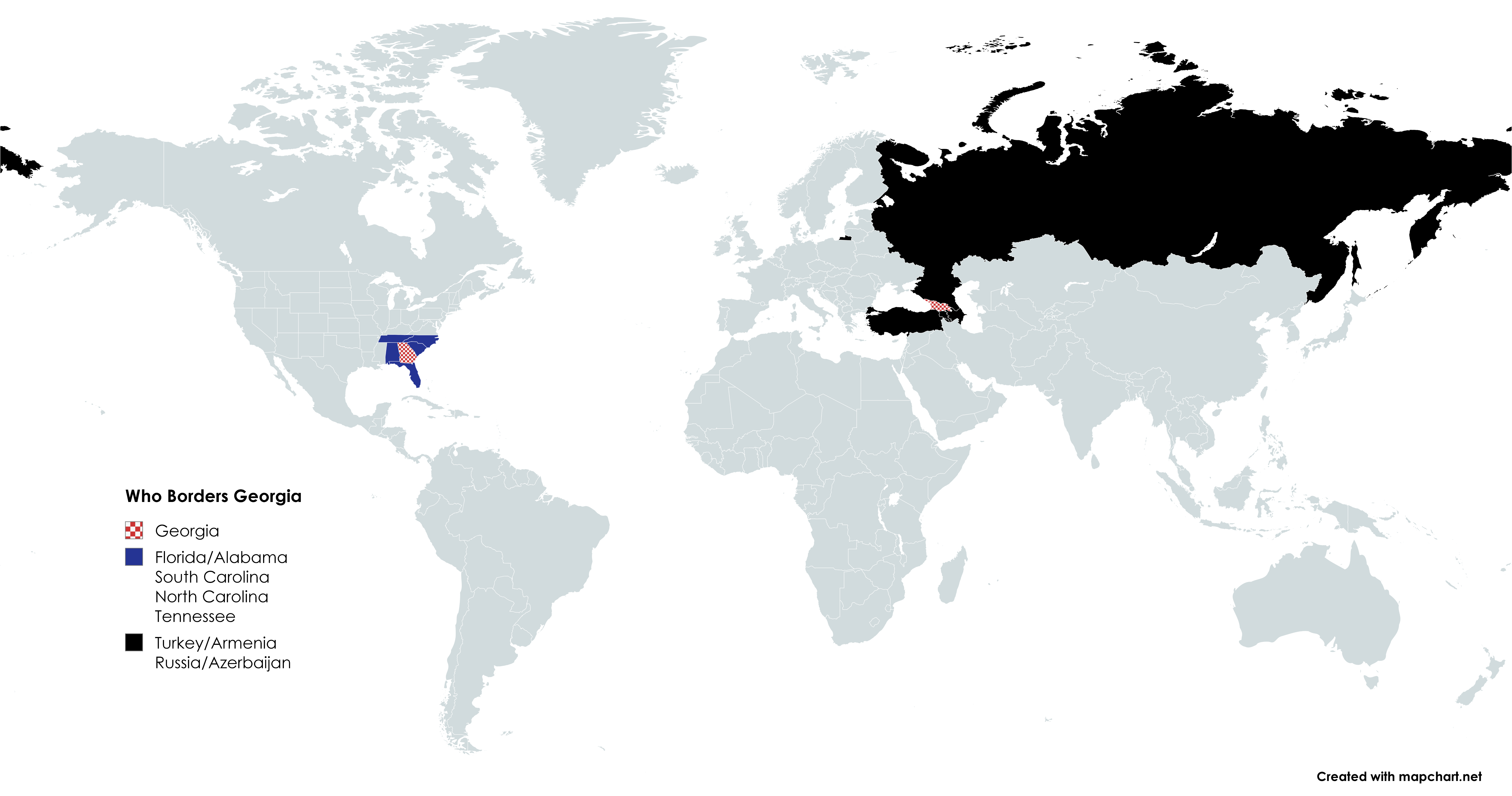
Bordering Countries of Georgia Map
This map provides a clear visualization of the countries that share borders with Georgia, located at the intersection of...
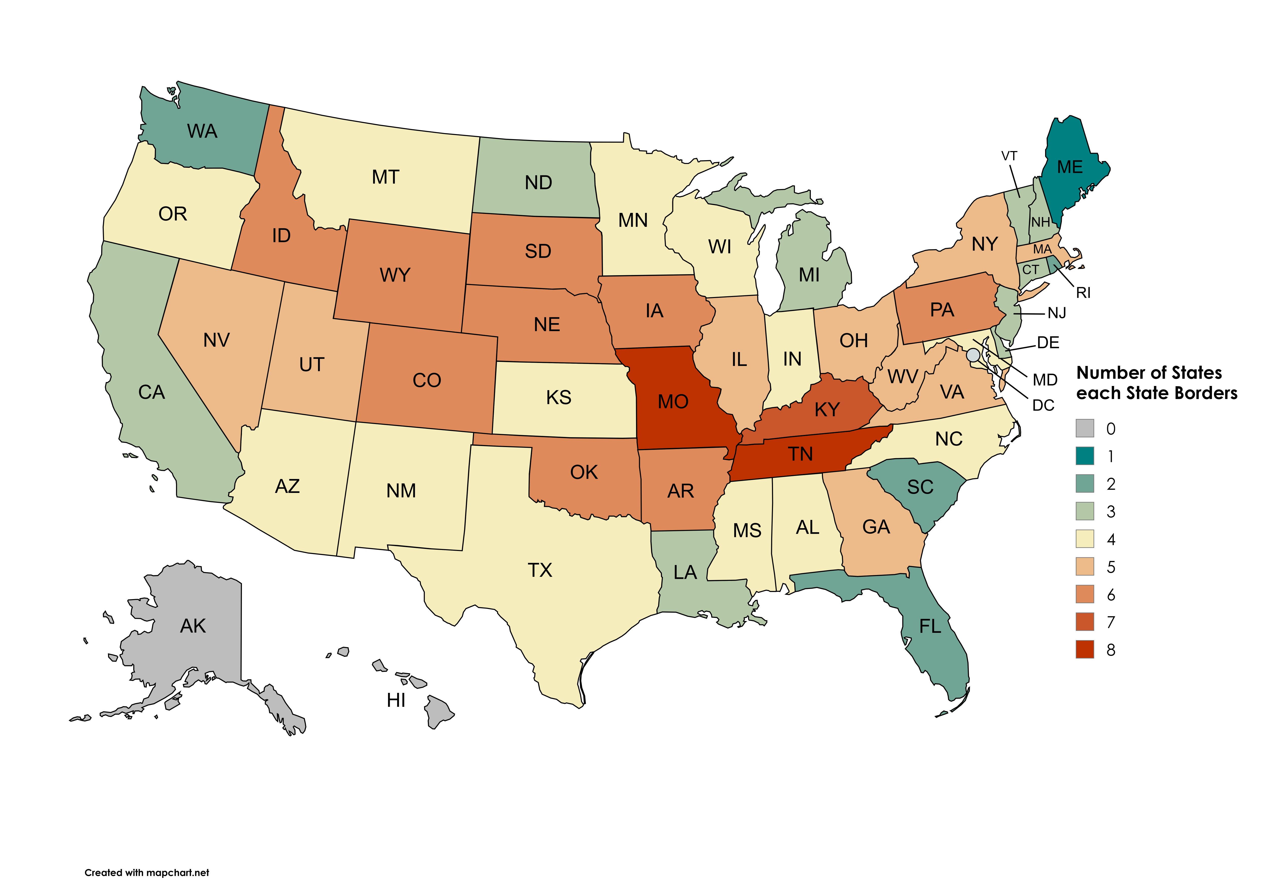
Map of States Each State Borders
This visualization illustrates the number of states each U.S. state borders, excluding Washington D.C., water borders, a...