africa Maps
32 geographic visualizations tagged with "africa"

Relief map of the Ottoman Empire at its greatest territorial extant, around 1683, when it encompassed huge swaths of Southeastern Europe, parts of the Middle East, and North Africa.
This map displays "Relief map of the Ottoman Empire at its greatest territorial extant, around 1683, when it encompassed...
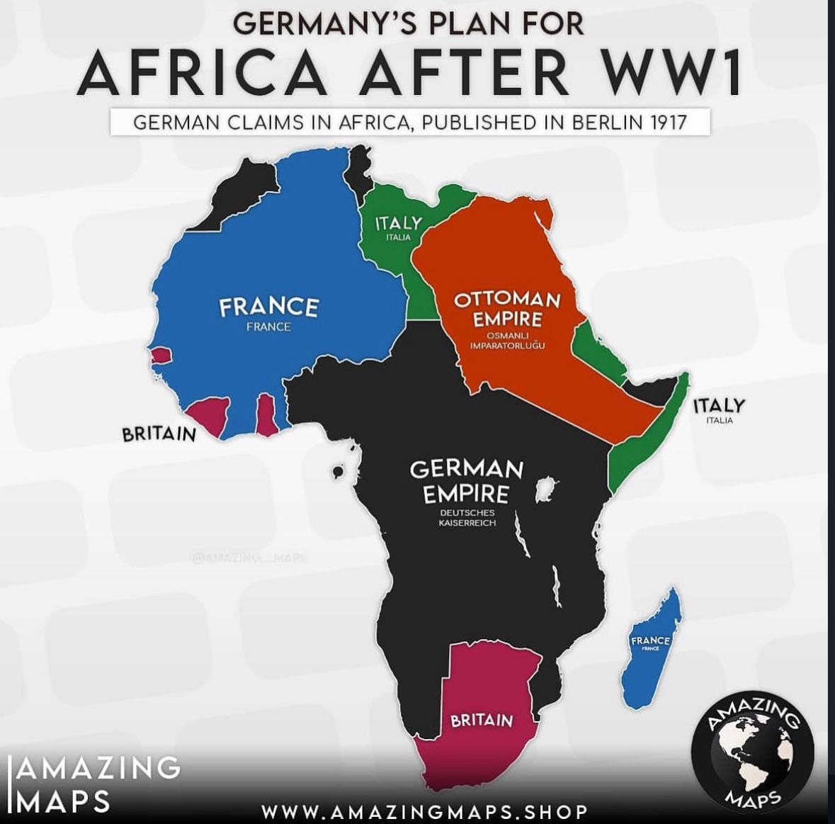
German Colonial Plans for Africa After WW1 Map
The map titled "German Colonial Plans for Africa After WW1" provides a visual representation of the territories that Ger...
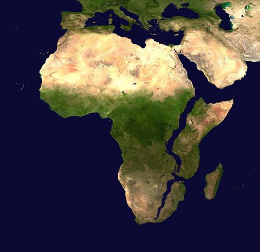
Map of Africa in 10 Million Years
This intriguing map titled "What Africa Might Look Like In 10 Million Years" presents a speculative visualization of the...
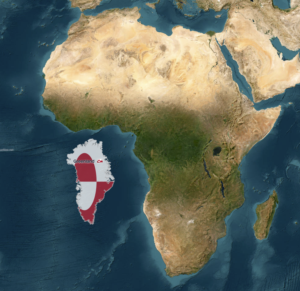
Greenland vs. Africa Size Comparison Map
The map titled "Greenland vs. Africa — the real scale" provides a striking visual comparison of the land areas of Greenl...
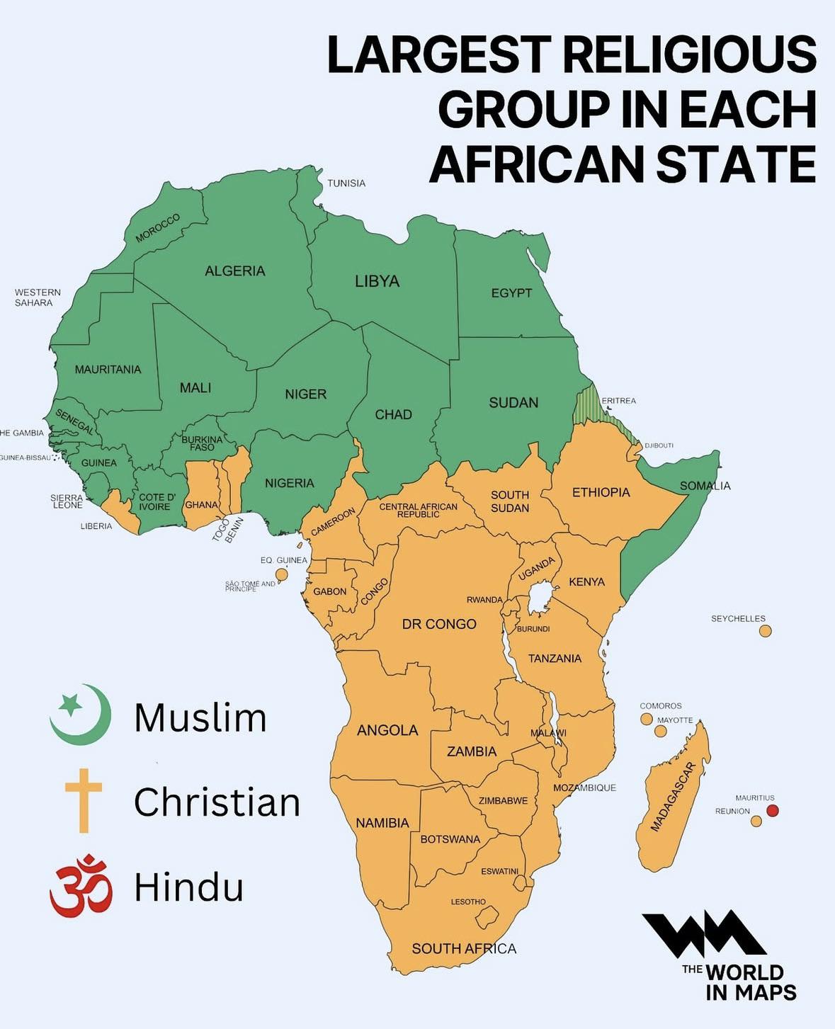
Map of Largest Religious Group in Each African State
The map titled "Largest Religious Group in Each African State" provides a clear visual representation of the predominant...
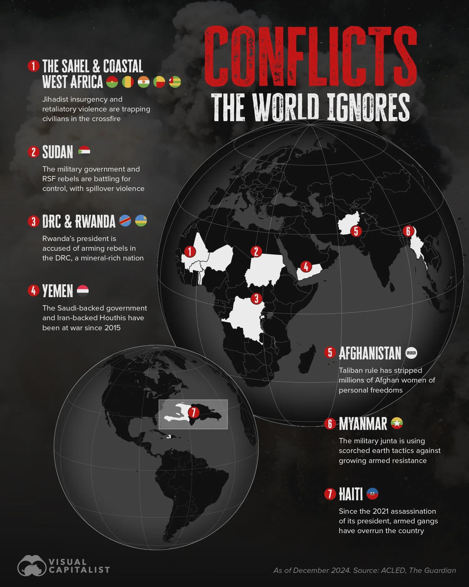
Ongoing Conflicts Map Beyond Ukraine and Palestine
The map titled "Ongoing Overlooked Conflicts in the World Beyond Ukraine/Russia and Palestine/Israel" highlights various...
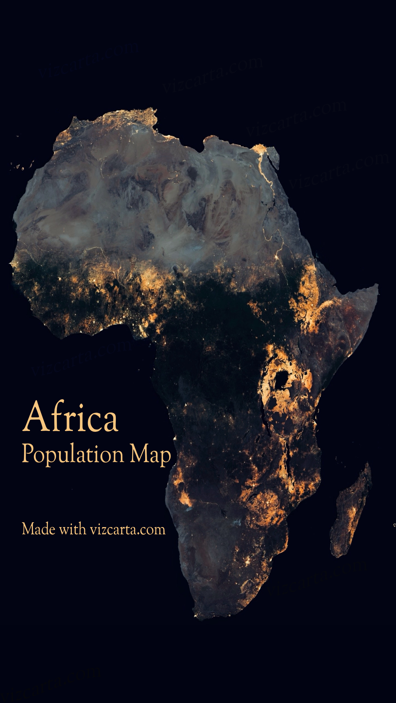
Africa Population Map
The Africa Population Map provides a visual representation of the demographic distribution across the continent. It illu...
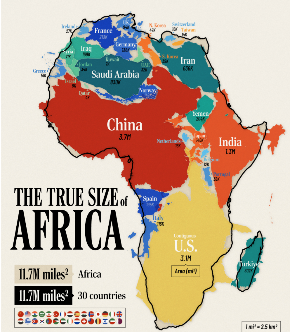
Africa Size Comparison Map
The "Africa is humongous" map offers a striking visual representation of Africa's vast land area compared to other conti...
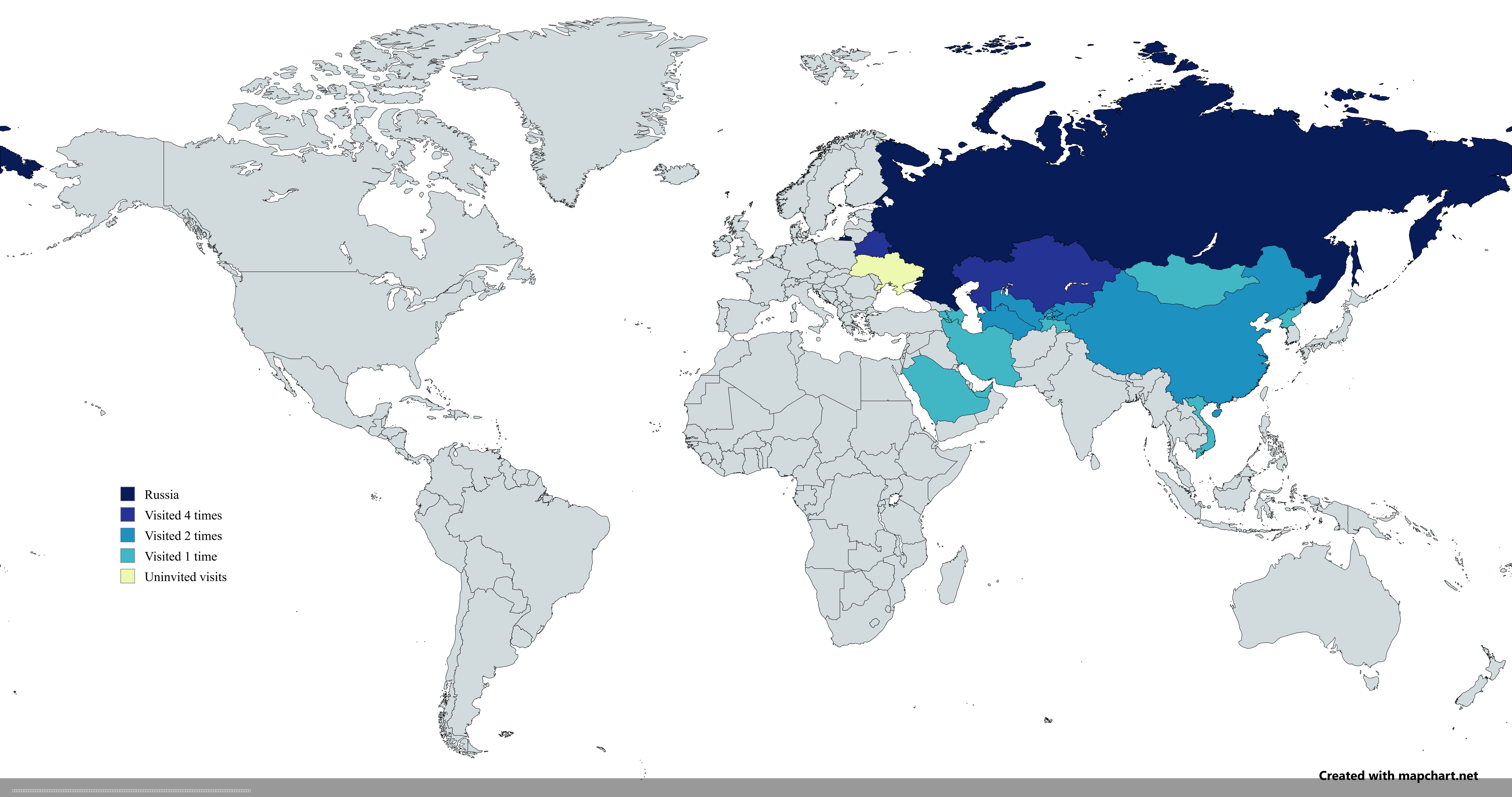
Map of Countries Visited by Vladimir Putin Post-2022 Invasion
The map titled "Countries Visited by Russian President Vladimir Putin After the 2022 Russian Invasion of Ukraine" provid...
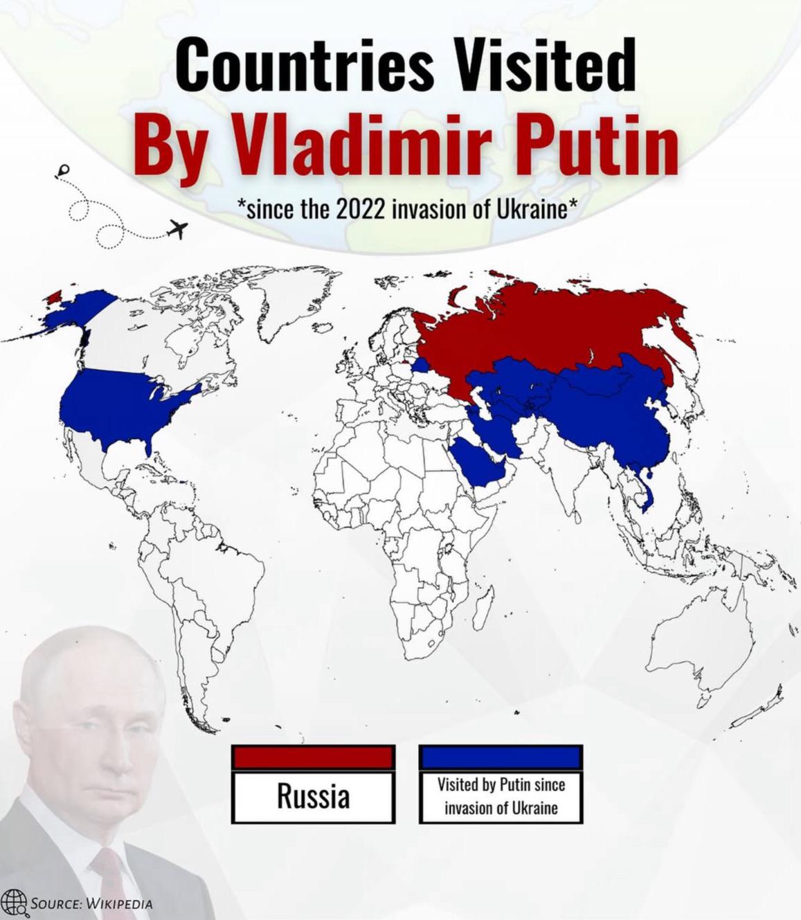
Countries Visited by Putin Since 2022 Invasion of Ukraine Map
The visualization titled "Countries Visited by Putin Since 2022 Invasion of Ukraine" displays a detailed overview of the...
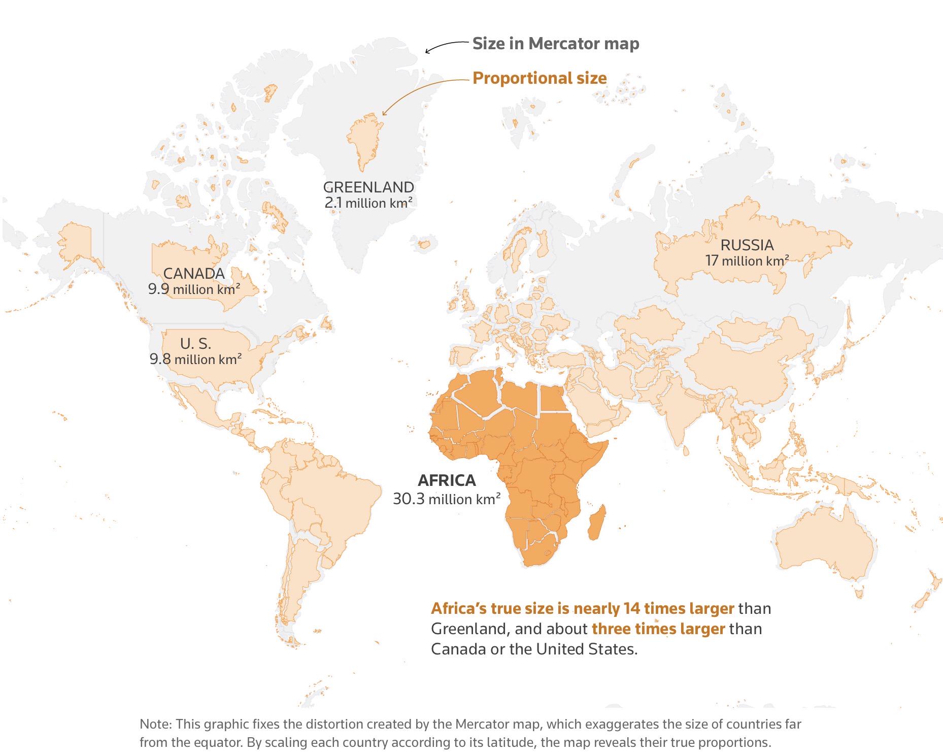
The True Size of Africa Map
The visualization titled "The True Size of Africa" challenges common misconceptions about the size of Africa relative to...
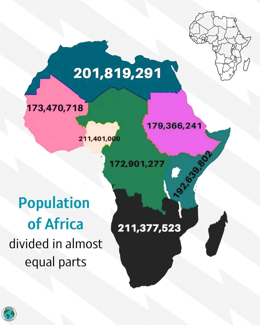
Population Distribution Map of Africa
The visualization titled \...
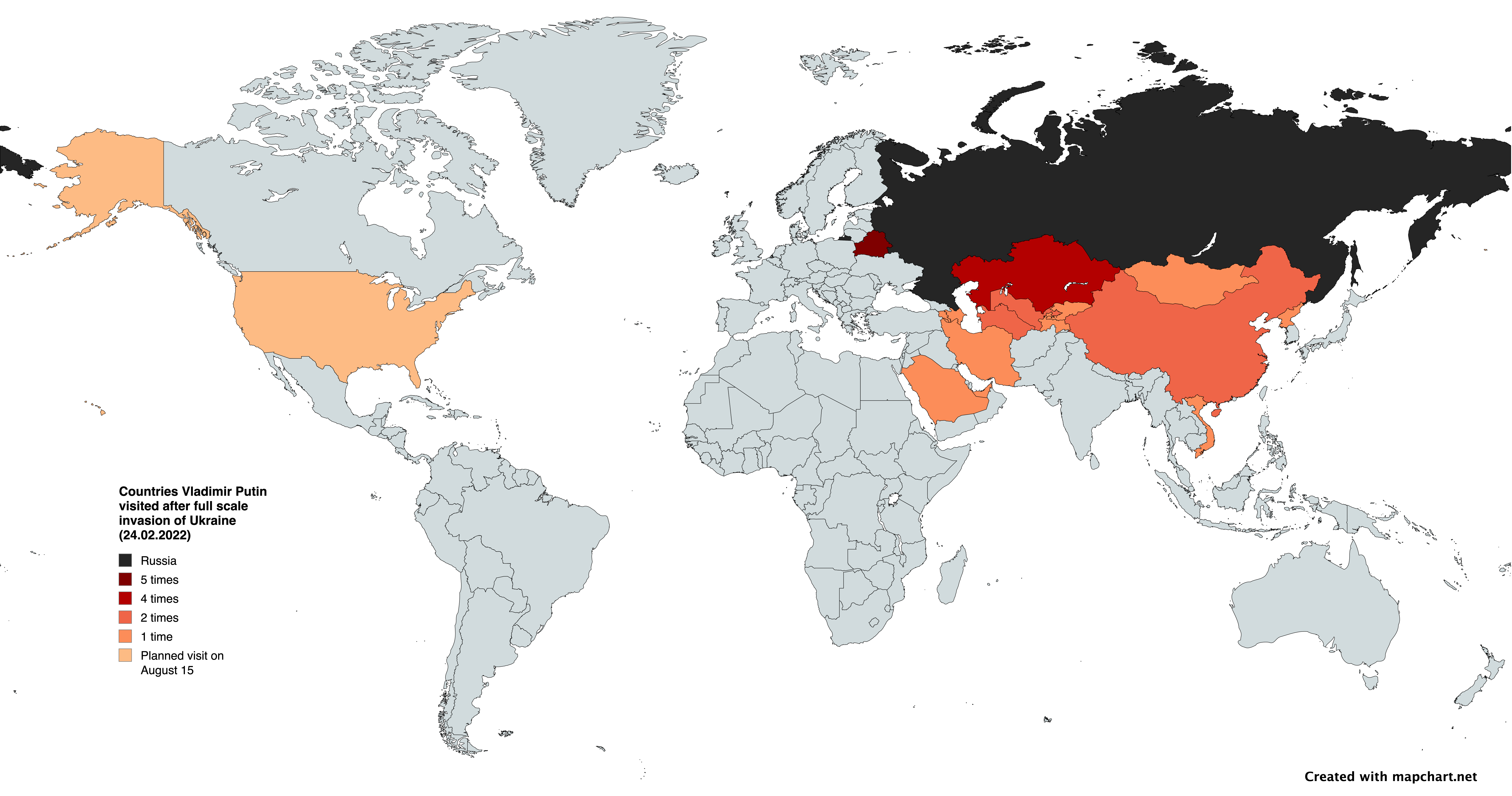
Map of Countries Vladimir Putin Visited Post-Invasion of Ukraine
This map provides a clear visualization of the countries that Russian President Vladimir Putin visited following the ful...
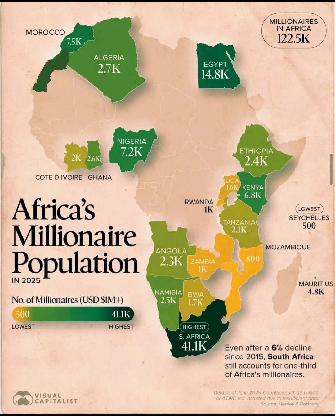
Africa's Millionaire Population Map 2025
The visualization titled "Africa's Millionaire Population in 2025" presents a detailed look at the projected number of m...
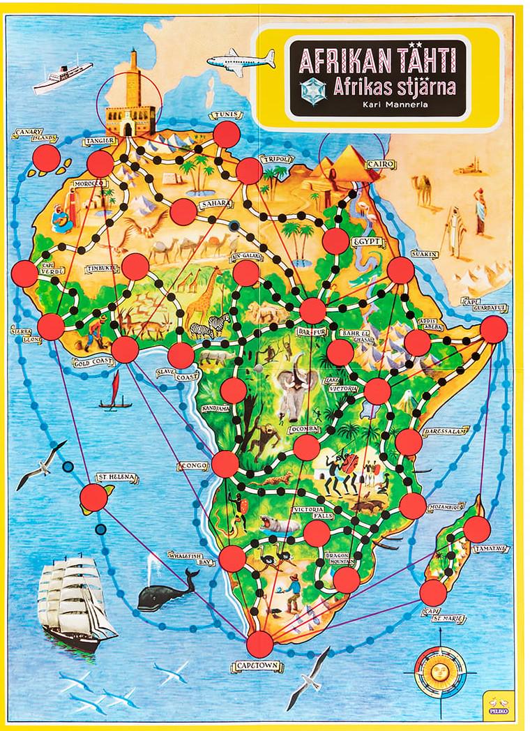
Geographical Distribution of Board Games in Africa Map
This map titled "Africa on a Board Game" illustrates the geographical distribution and popularity of various board games...
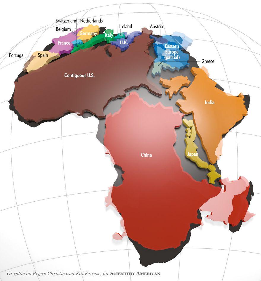
Actual Size of Africa Map
The 'Actual Size of Africa Map' presents a striking visual representation that highlights the continent’s true dimension...
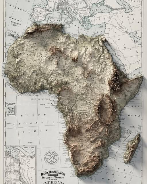
Topographic Map of Africa
The topographic map of Africa is a fascinating representation of the continent's varied landscapes, showcasing its mount...
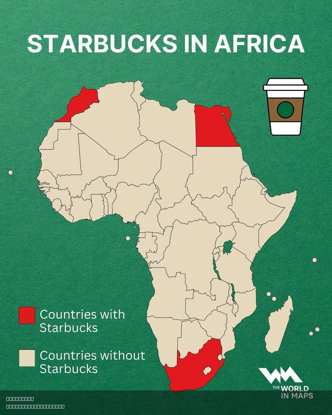
Starbucks Locations in Africa Map
Interestingly, Starbucks entered the African market relatively recently, with its first store opening in Johannesburg, S...
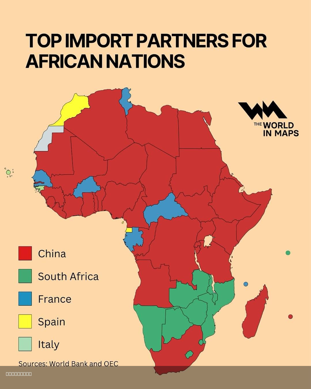
Top Import Partners for African Nations Map
This map illustrates the top import partners for various African nations, highlighting the countries from which each Afr...
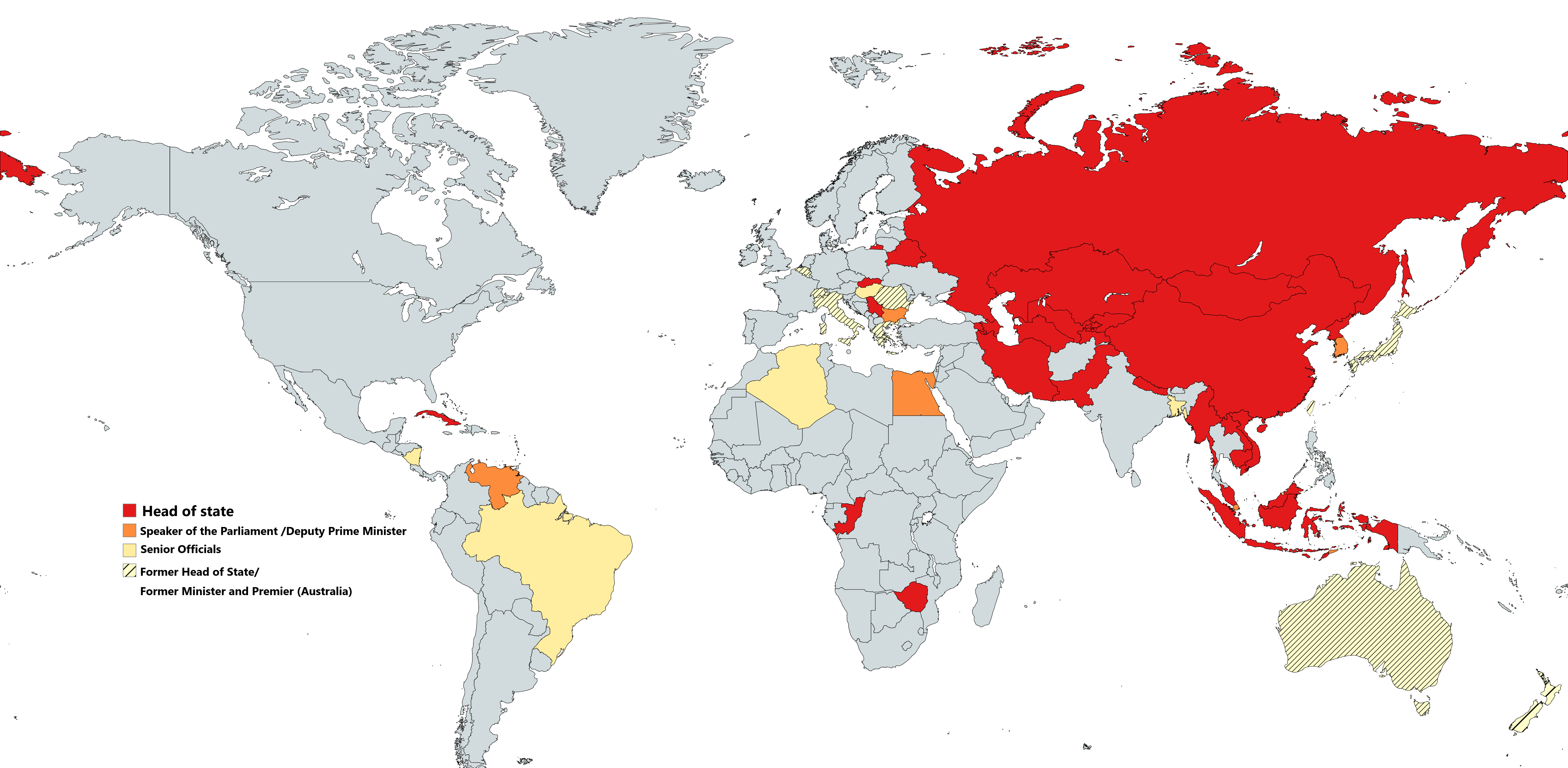
Countries Attending China's Victory Parade Map
Interestingly, the participation of various nations can sometimes be indicative of current diplomatic relations. For ins...
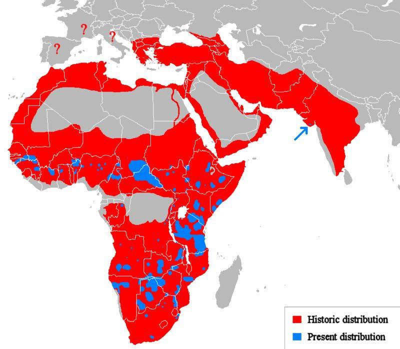
Historic vs Present Distribution of Lions Map
The "Historic vs Present Distribution of Lions" map visually contrasts the past and current range of lion populations ac...
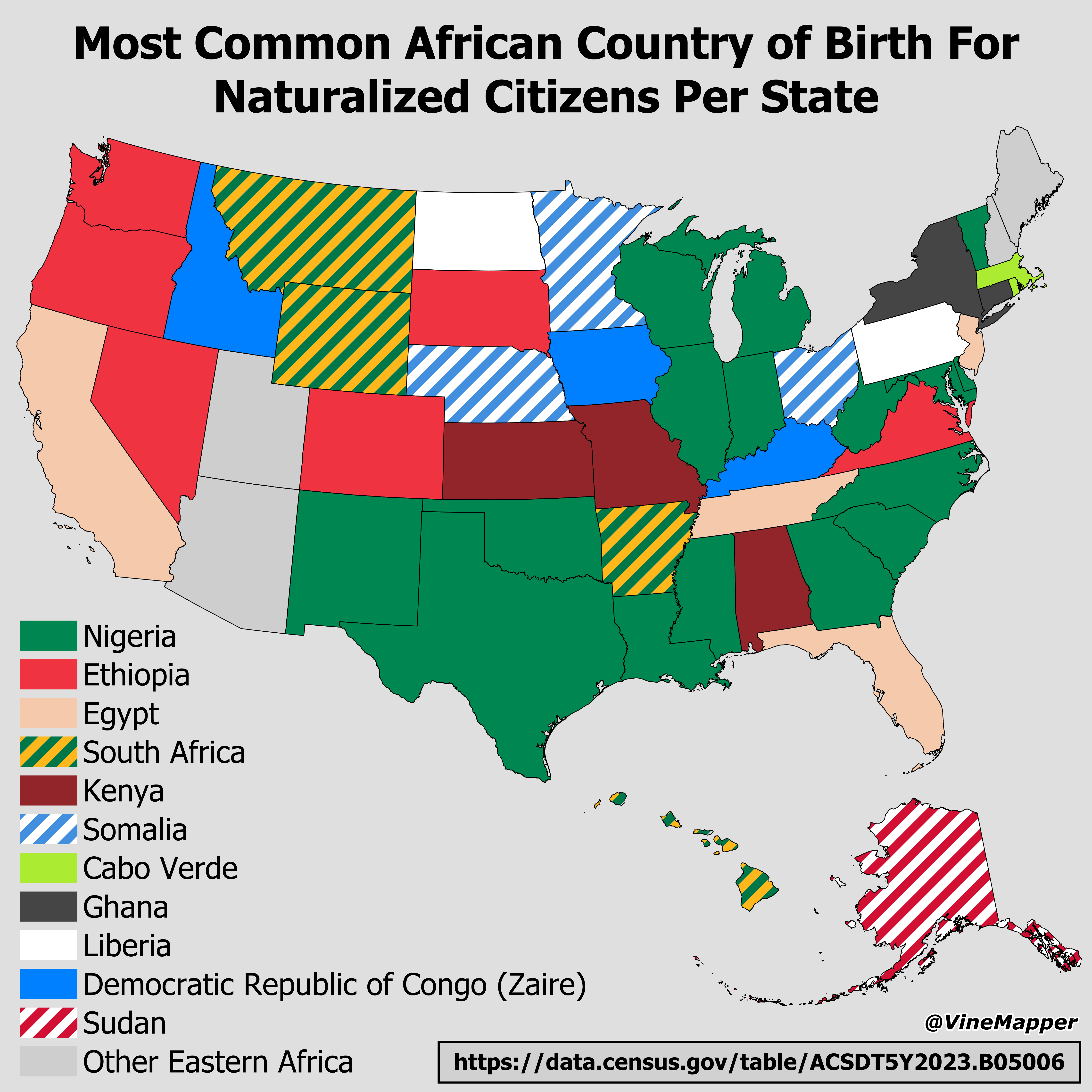
African Country of Birth for Naturalized Citizens Map
The visualization titled "Most Common African Country of Birth For Naturalized Citizens Per State" highlights the predom...
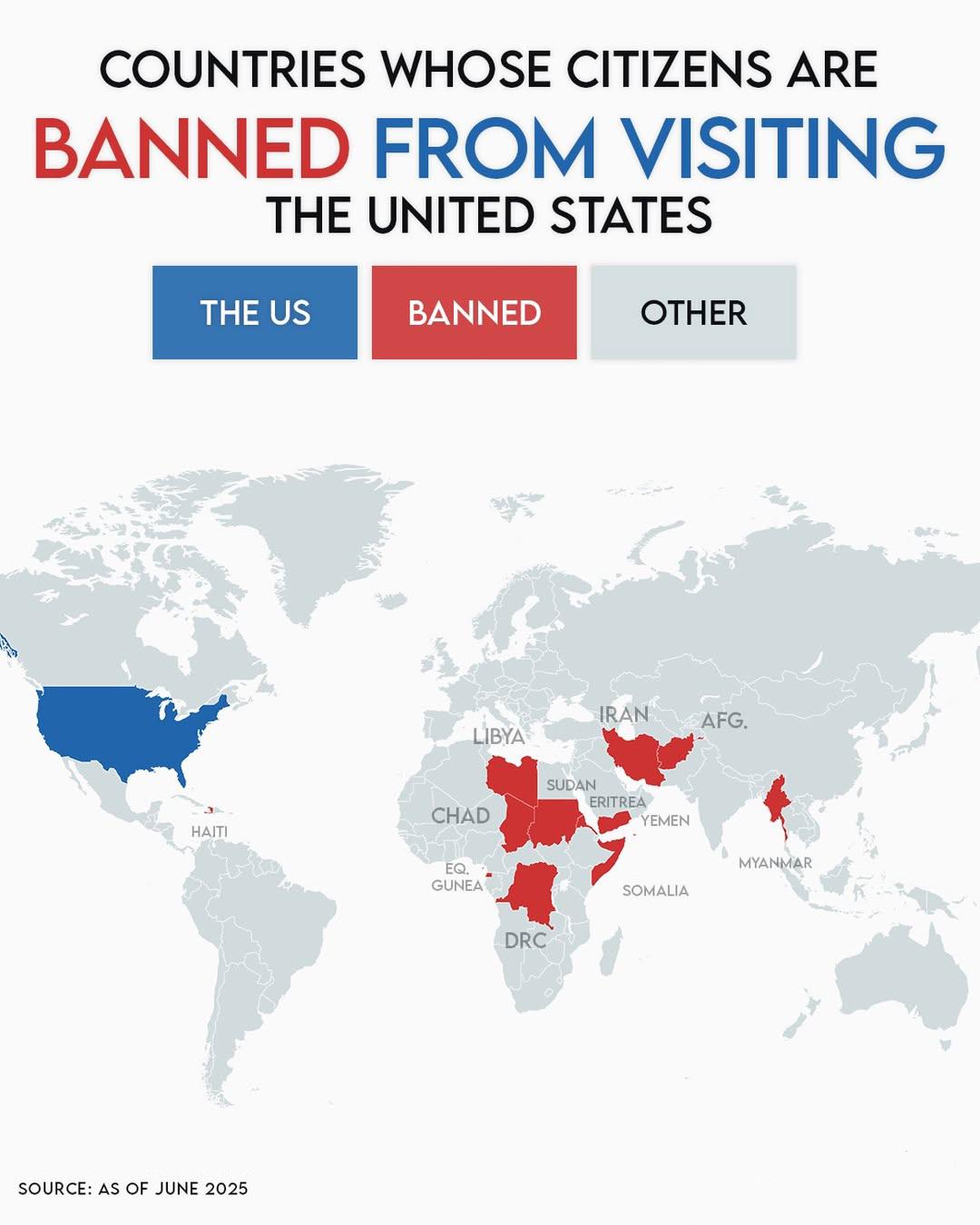
Countries Whose Citizens Are Banned from Entering the United States Map
The visualization at hand provides a clear depiction of countries whose citizens currently face restrictions preventing ...
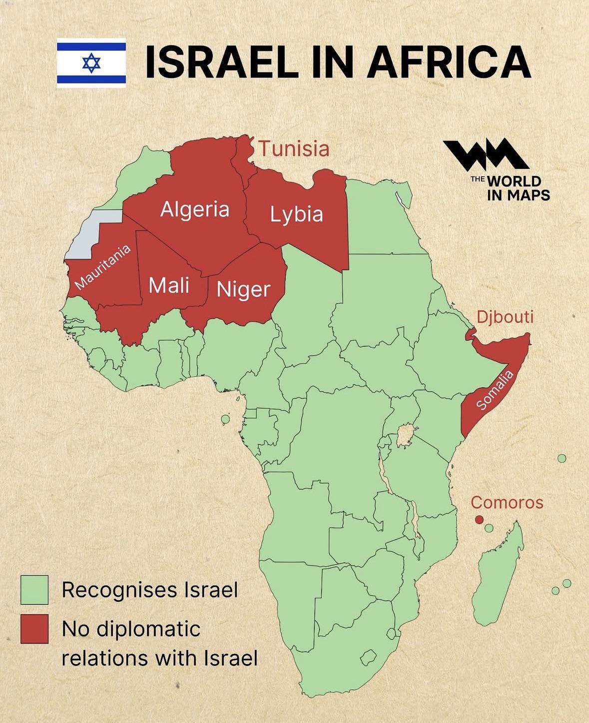
Diplomatic Relations of Israel in Africa Map
The "Diplomatic Relations of Israel in Africa Map" visually represents the complex web of diplomatic ties that Israel ma...
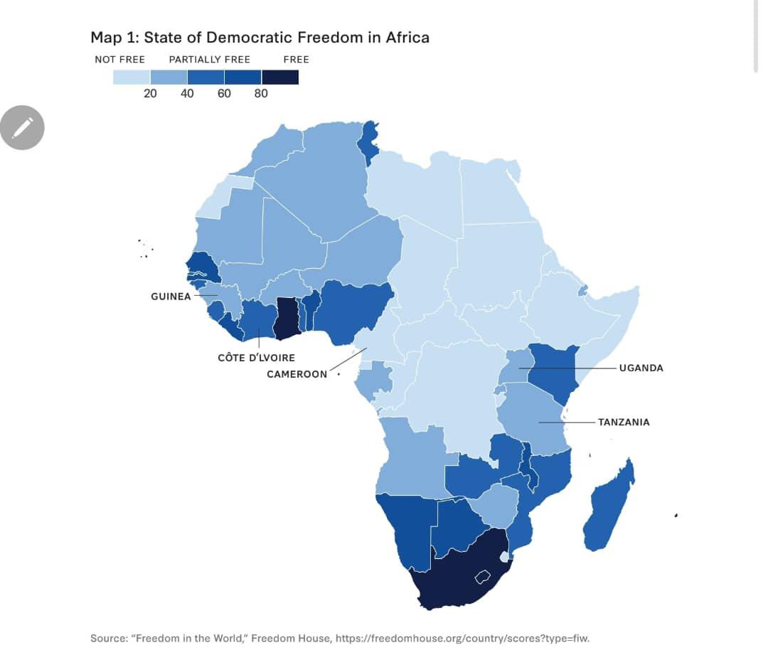
Democracy Status Map of Africa
The map titled \...
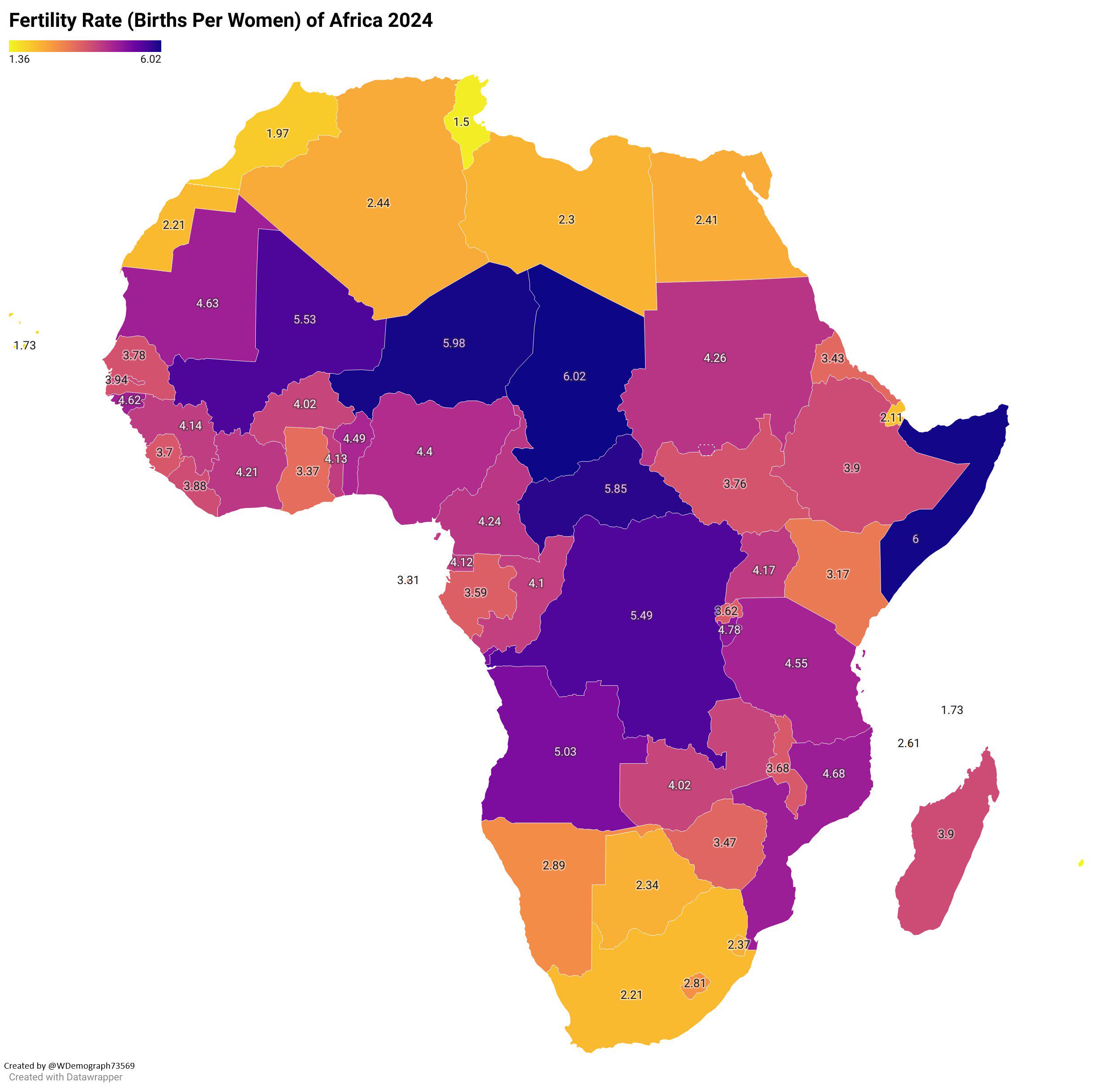
Fertility Rate of Africa 2024 Map
The "Fertility Rate of Africa 2024 Map" provides a comprehensive overview of the average number of children born per wom...
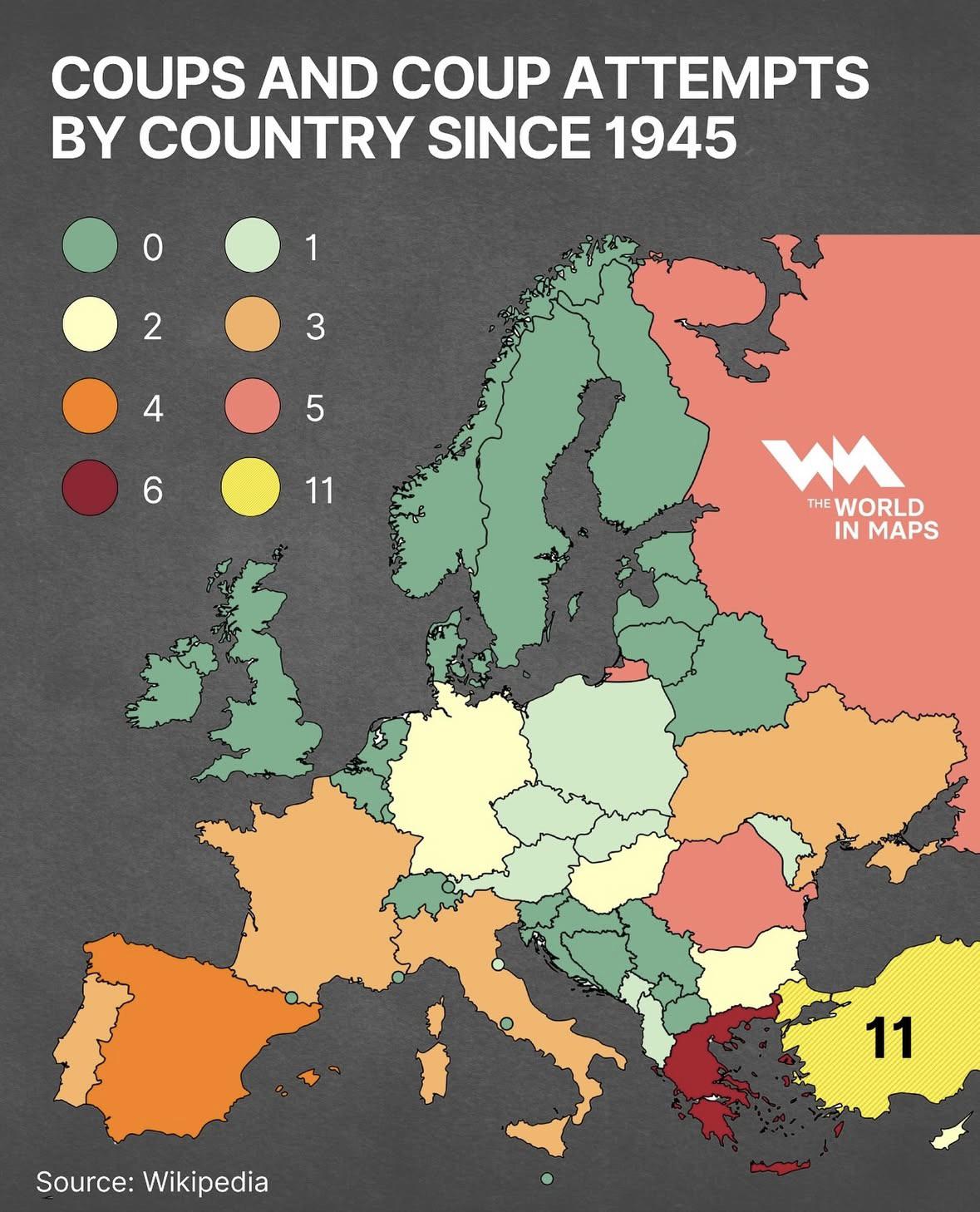
Coups and Coup Attempts by Country Map
The \...
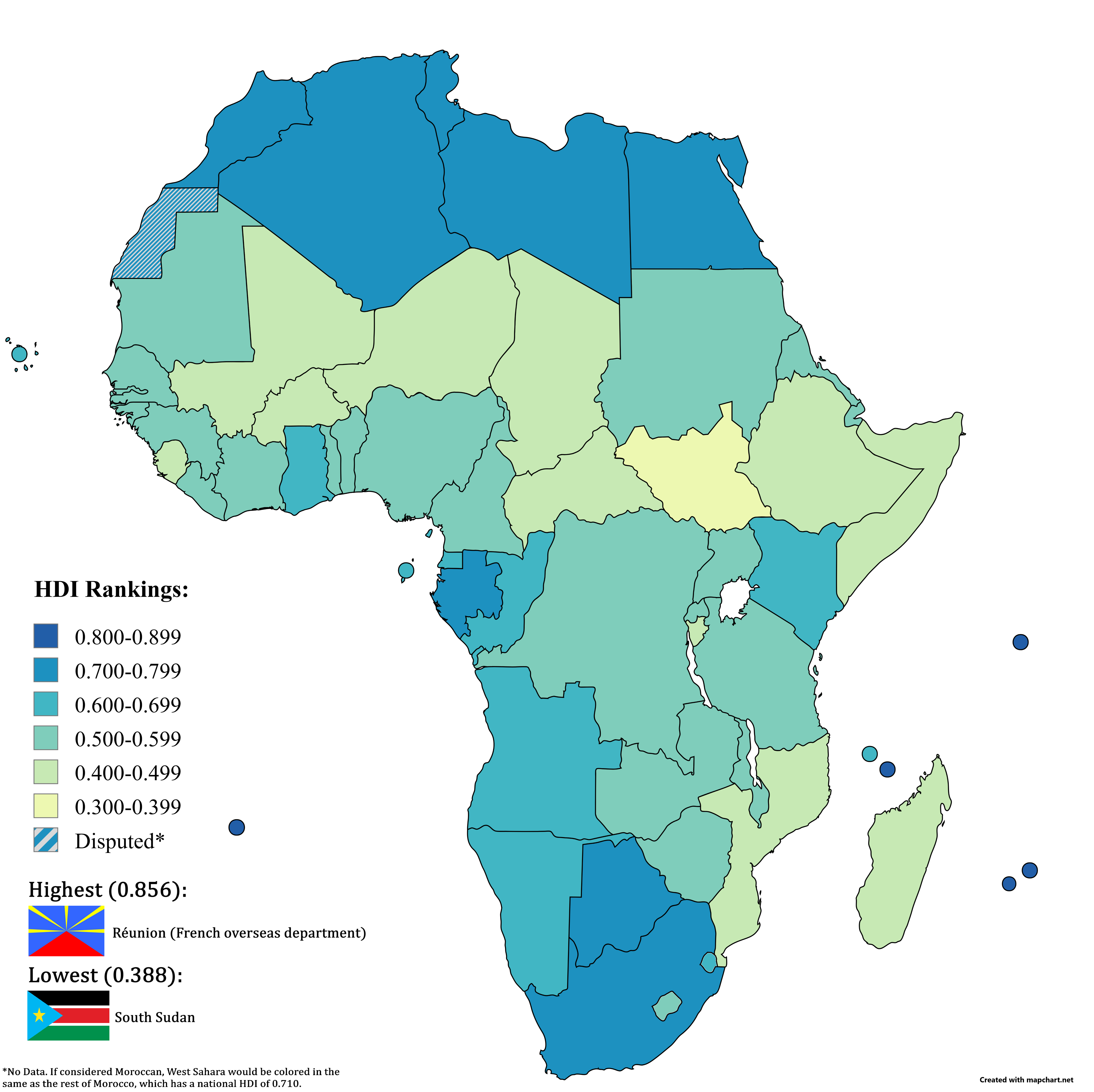
HDI in Africa Map 2023
The "HDI in Africa (2023 Data)" map provides a comprehensive overview of the Human Development Index (HDI) across Africa...
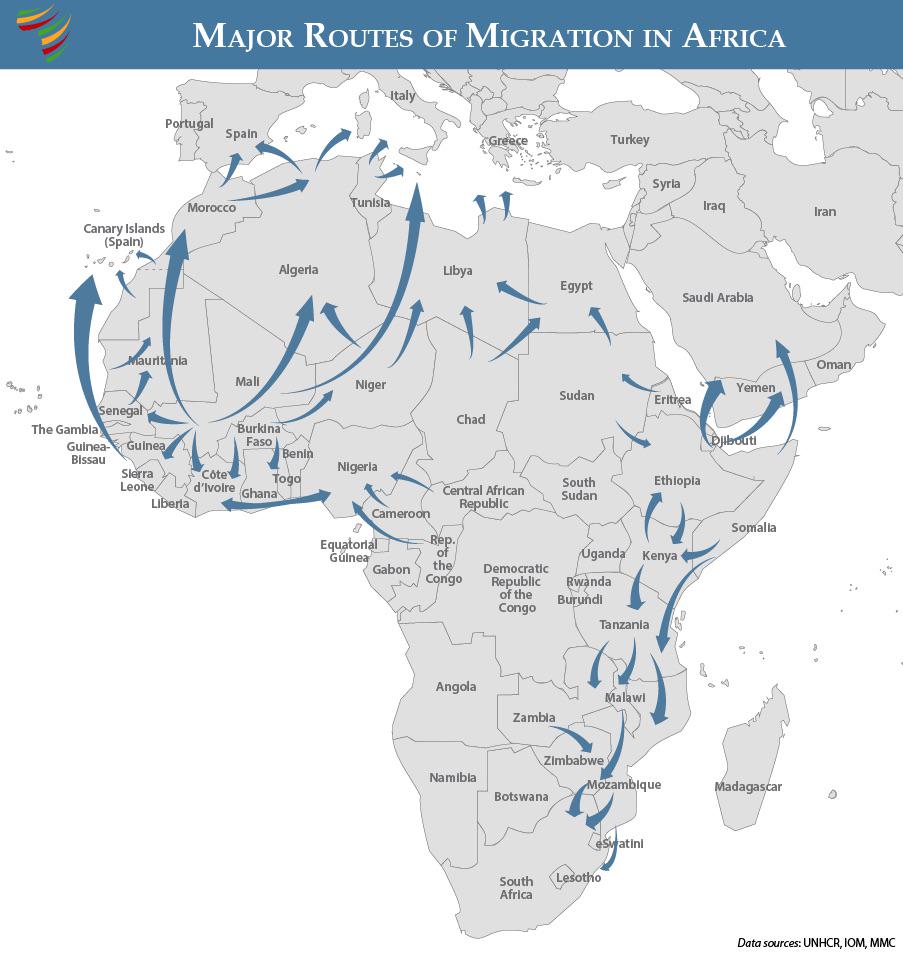
Major Routes of Migration in Africa Map
This map presents a comprehensive overview of the major routes of migration across Africa, highlighting the pathways tha...
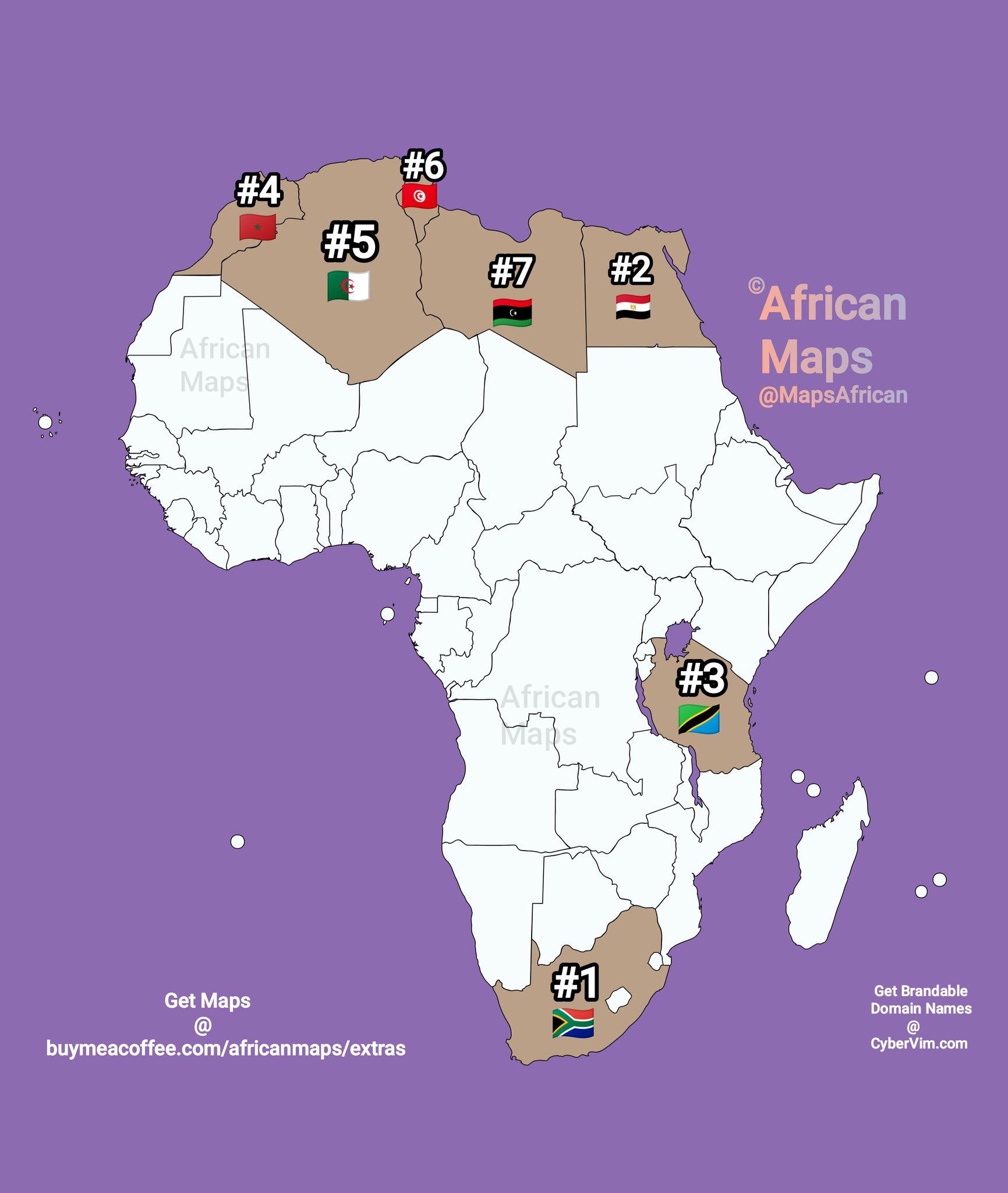
Map of African Countries with Popular Local Football Clubs
This map illustrates the countries in Africa where local football clubs hold more popularity than foreign teams. It high...
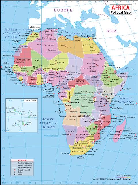
Equal Earth Projection Map for Africa
The visualization titled "African Union Calls for a Fairer World Map" showcases the implications of shifting from the tr...
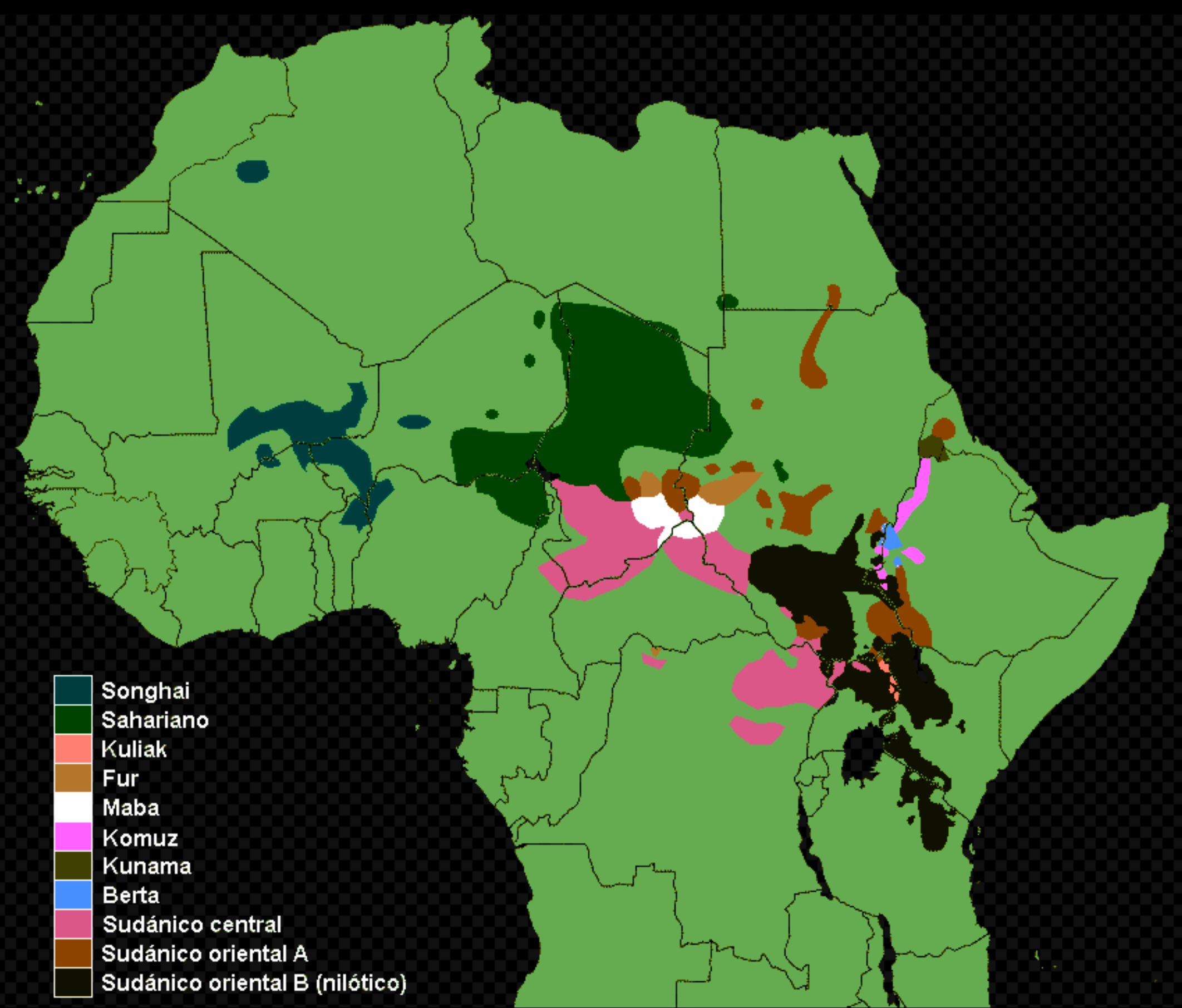
Nilo-Saharan Language Group Map
This map illustrates the distribution of the Nilo-Saharan language group, a fascinating family of languages primarily sp...