Borders of India and Pakistan Map 1947

David Chen
Data Visualization Specialist
David Chen is an expert in transforming complex geographic datasets into compelling visual narratives. He combines his background in computer science ...
Geographic Analysis
What This Map Shows
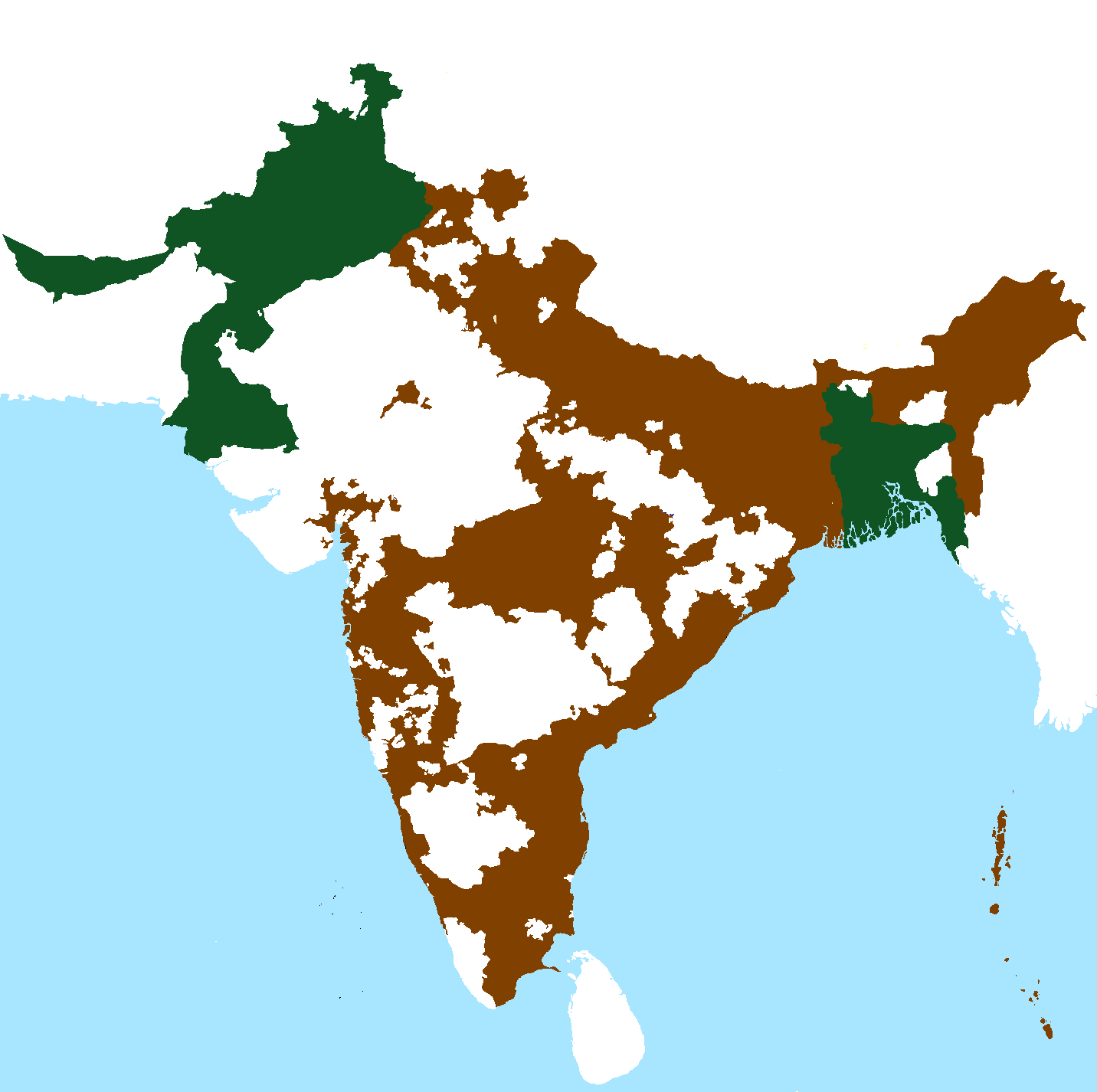
The map titled "Borders of India and Pakistan immediately after independence in 1947" illustrates the geopolitical landscape of the Indian subcontinent during a pivotal moment in history. Following the end of British colonial rule, India was partitioned into two sovereign nations: India and Pakistan. This map visually represents the boundaries that were drawn, highlighting the complexities and challenges that arose from this division.
What’s fascinating about this historical map is how it encapsulates the tensions and sentiments of the time. The borders were not merely lines on a piece of paper; they represented a significant demographic shift, the displacement of populations, and the creation of two distinct national identities. The map serves as a crucial reminder of the geographical and cultural ramifications of partition, setting the stage for future relations between these two countries.
Deep Dive into the Borders of India and Pakistan
The borders delineated on this map are not just geographic; they are emblematic of a tumultuous history. The partition of British India led to the formation of Pakistan, which was conceived as a separate nation for Muslims, while India remained a secular state with a Hindu majority. This division resulted in one of the largest mass migrations in history, with millions of people crossing borders based on their religious affiliations.
Have you ever wondered how such borders are drawn? In the case of India and Pakistan, the Radcliffe Line was established as the boundary between the two nations. Sir Cyril Radcliffe, a British lawyer, was tasked with drawing the line, but, interestingly, he had never been to India prior to his assignment. The hurried nature of the partition meant that many communities were split, leading to violence and displacement. Approximately 15 million people were uprooted, and estimates suggest that around 1 to 2 million lost their lives during this chaotic migration.
The map also shows the regions of Jammu and Kashmir, which became a flashpoint for conflict between the two nations. This area, rich in resources and strategically located, has remained a contentious zone, leading to wars and ongoing disputes. The borders are not static; they have evolved over the years, influenced by military conflicts, diplomatic negotiations, and international interventions.
Interestingly, the partition also brought about significant demographic changes. The Punjab region was particularly affected, with its population divided between the two nations. The western part became part of Pakistan, while the eastern section remained in India. This division resulted in a rich tapestry of cultural exchanges and conflicts that continue to shape the identity of both nations.
Regional Analysis
Looking closely at the regions depicted in the map, we can observe considerable differences in their social, economic, and political landscapes. For instance, Punjab, before partition, was one of the most fertile regions in the subcontinent. Today, the Indian Punjab is known for its agriculture and vibrant culture, while Pakistani Punjab has also developed into an economic powerhouse.
In contrast, the border regions like Kashmir have remained predominantly conflict zones, hindering their development. The map highlights how the line of control has evolved over the decades, with areas experiencing fluctuating control between Indian and Pakistani forces. The northeastern borders, particularly near Assam and West Bengal, showcase a different demographic dynamic, with diverse tribal populations and varying socio-economic conditions.
Furthermore, the coastal areas along the Arabian Sea and the Bay of Bengal reveal contrasting economic activities. The coastline of Gujarat in India is known for its thriving trade and maritime activities, while Karachi, Pakistan's largest city, serves as a vital port. This divergence in economic development can trace its roots back to the historical borders established in 1947.
Significance and Impact
The borders drawn in 1947 have had profound implications not just for India and Pakistan, but for the entire South Asian region. The partition instilled a legacy of mistrust and conflict, impacting bilateral relations for decades. The map is a historical artifact that reminds us of the fragility of borders and how they can influence national identities.
In today's context, the implications of these borders extend to issues like cross-border terrorism, trade relations, and refugee crises. Current geopolitical trends, such as the rise of nationalism and changing alliances, continue to shape the dynamics between the two countries. Notably, recent developments in Kashmir have reignited discussions about autonomy and self-determination, echoing the historical tensions evident in the 1947 map.
Looking ahead, understanding the historical context of these borders can provide insights into future relations and regional stability. The ongoing dialogue around the Kashmir issue and trade policies will be crucial as both nations navigate their complex histories while striving for economic development and peace. The borders of India and Pakistan, as captured in this map, are not just lines—they are stories of millions, shaping the lives of people on both sides.
Visualization Details
- Published
- October 19, 2025
- Views
- 30
Comments
Loading comments...