political map Maps
10 geographic visualizations tagged with "political map"
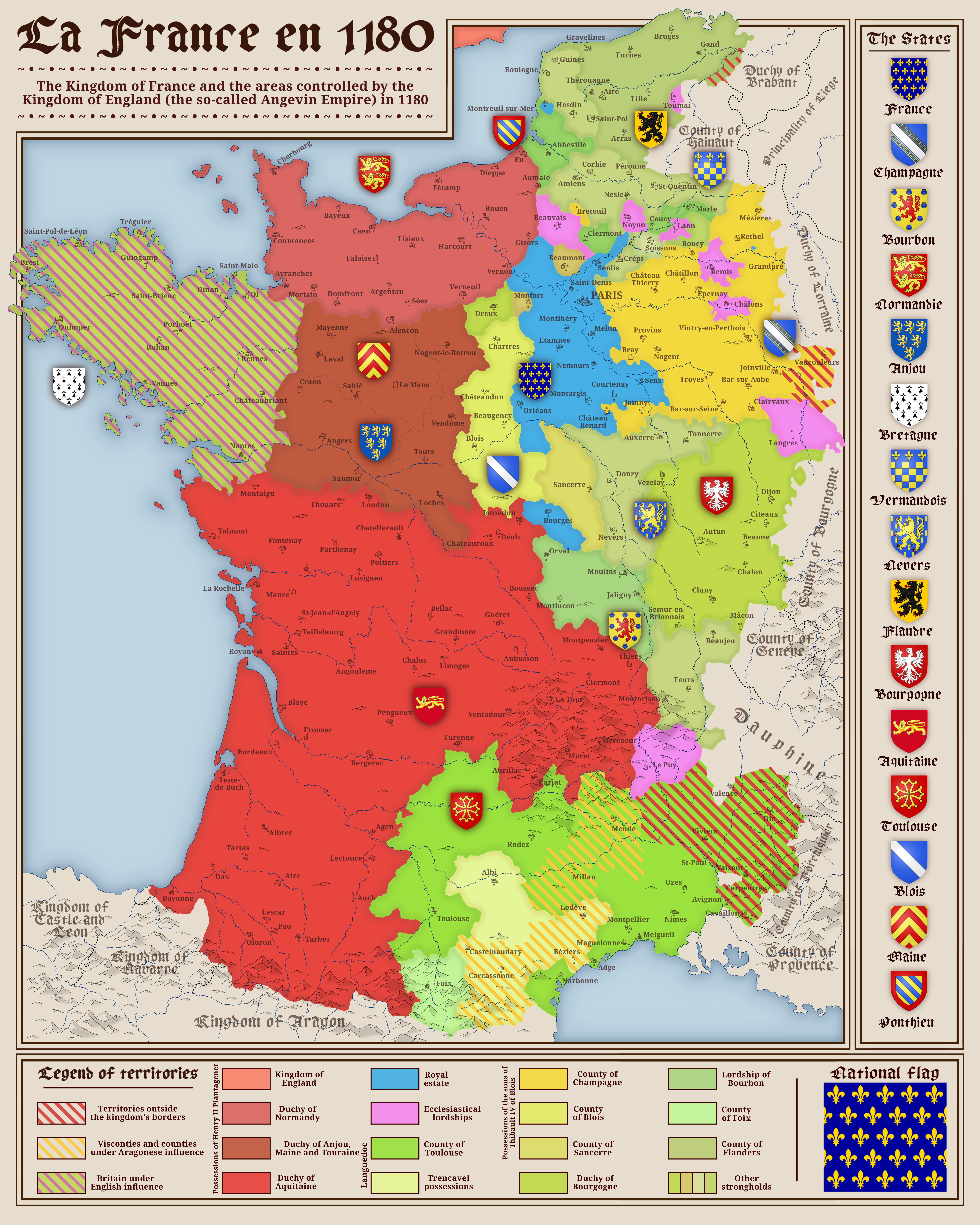
Political Map of France in 1180
The map titled "France in 1180" provides a detailed view of the political landscape of France during the late 12th centu...
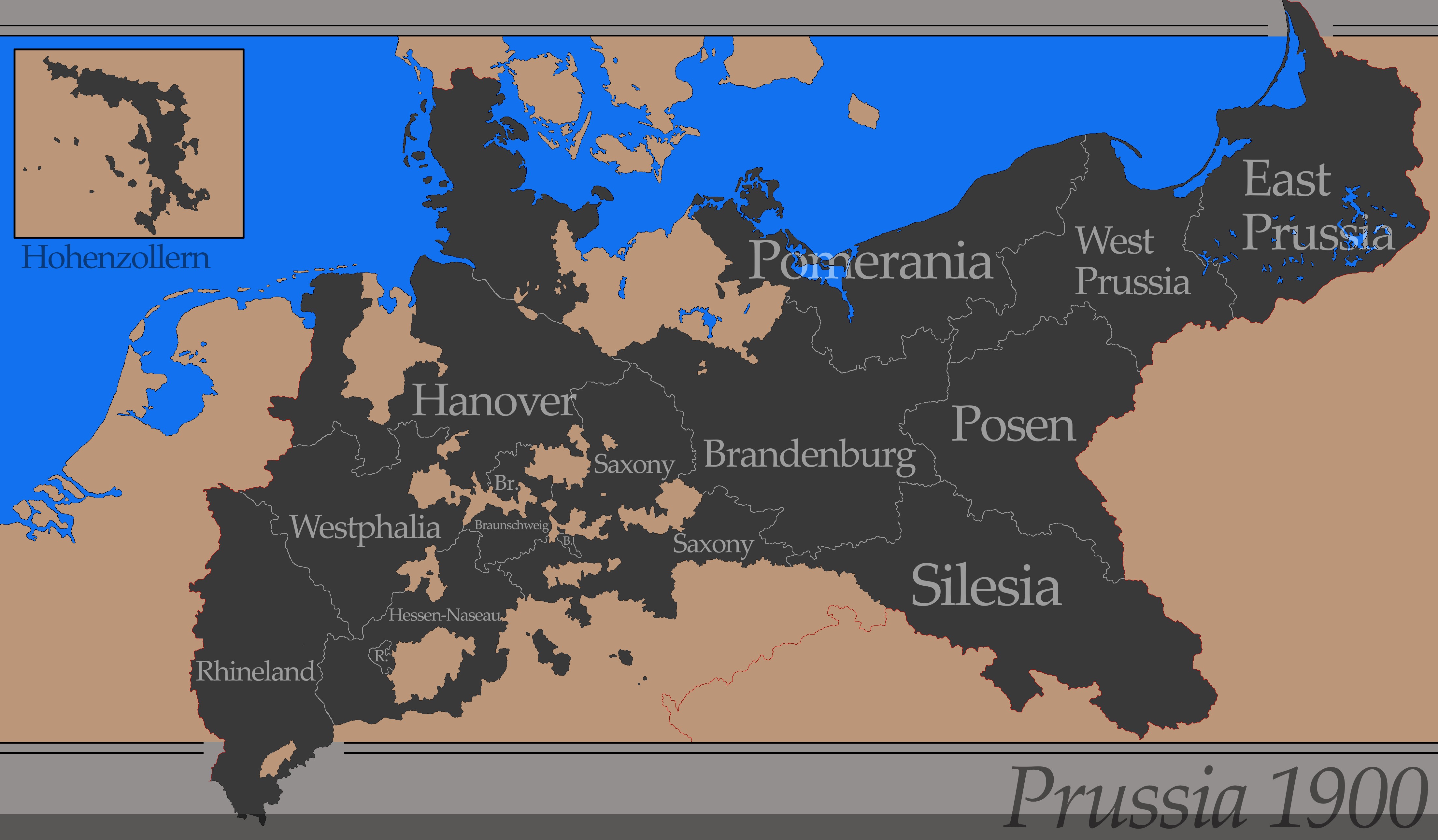
Political Map of Prussia in 1900
The "Simple Map of Prussia in 1900" visually represents the political boundaries and key geographical features of Prussi...
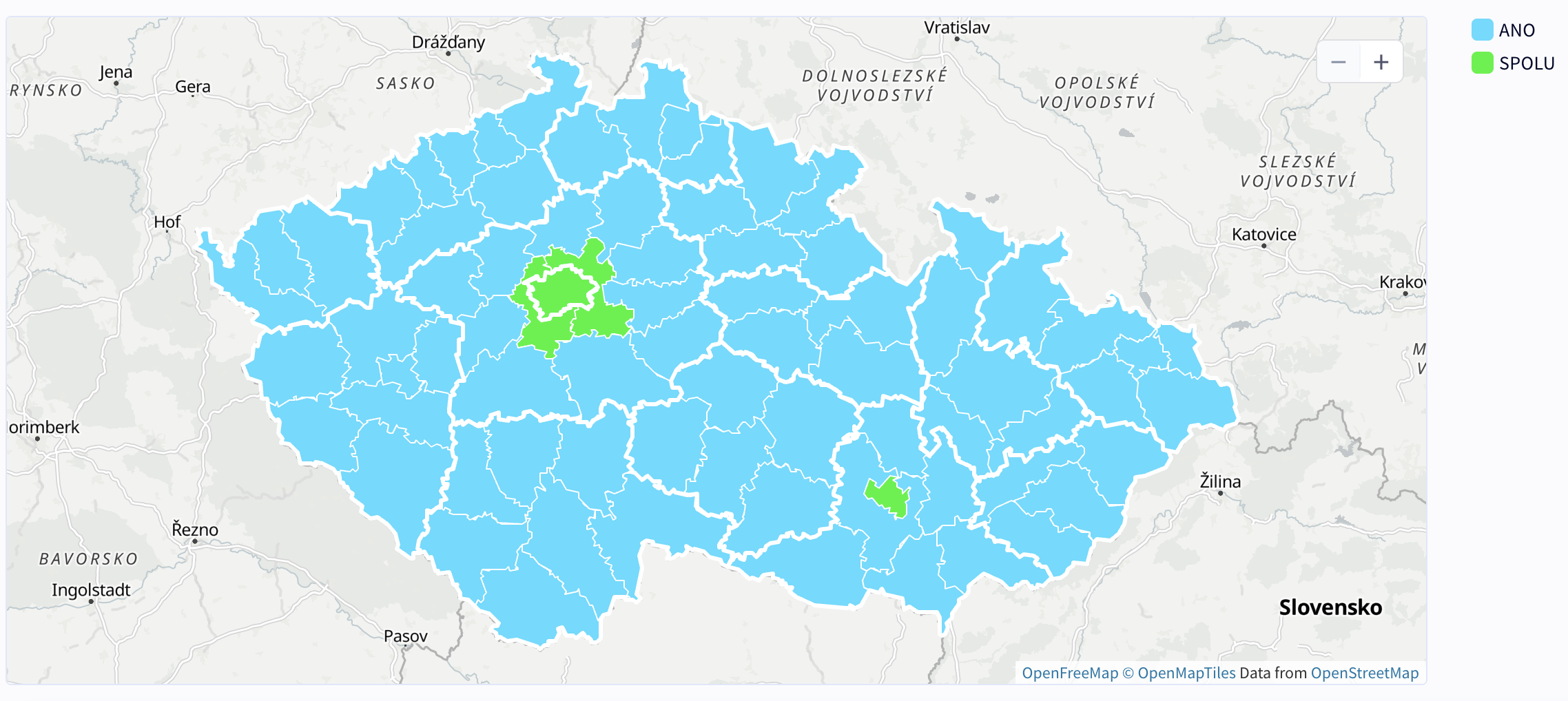
Winning Party by District Map – 2025 Czech Parliamentary Elections
The "Winning Party by District – 2025 Czech Parliamentary Elections" map offers a detailed visualization of the politica...
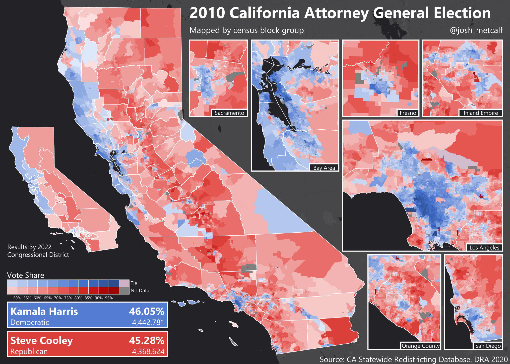
Map of Kamala Harris' 2010 Attorney General Bid
This map illustrates the geographic distribution of support for Kamala Harris during her 2010 bid for California Attorne...
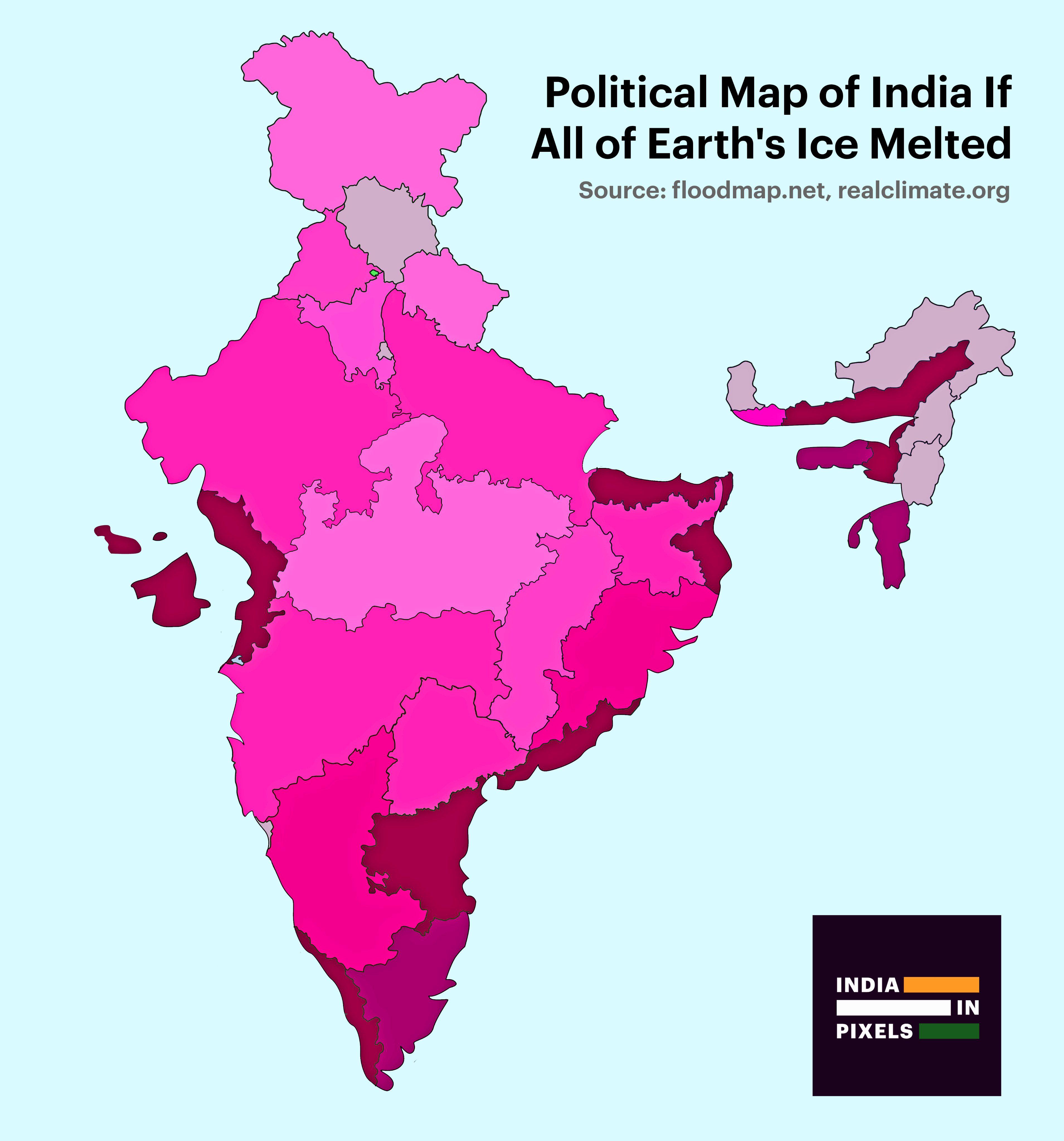
Political Map of India If All Ice Melted Map
This visualization presents a striking political map of India under the hypothetical scenario of complete ice melt acros...
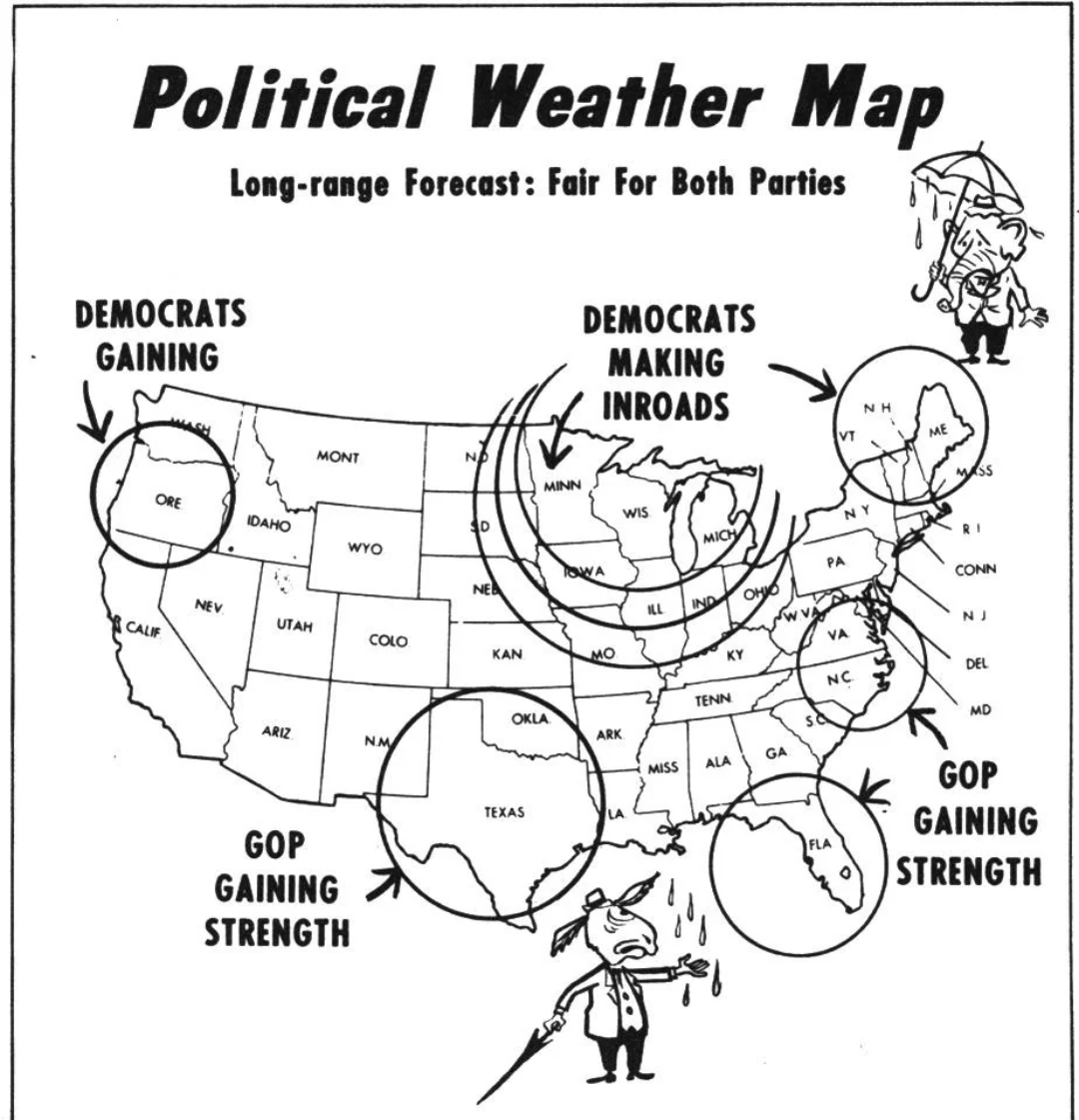
Political Weather Map of 1954
The "Political Weather Map of 1954" offers a striking visualization of the geopolitical landscape during a pivotal year ...
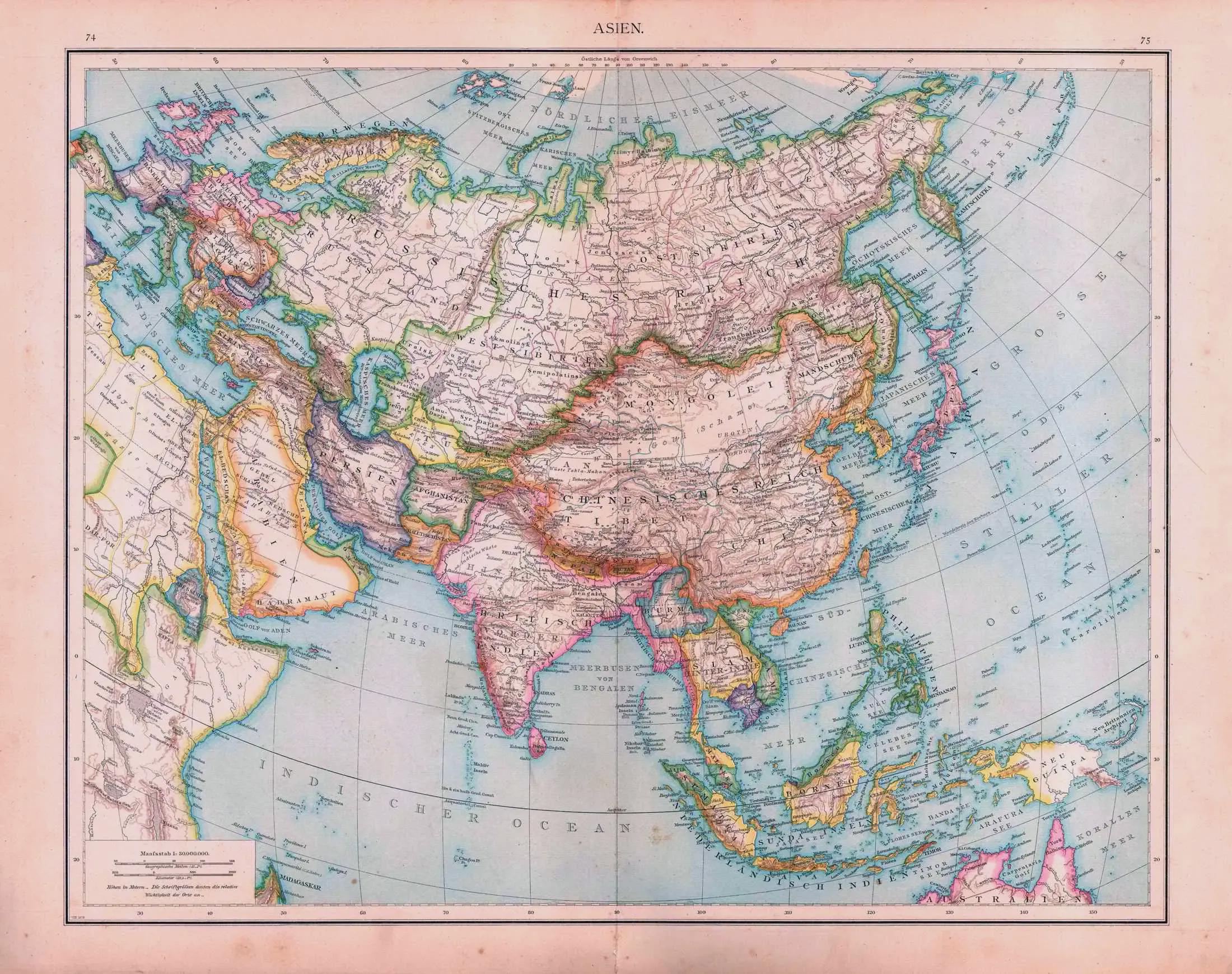
Political Map of Asia 1879
The "Asia (1879 political map)" offers a window into the geopolitical landscape of Asia during the late 19th century. Th...
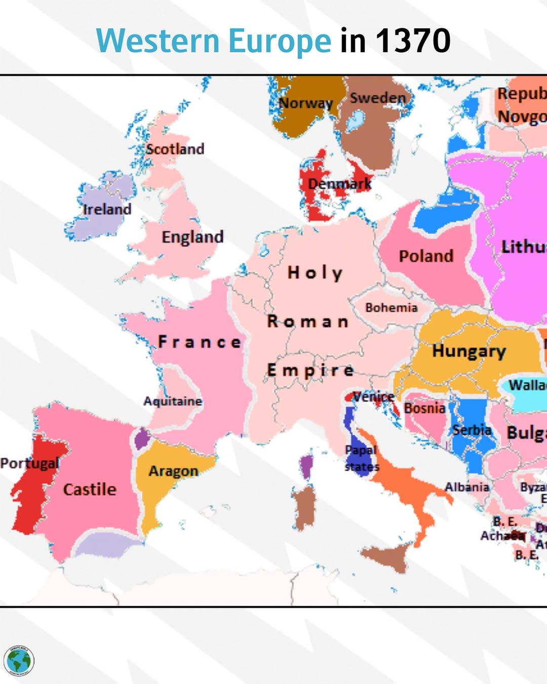
Political Map of Western Europe in 1370
...
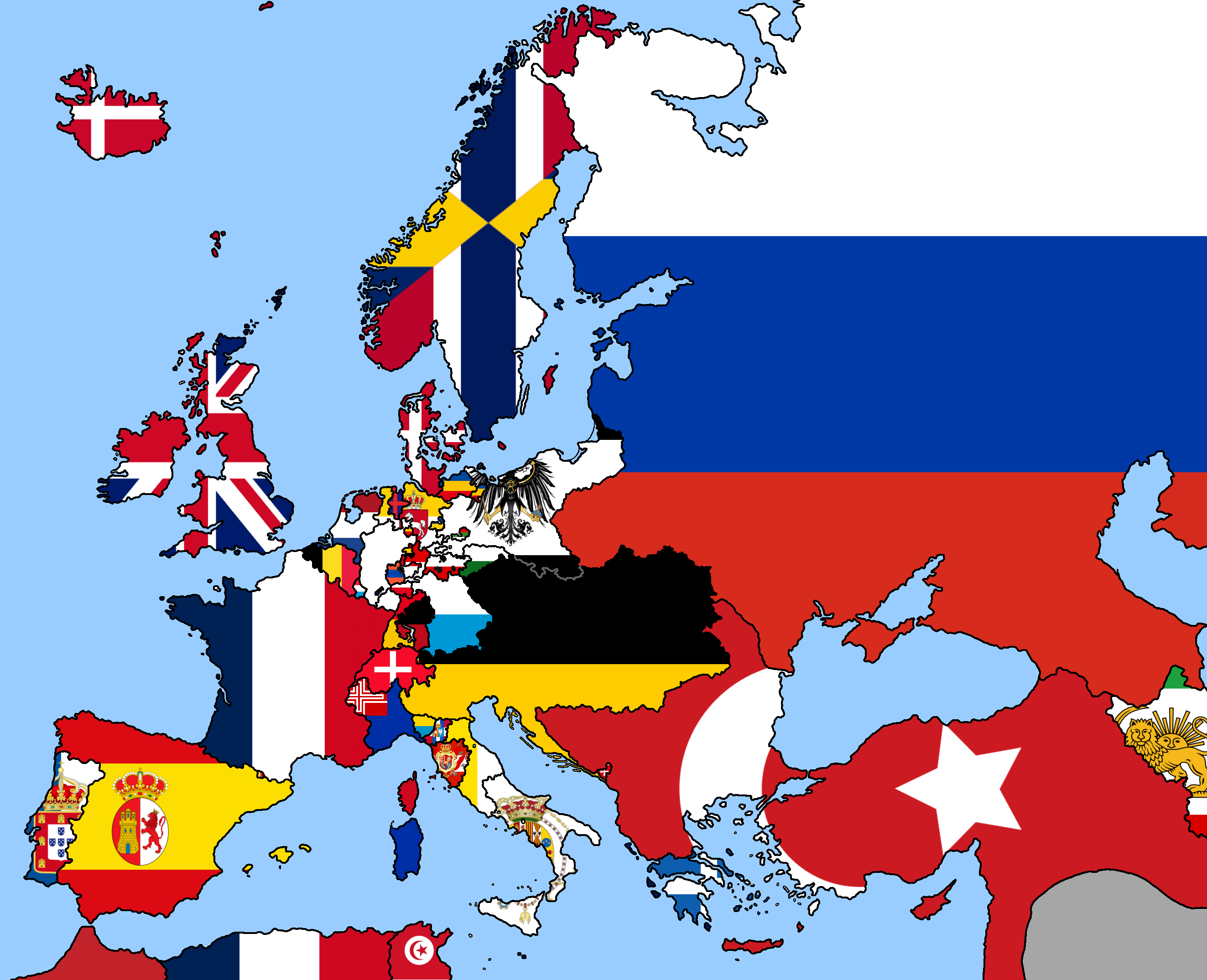
1849 Europe Political Map
The 1849 Europe political map is a fascinating snapshot of a continent undergoing significant changes in the wake of rev...
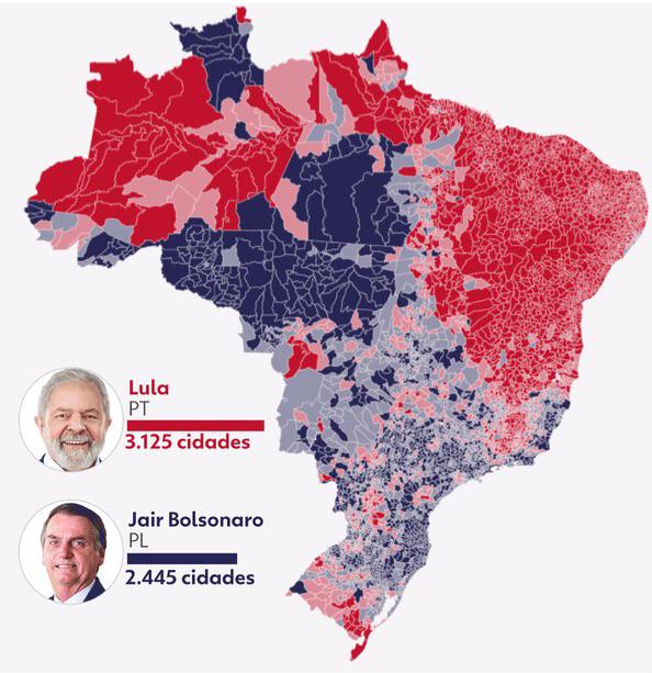
Brazil Presidential Elections 2022 Map by Municipality
The visualization titled "Brazil 2nd round presidential elections - Lula x Bolsonaro (2022) by municipality" provides a ...