new york city Maps
8 geographic visualizations tagged with "new york city"
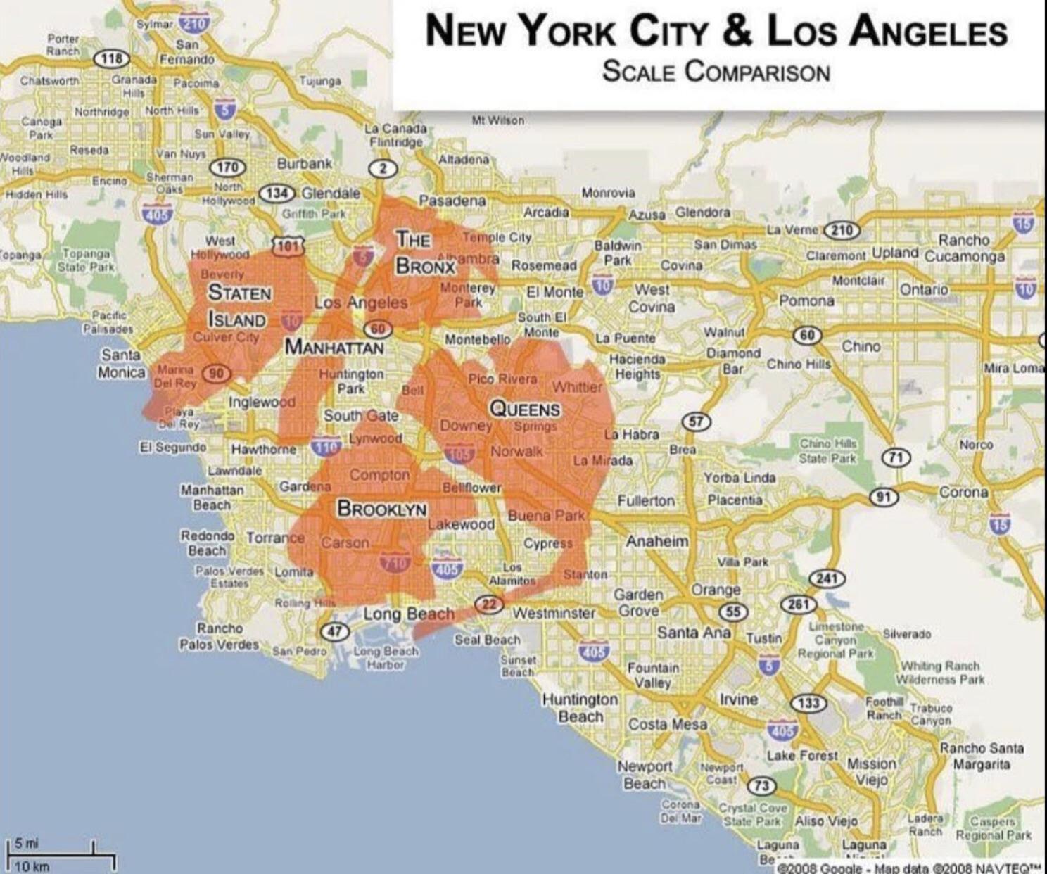
Population and Area Comparison Map of New York and Los Angeles
This map provides a clear visual comparison of the population and area of two of the most iconic cities in the United St...
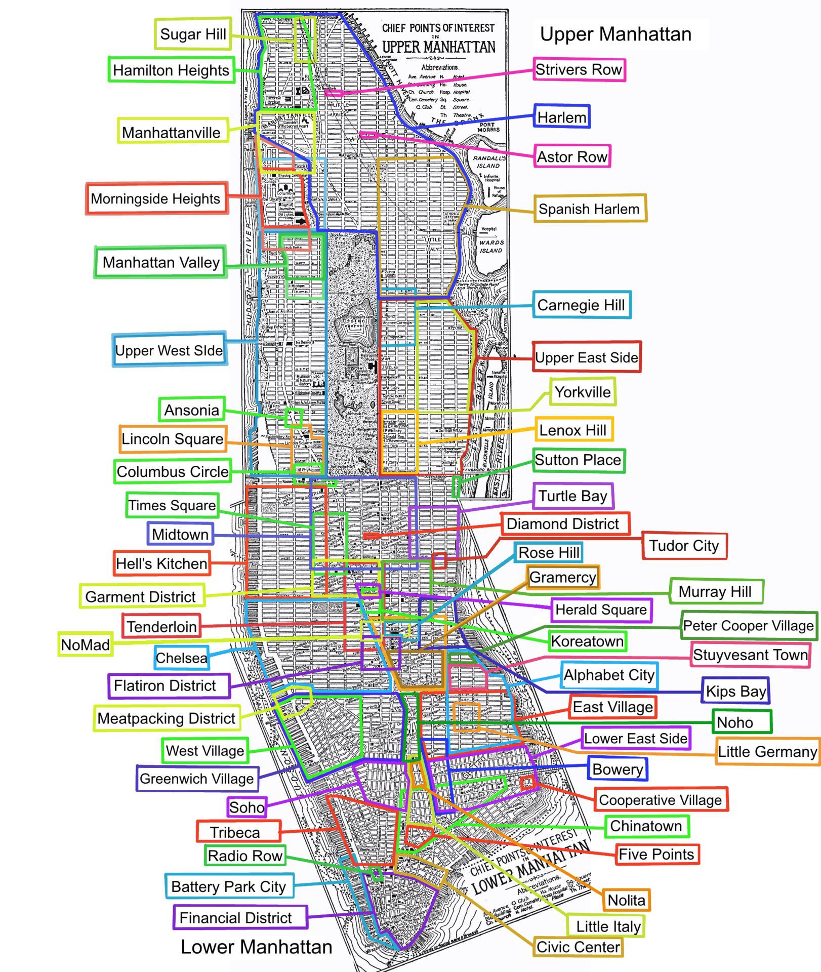
Neighborhoods of Manhattan Map
The "Neighborhoods of Manhattan Map" presents a detailed overview of the various neighborhoods that make up Manhattan, o...
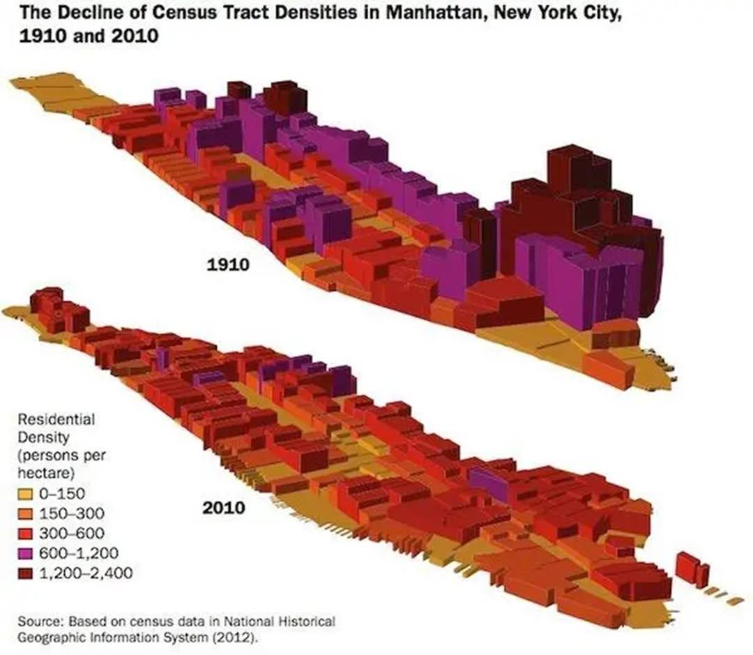
Manhattan Population Decline Map from 1910 to Today
Several factors have played a role in this population decline. The early 20th century was marked by rapid industrializat...
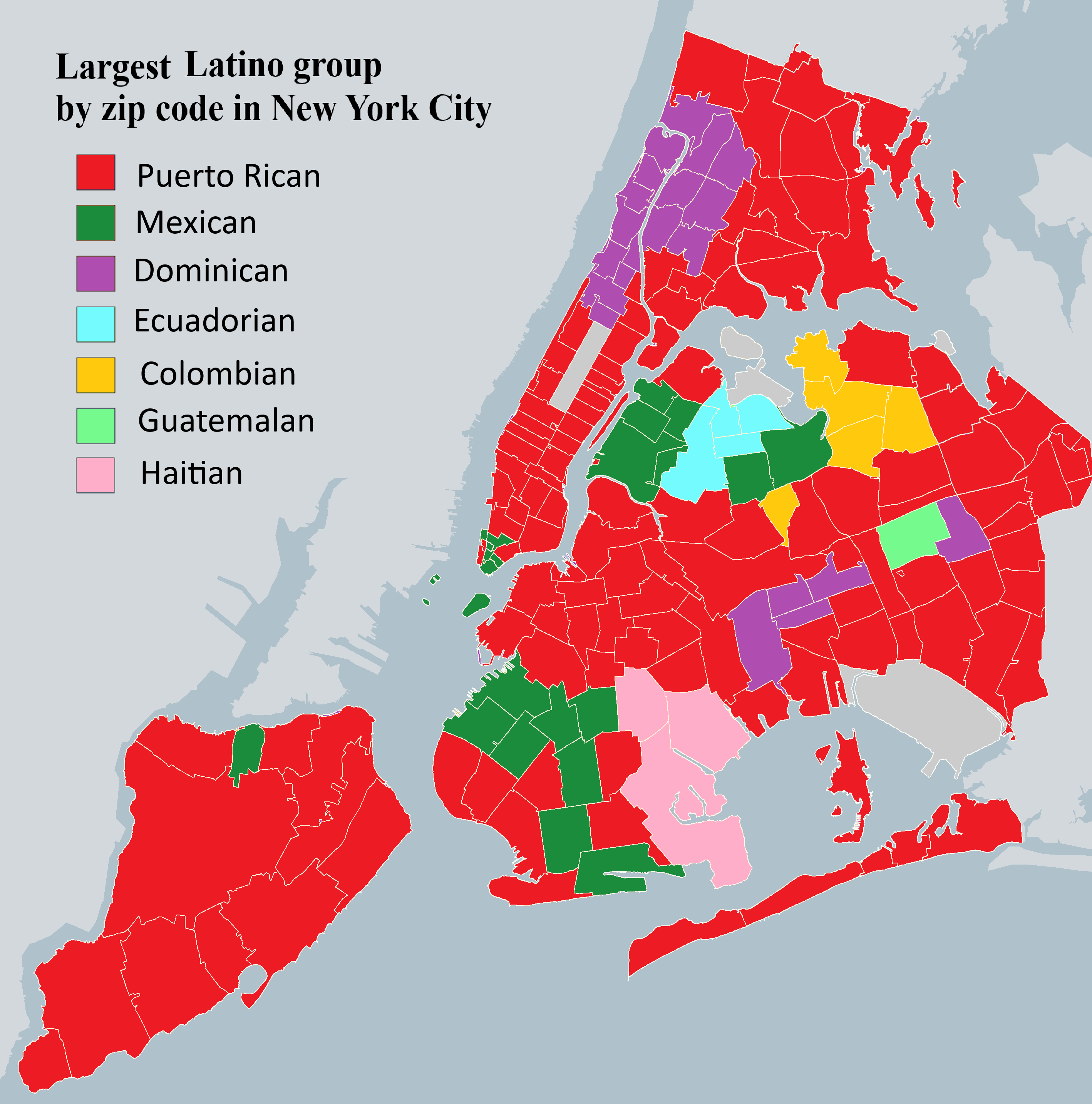
New York City Latin American Ancestry Map
The visualization titled "New York City's largest Latin American ancestry in each zip code area" provides an insightful ...
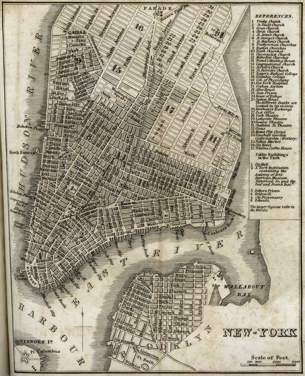
Map of New York City in 1842
The "New-York" map from 1842 by H.S. Tanner provides a detailed depiction of New York City during a transformative perio...
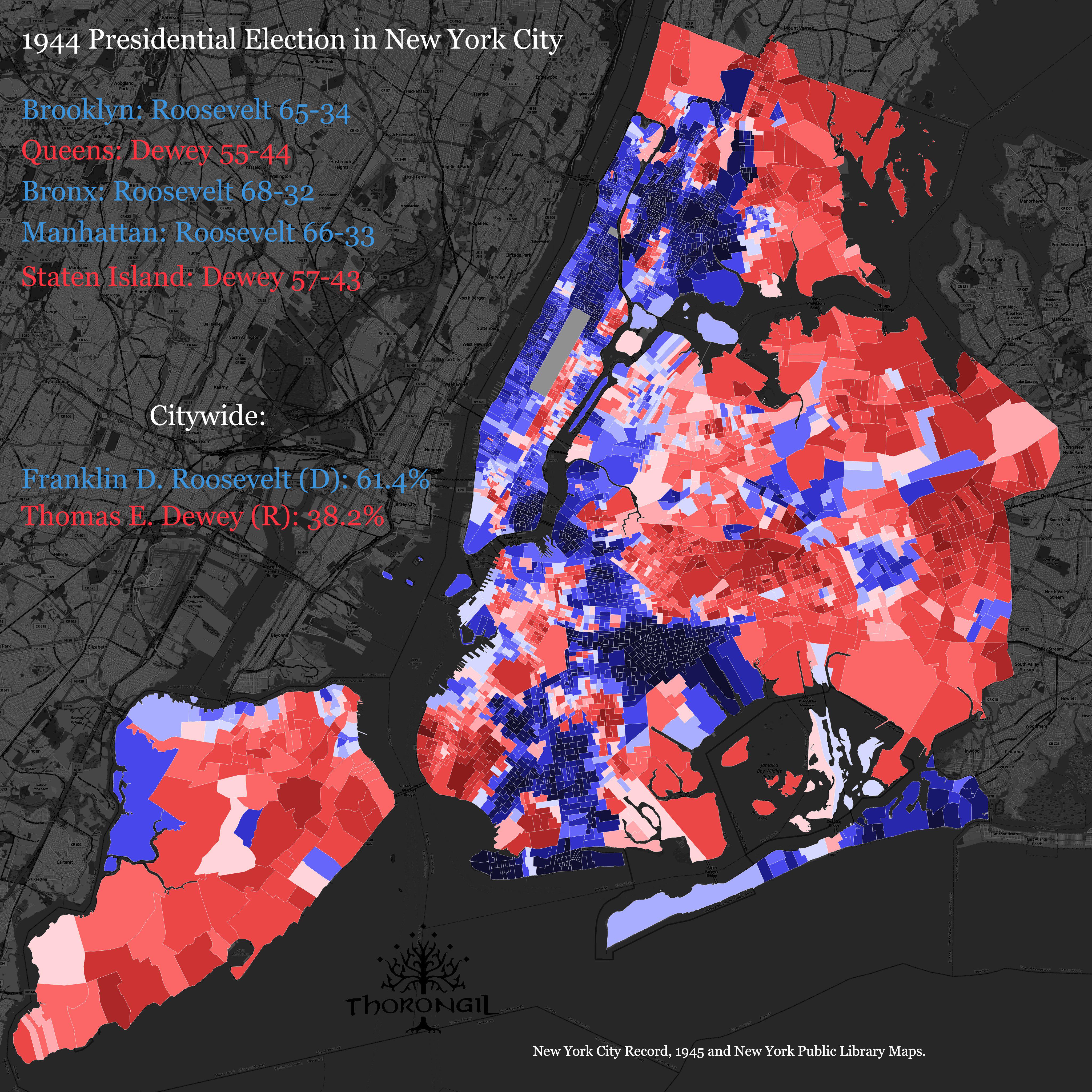
1944 Presidential Election Results Map of NYC
The "1944 Presidential Election Results Map of NYC" provides a visualization of how different neighborhoods and boroughs...
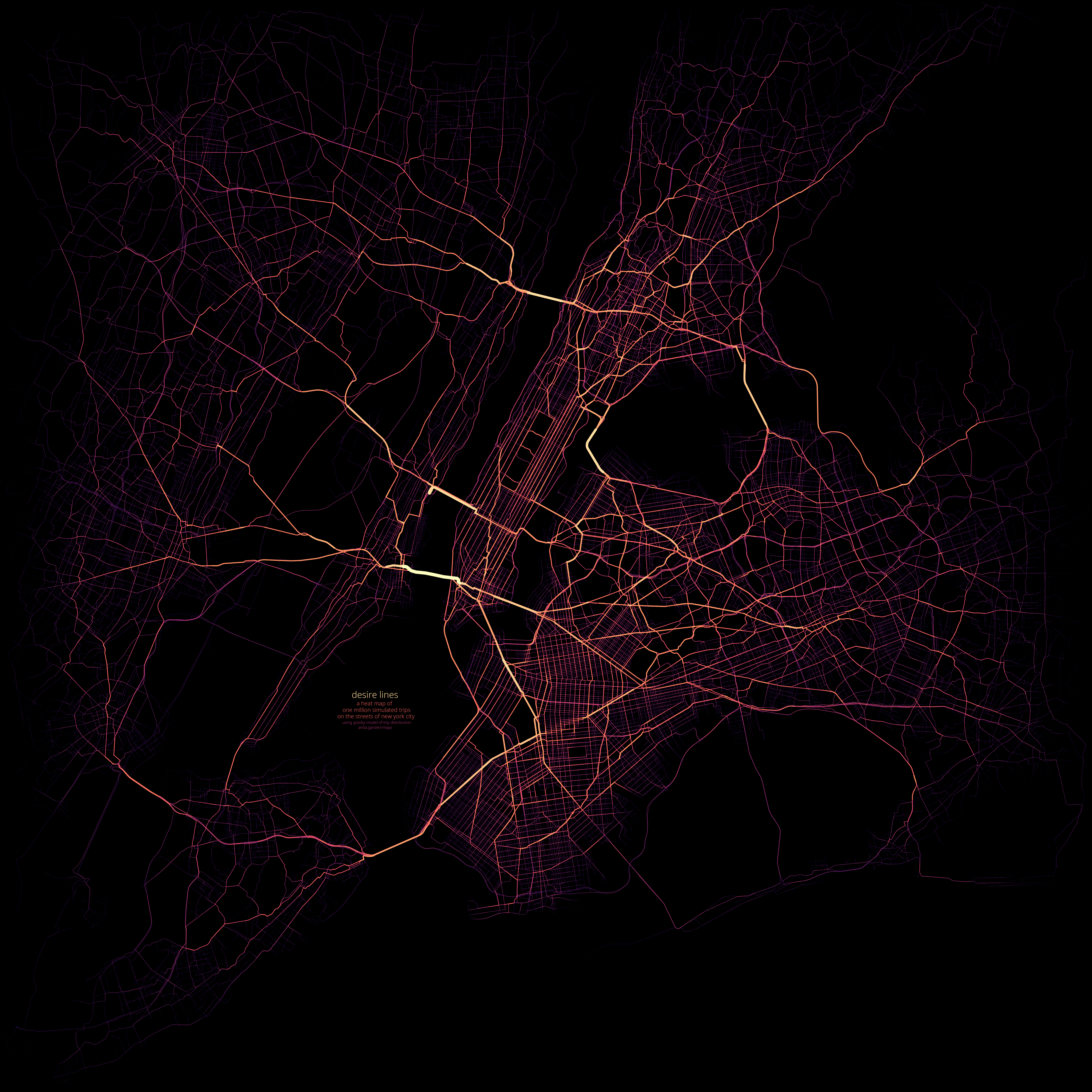
Heat Map of NYC Area Streets Usage
The heat map of one million simulated trips on NYC area streets presents a dynamic visualization of urban mobility patte...
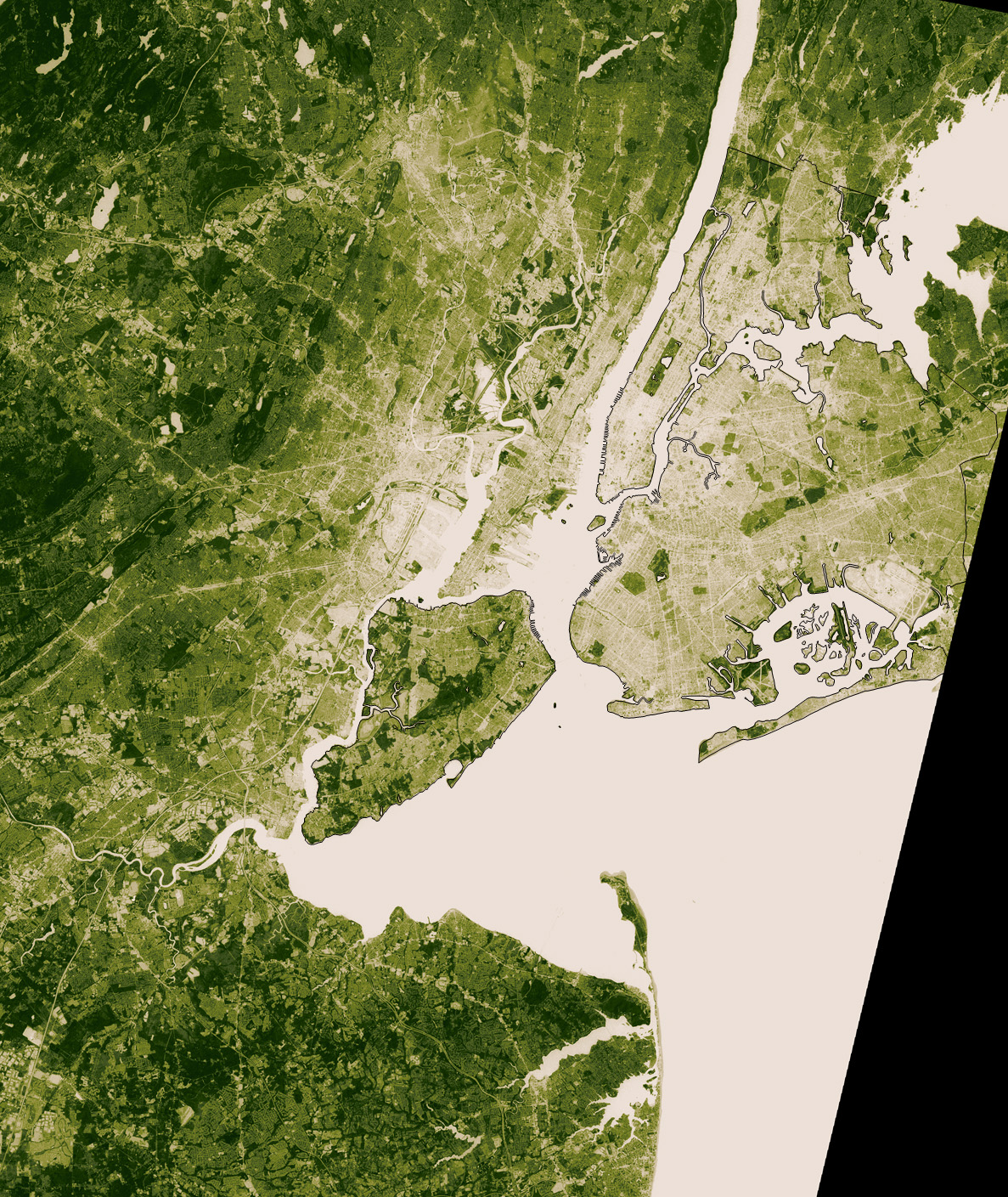
Vegetation Map of New York City
The Vegetation Map of New York City provides a detailed visualization of the various plant species and vegetation types ...