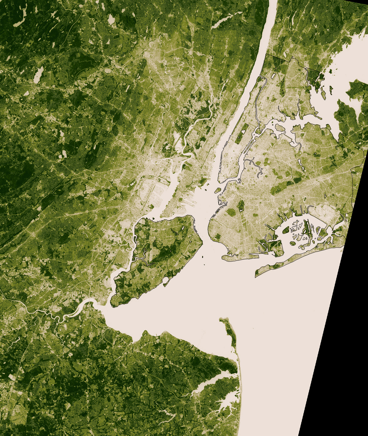
Vegetation Map of New York City

Alex Cartwright
Senior Cartographer & GIS Specialist
Alex Cartwright is a renowned cartographer and geographic information systems specialist with over 15 years of experience in spatial analysis and data...
Geographic Analysis
What This Map Shows
The Vegetation Map of New York City provides a detailed visualization of the various plant species and vegetation types that thrive across the city's diverse urban landscape. This map highlights the distribution of greenery—from lush parks and gardens to street trees and natural habitats—offering insight into the ecological tapestry that characterizes the Big Apple. It reveals not just where vegetation exists, but also hints at the biodiversity and environmental health of different areas within this bustling metropolis.
Deep Dive into Urban Vegetation in New York City
New York City is often seen as a concrete jungle, but what's fascinating is the intricate web of vegetation that coexists within this urban environment. Urban vegetation plays a crucial role in enhancing the quality of life for residents, providing shade, improving air quality, and supporting local wildlife. The vegetation types vary significantly across the city, influenced by factors such as soil conditions, climate, and human activity.
One of the most notable aspects of New York City's vegetation is its parks. Central Park, for instance, is a prime example of a designed landscape that incorporates a variety of plant species. Spanning 843 acres, it features woodlands, meadows, and water bodies, home to over 20,000 trees and countless shrubs and herbaceous plants. Interestingly, the park serves as a crucial habitat for migratory birds, making it a vital green space within an urban setting.
Beyond Central Park, other significant green spaces include Prospect Park in Brooklyn and Flushing Meadows-Corona Park in Queens. These parks not only provide recreational opportunities for residents but also contribute to the city’s ecological health. The vegetation in these parks is meticulously managed to preserve native species and promote biodiversity. For example, Prospect Park showcases a diverse range of trees, including oaks, maples, and dogwoods, many of which are over a century old.
Interestingly, street trees also form an integral part of NYC's vegetation. The city boasts over 600,000 street trees, which are strategically planted to shade sidewalks, reduce heat, and improve air quality. The most common species include London plane trees, honey locusts, and red maples. These trees not only enhance the aesthetic appeal of neighborhoods but also provide essential services, such as stormwater absorption and carbon sequestration.
Regional Analysis
Examining the Vegetation Map of New York City reveals distinct differences in vegetation patterns across the five boroughs: Manhattan, Brooklyn, Queens, The Bronx, and Staten Island. For instance, Manhattan is characterized by its high-density urban landscape, where green spaces like Bryant Park and the High Line demonstrate innovative uses of limited space. Despite its urbanization, Manhattan has made efforts to integrate green architecture and vertical gardens, showcasing a commitment to sustainability.
In contrast, Staten Island, often referred to as the "Green Borough," boasts the highest percentage of natural vegetation in NYC. Over 60% of its land is designated as parkland or preserved natural areas, including the Staten Island Greenbelt, which features extensive woodlands and wetlands. This area's vegetation supports a rich array of wildlife, making it a haven for nature enthusiasts.
Queens and Brooklyn present a mixed picture, with both urban and green spaces. Forest Park in Queens offers a blend of woodlands and recreational areas, while Brooklyn's Prospect Park stands out as a model of urban forestry and biodiversity conservation. The Bronx, known for its botanical gardens and the Bronx Zoo, showcases a unique blend of urban vegetation and natural habitats, emphasizing conservation efforts in urban settings.
Significance and Impact
Understanding the vegetation patterns in New York City is crucial for several reasons. First, urban vegetation contributes significantly to the city's ecological health, acting as a buffer against climate change by absorbing carbon dioxide and mitigating urban heat islands. This is increasingly important as cities face rising temperatures and extreme weather events.
Moreover, the presence of green spaces has been linked to improved mental health and well-being among urban residents. Studies have shown that access to parks and greenery can reduce stress and enhance overall quality of life. As urban planners and policymakers prioritize sustainability, the role of vegetation becomes even more critical in shaping resilient cities of the future.
Interestingly, trends indicate a growing movement towards increasing urban greenery through initiatives like the MillionTreesNYC program, which aims to plant one million trees across the city. This not only enhances the urban landscape but also fosters community involvement and environmental stewardship.
In conclusion, the Vegetation Map of New York City reveals more than just where plants grow; it tells a story of resilience, community, and the ongoing struggle to balance urban development with environmental sustainability. As New York City continues to evolve, understanding and preserving its rich tapestry of vegetation will be key to ensuring a livable and vibrant urban future.
Visualization Details
- Published
- September 24, 2025
- Views
- 58
Comments
Loading comments...