biodiversity Maps
68 geographic visualizations tagged with "biodiversity"
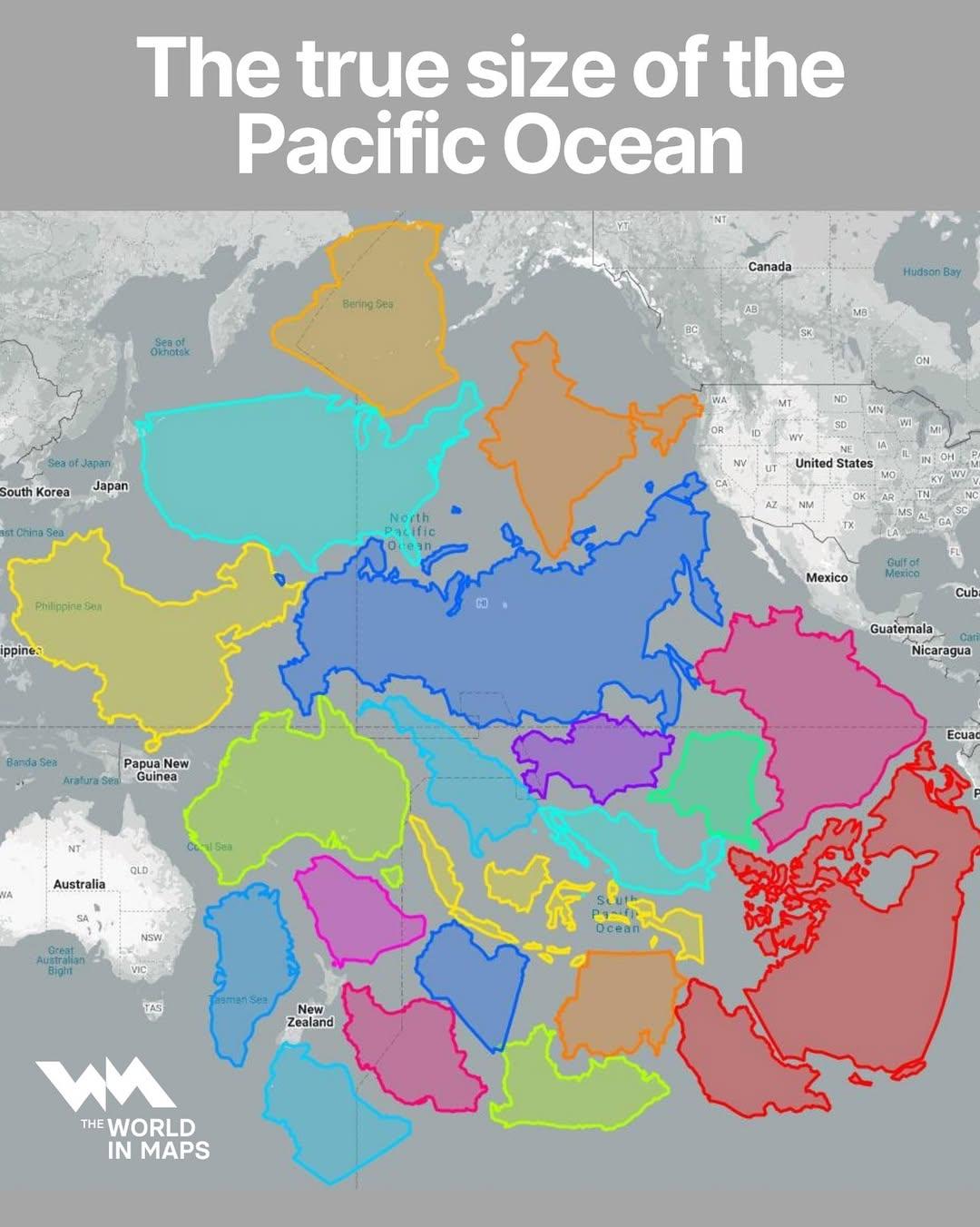
Map of the True Size of the Pacific Ocean
The visualization titled "The True Size of the Pacific Ocean" illustrates the vastness of the Pacific Ocean by accuratel...
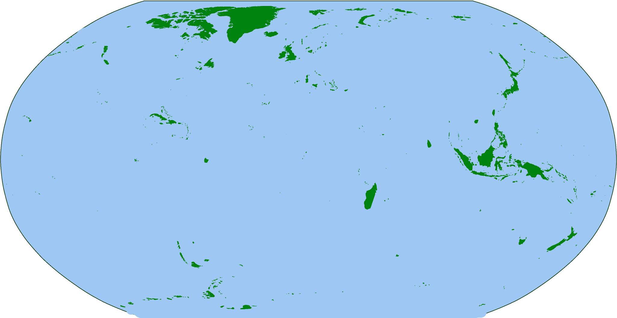
Map of the World's Islands
The visualization titled "The Earth... But Just Islands" presents a unique perspective on our planet by isolating and hi...
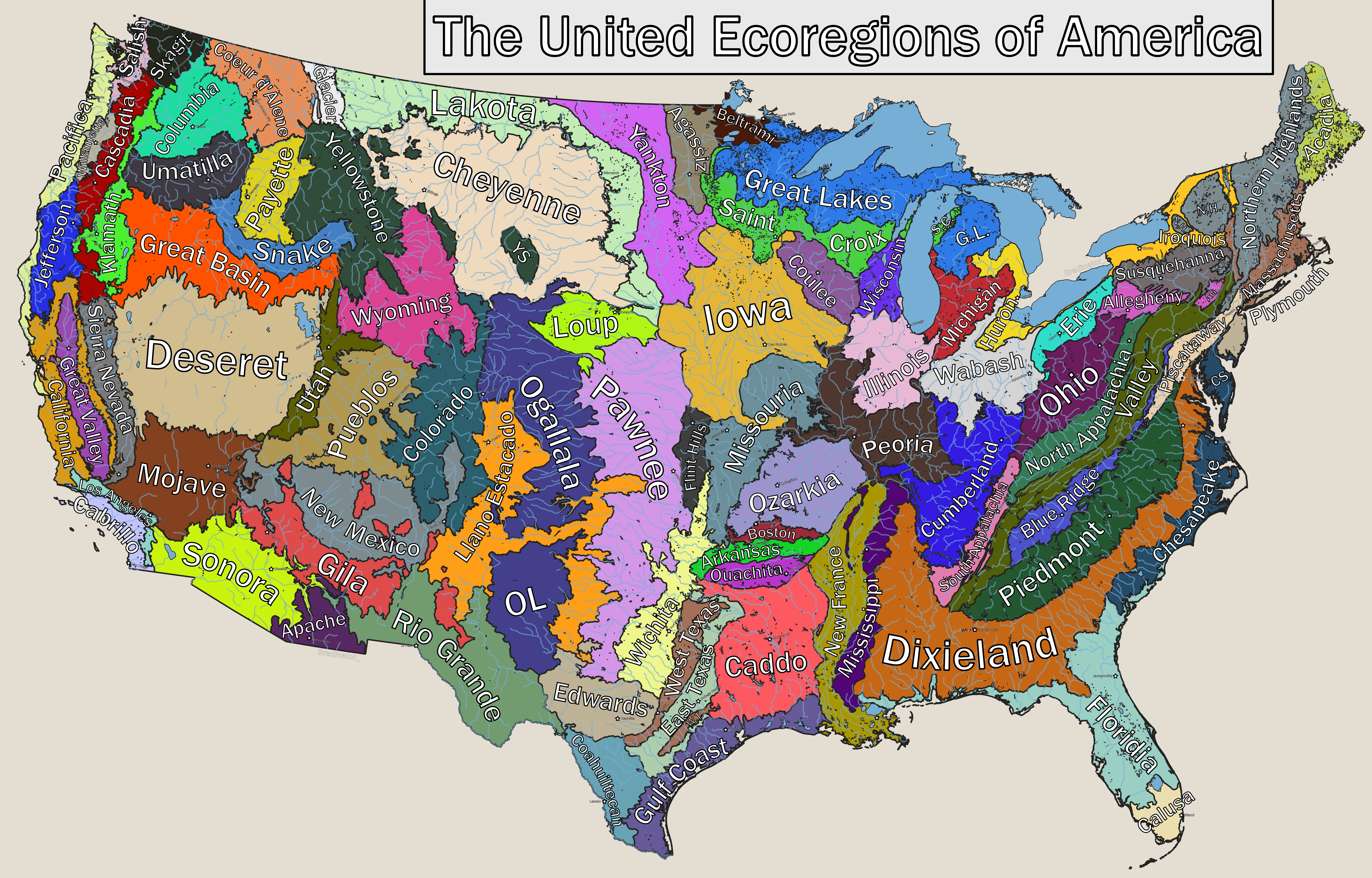
Ecoregions of America Map
...
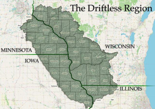
Driftless Area Geographical Features Map
The "Driftless Area Geographical Features Map" highlights a unique geological and ecological region in the Midwestern Un...
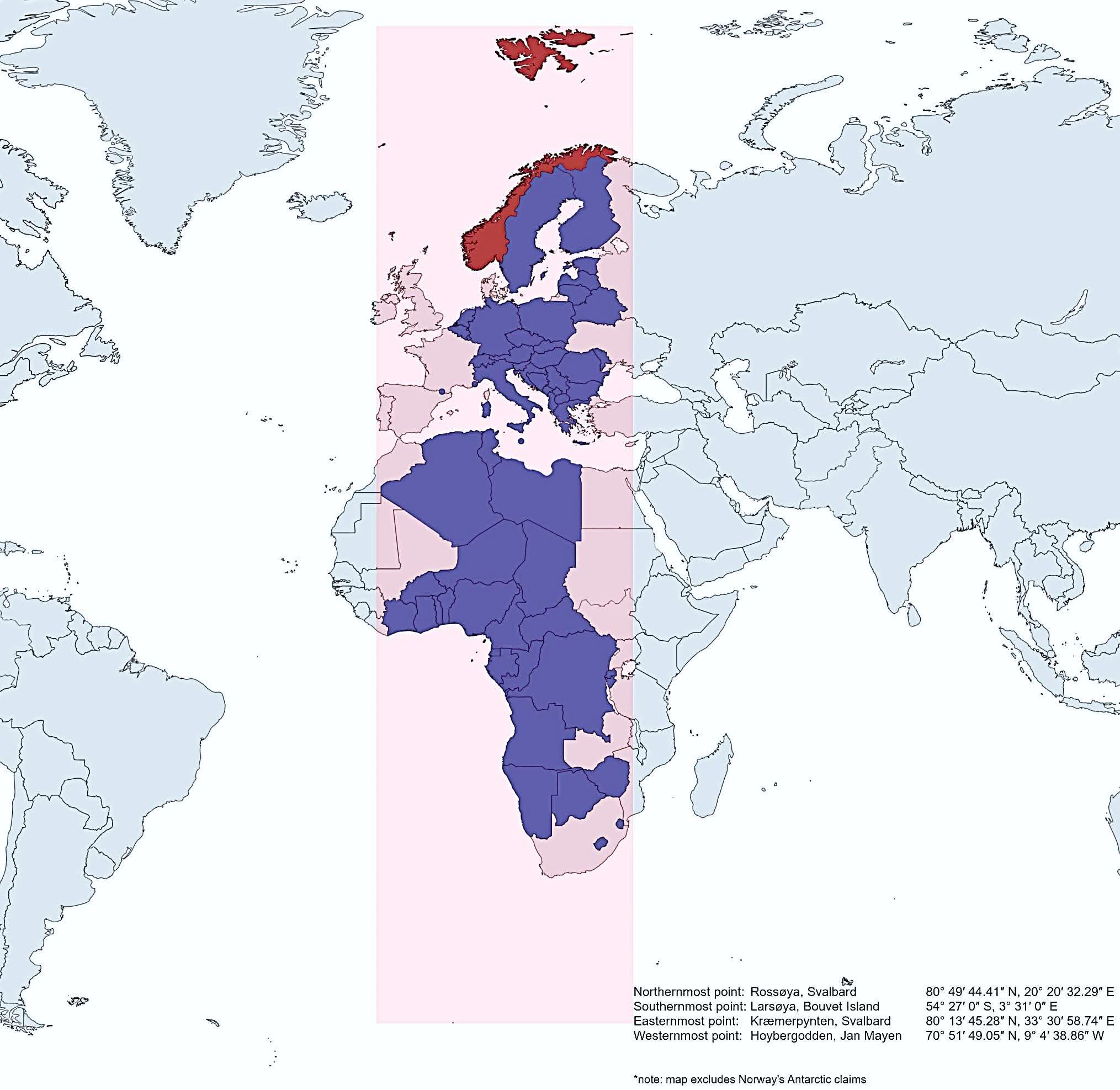
Map of Norway's Geographic Extent Compared to Other Countries
This map vividly illustrates how Norway extends further north, south, east, and west than several other countries, showc...
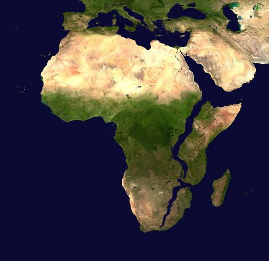
Map of Africa in 10 Million Years
This intriguing map titled "What Africa Might Look Like In 10 Million Years" presents a speculative visualization of the...
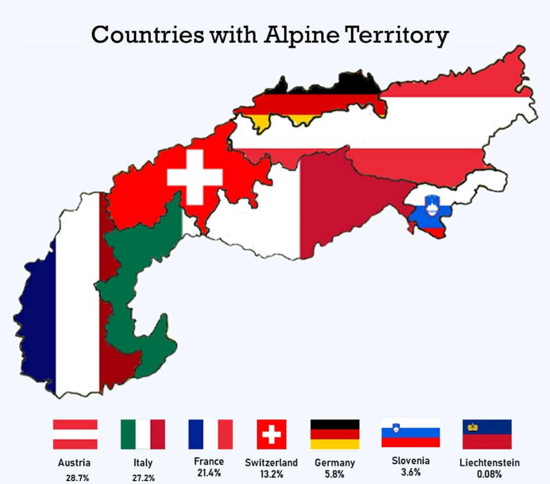
Countries with Alpine Territory Map
This map provides a visual representation of the countries that possess alpine territories, highlighting regions charact...
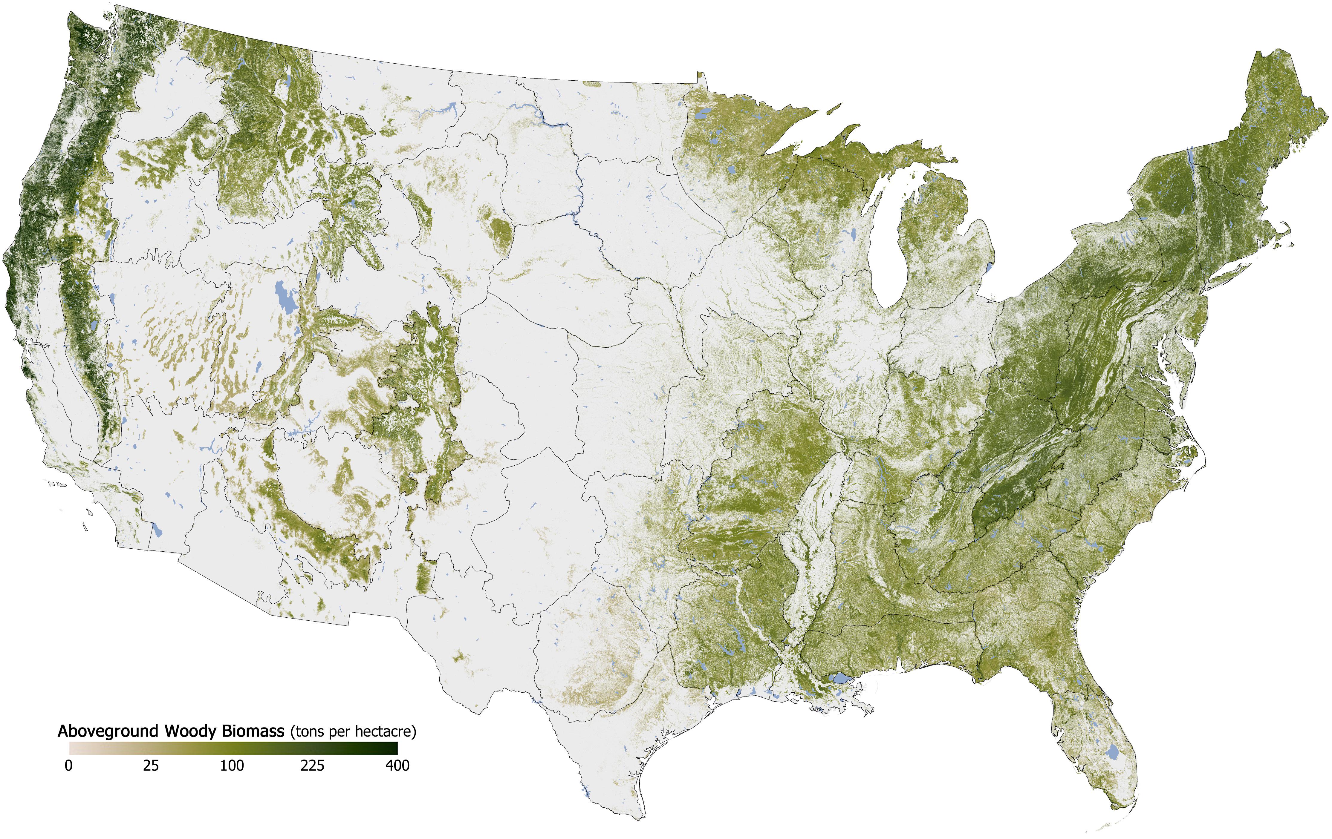
Forest Cover in the U.S. Map
The "Forest Cover in the U.S. Map" provides a detailed visualization of the distribution and density of forested areas a...
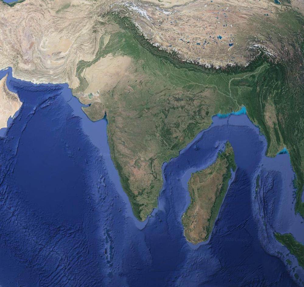
Geographical Comparison Map of Madagascar and India
This map provides a comparative geographical overview of Madagascar and India, two distinct nations that share a fascina...
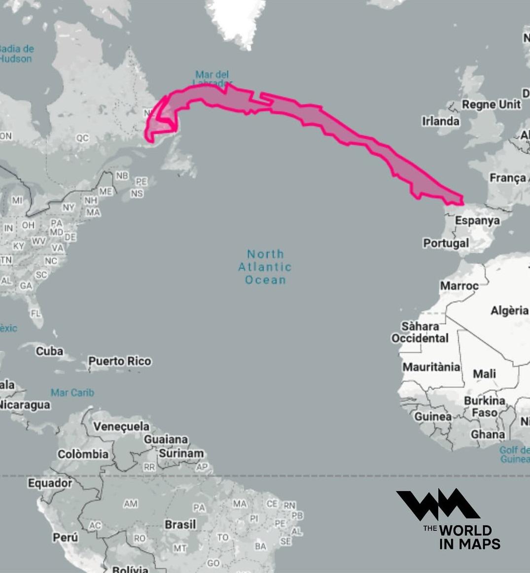
Geographical Length of Chile Map
The northern region of Chile is known for the Atacama Desert, one of the driest places on Earth, where annual rainfall i...
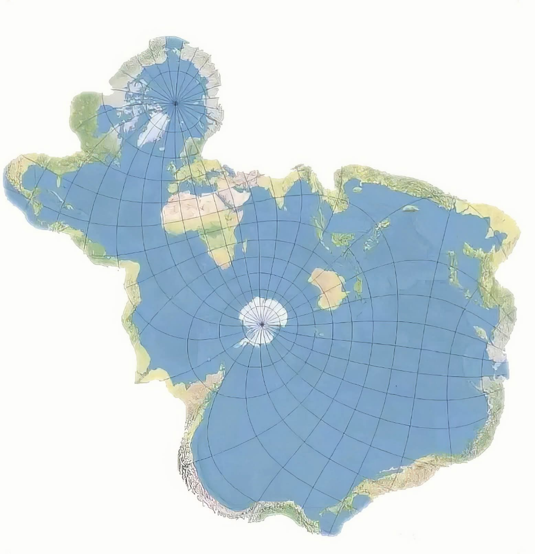
Global Fish Distribution Map
This engaging visualization titled "This is the world map according to fish" provides a comprehensive overview of global...
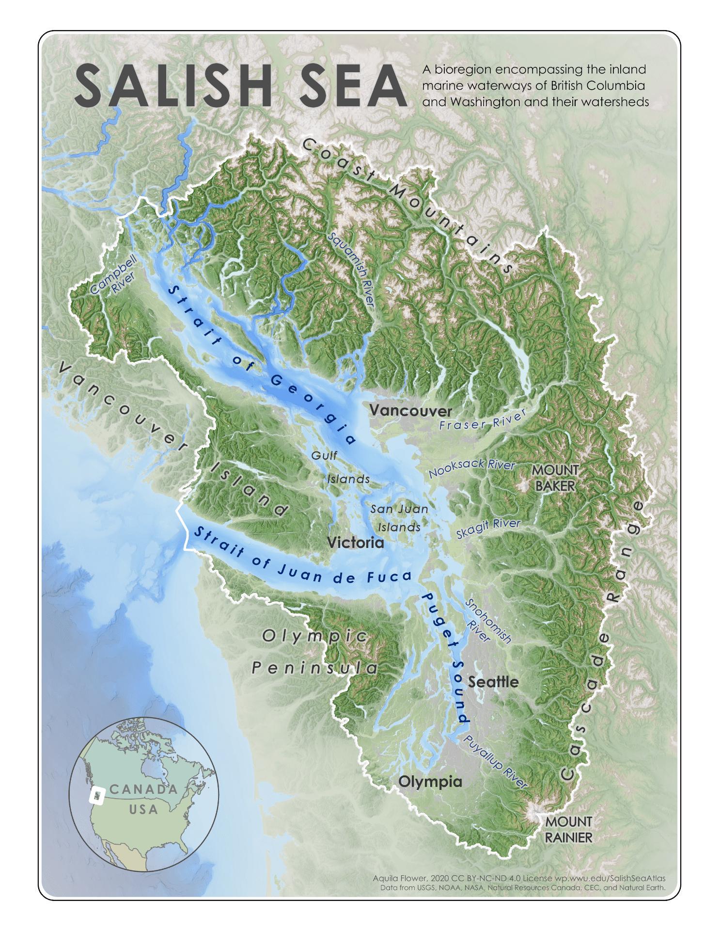
Salish Sea Watershed Map and Analysis
The map titled "The Salish Sea, comprised of the Strait of Georgia, Strait of Juan de Fuca, and the Puget Sound, and sur...
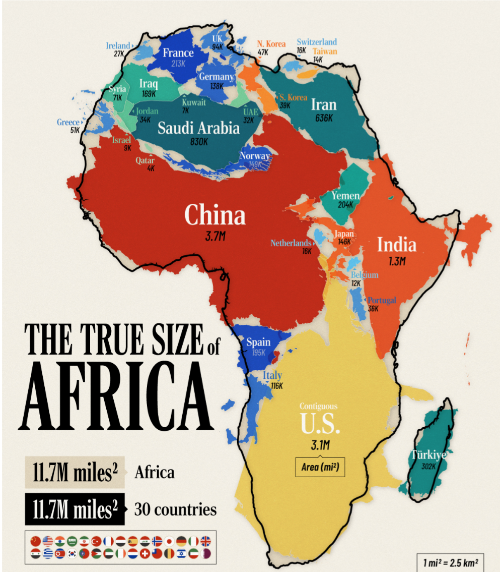
Africa Size Comparison Map
The "Africa is humongous" map offers a striking visual representation of Africa's vast land area compared to other conti...
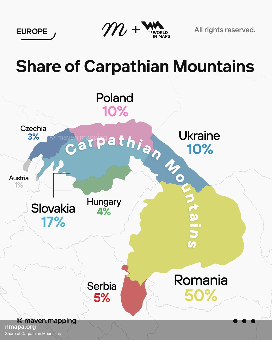
Share of Carpathian Mountains Map
The "Share of Carpathian Mountains Map" visually represents the distribution and extent of the Carpathian Mountain range...
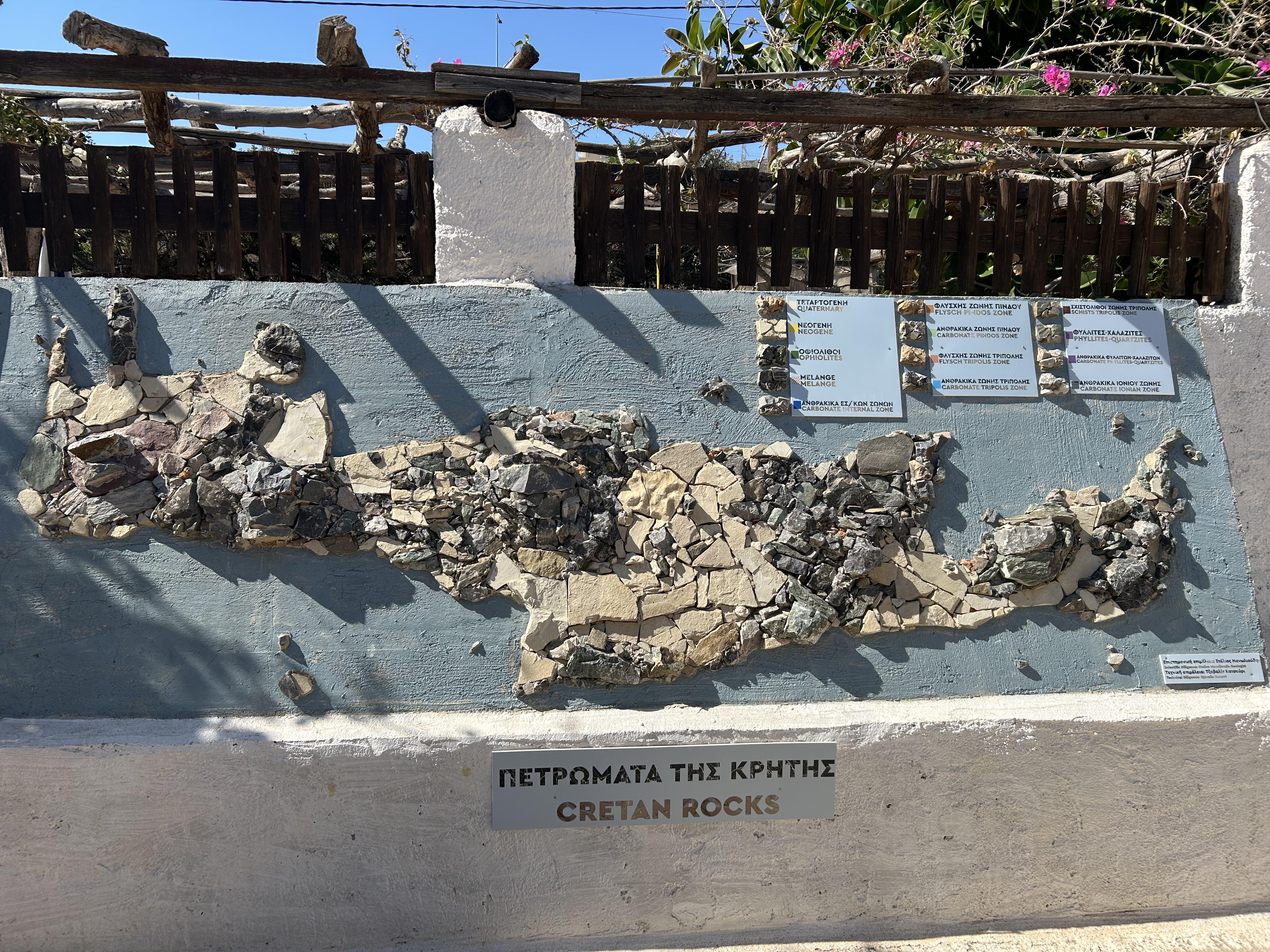
Rock Map of Crete
The Rock Map of Crete, located at the Lychnostatis Open Air Museum in Limenas Chersonisou, provides a detailed represent...
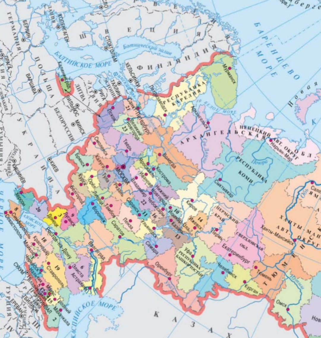
Geographical Features Map of Russia
This map serves as a comprehensive overview of the geographical features of Russia, highlighting its vast landscapes, fr...
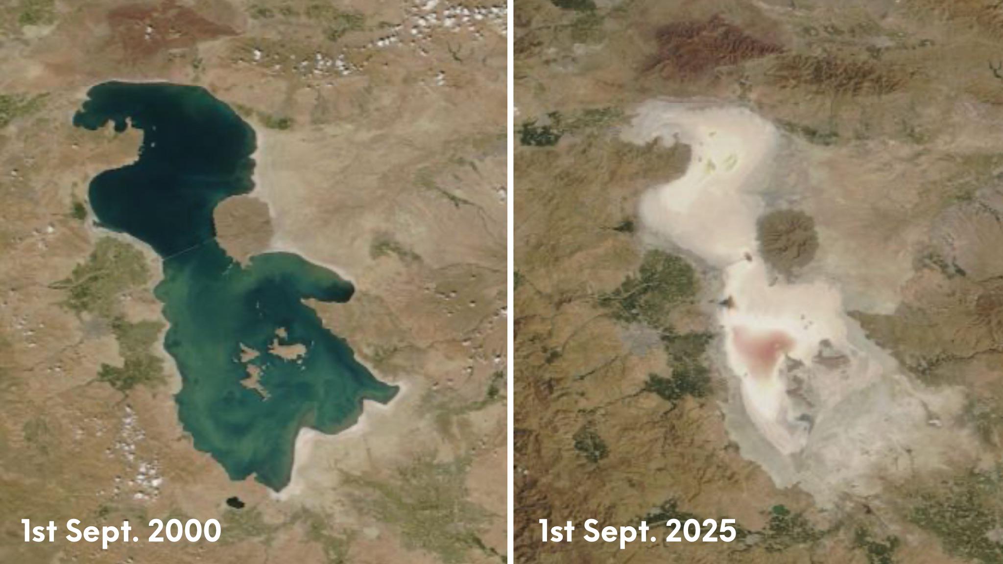
Lake Urmia Iran Map
This map highlights the geographical features and historical significance of Lake Urmia, located in northwestern Iran. O...
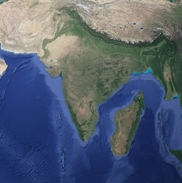
Geographical Map of Madagascar Next to India
The map titled "Geographical Map of Madagascar Next to India" provides a clear visual representation of the spatial rela...
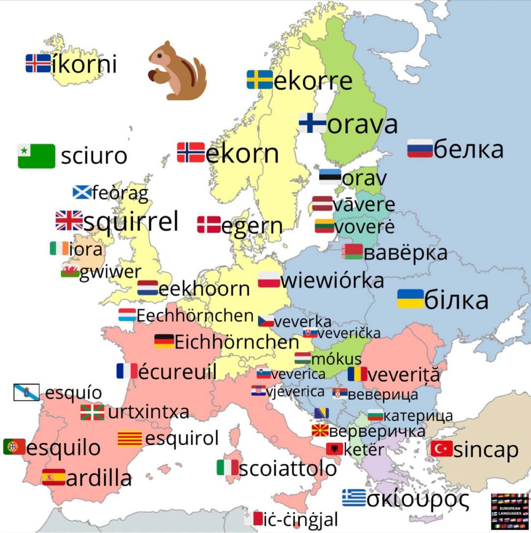
Squirrel Names in European Languages Map
The visualization titled "Squirrel in European Languages" provides a linguistic map showcasing how the word 'squirrel' i...
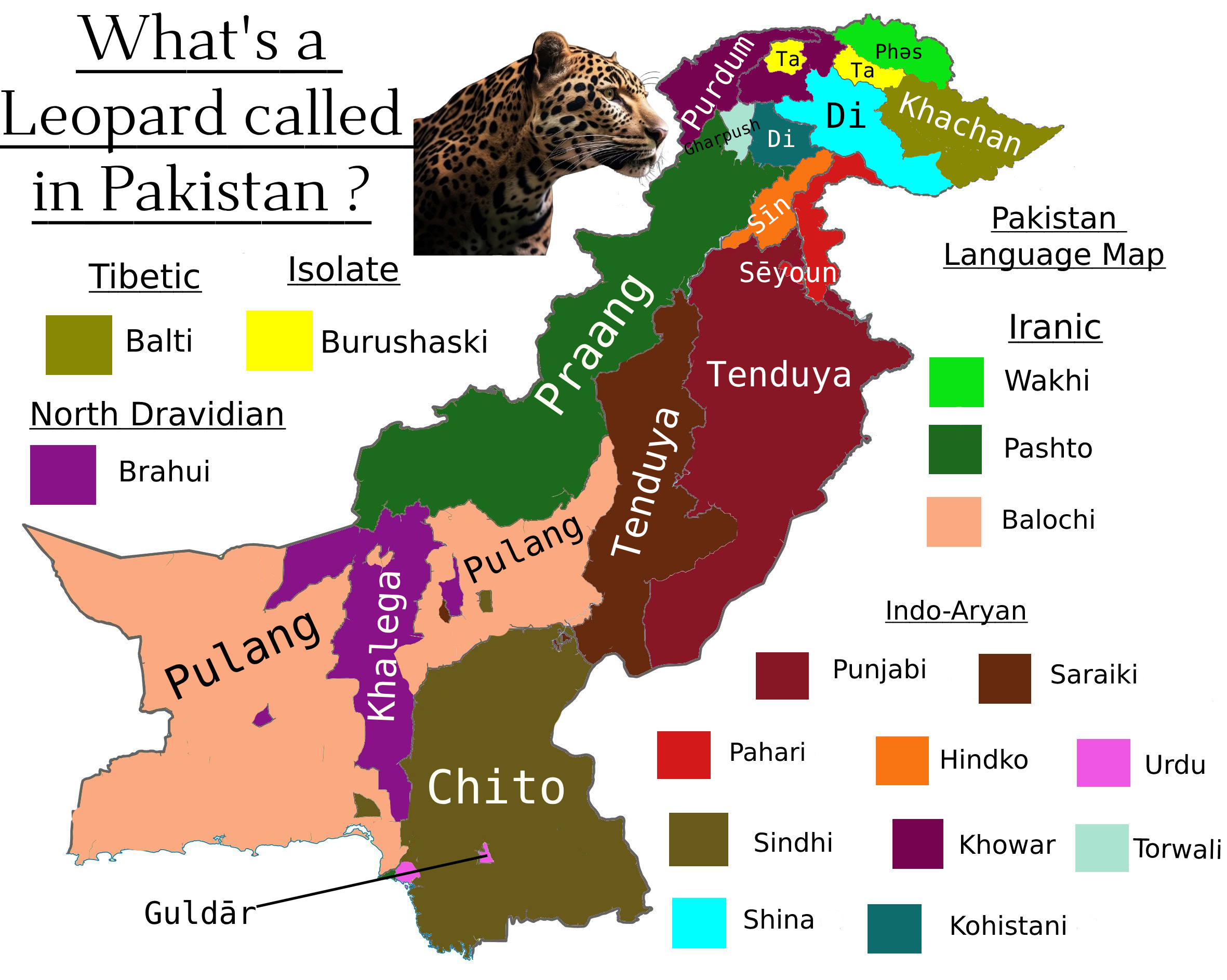
What is a Leopard Called in Pakistan Map
This map visualizes the various names and local terms used for leopards across different regions of Pakistan. It highlig...
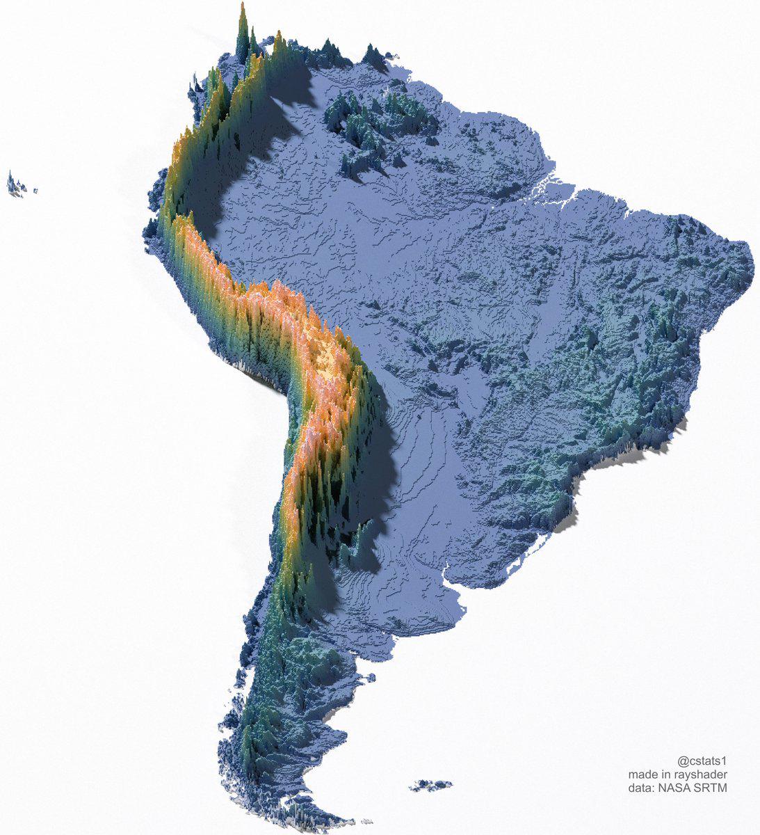
Great Wall of South America Map
The "Great Wall of South America" map visualizes a unique geographical phenomenon, showcasing the extensive network of n...
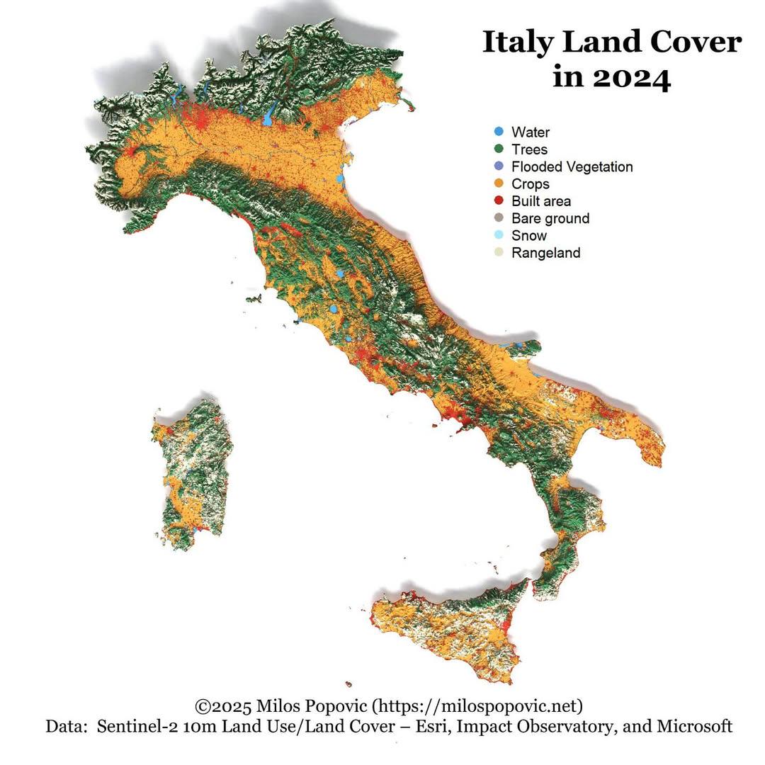
Italy Land Cover Map 2024
The "Italy Land Cover Map 2024" provides a comprehensive visualization of the various land cover types across Italy, ill...
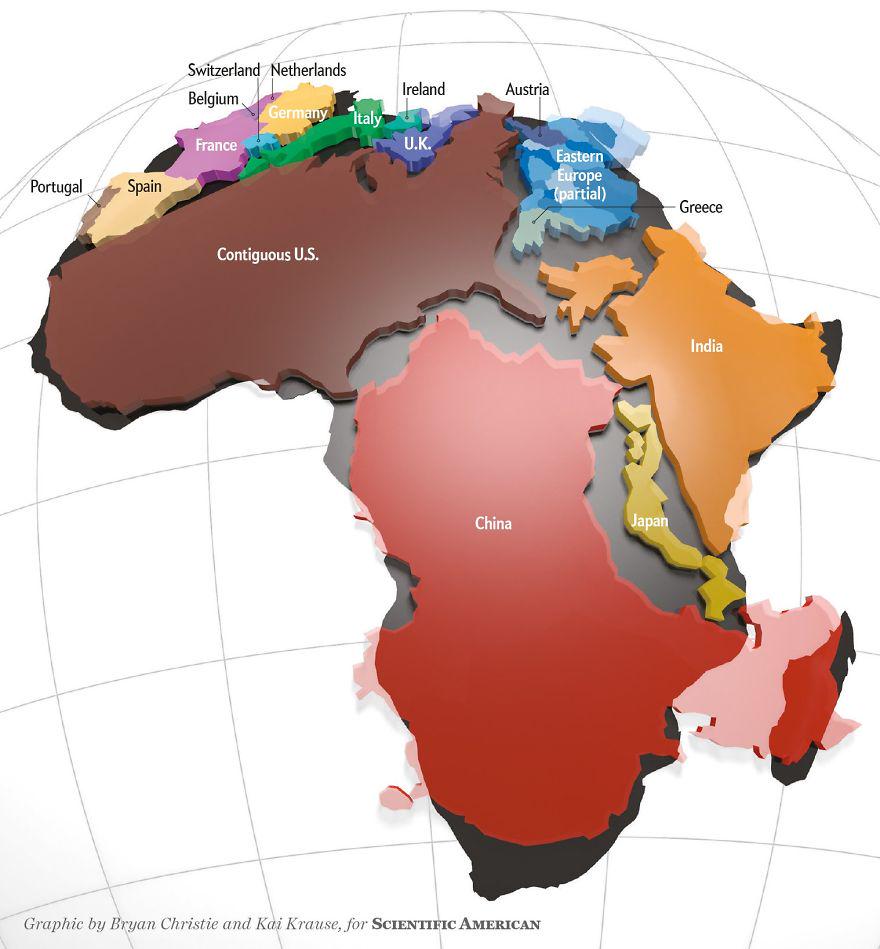
Actual Size of Africa Map
The 'Actual Size of Africa Map' presents a striking visual representation that highlights the continent’s true dimension...
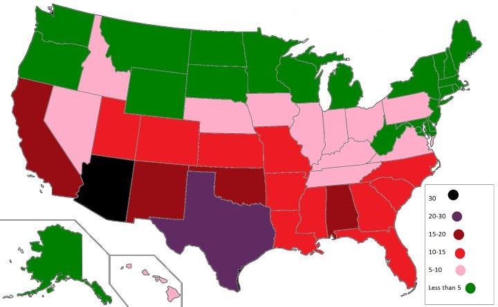
U.S. States with the Highest Number of Venomous Animals Map
The visualization titled "U.S. States with the Highest Number of Venomous Animals Map" provides a striking look at the d...
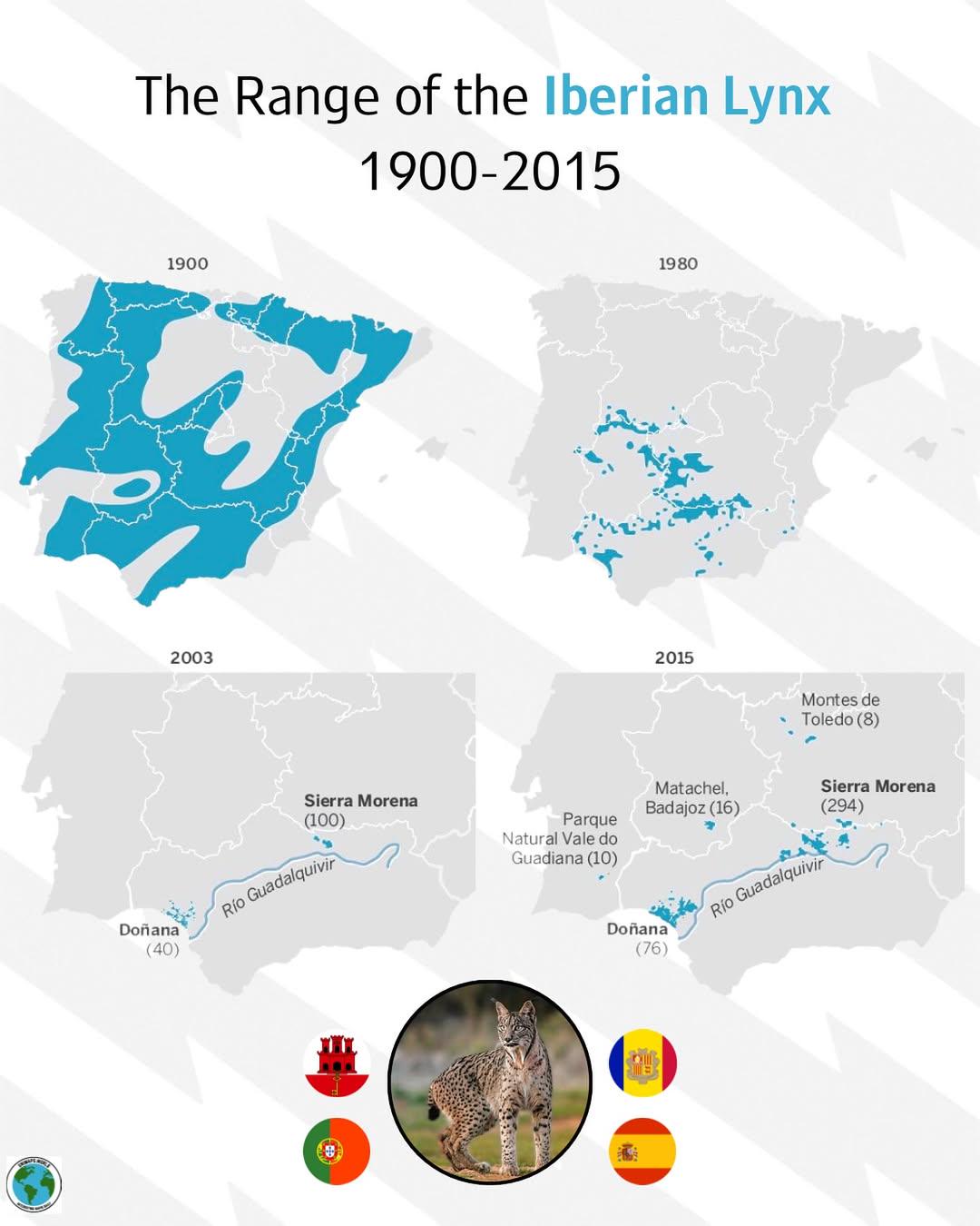
Iberian Lynx Range Map 1900-2015
...
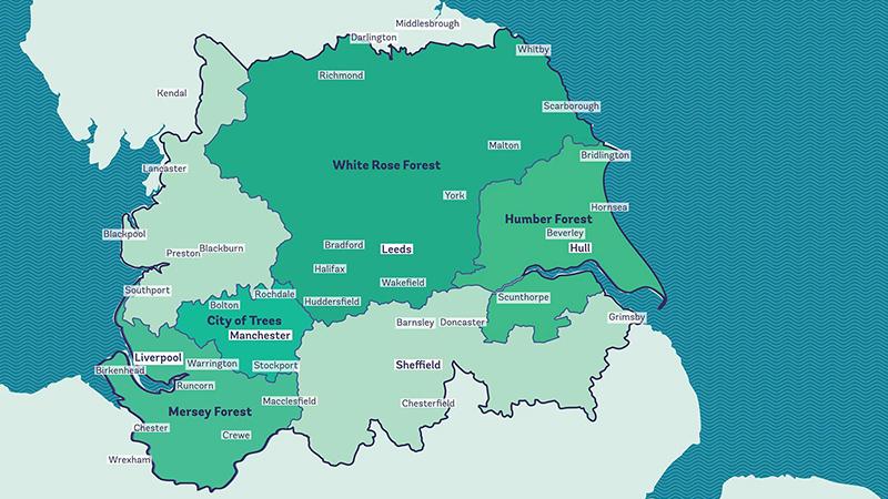
Reforesting Britain Map – The Northern Forest Map
The "Reforesting Britain Map – The Northern Forest" focuses on a significant environmental initiative launched in 2018. ...
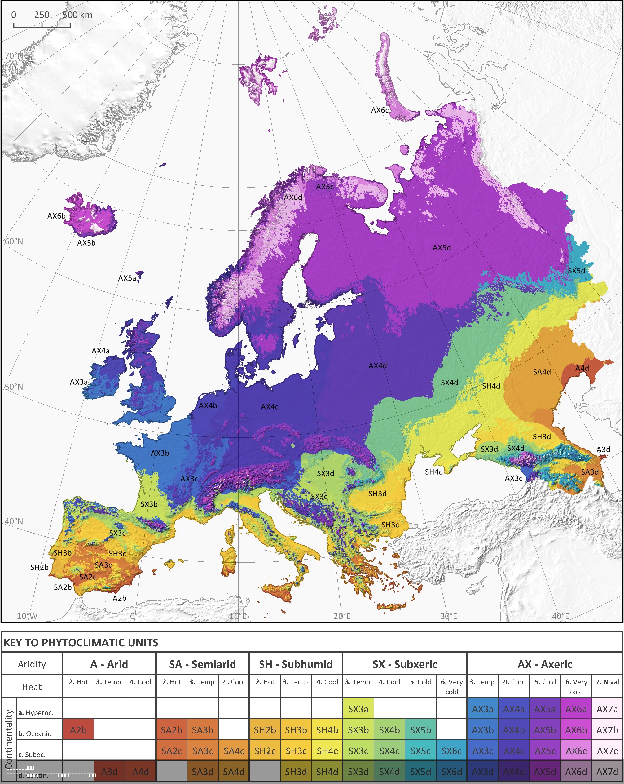
Phytoclimatic Map of Europe
The phytoclimatic map of Europe is a detailed visualization that illustrates the distribution of different plant communi...
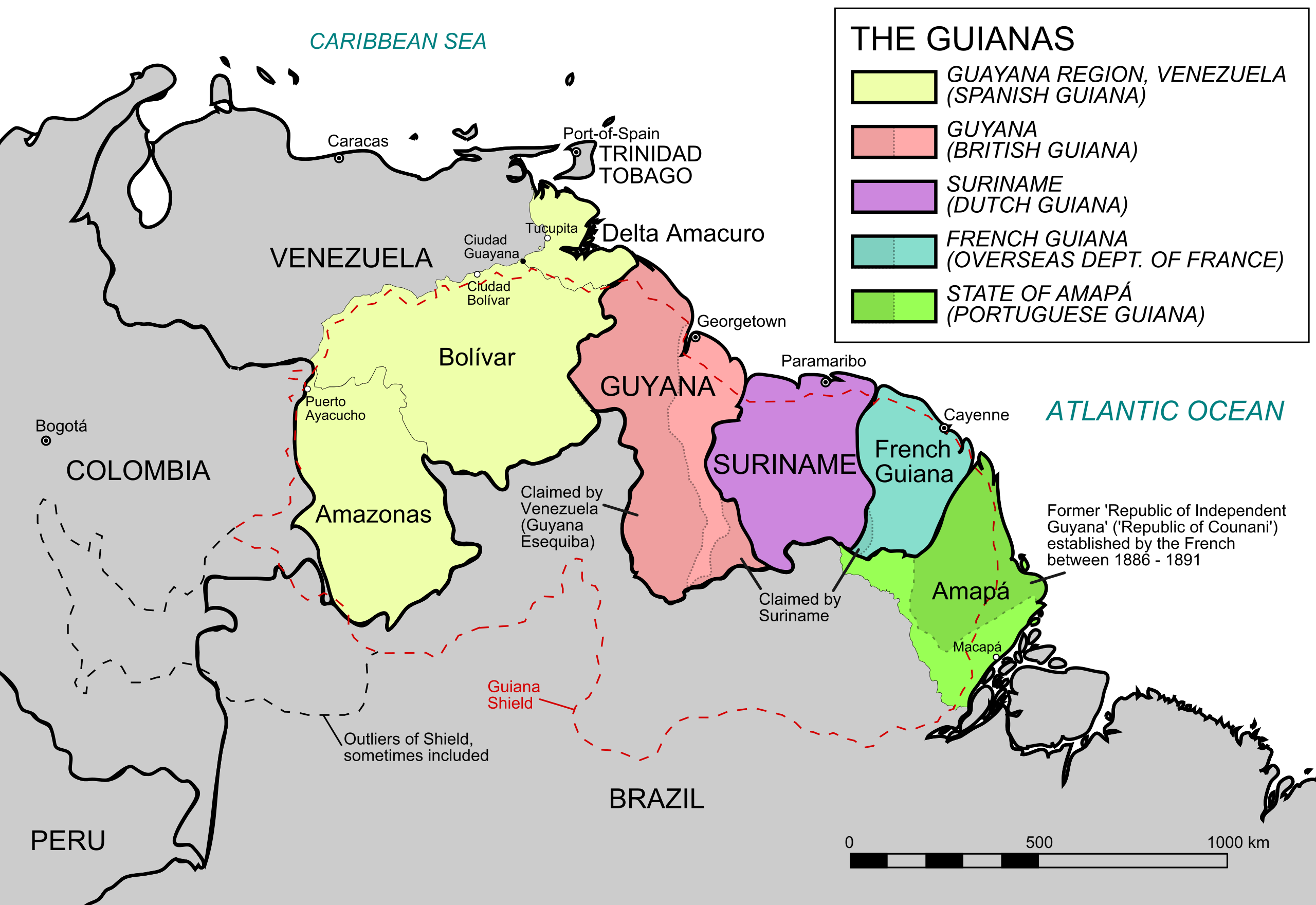
Geography Map of the Five Guianas
The map titled "The Five Guianas" highlights the unique geographical features and political borders of a region in north...
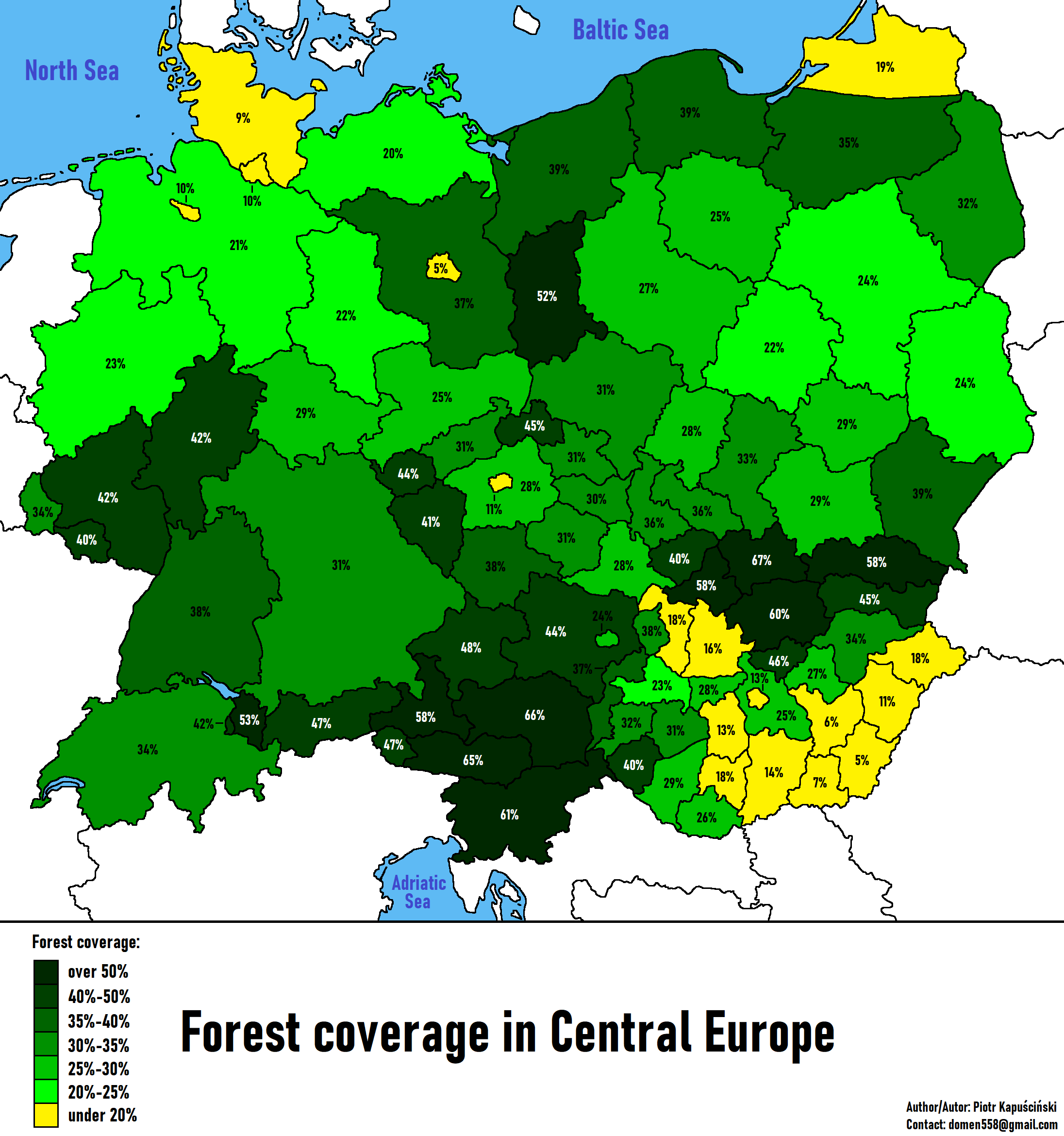
Forest Coverage in Central Europe Map
The "Forest Coverage in Central Europe Map" provides a comprehensive overview of the forested areas across several key c...
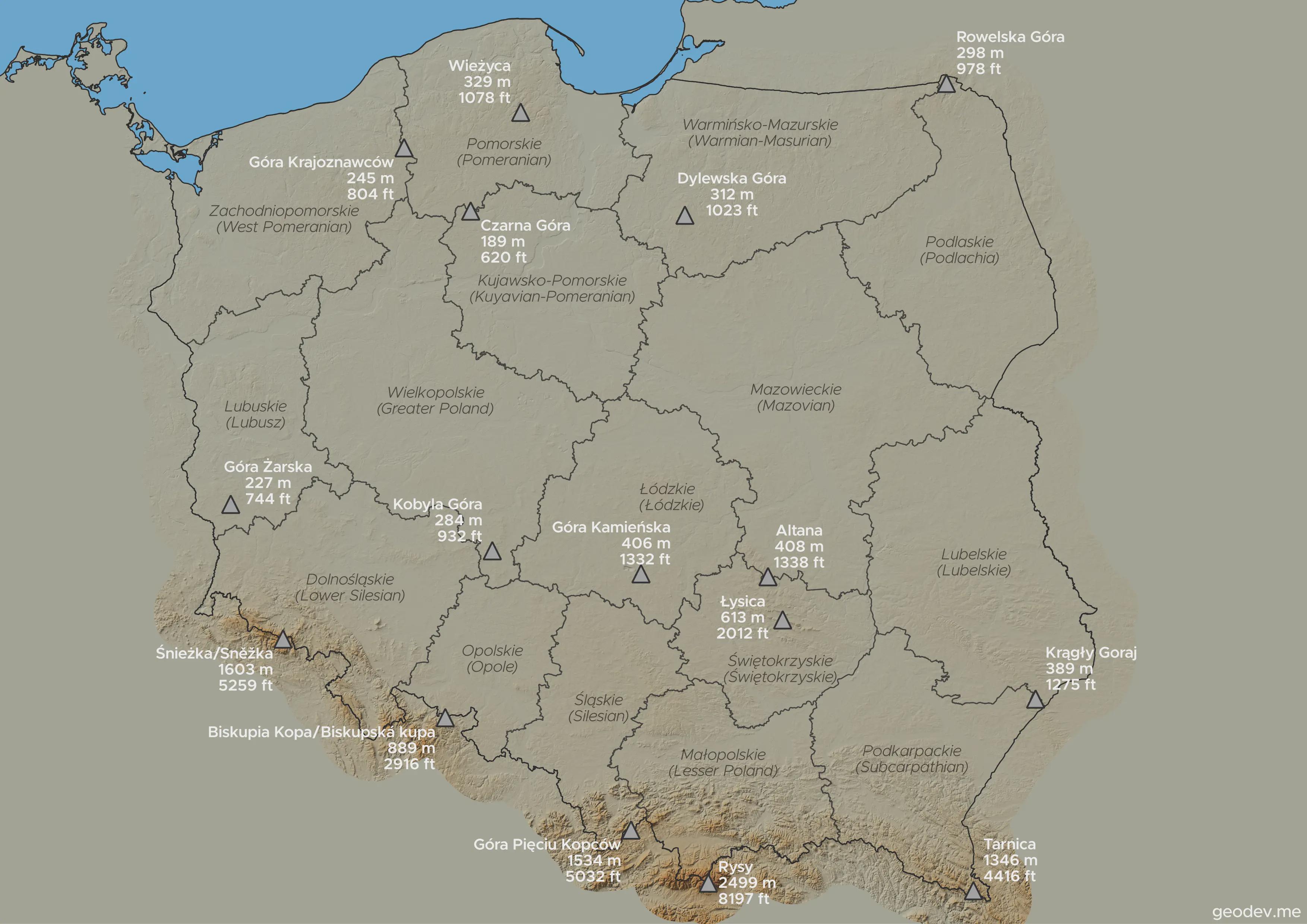
Highest Points in Each Voivodeship Map
This visualization highlights the highest points in every voivodeship in Poland, showcasing the diverse topography acros...
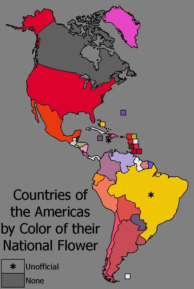
National Flower Colors Map of the Americas
The "Countries of the Americas by Color of their National Flower" map is a vibrant and playful visualization that displa...
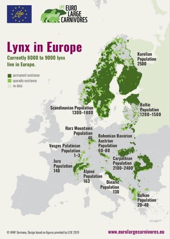
Lynx Distribution Map in Europe
The "Lynx in Europe" map provides a detailed visualization of the distribution and habitat of the lynx species across th...
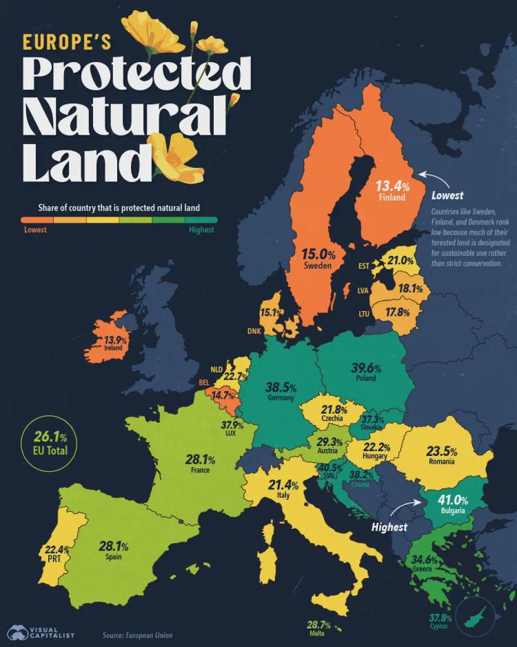
Map of European Union's Protected Natural Land
This visualization illustrates the extent of protected natural land across the European Union. It highlights regions des...
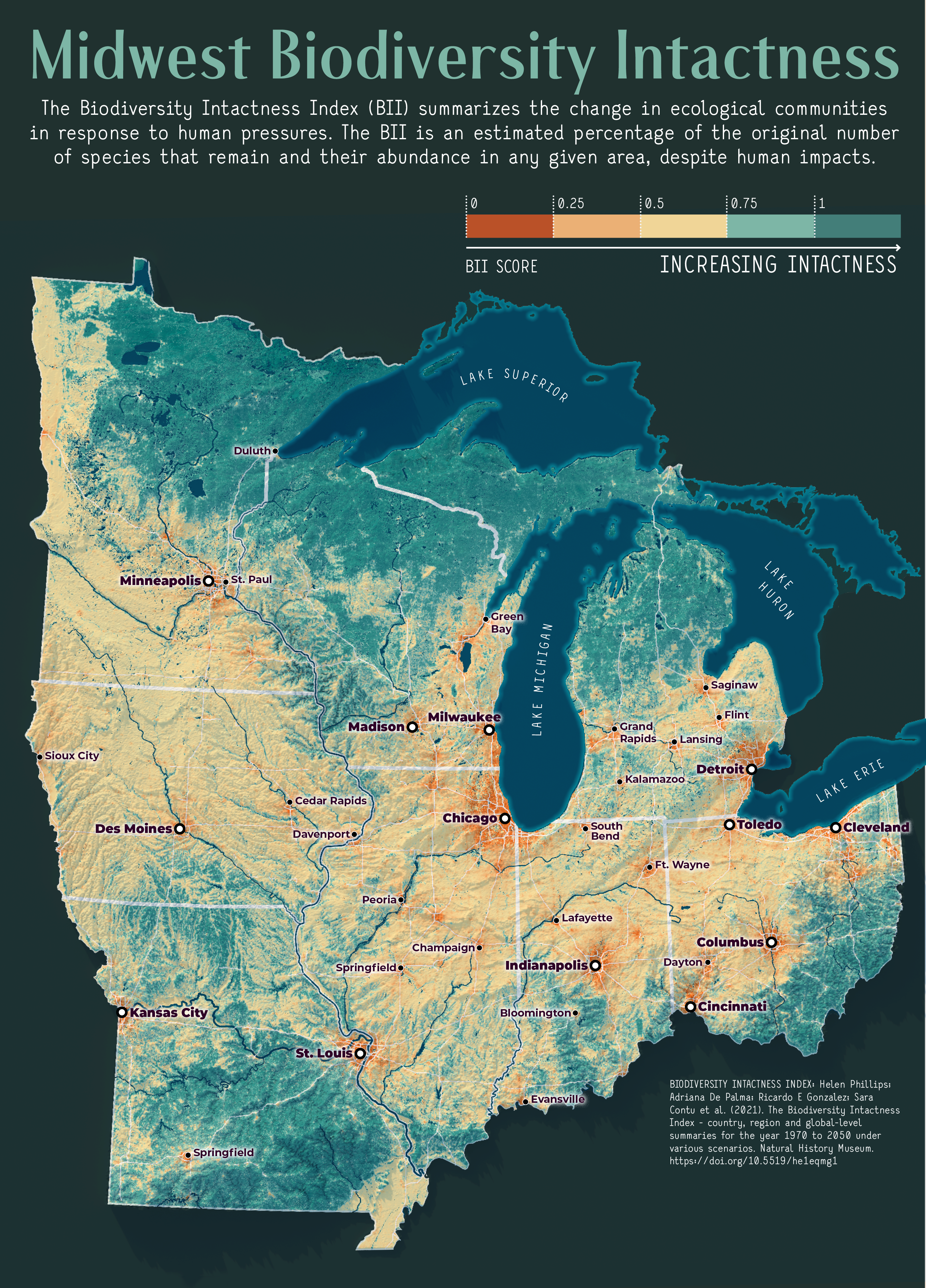
Midwest Biodiversity Intactness Map
The "Midwest Biodiversity Intactness Map" provides a detailed visualization of the ecological health and biodiversity le...
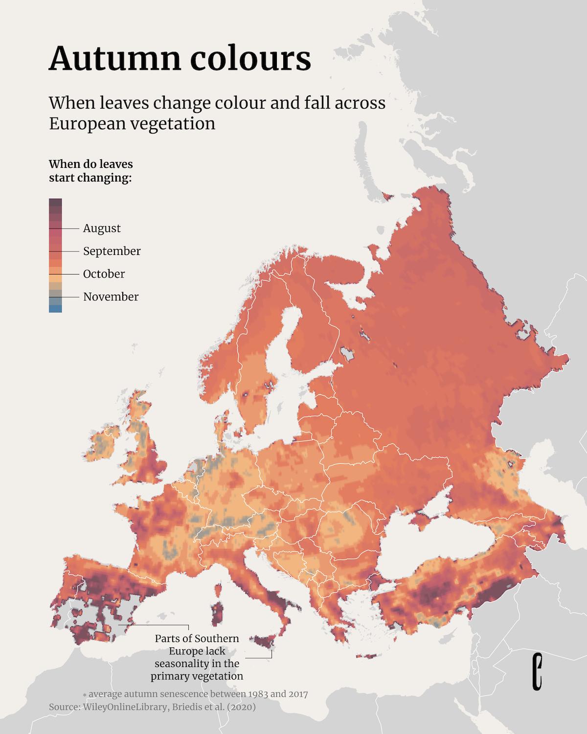
Map of Autumn Leaf Color Changes in Europe
The "When Leaves Change Colour and Fall Across European Vegetation" map provides a visual representation of the seasonal...
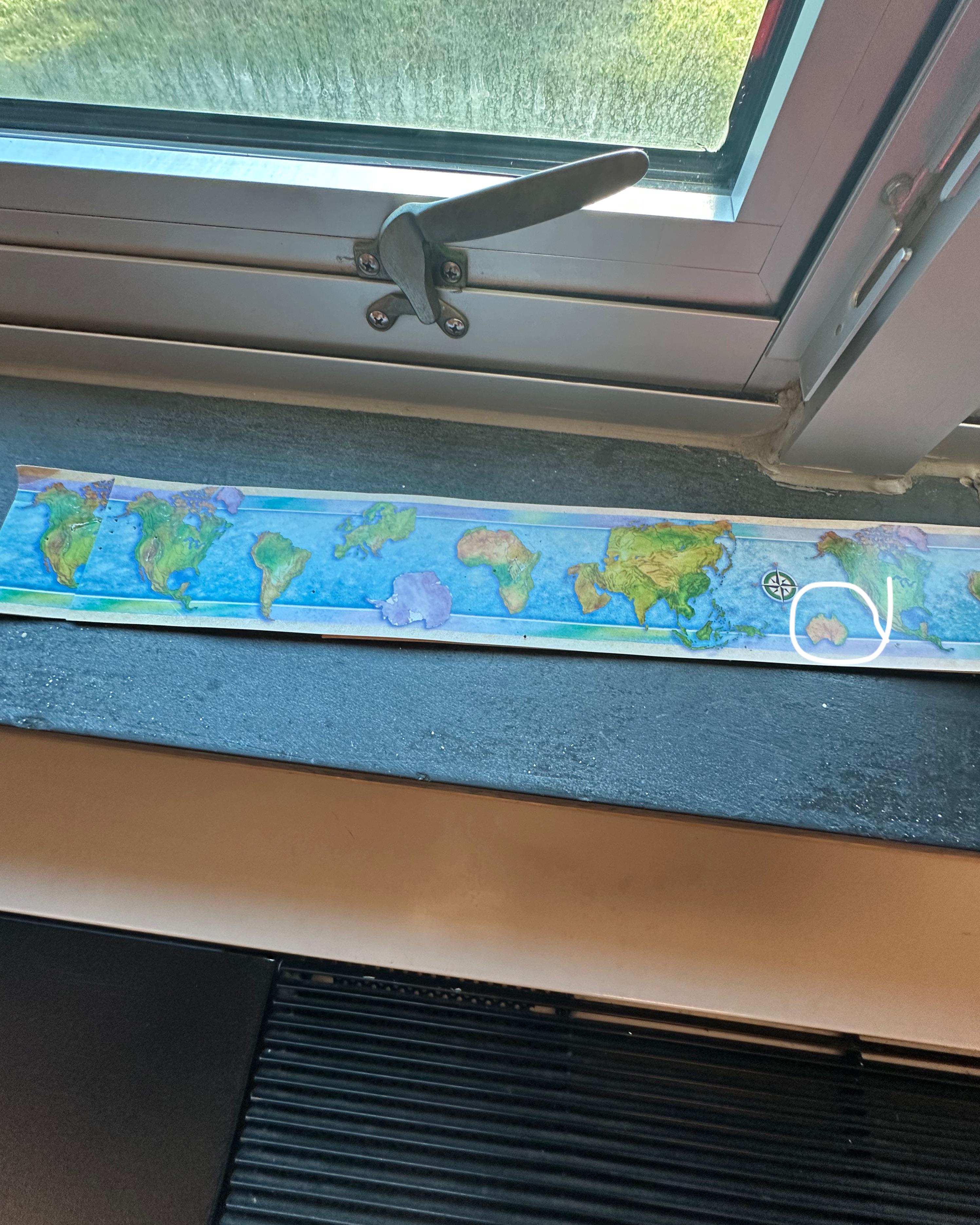
Map Showing Missing New Zealand
The visualization titled 'Map at school forgot New Zealand' highlights a curious omission in a geographical representati...
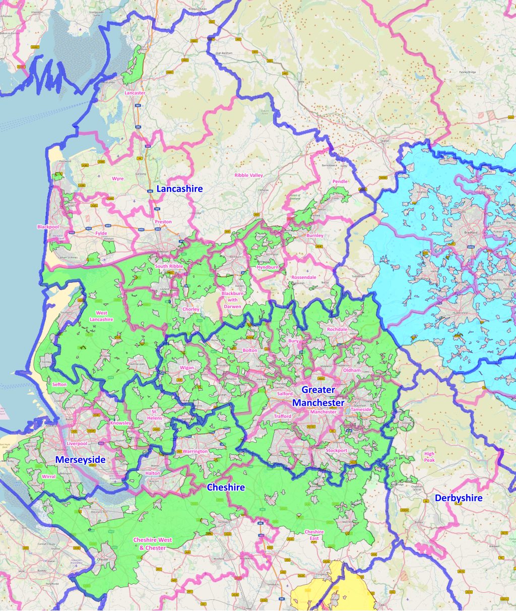
North West Green Belt in England Map
The map titled "The North West Green Belt in England" provides a clear visualization of the designated green belt areas ...
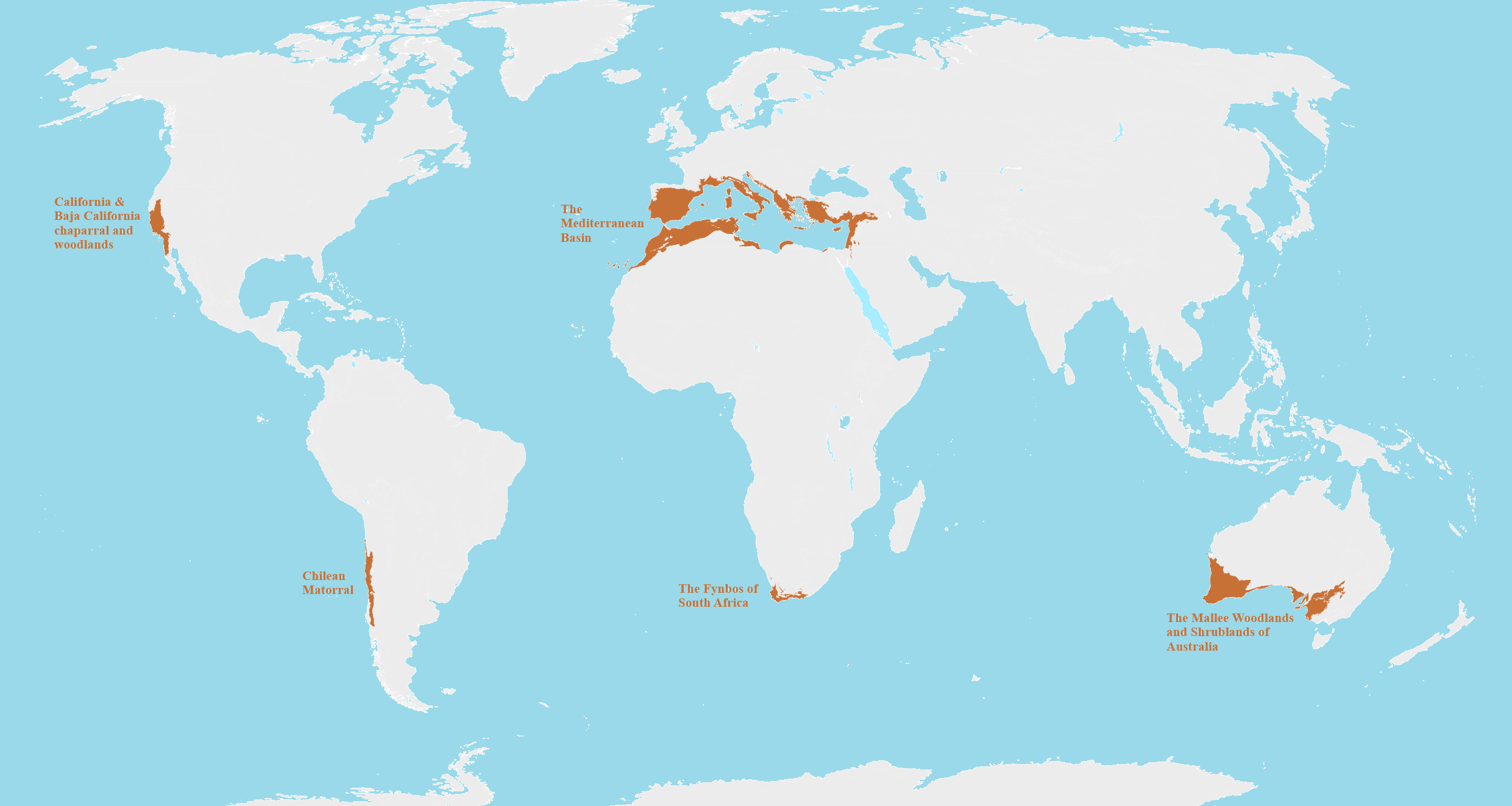
Mediterranean Biomes Around the World Map
This map provides a detailed visualization of Mediterranean biomes across the globe, highlighting regions that share sim...
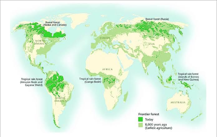
Map of Countries with Largest Forest Coverage 2025
The newly released map visualizes global forest distribution in 2025, spotlighting countries with the largest percentage...
Biodiversity Hotspots Map
This map presents the world's biodiversity hotspots, regions that are both rich in endemic species and are experiencing ...
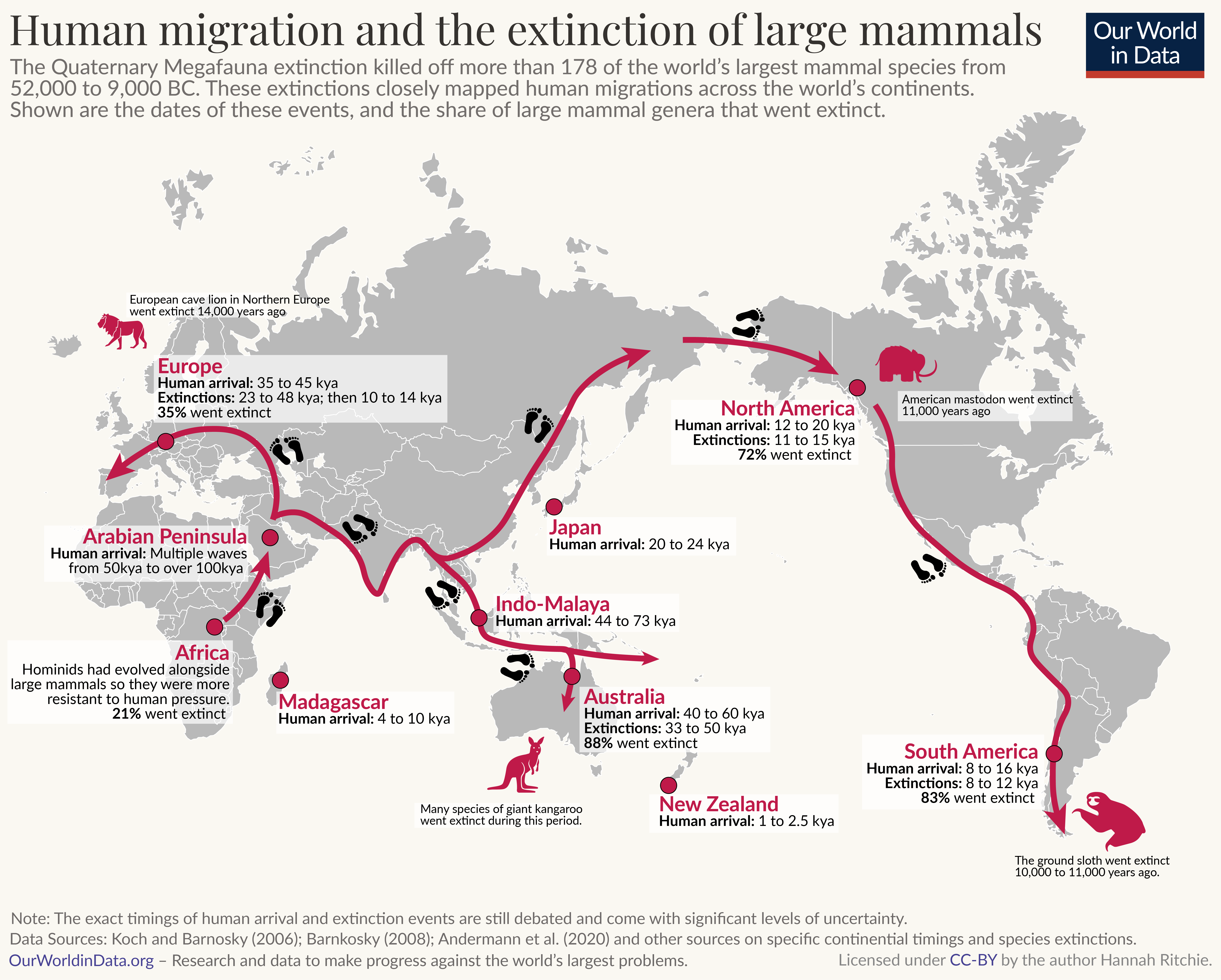
Human Migration and Megafauna Extinction Map
This map provides a visual representation of the relationship between human migration patterns and the extinction of lar...
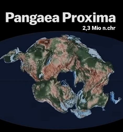
Map of Pangea Proxima
The "Map of Pangea Proxima" visualizes a speculative future supercontinent that is projected to form approximately 2.3 m...
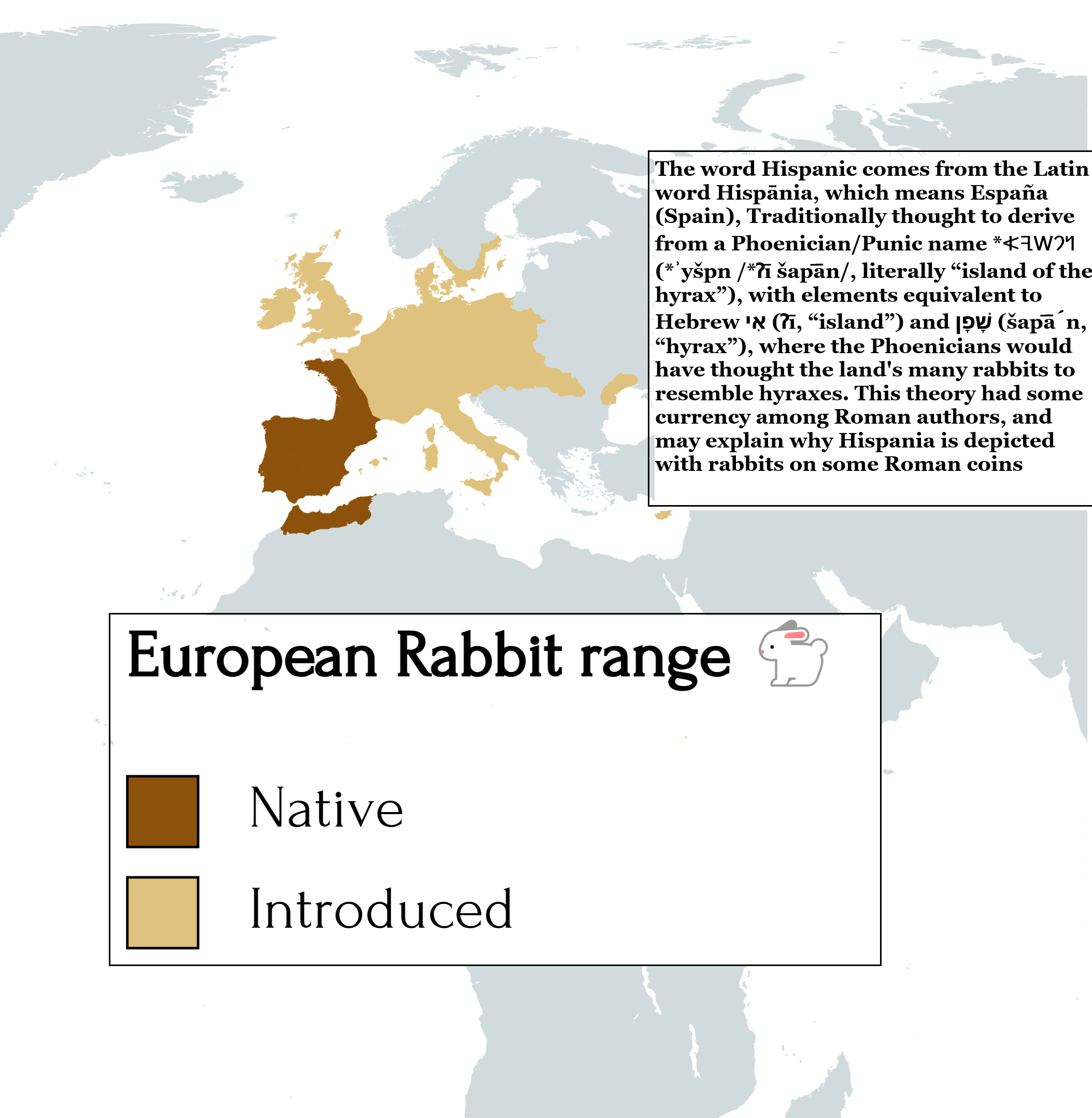
European Rabbit Range Map
The "European Rabbit Range Map" provides a detailed visualization of the geographical distribution of European rabbits a...
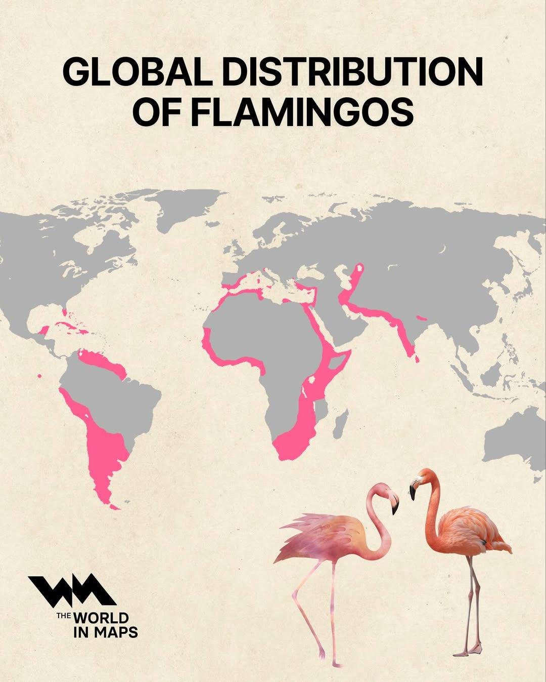
Global Distribution of Flamingos Map
The "Global Distribution of Flamingos Map" visually represents the regions where various species of flamingos are found ...
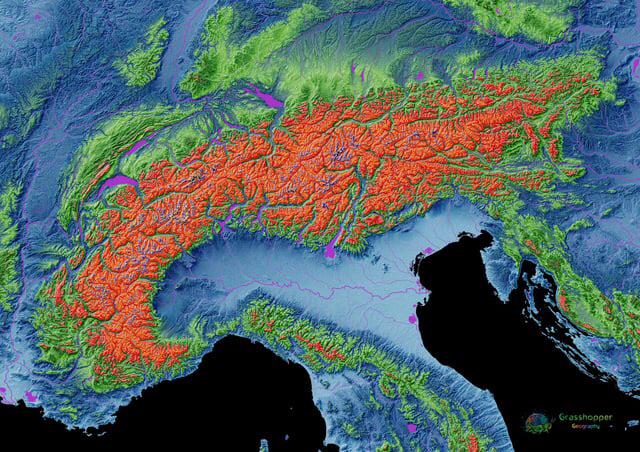
Elevation Map of the Alps
The elevation map of the Alps provides a stunning visual representation of the mountain range's topography, showcasing t...
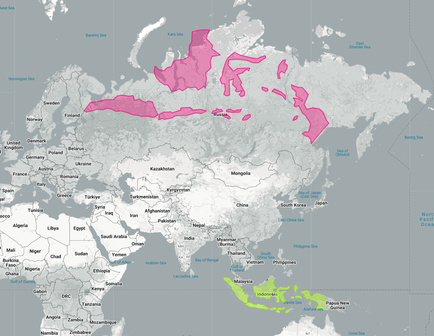
Indonesia Laid Out Over Russia Map
The map titled "Indonesia Laid Out Over Russia" provides a striking visual representation by superimposing the vast arch...
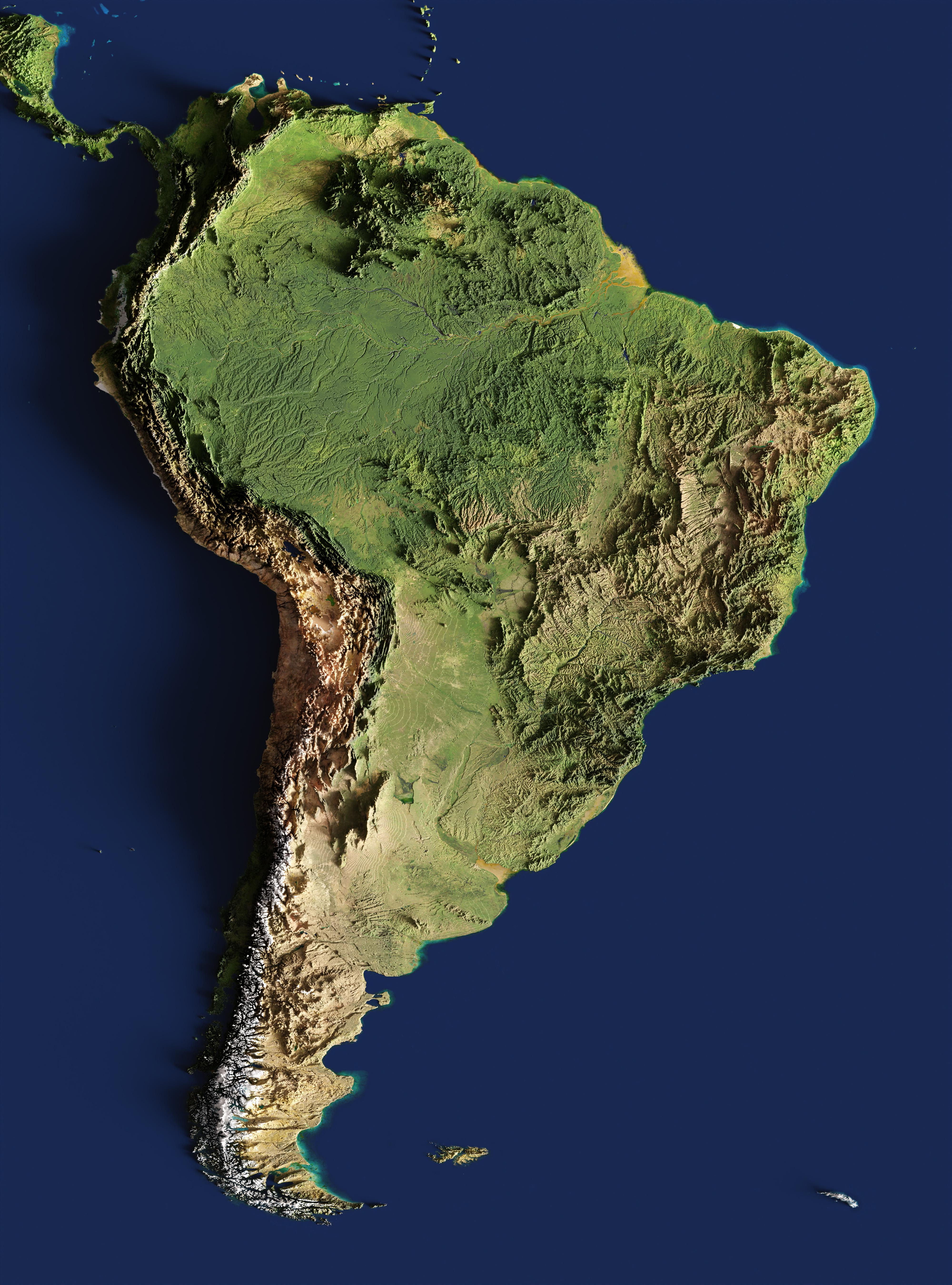
3-D Relief Map of South America
The 3-D relief map of South America provides a striking visual representation of the continent’s topography. This three-...
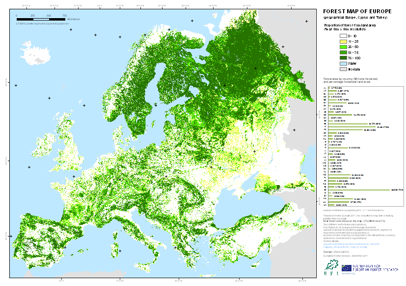
Forest Map of Europe
The "Forest Map of Europe" provides a comprehensive visualization of forest coverage across the continent. It highlights...
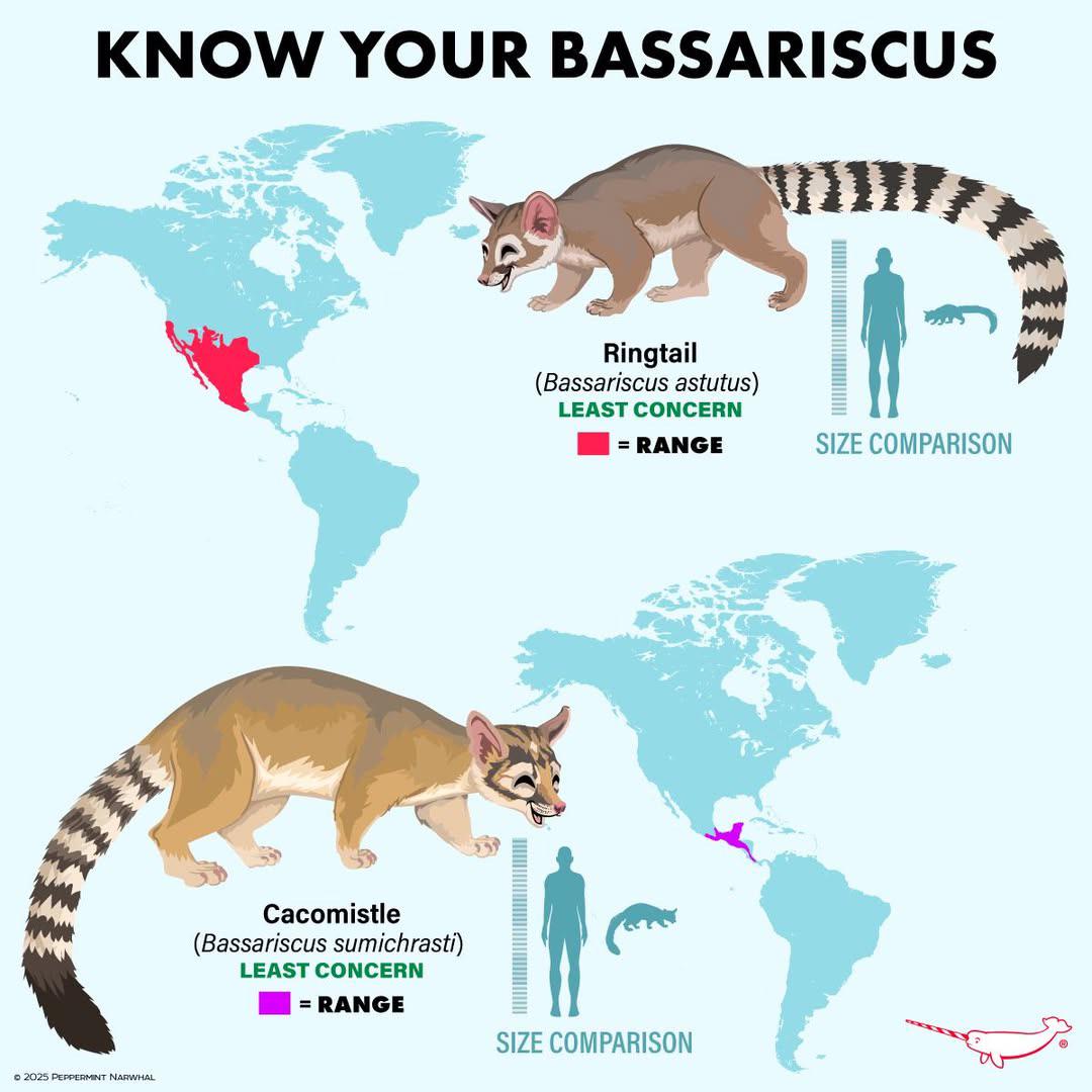
Bassariscus Species Distribution Map
The "Distribution of Bassariscus Species" map provides a detailed visualization of where various species of the genus Ba...
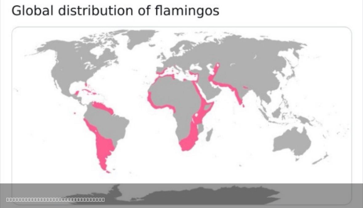
Global Distribution of Flamingos Map
The "Global Distribution of Flamingos Map" illustrates the various regions around the world where flamingos are found. T...