national identity Maps
21 geographic visualizations tagged with "national identity"
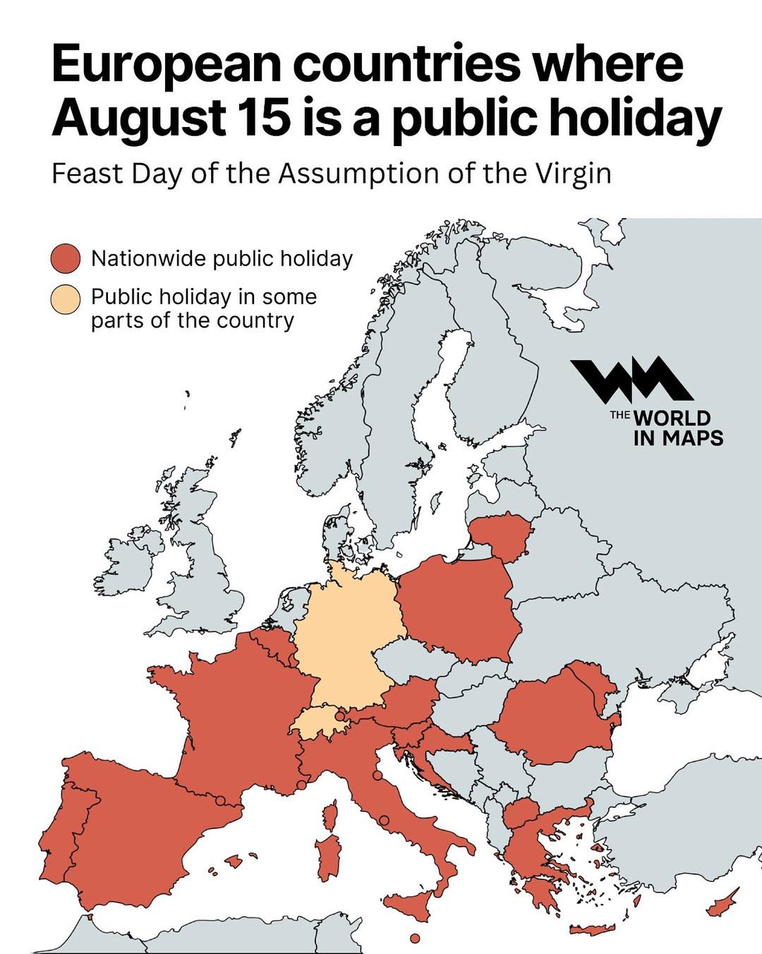
Public Holiday Map of Europe on August 15
The visualization titled "European countries where August 15 is a public holiday" provides a clear and informative overv...
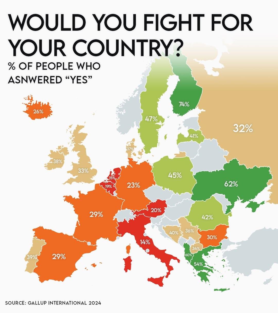
Military Service Participation by Country Map
The "Would You Fight for Your Country" map provides a striking visualization of military service participation across th...
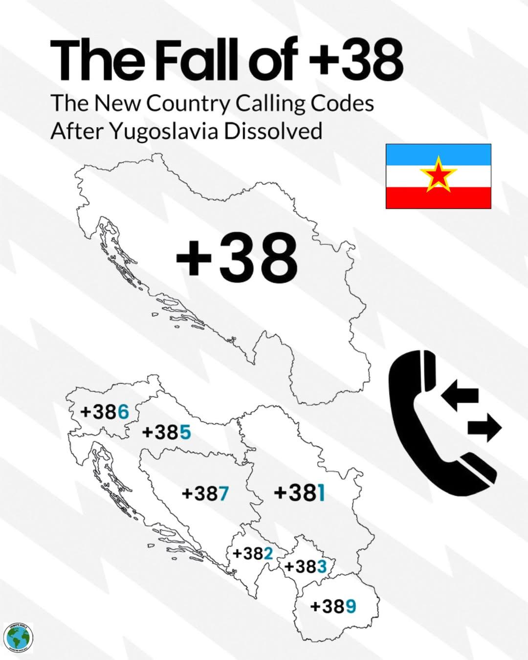
Decline of +38 Calling Code Map
The map titled "The Decline of +38 Calling Code" illustrates the geographical distribution of the countries currently us...
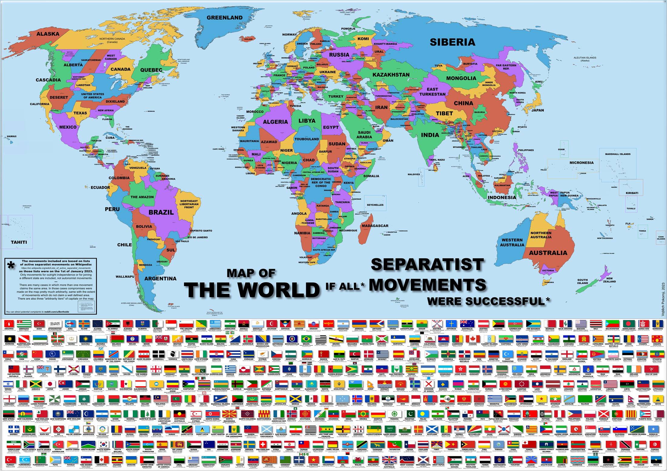
Map of the World if All Separatist Movements Succeeded
This map visualizes a hypothetical scenario where all separatist movements around the globe have achieved their goals an...
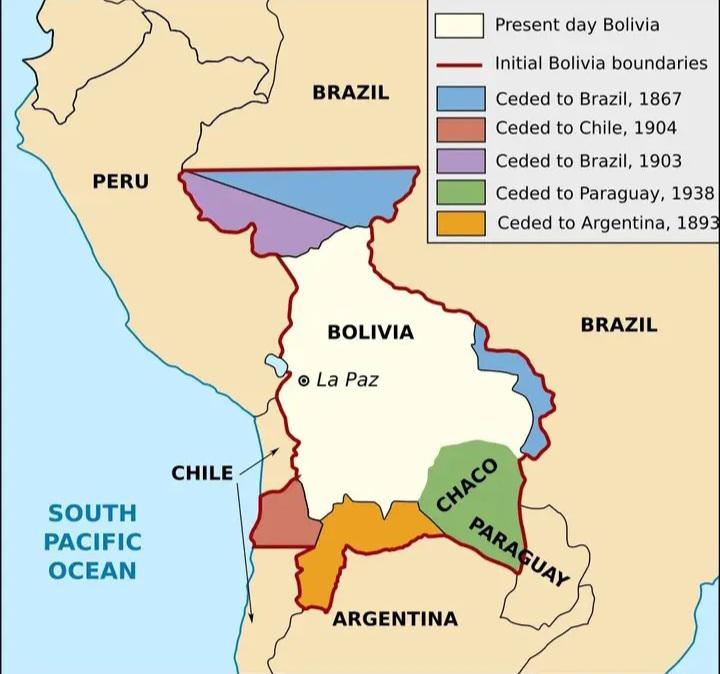
Bolivia Territorial Loss and Resilience Map
This map illustrates the evolving borders of Bolivia, highlighting the significant territorial losses the nation has end...
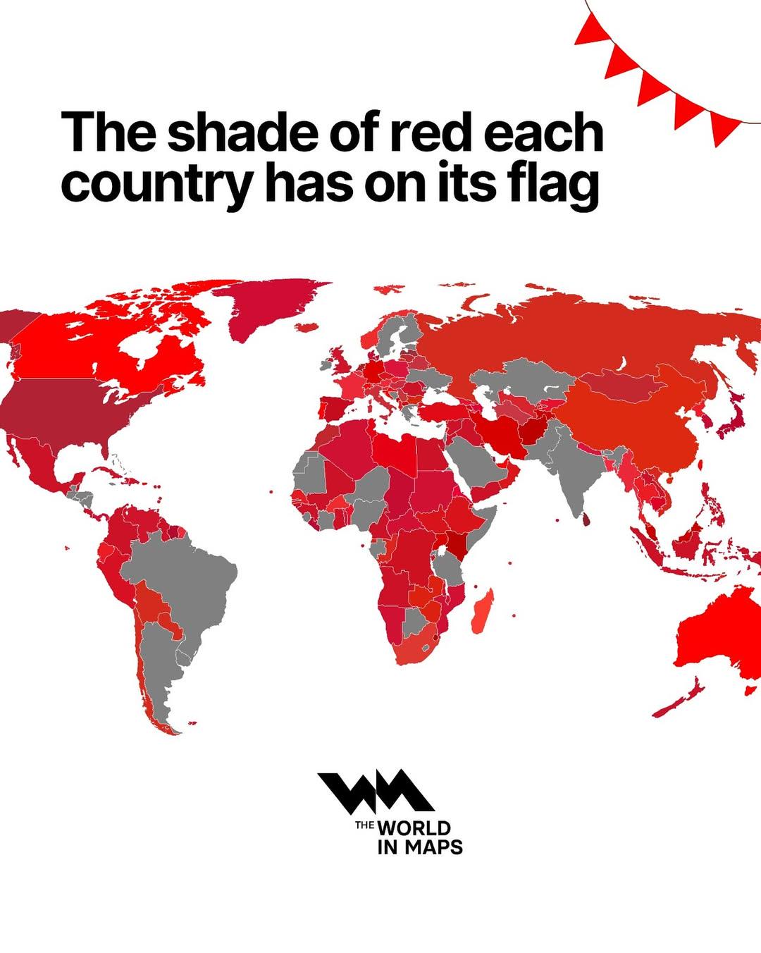
Flag Colors Map by Country
This map visualizes the predominant shade of red featured on the national flags of each country around the world. By dec...
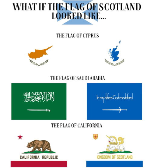
Scottish Flag Variations Map
The visualization titled "What If the Scottish Flag Looked Like…" presents a creative exploration of potential designs f...
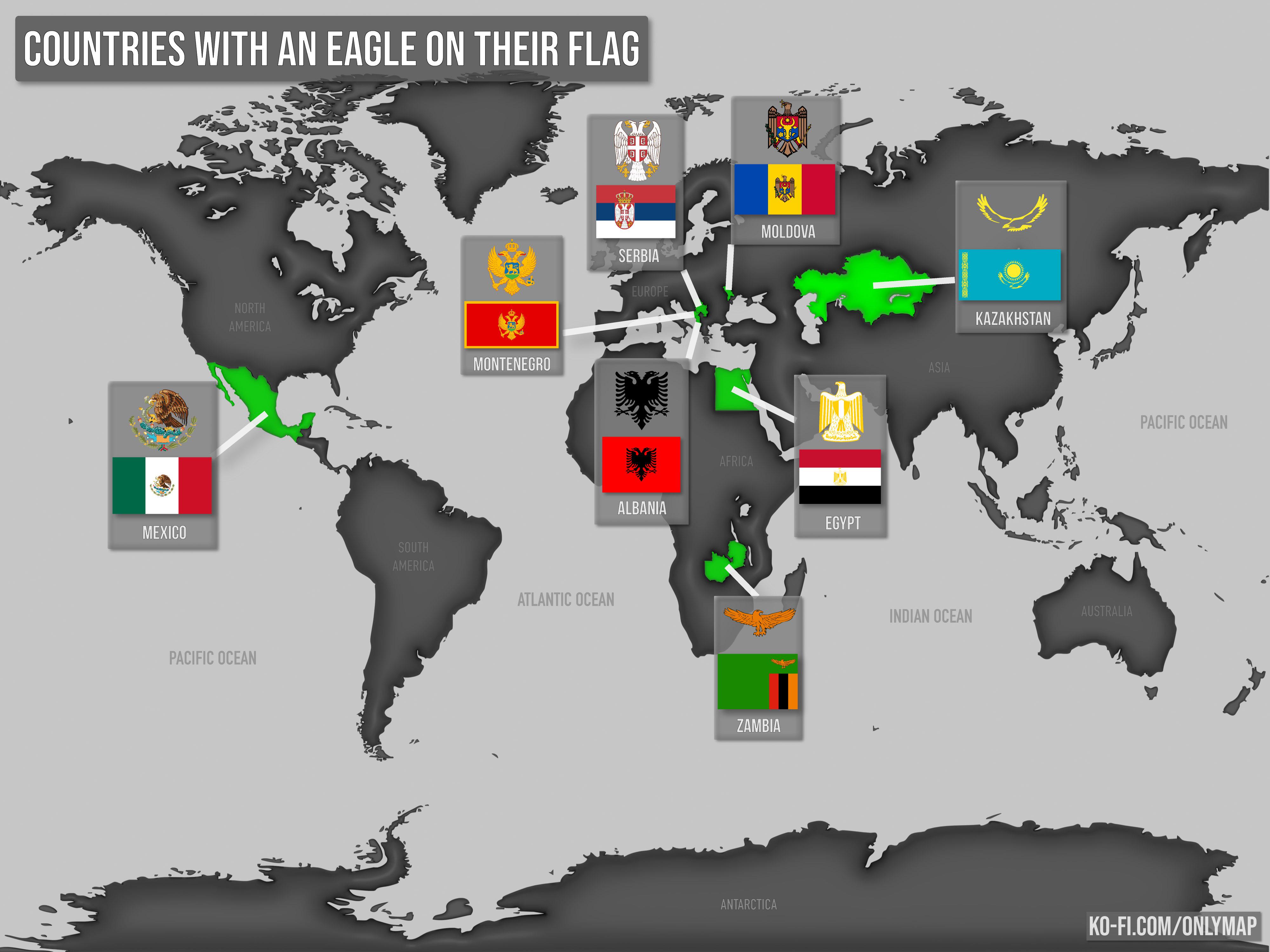
Countries with an Eagle on Their Flag Map
This map highlights the countries that feature an eagle as a prominent symbol on their national flags. The eagle, often ...
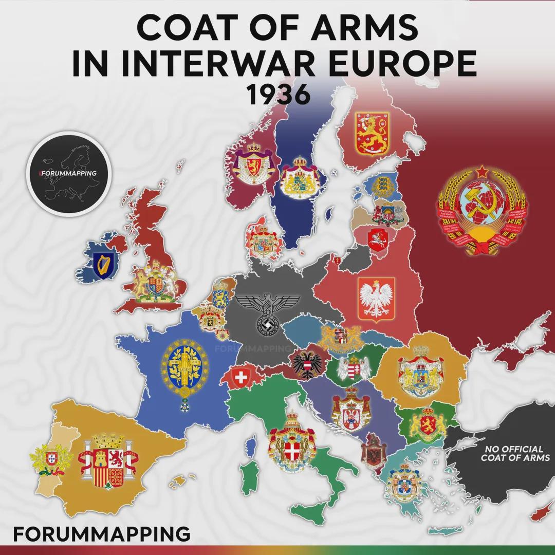
Coat of Arms in Interwar Europe Map
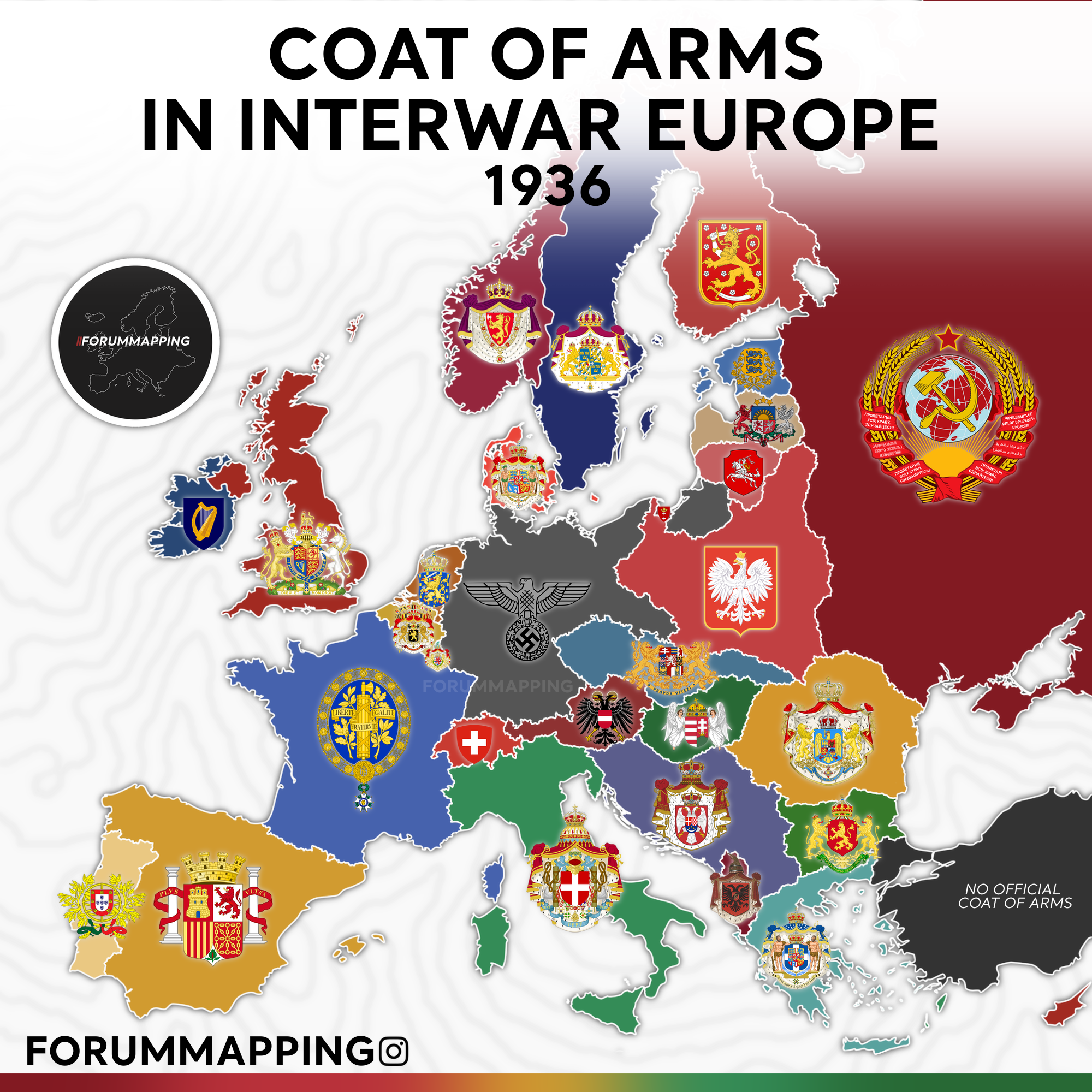
The visualization titled "Coat of Arms in Interwar Europe, 1936" presents a unique snapshot of European heraldry during ...
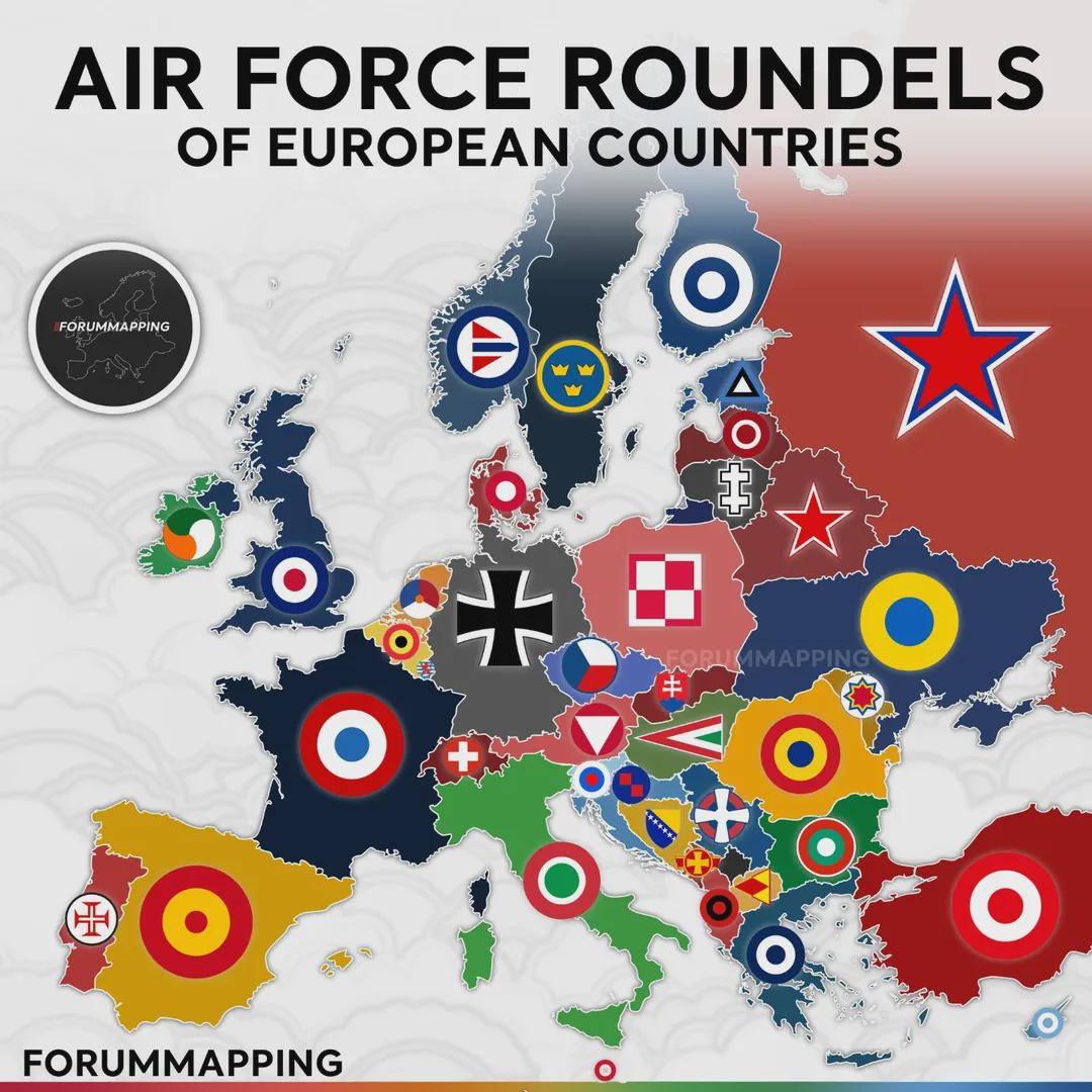
Air Force Roundels of European Countries Map
...
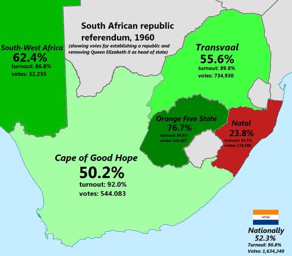
South African Republic Referendum 1960 Map
The "South African Republic Referendum 1960 Map" provides a visual representation of the regions in South Africa that pa...
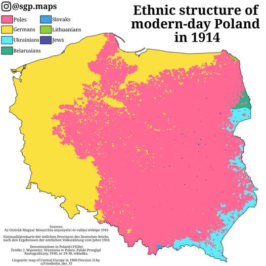
Ethnic Groups Map of Poland in 1914
This map titled "Ethnic Poles, Germans & Other Groups Living Within The Borders Of Modern Poland In 1914" provides a str...
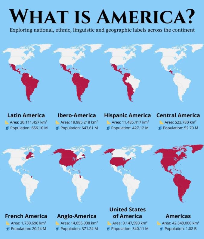
National and Ethnic Labels Map of America
The map titled "What is America?" provides a detailed visualization of the diverse national, ethnic, linguistic, and geo...
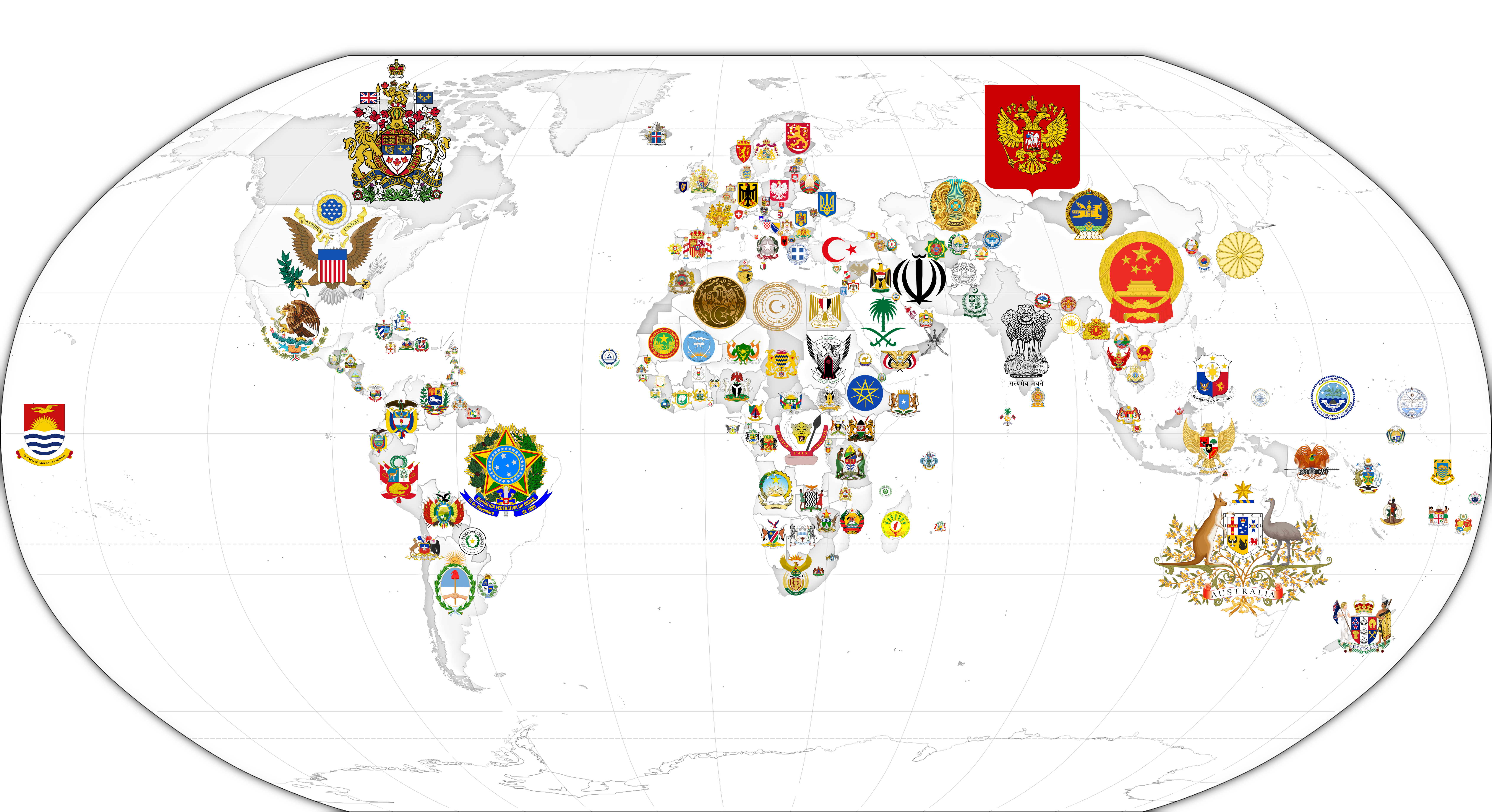
Map of Coat of Arms by Country
The "Map of Coat of Arms by Country" provides a fascinating visual representation of the heraldic symbols that represent...
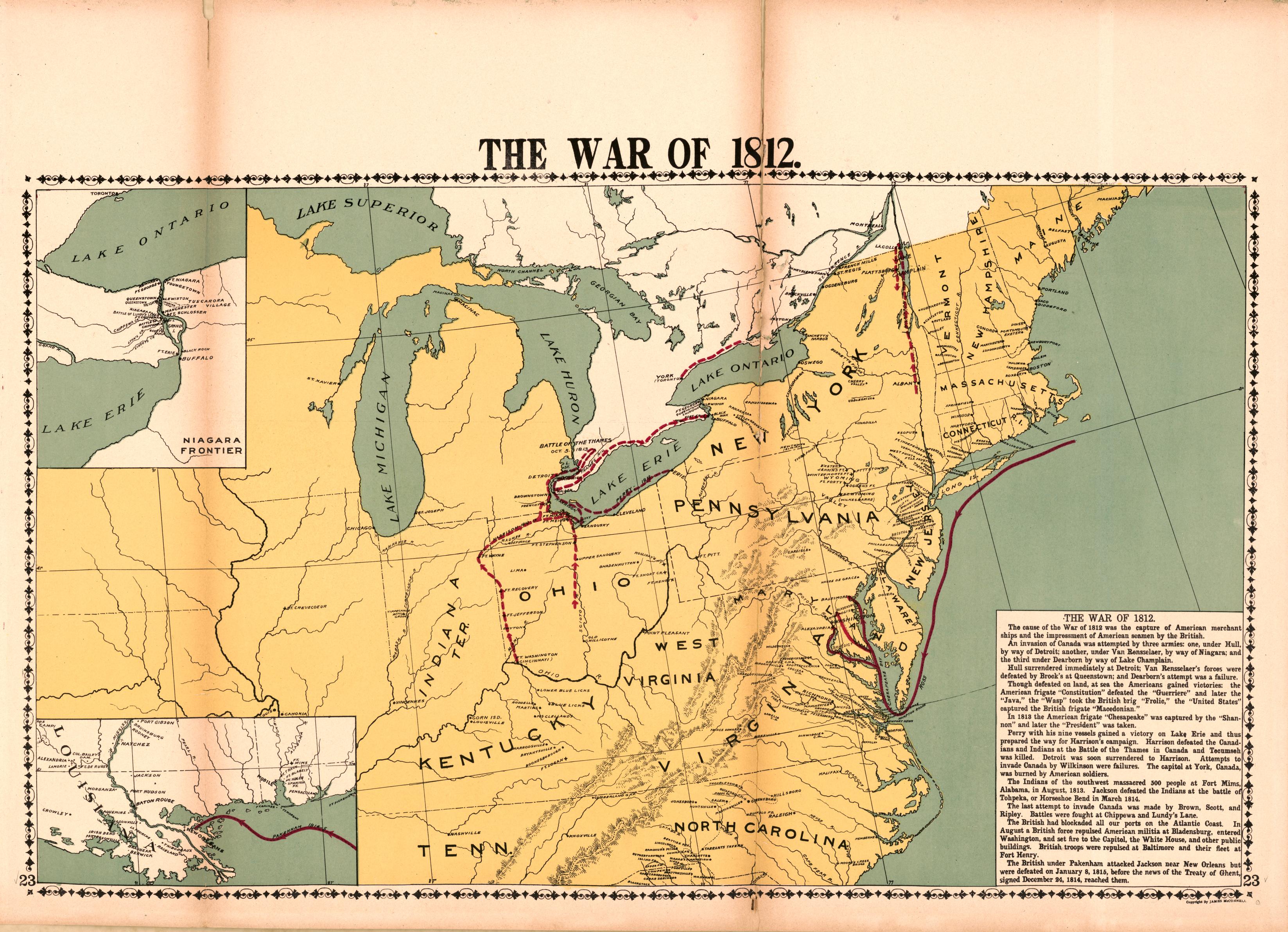
War of 1812 Battle Locations Map
The \...
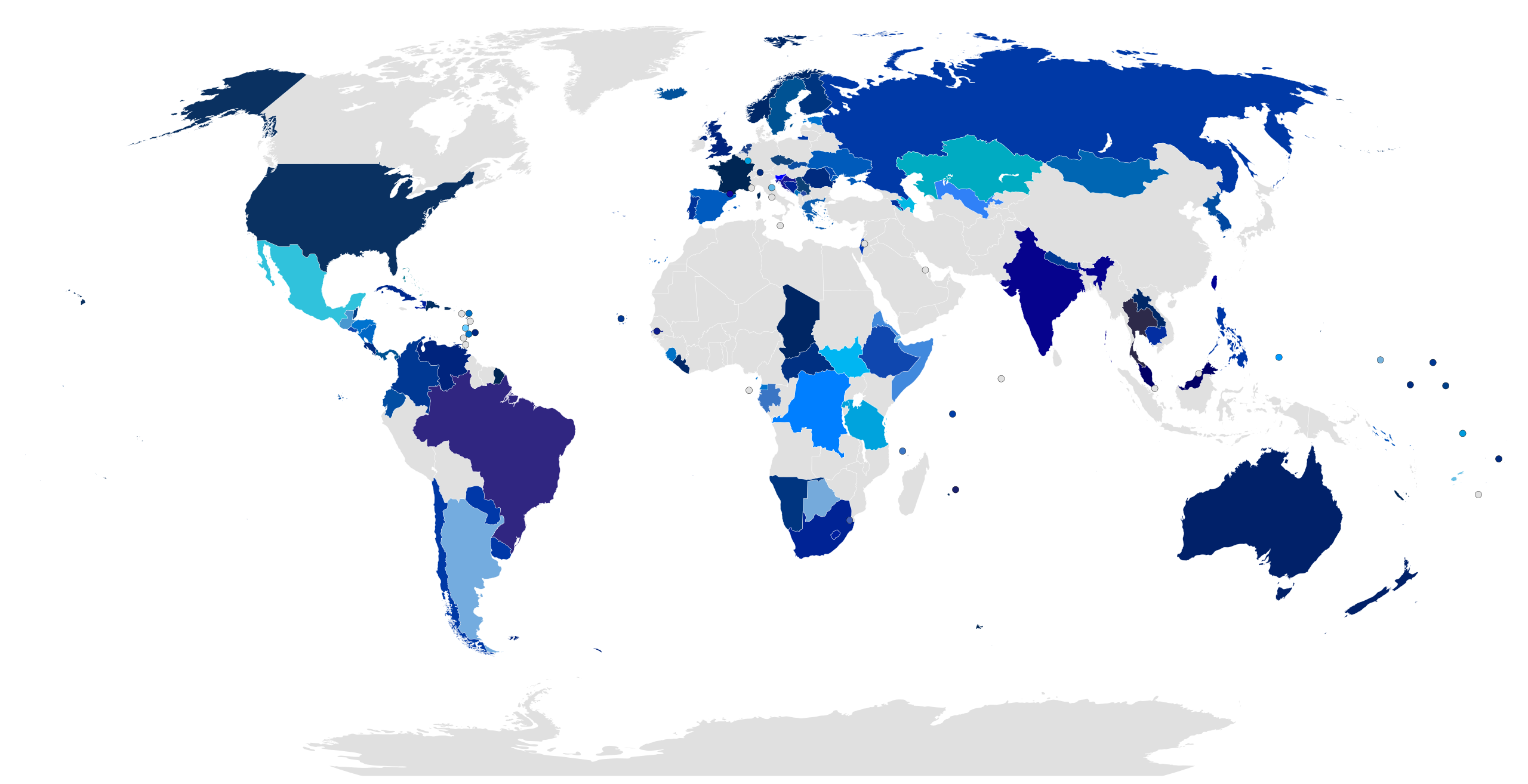
Countries with Blue and Cyan Flags Map
This map visually represents the countries around the world that feature blue or cyan in their national flags. It highli...
Coat of Arms in Interwar Europe Map
The visualization titled "Coat of Arms in Interwar Europe, 1936" showcases the heraldic symbols representing various nat...
Ethnic Groups of Central Europe Map
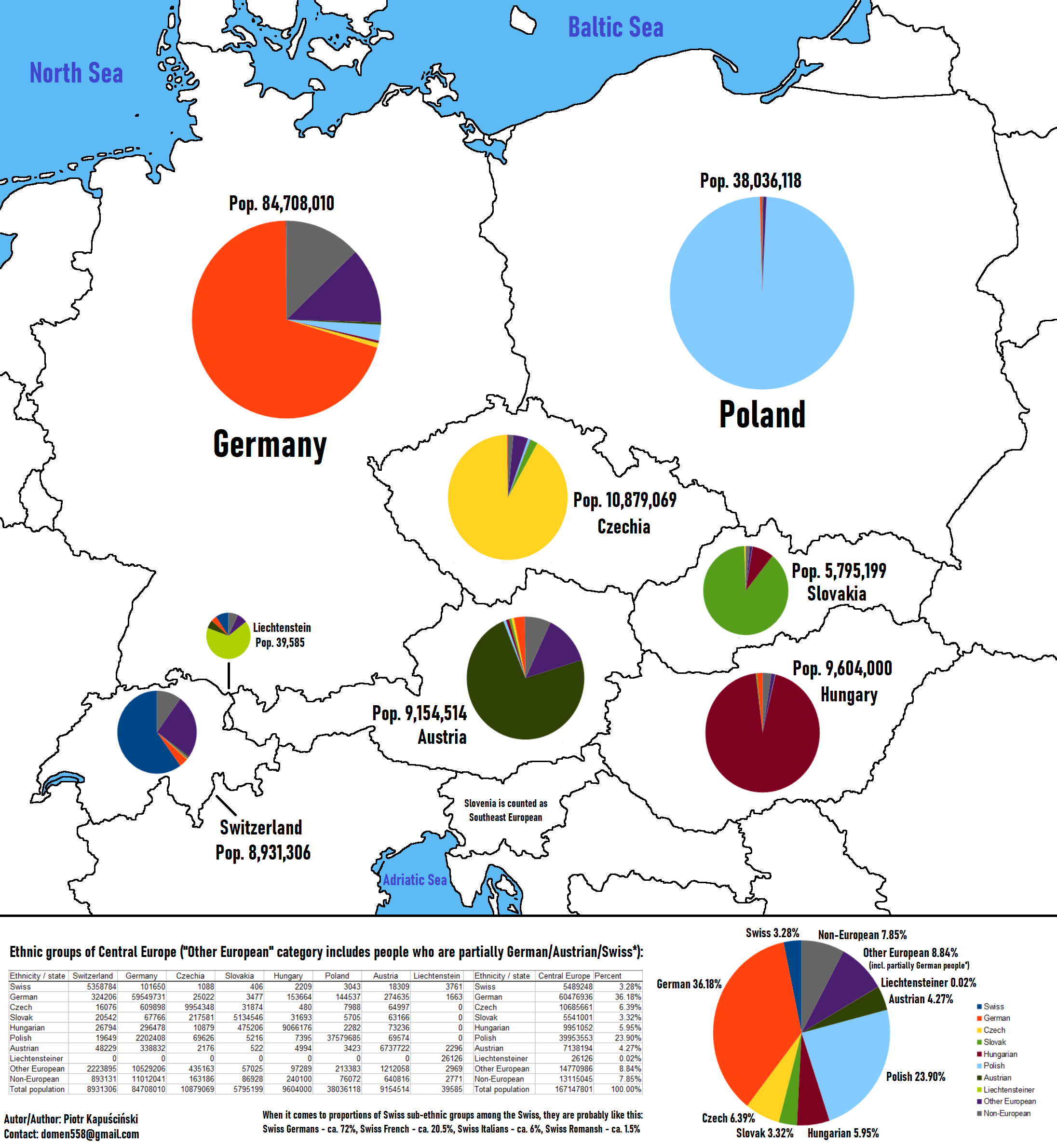
This map provides a detailed visualization of the ethnic groups residing in Central Europe, highlighting the diverse cul...
Map of South America with Flags
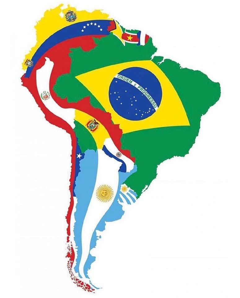
The 'Map of South America with Flags' is a vibrant visual representation that showcases the flags of each South American...
1959 Geographic Center of the United States Map
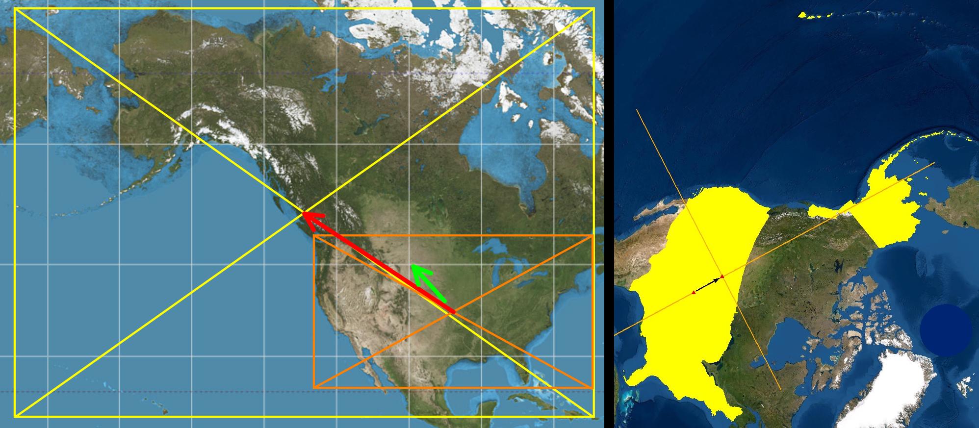
What’s particularly intriguing about the 1959 shift is how it reflects the broader geopolitical changes occurring within...
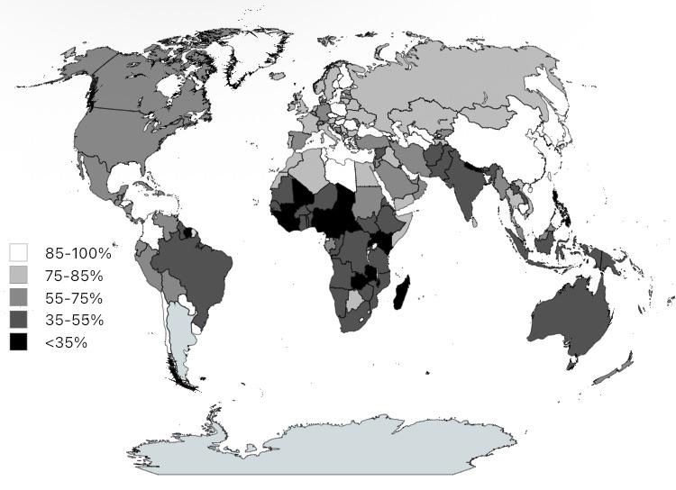
Map of Countries by Largest Ethnic Group Size
This map visualizes countries ranked by the size of their largest ethnic group relative to the total population. It high...