mapping Maps
20 geographic visualizations tagged with "mapping"
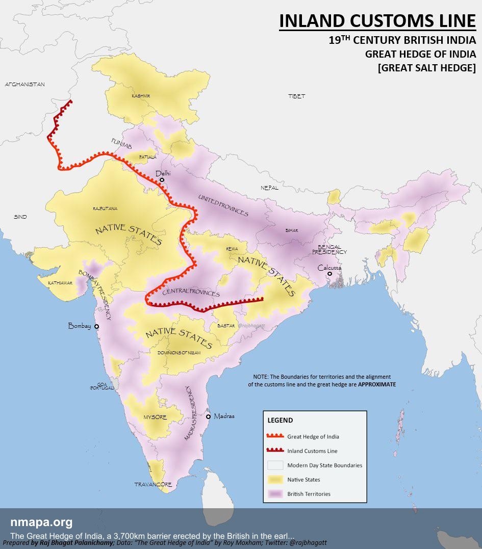
The Great Hedge of India, a 3,700km barrier erected by the British in the early 19th century to prevent people from illegally evading the salt tax by getting salt from the sea. Map
This geographical visualization presents "The Great Hedge of India, a 3,700km barrier erected by the British in the earl...
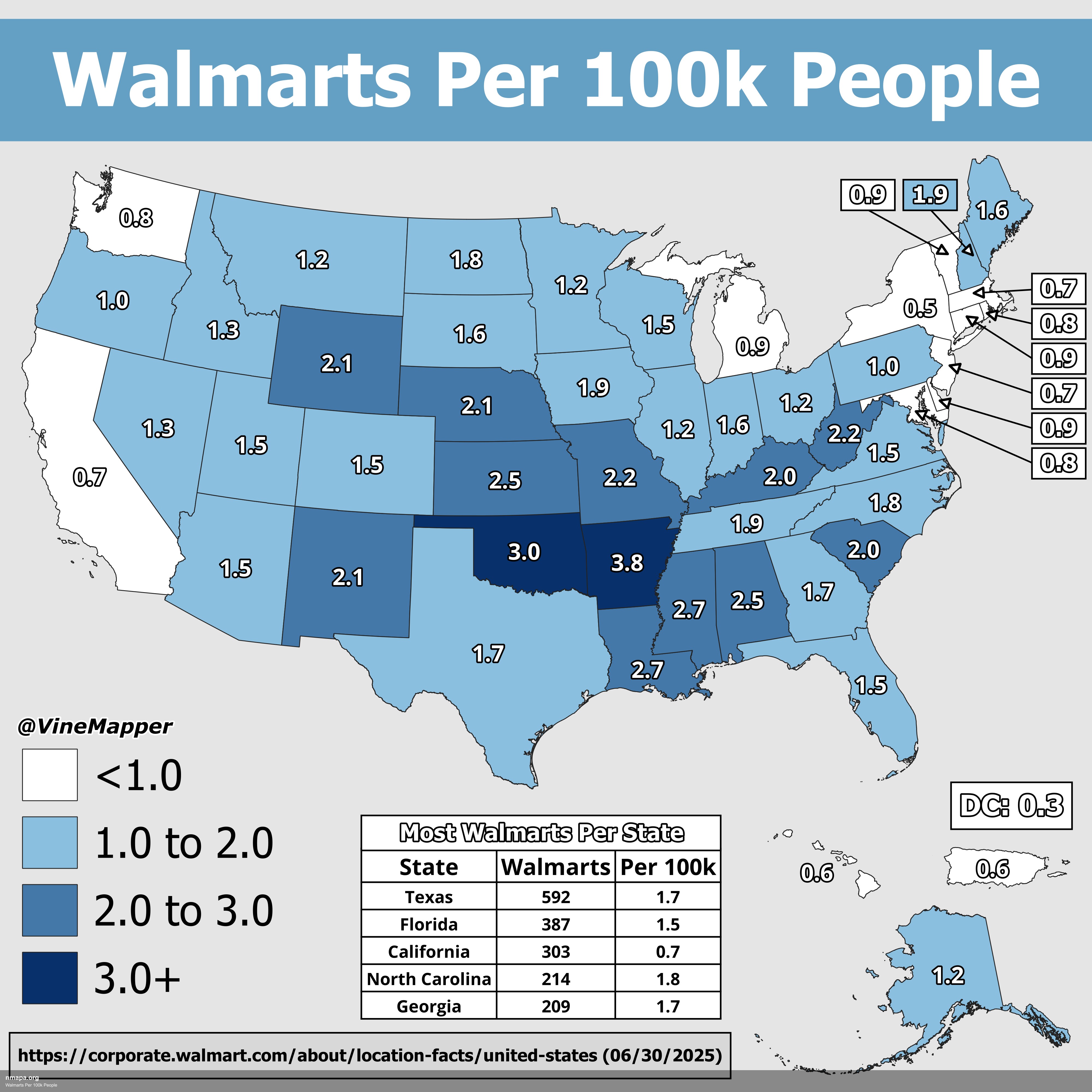
Walmarts Per 100k People Map
This geographical visualization presents "Walmarts Per 100k People" as a comprehensive map that displays spatial data pa...
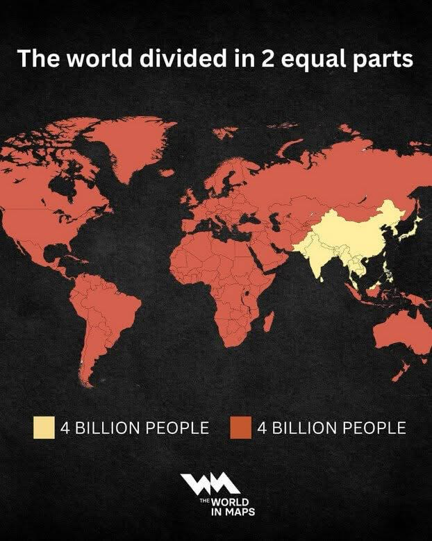
World Population Distribution Map
The 'World Population Distribution Map' effectively visualizes how the global population is divided into two equal parts...
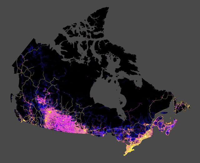
Roads in Canada Map
The map shared by Col. Chris Hadfield on Facebook provides a comprehensive visualization of all the roads in Canada. It ...
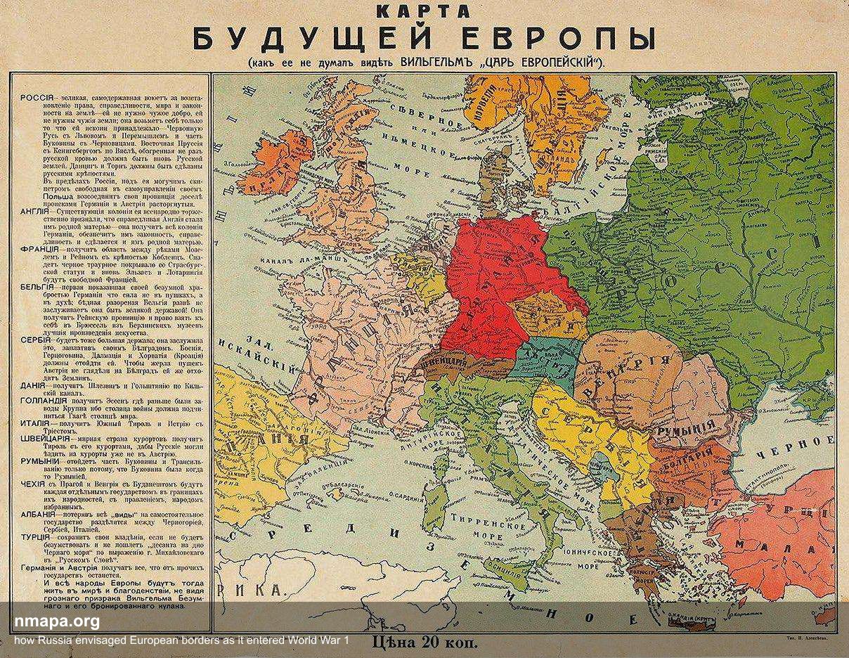
how Russia envisaged European borders as it entered World War 1 Map
This comprehensive geographical visualization presents "how Russia envisaged European borders as it entered World War 1"...
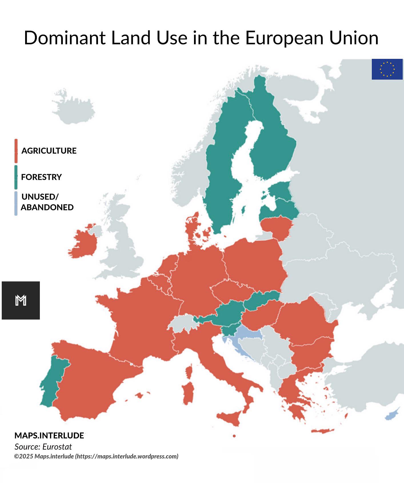
Dominant Land Use in the European Union Map
The "Dominant Land Use in the European Union" map provides a comprehensive visualization of how land is utilized across ...
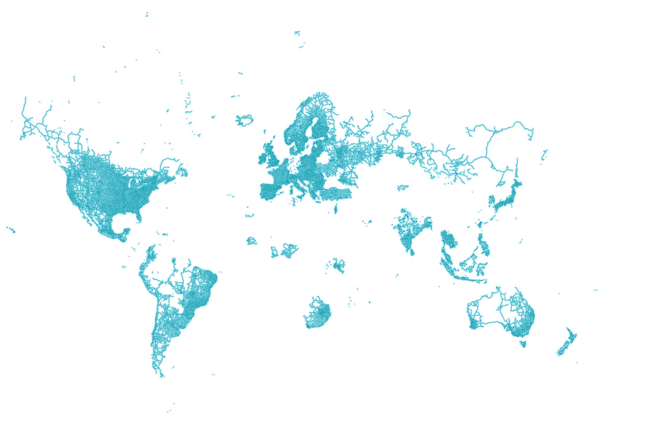
World Map According to Google Street View
The world map according to Google Street View offers a unique perspective on our planet by visualizing the locations tha...
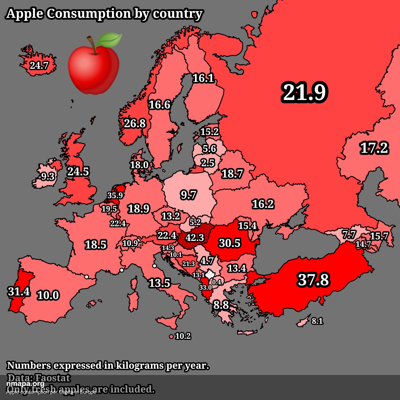
Apple consumption per Capita in Europe Map
This comprehensive geographical visualization presents "Apple consumption per Capita in Europe" in an accessible and inf...
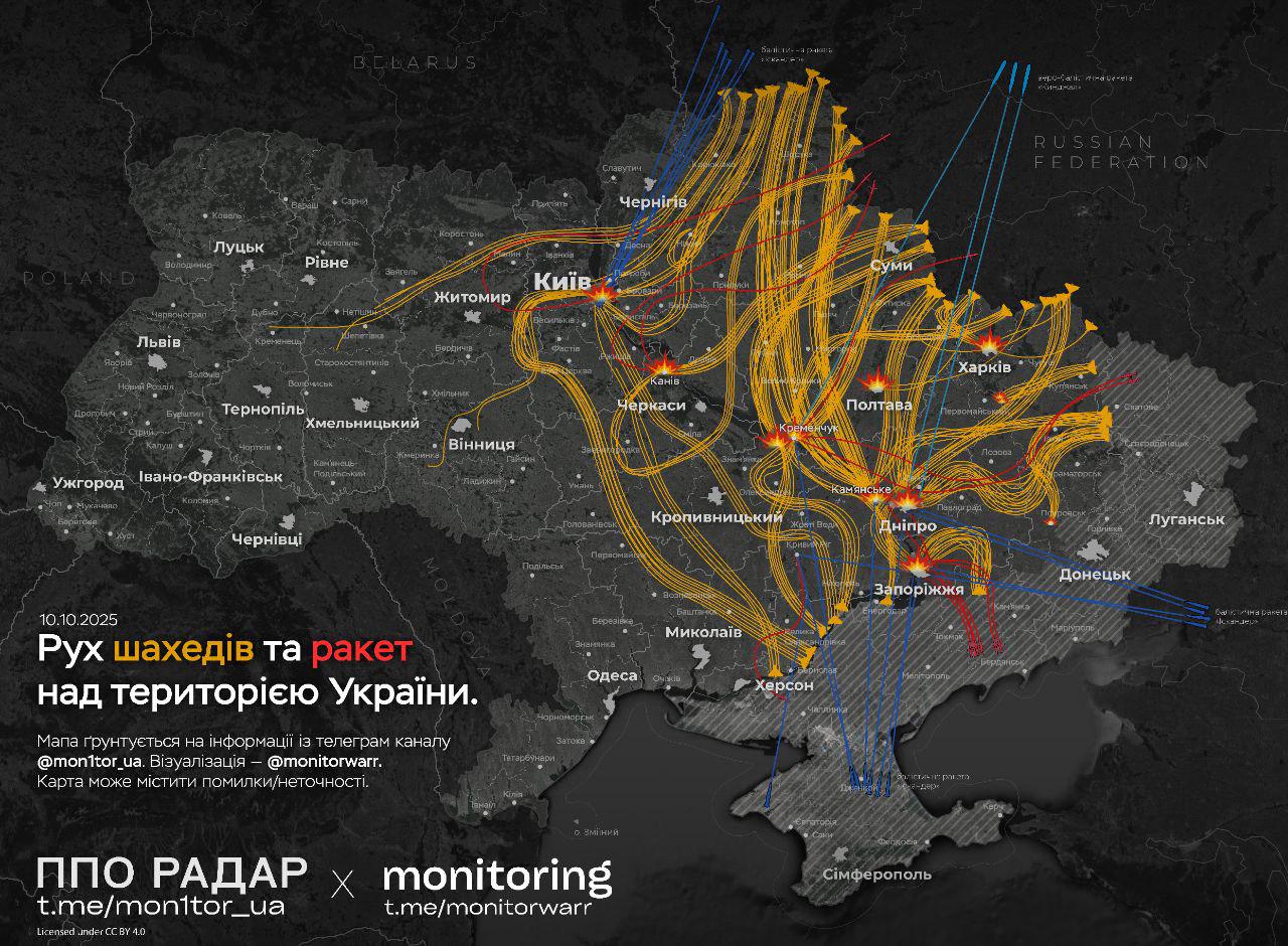
Map of Today's Air Attacks on Ukraine's Energy Infrastructure
The map titled "Today's Air Attack on Ukraine" provides a comprehensive visualization of the recent strikes launched aga...
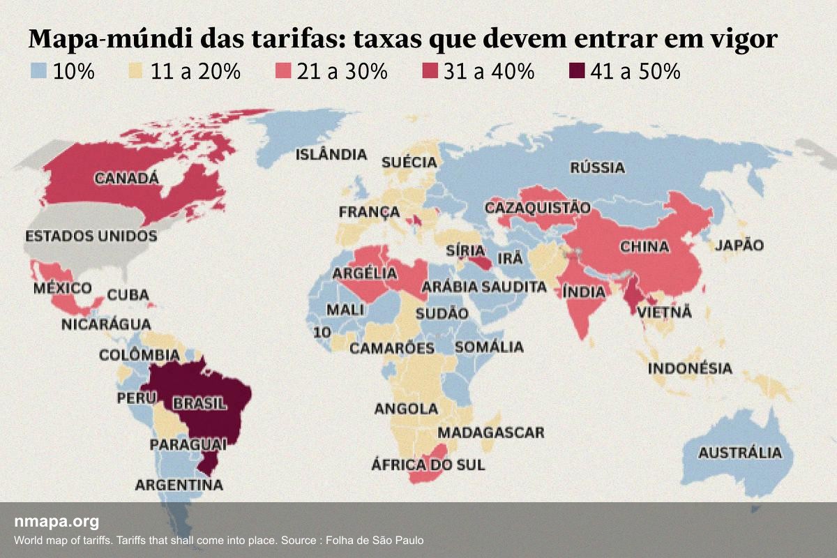
World map of tariffs. Tariffs that shall come into place. Source : Folha de São Paulo
This comprehensive geographical visualization presents "World map of tariffs. Tariffs that shall come into place. Source...
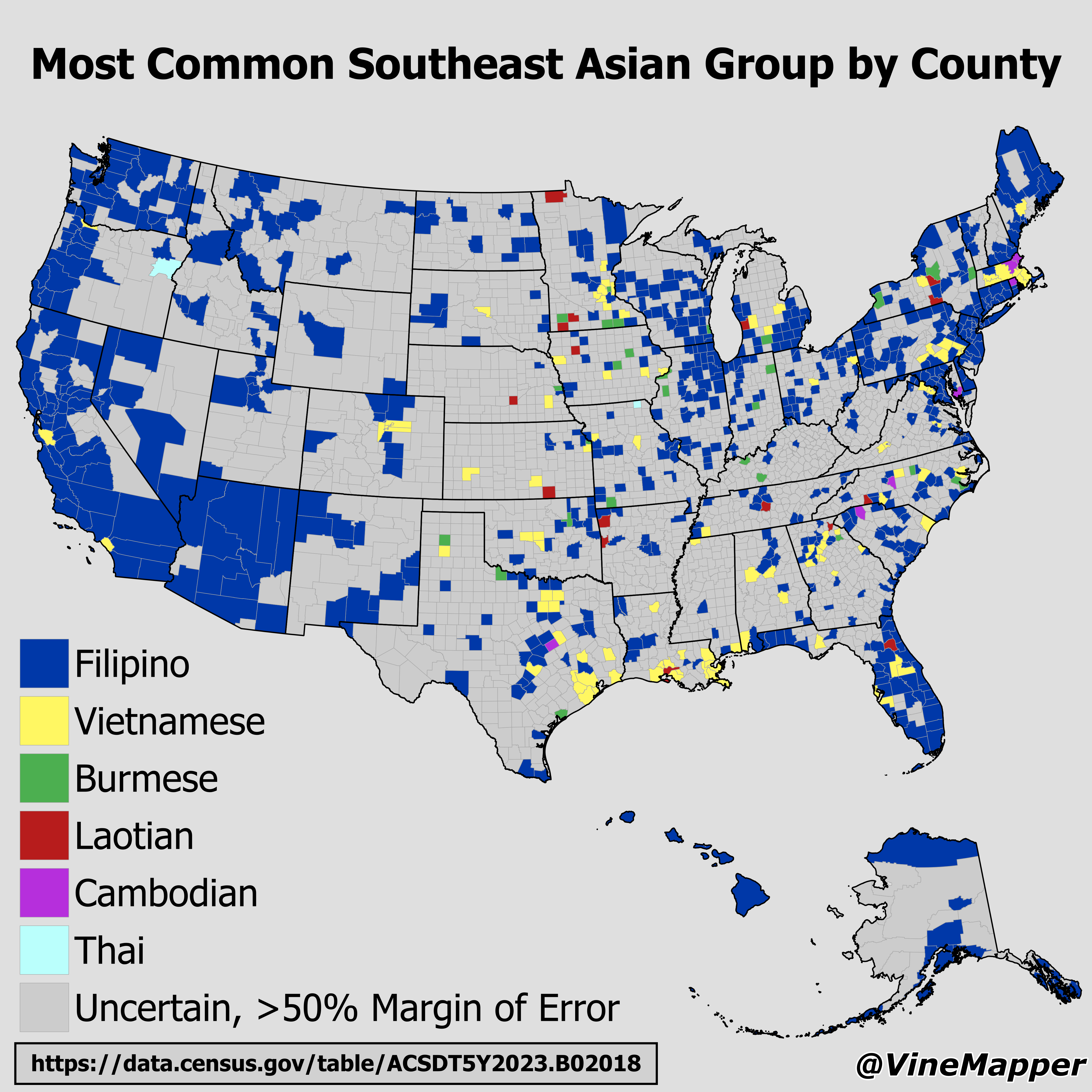
Most Common Southeast Asian Group by County Map
The "Most Common Southeast Asian Group by County Map" provides a detailed visualization of the predominant ethnic groups...
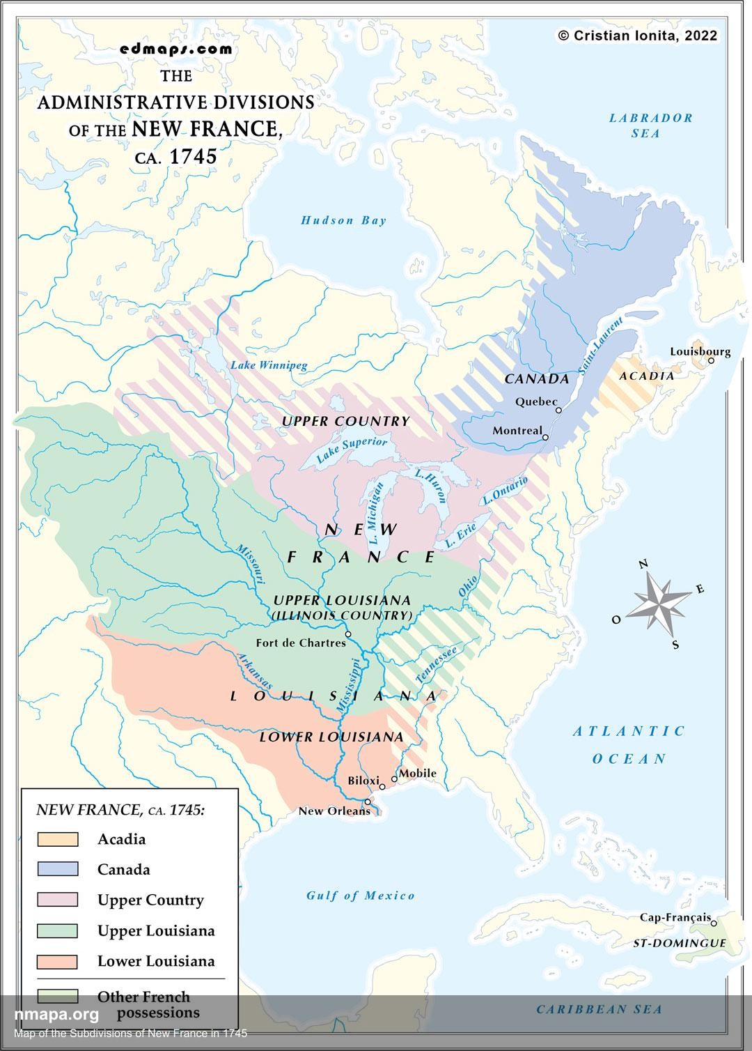
Map of the Subdivisions of New France in 1745
This comprehensive geographical visualization presents "Map of the Subdivisions of New France in 1745" in an accessible ...

Urbanization Rate by Indian State Map
The "Urbanization Rate by Indian State Map" visualizes the extent to which different states in India have transitioned f...
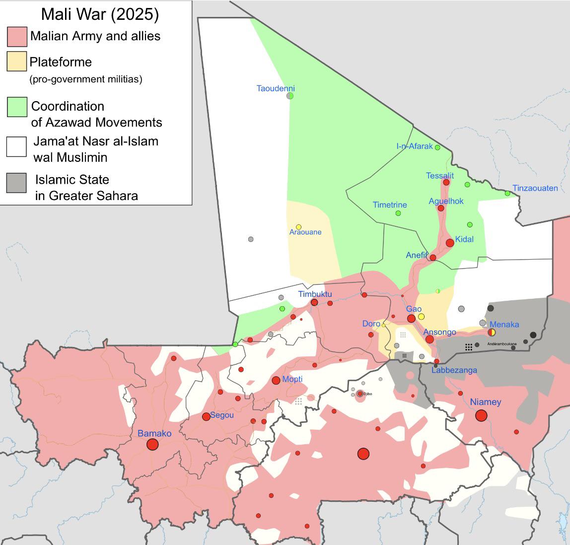
Current State of Mali War Map
The visualization titled "The Current State of Mali War (c. August 2025)" provides a snapshot of the ongoing conflict in...
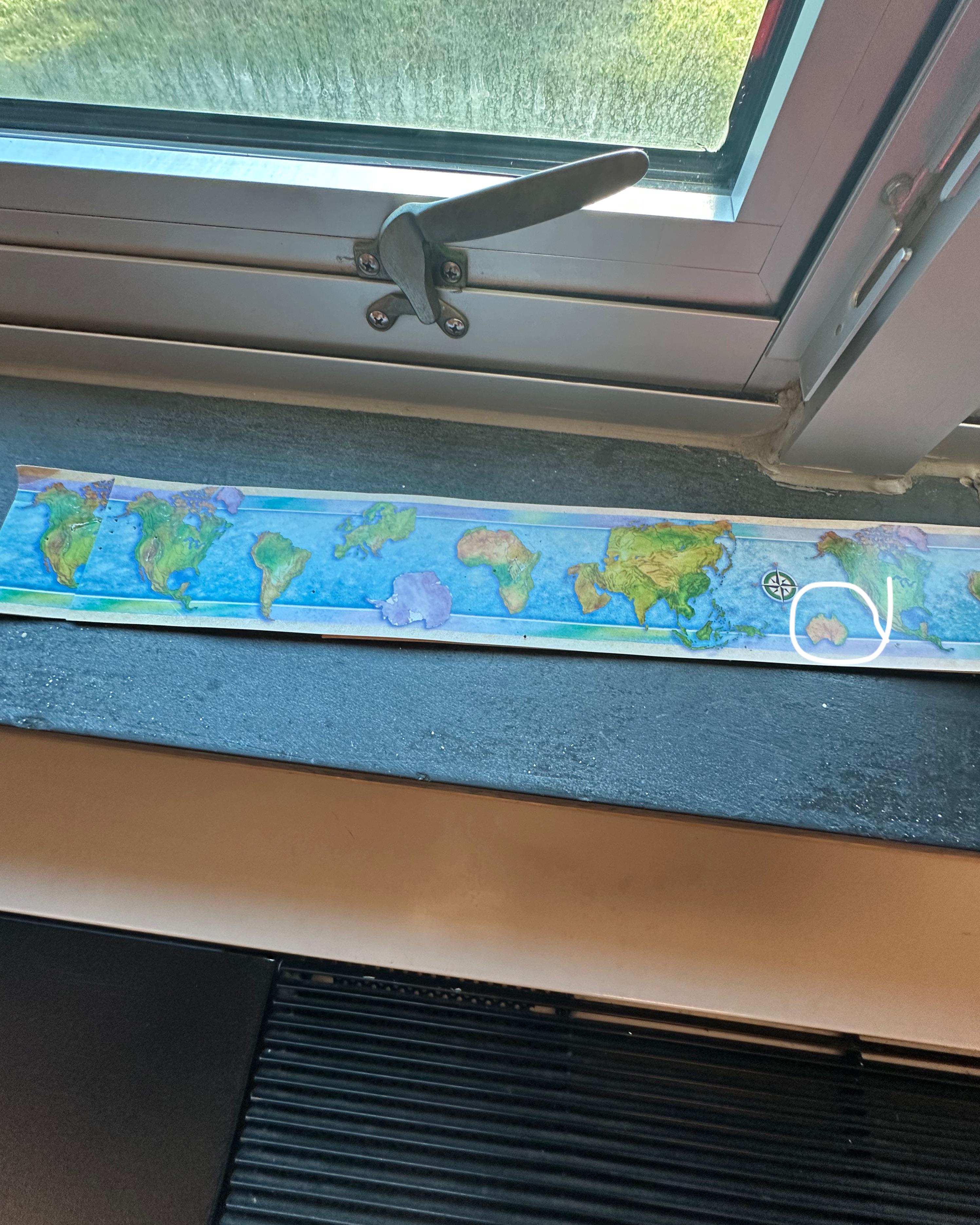
Map Showing Missing New Zealand
The visualization titled 'Map at school forgot New Zealand' highlights a curious omission in a geographical representati...
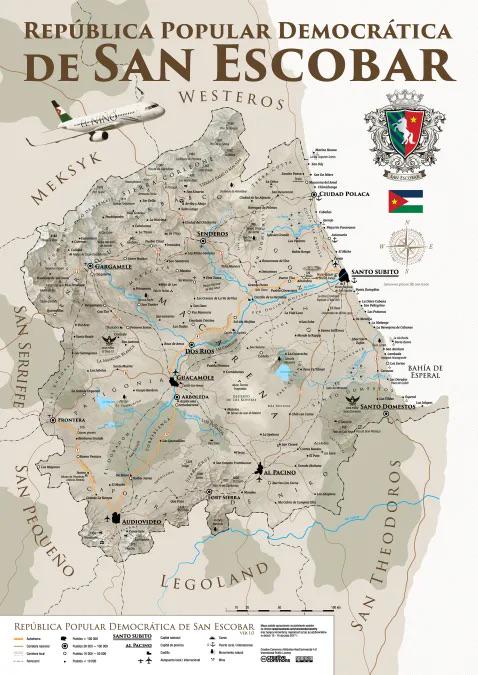
Map of the Fictional Country San Escobar
Fictional places often serve as a canvas for creativity, allowing individuals to explore ideas that might not be possibl...
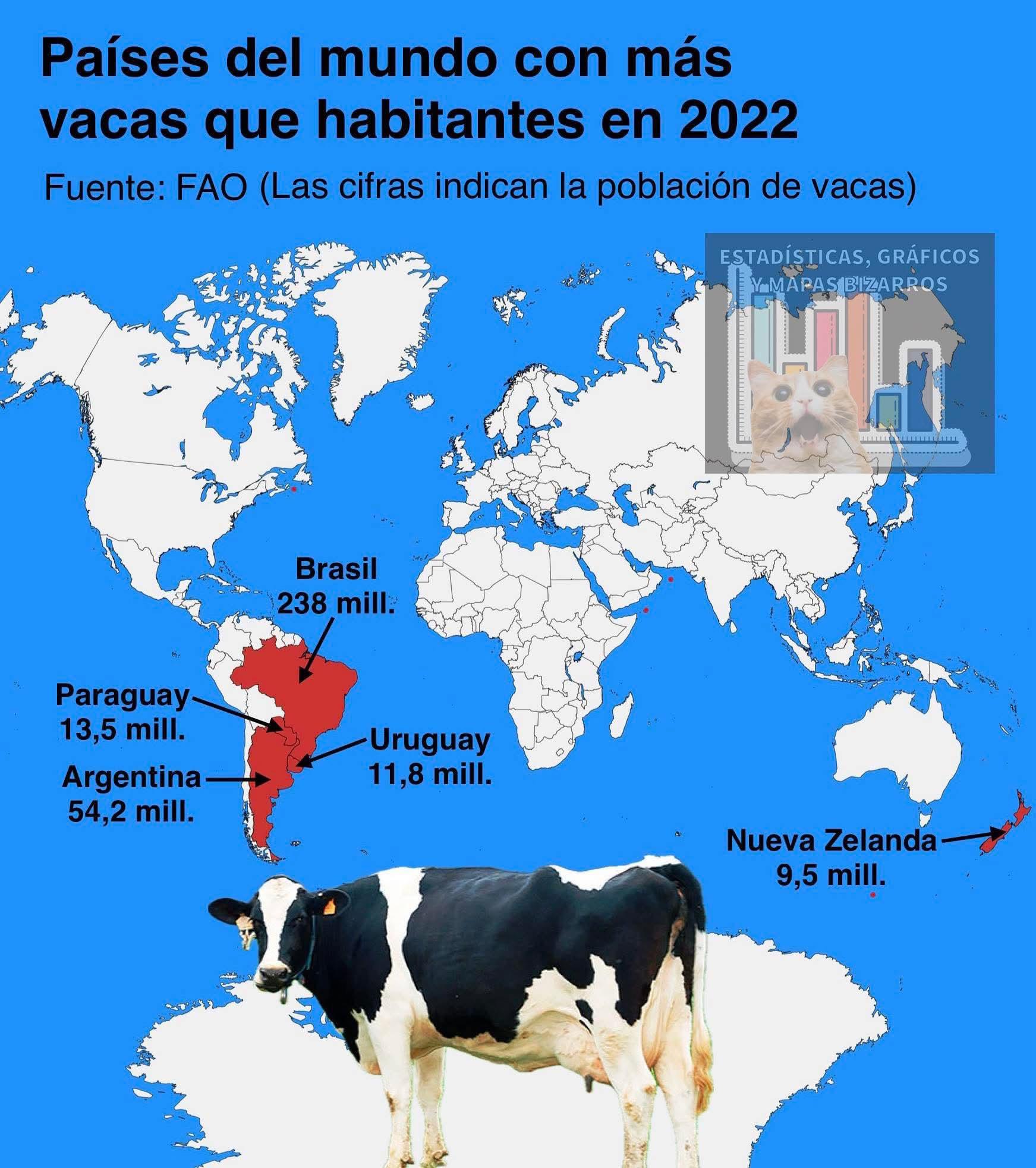
Map of Countries with More Cows than Humans
The visualization titled "Countries where they have more cows than humans" illustrates a fascinating aspect of global li...
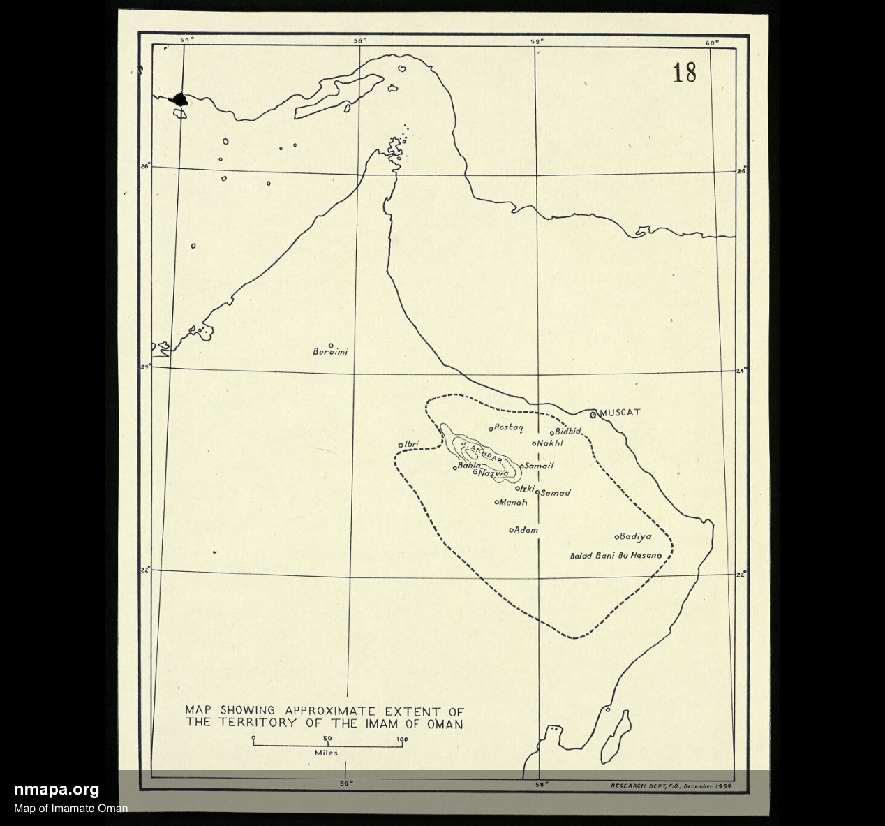
Map of Imamate Oman
This comprehensive geographical visualization presents "Map of Imamate Oman" in an accessible and informative format, of...
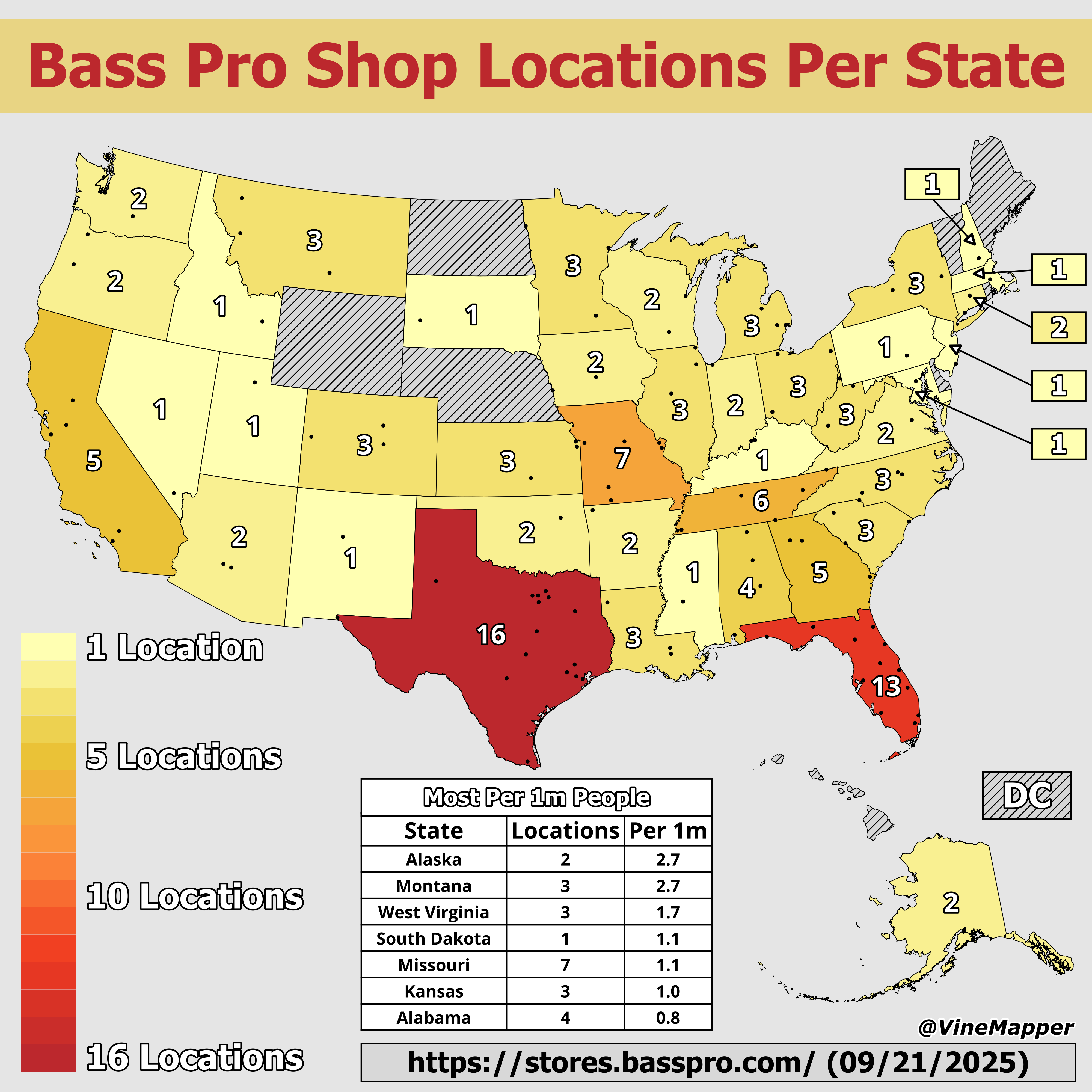
Bass Pro Shop Locations by State Map
The "Bass Pro Shop Locations by State Map" provides a clear visualization of where these popular outdoor retail stores a...
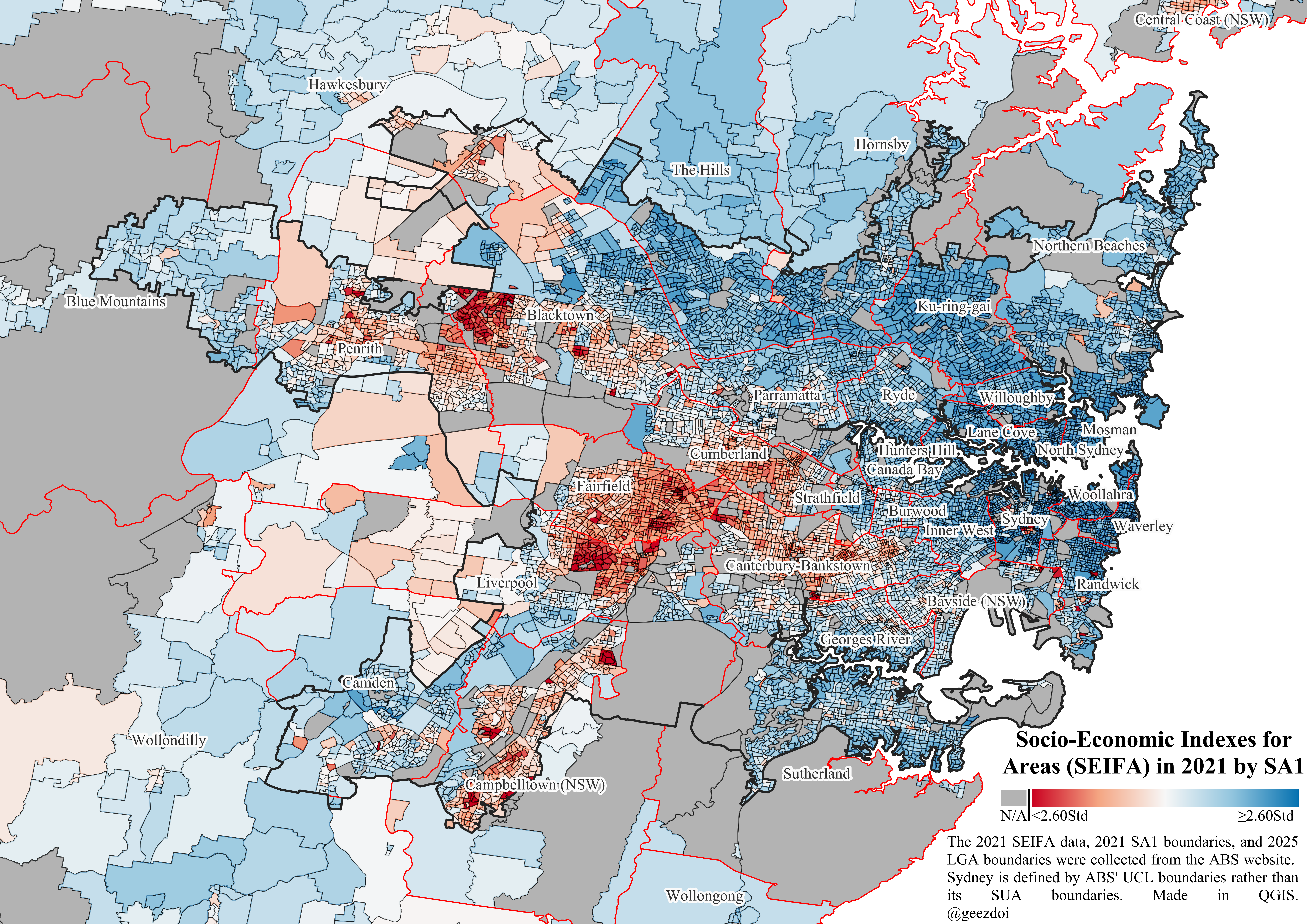
Socio-Economic Advantage and Disadvantage Map of Sydney
The "Map of Relative Socio-Economic Advantage and Disadvantage within Sydney" provides a visual representation of socio-...