japan Maps
17 geographic visualizations tagged with "japan"
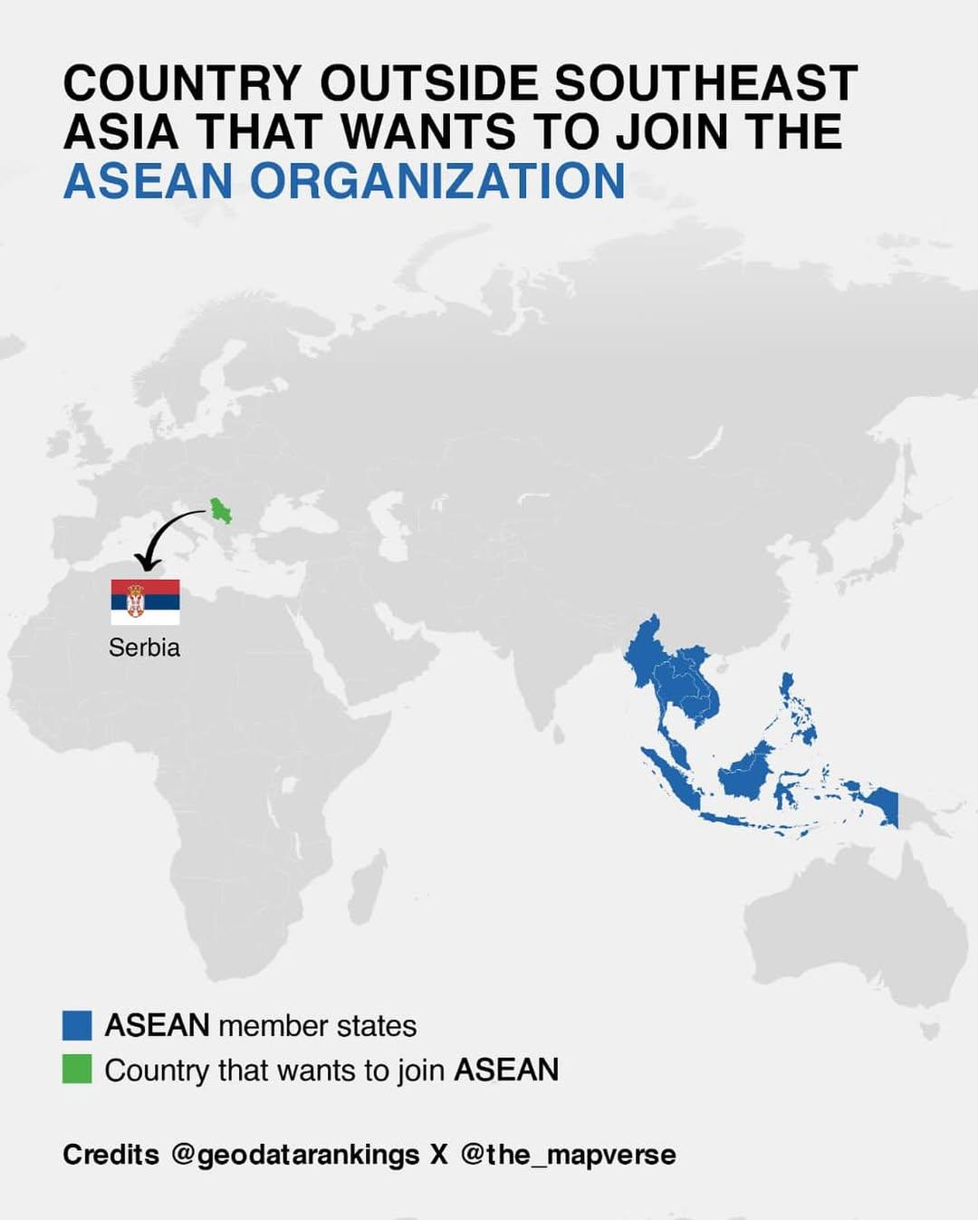
Map of Countries Outside Southeast Asia Wanting to Join ASEAN
This map illustrates the various countries outside of Southeast Asia that have expressed interest in joining the Associa...
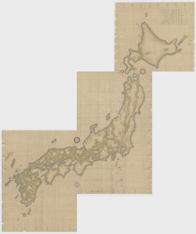
Japanese Topographical Map by Inō Tadataka
The map created by Inō Tadataka in 1821 represents a detailed topographical outline of Japan, showcasing the country's m...
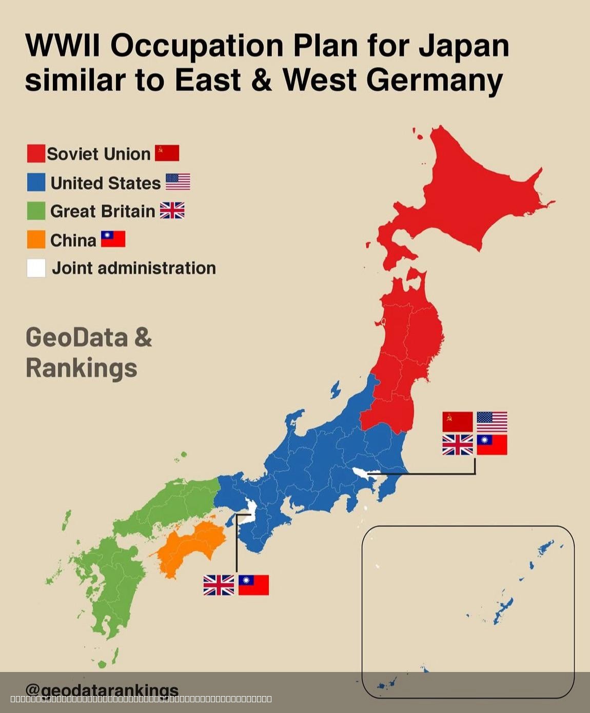
Japan Post-World War 2 Division Map
This map illustrates the proposed division of Japan after World War II, shedding light on the geopolitical landscape tha...
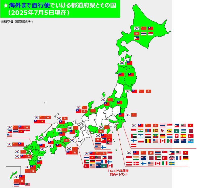
Map of International Direct Flights to Japan Prefecture
This map provides a comprehensive overview of international direct flight routes to various prefectures in Japan, displa...
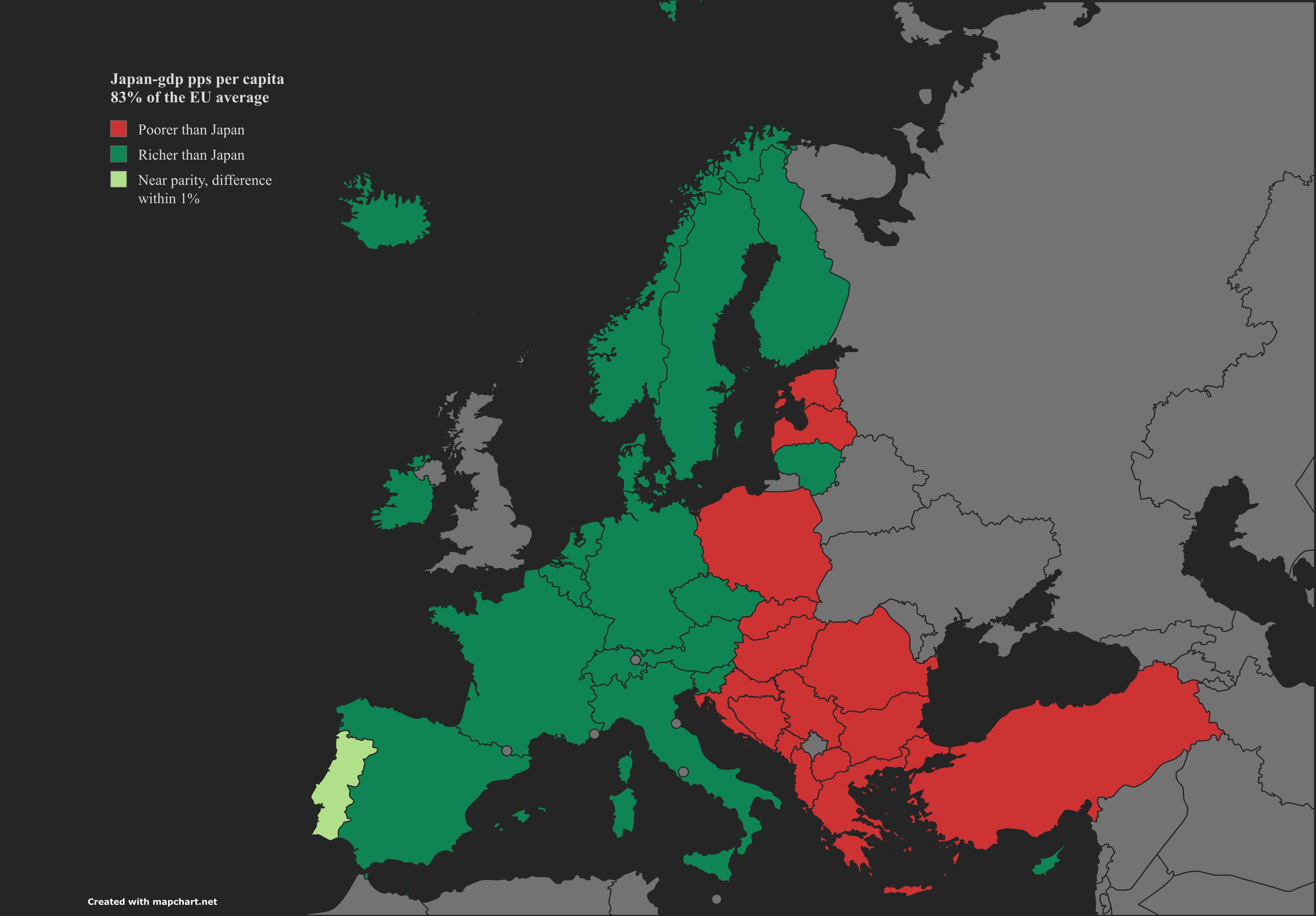
GDP PPS Per Capita Comparison Map: Japan and Europe
The visualization titled "Yen Meets Euro" presents a detailed comparison of Japan's GDP per capita in purchasing power s...
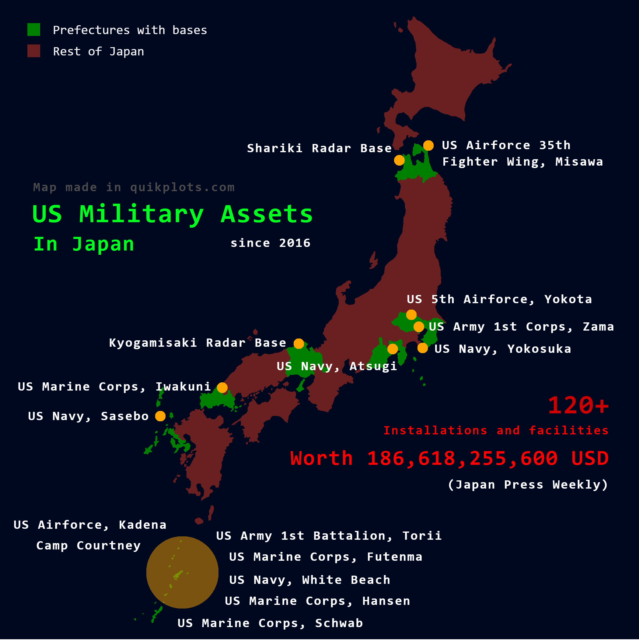
US Military Assets in Japan Map
The visualization titled "US Military Assets in Japan" provides a detailed look into the strategic military infrastructu...
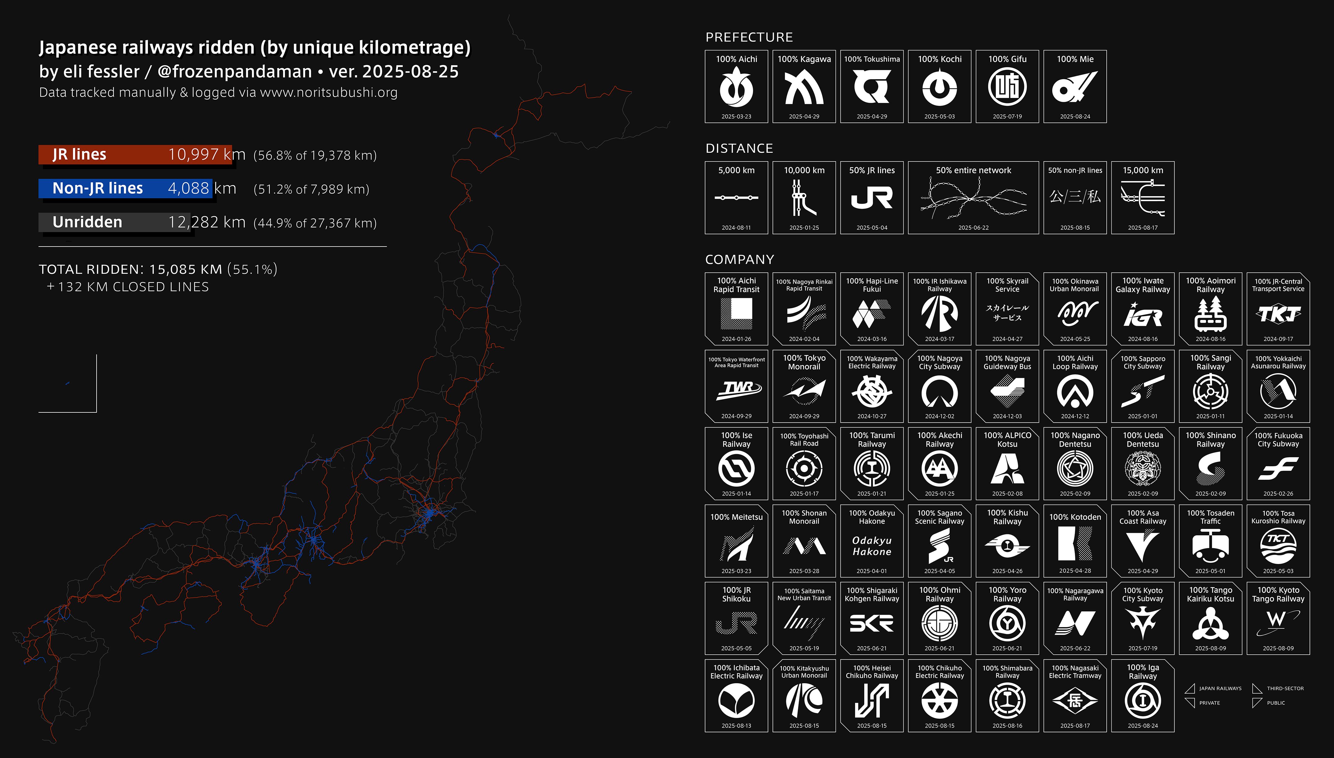
Railway Network Map of Japan
This engaging visualization highlights an impressive journey through Japan’s extensive railway network, showcasing a rem...
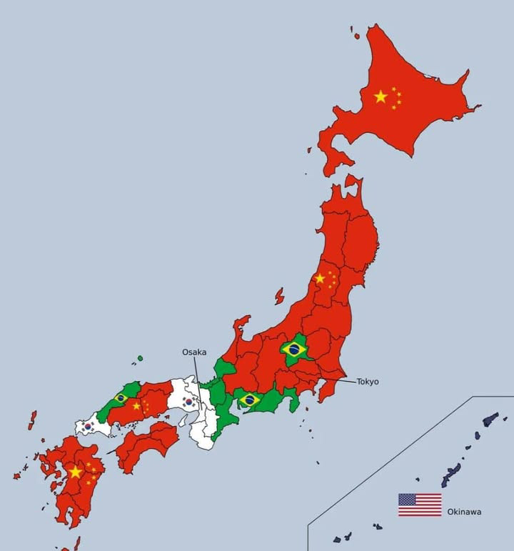
Most Common Foreign Nationality in Each Japanese Prefecture Map
This map illustrates the most common foreign nationality residing in each of Japan's 47 prefectures. By highlighting the...
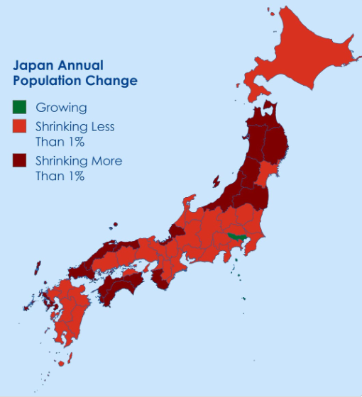
Japan's Annual Population Decline by Prefecture Map
This map visually represents the annual population decline across Japan’s prefectures, highlighting areas where demograp...
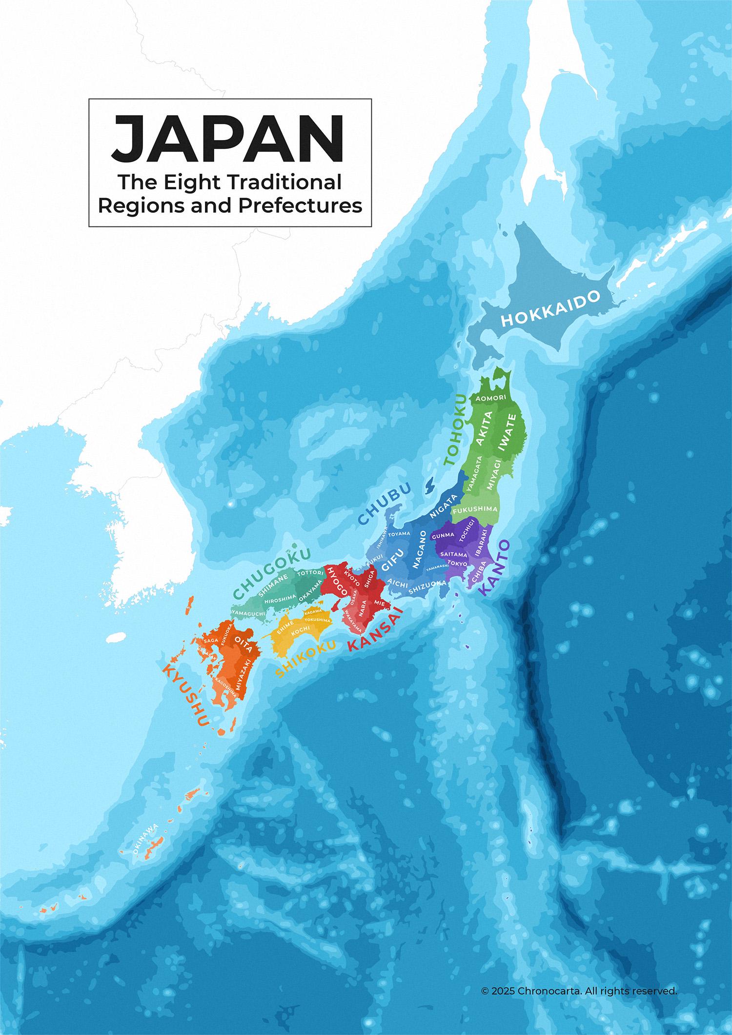
Japan’s Traditional Regions and Prefectures Map
This detailed administrative map of Japan illustrates the country's eight traditional regions and their corresponding pr...
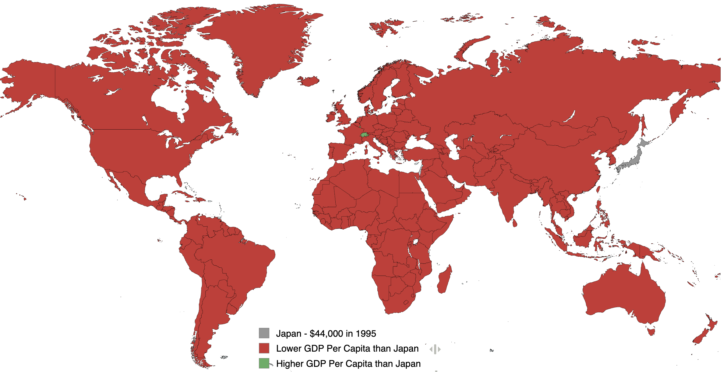
GDP Per Capita Map of Japan 1995
This visualization illustrates the GDP per capita of various countries in the year 1995, with Japan's GDP per capita peg...
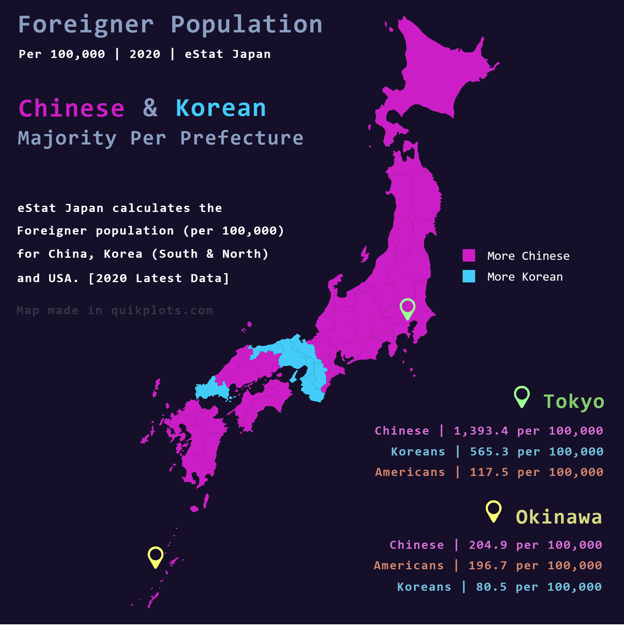
Chinese and Korean Foreigners in Japan Map
The map titled "Chinese & Korean foreigners in Japan" provides a detailed visualization of the foreign population from C...
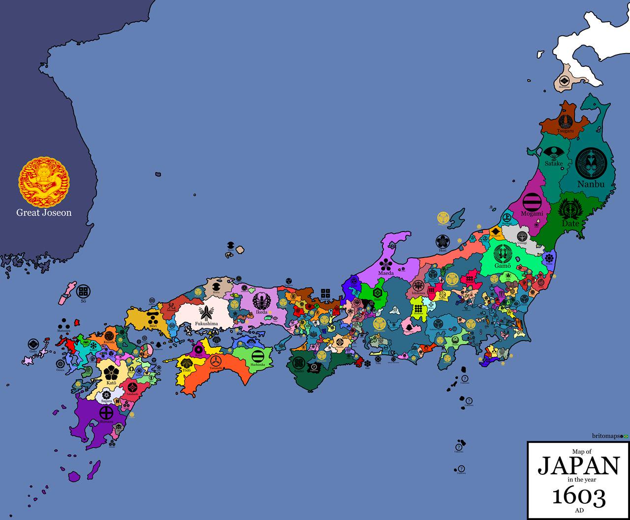
Clan Flag Map of Japan in 1603
...
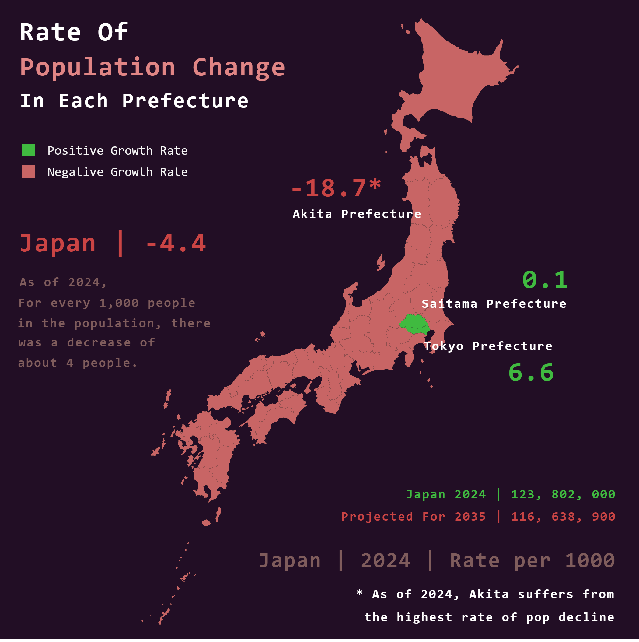
Japan Population Trend Map 2024
The visualization titled \...
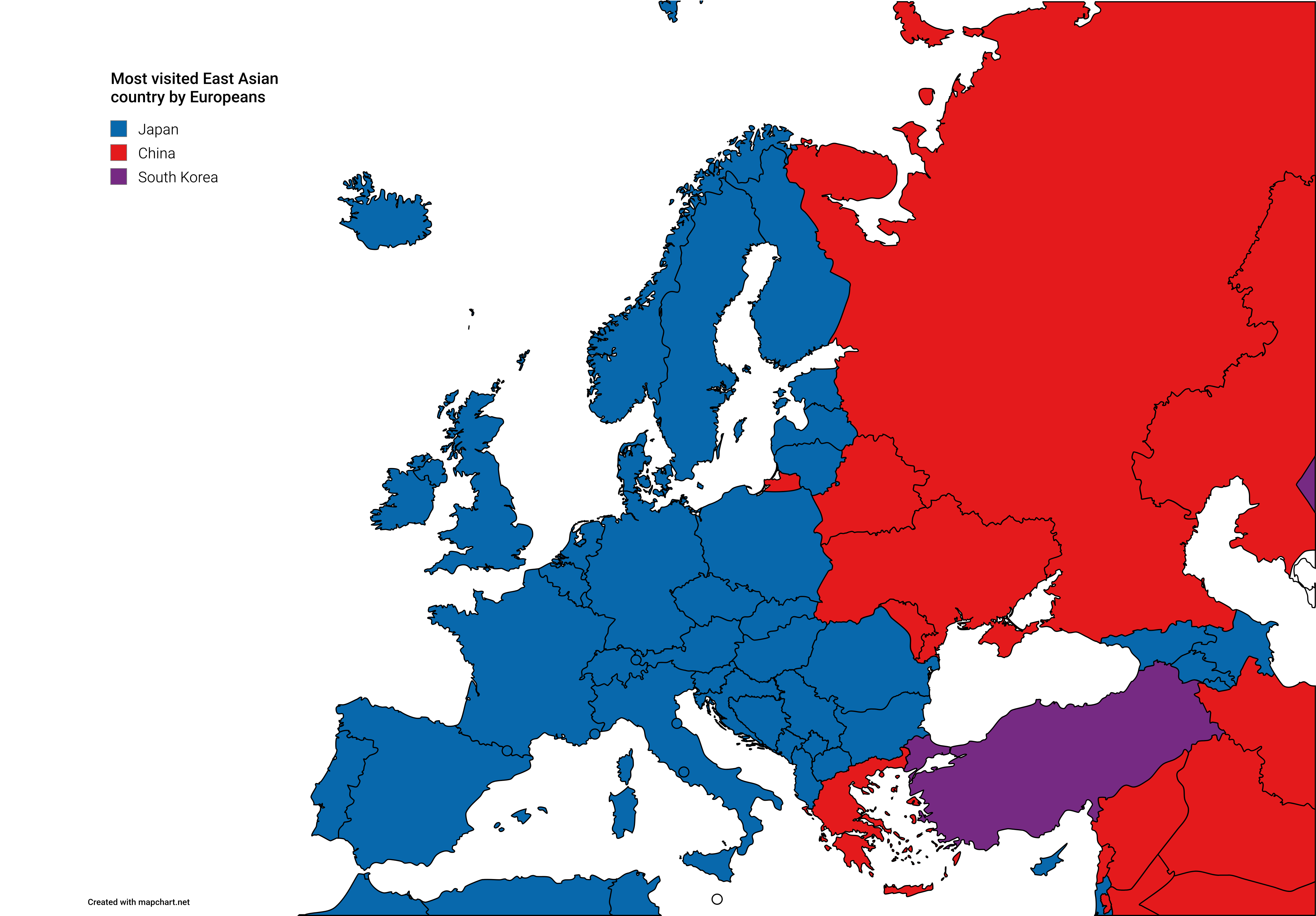
Map of Most Visited East Asian Countries by Europeans
The visualization titled 'Most Visited East Asian Countries by Europeans' presents an insightful look into travel patter...
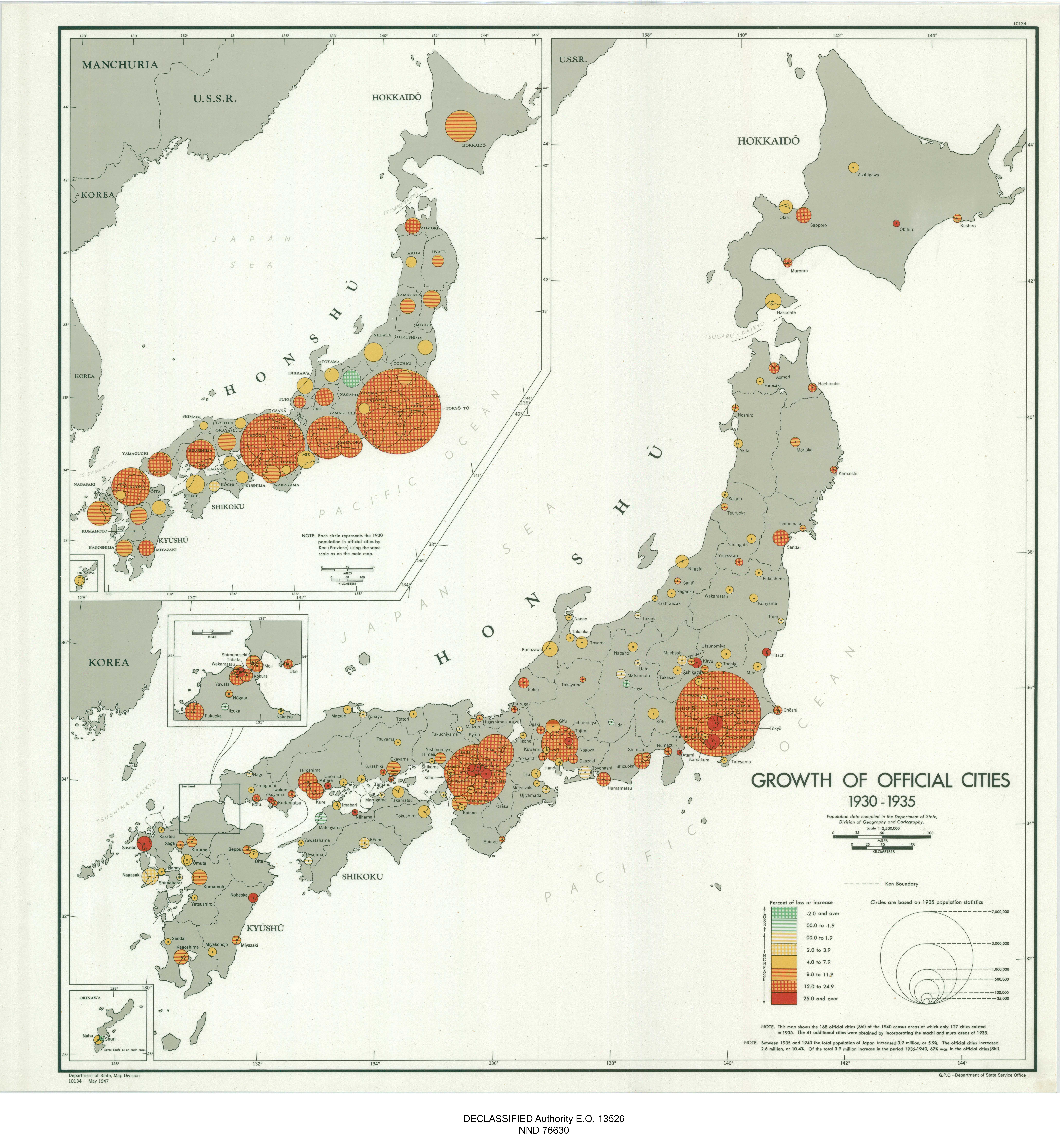
Japan Official Cities Growth Map 1930-1935
The "Japan Growth of Official Cities 1930-1935" map presents a pivotal look into Japan's urbanization during the early 2...
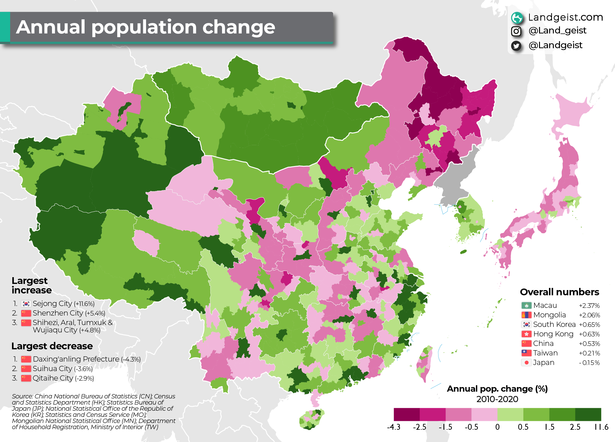
Annual Population Change Map of East Asia 2010-2020
This map illustrates the annual population change in East Asia from 2010 to 2020, providing a vivid snapshot of demograp...