historical map Maps
8 geographic visualizations tagged with "historical map"
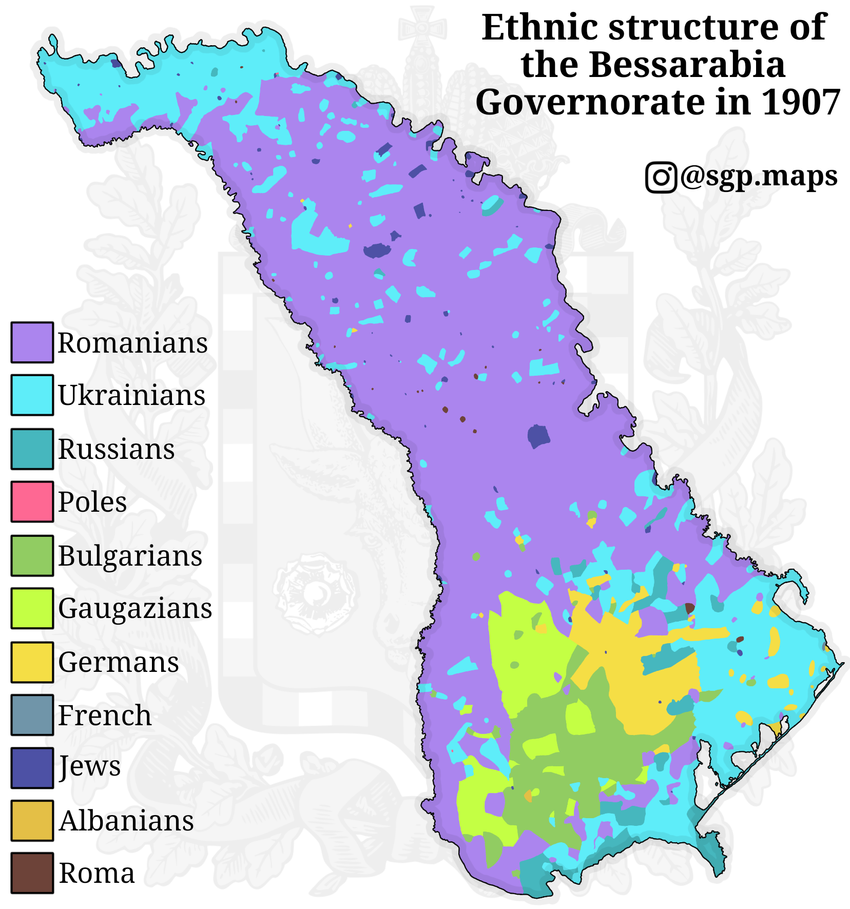
Ethnic Map of Bessarabia in 1907
The "Ethnic Map of Bessarabia in 1907" provides a detailed visualization of the ethnic composition of the Bessarabia Gov...
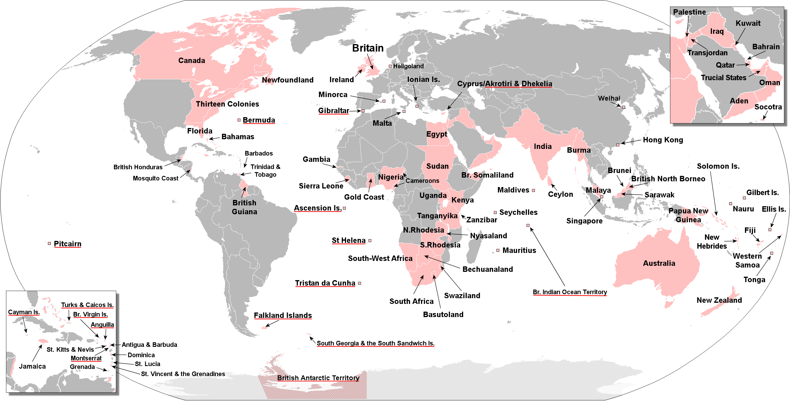
Map of Territories Ever Held by the British Empire
This visualization presents an anachronous map detailing the vast territories once held by the British Empire at various...
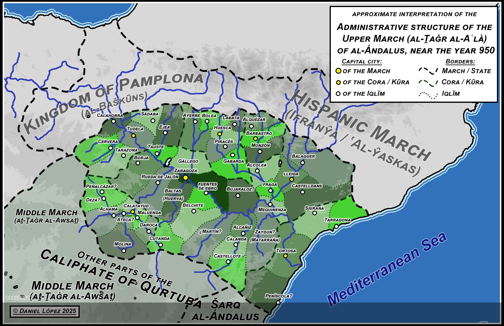
Map of al-Andalus' Upper March and Subdivisions, c.950
This map titled "Map of al-Andalus' Upper March and its subdivisions, c.950" provides an insightful snapshot of the poli...
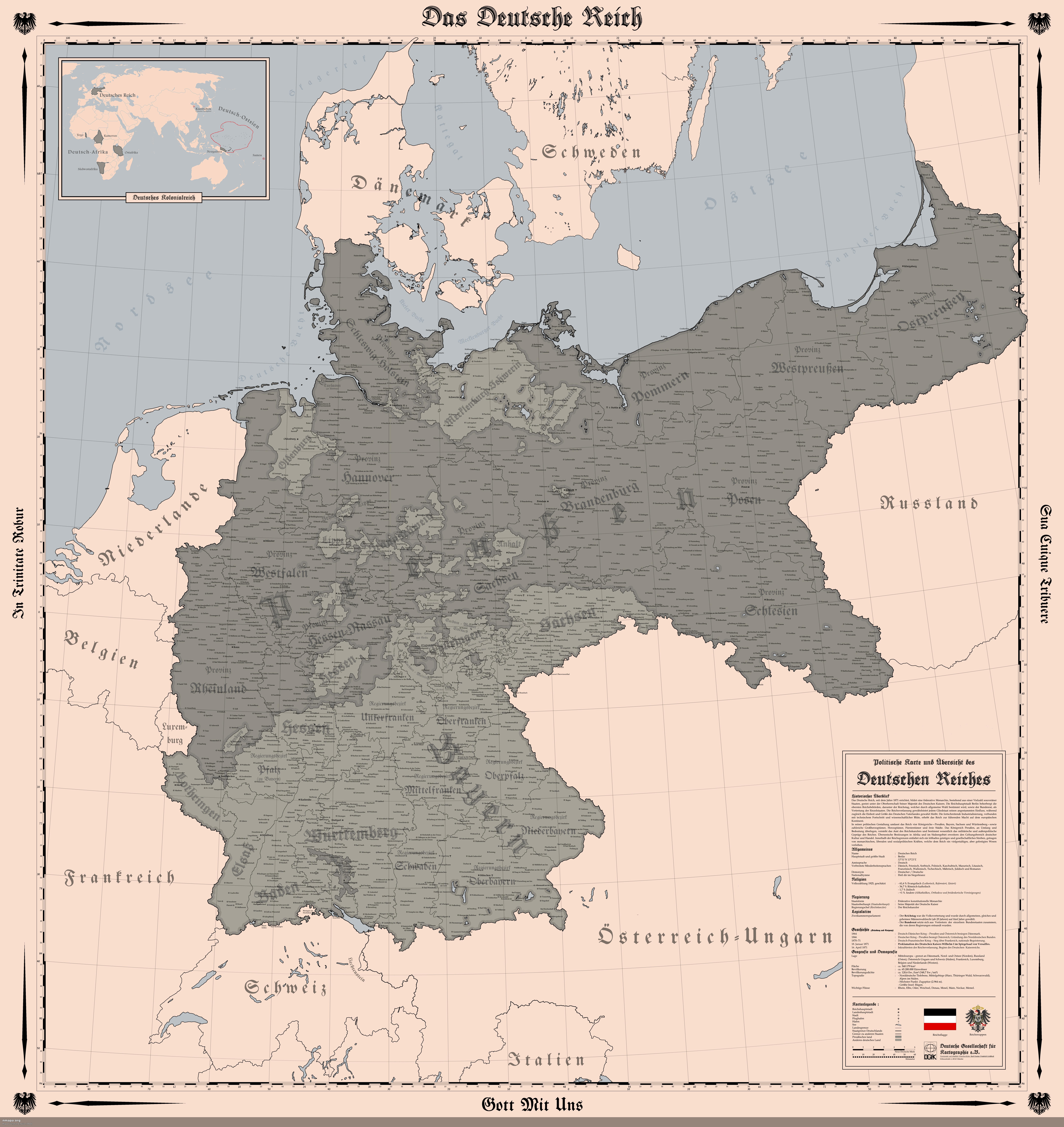
Map of the German Empire in 1914
The "Map of the German Empire (1914)" provides a detailed representation of the territorial boundaries, cities, and infr...
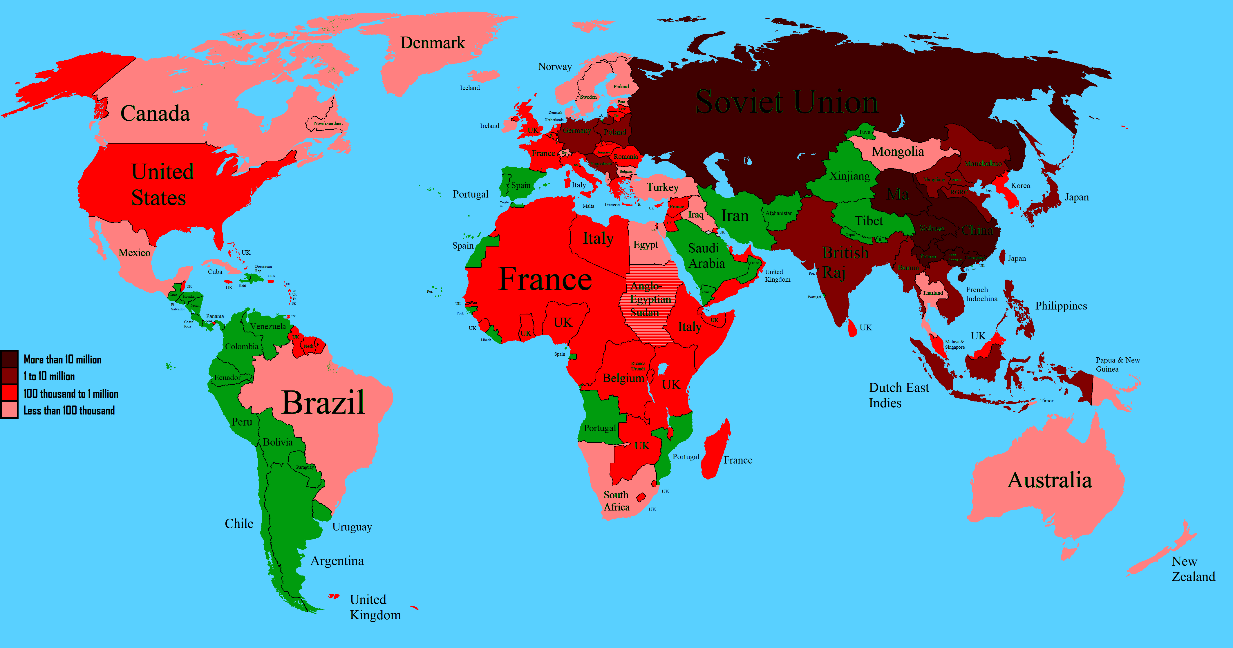
World Map of WW2 Deaths Map
The "World Map of WW2 Deaths (1939 Map)" provides a stark visual representation of the immense human cost of World War I...
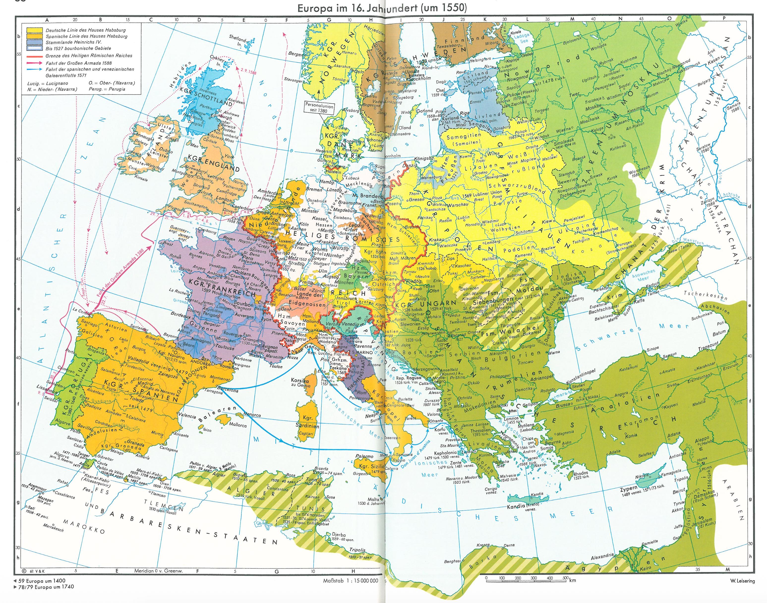
Political Map of Europe in the 16th Century
The map titled \...
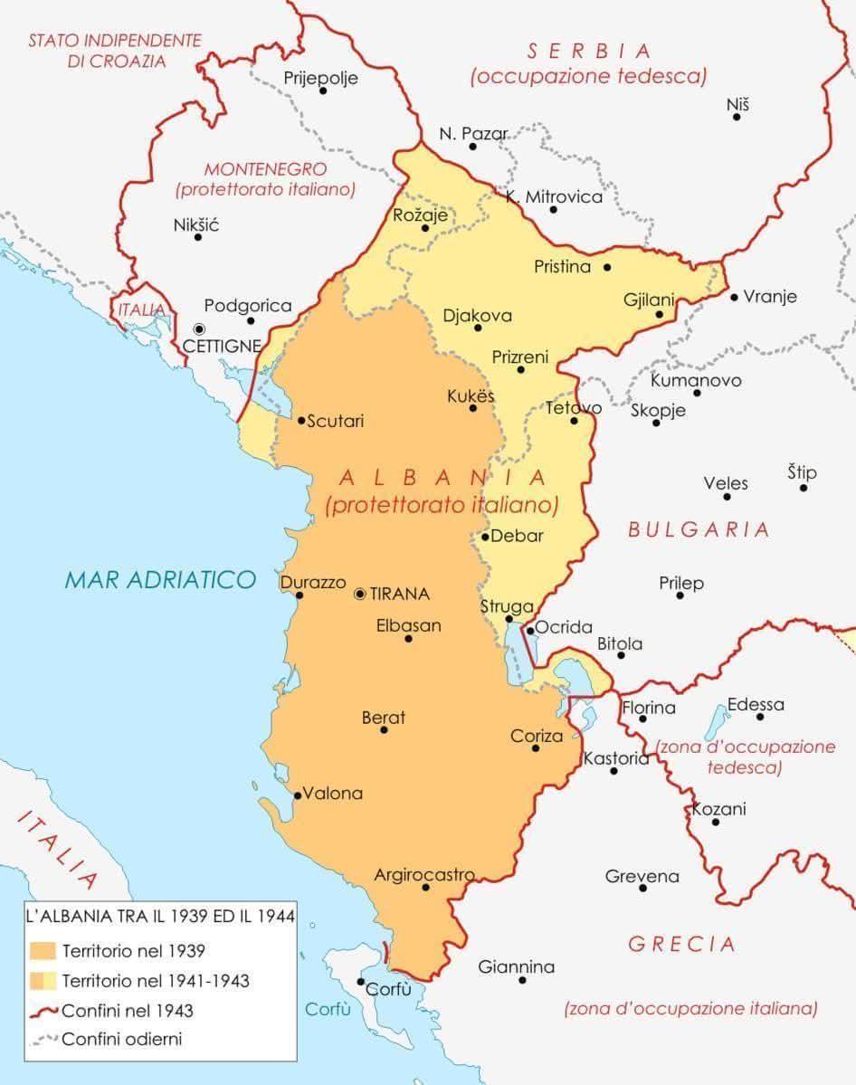
Historical Map of Albania 1939 to 1944
The map titled "Albania Between 1939 and 1944" provides a detailed visualization of Albania's geographical and political...
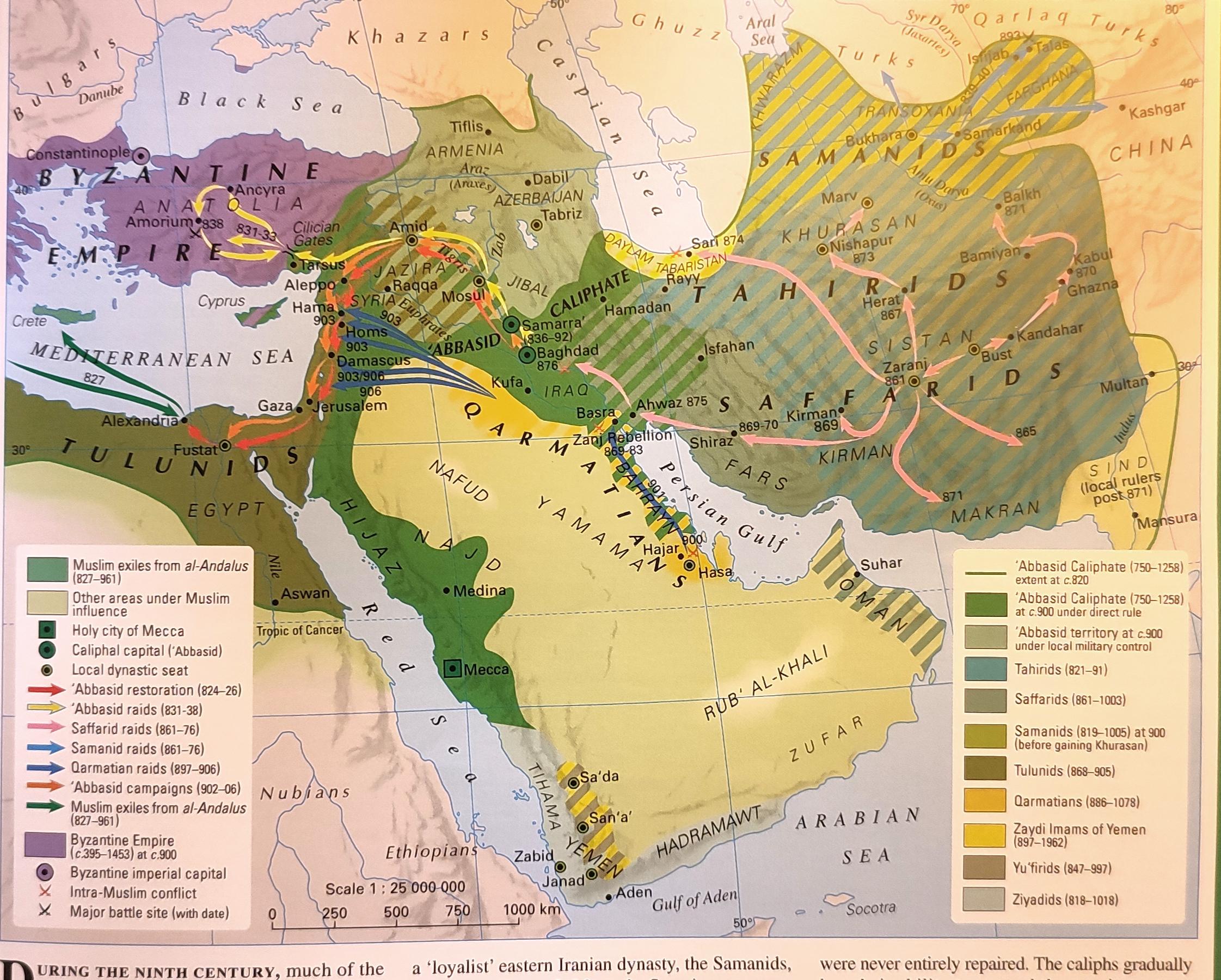
Political Map of the Middle East in the 9th Century
This map provides a detailed political visualization of the Middle East during the 9th century, highlighting the various...