canada Maps
25 geographic visualizations tagged with "canada"
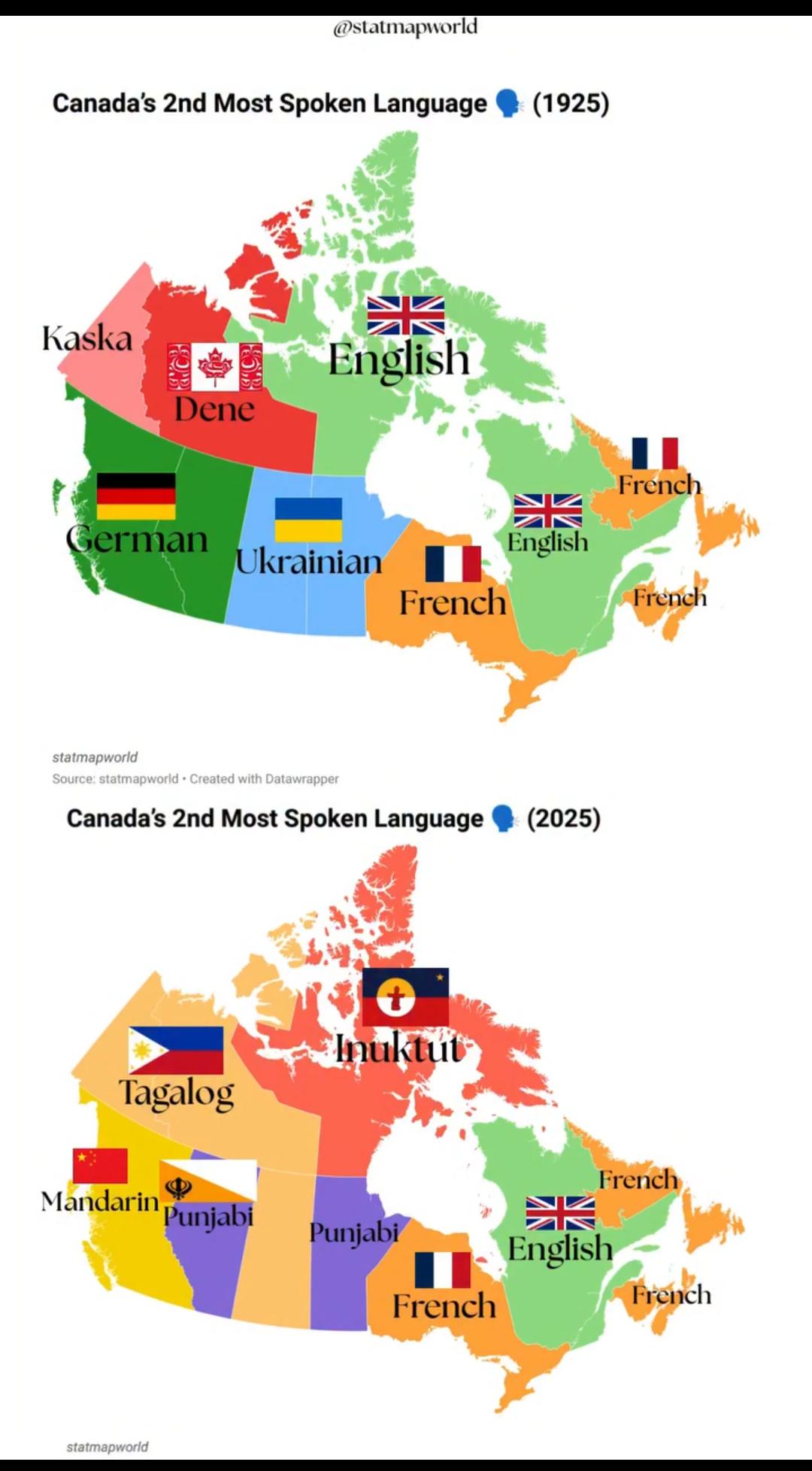
Canada's 2nd Most Spoken Language Map 1925 vs 2025
The visualization titled "Canada's 2nd Most Spoken Language 1925 vs 2025" illustrates the evolution of language demograp...
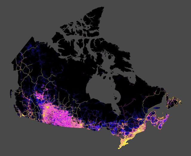
Roads in Canada Map
The map shared by Col. Chris Hadfield on Facebook provides a comprehensive visualization of all the roads in Canada. It ...
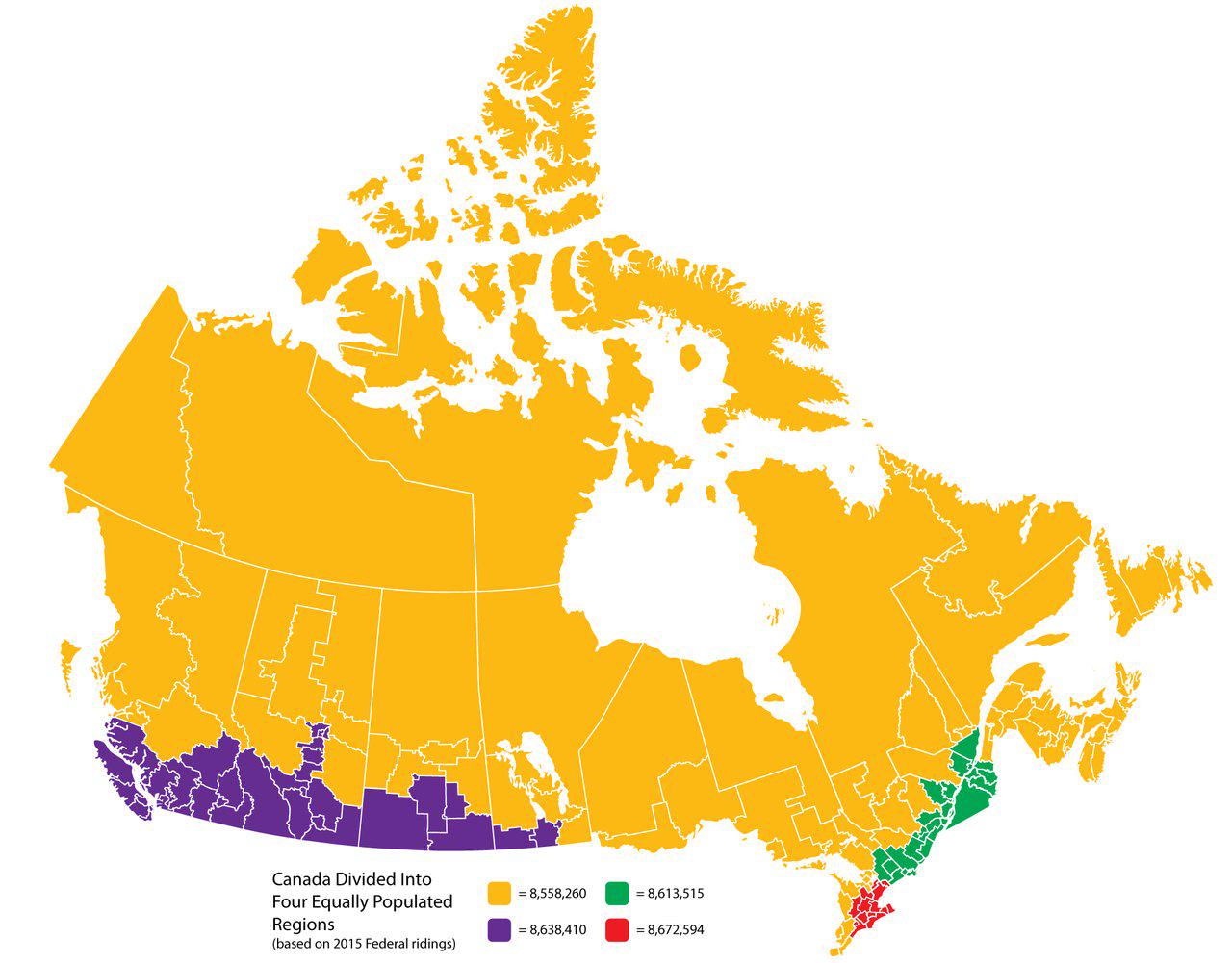
Canada Divided Into Four Equally Populated Regions Map
This map visualizes Canada divided into four equally populated regions, providing a unique perspective on the distributi...
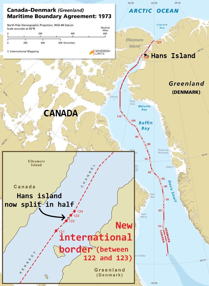
Hans Island Border Map Between Canada and Denmark
This map visually represents the unique land border established between Canada and Denmark in 2022, specifically splitti...
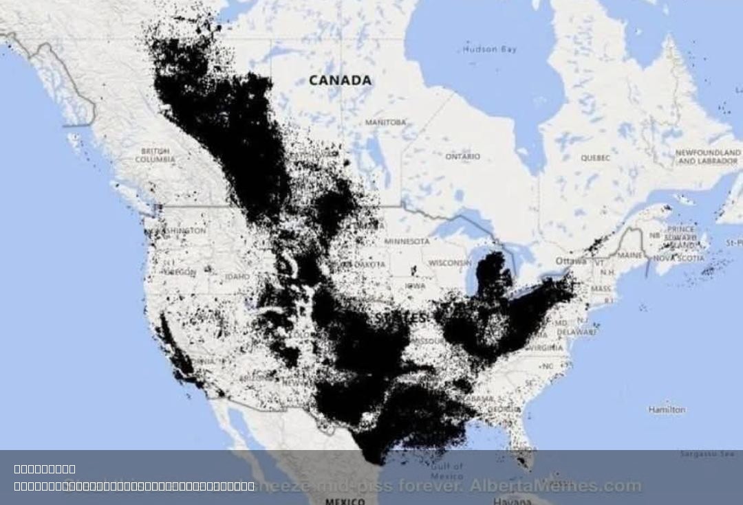
Oil Reserves Map of States and Canada
The "Oil Reserves in States & Canada" map provides a detailed overview of the distribution of oil reserves across variou...
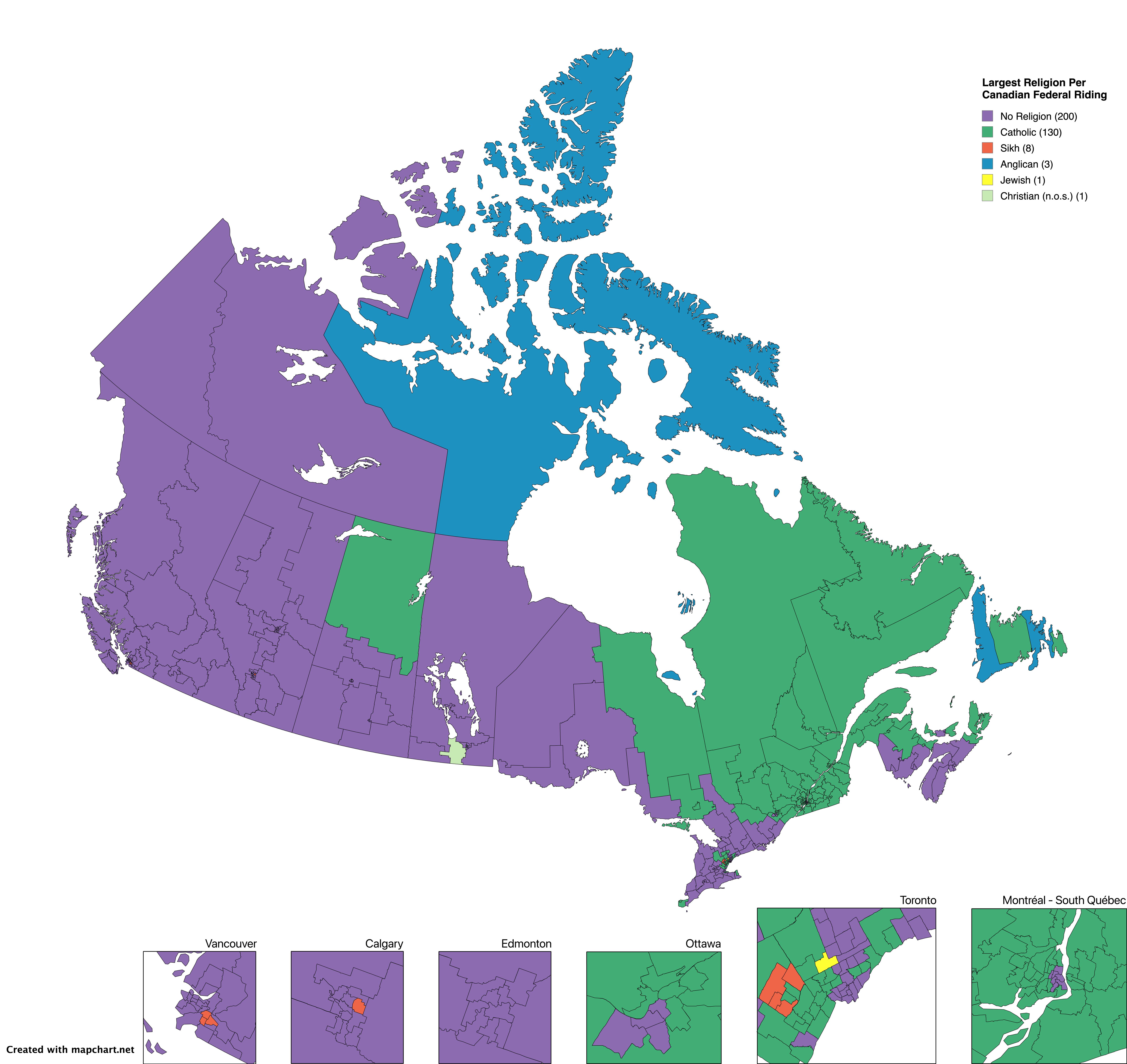
Largest Religion by Canadian Electoral Area Map
This visualization presents an intriguing look at the largest religion practiced in each Canadian electoral area, based ...
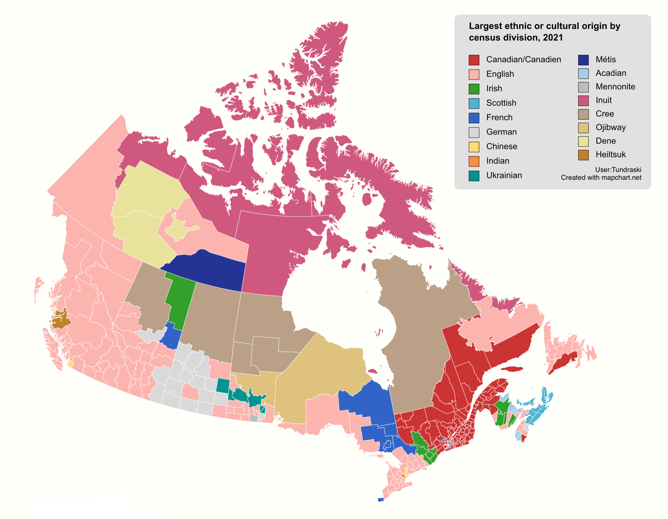
Ethnic Diversity Map of Canada
The "Ethnic Diversity Map of Canada" provides a stunning visual representation of the rich tapestry of cultures and ethn...
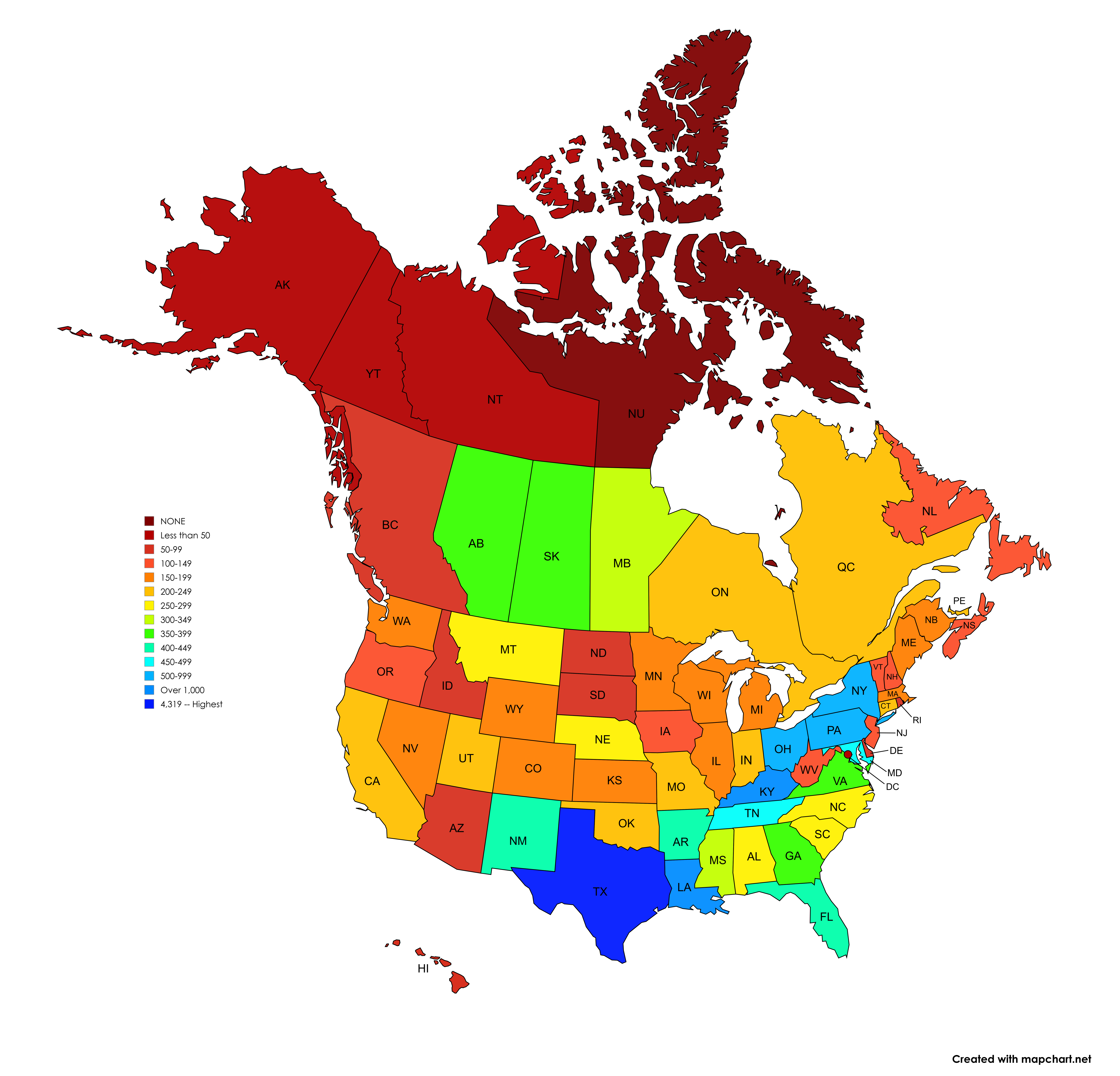
Number of Signed Highways Map by U.S. State and Canadian Province
The visualization titled 'Number of Signed Highways in each U.S. State and Canadian Province' presents a detailed count ...
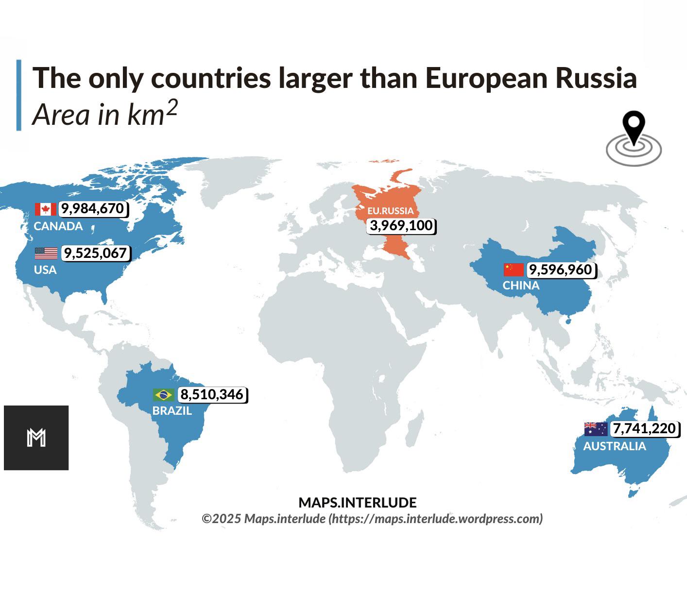
Map of Countries Larger than European Russia
This visualization highlights the countries that surpass European Russia in terms of land area. European Russia, which e...
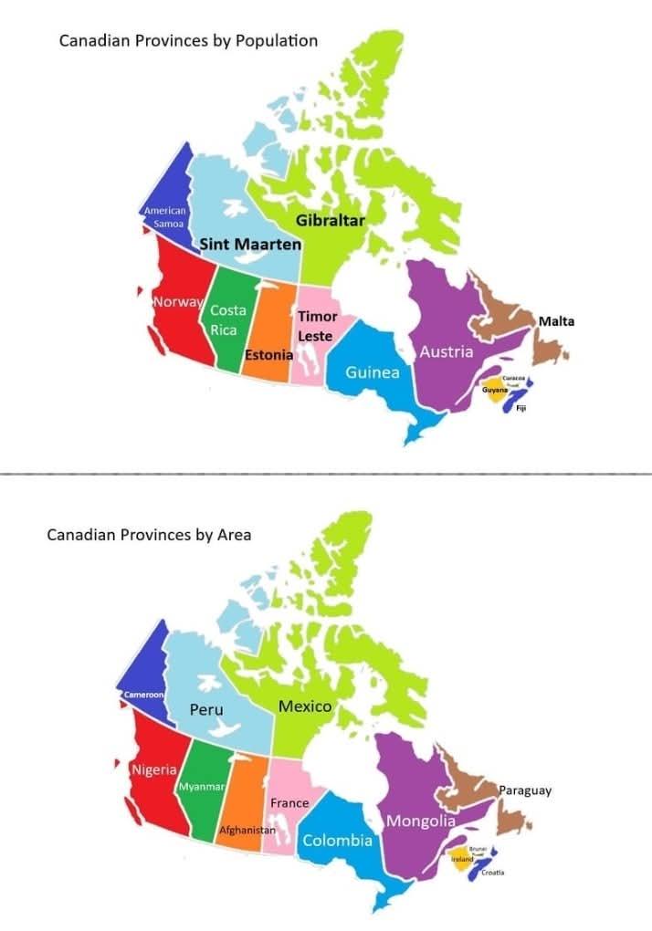
Canadian Provinces and Territories Size and Population Map
This map presents a fascinating comparison between the provinces and territories of Canada and various countries that sh...
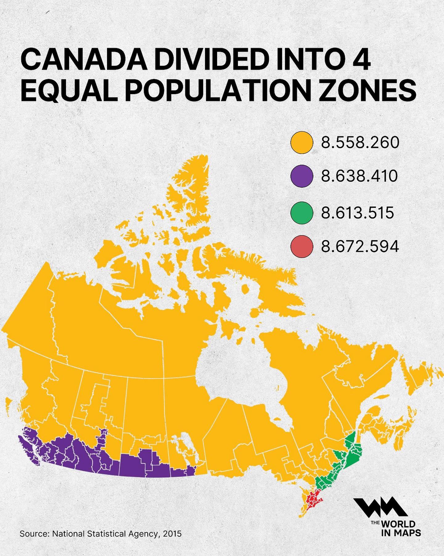
Canada Population Zones Map
This map visualizes Canada divided into four equal population zones, highlighting how the population distribution varies...
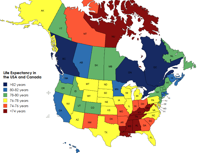
Life Expectancy in the USA and Canada Map
The 'Life Expectancy in the USA and Canada Map' provides a visual representation of the average life expectancy across v...
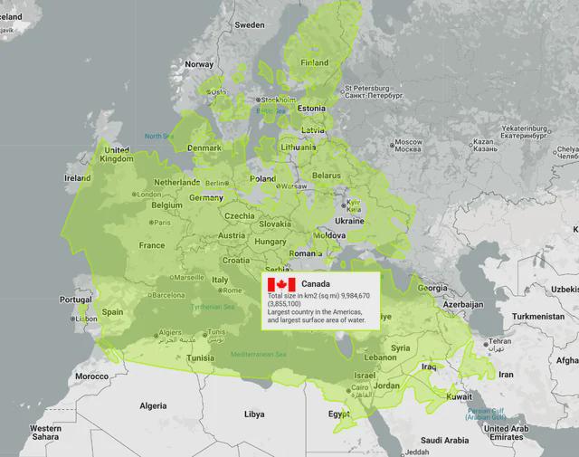
Canada vs Europe Map Comparison
Interestingly, Canada is home to the longest coastline in the world, measuring over 202,080 kilometers. This extensive c...
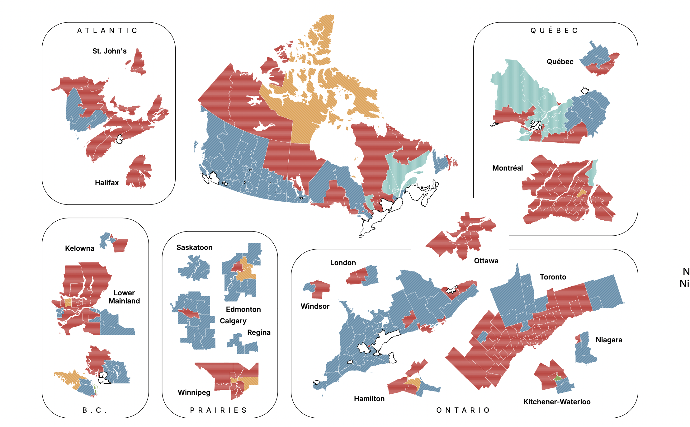
Canadian Federal Election Projection Map September 2025
The "Canadian Federal Election Projection - September 14, 2025" map provides a detailed forecast of the anticipated outc...
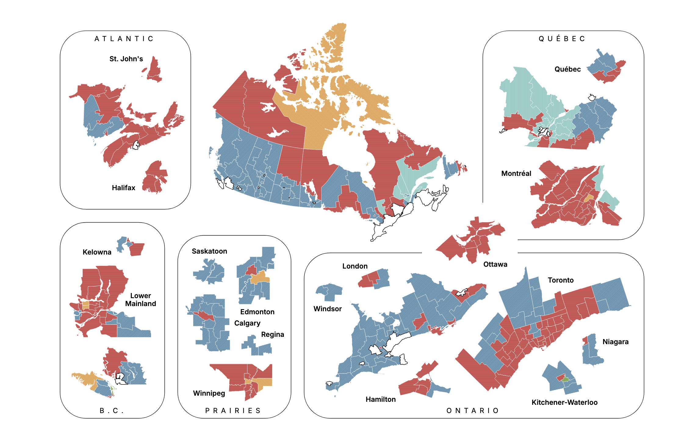
Canadian Election Projection Map September 2025
The "Canadian Election Projection - September 28, 2025" map provides a visual representation of the anticipated results ...
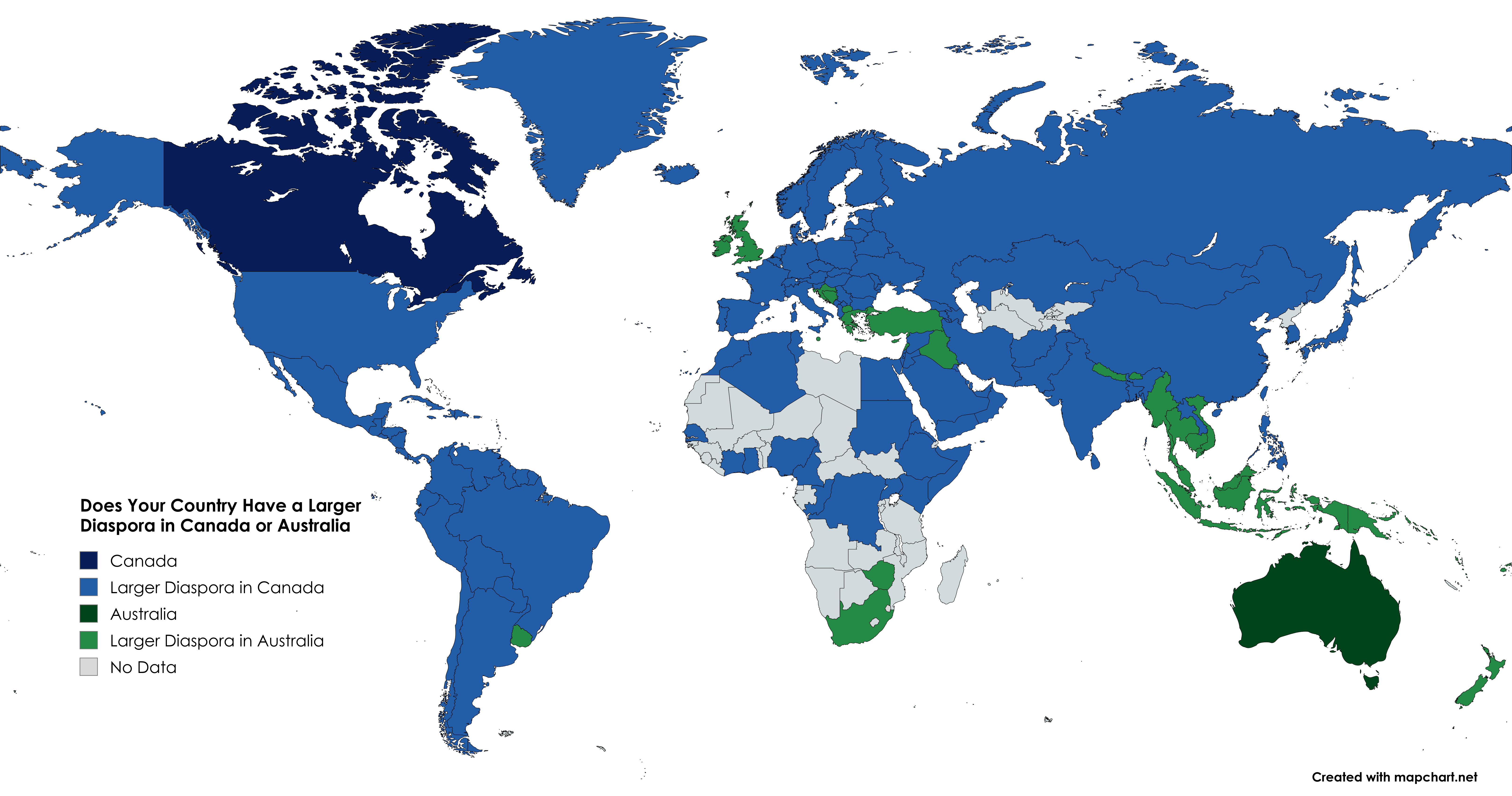
Diaspora Distribution Map: Canada vs Australia
This visualization provides an insightful comparison of the diaspora populations from various countries residing in Cana...
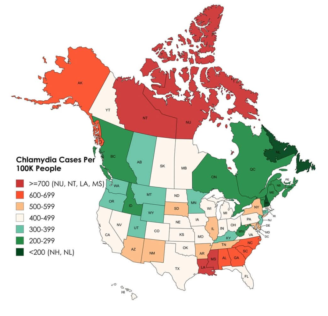
Chlamydia Cases Per 100,000 People Map
This map illustrates the incidence of chlamydia cases per 100,000 people across the United States and Canada, providing ...
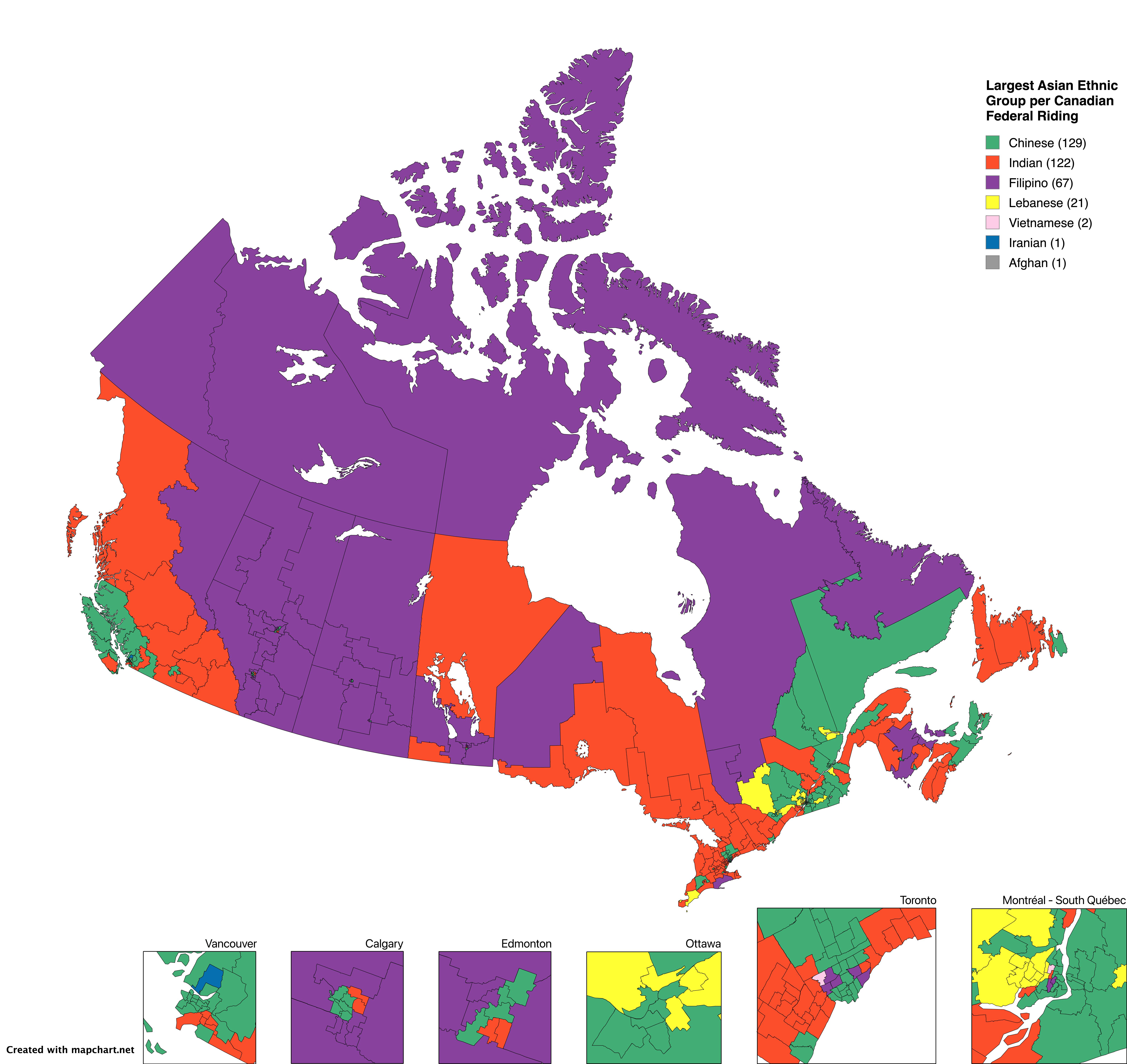
Largest Asian Ethnic Group per Canadian Federal Riding Map
The "Largest Asian Ethnic Group per Canadian Federal Riding" map provides a detailed visualization of the predominant As...

Map of Canada's Named Water Features
This detailed map provides a comprehensive overview of Canada's named water features, showcasing over 224,000 distinct e...
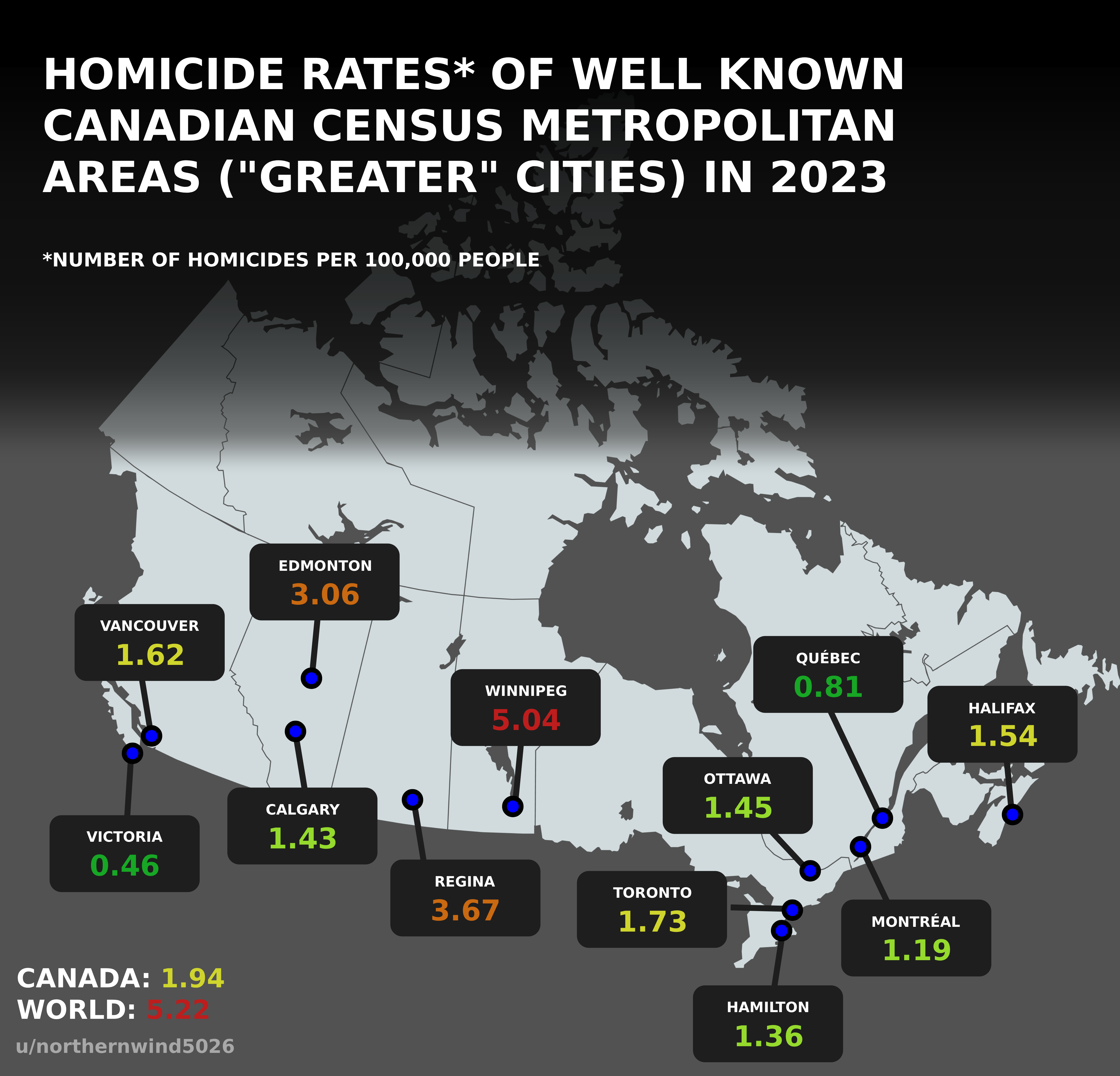
Homicide Rates Map of Canadian Census Metropolitan Areas 2023
The visualization titled "Homicide Rates of Well Known Canadian Census Metropolitan Areas in 2023" presents a detailed l...
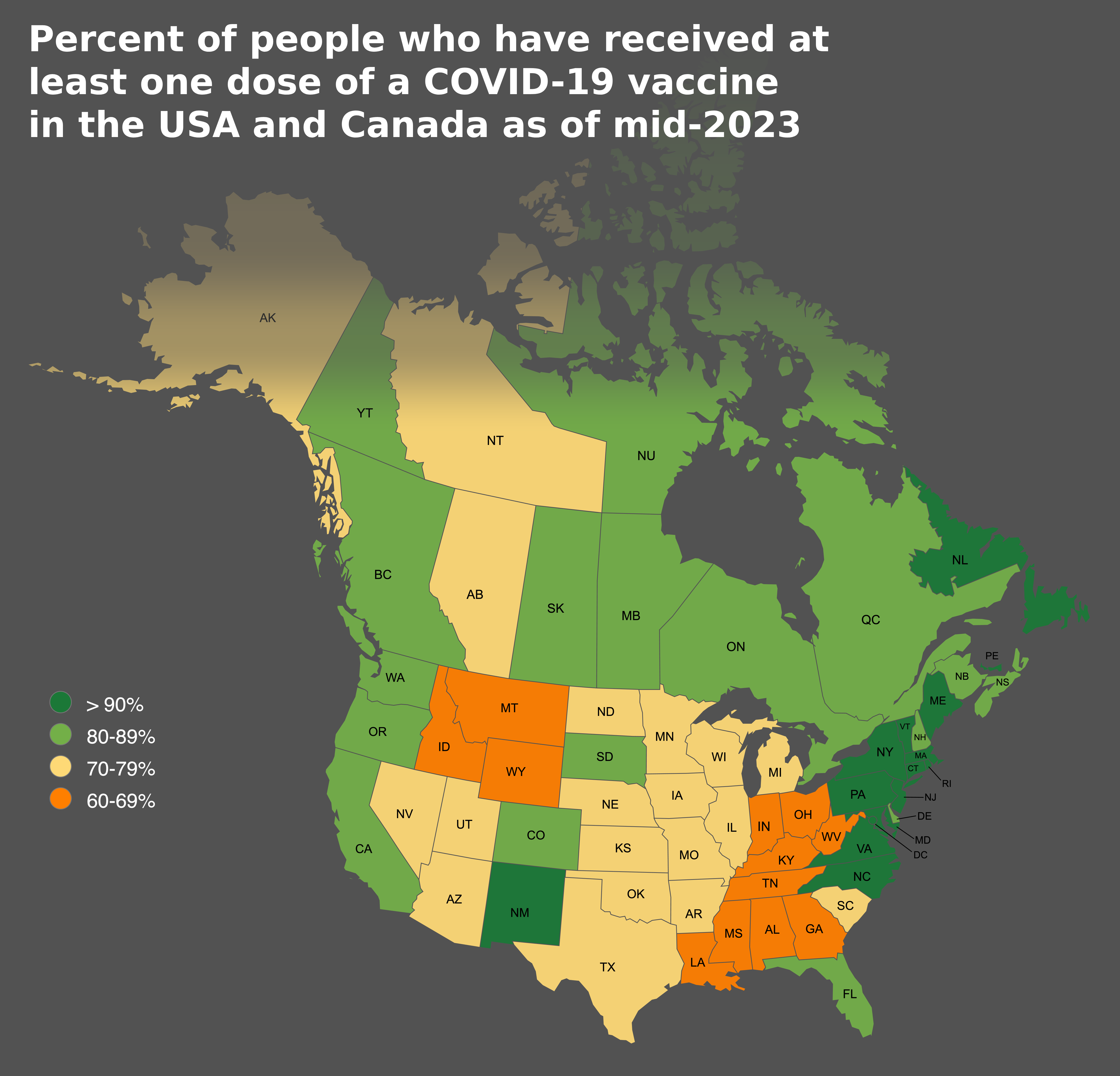
COVID-19 Vaccine Coverage Map USA and Canada
This map provides a clear visualization of the percentage of people who have received at least one dose of a COVID-19 va...
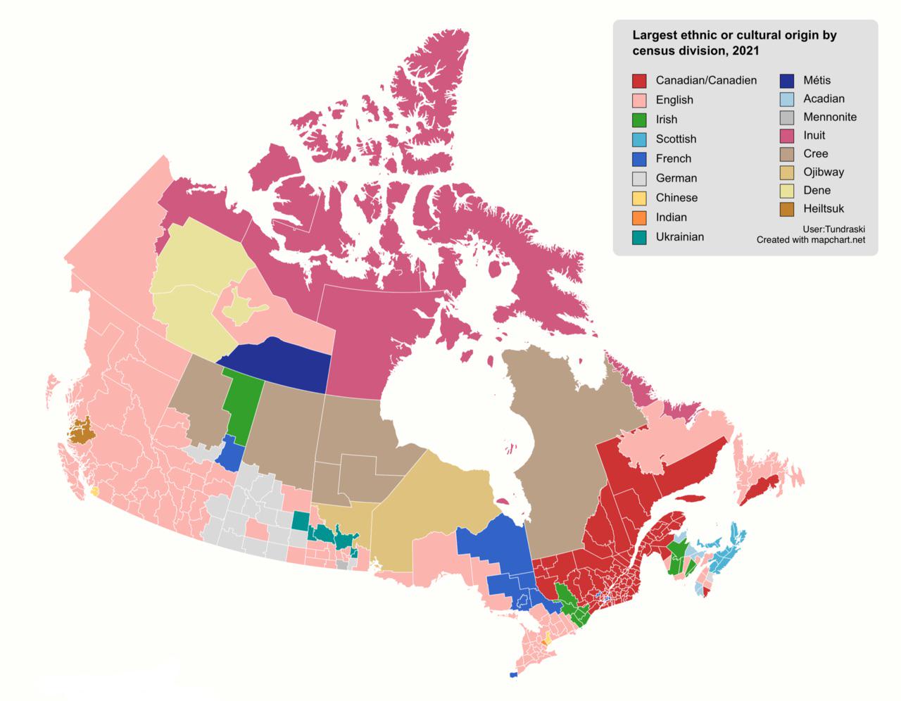
Largest Ethnic Origins in Canada by Census Division Map
This map visualizes the largest ethnic or cultural origins across Canada based on the 2021 census data. By breaking down...
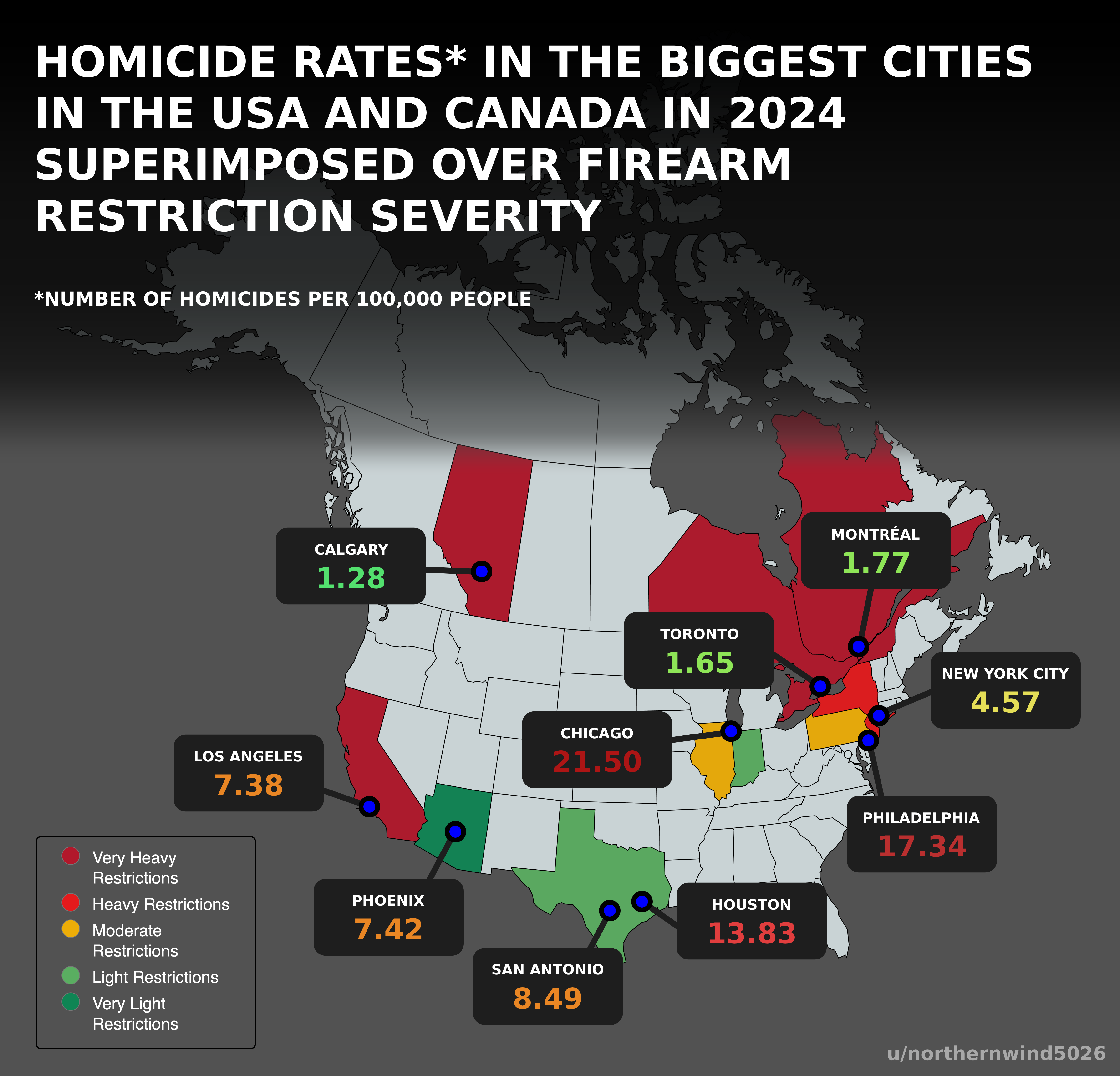
Homicide Rates and Firearm Restrictions Map USA Canada 2024
Interestingly, U.S. cities such as St. Louis and Baltimore are notorious for high homicide rates, while cities like New ...
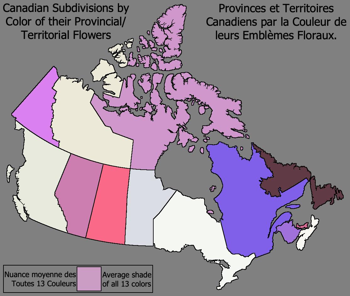
Map of Canada by Provincial Flower Color
This captivating map visually represents Canada through the colors of each province's and territory's floral emblem. Unl...
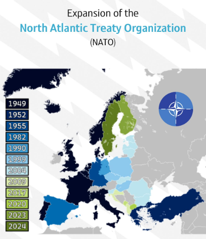
NATO Expansion over Time Map
This map provides a visual representation of the expansion of the North Atlantic Treaty Organization (NATO) over time, h...