ancient history Maps
12 geographic visualizations tagged with "ancient history"
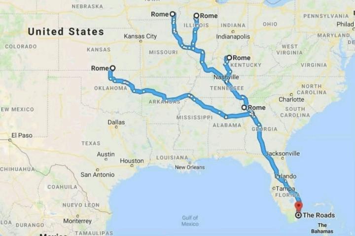
Road Networks Map of Ancient Rome
The visualization titled "All Roads Lead to Rome" illustrates the extensive network of roads constructed during the Roma...
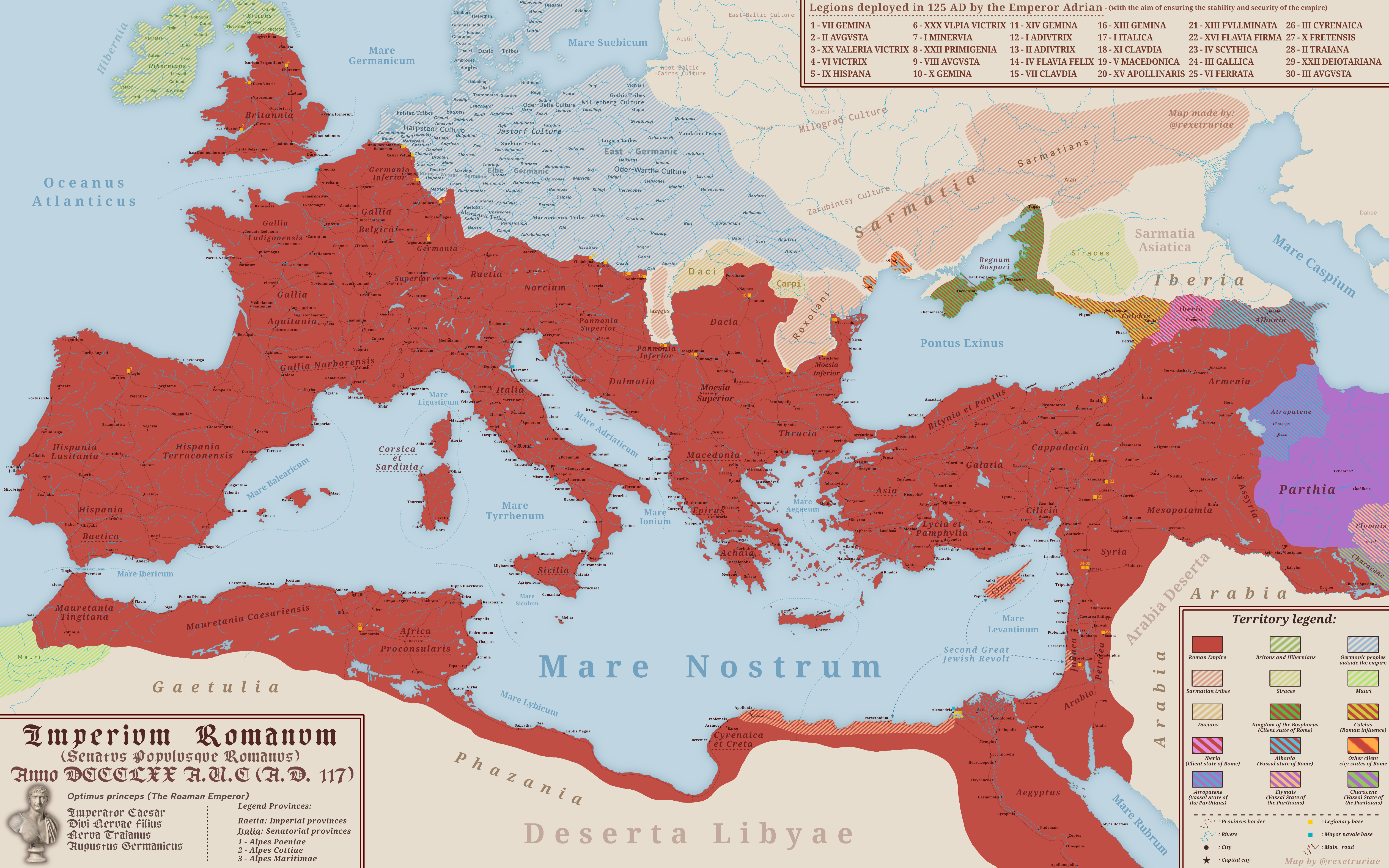
Map of the Roman Empire at Its Peak 117 A.D.
The map titled "The Roman Empire at Its Peak 117 A.D." illustrates the vast territorial expanse of one of history's most...
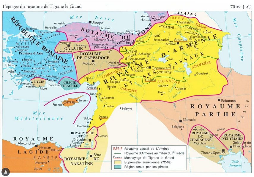
Map of the Kingdom of Armenia in 70 BC
The "Map of the Kingdom of Armenia in 70 BC" provides a detailed visual representation of Armenia during a pivotal perio...
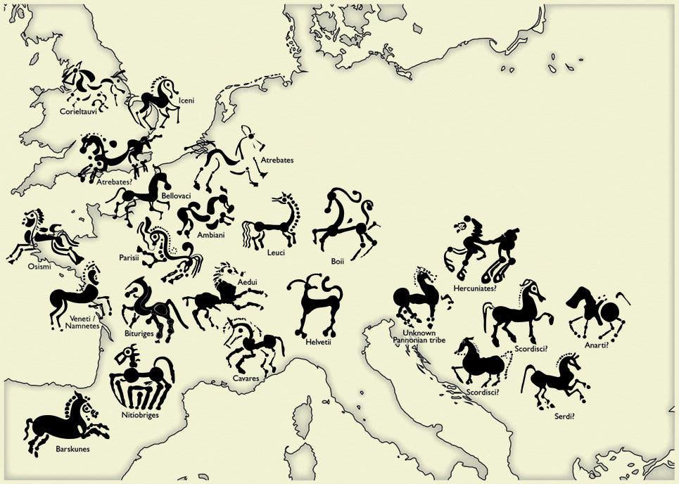
Map of Ancient Celtic Horse Depictions on Coins
This map presents a fascinating look at various depictions of horses found on ancient Celtic coins, illustrating their a...
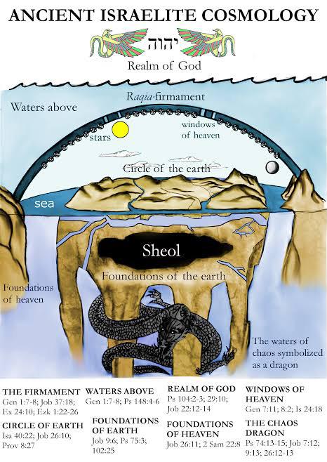
Map of Locations in the Old Testament
This map titled "The World According to the Old Testament" presents a geographical representation of locations mentioned...
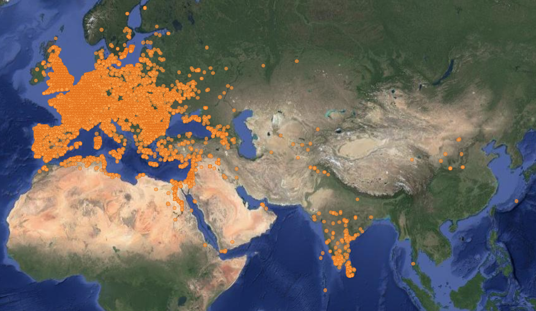
Map of Locations of Unearthed Roman Coins
This map illustrates the locations where Roman coins have been unearthed across various regions of Europe and the Medite...
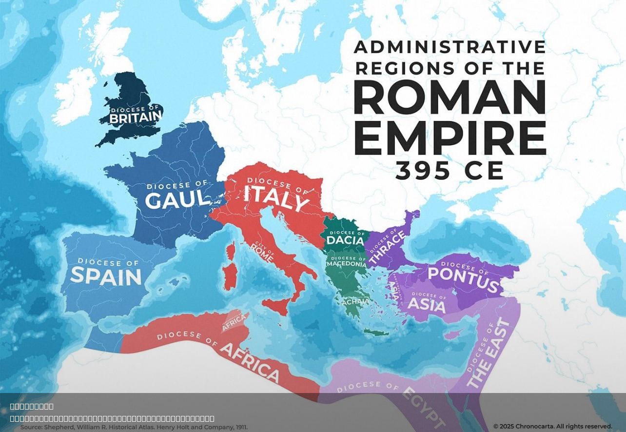
Administrative Regions of the Roman Empire Map
The "Administrative Regions of the Roman Empire Map" provides a detailed representation of the vast territories governed...
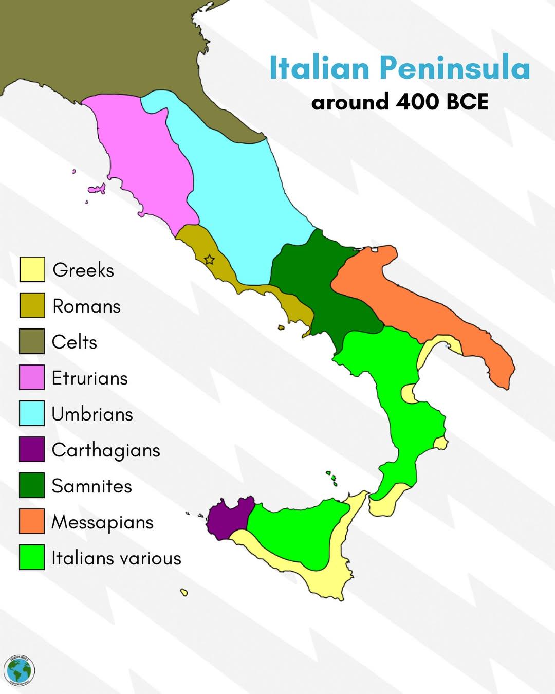
Italian Peninsula Geography Map 400 BCE
The "Italian Peninsula in 400 BCE" map provides a fascinating snapshot of the geographic and cultural landscape of Italy...
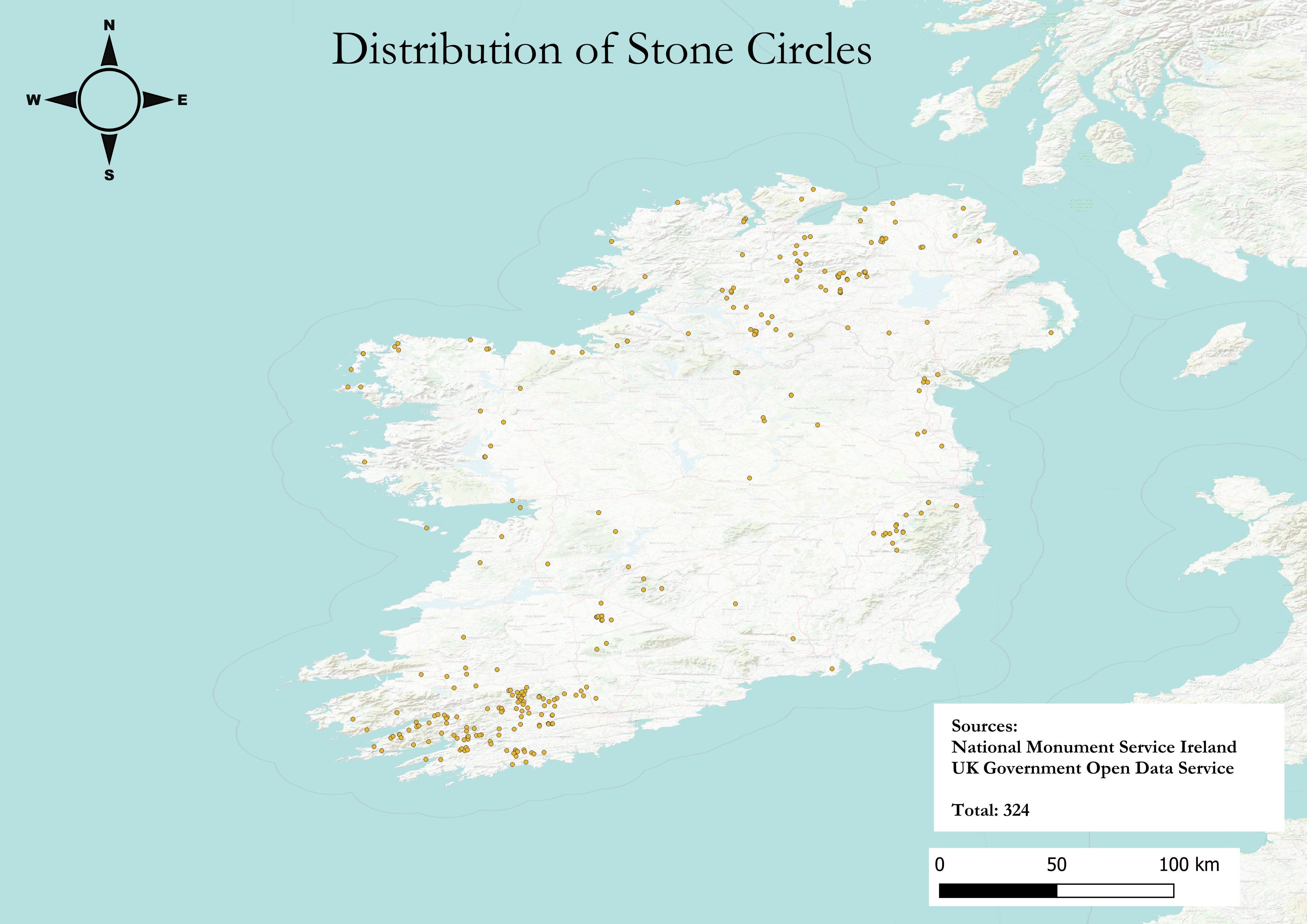
Stone Circles Distribution Map in Ireland
The "Distribution of Stone Circles in Ireland" map visually outlines the locations of these ancient structures across th...
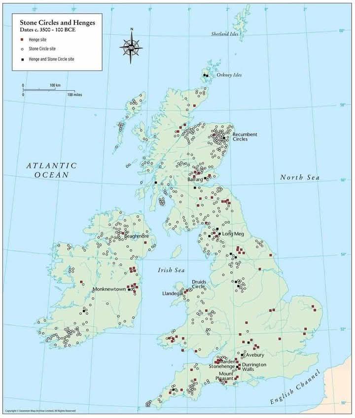
Map of Stone Circles and Henges in the British Isles
This map provides a detailed visualization of stone circles and henges located throughout the British Isles, dating from...
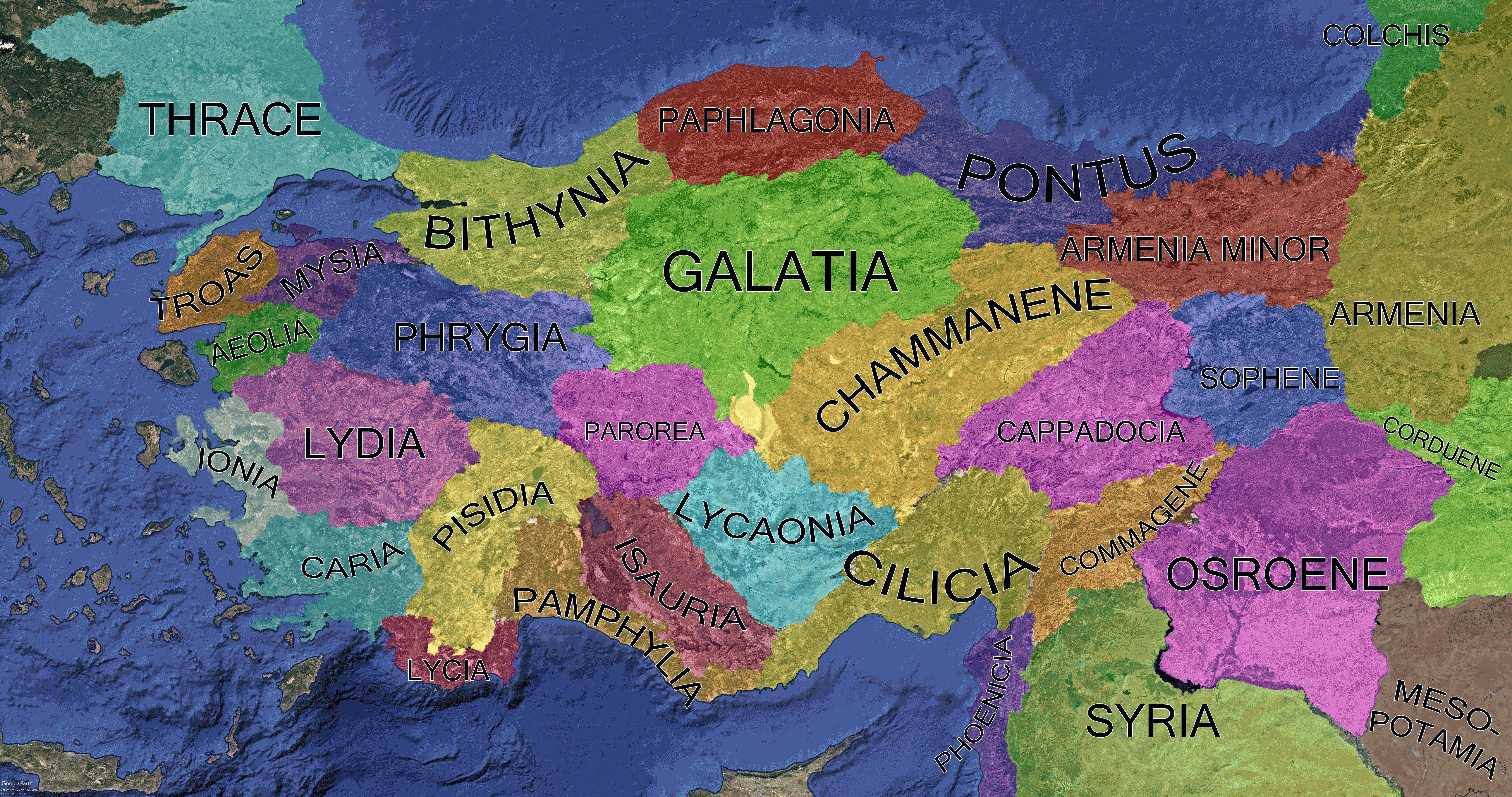
Anatolia Asia Minor Regions Map 200 BCE
This detailed map illustrates Anatolia, also known as Asia Minor, during the Greco-Roman period, specifically around 200...
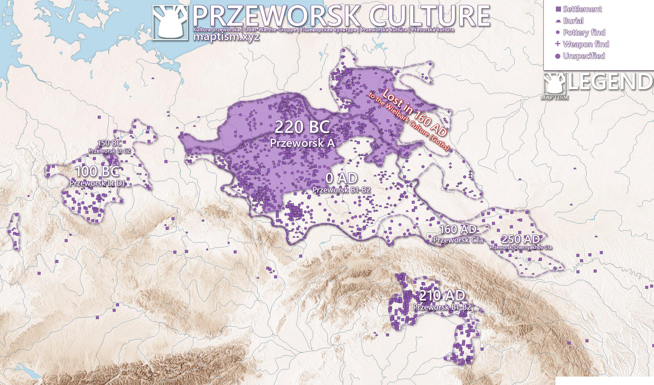
Przeworsk Culture Map of Poland
The Przeworsk Culture Map of Poland provides a visual representation of the archaeological sites and settlements associa...