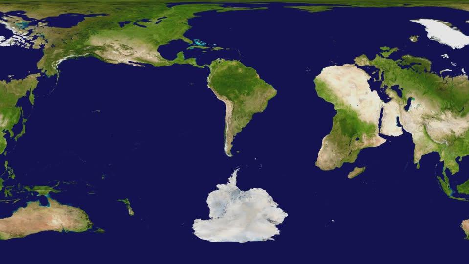
A World Map Centered on Argentina

Marcus Rodriguez
Historical Geography Expert
Marcus Rodriguez specializes in historical cartography and geographic data analysis. With a background in both history and geography, he brings unique...
Geographic Analysis
What This Map Shows
This visualization presents a world map with Argentina strategically positioned at its center, allowing us to view the globe from a unique perspective. By centering the map on Argentina, we can better appreciate its geographic context in relation to surrounding countries and continents, as well as its global significance. This central focus highlights Argentina's geographical diversity, from its sprawling plains to the majestic Andes Mountains, and sets the stage for an exploration of the country's rich natural resources and cultural landscapes.
Deep Dive into Argentina's Geography
Argentina, the eighth largest country in the world, boasts a varied geography that encompasses a range of landscapes and ecosystems. Stretching over 3,650 kilometers from north to south, the country exhibits tremendous climatic and geographical diversity. The northern region, characterized by subtropical climates, is home to the lush landscapes of the Gran Chaco and the tropical forests of Misiones, where the breathtaking Iguazu Falls captivates visitors with its sheer magnificence.
As we move southward, the climate shifts dramatically. The central part of Argentina features the fertile Pampas, a vast lowland region that is crucial for agriculture. This area is renowned for its production of wheat, corn, and soybeans, making Argentina one of the primary agricultural producers globally. Interestingly, the Pampas is often referred to as the "breadbasket" of the country, highlighting its importance in the national economy.
The Andes Mountains, which border Argentina to the west, present a stark contrast to the flat plains of the Pampas. This formidable mountain range includes Aconcagua, the highest peak outside of Asia at 6,961 meters. The Andes not only serve as a natural boundary but also influence climate patterns and biodiversity. The varied altitudes create distinct ecological zones, from dry deserts to lush temperate rainforests. Have you ever wondered how such diverse ecosystems can exist in one country?
Moving further south, Patagonia emerges as a land of stark beauty and dramatic landscapes. This region, known for its glaciers, fjords, and rugged terrain, is less populated than the northern regions, providing a sanctuary for diverse wildlife, including guanacos, condors, and even the elusive Andean deer. The climate here is predominantly cool and windy, making it a prime destination for adventurers and nature enthusiasts alike.
Regional Analysis
When examining the map centered on Argentina, we can see various regional differences that showcase the country’s geographic diversity. In the north, provinces like Salta and Jujuy are marked by colorful mountains and rich indigenous culture, attracting tourists keen to experience local traditions and breathtaking landscapes. Meanwhile, provinces in the central Pampas, such as Buenos Aires and Santa Fe, are more urbanized and economically dynamic, with major cities driving Argentina's economic output.
Interestingly, the southern regions, including Tierra del Fuego, present a stark contrast to the agricultural wealth of the north. This area is sparsely populated and dominated by natural parks, such as Tierra del Fuego National Park, which showcases the pristine wilderness of the region. The map allows us to appreciate how these diverse areas contribute to Argentina’s national identity.
Significance and Impact
Understanding the geography of Argentina is crucial for several reasons. First and foremost, it highlights the country's role in global agriculture and natural resource management. Argentina is one of the world's largest exporters of beef, soy, and wine, and its geographic diversity allows for a wide range of agricultural activities. With climate change affecting weather patterns, it is vital to monitor how these changes may impact agricultural productivity in the future.
Moreover, the geography of Argentina has significant implications for tourism. The stunning Andes, vibrant cities like Buenos Aires, and natural wonders such as Iguazu Falls draw millions of visitors each year, contributing significantly to the economy. As the country navigates challenges such as environmental conservation and sustainable development, understanding its geography will be essential in balancing economic growth with ecological preservation.
In conclusion, centering a world map on Argentina allows us to explore its rich geographic tapestry, from the fertile Pampas to the breathtaking Andes. Argentina's diverse landscapes not only define its cultural and economic identity but also present both challenges and opportunities for the future. As we continue to analyze geographic data and trends, the significance of this map becomes even clearer, connecting Argentina to global dynamics in ways that are both complex and compelling.
Visualization Details
- Published
- October 26, 2025
- Views
- 20
Comments
Loading comments...