map Maps
22 geographic visualizations tagged with "map"
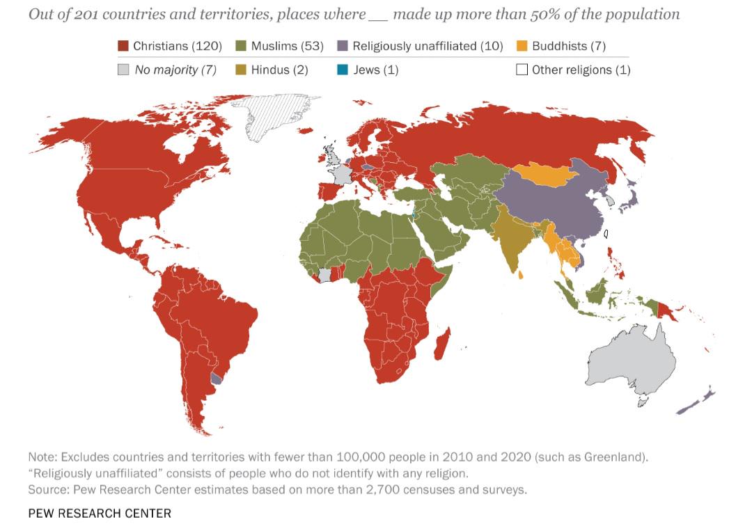
Largest Religious Affiliation by Country Map
The "Largest Religious Affiliation by Country Map" provides a visual representation of the predominant religious beliefs...
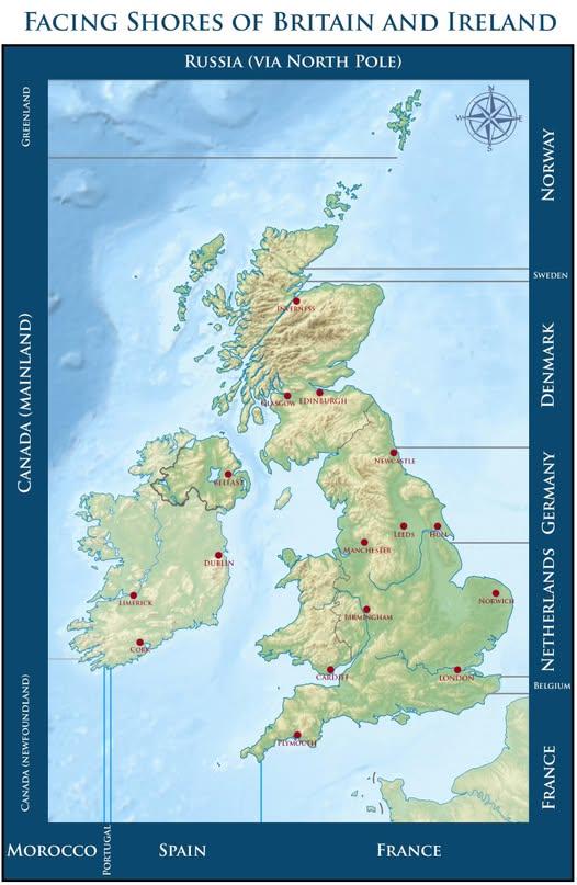
Map of Countries Across From Beaches in Britain and Ireland
This map visually represents which countries you would face if you were standing on a beach in Britain or Ireland, gazin...
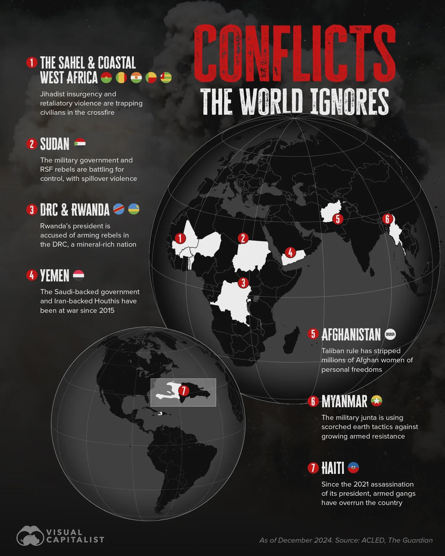
Ongoing Conflicts Map Beyond Ukraine and Palestine
The map titled "Ongoing Overlooked Conflicts in the World Beyond Ukraine/Russia and Palestine/Israel" highlights various...
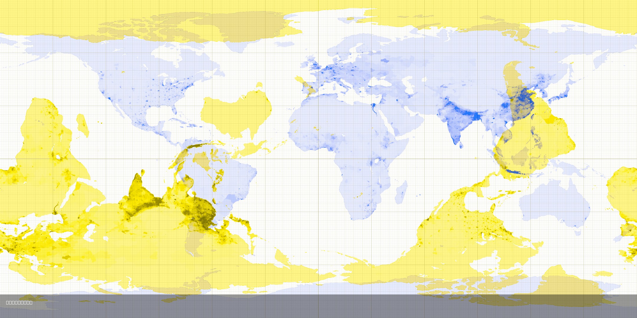
Antipode Map Showing Opposite Countries
This map visualizes the concept of antipodes, which are points that are diametrically opposite to each other on the Eart...
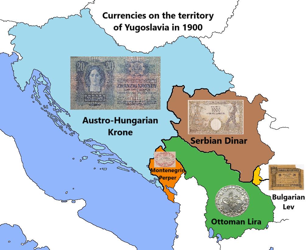
Currency Map of Yugoslavia in 1900
The map titled "Currencies on the territory of Yugoslavia in 1900" illustrates the various currencies that were in circu...
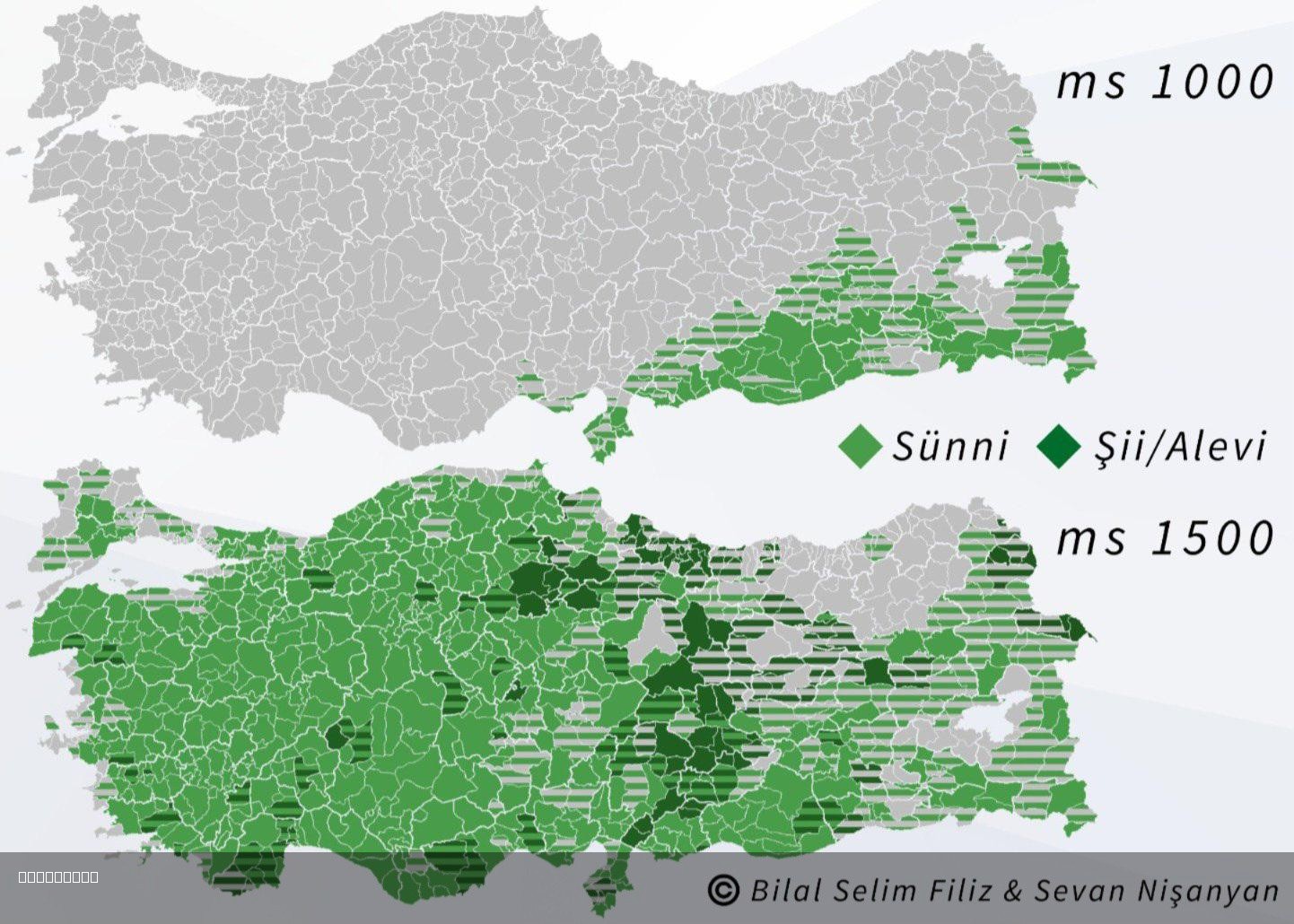
Islam in Turkey 1000 and 1500 Map
The "Islam in Turkey 1000 and 1500 Map" visually represents the spread and influence of Islam across the region of Turke...
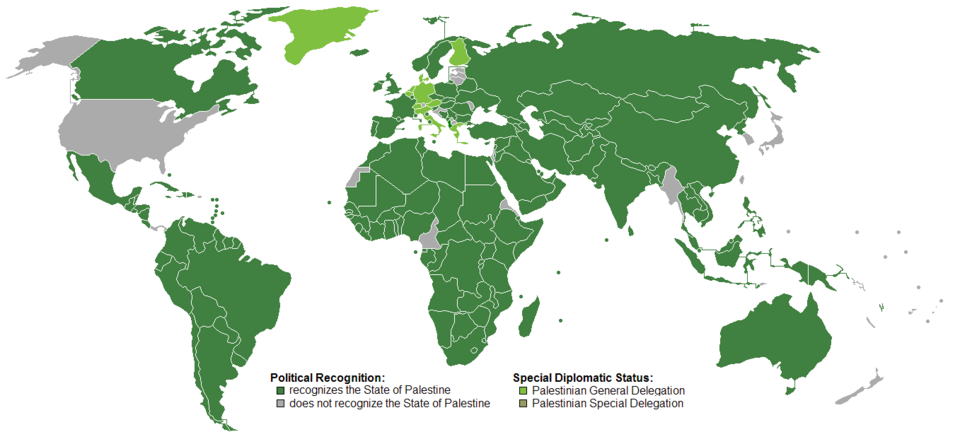
Recognition of the State of Palestine Map
Interestingly, the Palestinian territories comprise two main areas: the West Bank and Gaza Strip. The West Bank is under...
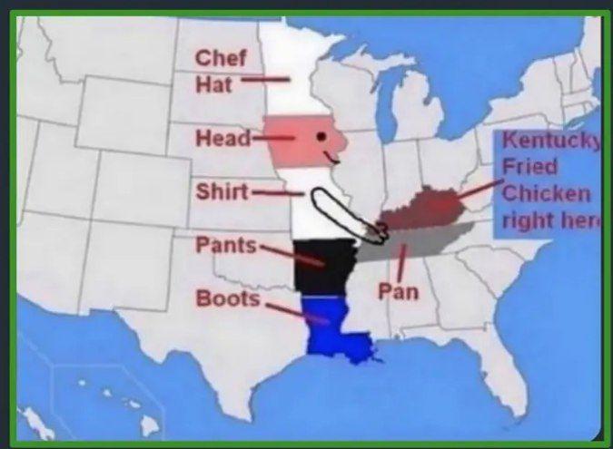
Kentucky Location Map
The Kentucky Location Map provides a clear and concise visual representation of the state of Kentucky within the United ...
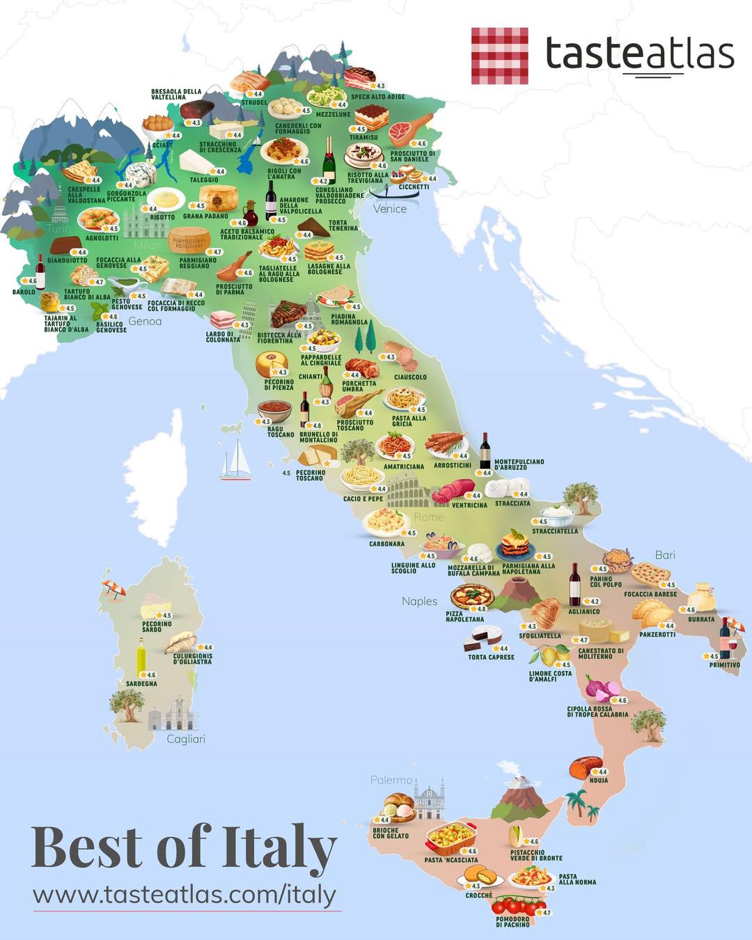
Italian Foods Map by Region
This map provides a visual representation of some of the best Italian foods, categorized by regions across Italy. It ser...
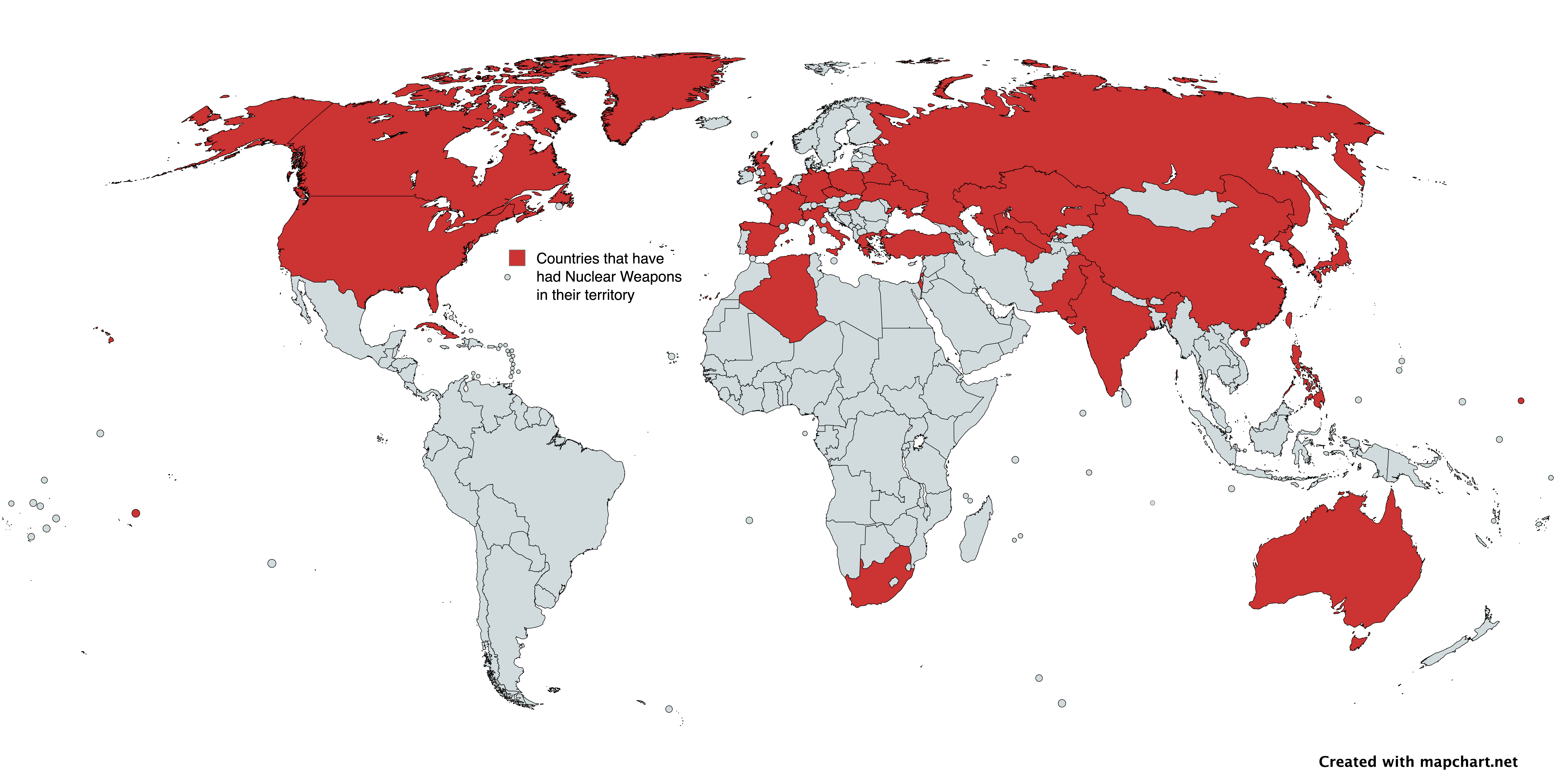
Countries with Nuclear Weapons Map
The map titled "Countries with Nuclear Weapons" provides a visual representation of nations that have had nuclear weapon...
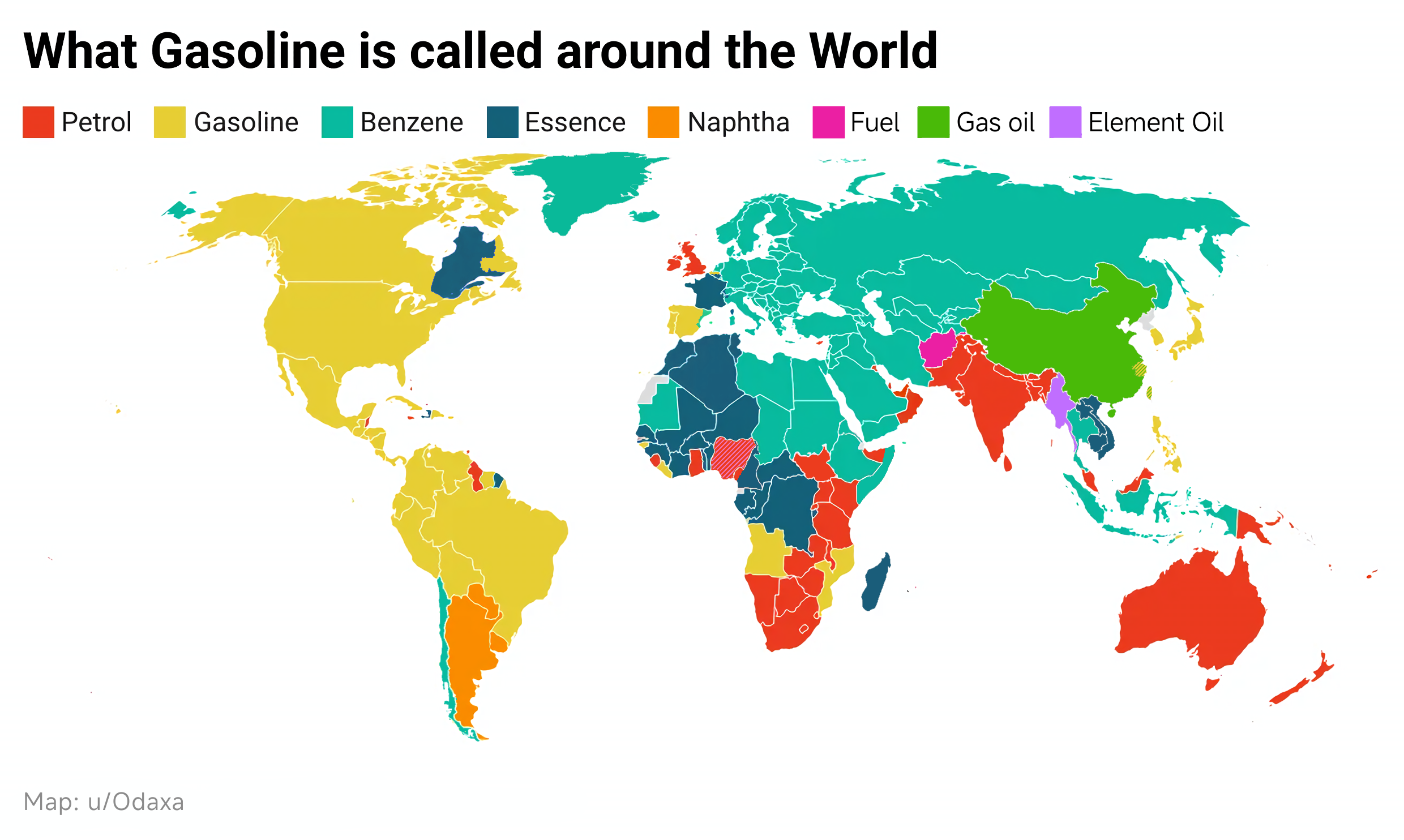
Gasoline Terminology Around the World Map
The visualization titled "What is Gasoline called around the world?" provides an insightful look into the diverse termin...
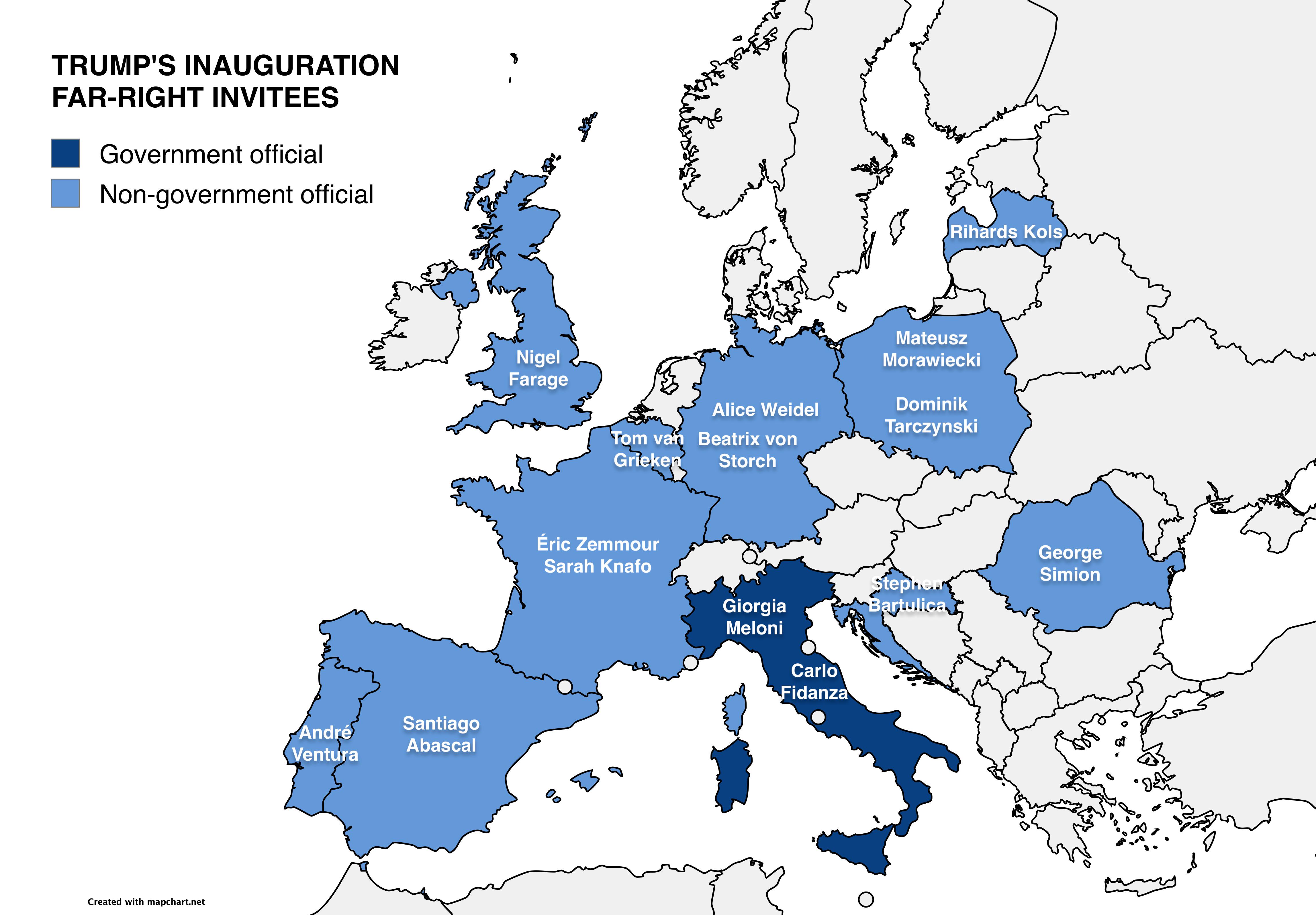
Map of Far-Right European Officials at Trump’s Inauguration
This map visually represents the various far-right European officials who received invitations to Donald Trump's second ...
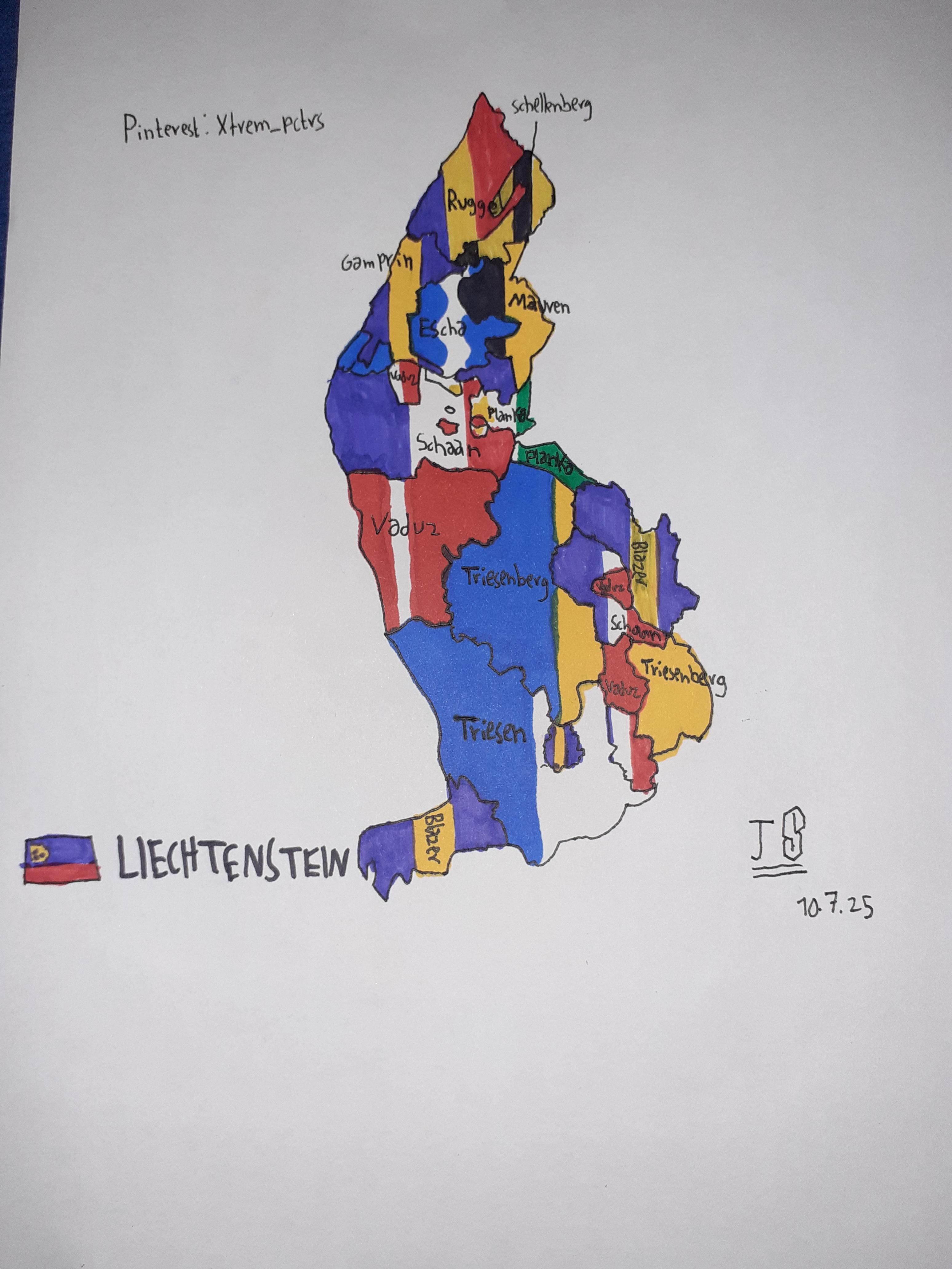
Self-Drawn Flag Map of Liechtenstein States
The visualization titled "Self-Drawn Flag Map of Liechtenstein States" presents a unique and artistic representation of ...
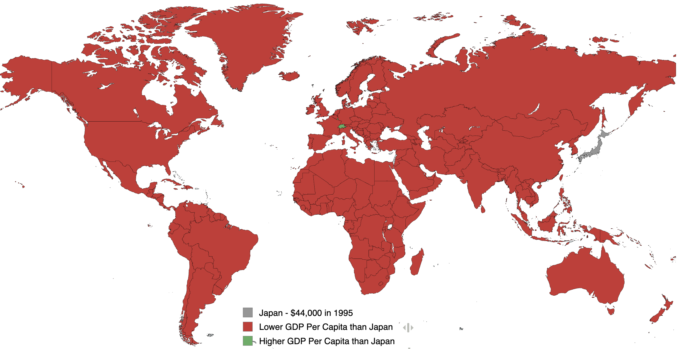
GDP Per Capita Map of Japan 1995
This visualization illustrates the GDP per capita of various countries in the year 1995, with Japan's GDP per capita peg...

Map of Percent of Commuting Workers Who Commute 60+ Minutes
The visualization titled "Percent of Commuting Workers Who Commute 60+ Minutes" provides a clear illustration of the sta...
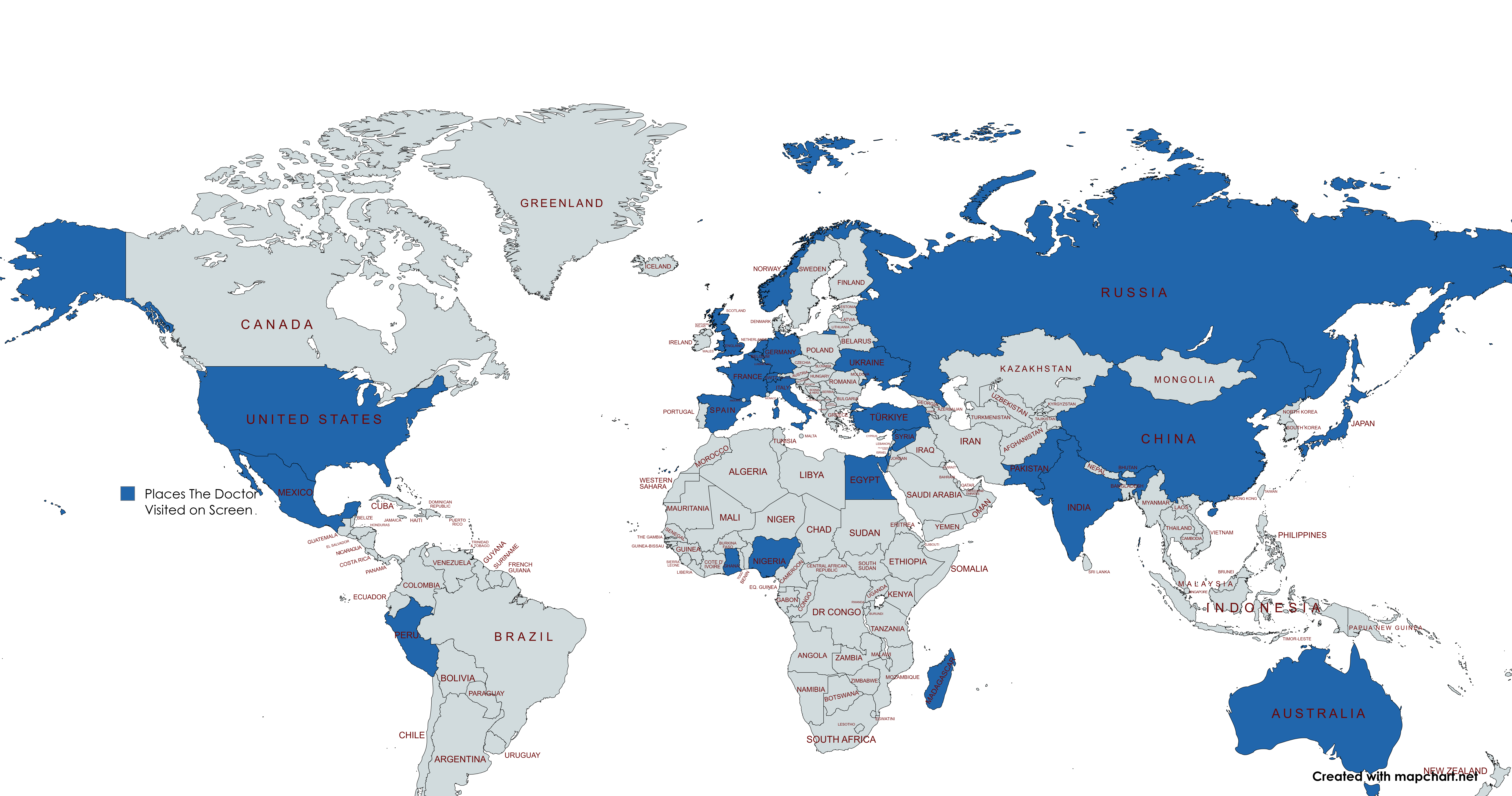
Doctor Who Countries Visited Map
This map provides a fascinating visual representation of every country in the world that has been visited by the Doctor,...
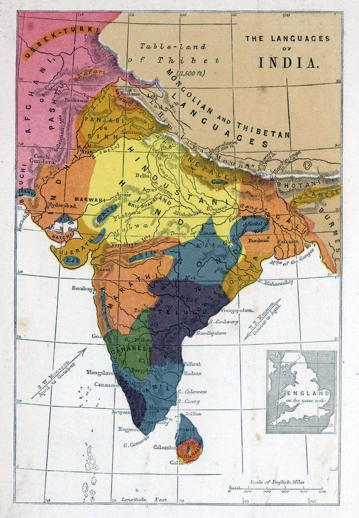
Linguistic Map of British India 1862
...
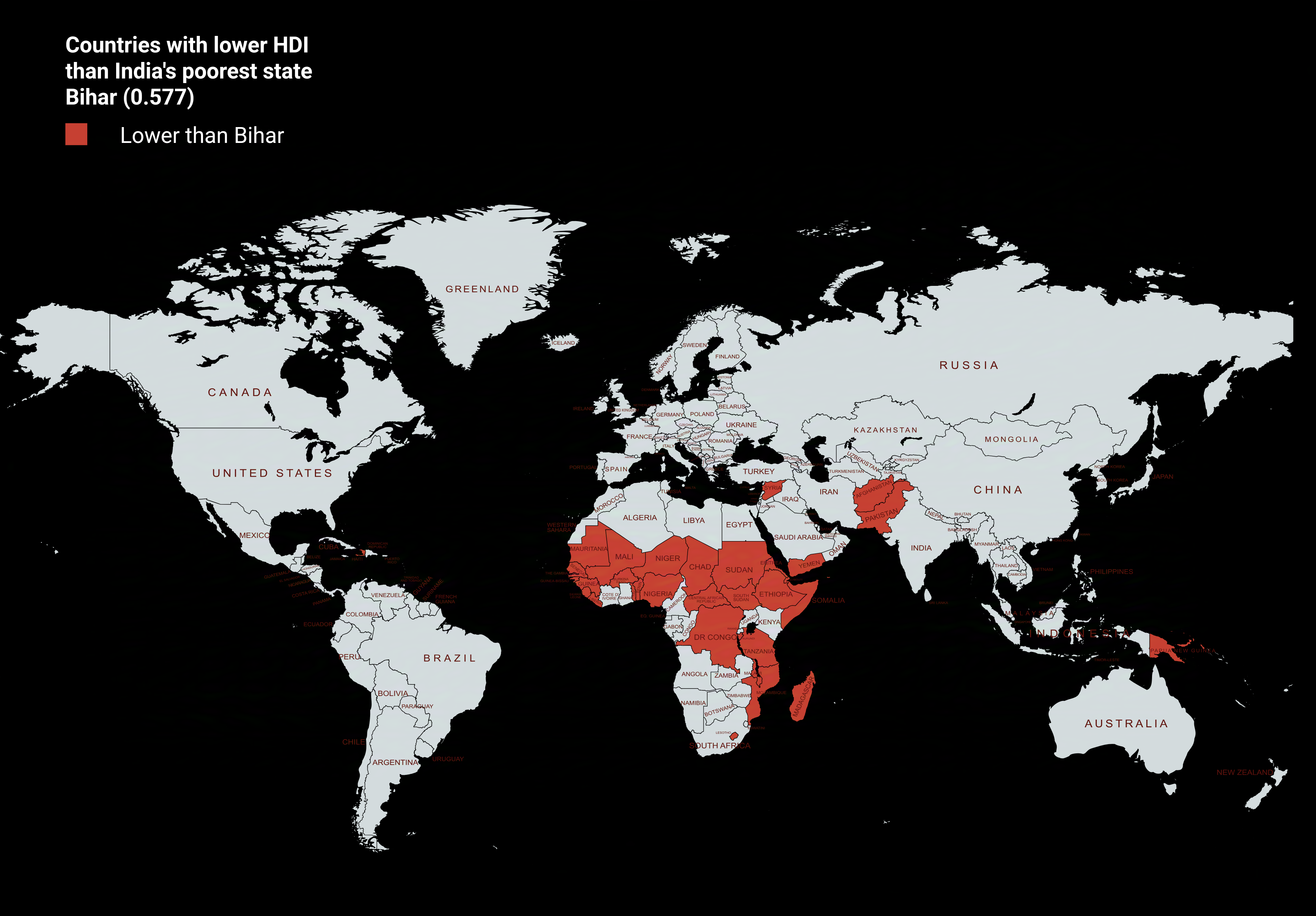
Countries with Lower HDI than Bihar Map
The visualization titled "Countries with Lower HDI than Bihar Map" provides a stark comparison of human development acro...
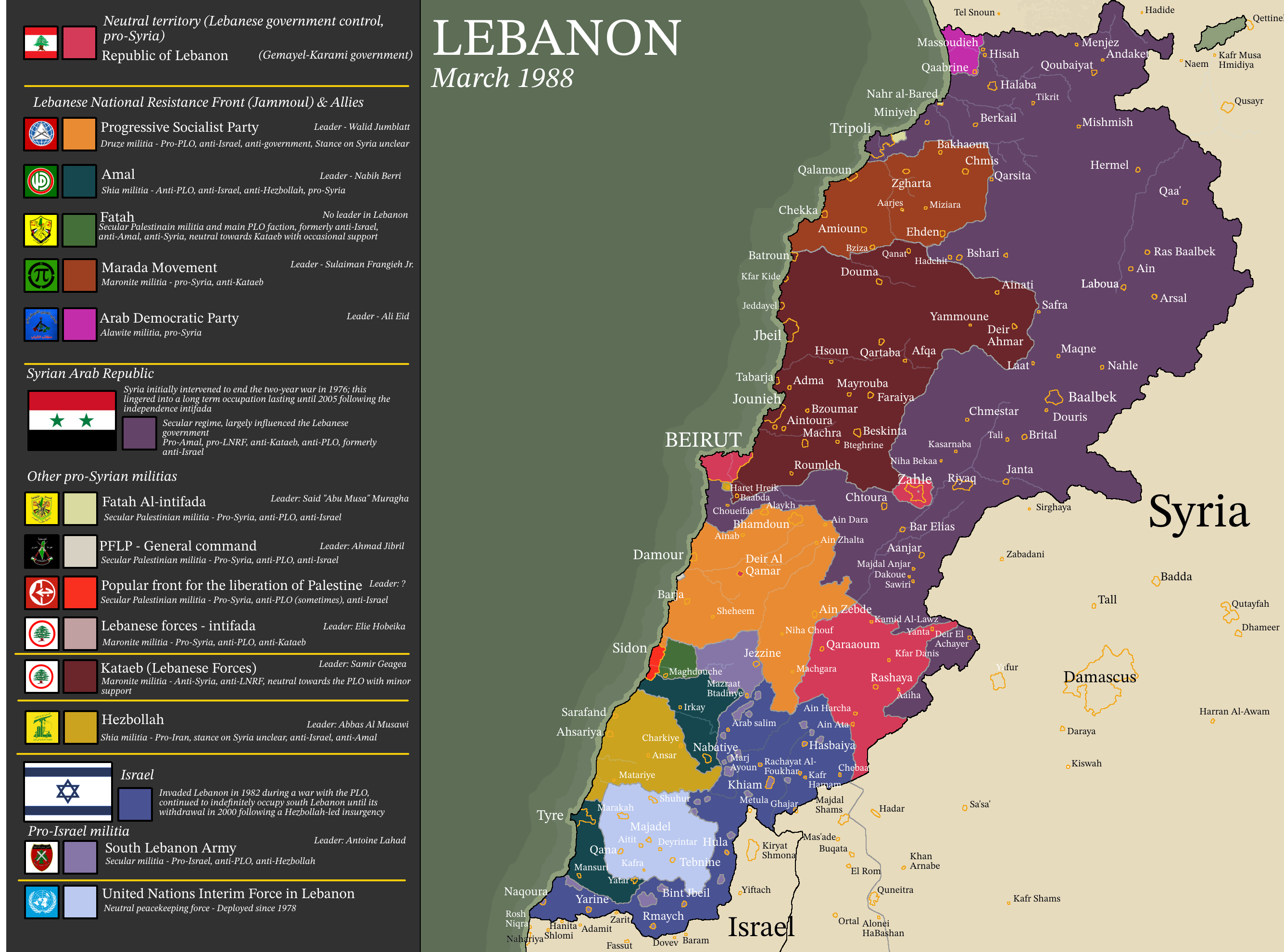
Map of Lebanon in 1988 Civil War Cantons
The 1988 map of Lebanon illustrates the complex and fractured political landscape that emerged during the Lebanese Civil...
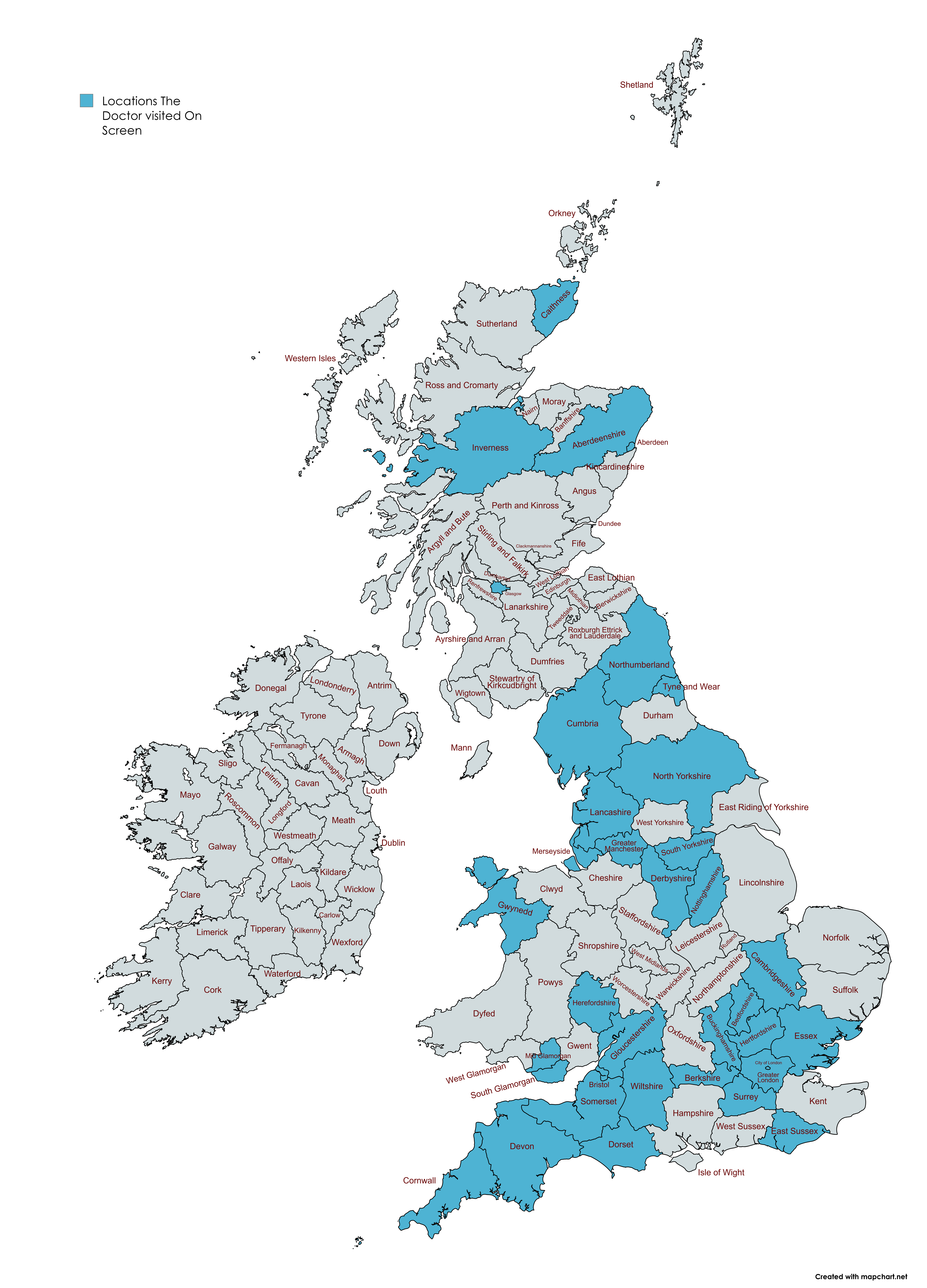
Doctor Who Filming Locations Map in the UK
This map presents a detailed visualization of the various locations across the British and Irish Isles that have feature...
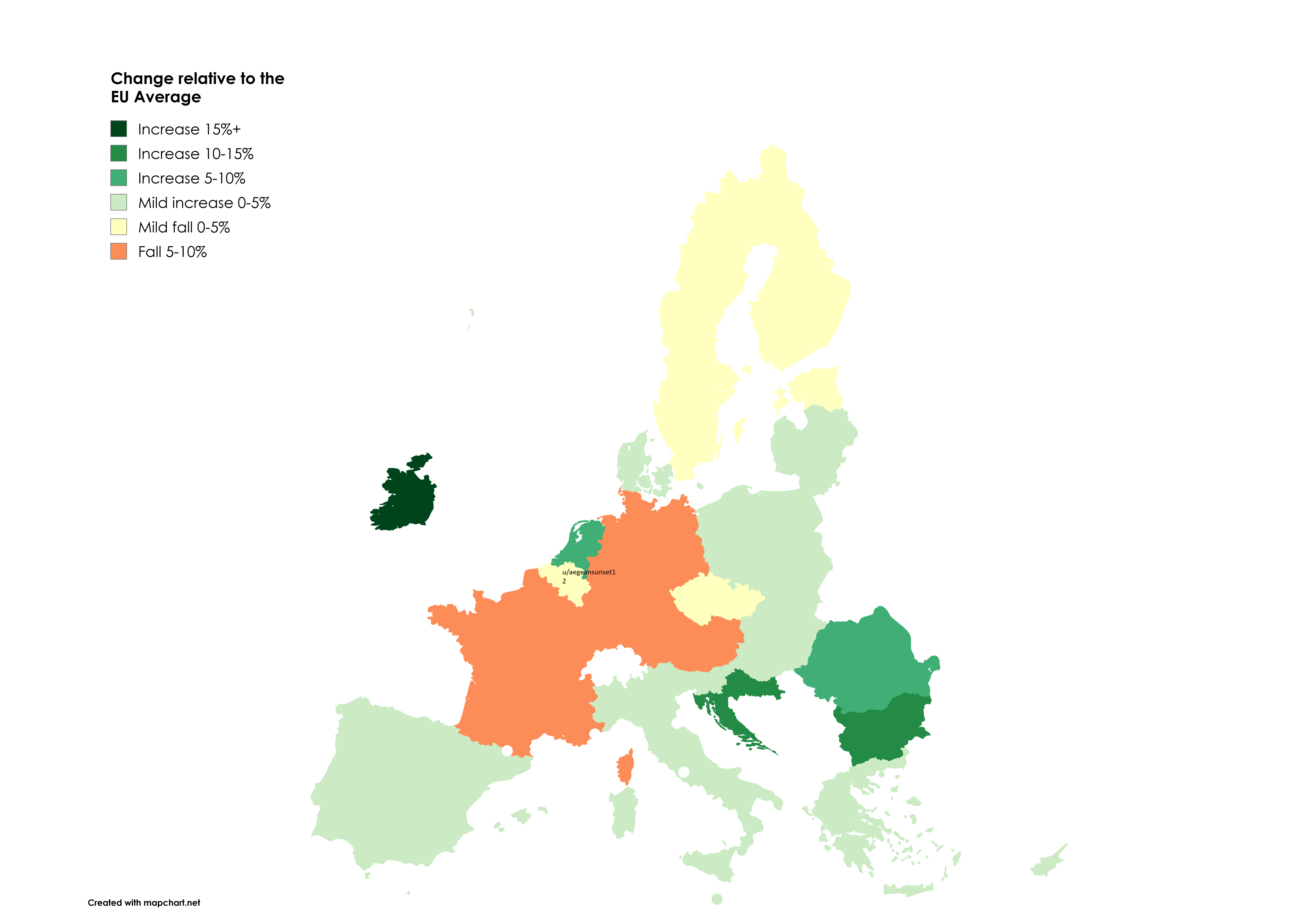
GDP Per Capita Compared to EU Average Map
The visualization titled "Europe in Flux: How COVID, Inflation, and War Reshaped GDP Per Capita vs EU Average (2019-2024...
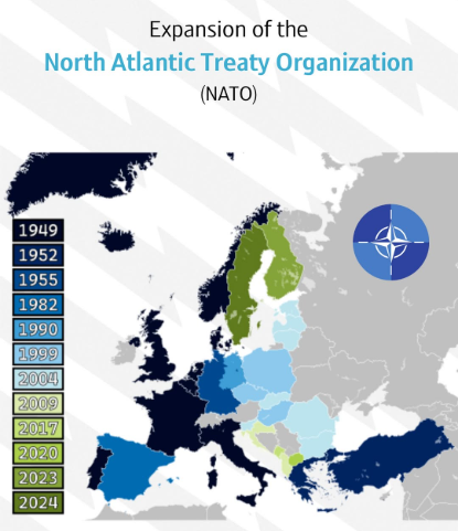
NATO Expansion over Time Map
This map provides a visual representation of the expansion of the North Atlantic Treaty Organization (NATO) over time, h...