Relief Map of Uruguay

David Chen
Data Visualization Specialist
David Chen is an expert in transforming complex geographic datasets into compelling visual narratives. He combines his background in computer science ...
Geographic Analysis
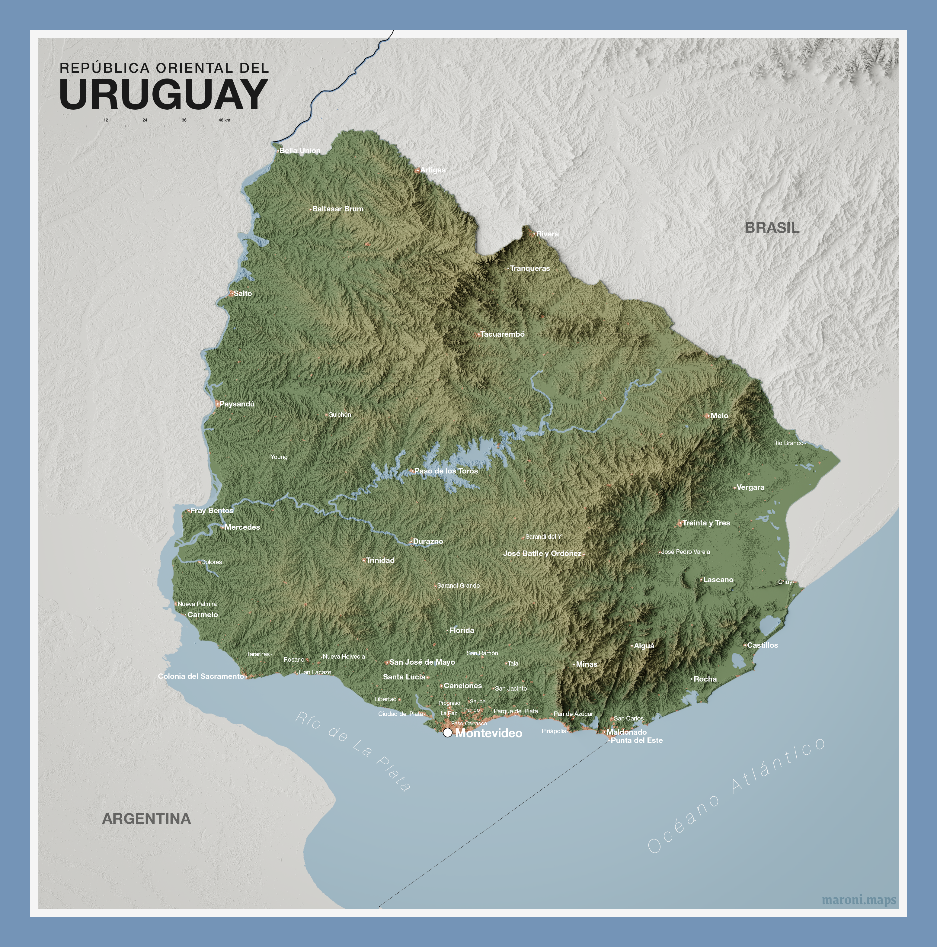
What This Map Shows
This relief map of Uruguay provides a striking visual representation of the country's topography, highlighting its varied elevations and important cities. With exaggerated terrain features, viewers can easily identify coastal plains, rolling hills, and the prominent ranges that shape this small yet dynamic nation. Uruguay, located in the southeastern part of South America, is bordered by Brazil to the north, Argentina to the west, and the Atlantic Ocean to the south and east. The map not only shows the physical landscape but also the urban centers that play a crucial role in the country’s economy and culture.
Deep Dive into Uruguay's Topography
Uruguay's geography is characterized by its relatively flat terrain, with the highest point being Cerro Catedral, which rises to just 514 meters (1,686 feet) above sea level. What's fascinating is that much of the country consists of rolling hills and low plateaus that gently slope towards the Atlantic coastline. The land is primarily composed of grasslands, which are ideal for agriculture and livestock grazing, making it one of the world's leading beef exporters.
Interestingly, the country's overall topography can be divided into three main regions: the coastal plains, the central plateau, and the hilly terrain of the north. The coastal area features beautiful beaches and a vibrant tourism sector, particularly around cities like Punta del Este, renowned for its upscale resorts and nightlife.
The central plateau, which includes Montevideo—the capital and largest city—serves as the economic heart of Uruguay. Montevideo is not just the political center; it is also the cultural hub, with a rich history reflected in its architecture and urban layout. The central region is predominantly agricultural, with a focus on crops like rice and soybeans.
In the northern part of the country, the landscape becomes more rugged, with a series of hills and valleys that offer a more diverse ecosystem. This area is less populated but is known for its natural beauty, including rivers like the Uruguay River, which forms part of the border with Argentina and is crucial for both ecosystems and commerce.
Regional Analysis
Diving deeper into specific regions, we can see how the geography influences the development of urban areas. For instance, Montevideo, located along the southern coast, benefits from its position as a port city, which has led to its growth as the most populous area in the country, hosting nearly 40% of Uruguay's total population. The city is a melting pot of cultures, blending European influences with local traditions, and it is a key player in Uruguayan commerce.
In contrast, cities like Salto and Paysandú, located in the northwest, exhibit a different demographic profile. These cities are situated near the Uruguay River and are pivotal for agriculture and livestock industries. The populations here are smaller, but they reflect a rich local culture that is deeply connected to the surrounding natural landscapes.
Additionally, the eastern region, which includes cities like Rocha, is marked by its beautiful beaches and is popular for tourism. This area contrasts sharply with the agricultural north and the urban south, showcasing how geography influences economic activities and settlement patterns across the country.
Significance and Impact
Understanding the topography of Uruguay is essential for several reasons. First, it highlights the relationship between the land and the economic activities that take place there. The rolling hills and fertile plains have made Uruguay an agricultural powerhouse, driving its economy and export markets. The emphasis on livestock and crop production is not only vital for the country's income but also for its cultural identity.
Moreover, as climate change continues to impact global weather patterns, the geography of Uruguay will play a crucial role in how the nation adapts. Rising sea levels threaten coastal cities, while changes in rainfall could affect agricultural outputs. Therefore, mapping and understanding these geographical features is not just about appreciating the landscape; it’s about preparing for future challenges.
In conclusion, the relief map of Uruguay serves as a powerful tool for understanding the intricate relationship between geography, economy, and culture. By examining the terrain, we can gain insights into how this small nation has developed and what future trends may look like as it navigates the complexities of a changing world.
Visualization Details
- Published
- October 17, 2025
- Views
- 40
Comments
Loading comments...