Austria's Greatest Extent Map

Marcus Rodriguez
Historical Geography Expert
Marcus Rodriguez specializes in historical cartography and geographic data analysis. With a background in both history and geography, he brings unique...
Geographic Analysis
What This Map Shows
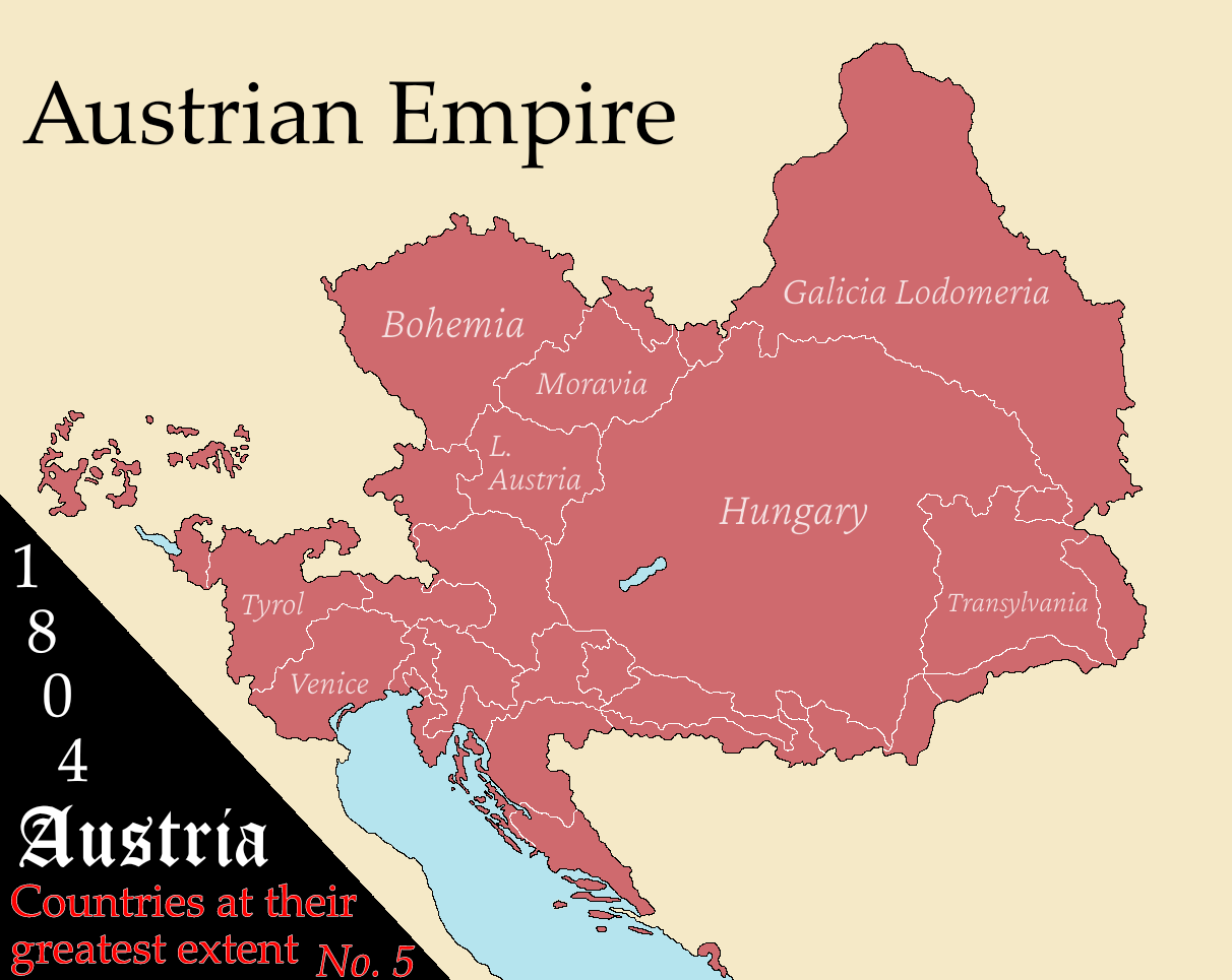
The "Austria at Its Greatest Extent" map provides a fascinating glimpse into the historical boundaries of Austria, showcasing the vast territories that this Central European nation has controlled at various points in its history. This visualization highlights not only modern Austria but also the regions that were part of the Austro-Hungarian Empire, stretching at its peak across much of Central and Eastern Europe. It’s interesting to note how these borders have shifted due to wars, treaties, and political changes, creating a dynamic historical narrative that is reflected in the geographical layout.
Deep Dive into Austria's Historical Geography
Austria's geographical significance is deeply intertwined with its history. At the height of the Austro-Hungarian Empire in the early 20th century, Austria encompassed a diverse range of ethnic groups and cultures, spreading across present-day countries such as Hungary, the Czech Republic, Slovakia, Slovenia, and parts of Italy and Poland. This extensive reach allowed Austria to play a pivotal role in European politics and economics.
One of the most notable aspects of Austria's geographical landscape is the diversity of its topography. The Alps, which dominate the western part of the country, are home to some of Europe’s highest peaks, influencing climate, biodiversity, and even cultural practices. The eastern regions, in contrast, feature the expansive plains of the Danube River Basin, which have been crucial for agriculture and trade.
The river systems themselves, particularly the Danube, have historically served as vital trade routes that facilitated cultural exchange and economic prosperity. The Danube River, which flows through several countries and connects various cultural landscapes, has been the lifeblood of the region since ancient times. Interestingly, the river has also shaped the political landscape, acting as a natural border and influencing settlement patterns.
In terms of demographics, the historical extent of Austria has resulted in a rich tapestry of languages and ethnicities, from German-speaking Austrians to Hungarian, Slovene, and Croatian minorities. This diversity has created a complex socio-political environment where cultural heritage plays a significant role in contemporary Austrian identity. The historical map not only serves as a reminder of territorial changes but also as a testament to the evolution of these communities over time.
Regional Analysis
Examining the map, we can break down the historical regions of Austria into several key areas:
- **Western Austria (Tyrol and Vorarlberg)**: This mountainous region showcases a predominantly German-speaking population, with a strong cultural identity tied to Alpine traditions. The economic activities here are largely centered around tourism, skiing, and agriculture.
- **Central Austria (Lower Austria and Upper Austria)**: Known for its vineyards and agriculture, this area has seen significant urban development, especially in cities like Linz and St. Pölten. The proximity to the Danube River has facilitated trade and industry, making this region economically vibrant.
- **Eastern Austria (Burgenland and Vienna)**: Vienna, the capital, is a cultural hub that reflects the historical diversity of the empire. Burgenland, once a contested border region, now enjoys a peaceful coexistence of various ethnic groups, including a notable Hungarian minority.
- **Southern Austria (Styria and Carinthia)**: This region has a rich Slavic influence, particularly in Carinthia, which borders Slovenia. The cultural blend here is evident in dialects, festivals, and culinary traditions.
Each of these areas tells a story of its own regarding historical boundaries and cultural influences, making Austria a unique case study in European geography.
Significance and Impact
Understanding Austria's greatest extent is crucial for appreciating the complexities of its current political and social landscape. The historical shifts in borders have had lasting impacts on national identity and regional relationships. Today, as Austria continues to navigate its role within the European Union, the lessons from its past remain relevant in discussions about nationalism, regional cooperation, and cultural integration.
Moreover, the historical map serves as a reminder of the ever-changing nature of geopolitical boundaries. As global dynamics shift, understanding the historical context can provide insight into current issues such as migration, economic partnerships, and cultural exchanges. Have you noticed how history often repeats itself in modern geopolitics? The map of Austria's greatest extent is more than just a geographical representation; it is a window into the past that informs the present and shapes the future.
As we look ahead, it is essential to consider how historical geography influences contemporary issues. What’s fascinating is that while physical borders may change, the cultural and historical ties that bind regions and peoples together remain strong. The map of Austria at its greatest extent is not just an artifact; it is a living document that continues to resonate in today’s discussions on identity, culture, and international relations.
Visualization Details
- Published
- October 14, 2025
- Views
- 34
Comments
Loading comments...