austro-hungarian empire Maps
7 geographic visualizations tagged with "austro-hungarian empire"
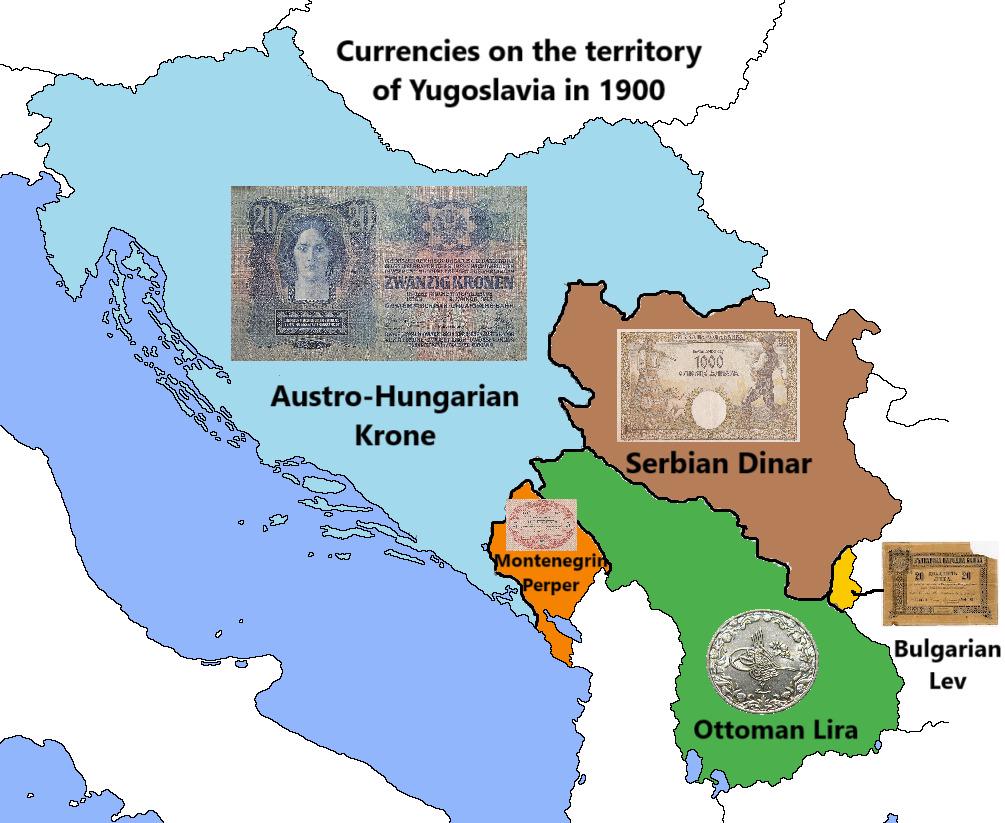
Currency Map of Yugoslavia in 1900
The map titled "Currencies on the territory of Yugoslavia in 1900" illustrates the various currencies that were in circu...
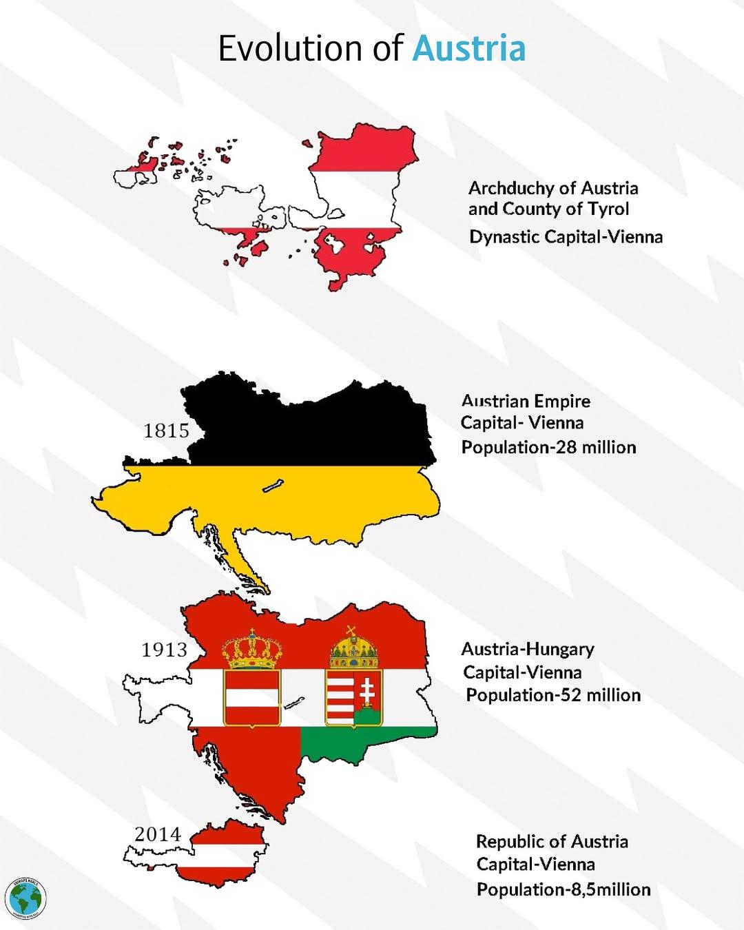
Historical Evolution of Austria Map
The "Historical Evolution of Austria" map provides a comprehensive overview of the territorial changes that Austria has ...
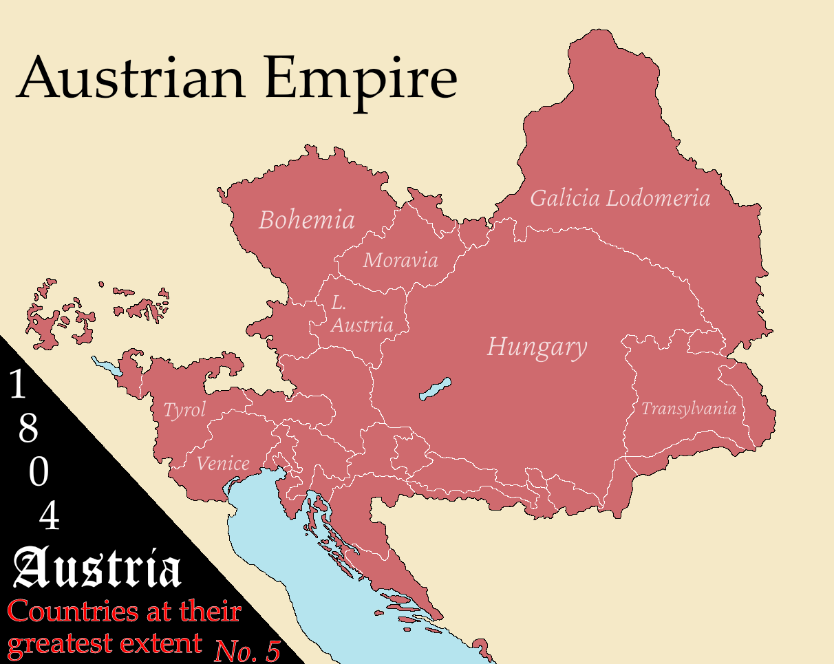
Austria's Greatest Extent Map
The "Austria at Its Greatest Extent" map provides a fascinating glimpse into the historical boundaries of Austria, showc...
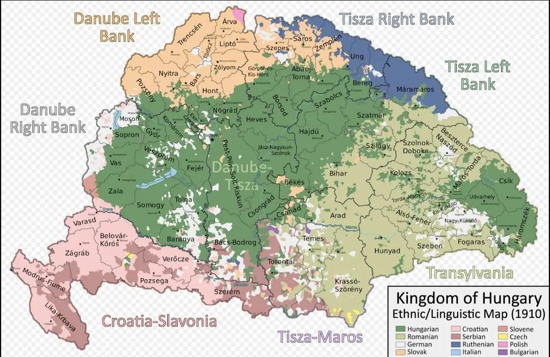
Ethnic Map of the Kingdom of Hungary in 1910
The "Ethnic Map of the Kingdom of Hungary in 1910" provides a vivid representation of the diverse ethnic landscape of Hu...
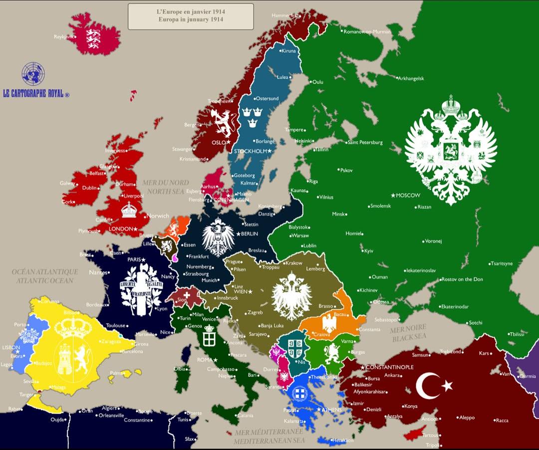
Political Map of Europe January 1914
The "Europe in January 1914" map provides a snapshot of the political landscape of Europe just months before the outbrea...
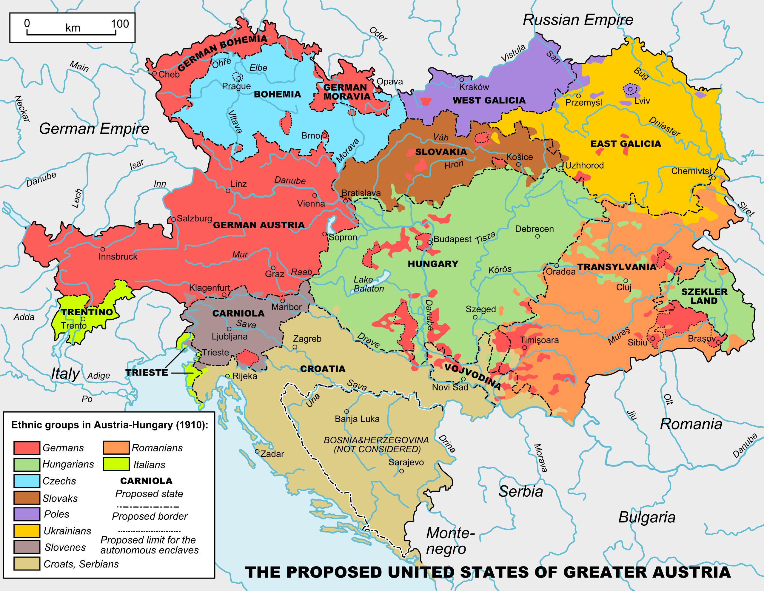
Map of United States of Greater Austria
...
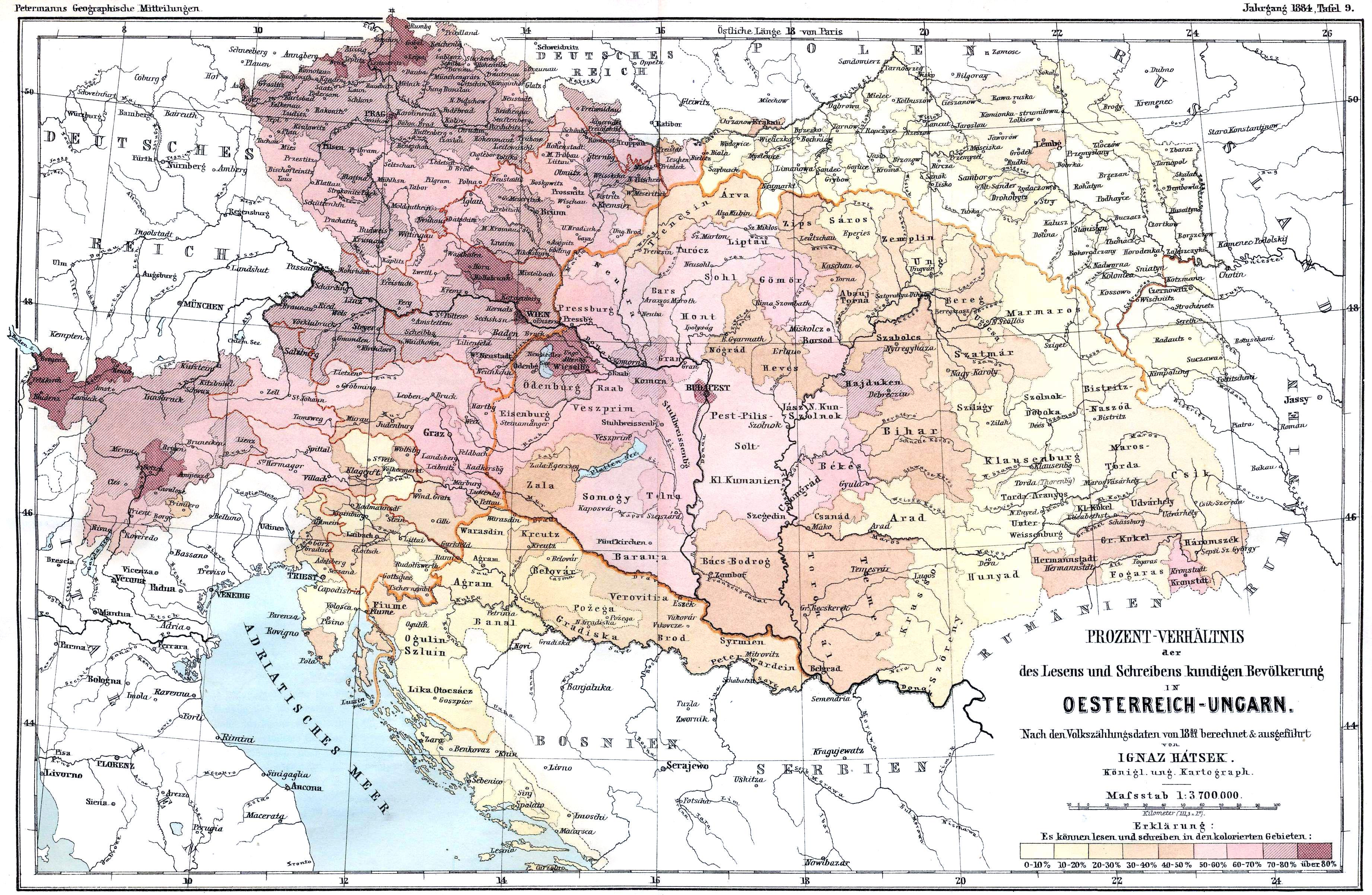
Literacy Rates Map of Austro-Hungarian Empire 1880
The map titled "Literacy Rates in Austro-Hungarian Empire (Census 1880)" visually represents the literacy levels across ...