socioeconomic status Maps
4 geographic visualizations tagged with "socioeconomic status"

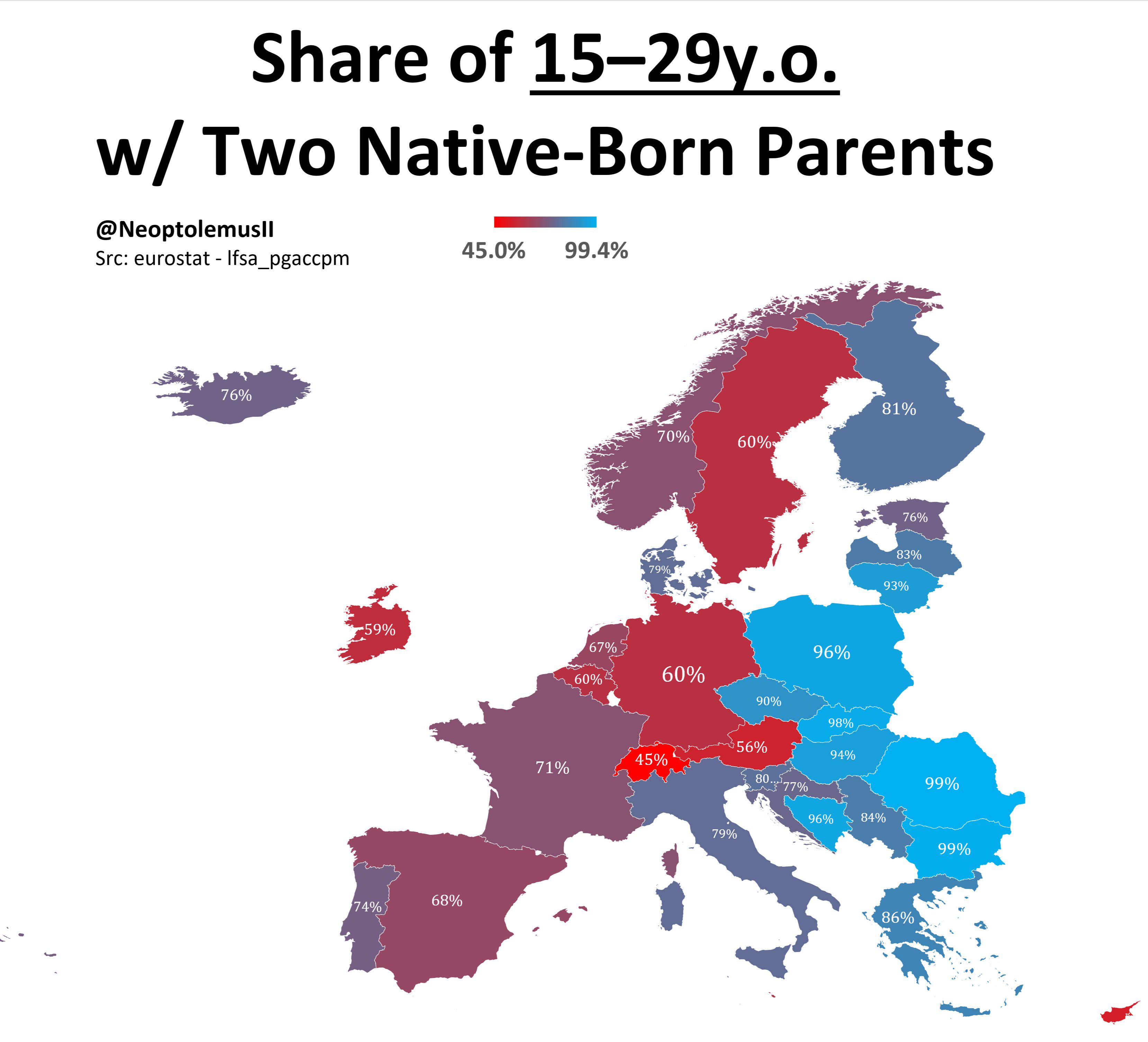
Map of Share of 15-19 Year Olds with Two Native Born Parents
The visualization titled \...
👁 16📅 10/8/2025

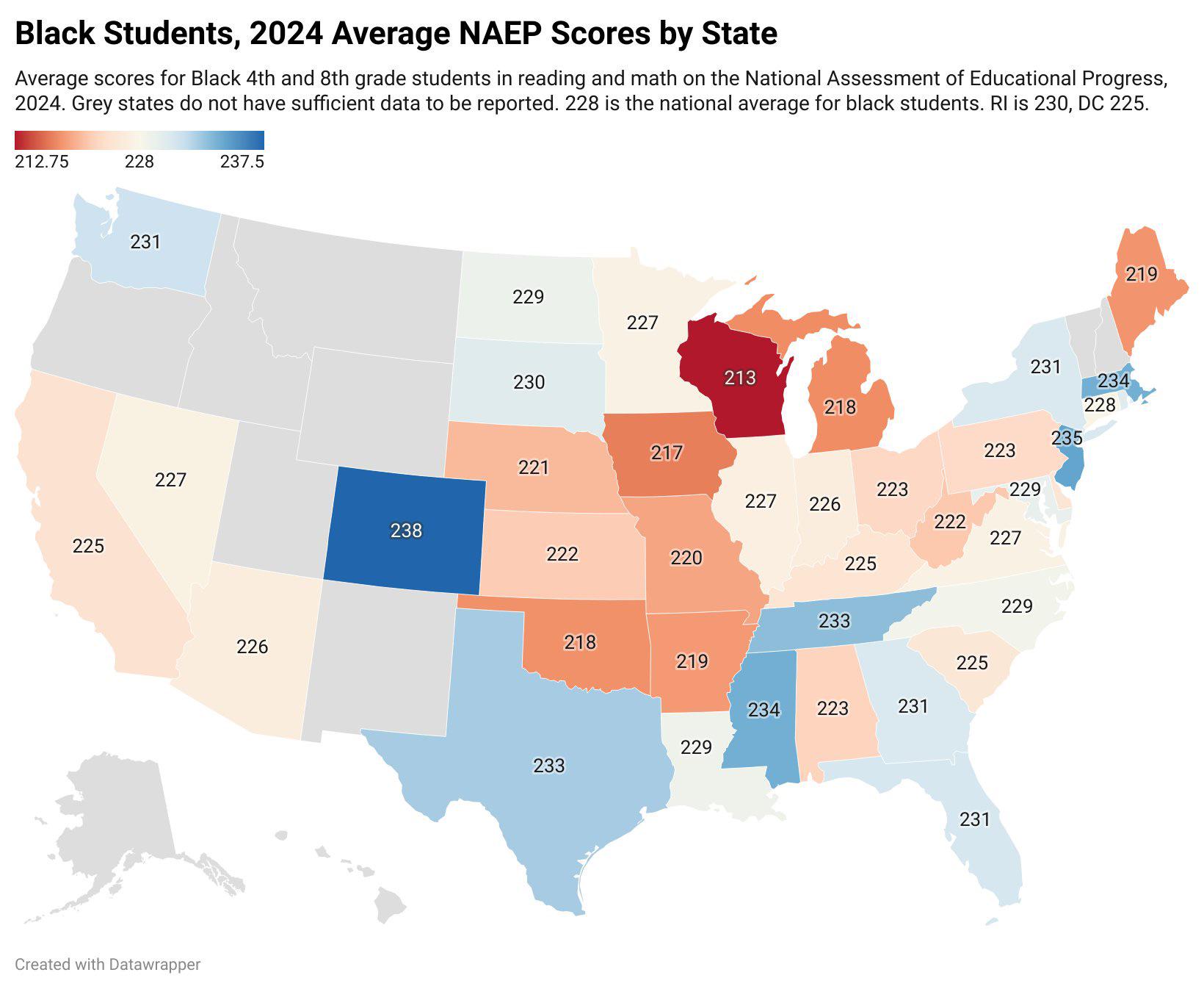
Black Student Test Scores by US State Map
The "Black Student Test Scores by US State" map visualizes the academic performance of Black students across various sta...
👁 76📅 8/20/2025

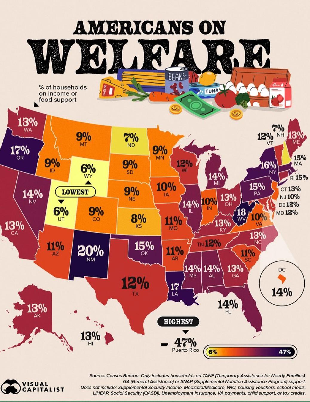
% of Households on Income or Food Support Map
The "% of Households on Income or Food Support" map provides a visual representation of the percentage of households wit...
👁 0📅 10/18/2025

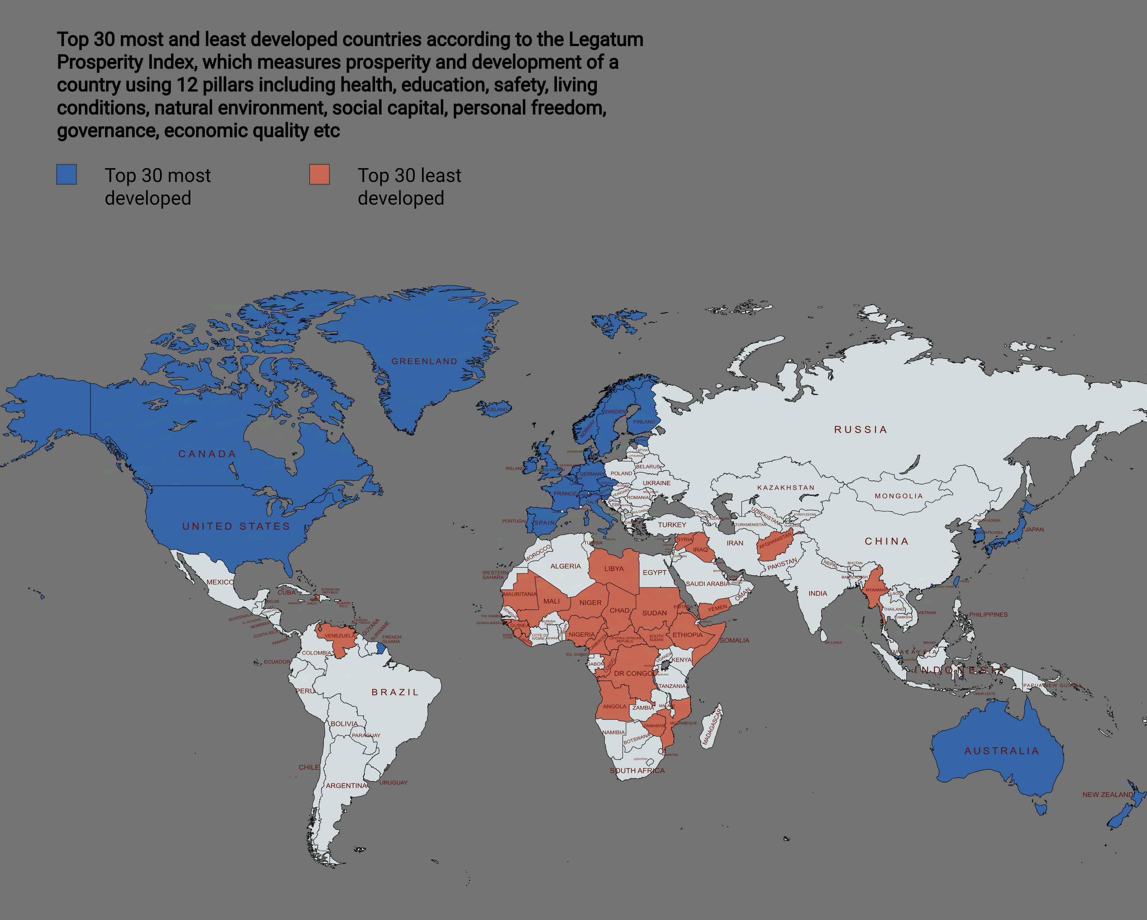
Top 30 Most and Least Developed Countries Map
This map visually represents the top 30 most and least developed countries based on various socio-economic indicators. I...
👁 64📅 9/3/2025