sea level Maps
3 geographic visualizations tagged with "sea level"

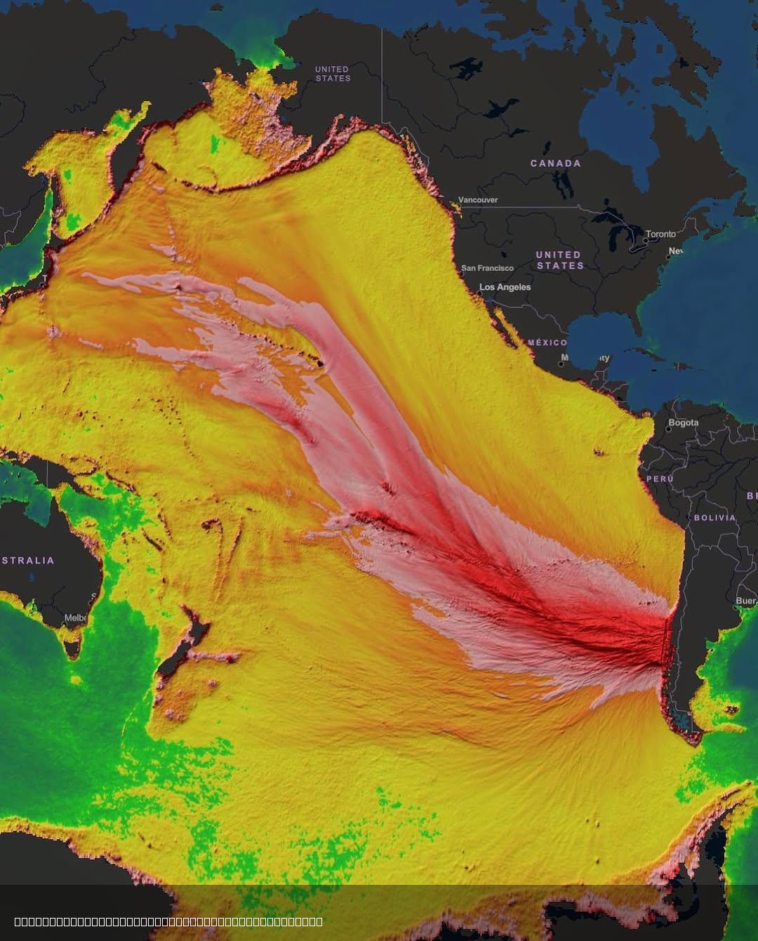
1960's M9.5 Tsunami Sea-Level Rise Map
The visualization titled 'Historic Energy Model of 1960's M9.5 Tsunami' from NOAA's Pacific Tsunami Warning Center illus...
👁 122📅 8/3/2025

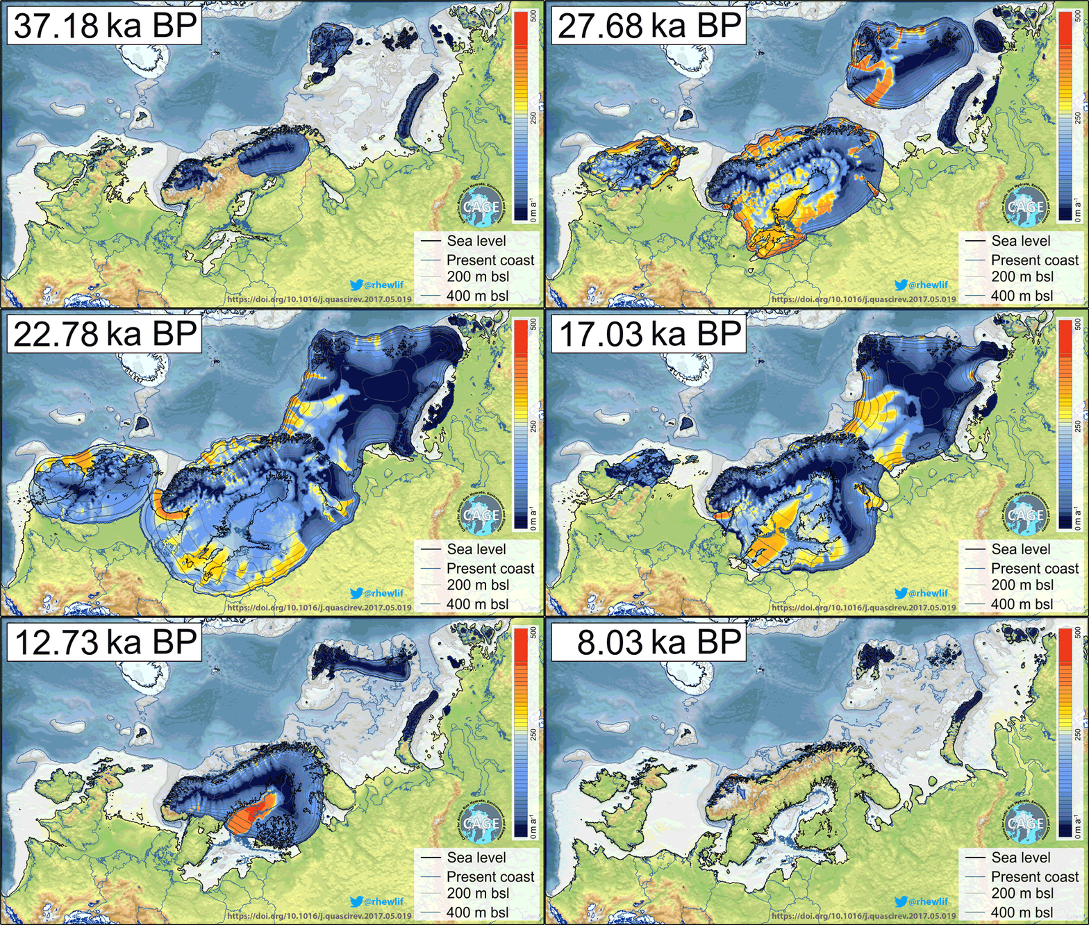
Eurasian Ice Sheets and Sea Level Map
This map visualizes the distribution of Eurasian ice sheets and the corresponding sea levels during the Upper Paleolithi...
👁 36📅 9/11/2025

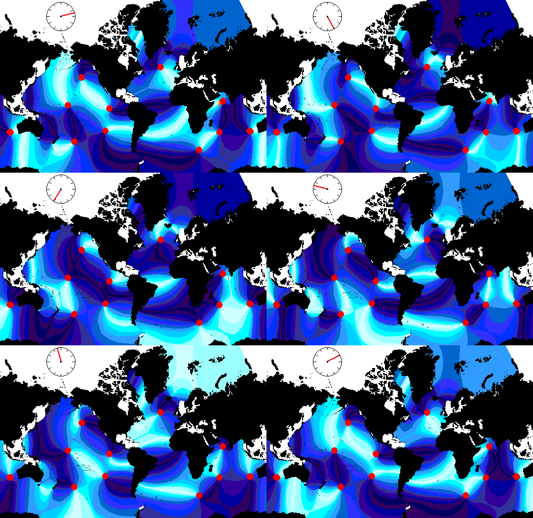
Global Tides Map with Animated Visualization
The "Animated Global Tides Map" provides a dynamic visualization of the world's tidal patterns, illustrating how ocean t...
👁 56📅 9/2/2025