satellite imagery Maps
5 geographic visualizations tagged with "satellite imagery"
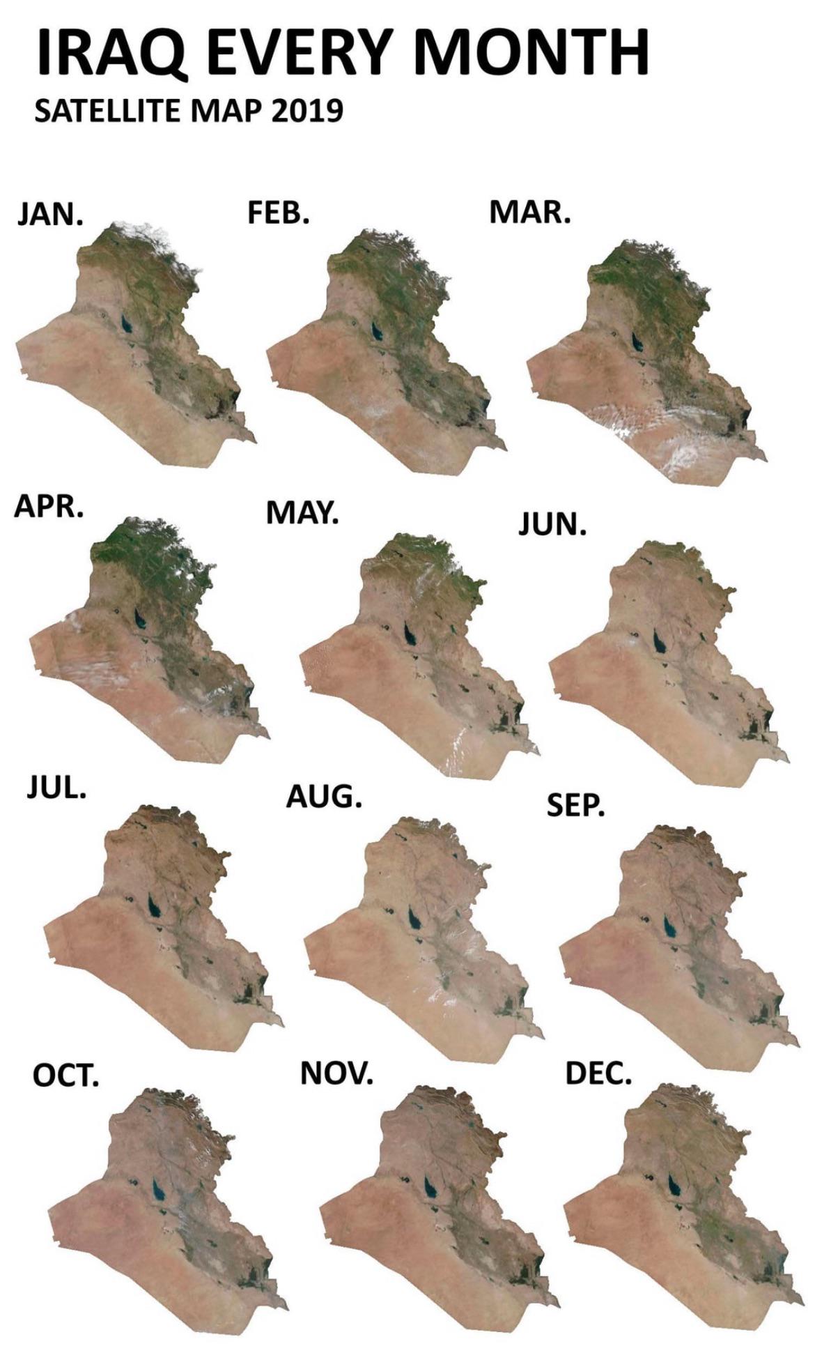
Iraq Seasonal Greenery Changes Map
This map visualizes how Iraq’s greenery fluctuates throughout the seasons, particularly focusing on satellite imagery ca...
👁 74📅 9/3/2025
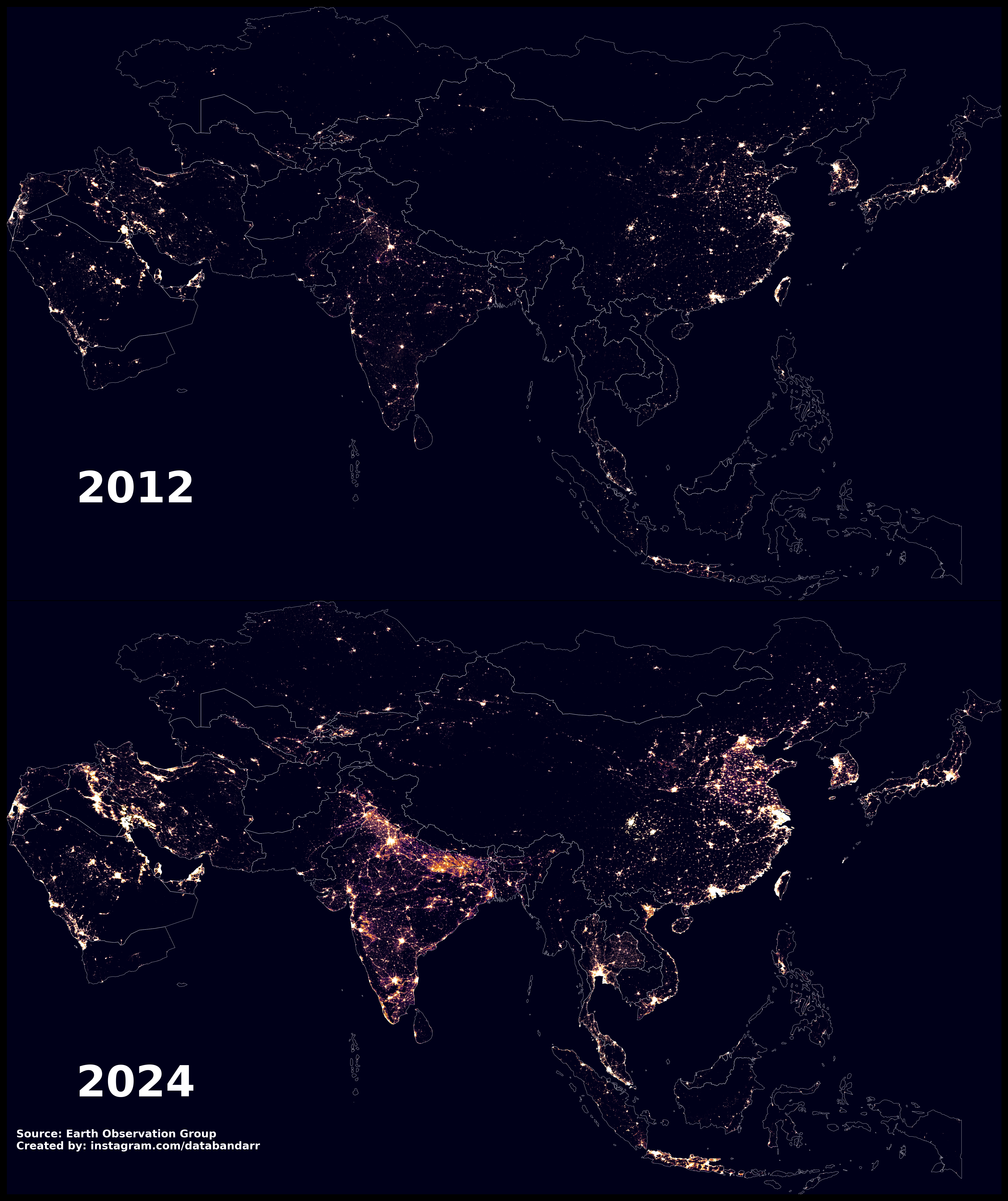
Night-time Light Map of Asia 2012 vs 2024
The "Night-time Light in Asia, 2012 vs 2024" map presents a striking visual comparison of light emissions across various...
👁 88📅 8/22/2025
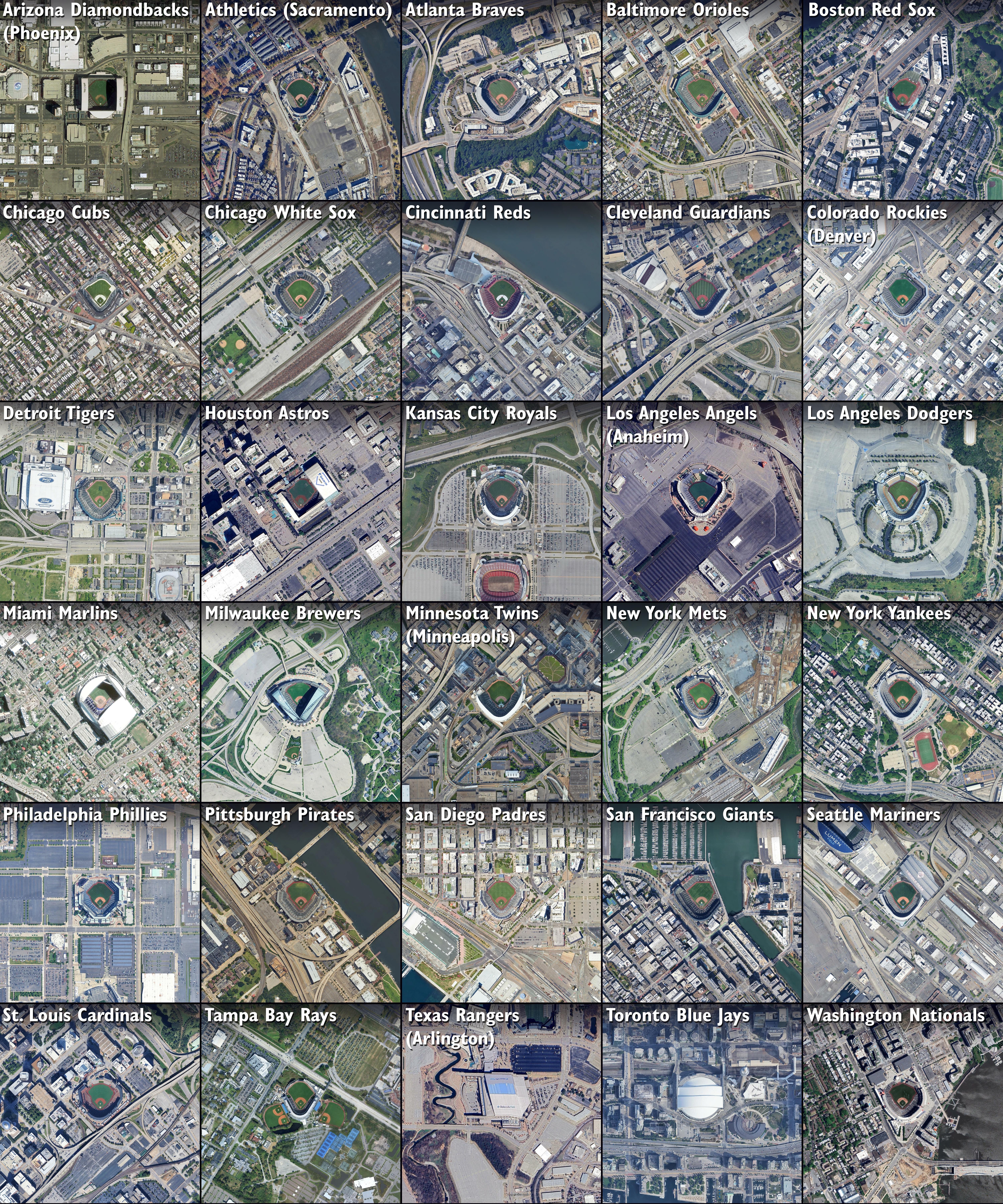
Land Use Map Around 30 MLB Stadiums
This map presents satellite images illustrating land use around the 30 Major League Baseball (MLB) stadiums across the U...
👁 148📅 8/23/2025
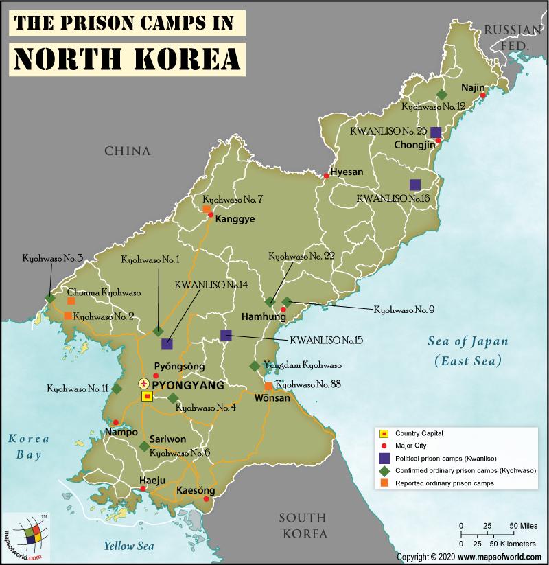
Prison Camps in North Korea Map
The visualization titled \...
👁 68📅 9/9/2025
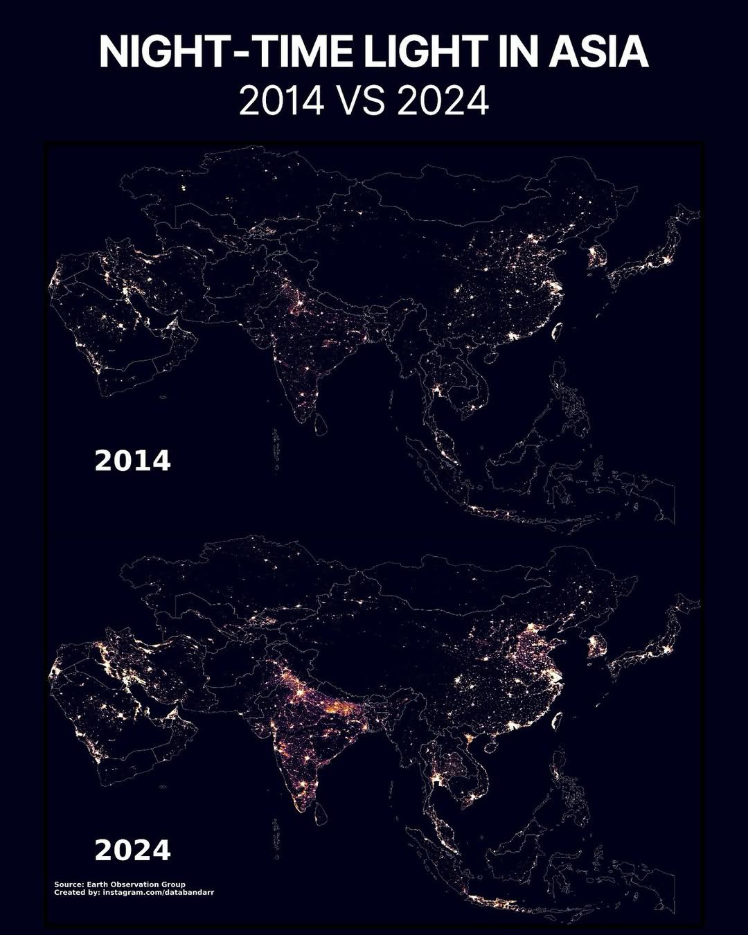
Night-time Light Map of Asia 2024 vs 2014
The visualization titled "Night-time Light in Asia (2024 vs 2014)" provides a comparative analysis of light emissions ac...
👁 46📅 9/24/2025