regional economics Maps
4 geographic visualizations tagged with "regional economics"

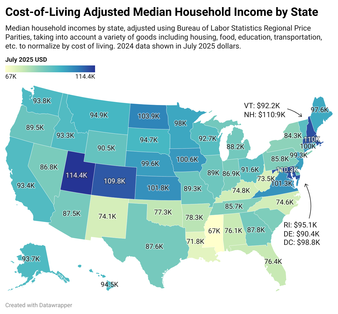
Cost-of-Living Adjusted Median Household Income by State Map
The "Cost-of-Living Adjusted Median Household Income by State Map" provides a comprehensive view of how median household...
👁 136📅 9/11/2025

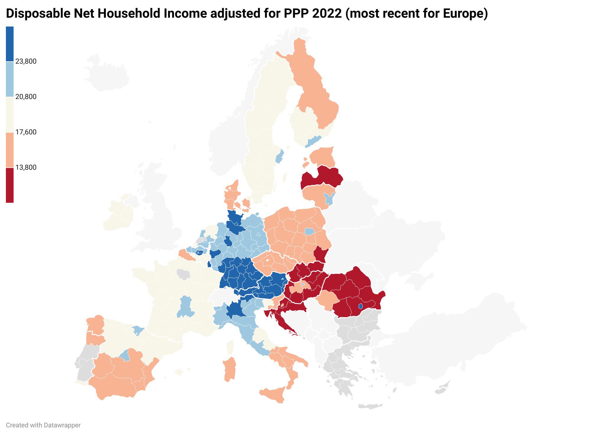
Median Disposable Net Household Income Map in Europe
The "Median Disposable Net Household Income Adjusted for Purchasing Power Parity in Europe" map provides a clear visuali...
👁 64📅 8/30/2025

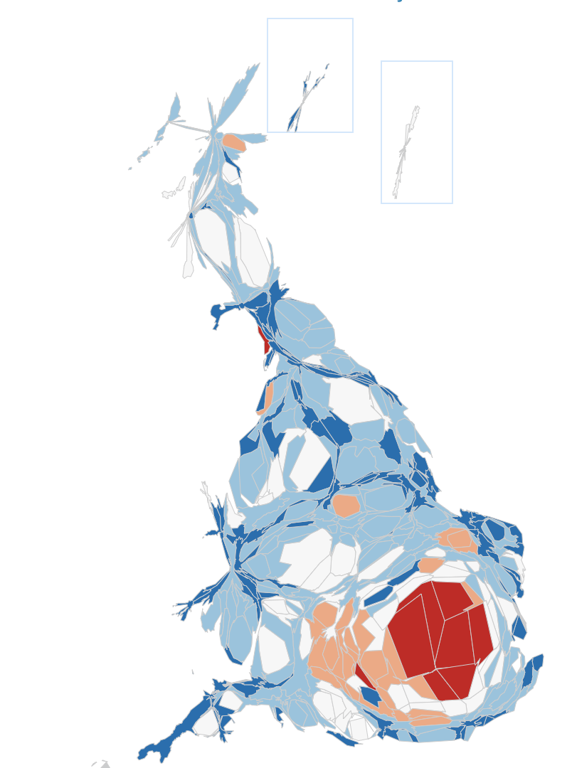
UK Job Pay Distribution Map
The ONS cartogram visualizes the distribution of jobs across the UK, illustrating not just the number of jobs available ...
👁 54📅 9/6/2025

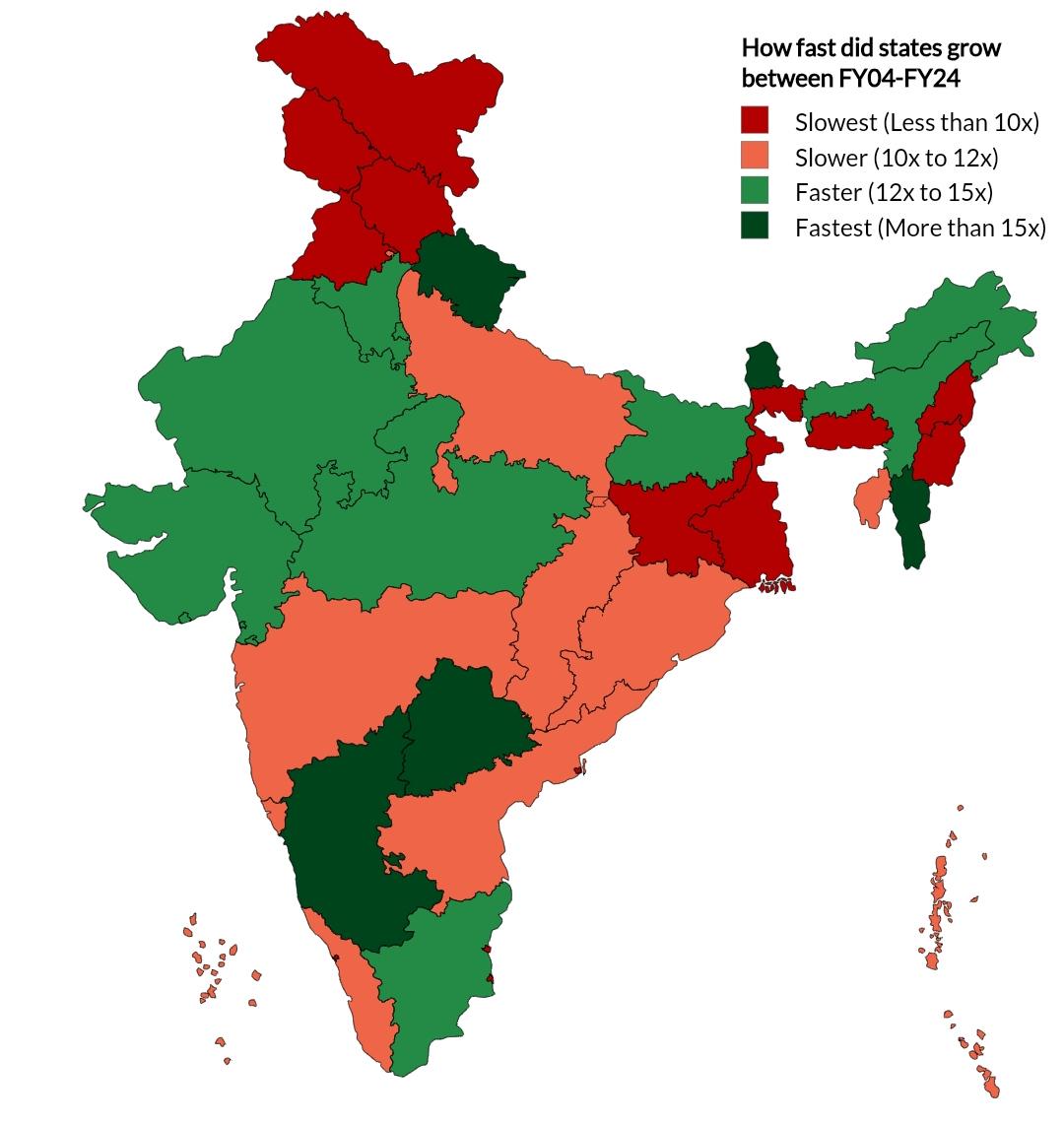
Indian States GDP Growth Map Over Two Decades
The map titled "How fast did Indian states grow in past two decades" provides a compelling visual representation of the ...
👁 56📅 9/15/2025