public policy Maps
5 geographic visualizations tagged with "public policy"

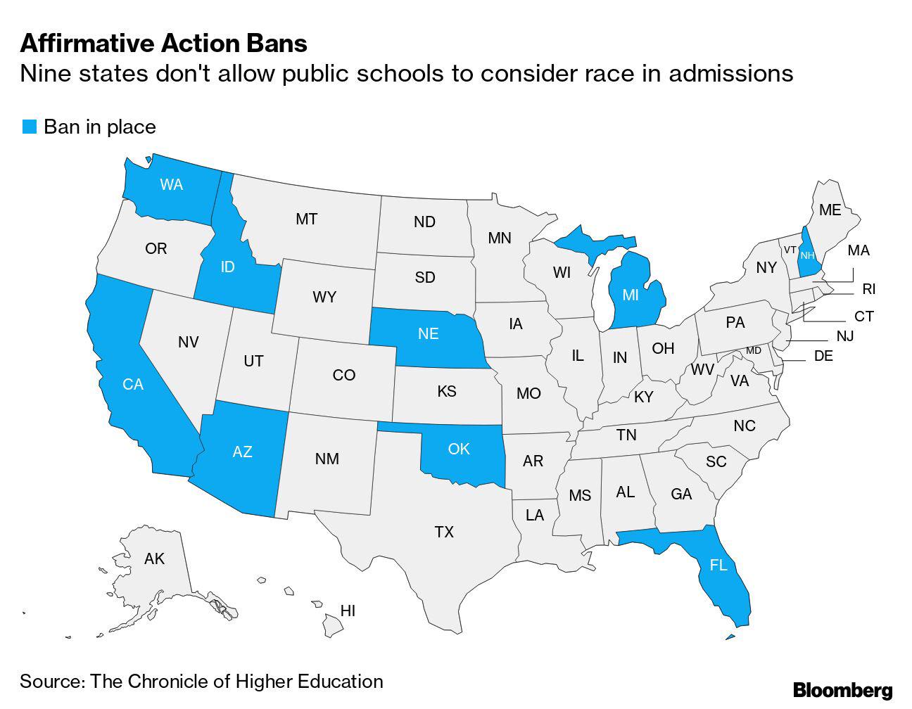
Map of States with Affirmative Action Bans
This map visually represents states in the United States that have enacted affirmative action bans, indicating where pub...
👁 34📅 9/29/2025

Social Security Recipients by State Map
The "Where Americans Receive Social Security, by State" map provides a visual representation of the distribution of Soci...
👁 70📅 9/15/2025

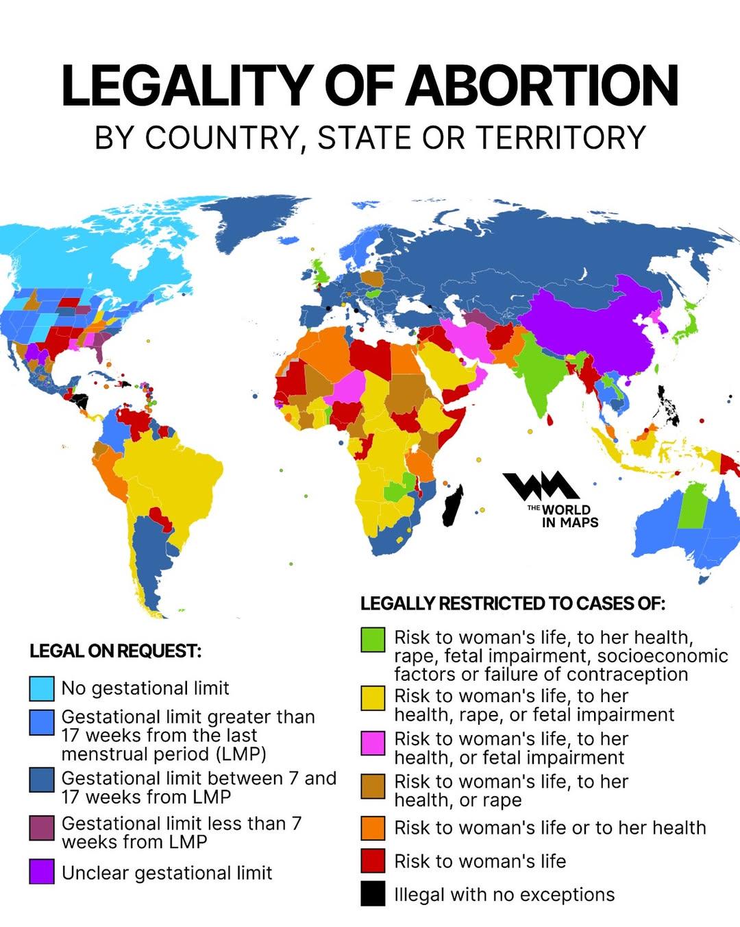
Legality of Abortion by Country Map
The \...
👁 32📅 9/30/2025

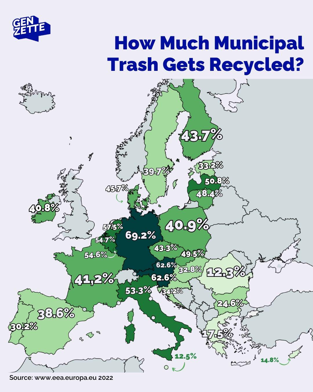
Municipal Waste Recycling Rates Map
The "Municipal Waste Recycling Rates Map" provides a visual representation of how much municipal waste is being recycled...
👁 42📅 9/27/2025

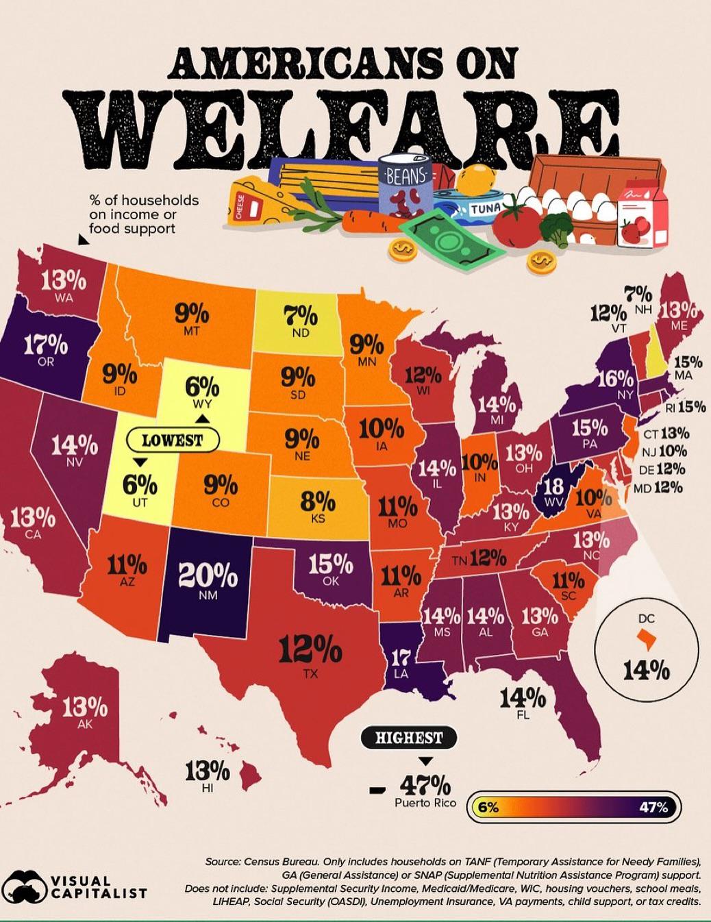
% of Households on Income or Food Support Map
The "% of Households on Income or Food Support" map provides a visual representation of the percentage of households wit...
👁 4📅 10/18/2025