political representation Maps
8 geographic visualizations tagged with "political representation"
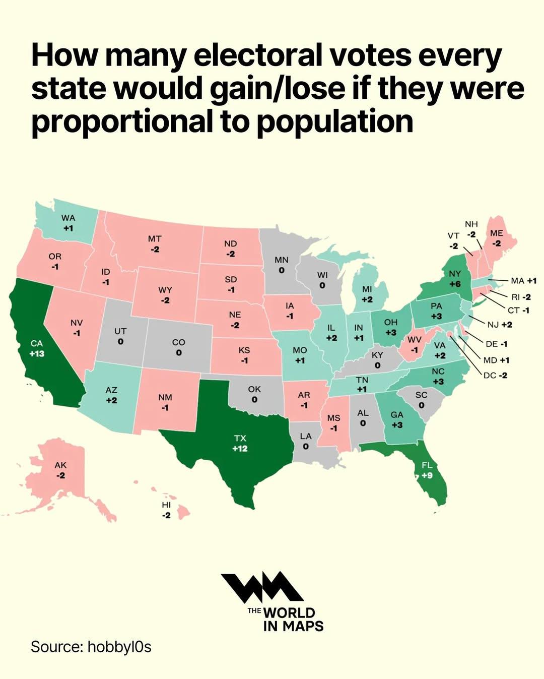
Electoral Votes by State Population Map
This map visualizes how the allocation of electoral votes would change if they were distributed proportionally to the po...
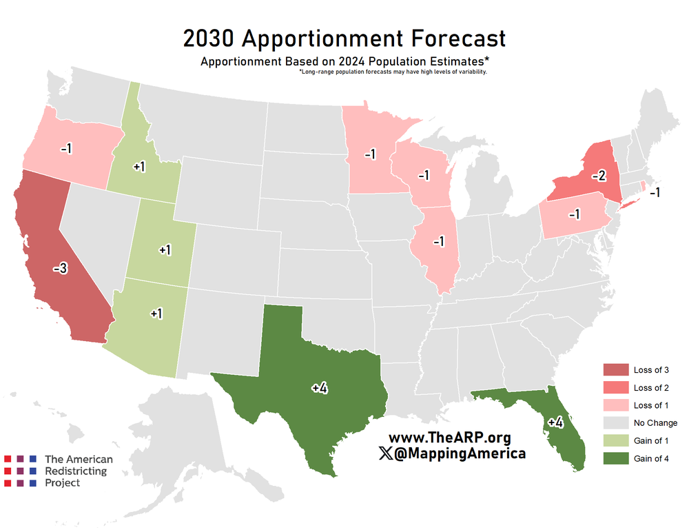
Electoral College Votes Forecast Map 2030
The "Forecast Apportionment of Electoral College Votes of 2030" map illustrates the projected distribution of electoral ...
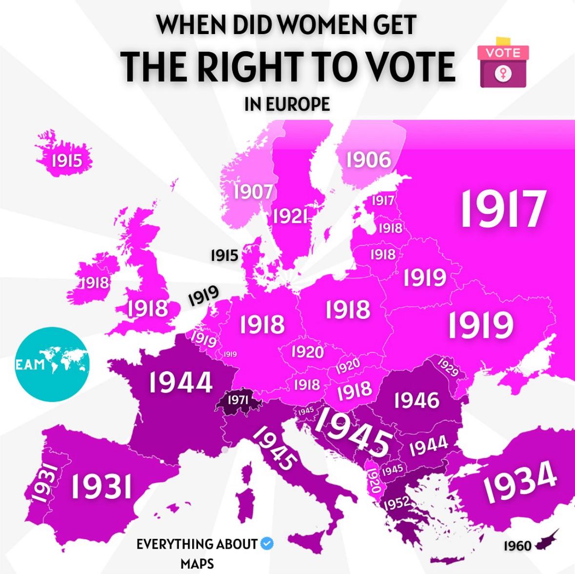
Voting Rights for Women in Europe Map
The map titled "When Did Women Get The Right To Vote in Europe" provides a comprehensive overview of the timeline of wom...
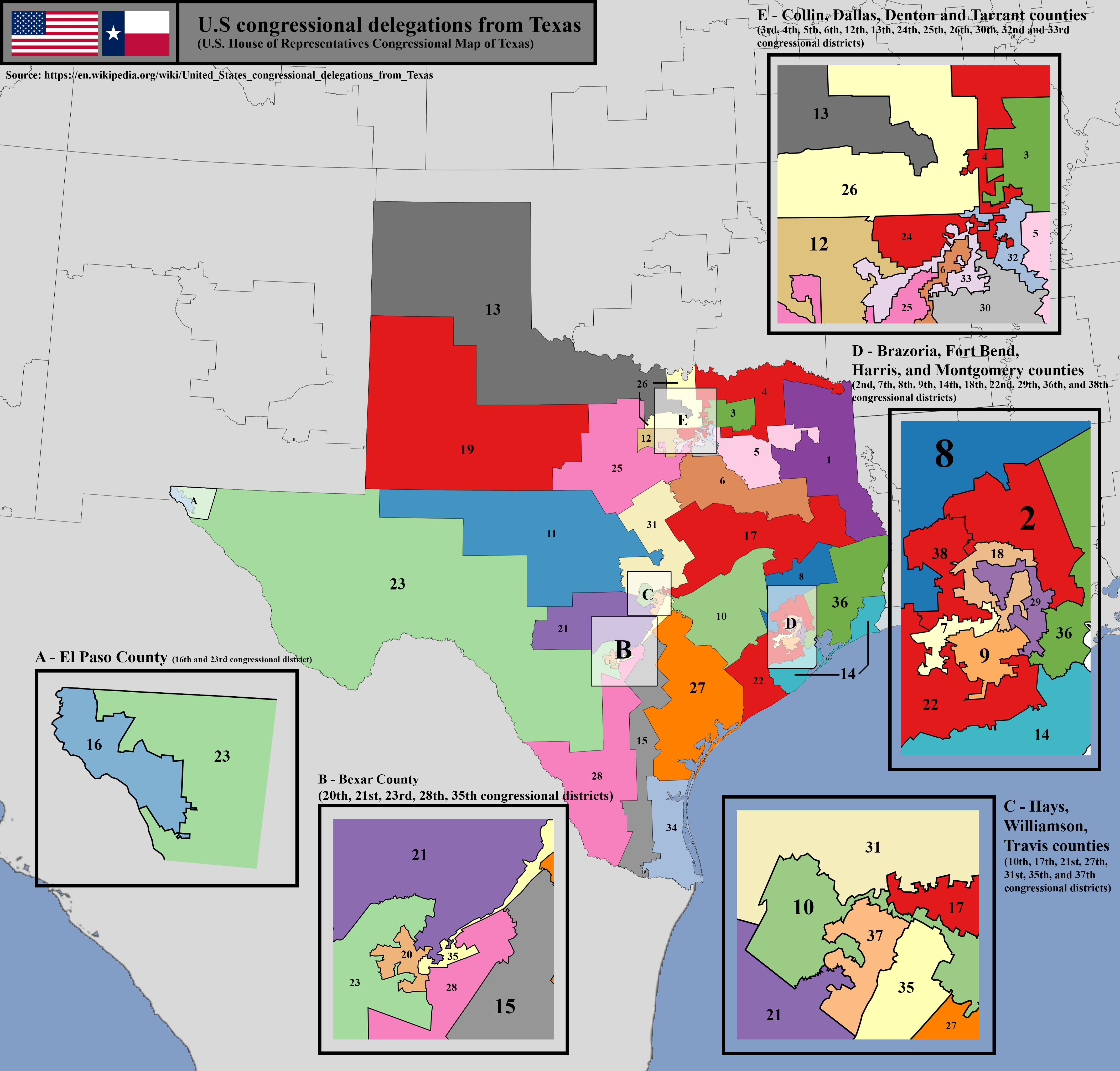
U.S. House of Representatives Congressional District Map of Texas
The U.S. House of Representatives congressional district map of Texas visually represents the boundaries of each congres...
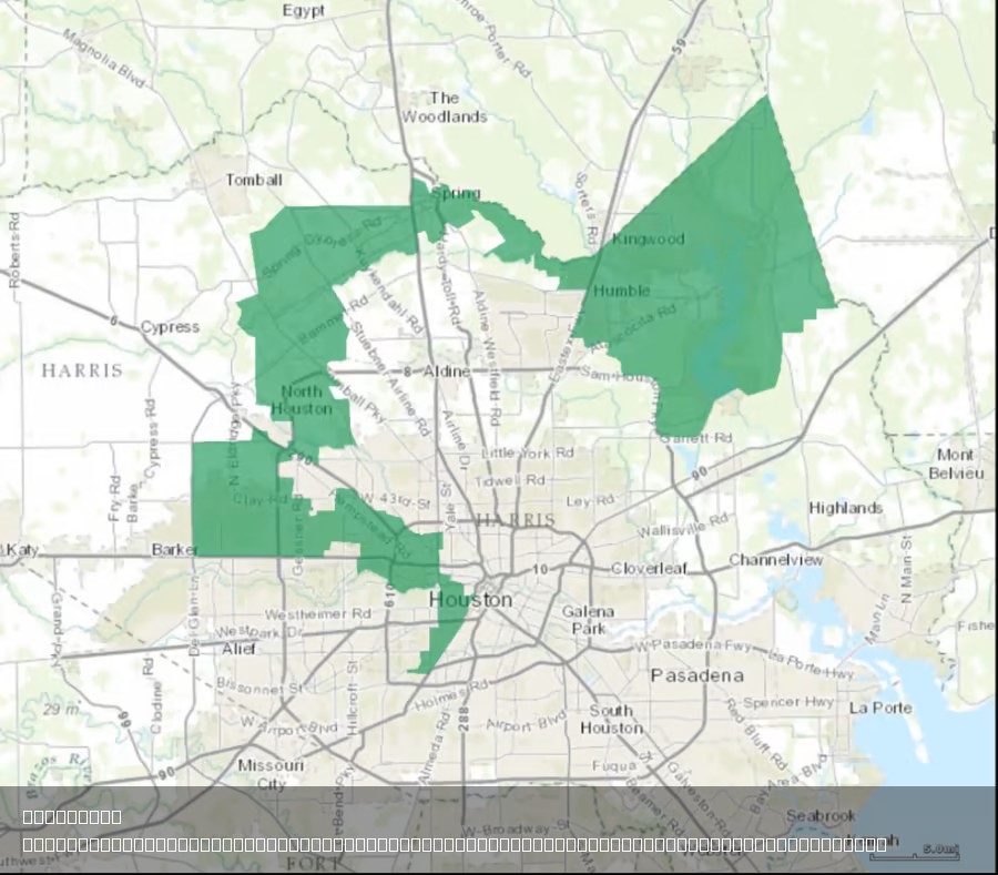
Texas's 2nd Congressional District Map Analysis
The provided map illustrates the geographical boundaries of Texas’s 2nd Congressional District, a region that has been t...
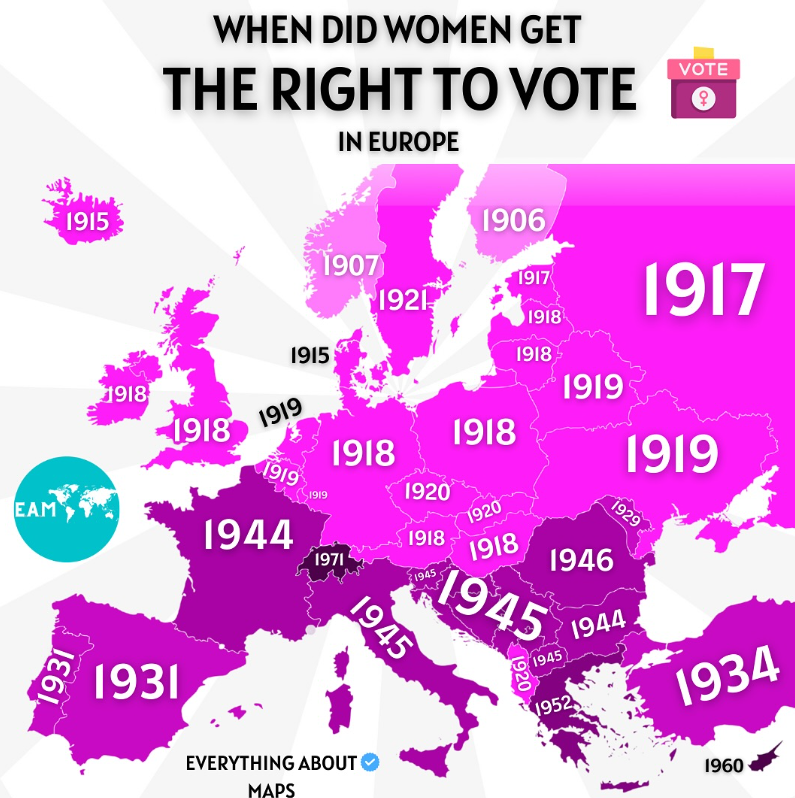
Women's Voting Rights Timeline Map in Europe
The map titled "When did women get the right to vote in Europe" provides a chronological overview of when women gained s...
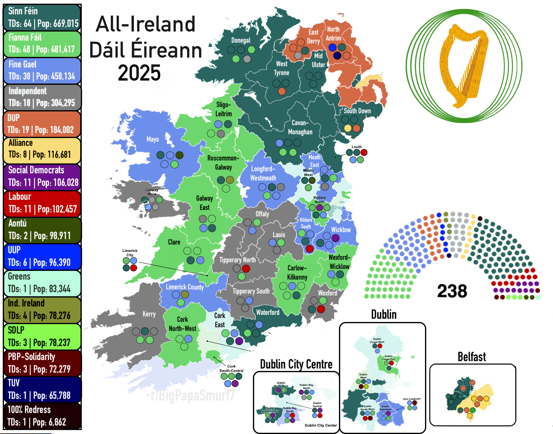
All-Ireland Parliament Constituency Map 2025
The "All-Ireland Parliament (Dáil Éireann) 2025" map visualizes the proposed constituencies for the Irish Parliament bas...
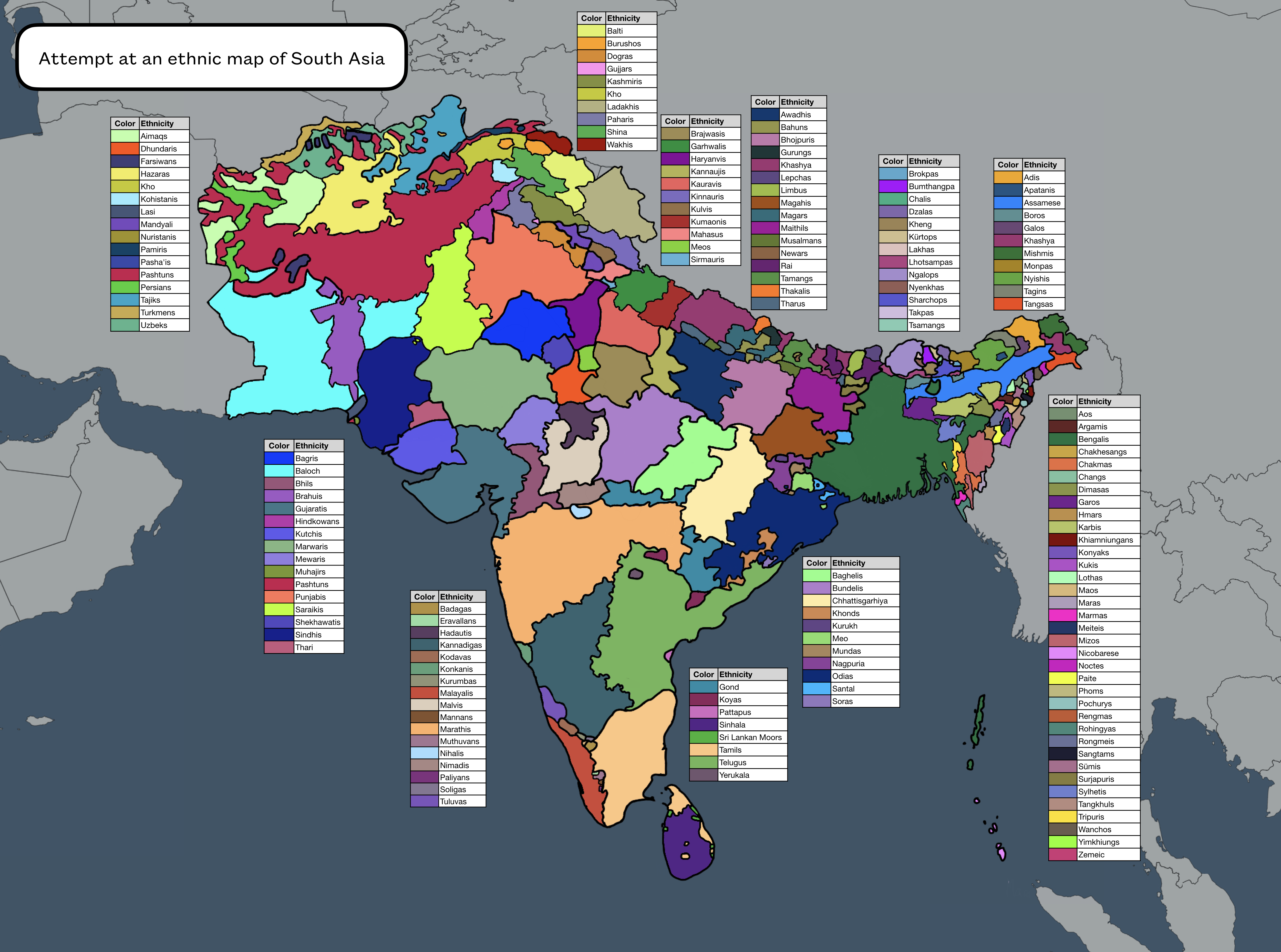
Ethnic Map of South Asia
This ethnic map of South Asia provides a visual representation of the diverse cultural and ethnic groups inhabiting the ...