norway Maps
11 geographic visualizations tagged with "norway"
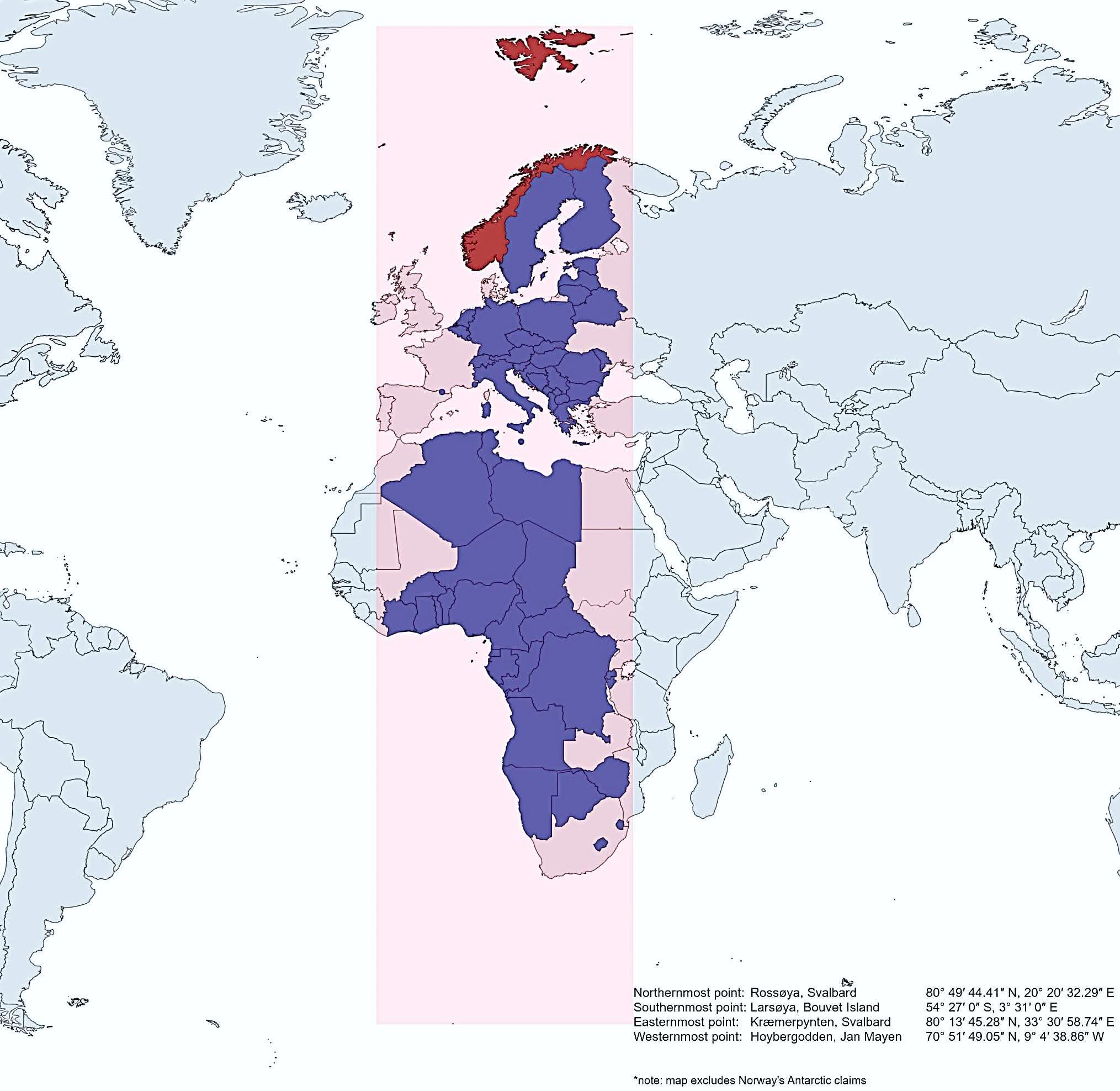
Map of Norway's Geographic Extent Compared to Other Countries
This map vividly illustrates how Norway extends further north, south, east, and west than several other countries, showc...
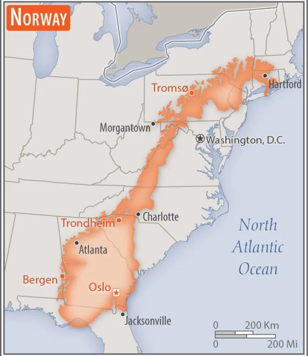
Norway Overlaid on the US Map
This intriguing map overlays the geographical boundaries of Norway onto the continental United States, providing a uniqu...
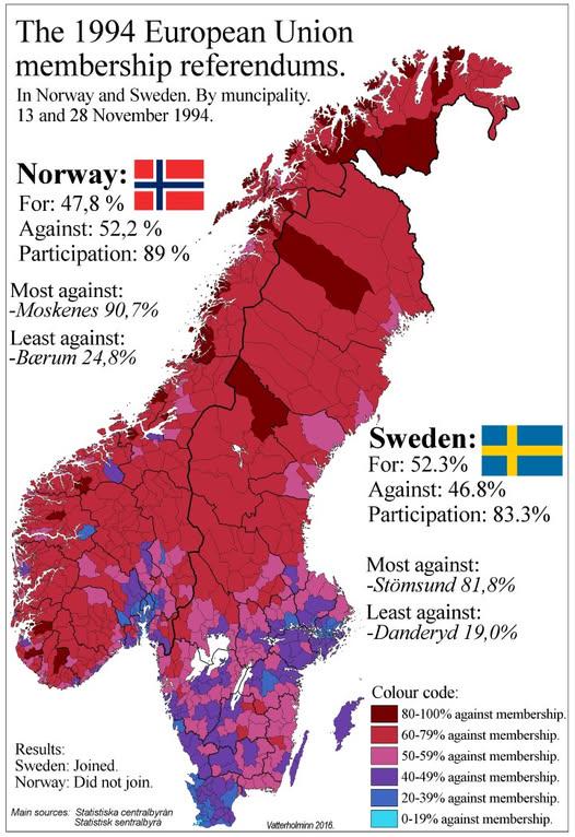
1994 Swedish and Norwegian EU Referendum Results Map
The "1994 Swedish and Norwegian EU Referendum Results By Municipality" map presents a detailed view of how different mun...
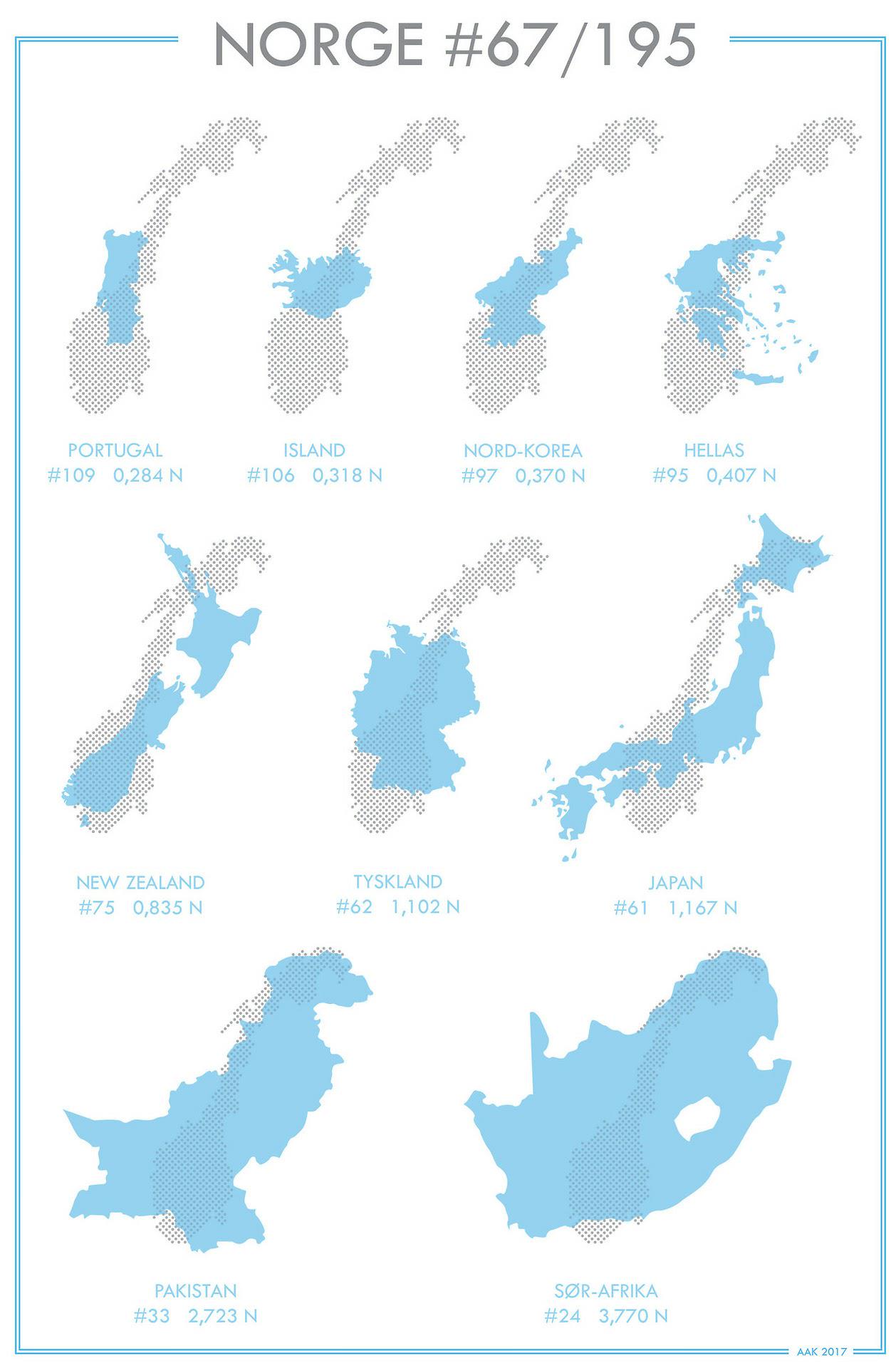
Norway Compared to Other Countries Map
The "Norway Compared to Other Countries Map" provides a visual representation of various attributes that define Norway i...
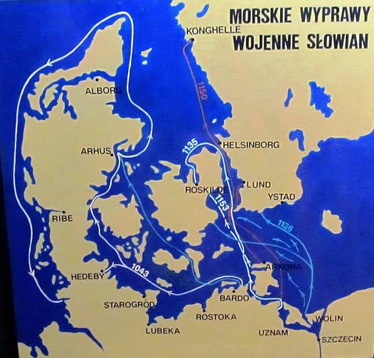
Map of Slavic Raids on Denmark Norway and Sweden
Interestingly, the motivations behind these Slavic incursions varied. While many were driven by the desire for plunder a...
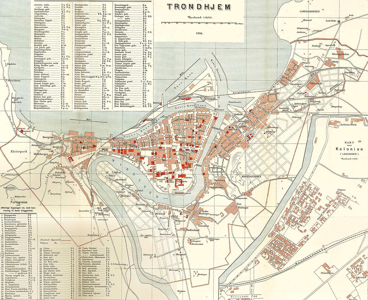
Map of Trondheim Norway from 1898
Interestingly, Trondheim’s location by the Trondheim Fjord had a profound impact on its development. The fjord provided ...
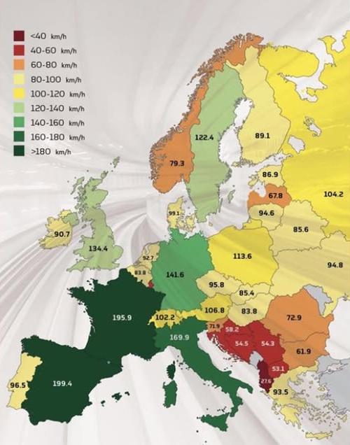
Average Train Speeds in Europe Map
This map visualizes the average train speeds in kilometers per hour (kph) across various countries in Europe, providing ...
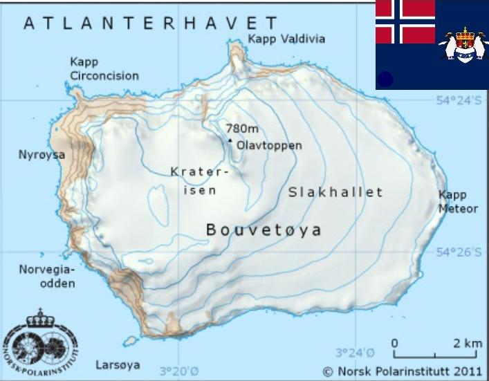
Geographic Map of Bouvetøya, Norway
This geographic map of Bouvetøya provides a detailed representation of this remote island, which is one of the world's m...
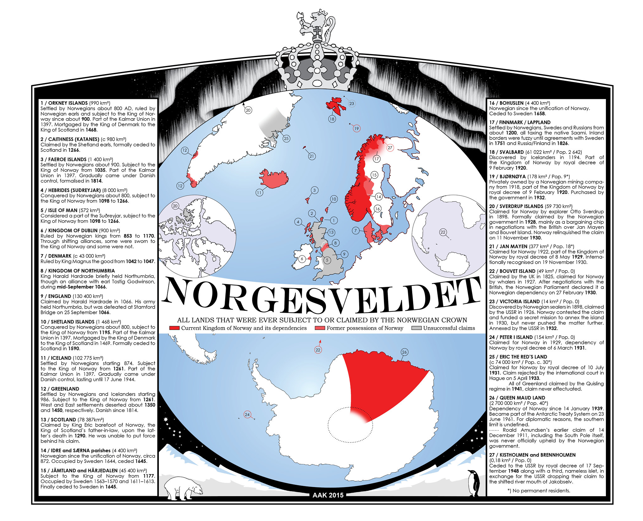
Map of Everything that was Ever Norwegian
This captivating map titled "Everything that was ever Norwegian" presents a comprehensive visualization of Norway's cult...
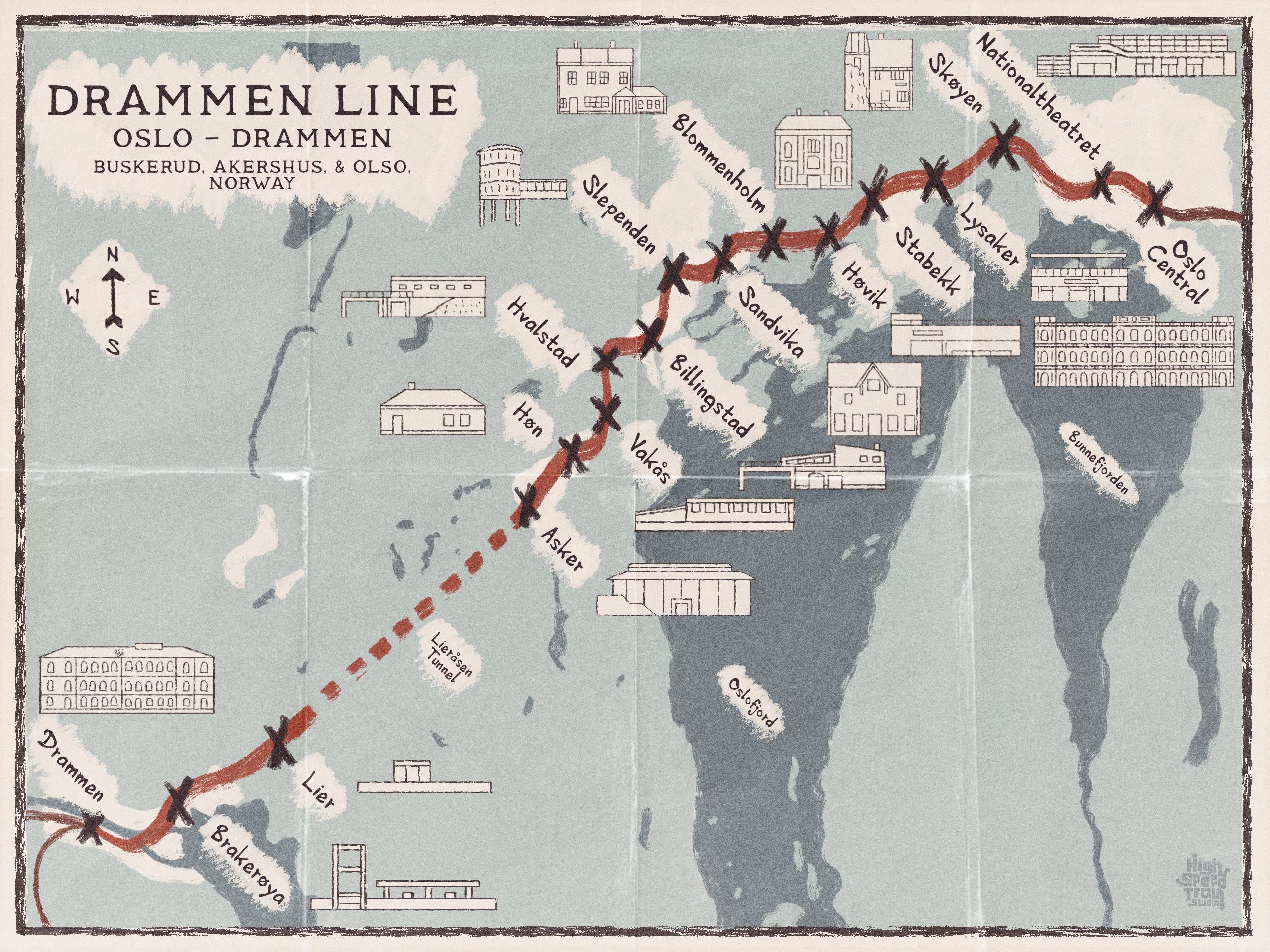
Drammen Line Map of Norway
The map titled "A Map of the Drammen Line, Norway" vividly illustrates the railway line that stretches from Oslo to Dram...
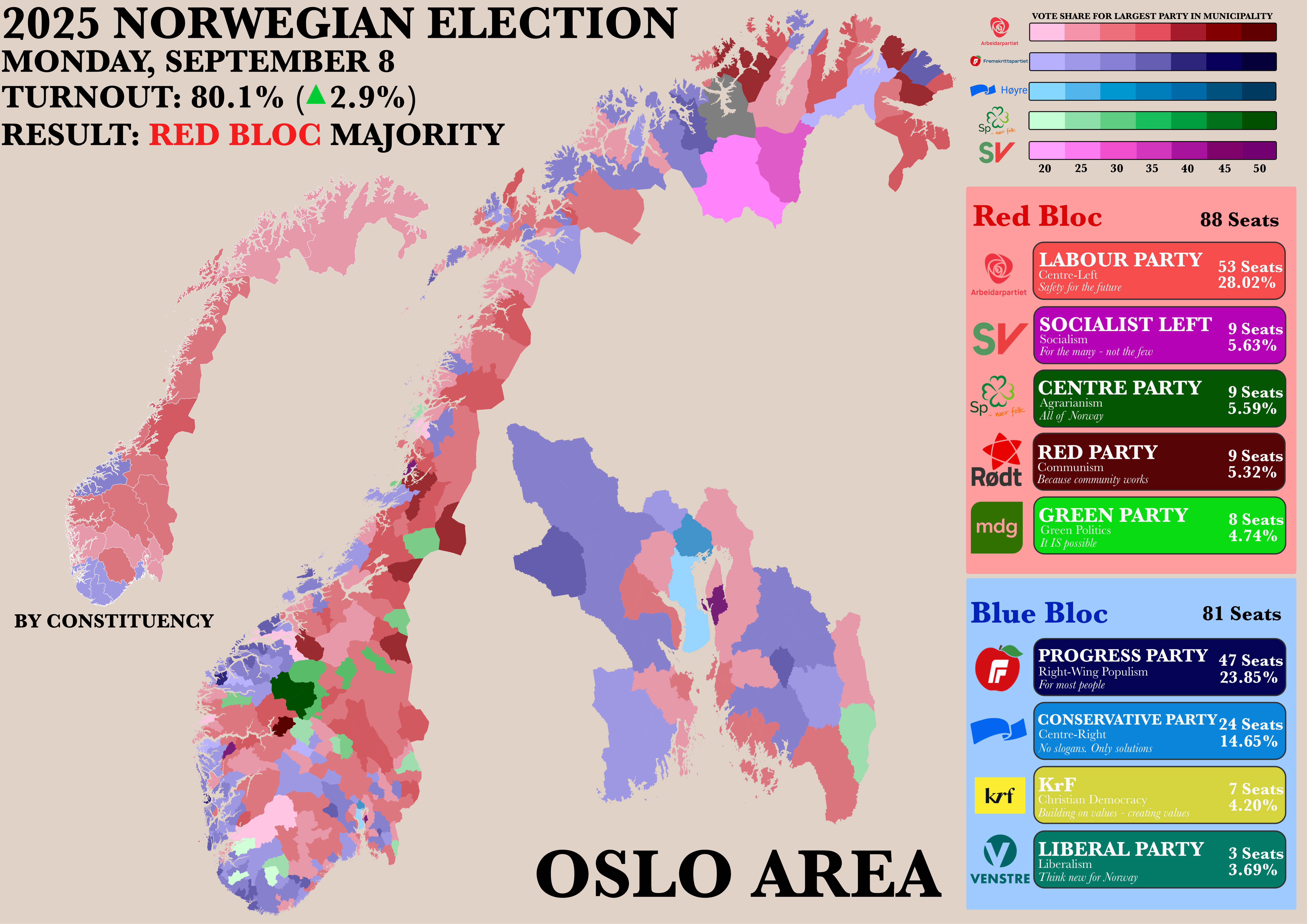
Norwegian Parliamentary Election Results by Municipality Map
The "Poster of the Recent Norwegian Parliamentary Election by Municipality" map provides a detailed visualization of the...