nation-states Maps
4 geographic visualizations tagged with "nation-states"

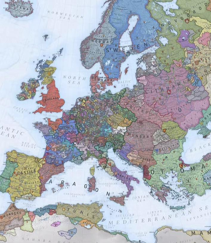
Political Map of Europe in the 1400s
The map titled "Europe in the 1400s" provides a detailed political overview of the continent during a pivotal period in ...
👁 24📅 10/26/2025

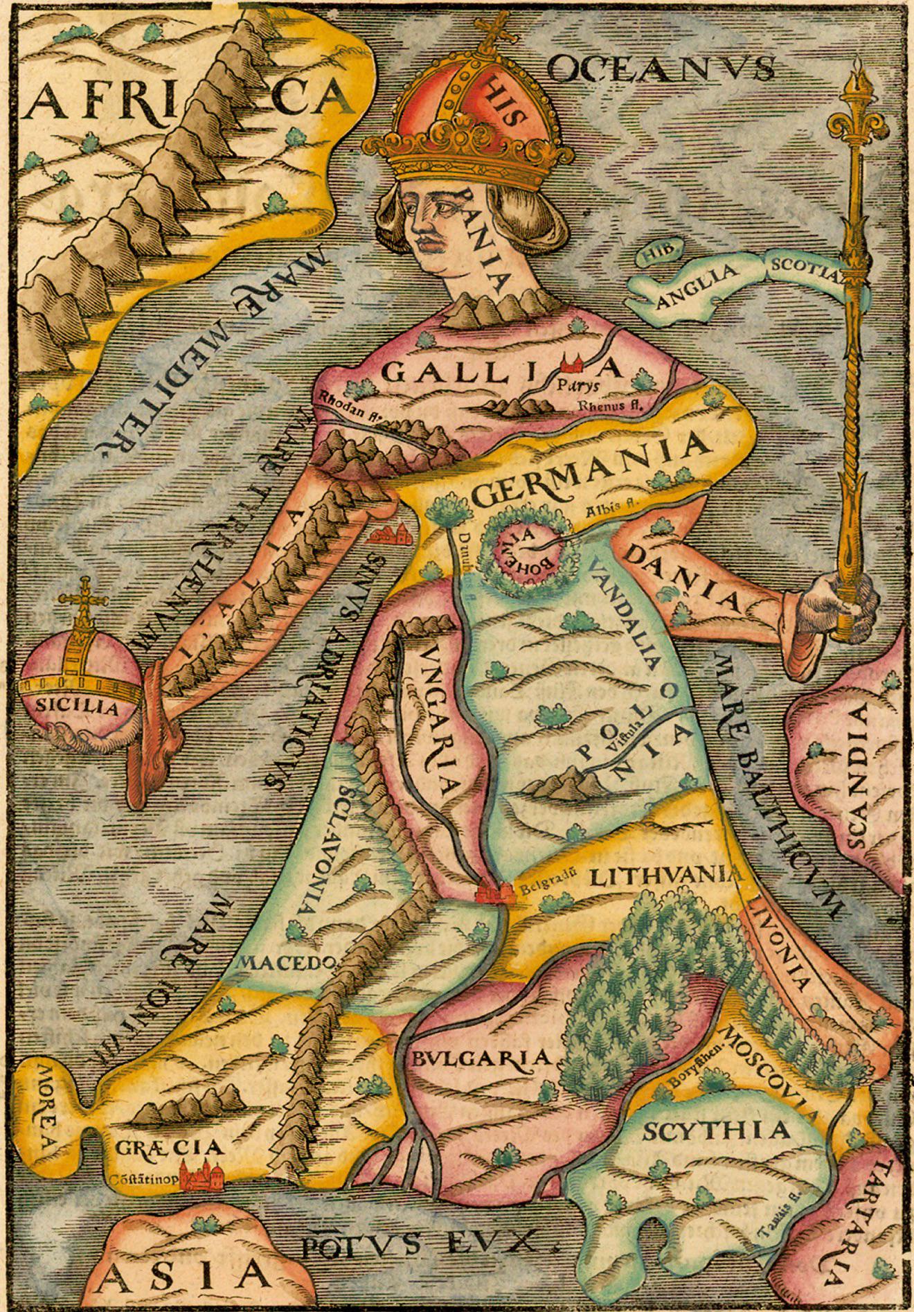
Geopolitical Map of Europe 1588
The "Europa Regina" map from the 1588 edition of Cosmographia presents a unique depiction of Europe during a transformat...
👁 6📅 10/30/2025

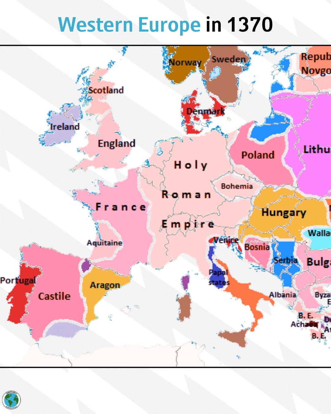
Political Map of Western Europe in 1370
...
👁 44📅 9/28/2025

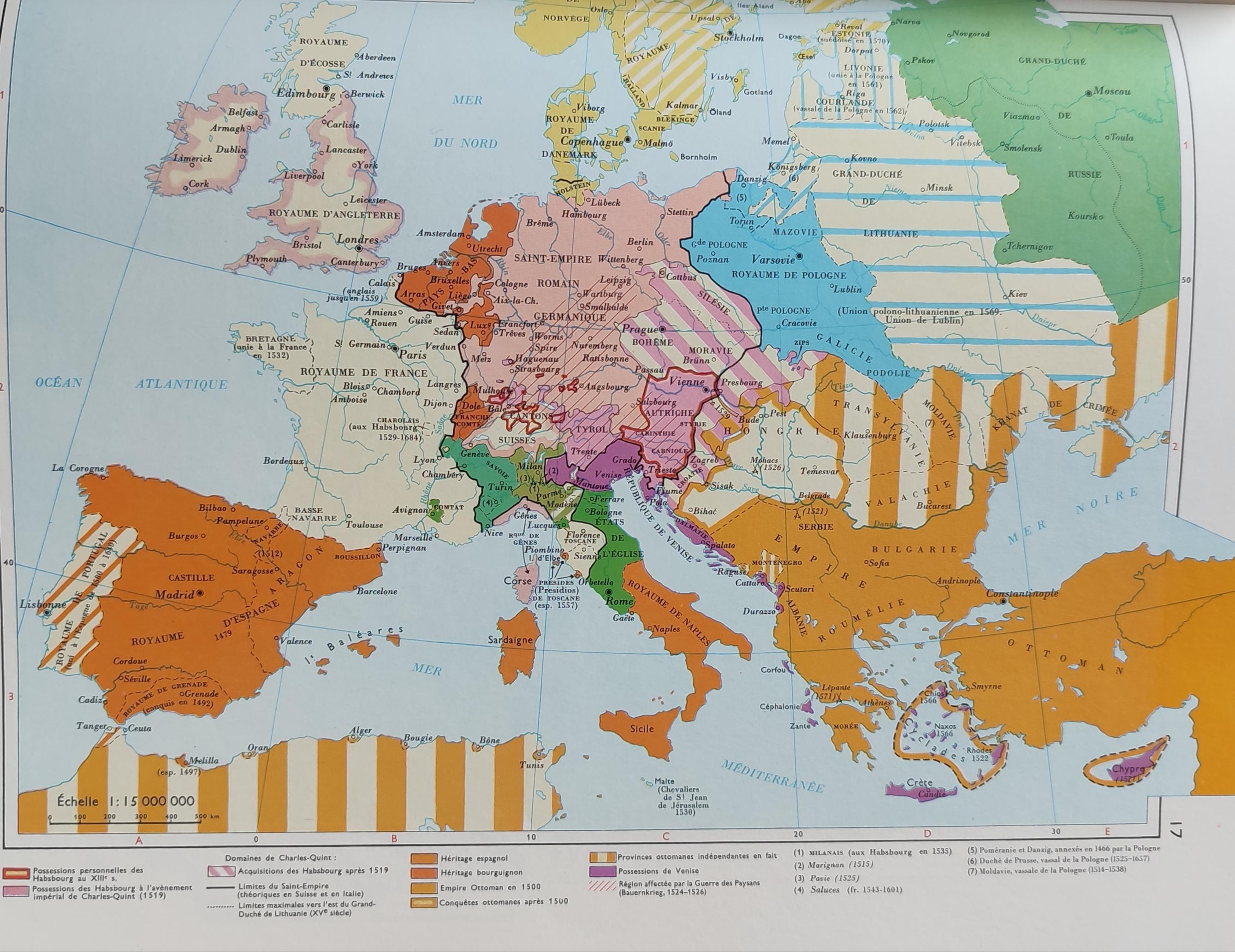
Simplified Map of Europe in the 16th Century
The 'Very Simplified Map of Europe in the 16th Century' presents a bird's-eye view of a continent in the midst of profou...
👁 92📅 8/27/2025