israel Maps
18 geographic visualizations tagged with "israel"
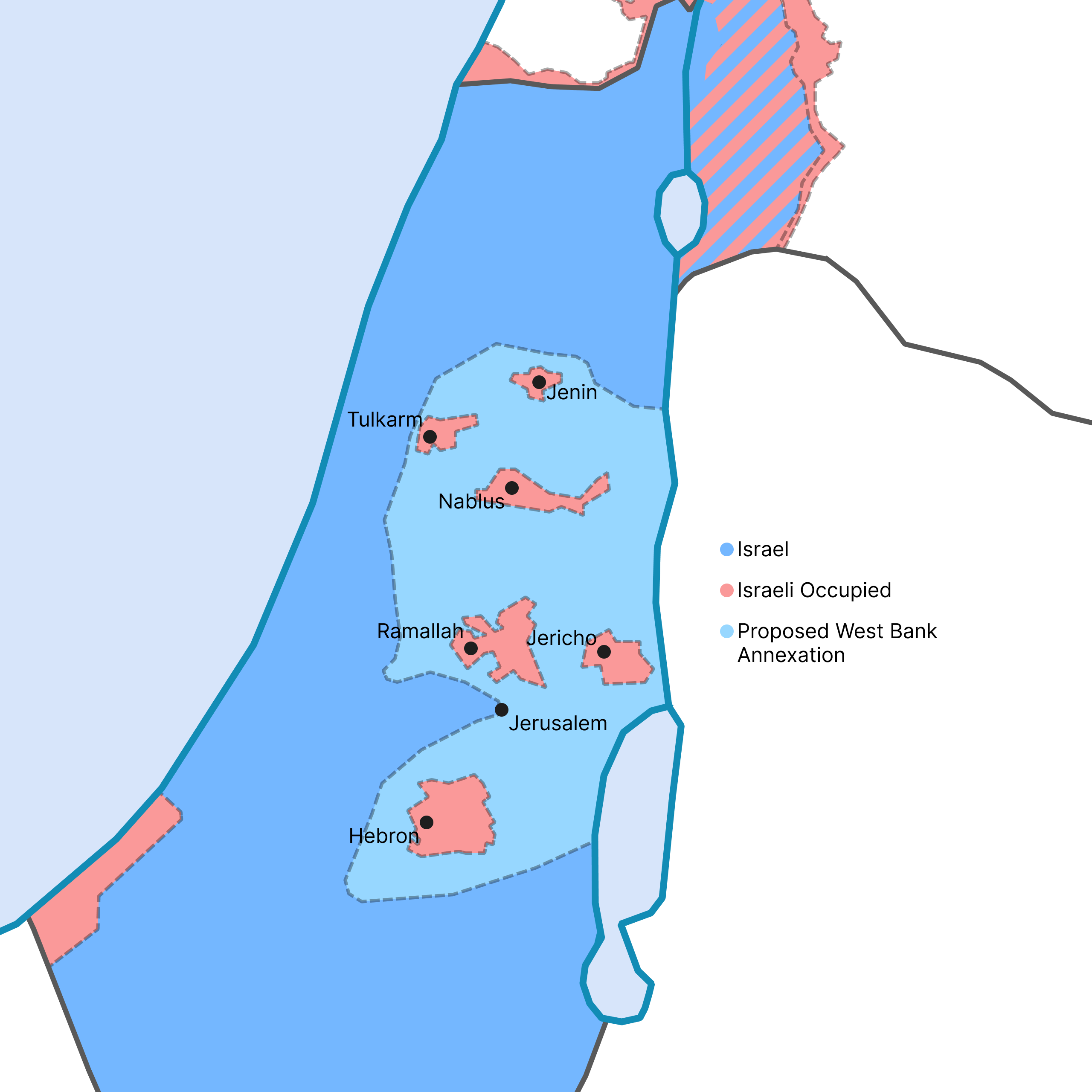
West Bank Annexation Proposal Map
This map visualizes the potential outcome of the Israeli government's recent proposal to annex a significant portion of ...
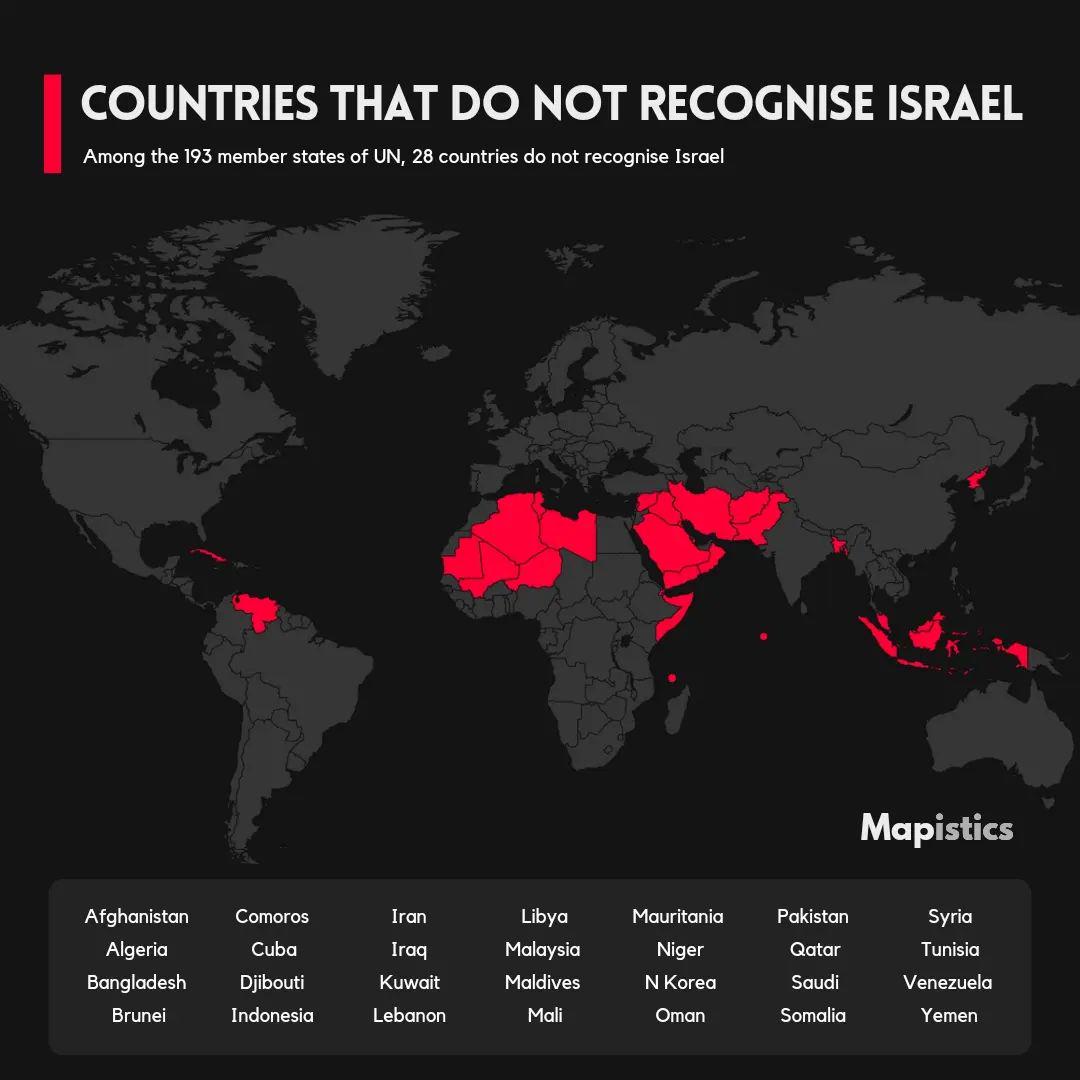
Countries That Do Not Recognize Israel Map
This map visually represents the countries that do not recognize the state of Israel. It highlights the geopolitical lan...
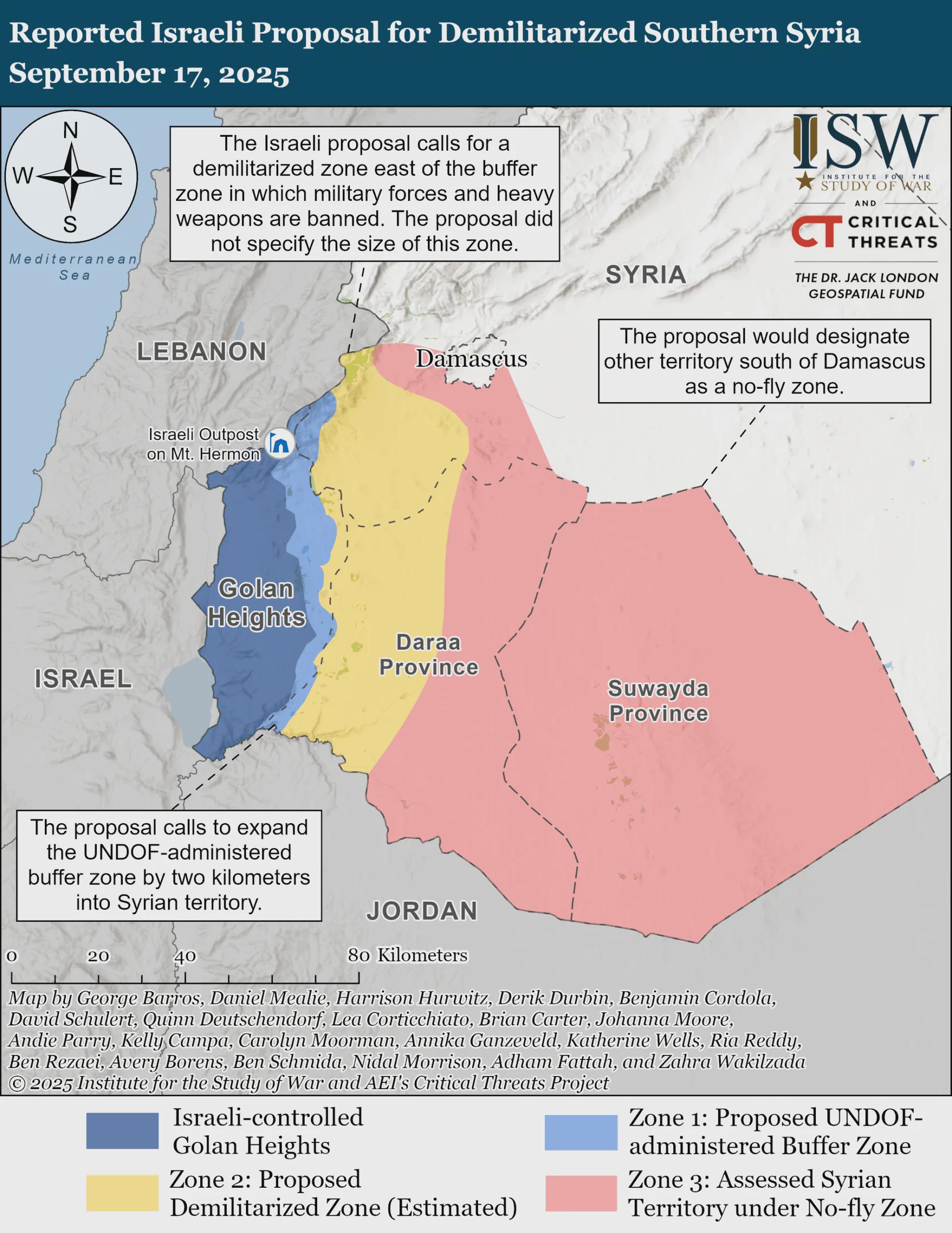
Demilitarized Southern Syria Proposal Map
The visualization titled "Reported Israeli Proposal for Demilitarized Southern Syria, September 17, 2025" provides a geo...
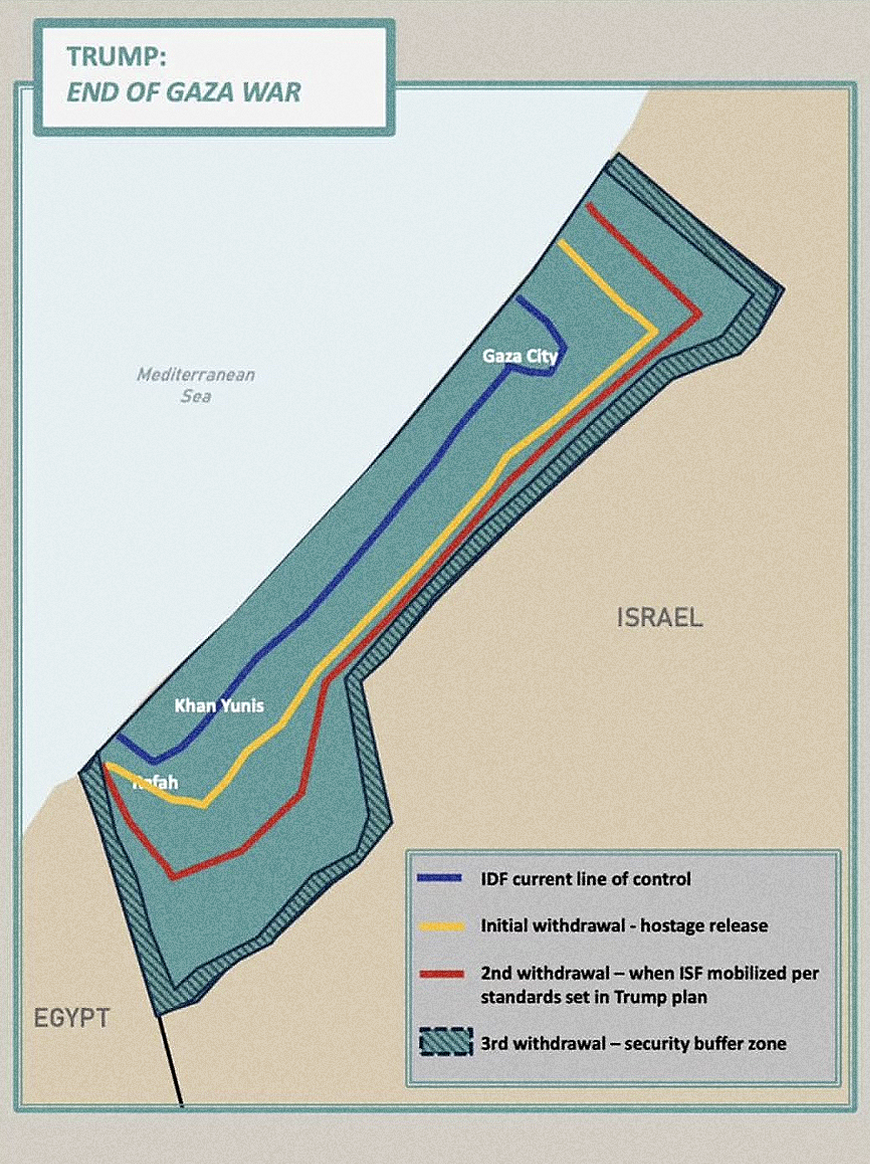
Trump's Gaza Withdrawal Map Analysis
The "Trump’s Gaza Withdrawal Map" published by the White House visualizes the proposed territorial changes and withdrawa...
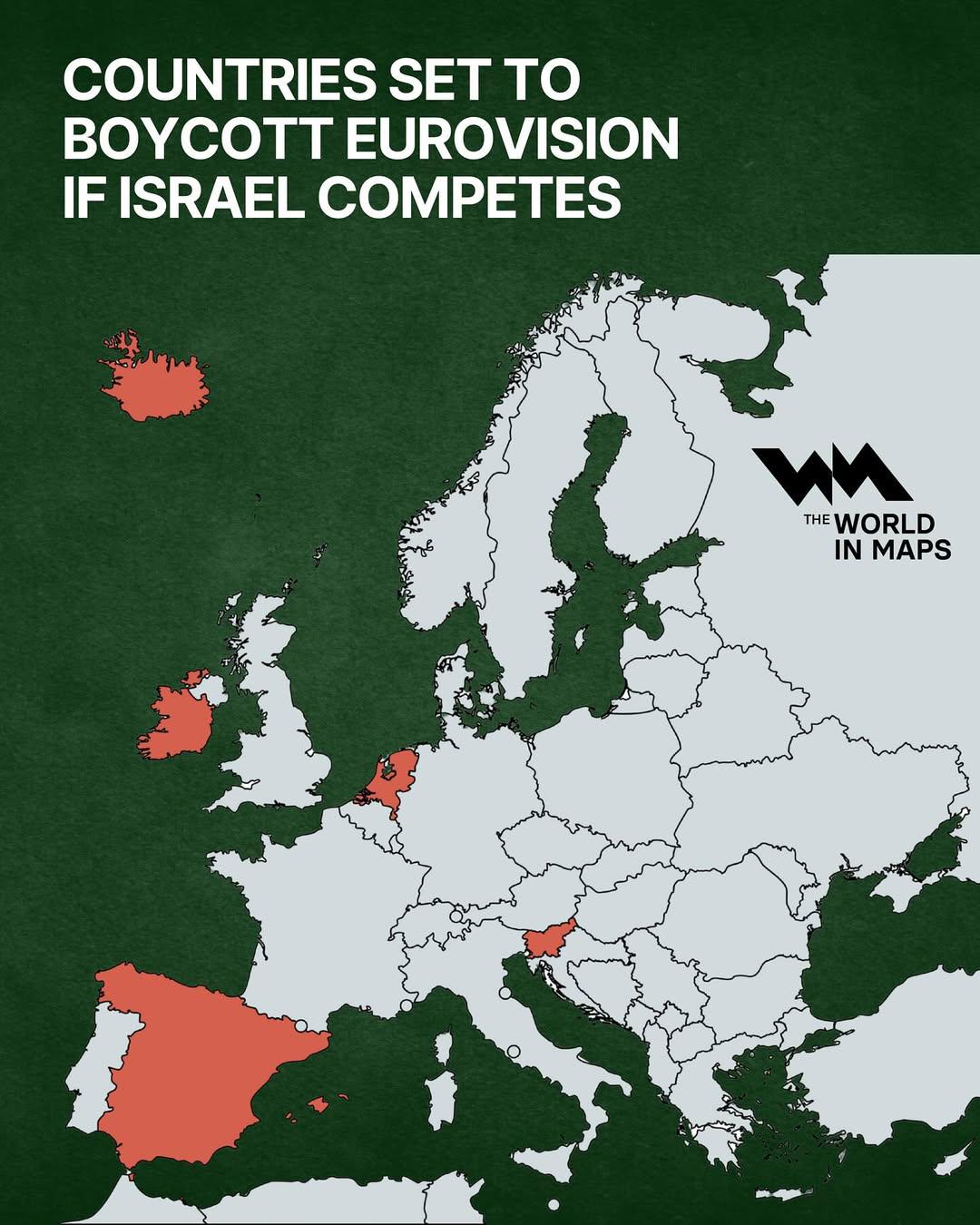
Boycotting Countries Map for Eurovision Israel
The visualization titled "Countries Set to Boycott Eurovision if Israel Competes" provides a geographical overview of th...
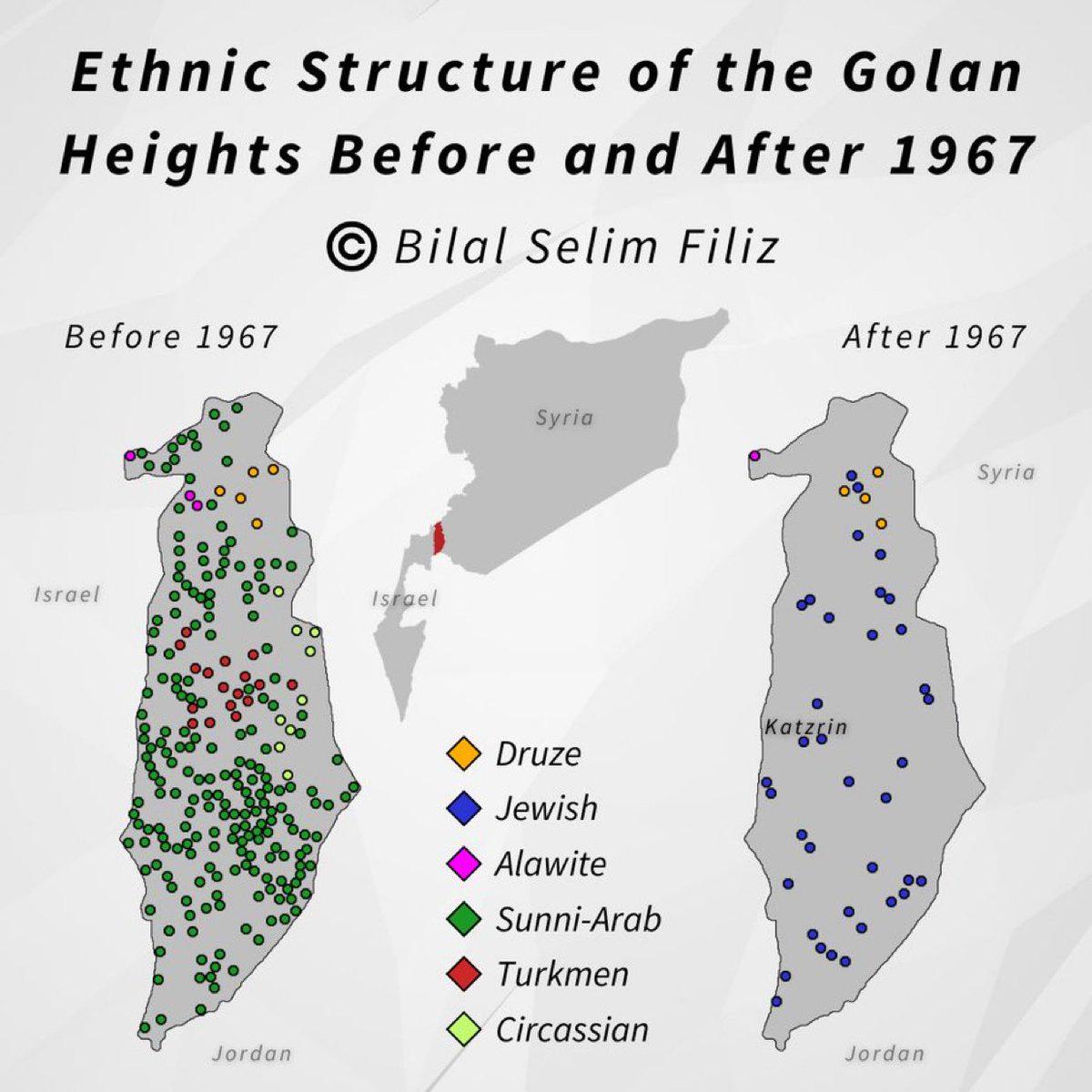
Golan Heights Historical Map Overview
The visualization titled "Golan Heights, then and now" presents a compelling comparison of the Golan Heights region, hig...
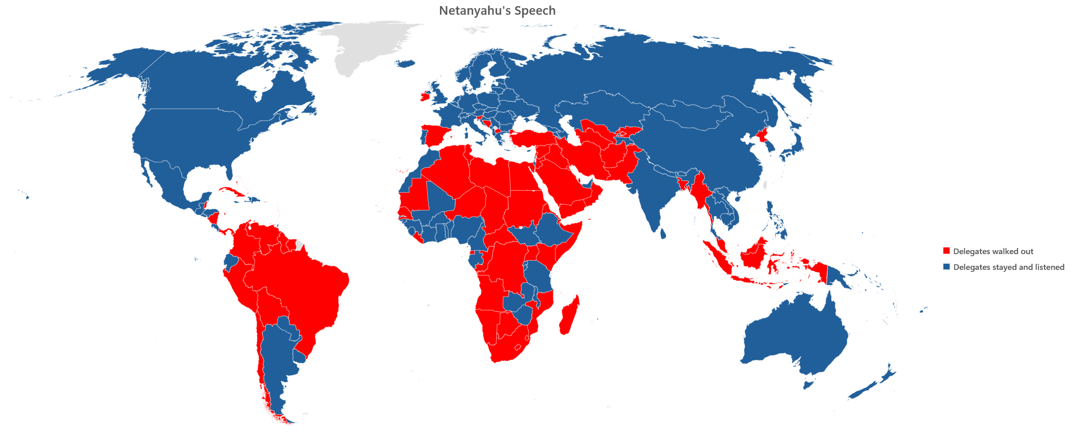
Netanyahu's Speech at the General Assembly Map
The visualization titled "Netanyahu's Speech at the General Assembly - 26th of September 2025" provides an overview of t...
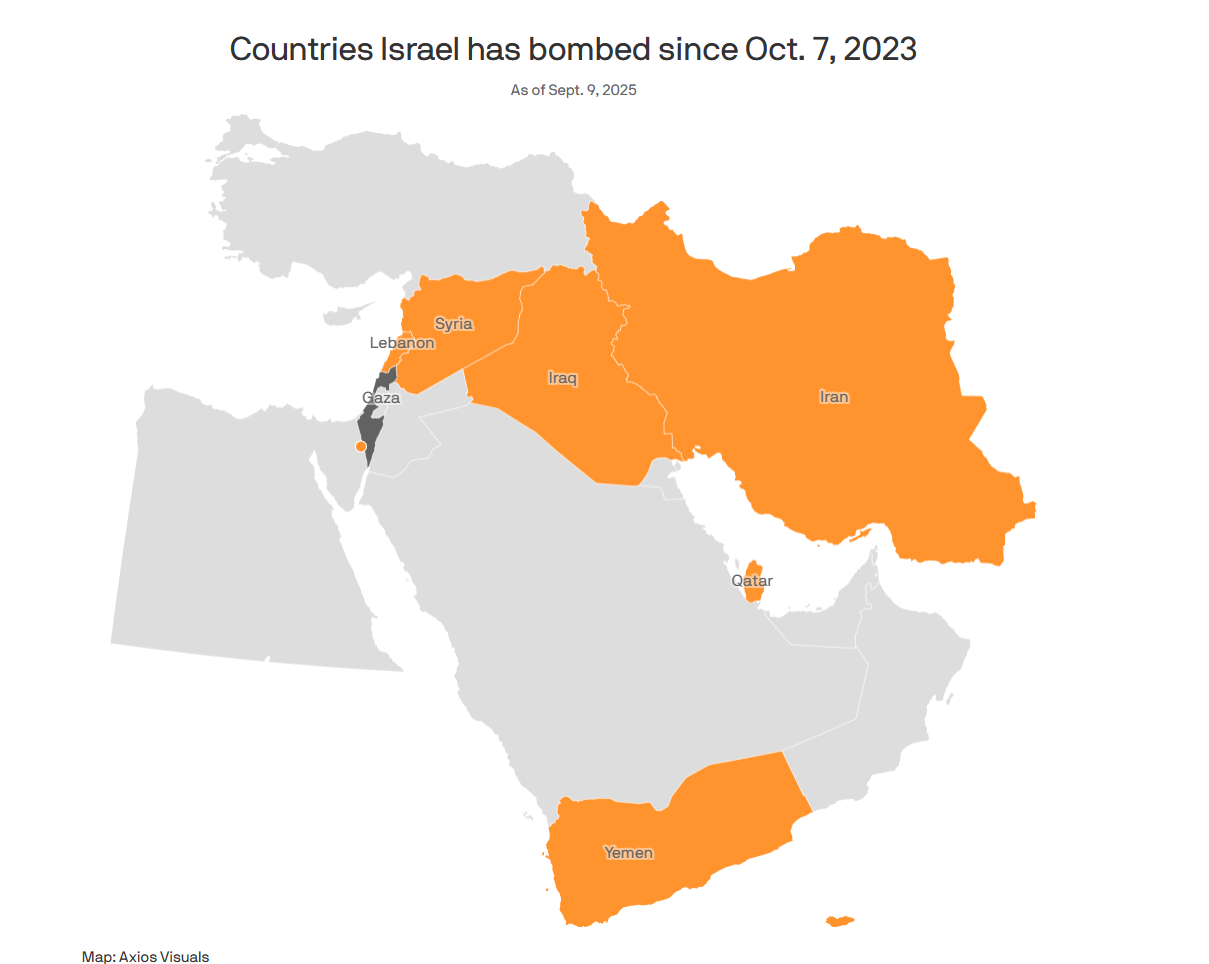
Map of Countries Bombed by Israel Since 7/10
...
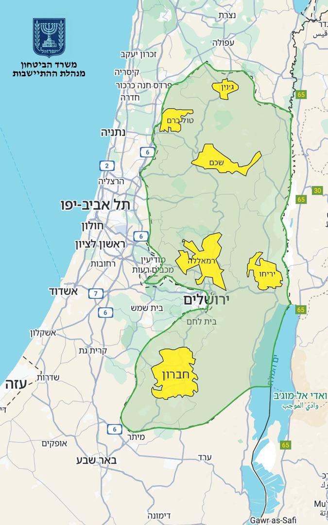
Israel Annexation Map of 82% West Bank
The map presented by Finance Minister Bezalel Smotrich highlights a proposed annexation plan that seeks to incorporate 8...
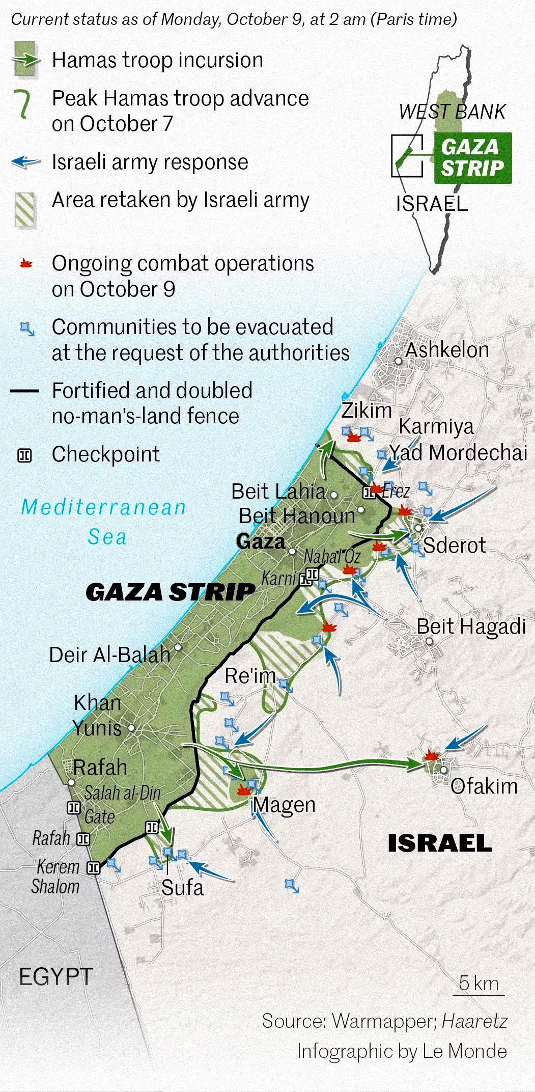
Map of Operation Al-Aqsa Flood Attacks Overview
As tensions escalated, this map serves as a crucial tool in understanding the geographical dynamics of the conflict. It ...
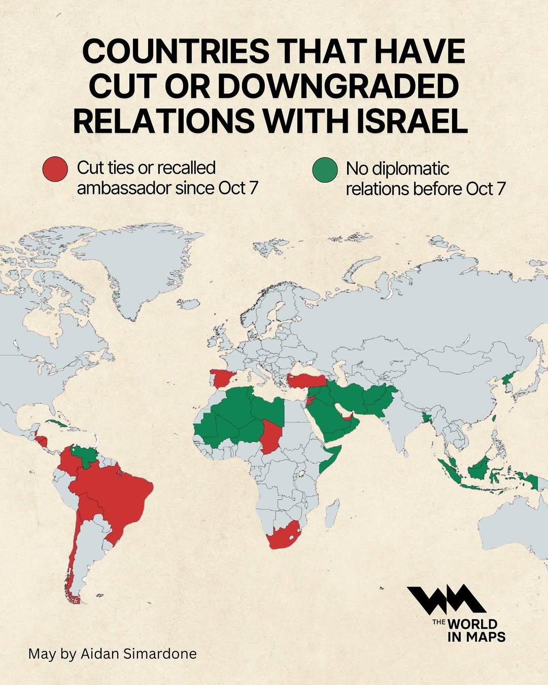
Countries That Have Cut or Downgraded Relations with Israel Map
This map visualizes the countries that have recently cut or downgraded their diplomatic relations with Israel. It highli...
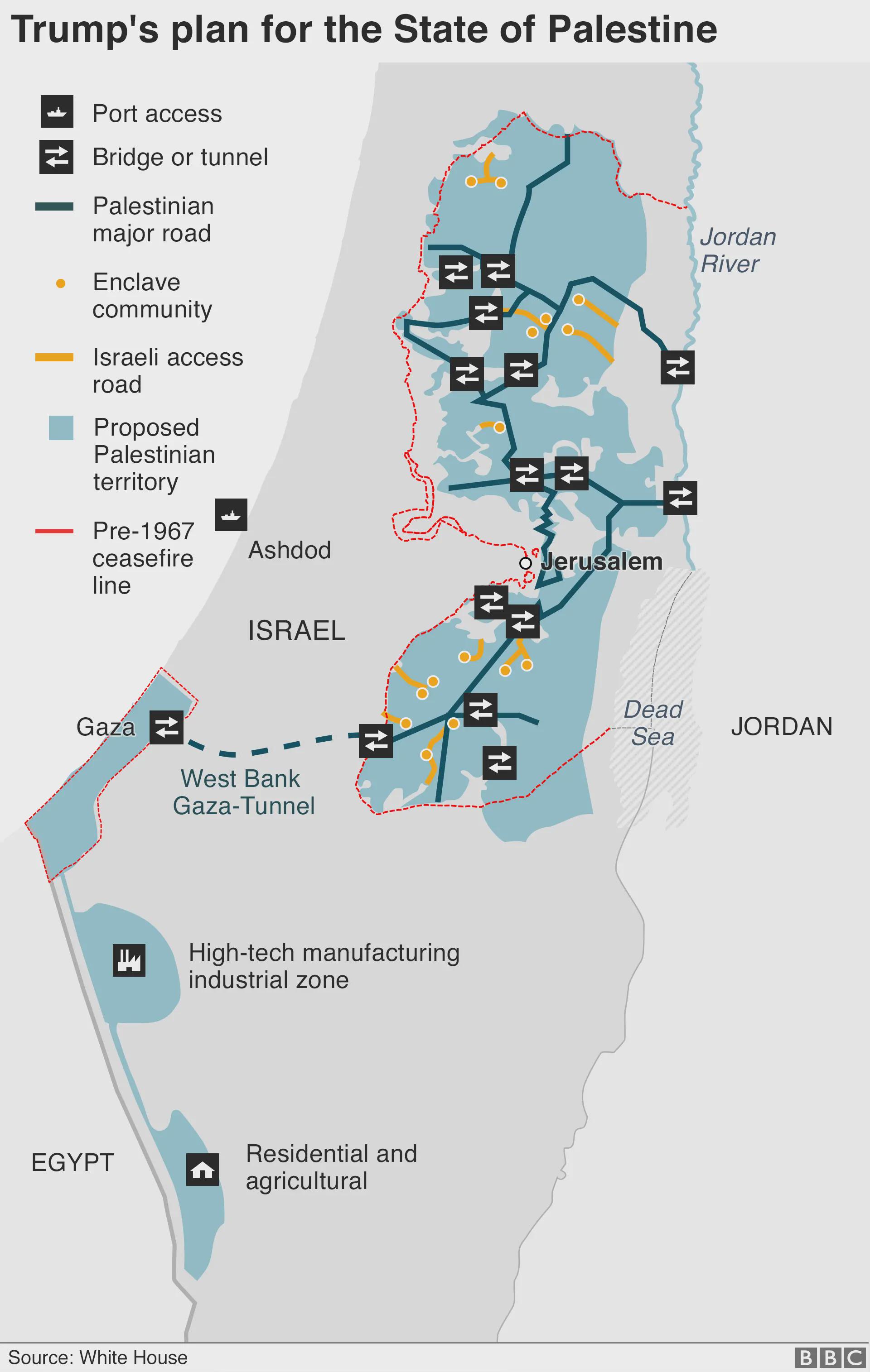
Trump's Plan for the State of Palestine Map
The map titled "Trump's Plan for the State of Palestine 2020" presents a proposed framework for the future of Palestine ...
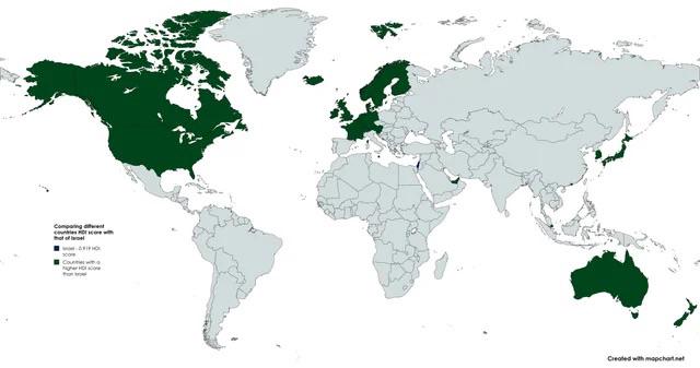
Countries with Higher HDI than Israel Map
The "Countries with Higher HDI than Israel Map" presents a visual representation of nations that boast a higher Human De...
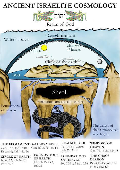
Map of Locations in the Old Testament
This map titled "The World According to the Old Testament" presents a geographical representation of locations mentioned...
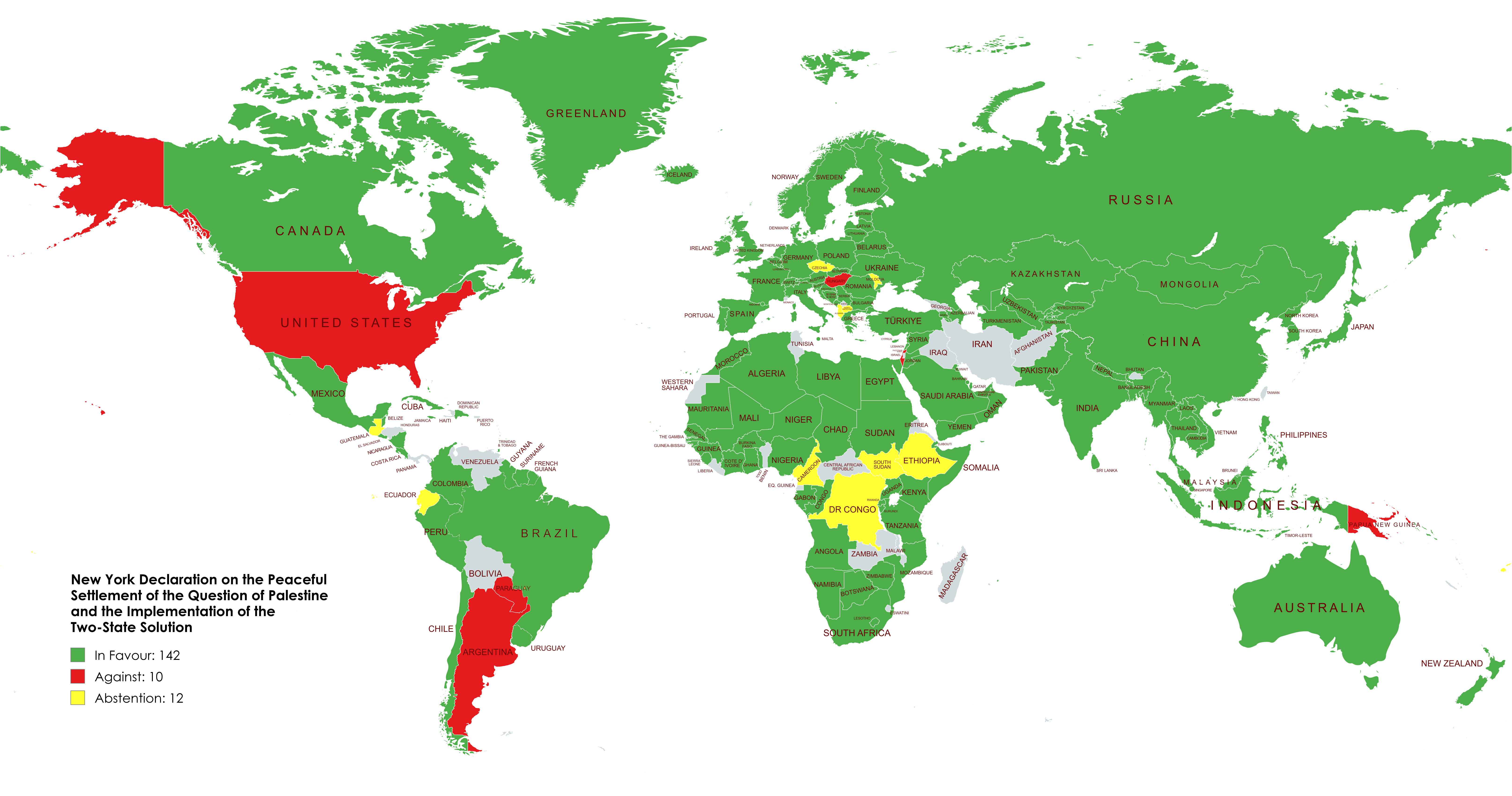
UN Vote Map on New York Declaration for Two-State Solution
The map visualizes the voting patterns of UN member states regarding the New York Declaration for a two-state solution b...
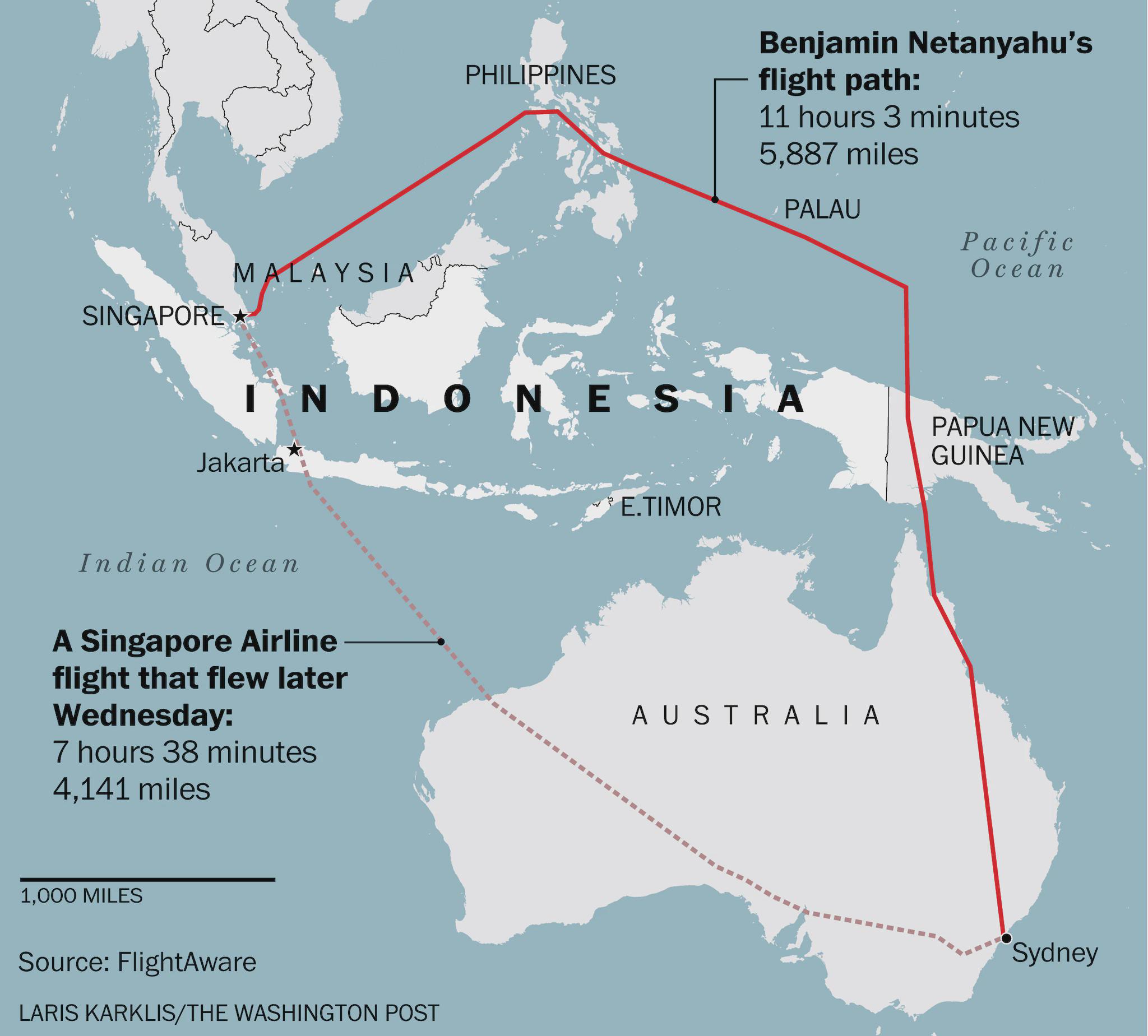
Flight Route Map of Israeli PM Avoiding Indonesia
This map visually represents the flight path taken by Israeli Prime Minister Benjamin Netanyahu during his journey from ...
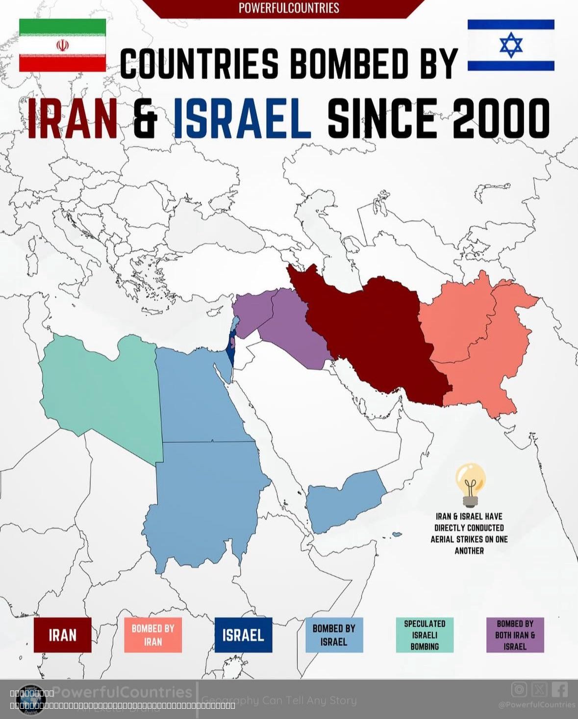
Countries Bombed by Israel and Iran Since 2000 Map
The map titled "Countries Bombed by Israel and Iran Since 2000" provides a visual representation of the nations that hav...
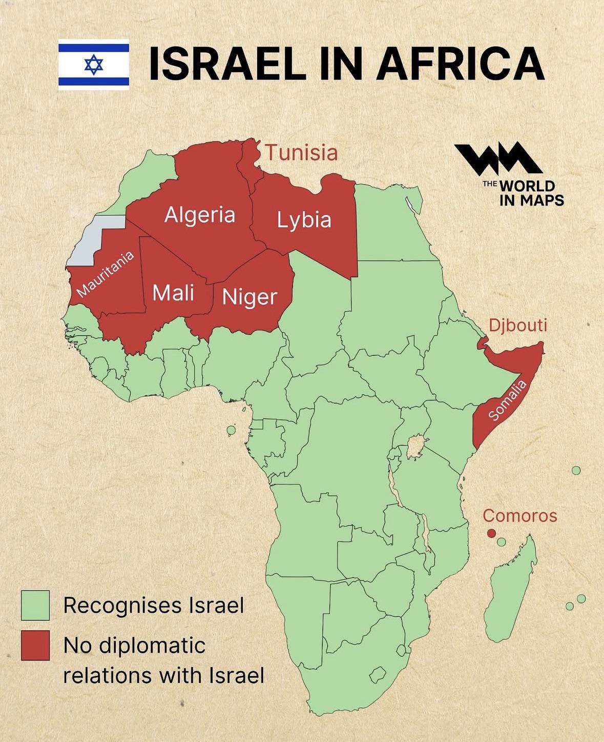
Diplomatic Relations of Israel in Africa Map
The "Diplomatic Relations of Israel in Africa Map" visually represents the complex web of diplomatic ties that Israel ma...