environmental policy Maps
13 geographic visualizations tagged with "environmental policy"
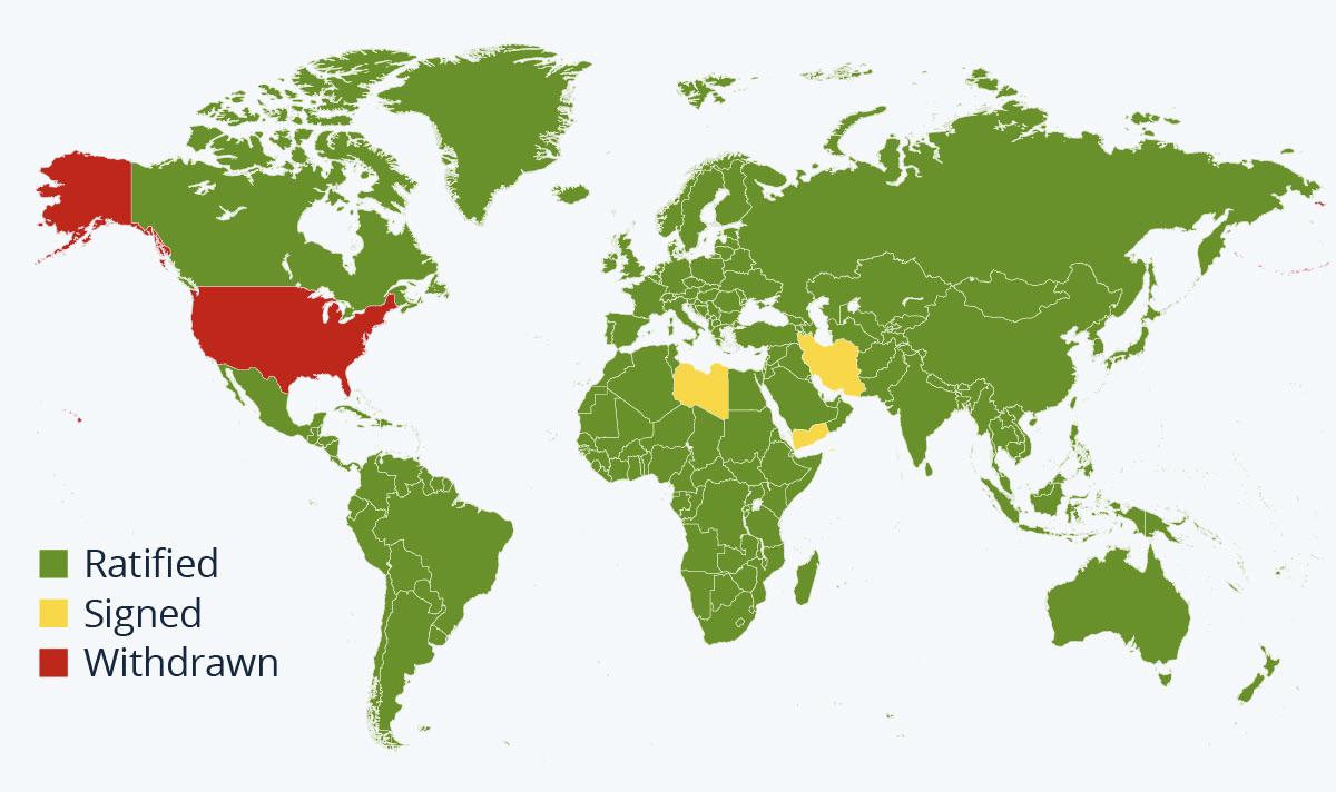
Map of Countries in the Paris Agreement
The visualization titled "A Map Of Every Country That Is In The Paris Agreement" succinctly illustrates the global commi...
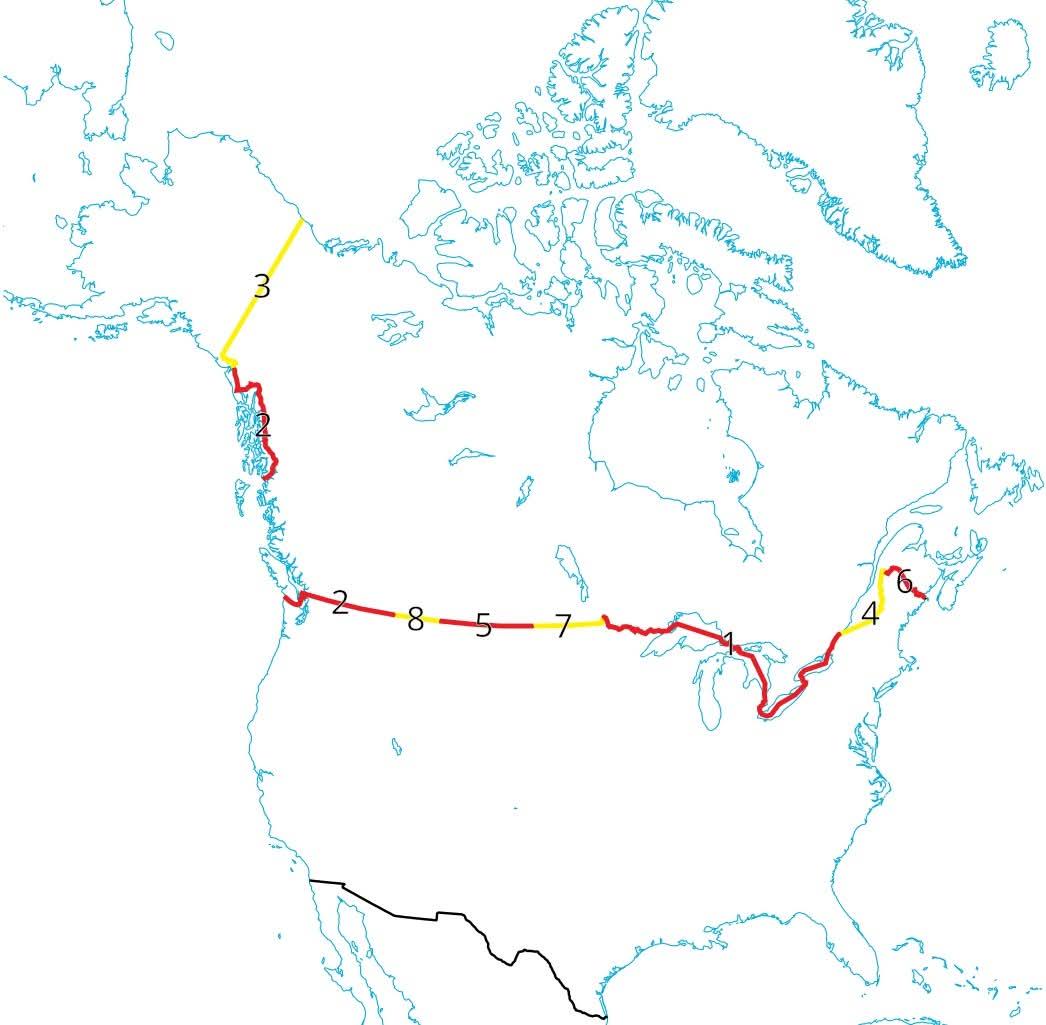
Ontario USA Border Map: Land vs Water
The visualization titled "Ontario has the longest border with the USA, but of the 2700+kms less than 1km of that is actu...
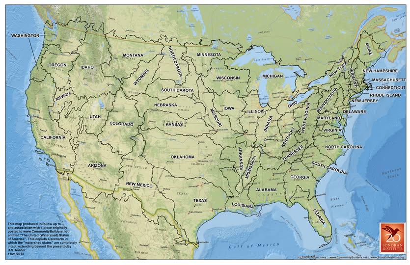
Watershed Boundaries Map Proposal for the U.S.
Understanding the significance of watersheds begins with recognizing their hydrological cycle. When it rains, water does...
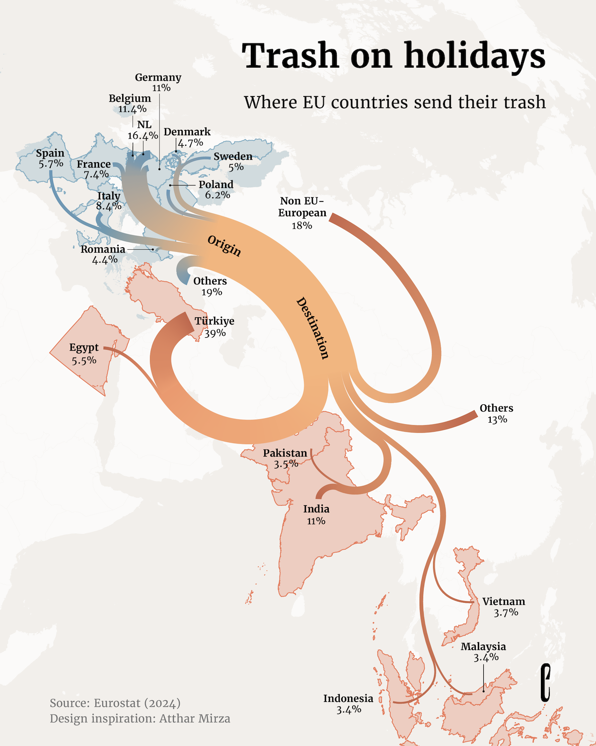
Map of Where EU Countries Send Their Trash
The map titled 'Where EU Countries Send Their Trash' provides a visual representation of the waste management practices ...
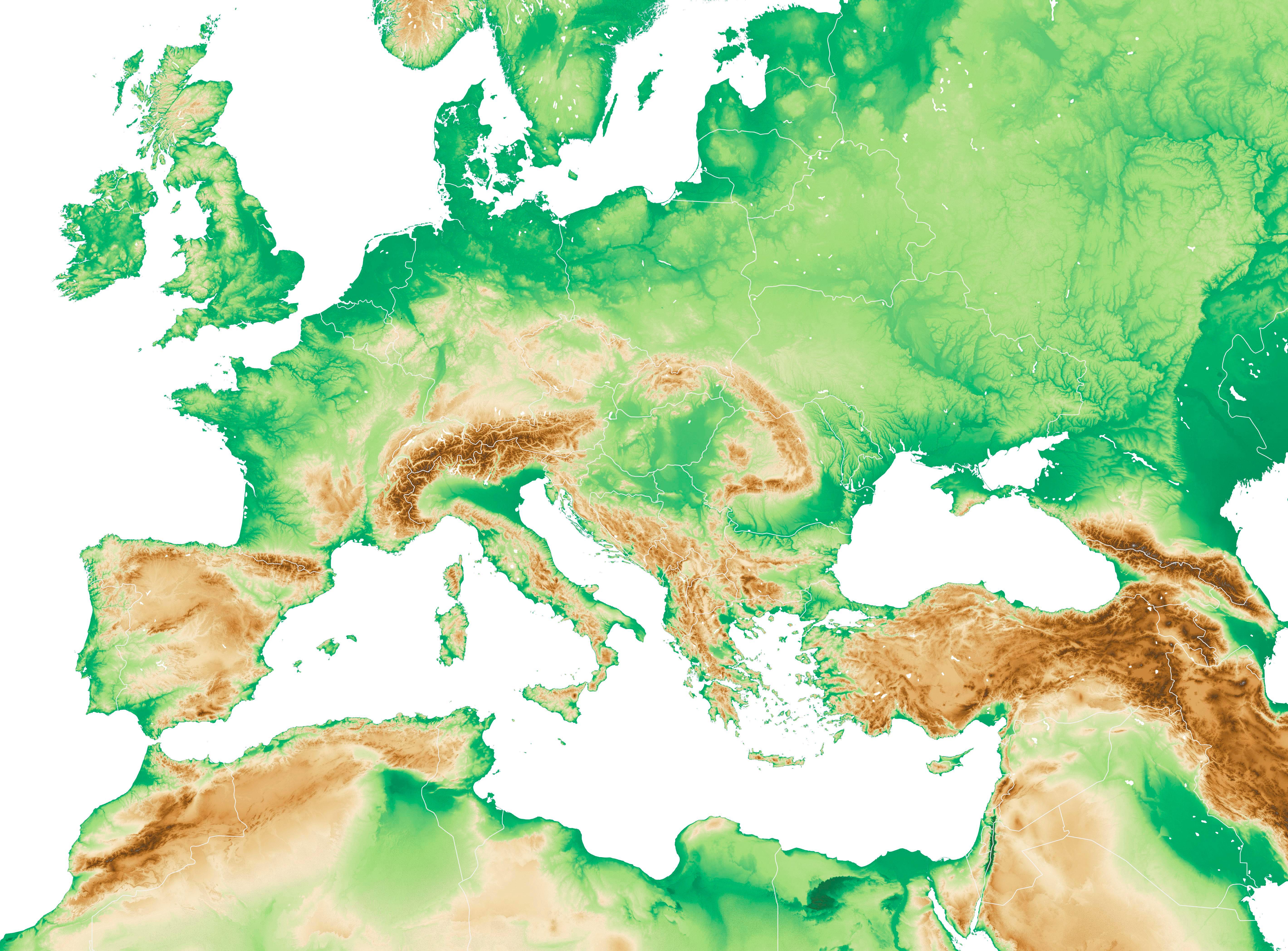
Physical Map of Western Europe and the Mediterranean Region
The physical map of Western Europe and the Mediterranean region provides a detailed representation of the diverse geogra...
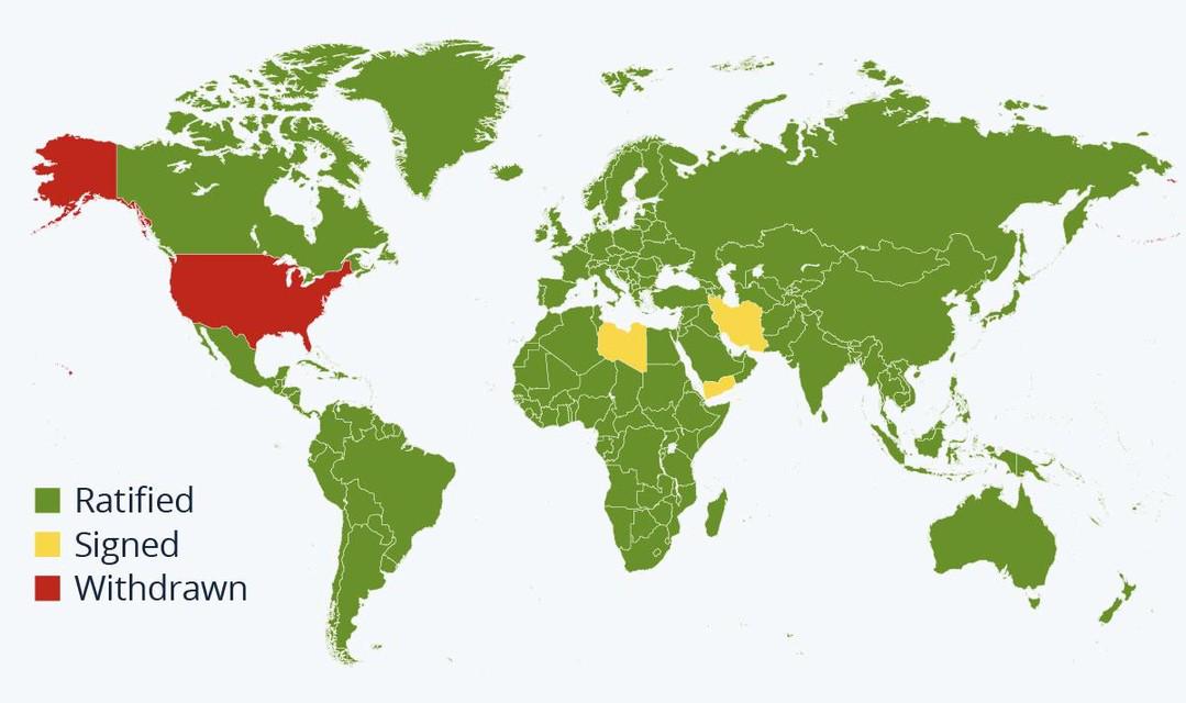
Paris Agreement Participation Status Map
This map provides a visual representation of countries that have ratified, signed, or withdrawn from the Paris Agreement...
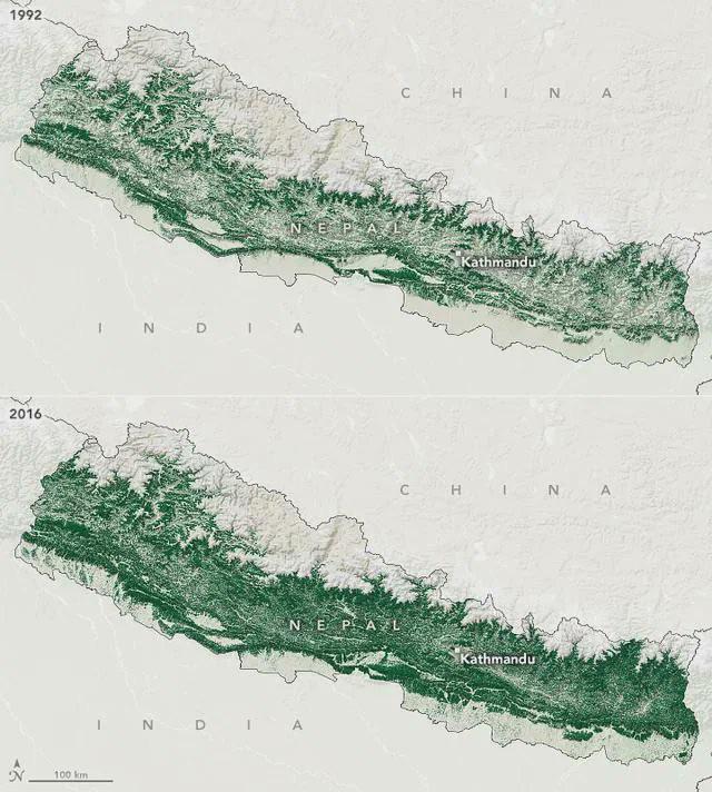
Nepal's Forest Area Map: 1992 vs 2016
The visualization titled "Nepal's Forest Area in 1992 vs 2016" presents a stark contrast in the forest cover of Nepal ov...
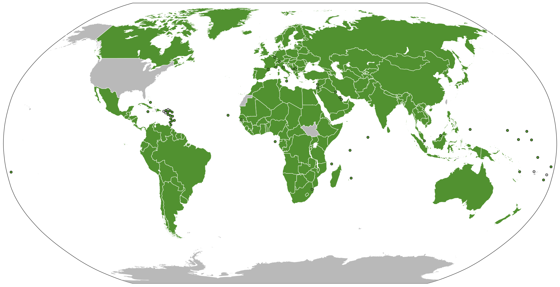
Map of Parties Signed to the Basel Convention
This map presents a comprehensive overview of the countries that are parties to the Basel Convention, an influential int...
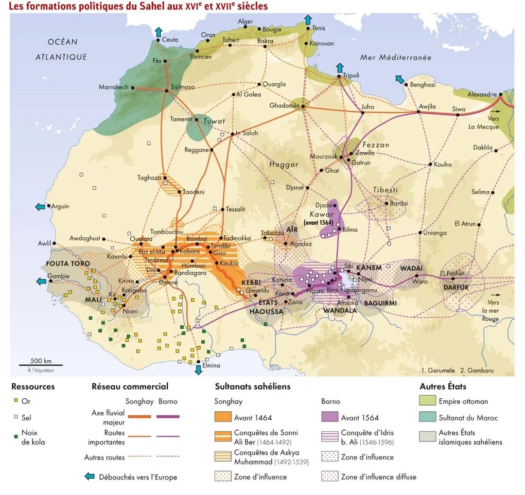
Sahelian Policies in the 16th and 17th Century Map
This map provides a detailed visualization of the policies that shaped the Sahel region during the 16th and 17th centuri...
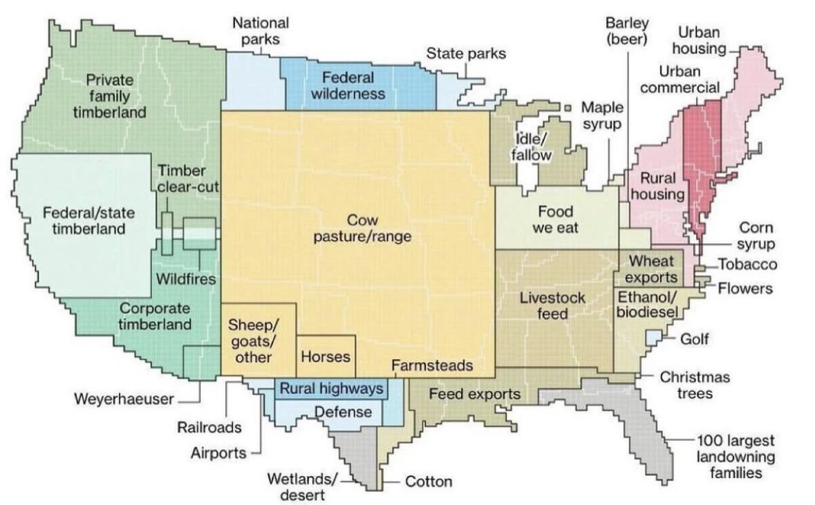
Land Use in the USA Map
This map provides a comprehensive visualization of land use across the United States, focusing on how land is utilized r...
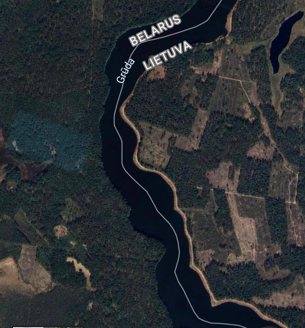
Belarus and Lithuania Forest Ownership Map
The visualization titled "Belarus and Lithuania Border: Forest Ownership" provides a clear depiction of the contrasting ...
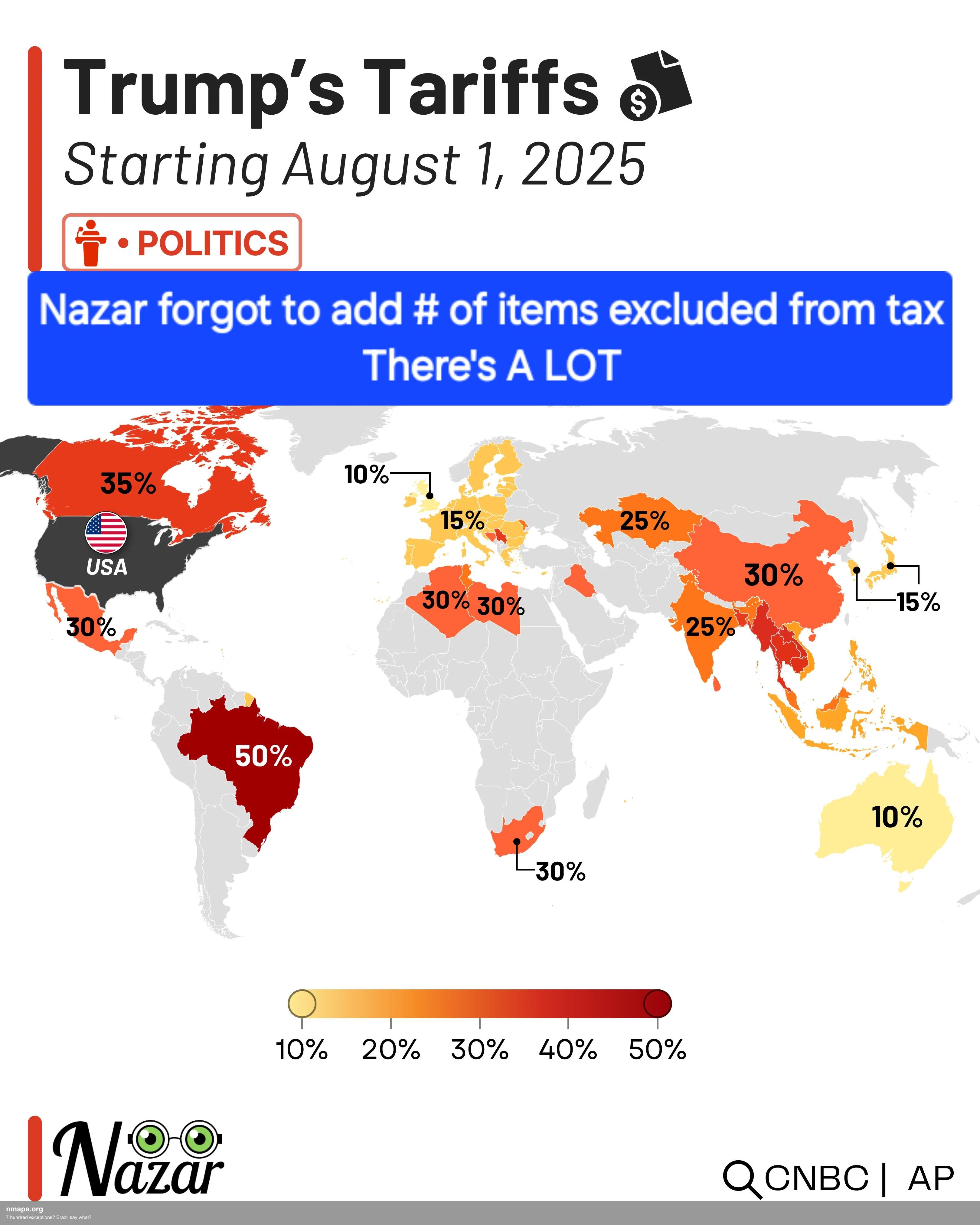
Brazil Exceptions Map: Understanding Unique Legalities
...
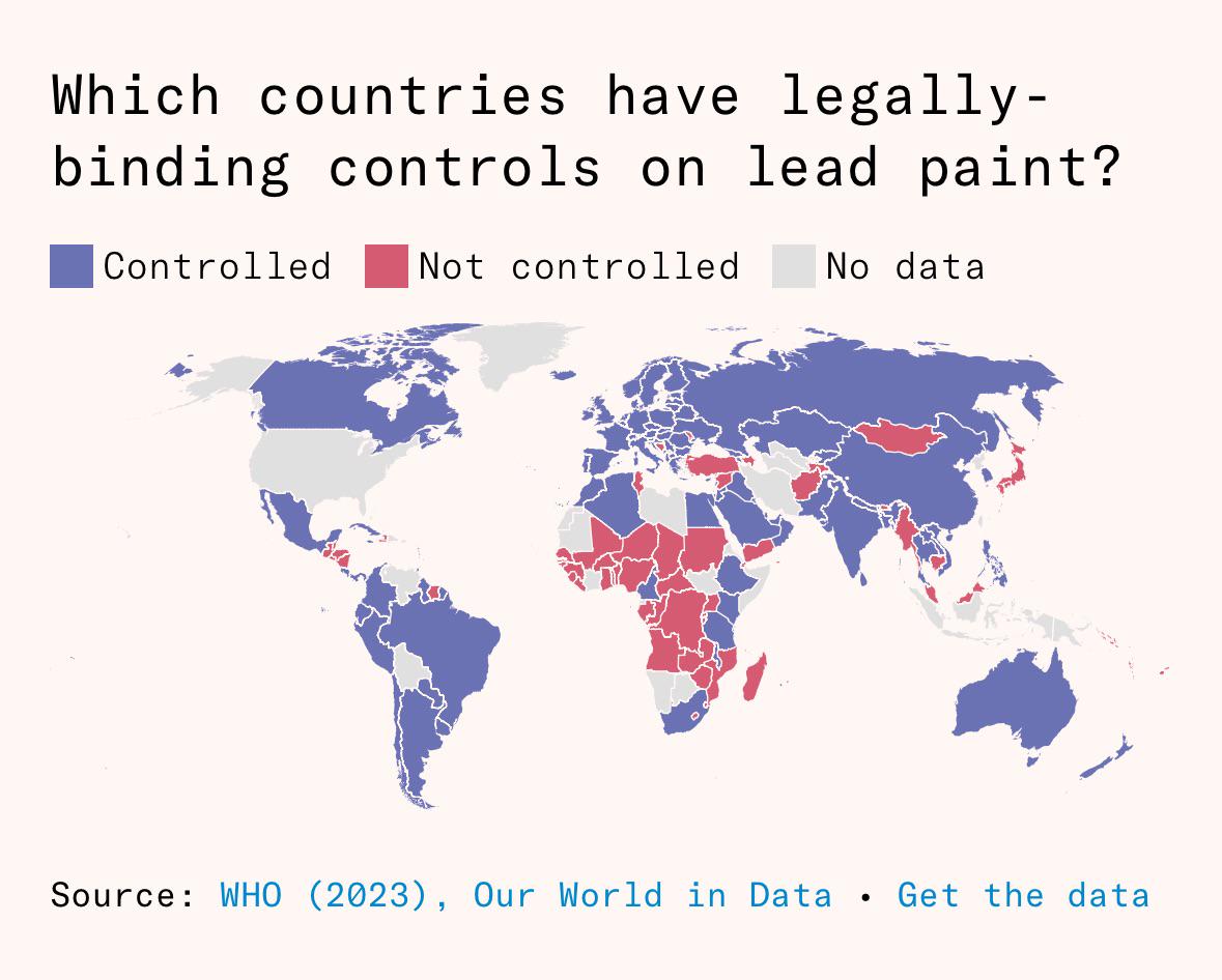
Lead Paint Regulation Map by Country
This visualization illustrates the global landscape of countries that have implemented legally-binding controls on lead ...