elections Maps
23 geographic visualizations tagged with "elections"
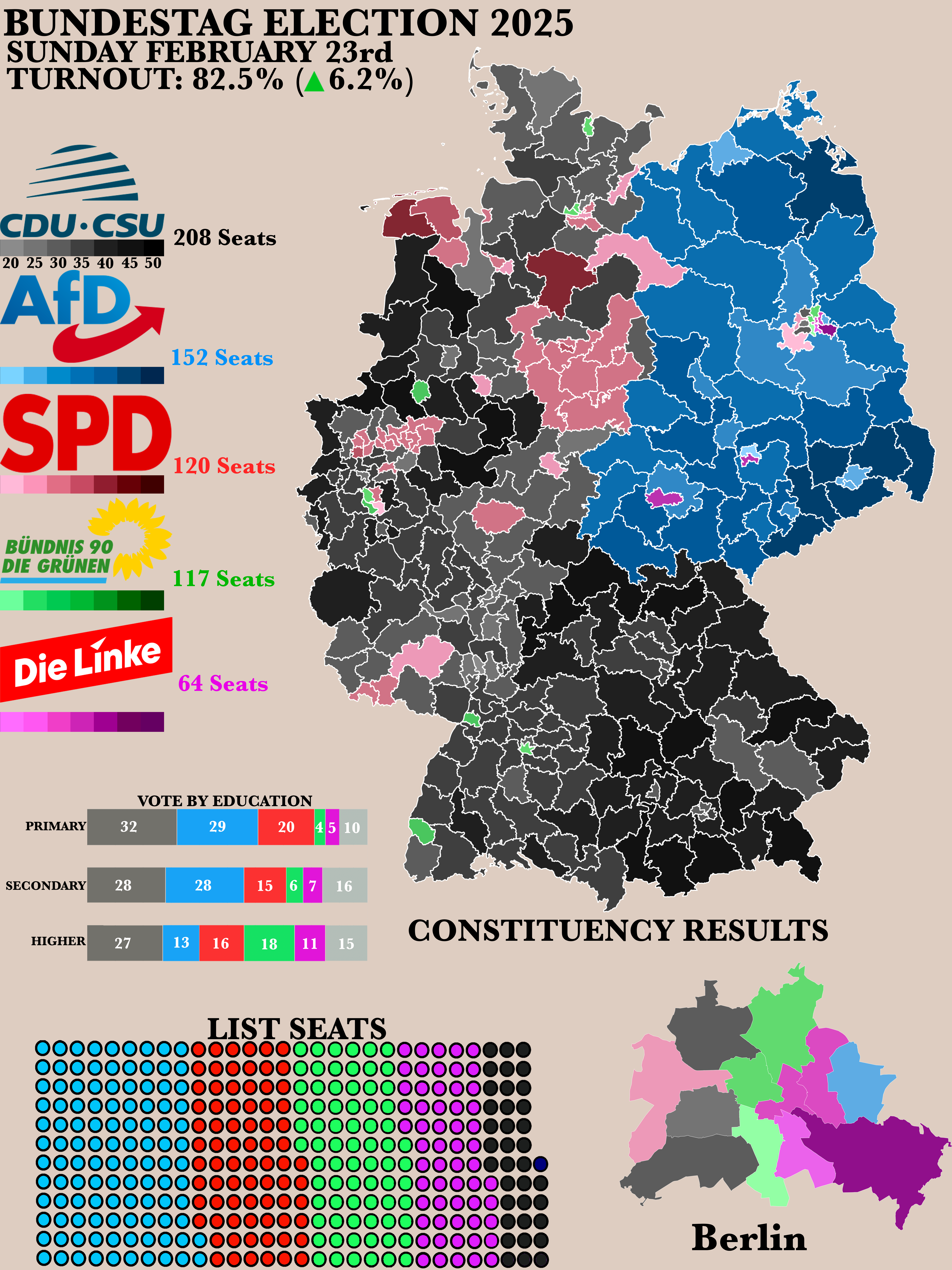
2025 German Bundestag Election Results Map
The "Poster of the 2025 German Bundestag Election Results" map provides a clear visual representation of the electoral o...
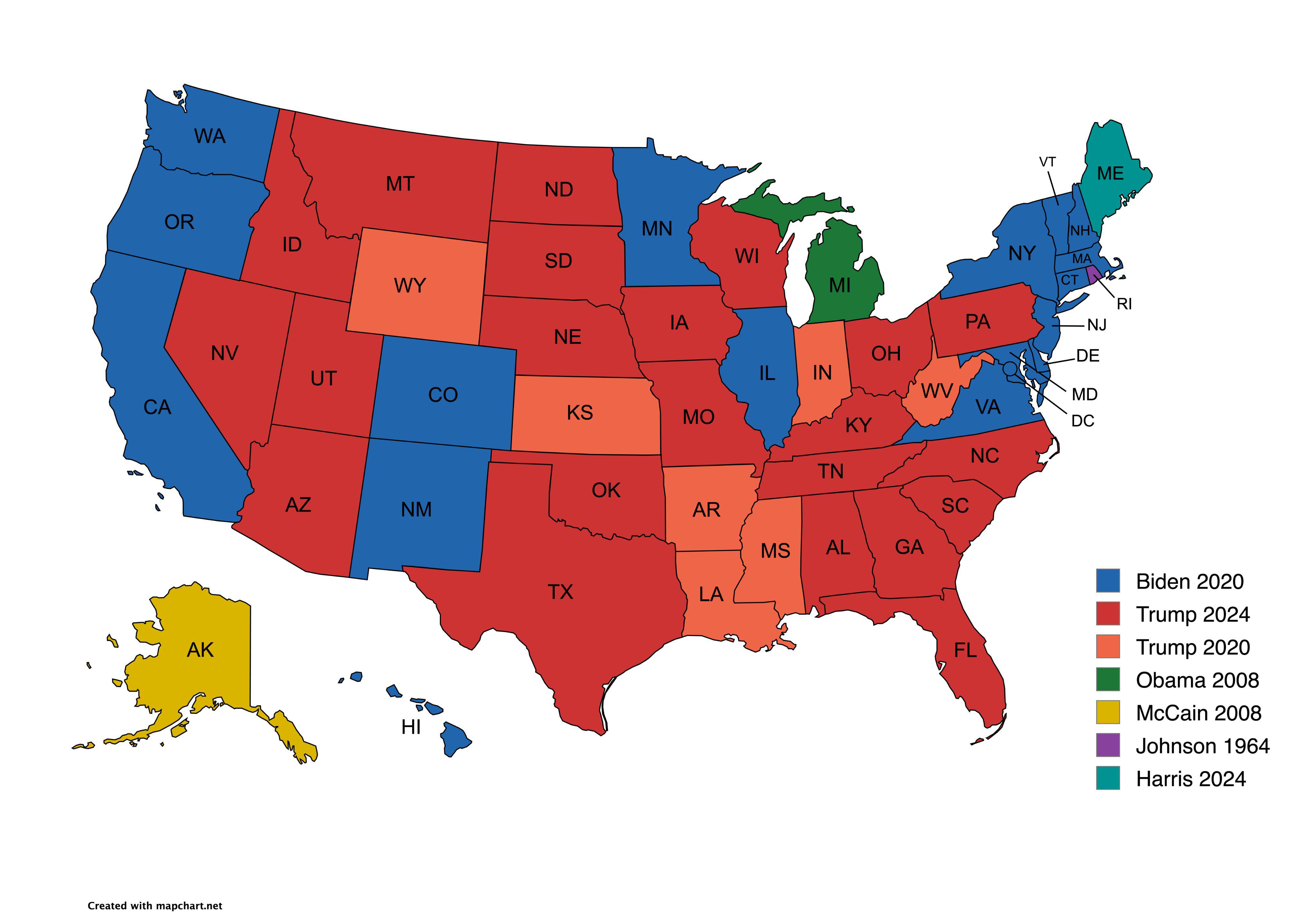
Presidential Candidate Vote Distribution by State Map
The map titled "Which Presidential Candidate Won The Largest Amount Of Votes In An Election By State" provides a visual ...
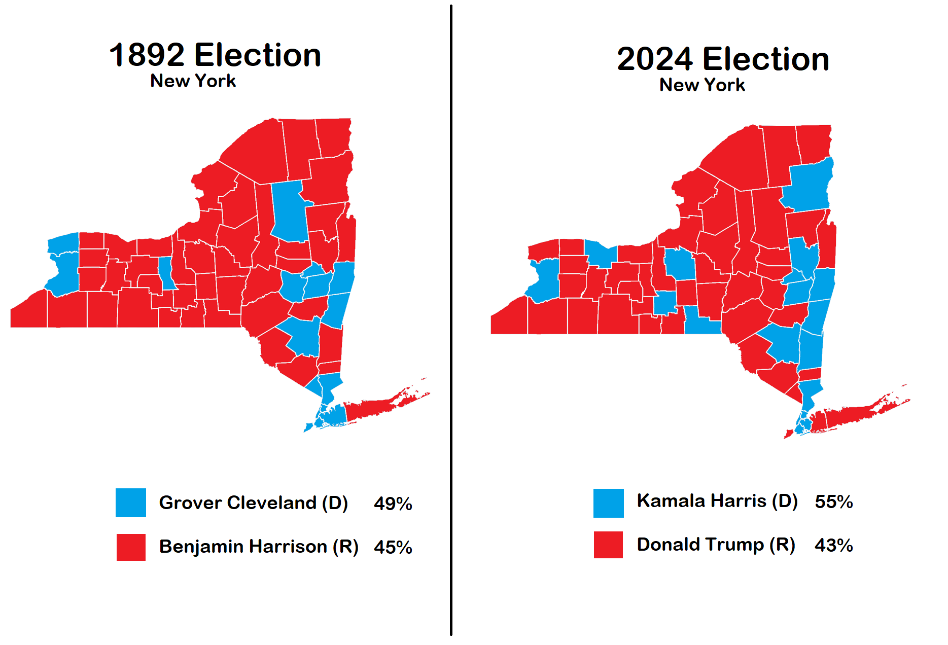
New York Election Map 1892 vs 2024
The visualization titled "Election in New York 1892 vs 2024" provides a compelling comparison of political landscapes ac...
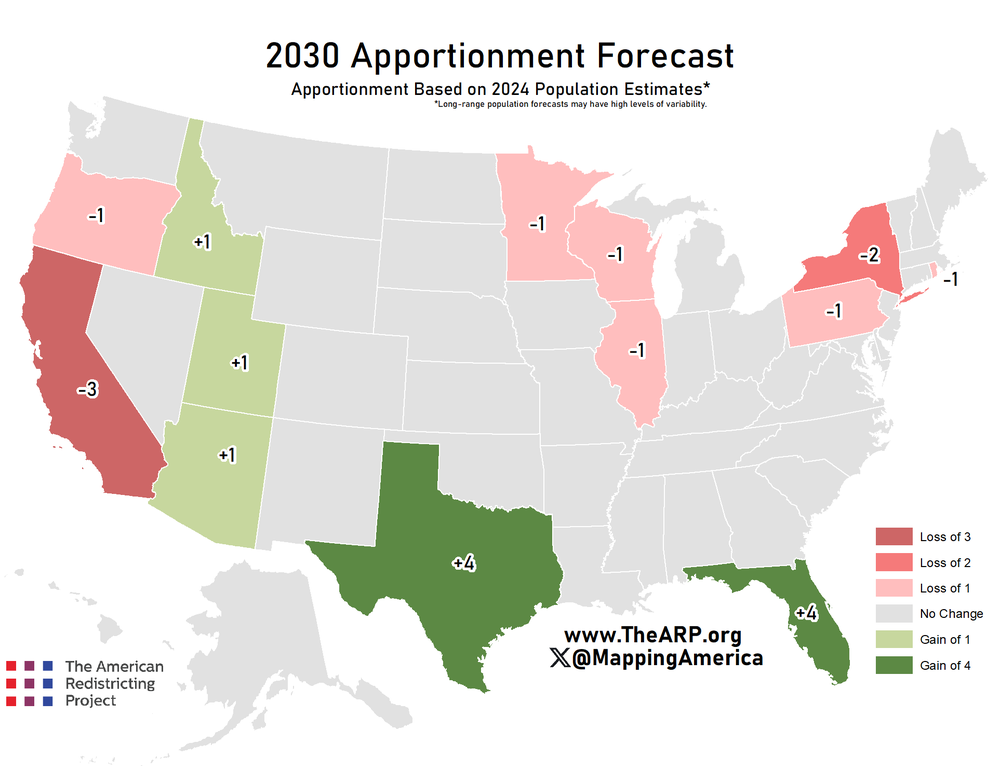
Electoral College Votes Forecast Map 2030
The "Forecast Apportionment of Electoral College Votes of 2030" map illustrates the projected distribution of electoral ...
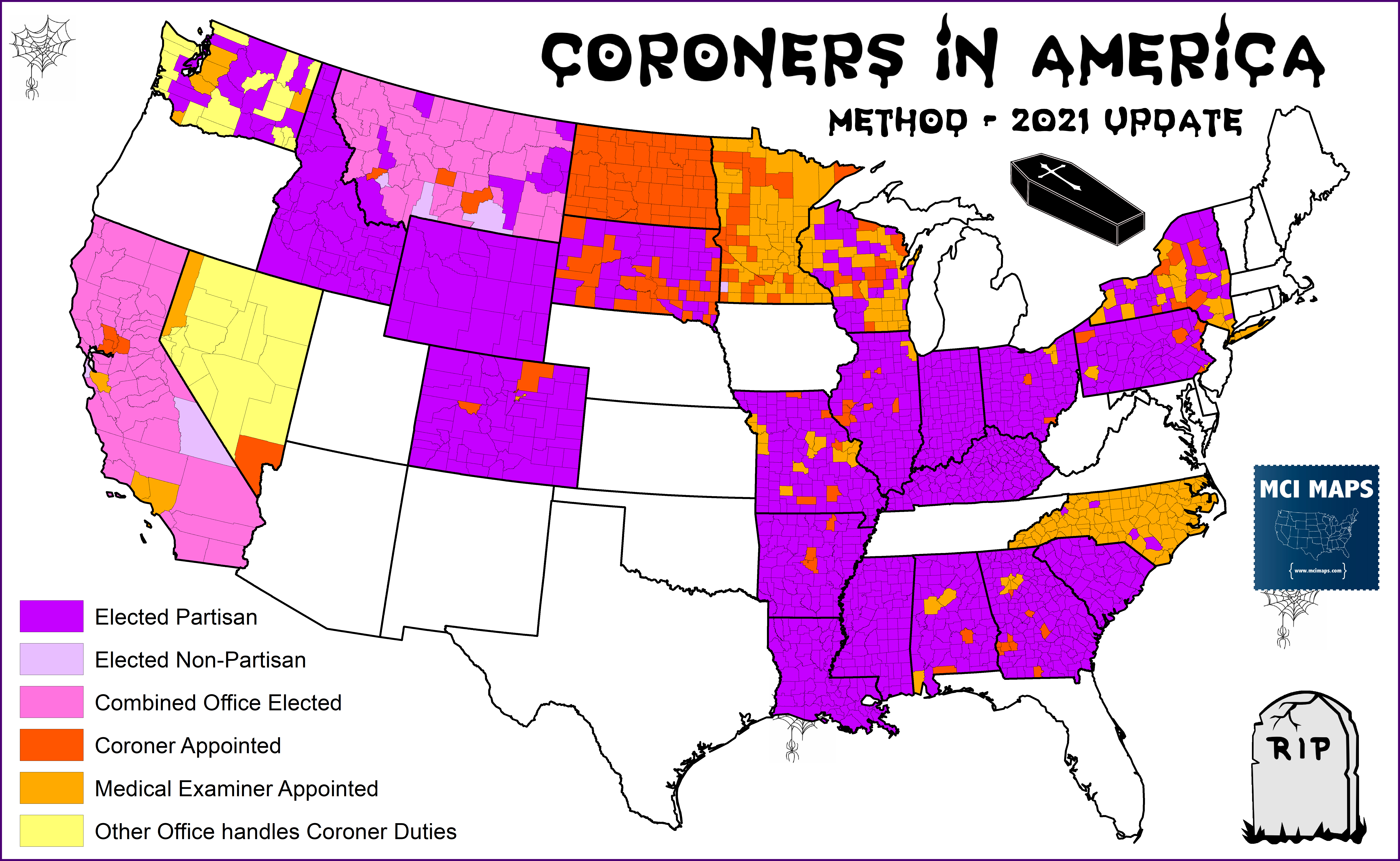
Map of Elected Coroners in America
...
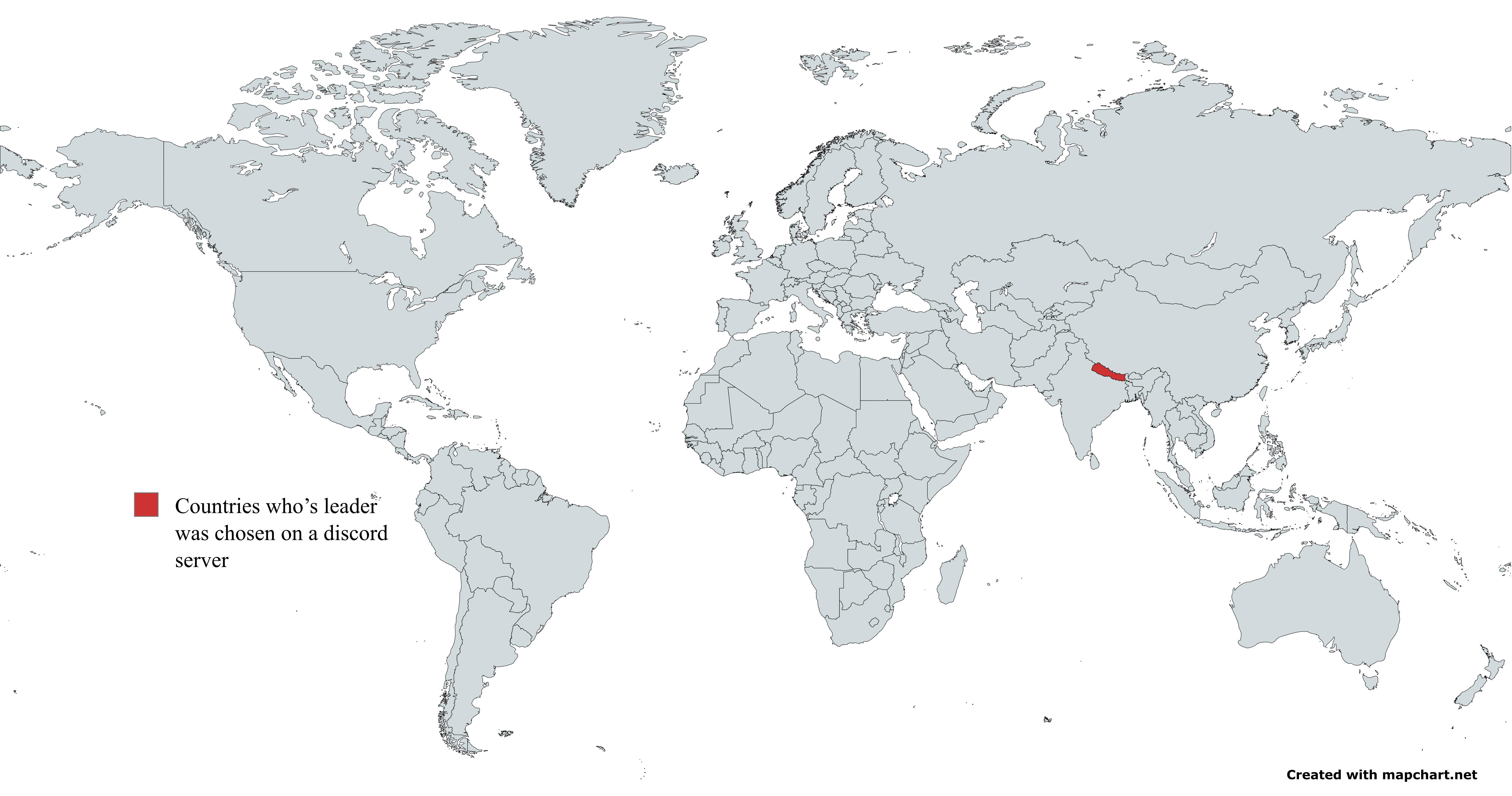
Map of Countries with Leaders Elected via Discord
This map represents a unique phenomenon in modern governance: countries where leaders were elected through voting conduc...
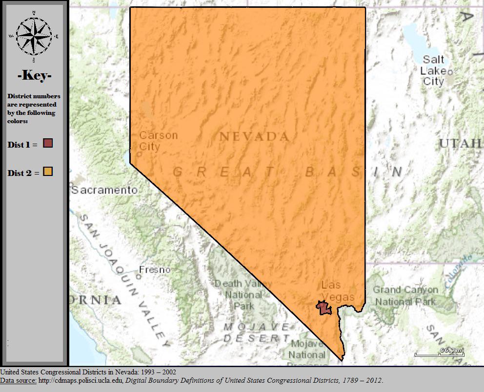
Nevada Congressional Districts Map 2000
The visualization titled 'Nevada’s Congressional Map In 2000' showcases the state's congressional district boundaries as...
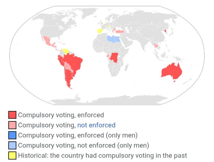
Mandatory Voting Countries Map
This visualization highlights countries where voting is mandatory, providing a clear representation of global electoral ...

Mexico Border Election Trends Map 2016-2024
The "Mexico Border Election Trends Map 2016-2024" provides a comprehensive visualization of voting patterns along the U....
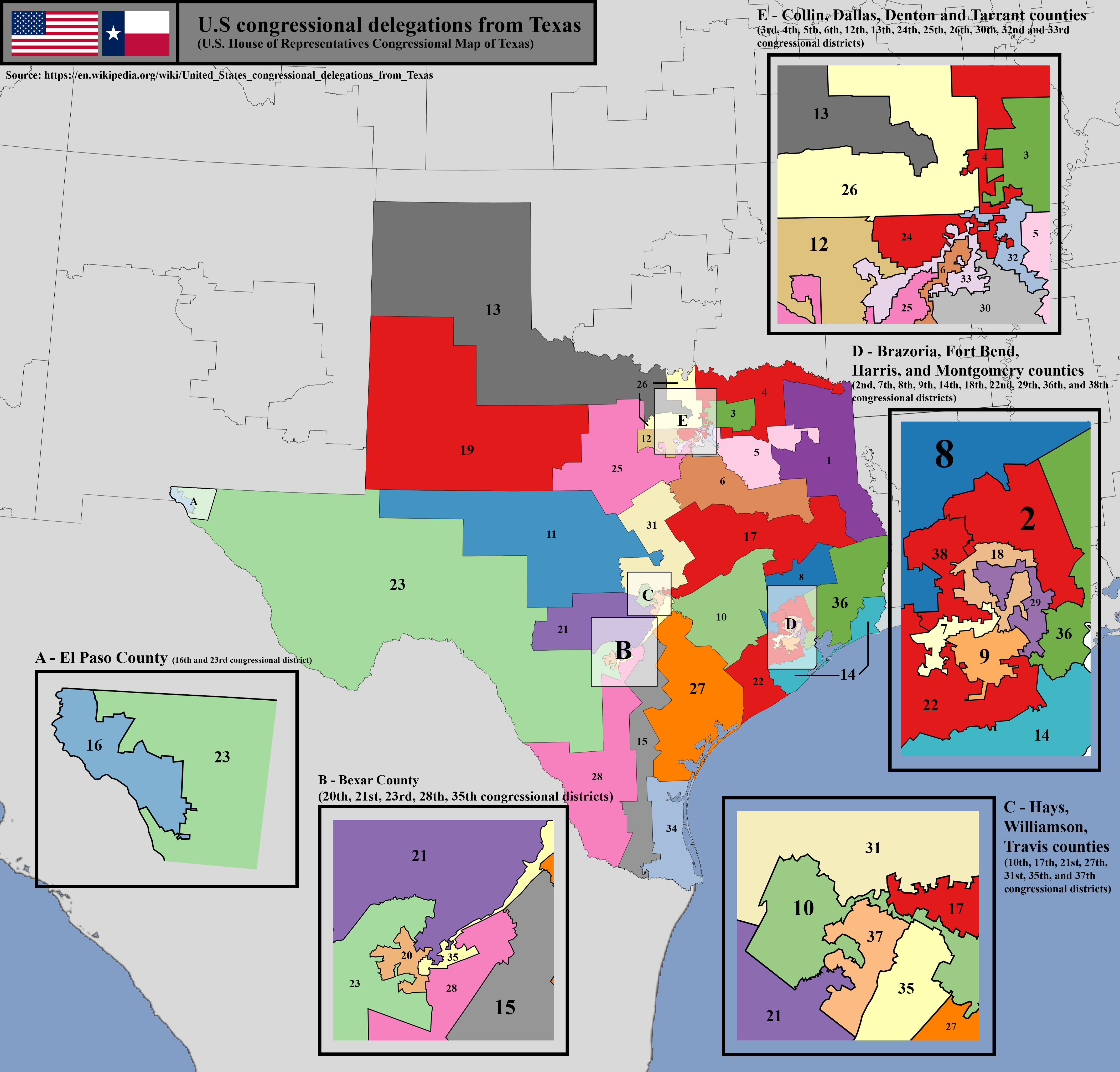
U.S. House of Representatives Congressional District Map of Texas
The U.S. House of Representatives congressional district map of Texas visually represents the boundaries of each congres...
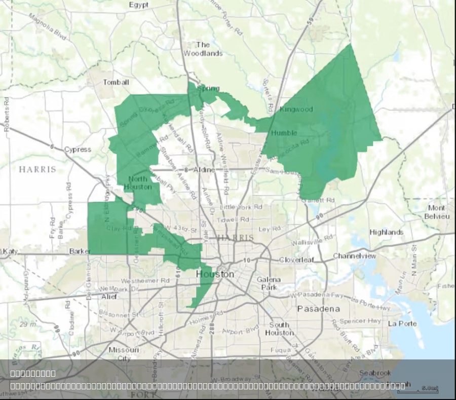
Texas's 2nd Congressional District Map Analysis
The provided map illustrates the geographical boundaries of Texas’s 2nd Congressional District, a region that has been t...
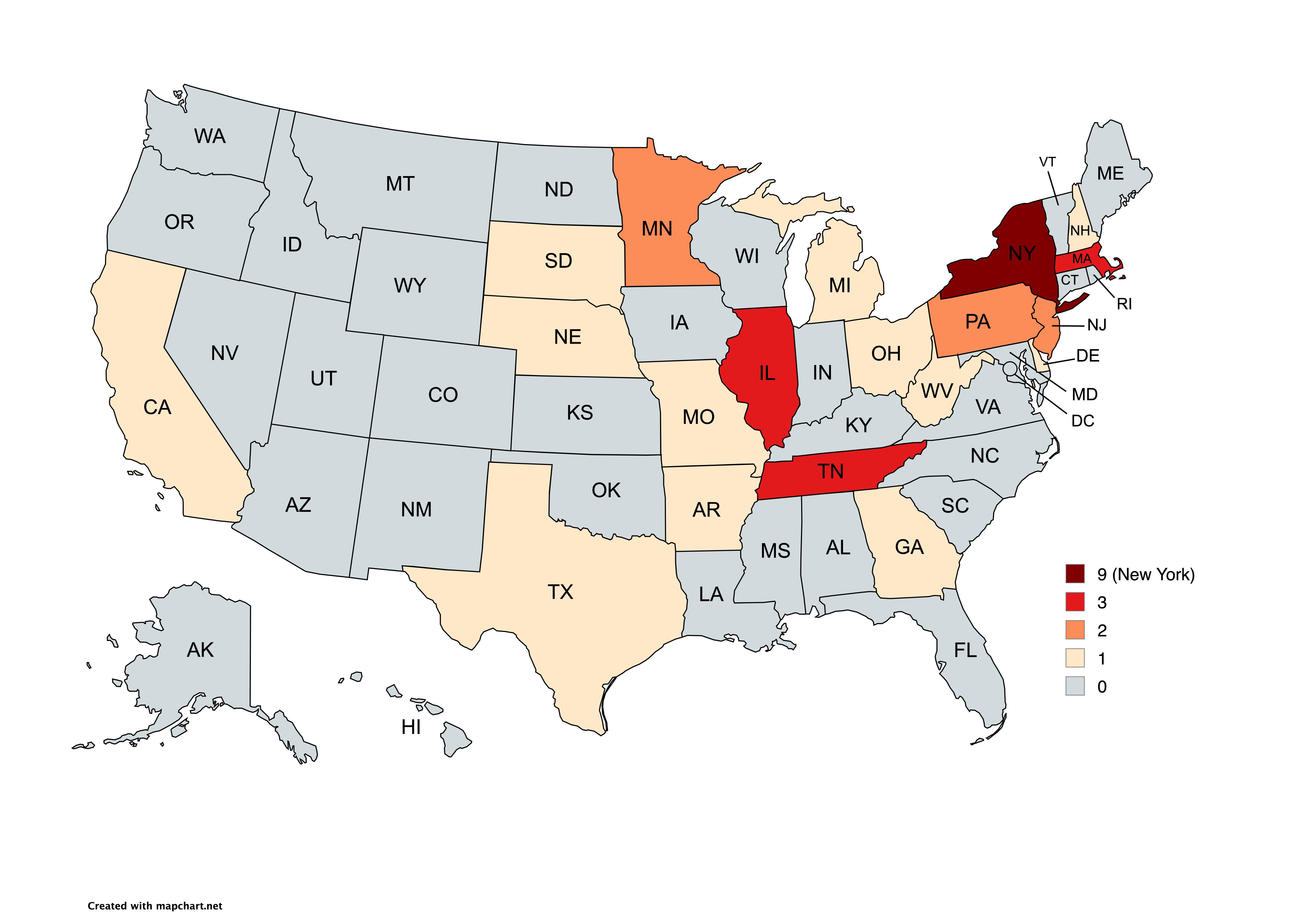
Map of Democratic Party Presidential Nominees by State
...
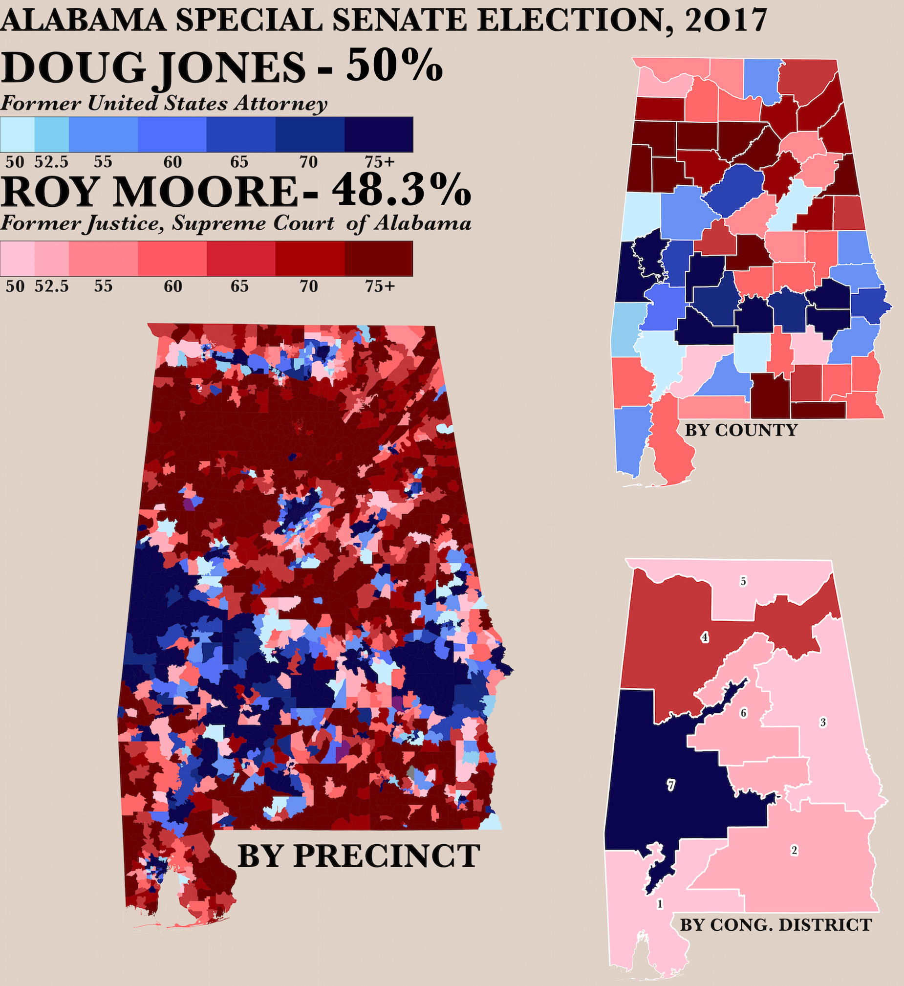
2017 Alabama Senate Race by Precinct Map
The "Poster of the 2017 Alabama Senate Race by Precinct Map" visually represents the voting patterns across various prec...
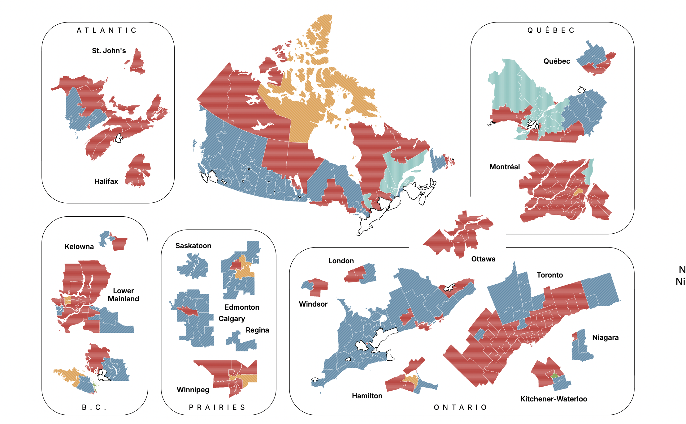
Canadian Federal Election Projection Map September 2025
The "Canadian Federal Election Projection - September 14, 2025" map provides a detailed forecast of the anticipated outc...

2024 US Election Vote Distribution Map
Interestingly, voter turnout also tends to correlate with population density. Urban areas often see higher engagement in...
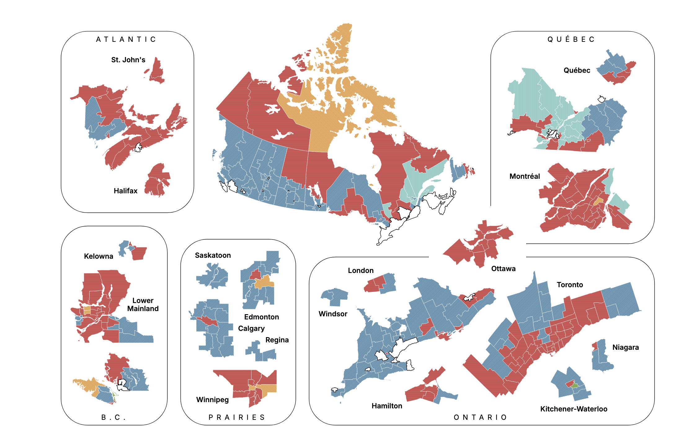
Canadian Election Projection Map September 2025
The "Canadian Election Projection - September 28, 2025" map provides a visual representation of the anticipated results ...
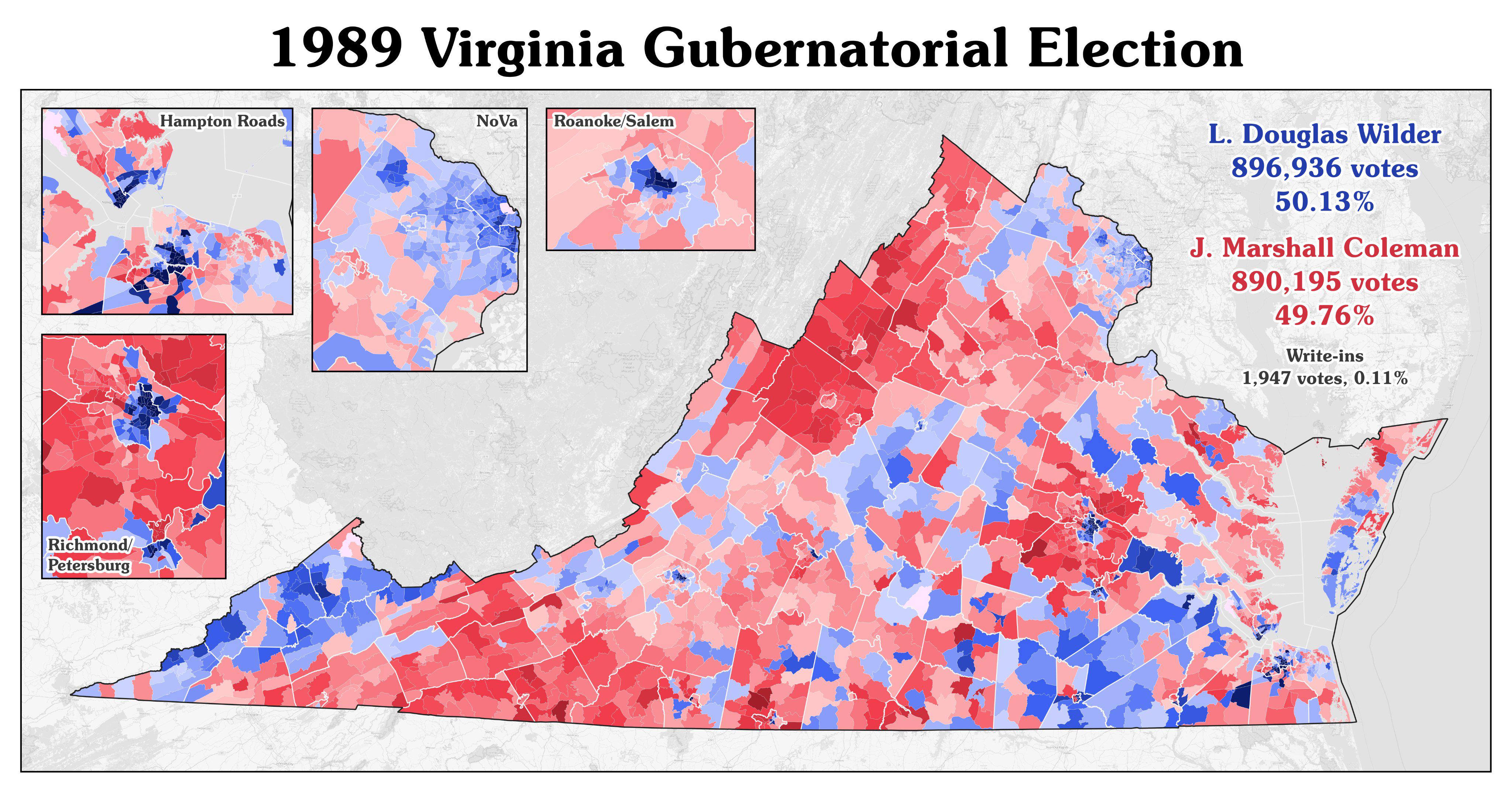
1989 Virginia Gubernatorial Election Map
Virginia's population had evolved significantly by the late 20th century. The state was experiencing urbanization, with ...
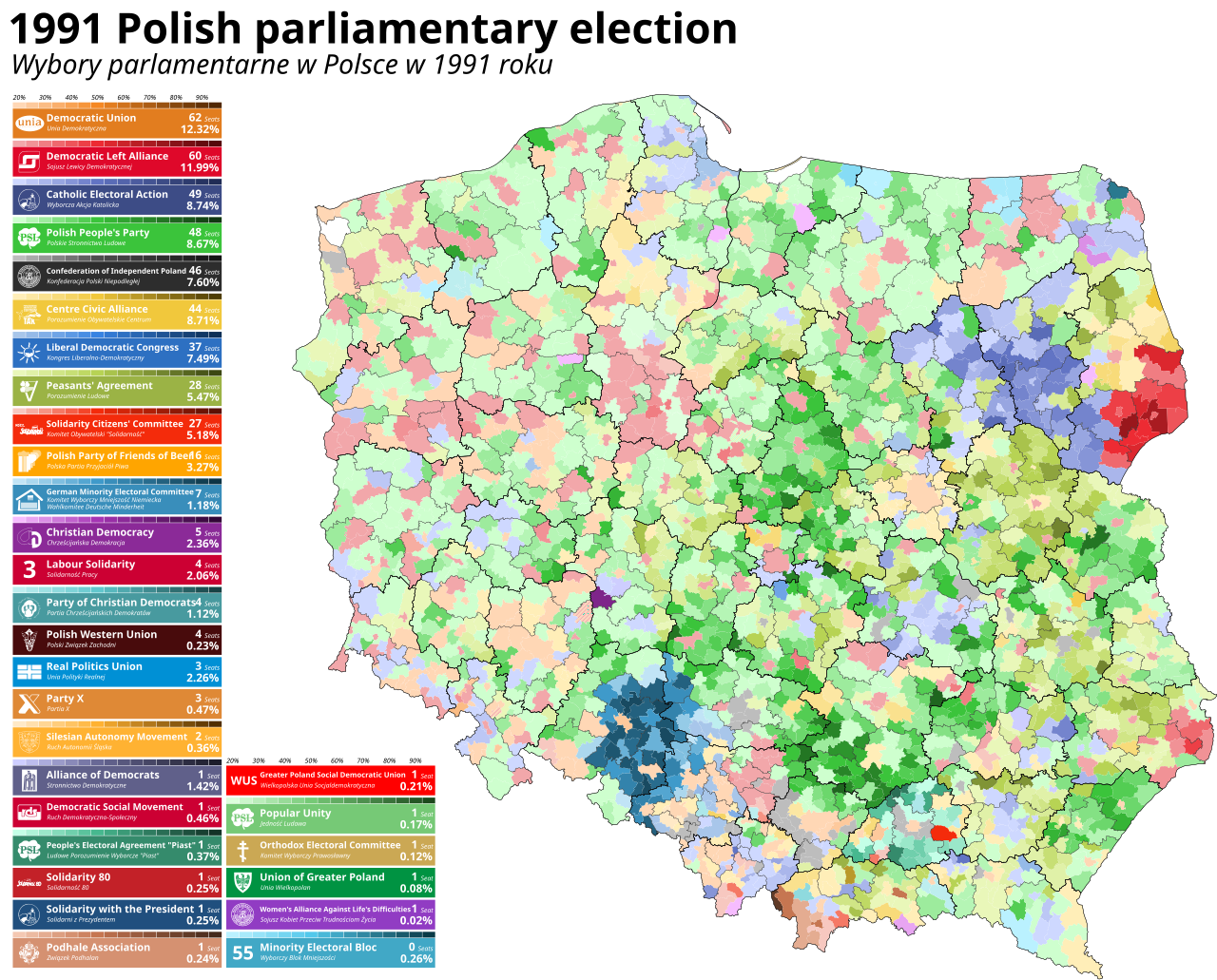
1991 Polish Parliamentary Election Map
This map visualizes the results of the 1991 Polish parliamentary election, marking a pivotal moment in Poland's history ...
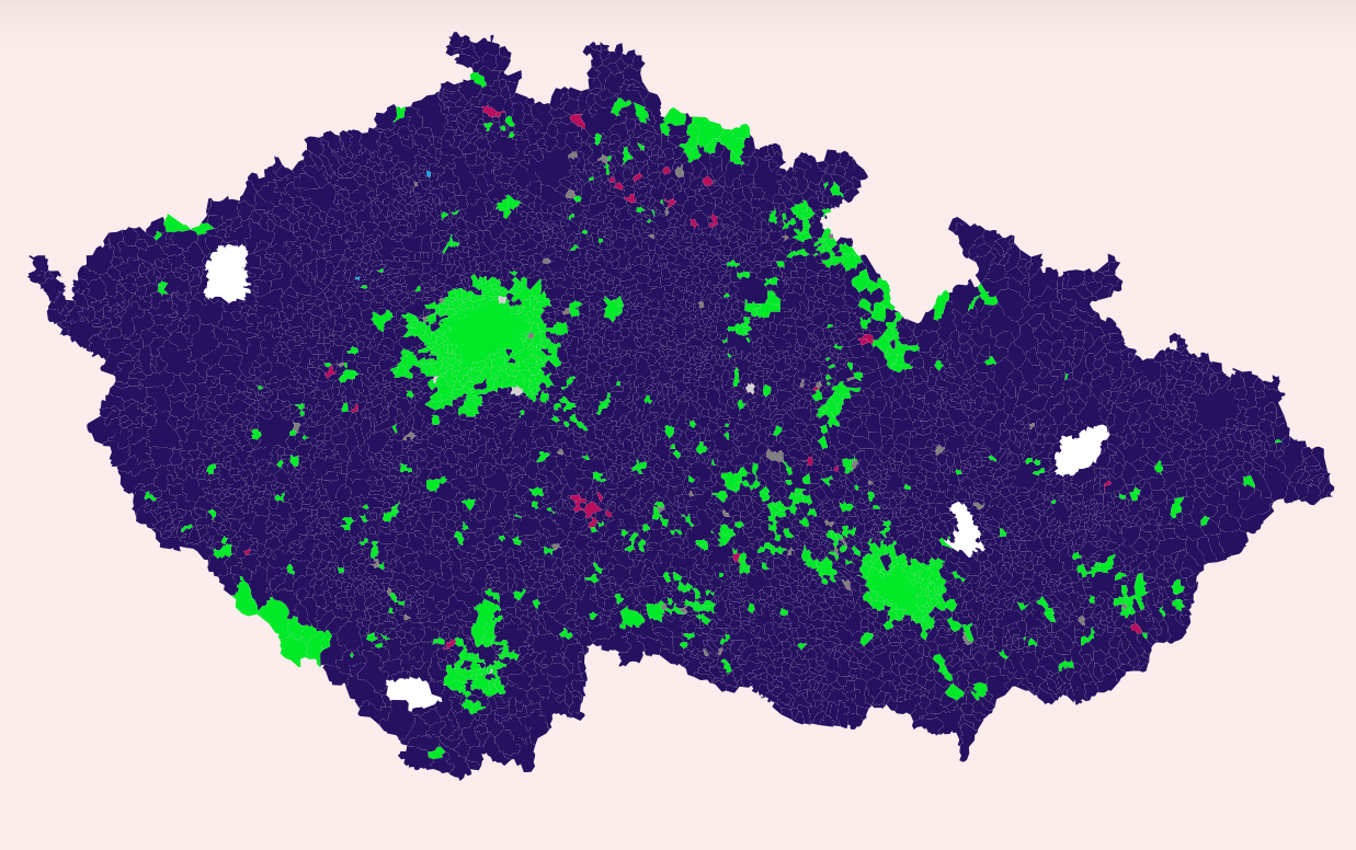
Czech Parliamentary Elections Voting Map
The map visualizes the voting patterns from the recent Czech Parliamentary elections held on Friday and today. It highli...
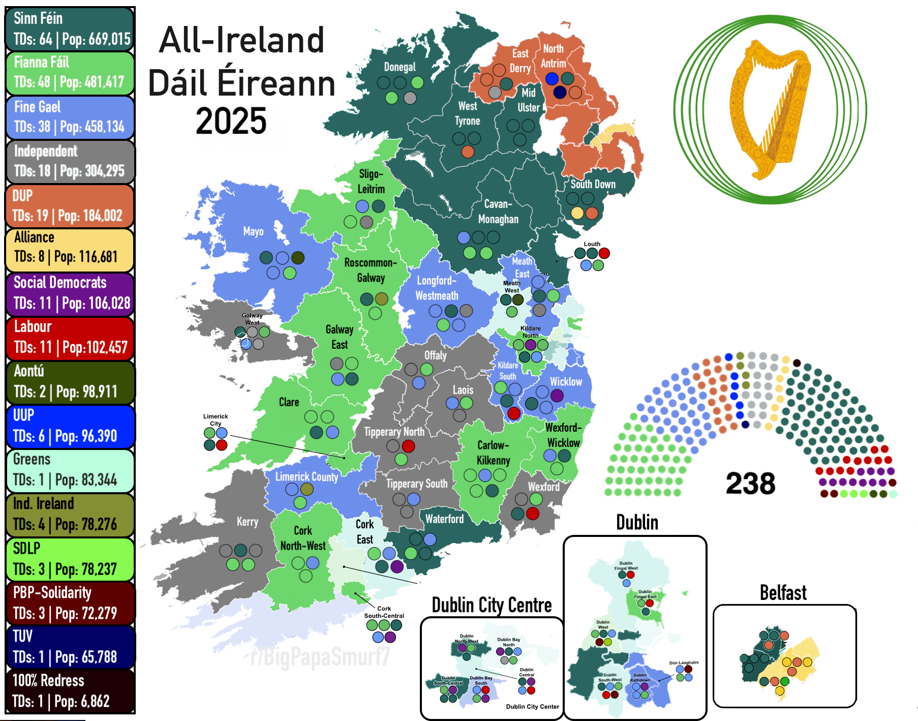
All-Ireland Parliament Constituency Map 2025
The "All-Ireland Parliament (Dáil Éireann) 2025" map visualizes the proposed constituencies for the Irish Parliament bas...
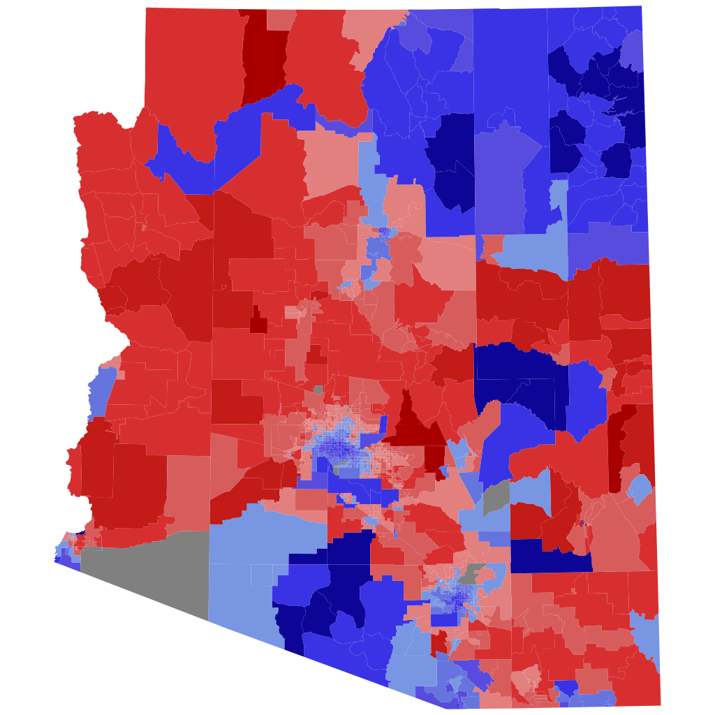
2022 Arizona Attorney General Election Precinct Map
The precinct map of the 2022 Arizona Attorney General election visually represents the voting patterns across the state,...
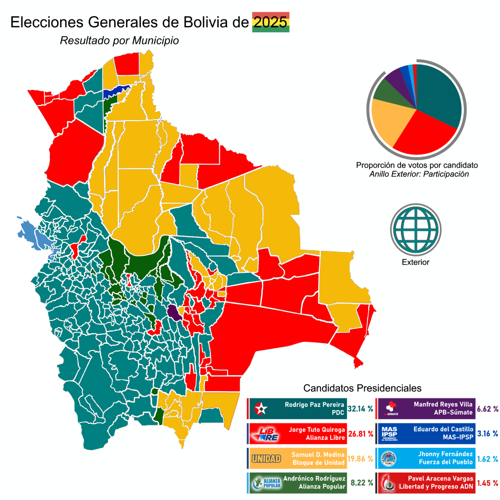
2025 Bolivian General Election Results by Municipality Map
The "Results of the 2025 Bolivian General Election by Municipalities" map provides a detailed visualization of how vario...
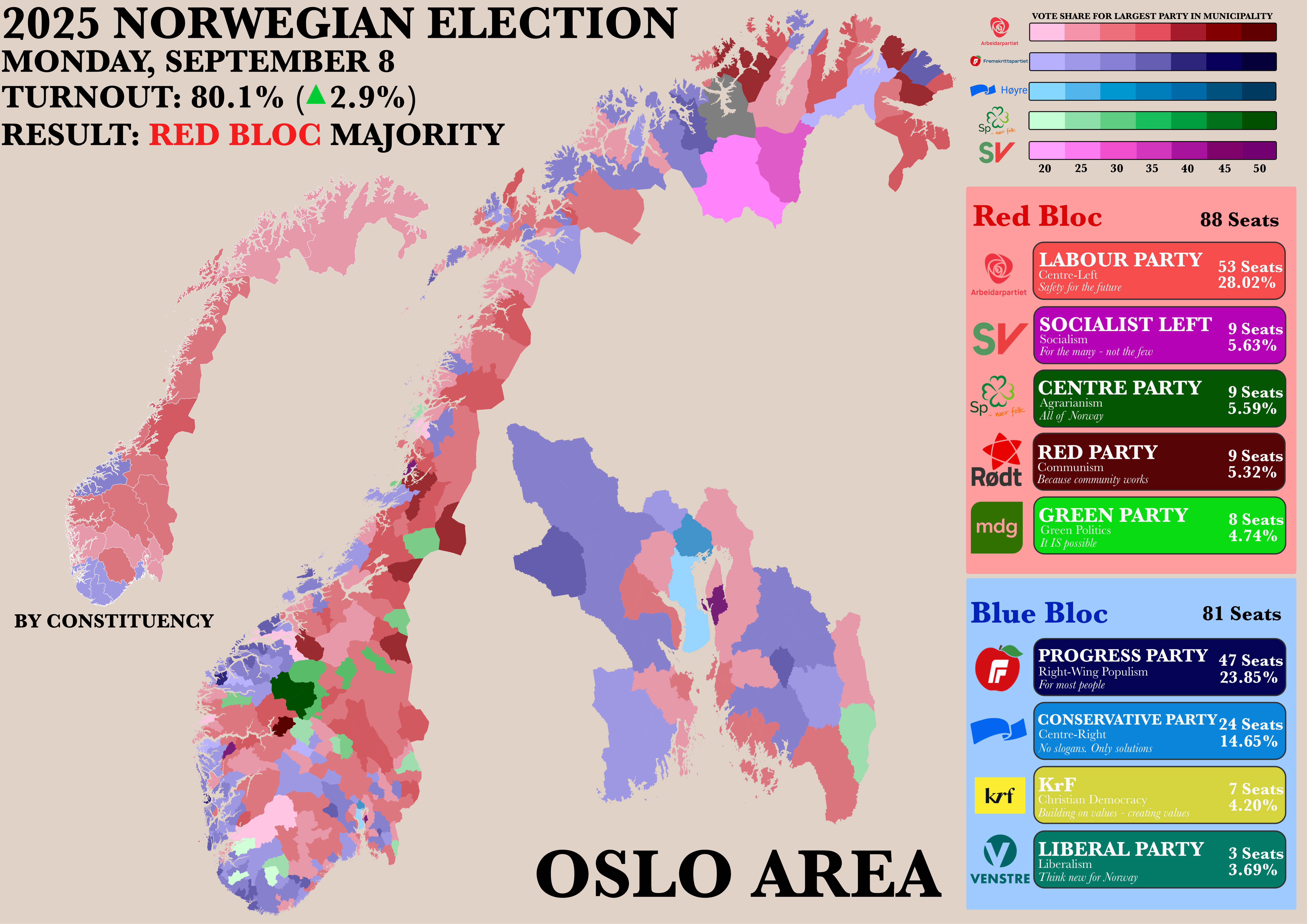
Norwegian Parliamentary Election Results by Municipality Map
The "Poster of the Recent Norwegian Parliamentary Election by Municipality" map provides a detailed visualization of the...