cold war Maps
17 geographic visualizations tagged with "cold war"
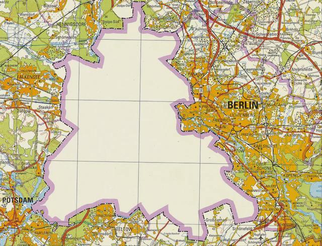
East German Map of West Berlin in 1988
One of the remarkable aspects of West Berlin was its demographic composition. In the late 1980s, the population of West ...

Map of Countries that Had Relations with Apartheid South Africa
This map provides a visual representation of the countries that maintained diplomatic, economic, or military relations w...
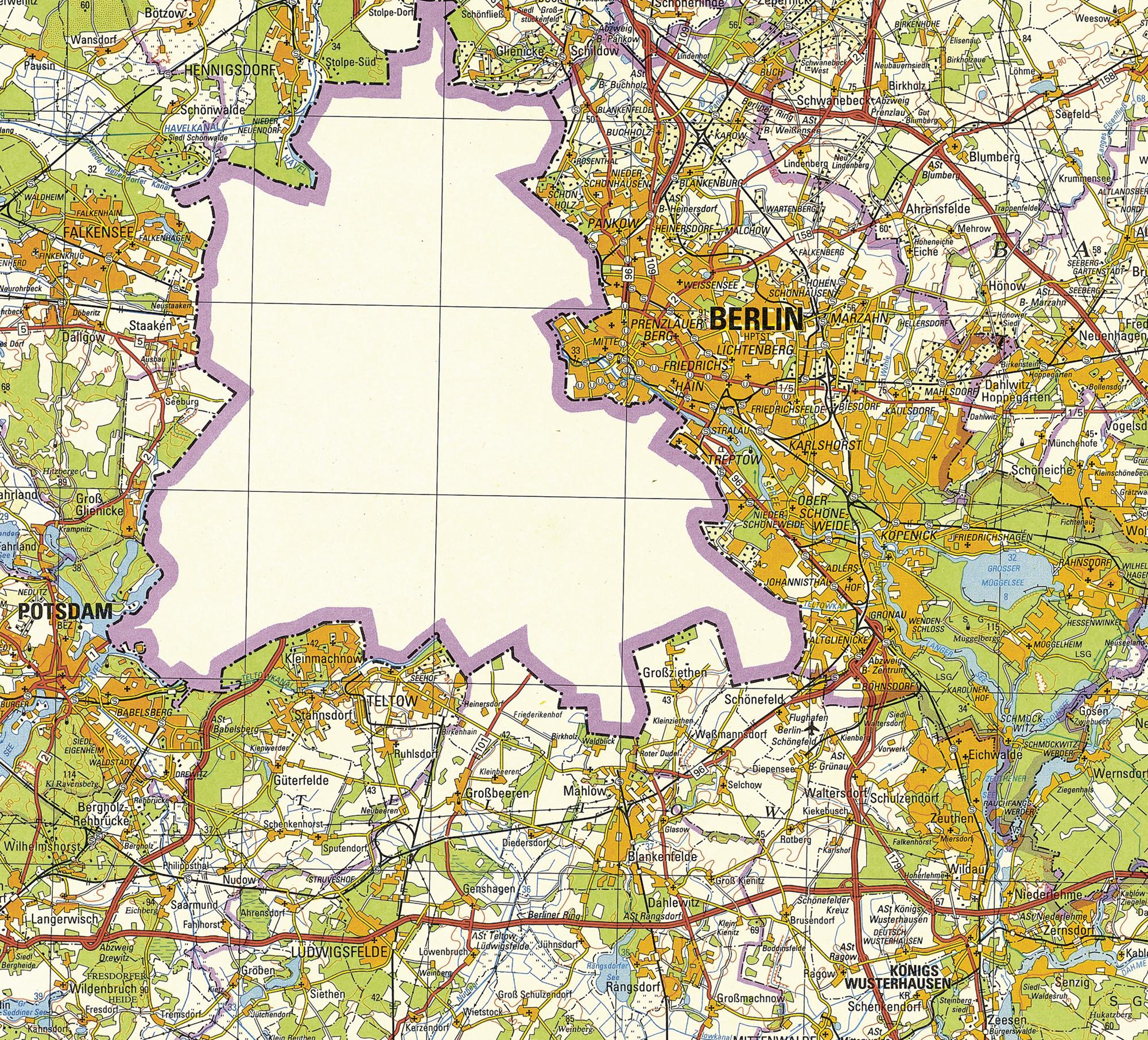
1988 East German Map of Berlin
The 1988 East German map of Berlin vividly illustrates a unique historical moment in a divided city. Notably, this visua...
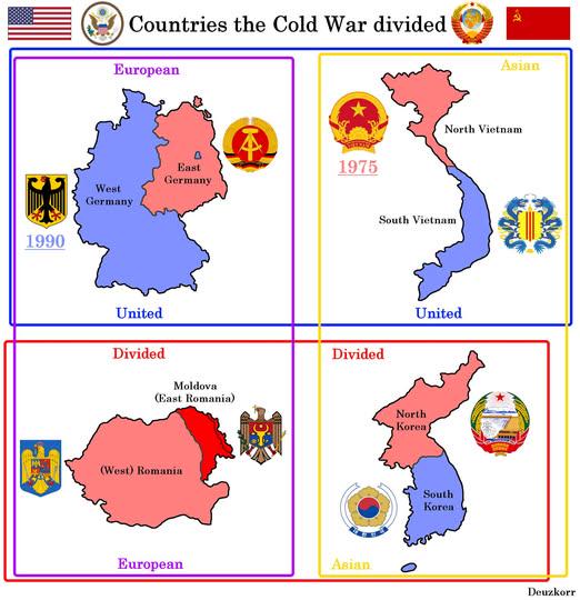
Map of Countries Divided by WW2 and Cold War
This map visually represents the geopolitical divisions of four countries—Germany, Korea, Vietnam, and Poland—resulting ...
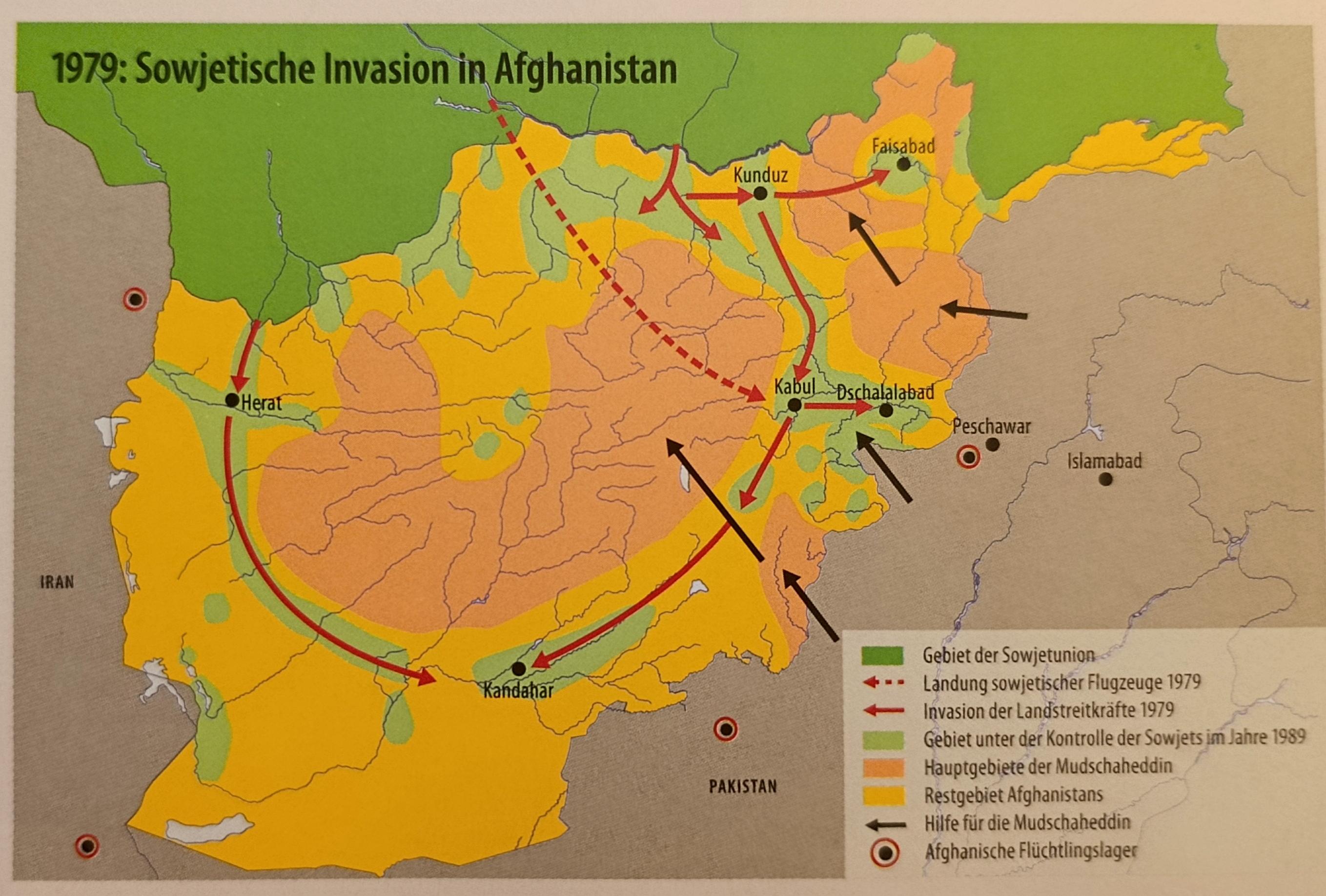
Map of the Soviet Invasion of Afghanistan
This map illustrates the Soviet invasion of Afghanistan, which began on December 24, 1979, and lasted until February 15,...
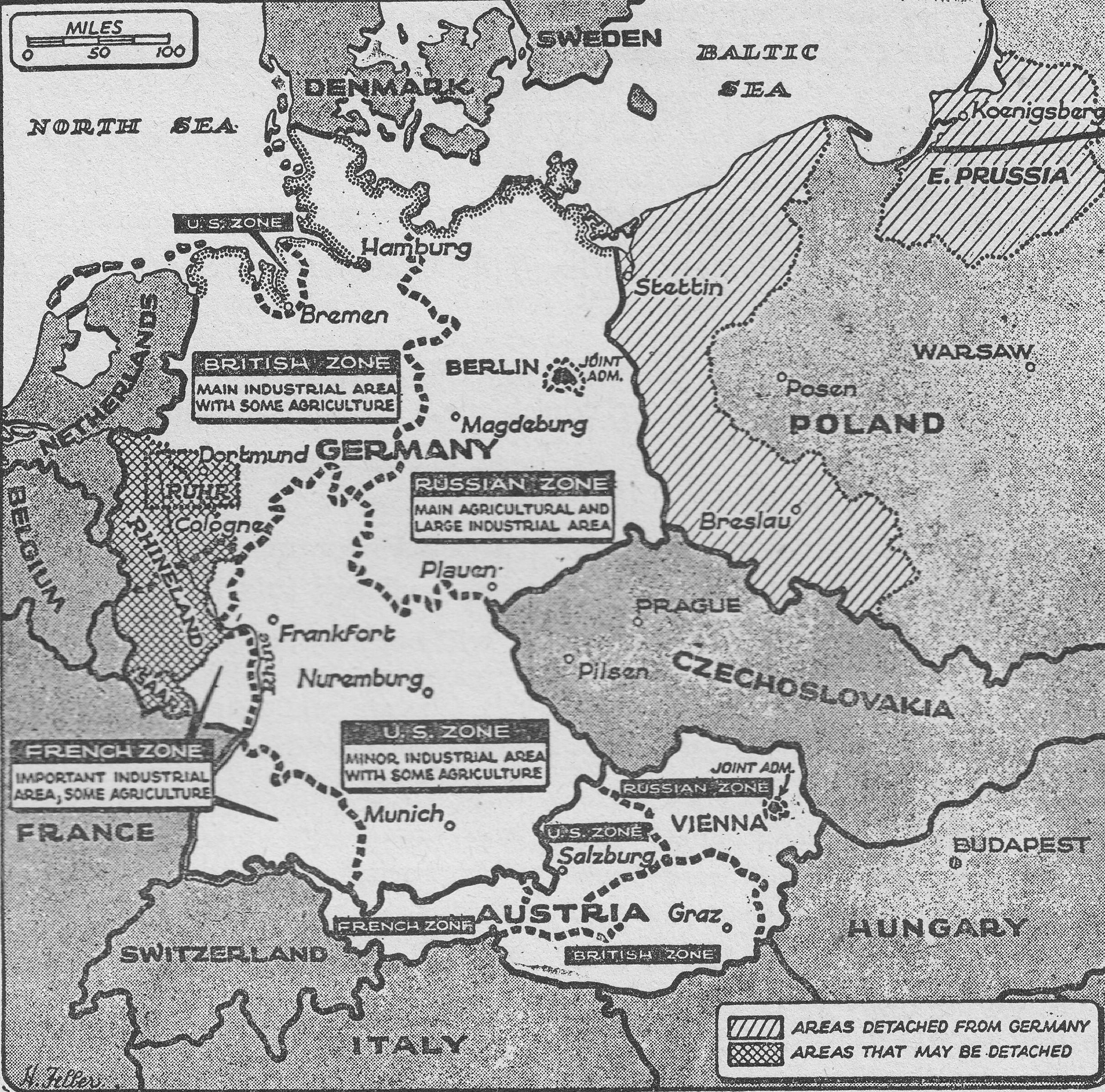
Post-War Occupation Division of Germany Map
The "Post-War Occupation Division of Germany (1948) Map" vividly illustrates the geographical demarcation of Germany int...
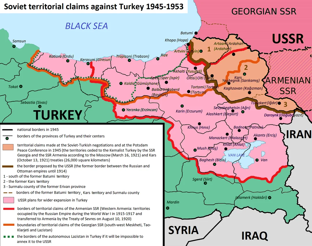
Soviet Union Territorial Claims Map from Türkiye
This map illustrates the territorial claims made by the Soviet Union regarding Türkiye during the Cold War. It details t...
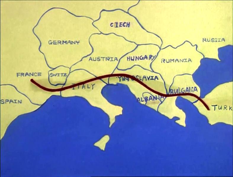
Map of Europe c. 1985 in The Transformers
...
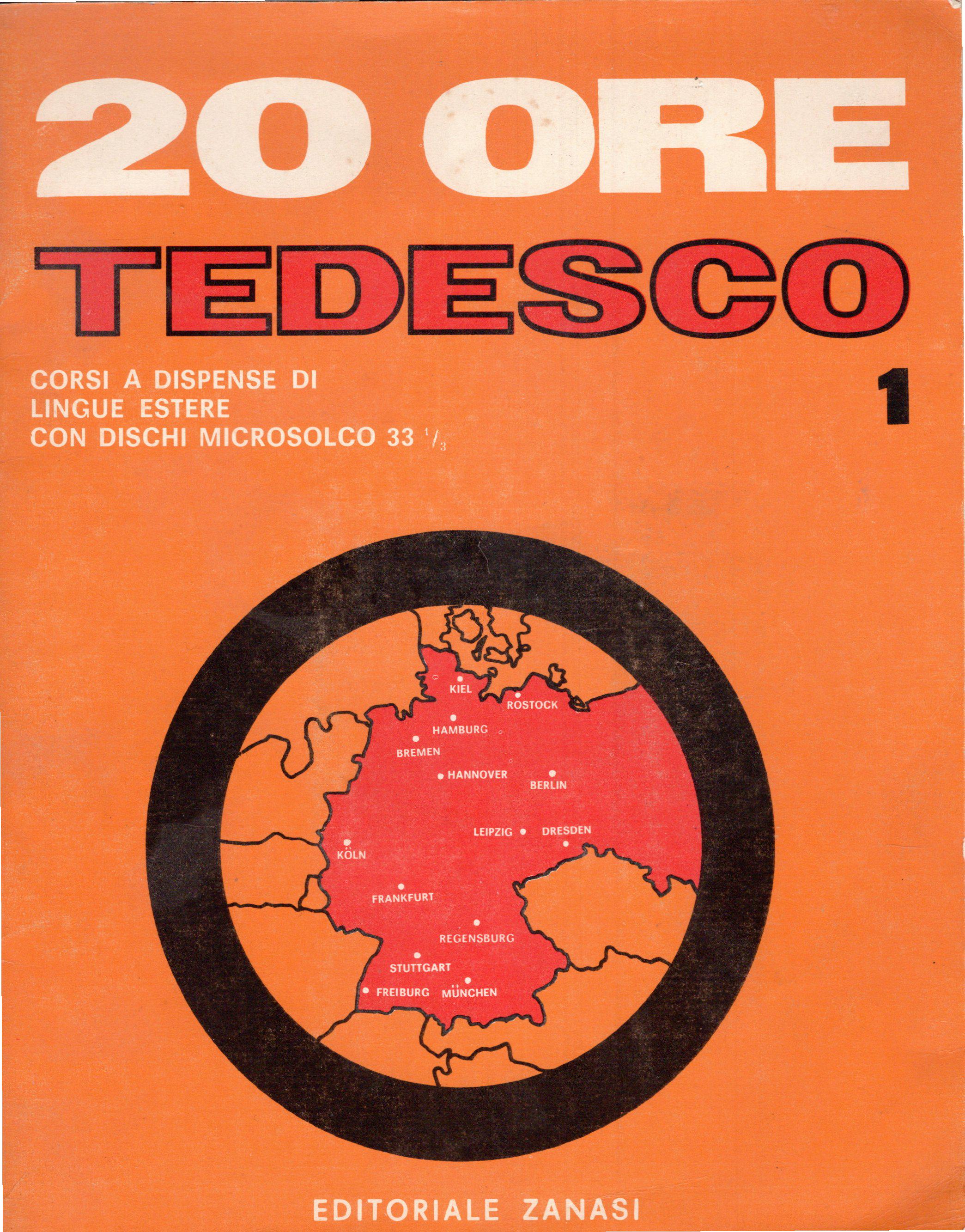
Germany Borders Map According to 1960s Italian Course
Interestingly, during the 1960s, West Germany was characterized by a flourishing economy, known as the \...
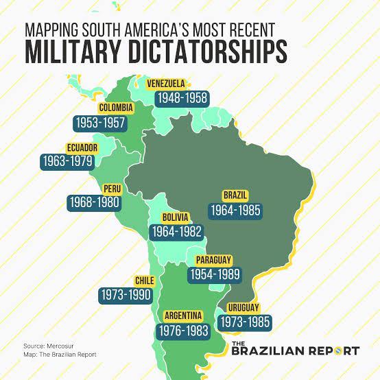
South America Military Dictatorships Map
The "South America Military Dictatorships Map" provides a stark visual representation of the political turmoil that grip...
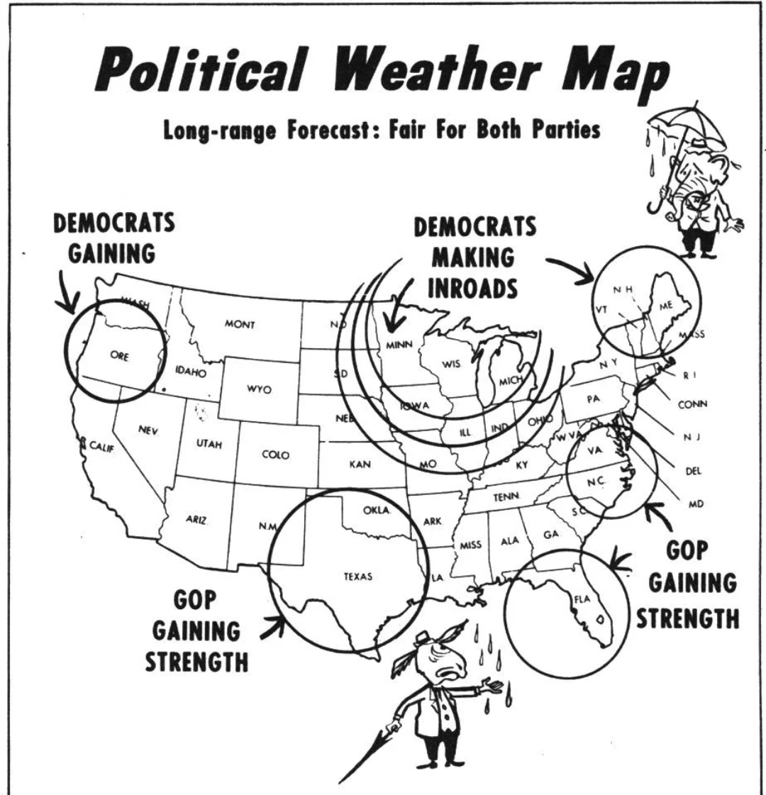
Political Weather Map of 1954
The "Political Weather Map of 1954" offers a striking visualization of the geopolitical landscape during a pivotal year ...
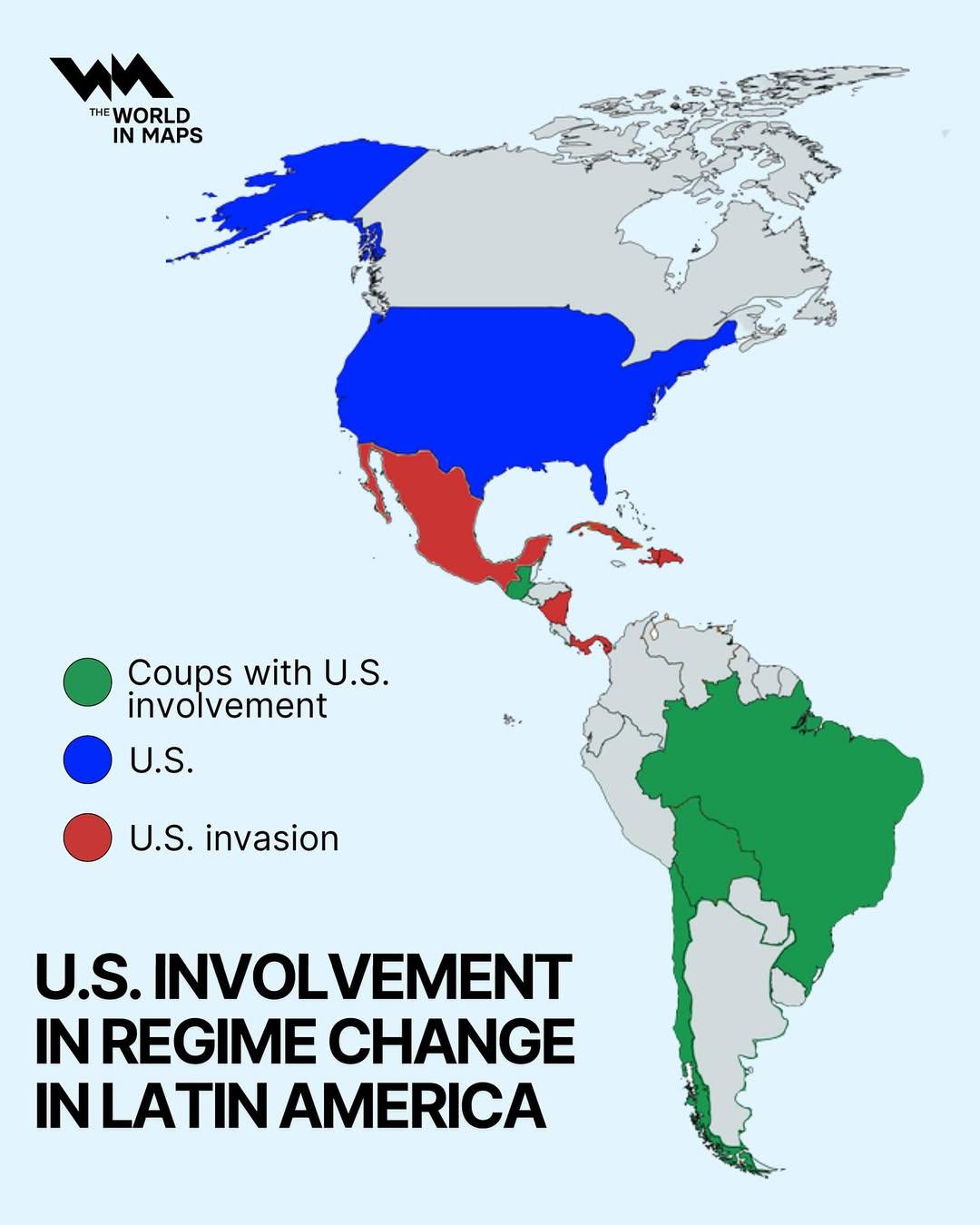
US Involvement in Regime Change in Latin America Map
The visualization titled "US Involvement in Regime Change in Latin America" provides a geographical representation of va...
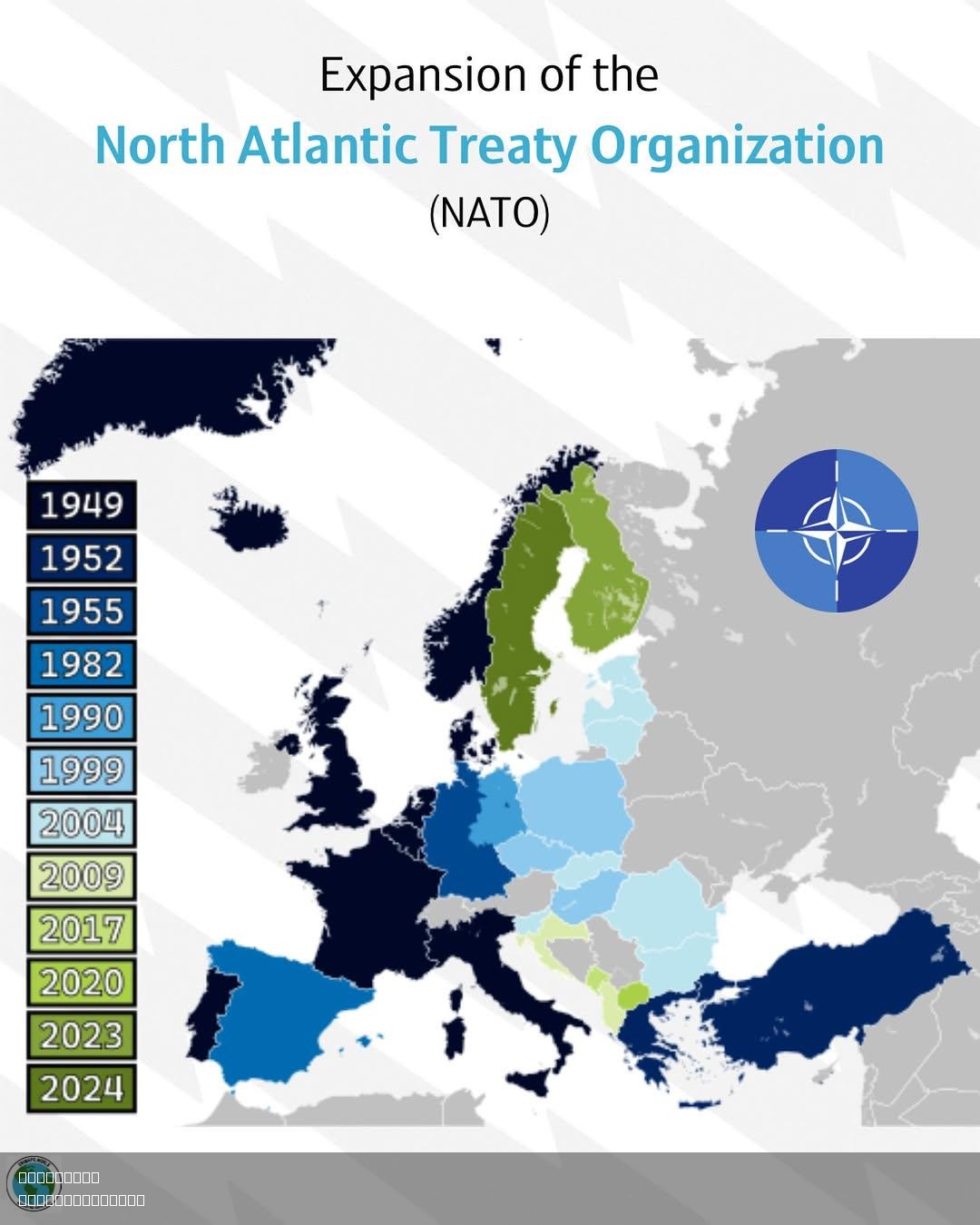
NATO Expansion Map
The NATO Expansion Map provides a visual representation of the North Atlantic Treaty Organization's growth since its inc...
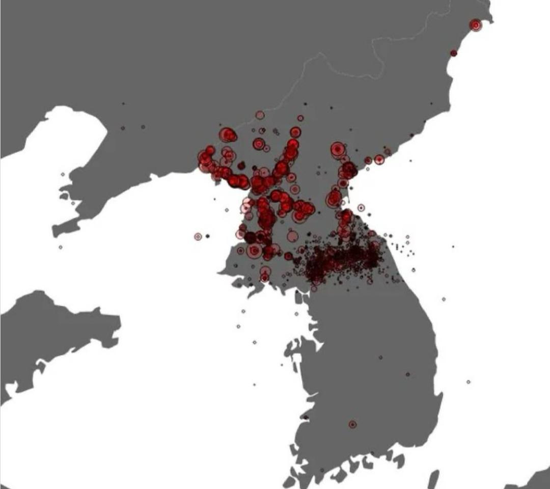
Aerial Bombings Intensity Map of Korean War
This map illustrates the intensity of aerial bombings across the Korean Peninsula during the Korean War, which lasted fr...
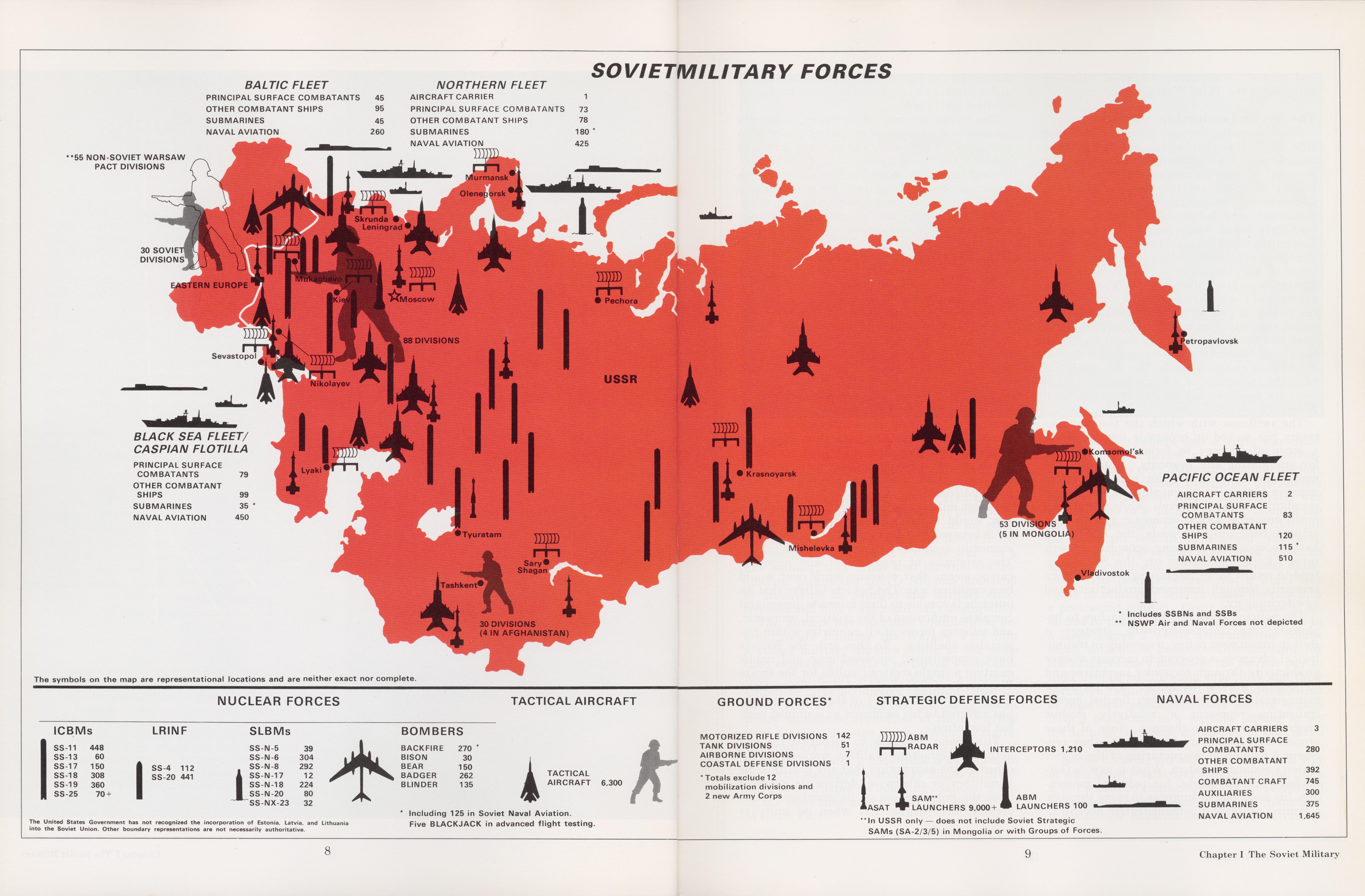
1986 Map of Soviet Military Forces
In 1986, the Soviet military was organized into several key components: the Ground Forces, the Navy, and the Air Force. ...
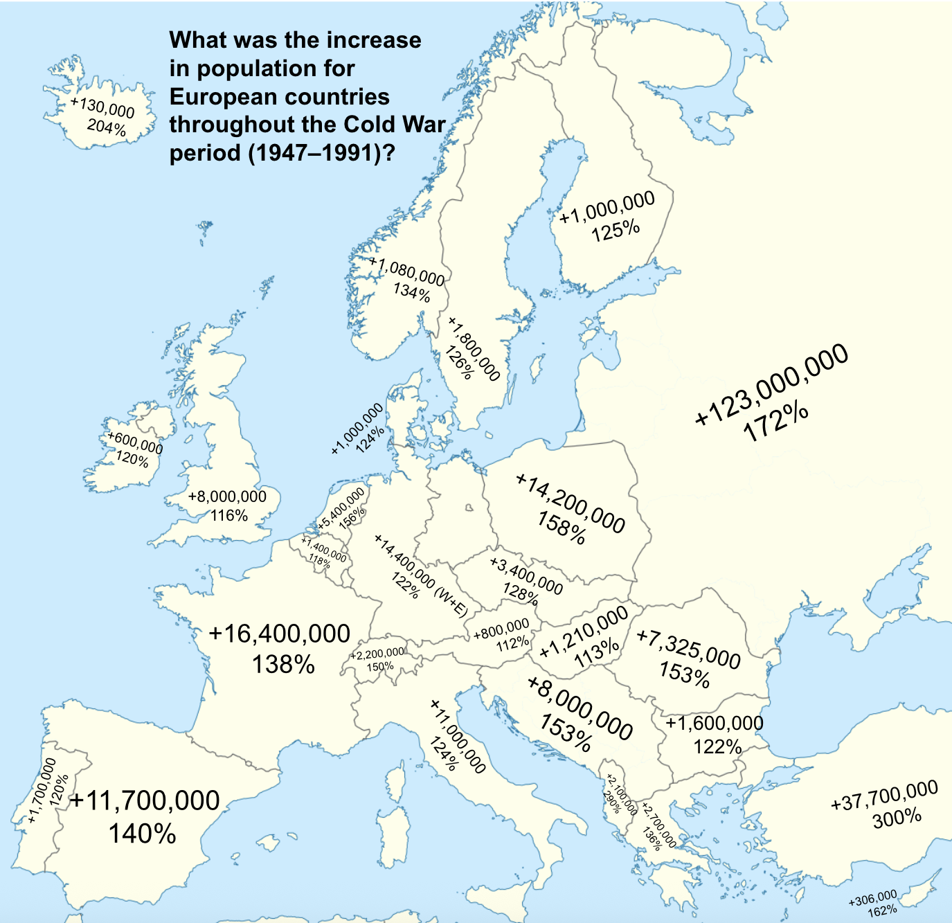
European Population Growth Map During Cold War
The map titled "What was the increase in population for European countries throughout the Cold War period (1947-1991)" v...
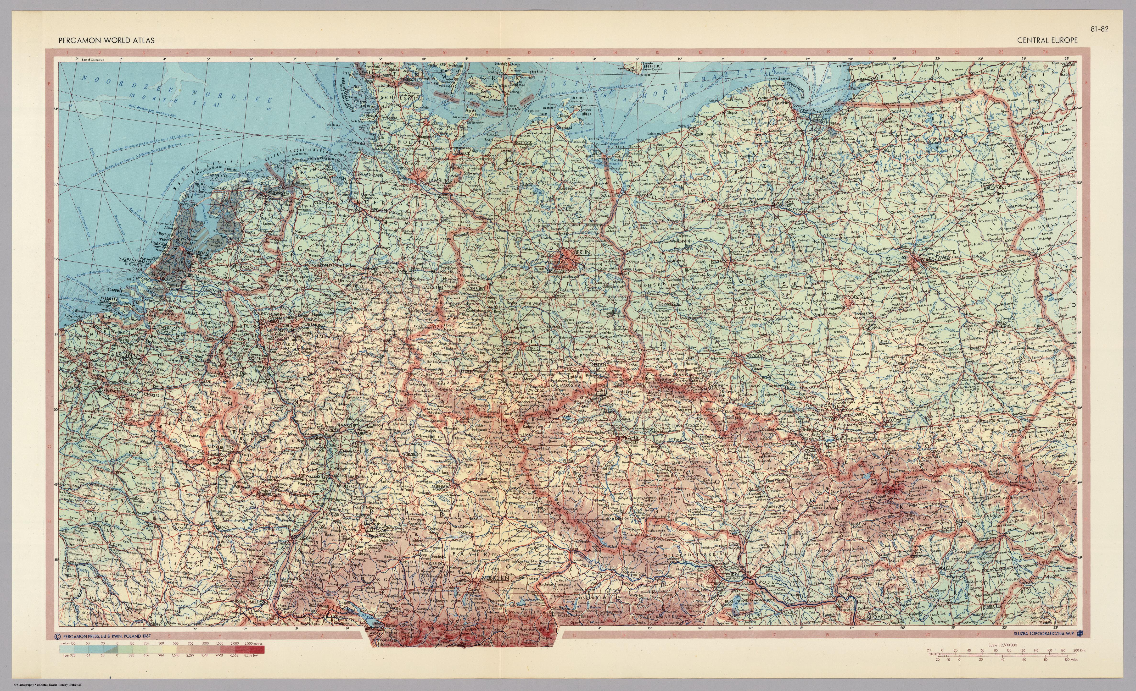
Central Europe Map of 1967
...