balkans Maps
24 geographic visualizations tagged with "balkans"
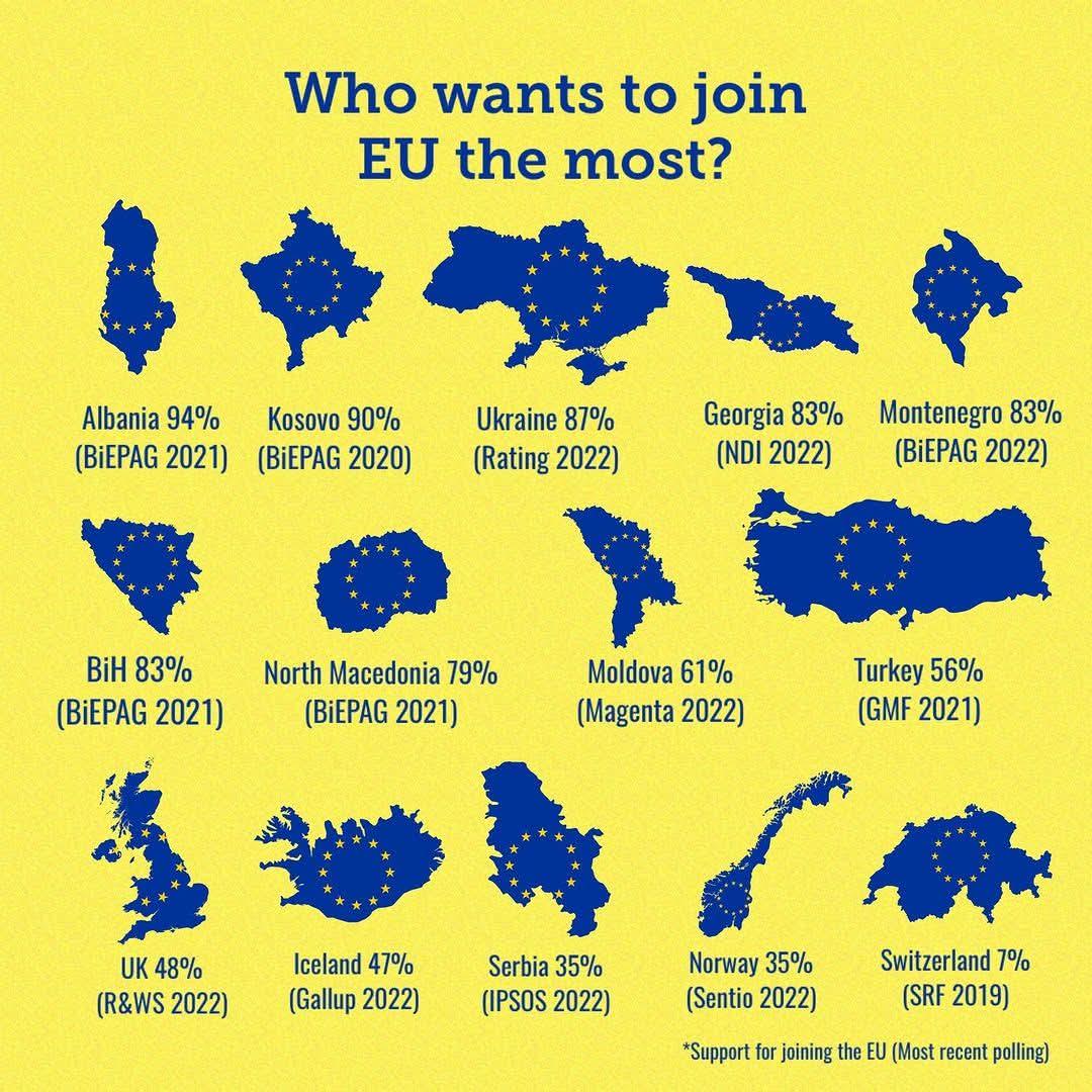
Map of European Countries Seeking EU Membership
This map provides a clear and informative visualization of European countries that are currently seeking to join the Eur...
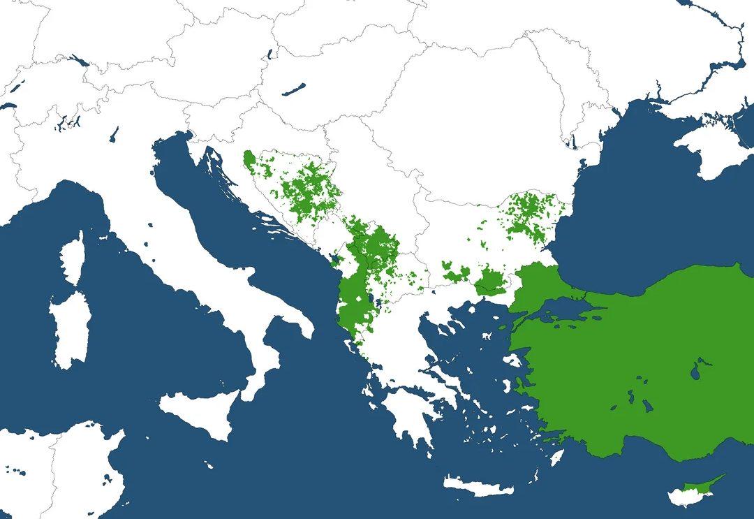
Muslim Majority Regions in the Balkans Map
The \...
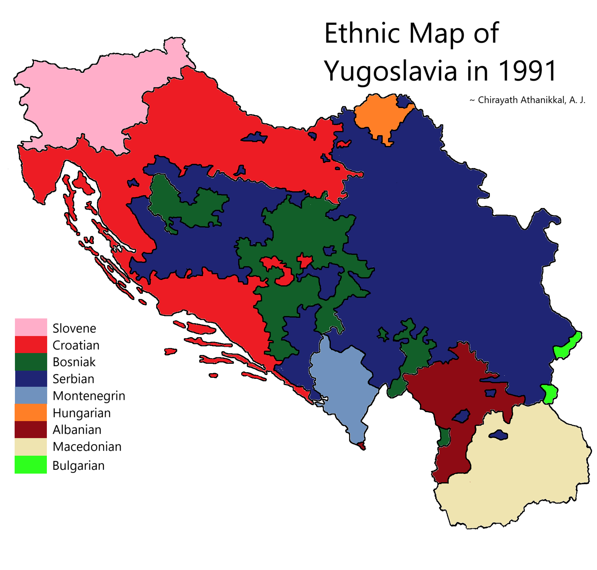
Ethnic Map of Yugoslavia in 1991
The "Ethnic Map of Yugoslavia in 1991" provides a detailed visualization of the diverse ethnic groups that populated the...
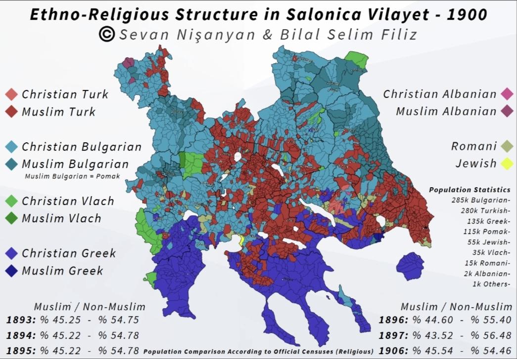
Ethno-Religious Structure Map of Salonica Vilayet 1900
...
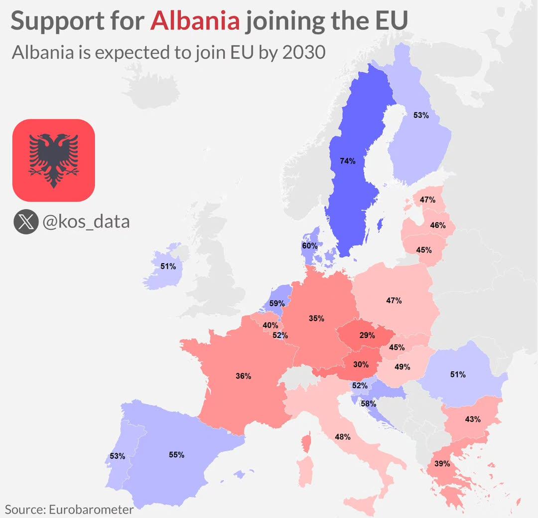
Support for Albania Joining the EU Map
This map visualizes the levels of support among European Union member states for Albania's accession to the EU. It highl...
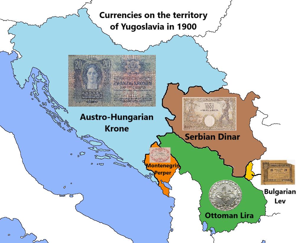
Currency Map of Yugoslavia in 1900
The map titled "Currencies on the territory of Yugoslavia in 1900" illustrates the various currencies that were in circu...
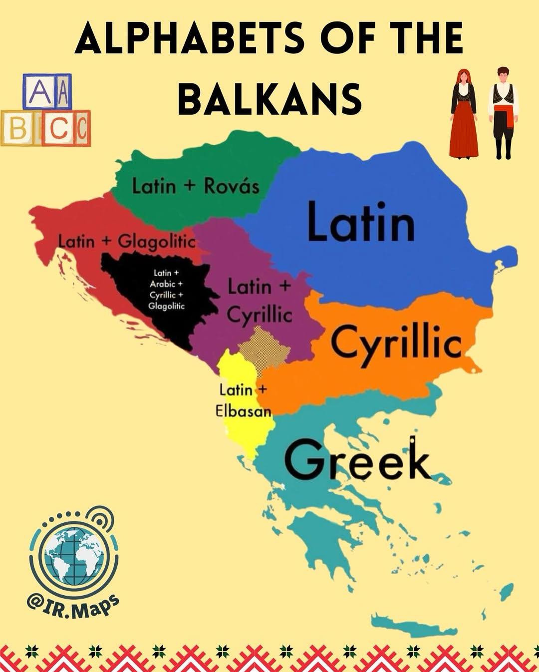
Alphabets of the Balkans Map
The "Alphabets of the Balkans Map" presents a visual representation of the diverse scripts used across the Balkan Penins...
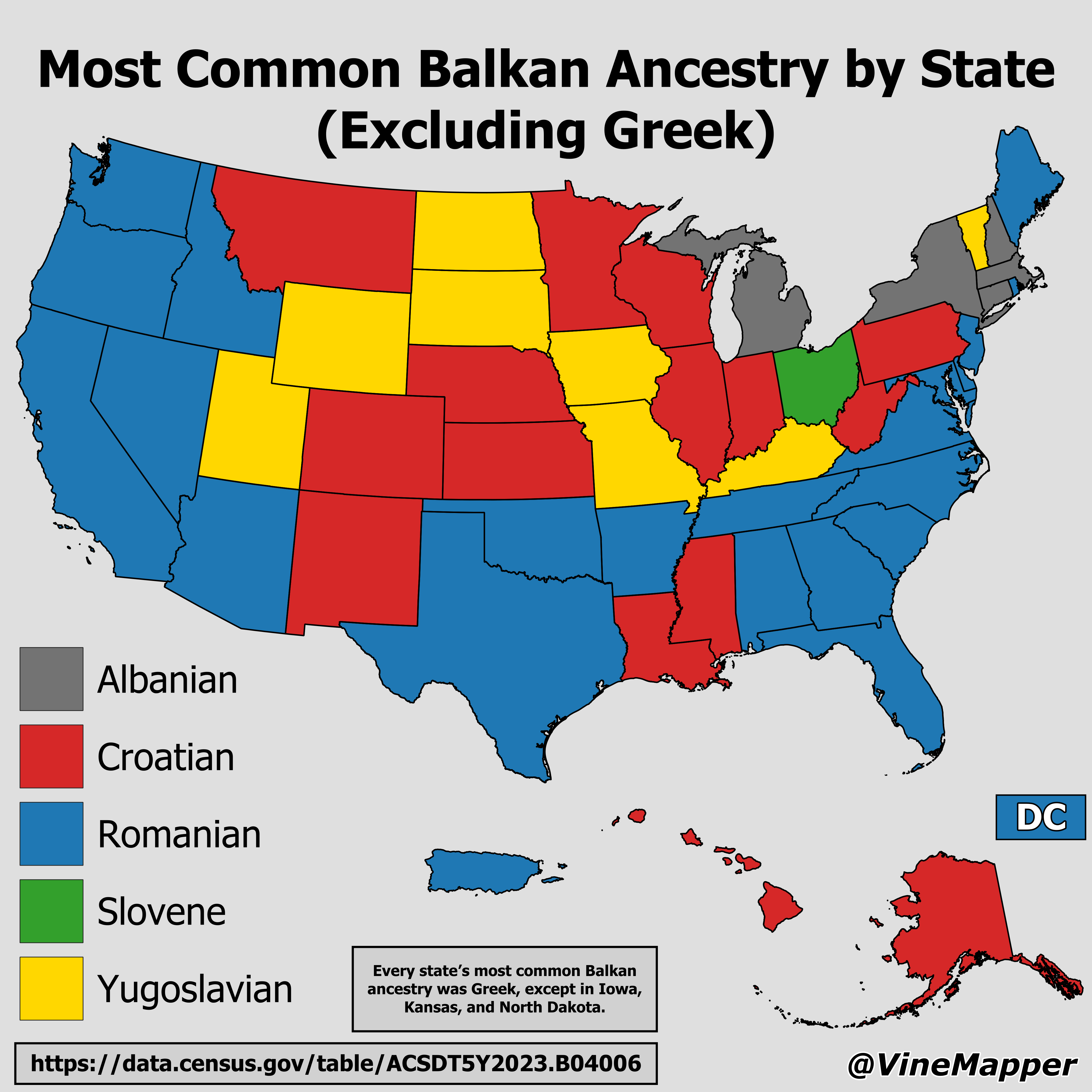
Most Common Balkan Ancestry by State Map
...
Map of the First Balkan War (1912)
...
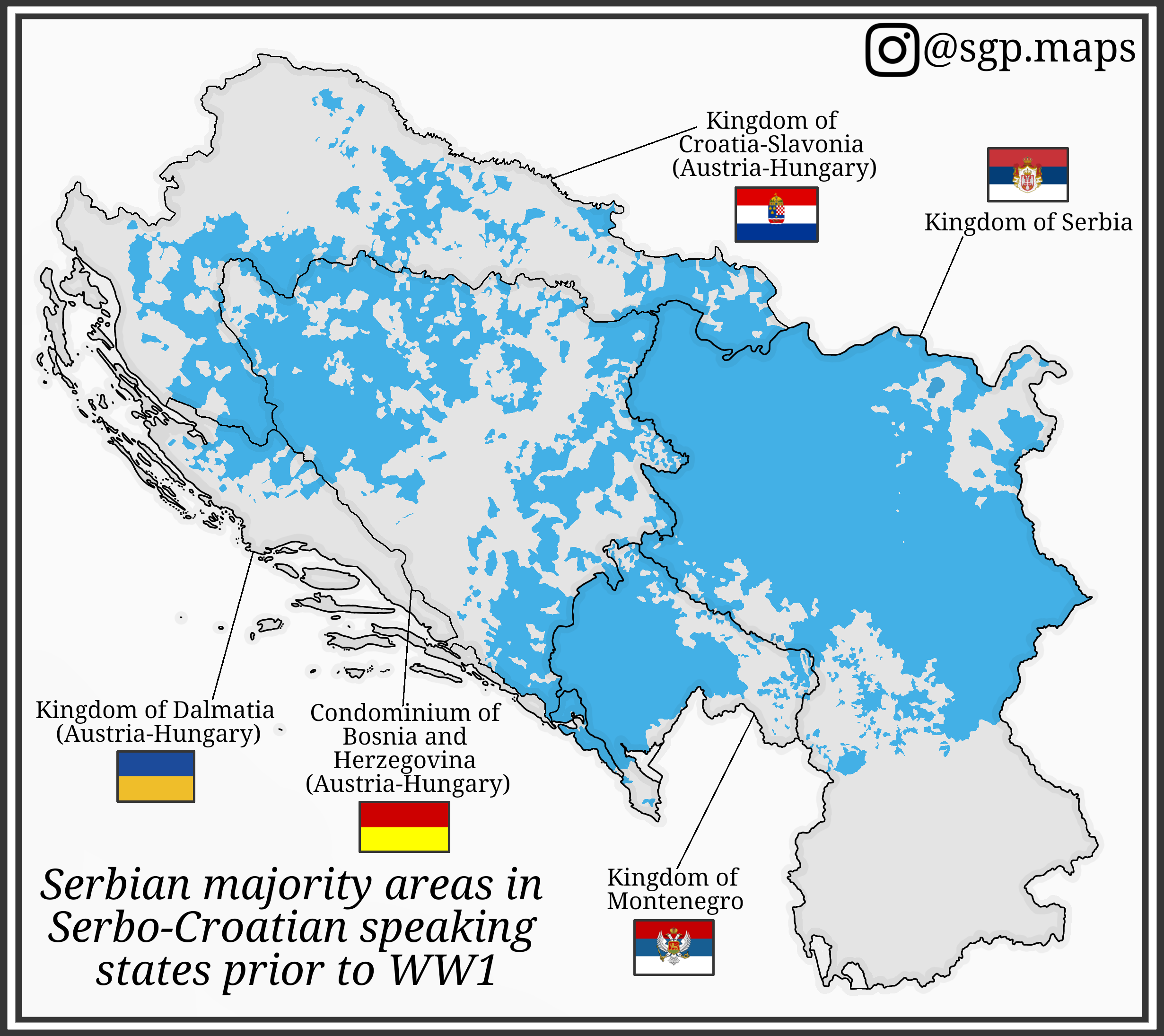
Serbian Majority Areas Map in Serbo-Croatian States Before WW1
This map illustrates the distribution of Serbian majority areas in the regions where Serbo-Croatian was spoken prior to ...

Map of Countries Refusing Access to Kosovo Citizens
This map highlights the countries that currently refuse access to citizens of Kosovo. Marked in distinct colors, it clea...
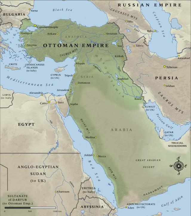
Ottoman Empire Territorial Map 1914
The "Map of the Ottoman Empire in 1914" vividly illustrates the territorial expanse of one of history's most influential...
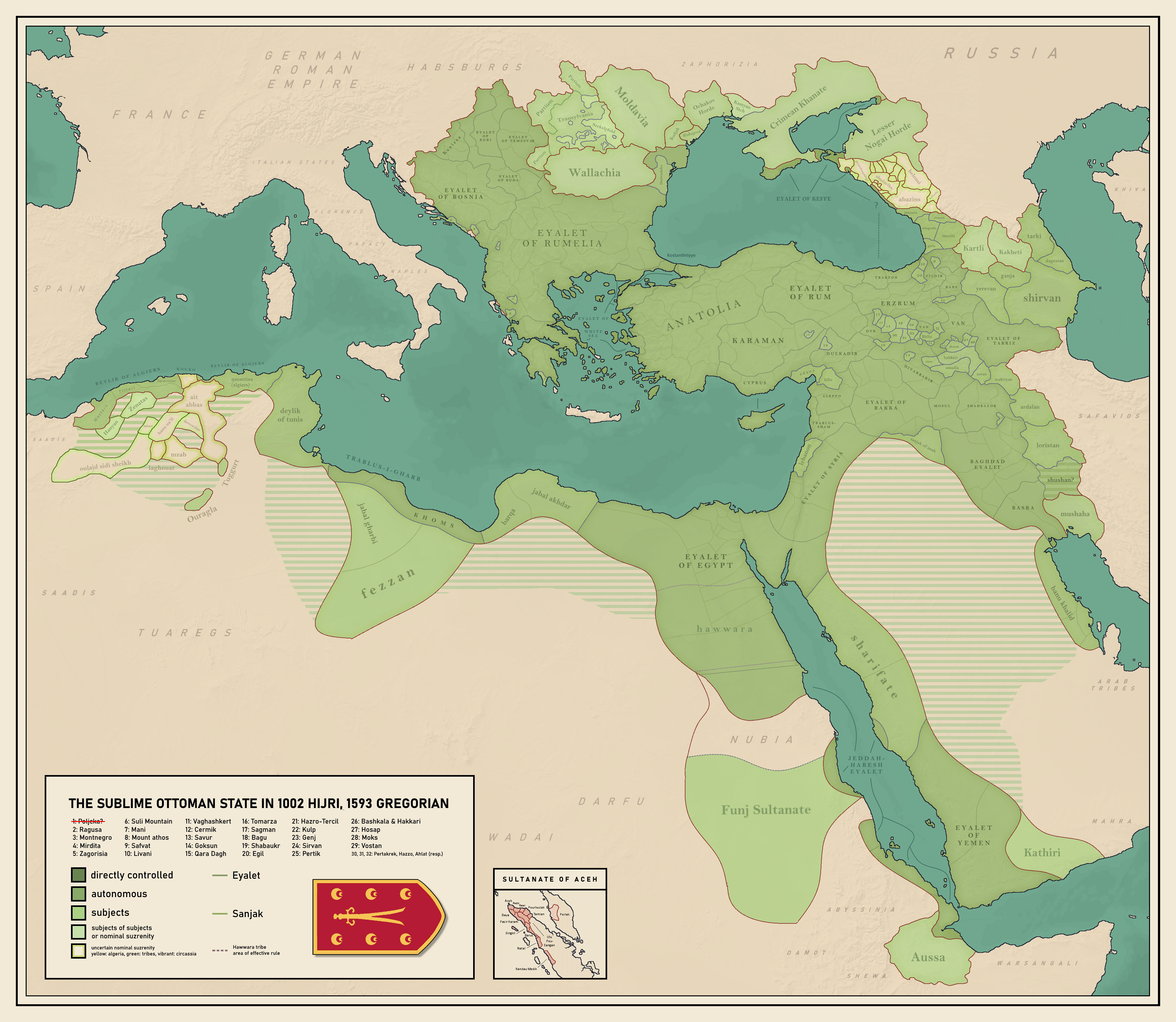
Ottoman Empire Map of 1593
...
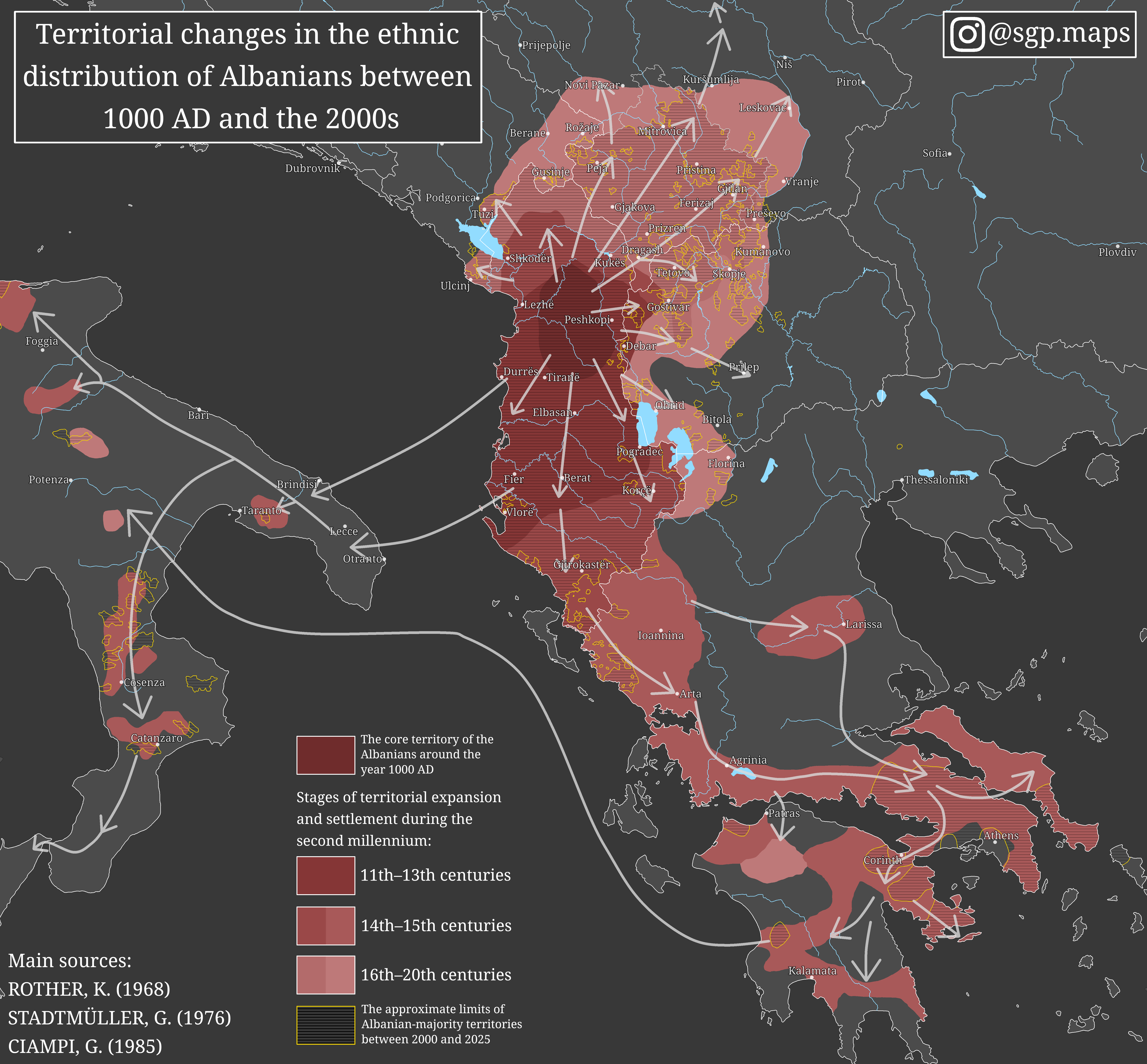
Ethnic Distribution Changes of Albanians Map
The map titled "Territorial changes in the ethnic distribution of Albanians between 1000 AD and the 2000s" provides an i...
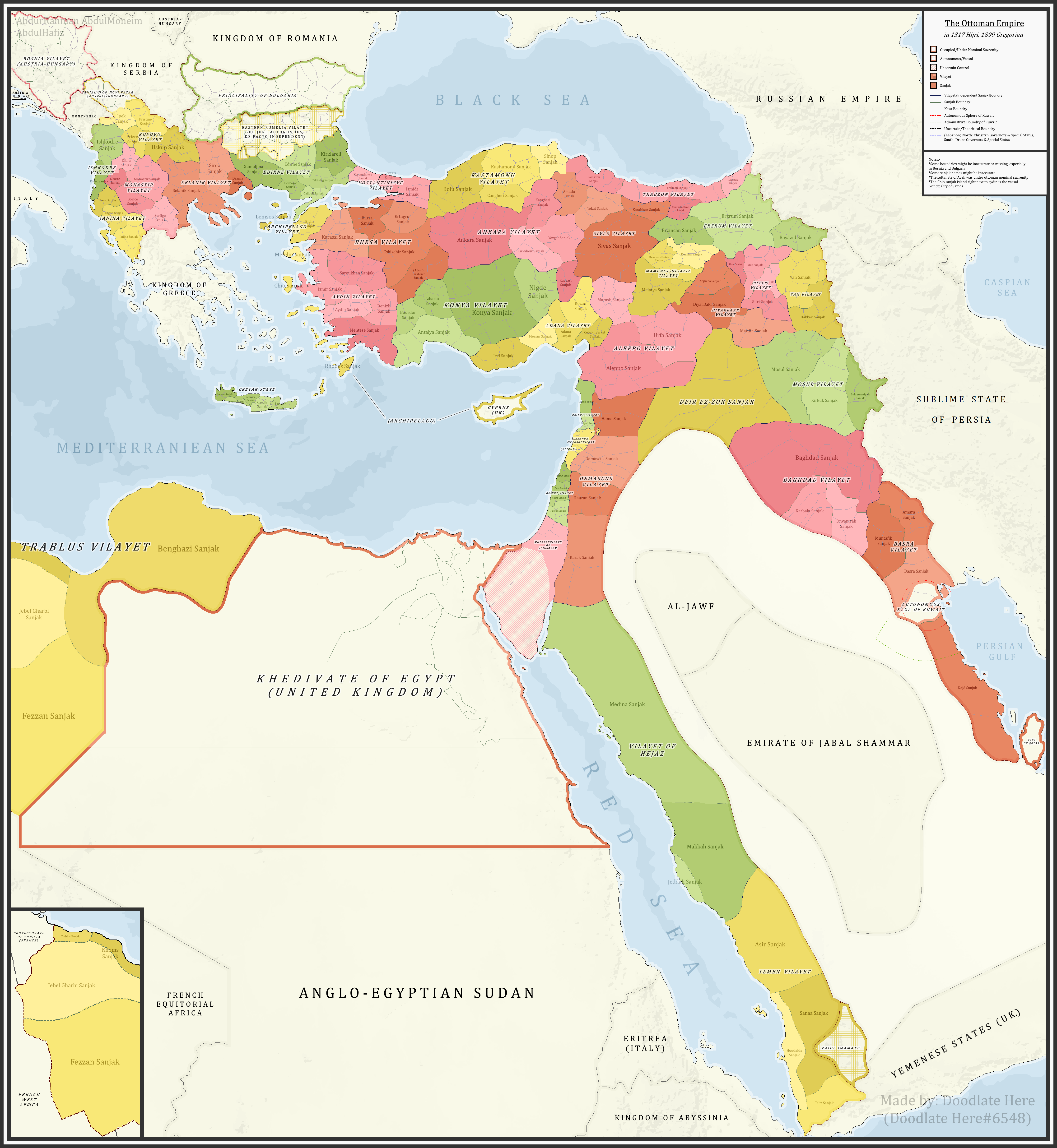
Ottoman Sanjaks in 1899 Map
...
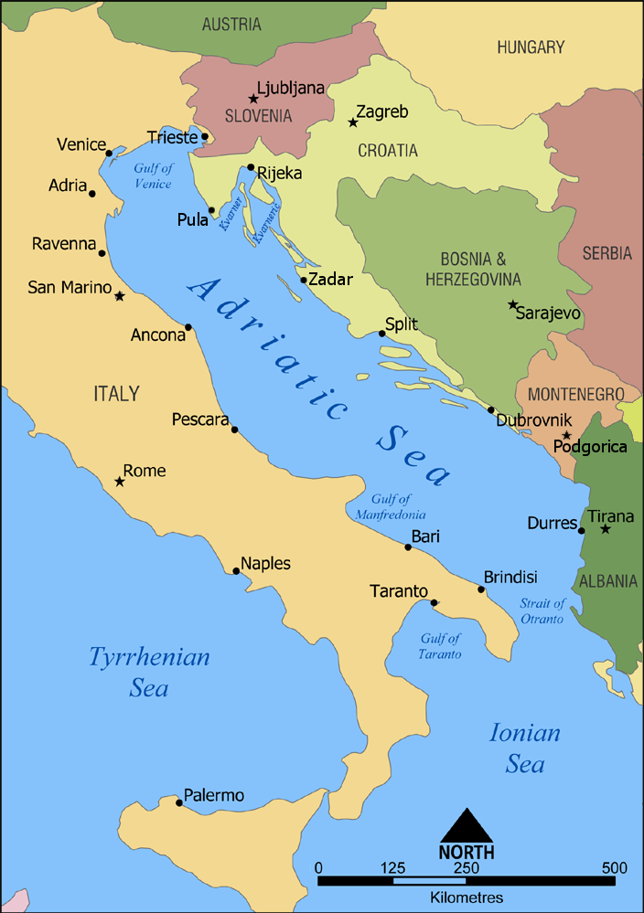
Geographic Orientation Map of Croatia and Bosnia
The visualization titled 'Croatia is more North, West and South than Bosnia & Herzegovina, whilst Italy is more North, W...
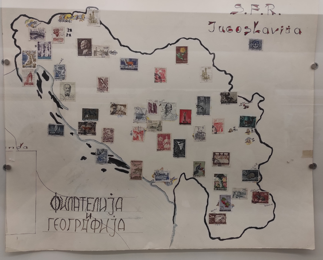
Map of Yugoslavia with Regional Stamps
The "Map of Yugoslavia with Regional Stamps" is a unique geographical visualization that highlights the various regions ...
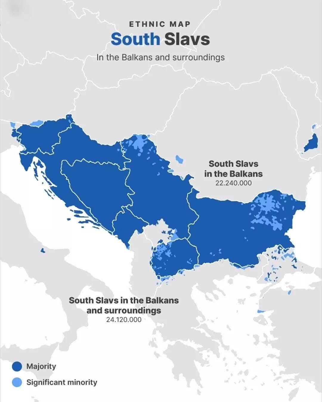
Ethnic Map of South Slavs in the Balkans
This visualization presents the ethnic distribution of South Slavs in the Balkans and surrounding regions, highlighting ...
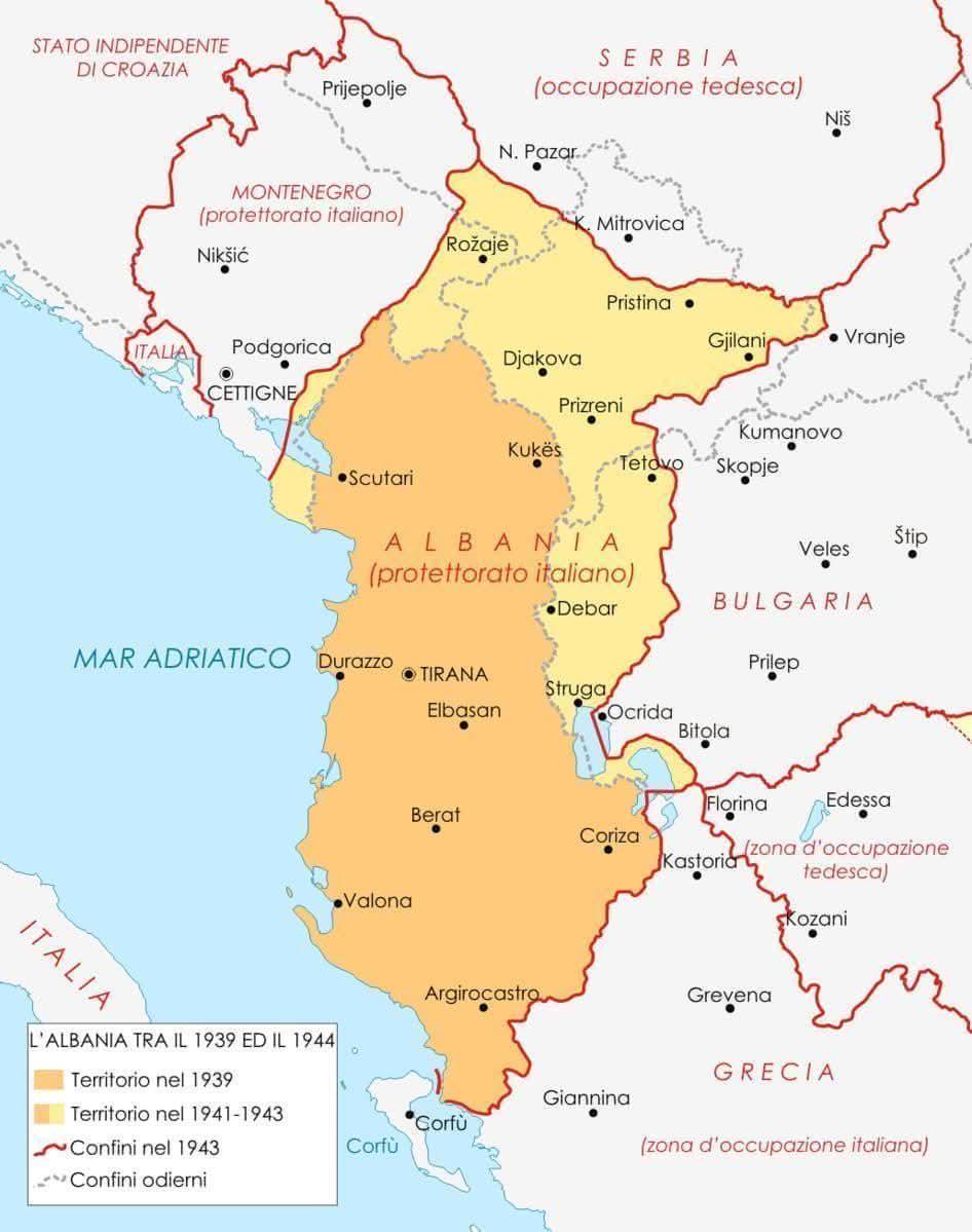
Historical Map of Albania 1939 to 1944
The map titled "Albania Between 1939 and 1944" provides a detailed visualization of Albania's geographical and political...
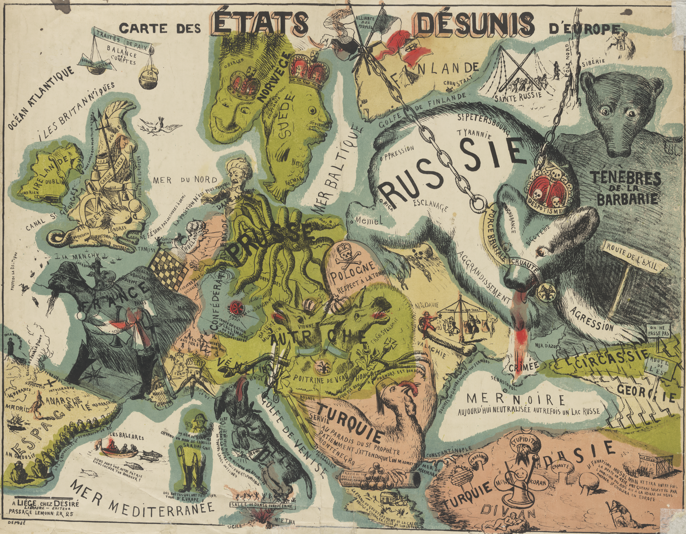
Map of Disunited States of Europe
The "Carte des états désunis d'Europe" visualizes the complex political landscape of Europe, highlighting regions that h...
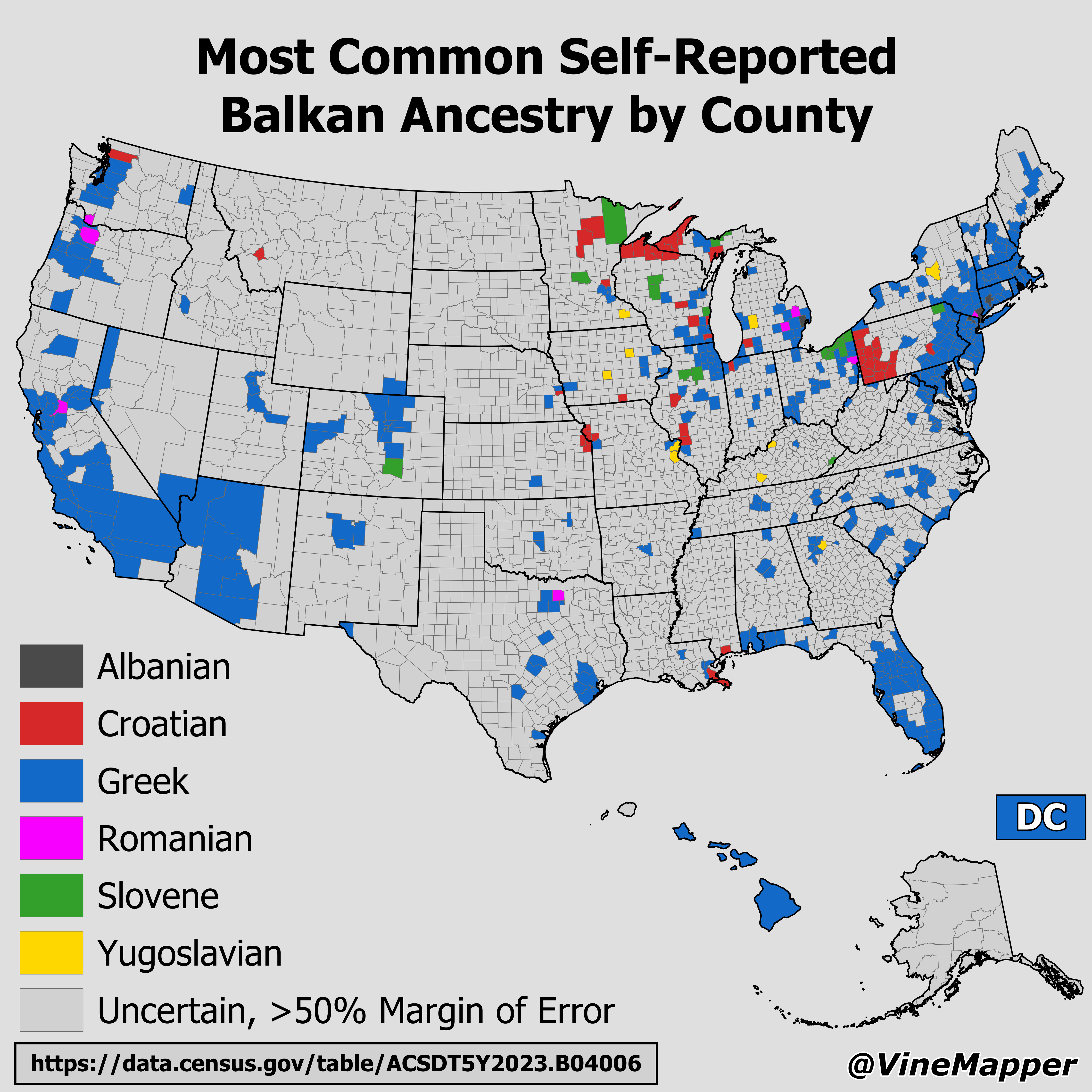
Most Common Self-Reported Balkan Ancestry by County Map
The "Most Common Self-Reported Balkan Ancestry by County Map" provides a detailed visual representation of the ancestral...
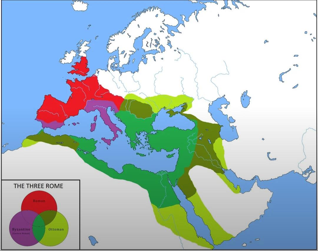
Map of Overlapping Borders of Ottoman and Roman Empires
This map illustrates the overlapping borders of the Ottoman Empire and the Roman Empire, providing a visual representati...
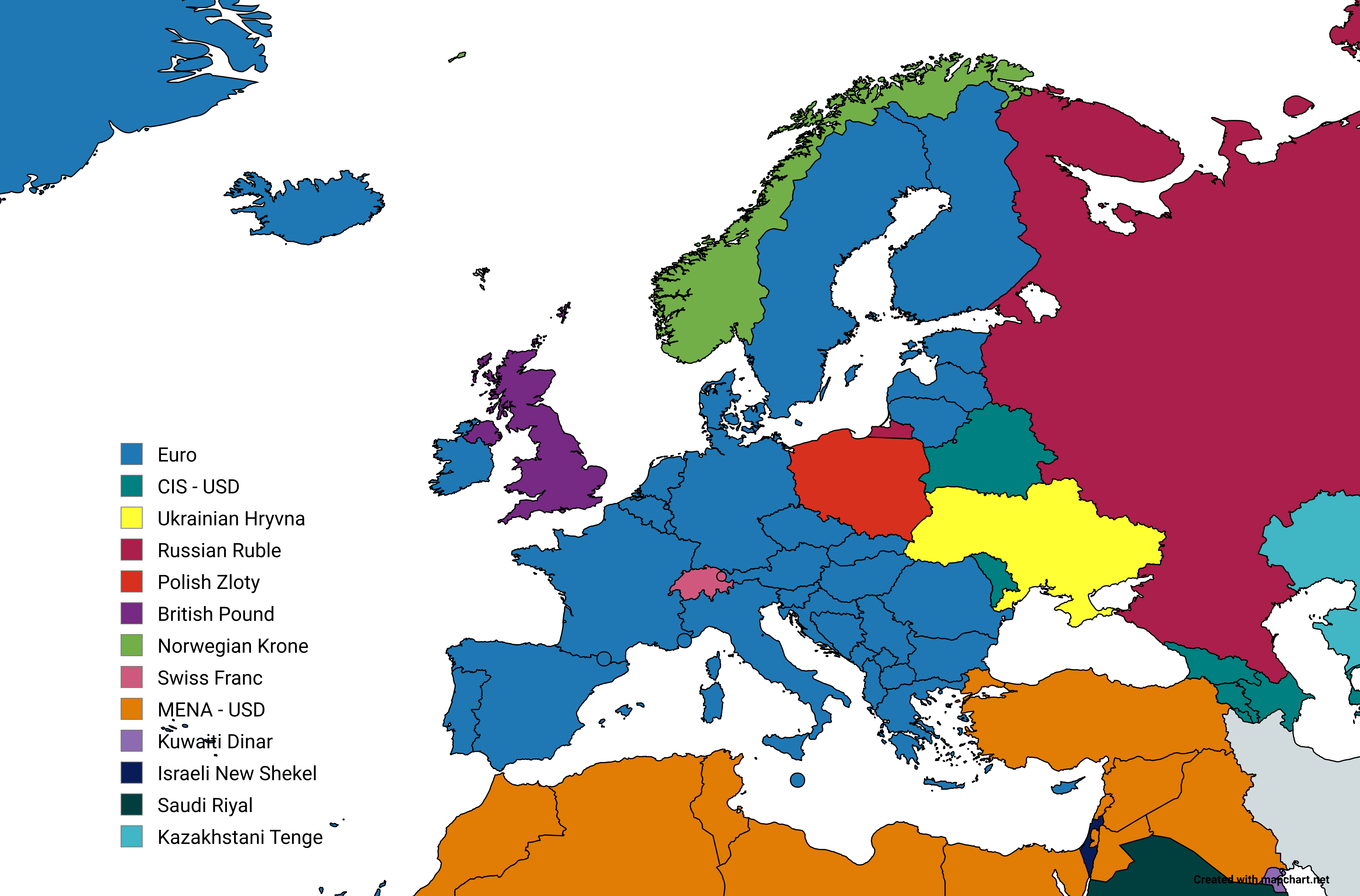
STEAM Pricing Groups Map by Country
The "STEAM Pricing Groups Map" provides a comprehensive visual representation of the various pricing groups assigned to ...
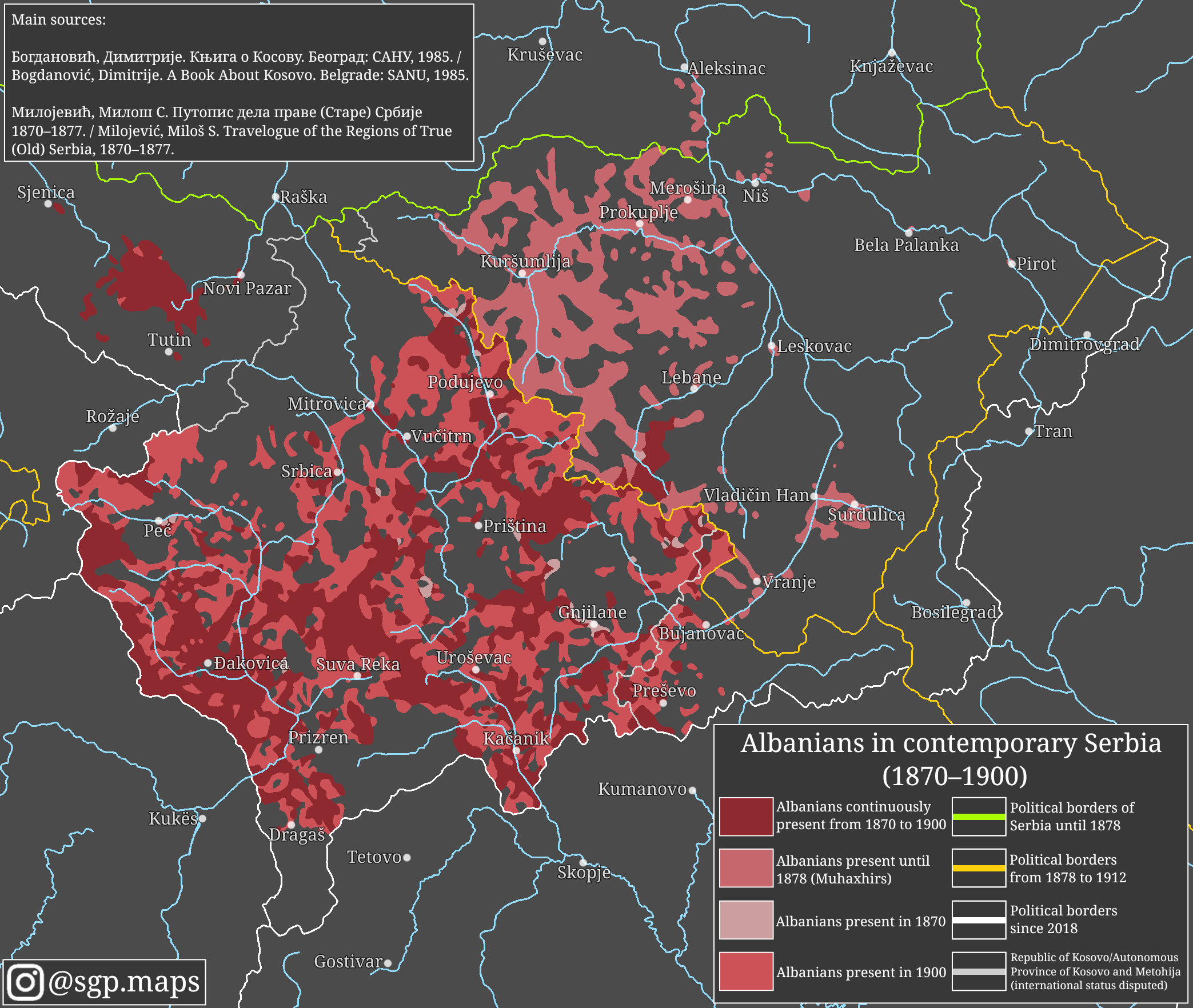
Albanians in Serbia 1870–1900 Map
The "Albanians in contemporary Serbia (1870–1900)" map provides a detailed visualization of the distribution and demogra...