Hand-Painted Map of US Route 41

Marcus Rodriguez
Historical Geography Expert
Marcus Rodriguez specializes in historical cartography and geographic data analysis. With a background in both history and geography, he brings unique...
Geographic Analysis
What This Map Shows
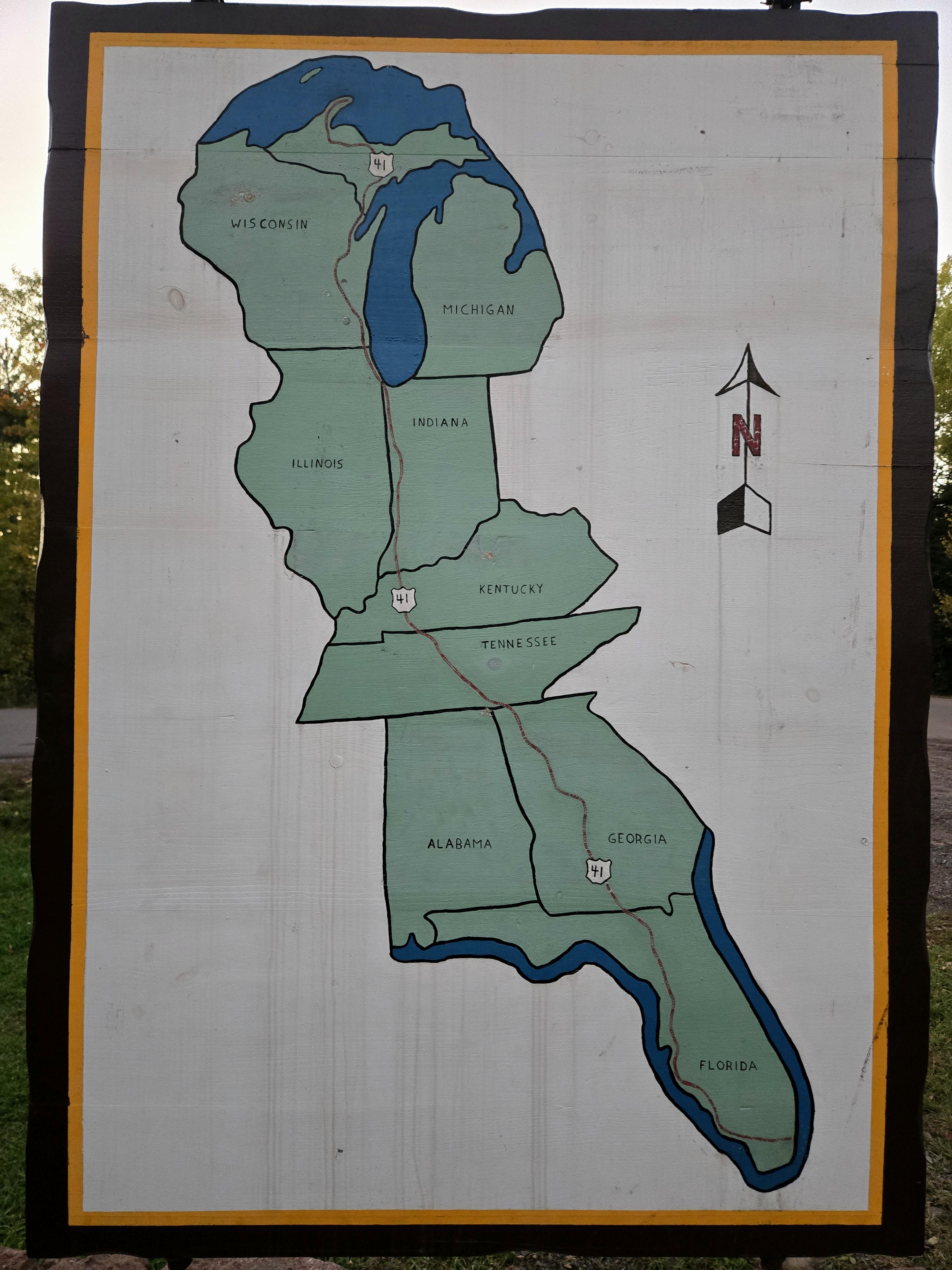
The hand-painted map of US Route 41 offers a unique visual representation of a significant highway that spans approximately 1,990 miles from the northern reaches of Michigan to the southern stretches of Florida. This route is particularly noteworthy as it traverses a diverse array of landscapes, cities, and cultural landmarks. The visualization captures not only the road itself but also highlights key towns, natural features, and historical sites along the way, providing a snapshot of the journey one might undertake along this iconic American road.
Deep Dive into US Route 41
US Route 41 has a rich history and plays a vital role in the transportation network of the United States. Established in the 1920s as part of the U.S. Highway System, it has evolved into a critical route connecting various regions and facilitating commerce and travel. The road begins in the picturesque Upper Peninsula of Michigan, where it winds through the rugged terrain and lush forests, offering stunning views and outdoor activities.
As travelers move southward, they encounter the vibrant cities of Wisconsin, including Milwaukee, known for its brewing heritage, and Madison, a hub of education and culture. Interestingly, Route 41’s path through Illinois leads it into the bustling metropolis of Chicago, where it merges with other significant highways, making it a key artery for both local and interstate traffic.
Continuing into Indiana, Route 41 showcases the transition from urban to rural landscapes, reflecting the agricultural heartland of America. Here, one can observe vast farmlands and small towns that exemplify Midwestern charm. Notably, the road passes through cities like Terre Haute, which has historical significance as a transportation and manufacturing center.
As the route progresses into Kentucky and Tennessee, it begins to reveal the rolling hills and picturesque landscapes of the Appalachian region. This area is rich in cultural heritage, with numerous opportunities to explore the music and arts that have flourished here. The map highlights several attractions, such as the Great Smoky Mountains National Park, which draws millions of visitors each year.
In Georgia and Florida, US Route 41 transforms once again, leading travelers through subtropical environments and iconic Southern cities. The vibrant energy of cities like Tallahassee and Tampa showcases the diverse cultural fabric of the region. The southern terminus of Route 41 culminates in Miami, a city celebrated for its beaches, nightlife, and multicultural atmosphere.
Regional Analysis
A closer examination of US Route 41 reveals distinct regional variations along its length. In the northern states, the route is characterized by its scenic beauty and outdoor recreational opportunities. The Upper Peninsula of Michigan, for instance, is known for its dense forests and pristine lakes, making it a popular destination for nature lovers.
As we move into the Midwest, the contrast becomes apparent with urban centers that have evolved around the highway. Chicago, for example, stands out as a cultural and economic powerhouse, while smaller towns along the route maintain a slower pace of life, reflecting the agricultural roots of the region. This juxtaposition highlights the diversity of experiences available to travelers.
Entering the Southern states, one sees a shift in climate and culture. The landscapes transition from the cooler northern climates to the warm, humid conditions typical of Florida. The cultural influences are equally diverse, with Southern hospitality and rich historical narratives punctuating the journey.
Significance and Impact
Understanding the significance of US Route 41 is crucial, as it serves not only as a transportation route but also as a historical corridor reflecting the development of the United States. It has facilitated trade, tourism, and cultural exchange, impacting local economies along its path. Moreover, the highway symbolizes the connectivity of rural and urban areas, bridging gaps between different lifestyles and communities.
In today's context, the relevance of US Route 41 is underscored by ongoing discussions about infrastructure and sustainability. As more people seek alternative travel routes and eco-friendly transportation options, highways like Route 41 will play a pivotal role in shaping future travel trends. Interestingly, with the rise of remote work, there may be an increase in road trips along this route as individuals explore the beauty and culture found along its path.
Ultimately, the hand-painted map of US Route 41 is more than just a visual representation; it encapsulates the spirit of American travel and the diverse experiences that await those who venture along this historic highway.
Visualization Details
- Published
- October 12, 2025
- Views
- 34
Comments
Loading comments...