Hawaii Size Comparison Map with the United States

David Chen
Data Visualization Specialist
David Chen is an expert in transforming complex geographic datasets into compelling visual narratives. He combines his background in computer science ...
Geographic Analysis
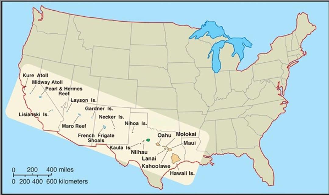
What This Map Shows
This map provides a visual representation of the size of Hawaii in relation to the rest of the United States. By comparing the land area of the Aloha State to the contiguous U.S., viewers can gain a clearer understanding of Hawaii's geographical scale. While Hawaii may seem small when viewed on a traditional map, this visualization emphasizes its actual size, highlighting how it fits within the larger context of the United States.
Deep Dive into Hawaii's Geography
Hawaii, an archipelago located in the central Pacific Ocean, is made up of 137 islands, with the eight main islands being the most well-known: Hawai'i (the Big Island), Maui, O'ahu, Kaua'i, Moloka'i, Lāna'i, Niʻihau, and Kahoʻolawe. The total land area of Hawaii is approximately 10,931 square miles, making it the 43rd largest state in the U.S. Interestingly, the Big Island alone, which is often confused with the entirety of Hawaii, is larger than the other seven islands combined.
One of the fascinating aspects of Hawaii's geography is its volcanic origin. The islands were formed through volcanic activity, and this geological history has shaped not only the landscape but also the unique ecosystems that exist on each island. For instance, the Hawaiian Islands are home to diverse climates, ranging from tropical rainforests to arid deserts. This climatic variety supports a rich array of flora and fauna, some of which are found nowhere else on Earth.
Hawaii's location also plays a crucial role in its weather patterns. Positioned in the trade wind belt, the islands experience consistent wind patterns that influence rainfall and temperature. The eastern side of the islands typically receives more rainfall, leading to lush vegetation, while the leeward sides are drier, often characterized by volcanic rock and sparse plant life. This contrast can be seen dramatically when traveling from the verdant mountains of Kaua'i to the arid landscapes of the Kona coast on the Big Island.
In terms of population, Hawaii has a unique demographic profile. According to the U.S. Census Bureau, as of 2020, the state had an estimated population of around 1.4 million people. The largest city, Honolulu, located on O'ahu, is home to about 350,000 residents, making it a bustling metropolitan area amidst the Pacific. The state's cultural diversity is also noteworthy, with a mix of Native Hawaiian, Asian, and Caucasian populations contributing to a rich cultural tapestry.
Regional Analysis
When examining Hawaii's geographical features, it’s crucial to consider the individual islands. For example, O'ahu, known as “The Gathering Place,” is not only the most populated but also the most developed island in terms of infrastructure, tourism, and education. Home to Pearl Harbor and the bustling city of Honolulu, O'ahu plays a strategic role in U.S. military presence and tourism, making it a focal point of economic activity in the state.
On the other hand, the Big Island showcases the stark contrast in Hawaii's geography with its diverse landscapes. It is home to Mauna Kea, the tallest mountain in the world when measured from its base on the ocean floor, and Kilauea, one of the most active volcanoes on the planet. Interestingly, the Big Island's vast size allows for a range of climates and ecosystems, from snow-capped mountains to tropical rainforests, highlighting Hawaii’s unique geographical diversity.
Maui, often celebrated for its stunning beaches and scenic drives, offers a different perspective on Hawaii's geography. The island features the famous Haleakalā National Park, home to a dormant volcano that rises over 10,000 feet. This park showcases not only the geological activity that formed the islands but also the breathtaking vistas that attract visitors worldwide.
Significance and Impact
Understanding the geographical size and diversity of Hawaii is essential for several reasons. First, it informs tourists and residents alike about the various ecosystems and climates, promoting awareness of the environment and conservation efforts. With rising concerns regarding climate change and its impact on island environments, recognizing how Hawaii's geography contributes to its vulnerability is crucial. Coastal erosion, rising sea levels, and the effects of tourism on natural habitats are pressing issues that require attention.
Moreover, Hawaii's unique cultural heritage and biodiversity are intricately linked to its geographic features. The islands are home to endemic species, many of which are threatened due to habitat loss and invasive species. This makes the preservation of Hawaii’s natural landscapes vital for maintaining its ecological balance and cultural identity. As tourism continues to grow, understanding the delicate balance between economic development and environmental sustainability becomes increasingly important.
In conclusion, this map serves as a reminder that while Hawaii may appear small compared to the vast expanse of the United States, its geographical significance is immense. By appreciating Hawaii's actual size and diverse landscapes, we can foster a deeper understanding of the state’s unique challenges and treasures.
Visualization Details
- Published
- October 12, 2025
- Views
- 20
Comments
Loading comments...