Mercator Projection World Map

Marcus Rodriguez
Historical Geography Expert
Marcus Rodriguez specializes in historical cartography and geographic data analysis. With a background in both history and geography, he brings unique...
Geographic Analysis
What This Map Shows
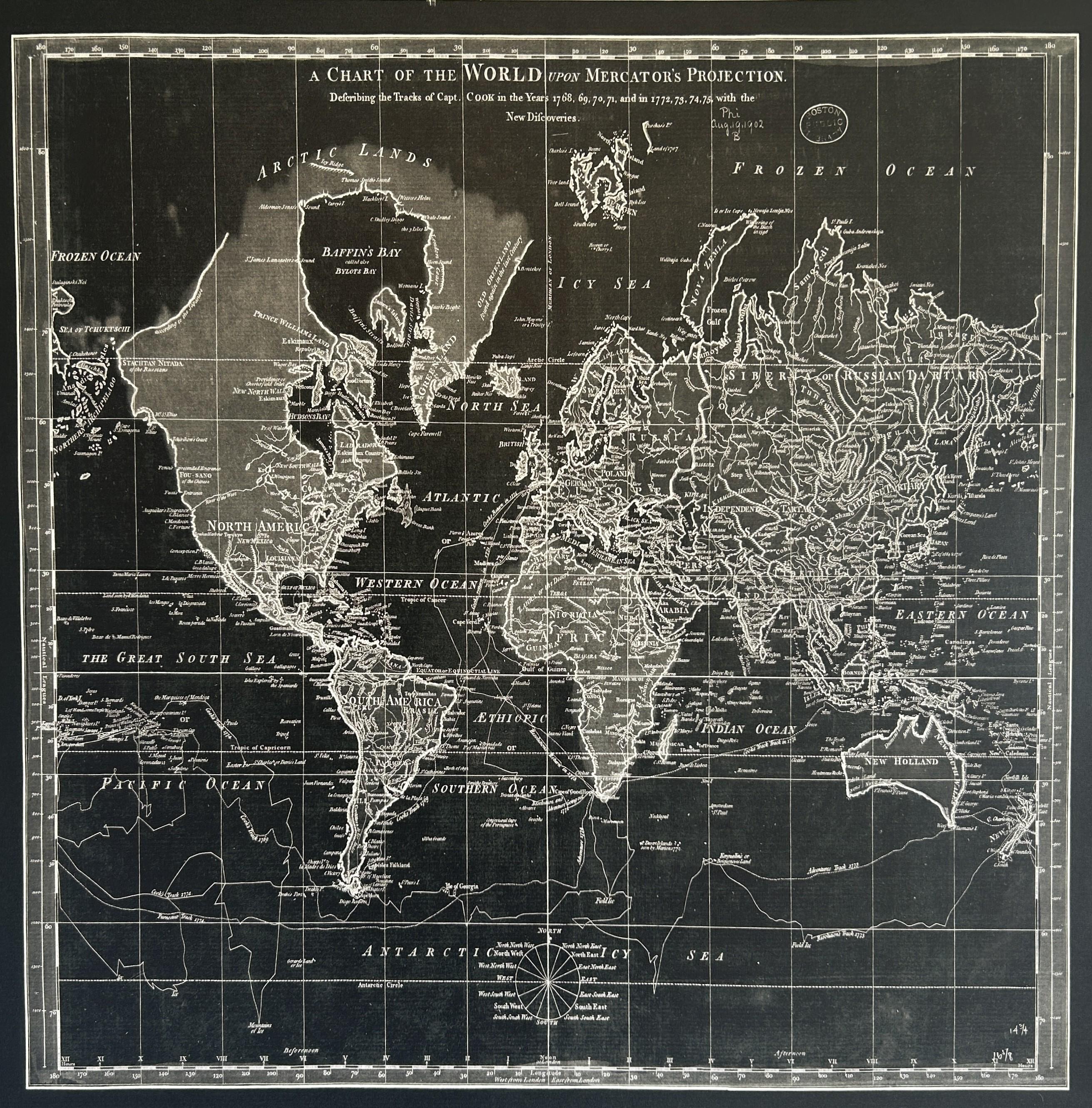
The Mercator Projection World Map is one of the most recognized and widely used maps in the world. It presents a cylindrical projection where the meridians are straight lines and the parallels of latitude are spaced evenly. This type of map distorts size and distance as you move away from the equator, making it particularly useful for navigation but less accurate for representing the true size of land masses. For instance, Greenland appears much larger than it actually is when compared to countries near the equator, highlighting the projection’s limitations.
Deep Dive into the Mercator Projection
The Mercator projection was developed by the Flemish cartographer Gerardus Mercator in 1569, primarily for maritime navigation. The design allows sailors to plot a straight-line course, which greatly simplifies navigation at sea. The mathematical formula behind the projection ensures that angles are preserved, making it a conformal map. However, this comes at the cost of area distortion, which is most pronounced in polar regions.
Interestingly, while the Mercator map is excellent for maritime purposes, it fails to accurately portray the relative sizes of the continents. For example, Africa appears significantly smaller on the Mercator map than it actually is, leading to misconceptions about its size and importance. In reality, Africa is about 14 times larger than Greenland, yet on the Mercator map, they are depicted as being much closer in size.
What's fascinating is that despite its distortions, the Mercator projection remains popular in various applications, including online mapping services. Users often overlook its flaws because the projection serves practical navigation needs effectively. Furthermore, it has become somewhat of a cultural icon, representing a Western viewpoint of the world that has been ingrained in our education and media.
In terms of geographical accuracy, the Mercator projection is used primarily in contexts where direction is more important than area, such as shipping and aviation. However, it's essential to be aware of its limitations. For example, when considering global warming and its effects on polar regions, relying solely on the Mercator projection can lead to misunderstandings about the scale of these changes.
Regional Analysis
When examining the world through the lens of the Mercator projection, variations in size and shape among regions become evident. For instance, countries like Russia and Canada, which are depicted as sprawling land masses, actually have vast areas that are less populated and less significant in terms of global economics. In contrast, countries closer to the equator, such as those in Africa or Southeast Asia, appear smaller, even though they may have larger populations and growing economies.
Furthermore, the projection creates a Eurocentric view of the world, with Europe and North America positioned prominently at the center. This can influence perceptions of importance and power dynamics globally. For example, while the map shows the United States as a dominant force, it overlooks the rising significance of countries in Asia, such as India and China, which are crucial players in the global economy.
Significance and Impact
Understanding the implications of the Mercator projection is vital in today’s world. As globalization continues to shape our societies, recognizing the biases and inaccuracies inherent in this map can influence how we view international relations and environmental issues. The distorted representation can lead to misconceptions, impacting everything from educational curricula to policy-making.
Additionally, as we face challenges such as climate change and geopolitical conflicts, it’s crucial to visualize the world accurately. Alternative projections, like the Robinson or Peters projections, offer different perspectives that can help illuminate the true sizes and relationships of countries. In the digital age, where map usage is ubiquitous, fostering an awareness of these differences is essential.
In conclusion, while the Mercator projection serves its purpose in navigation, it also embodies a historical perspective that may no longer be relevant in our interconnected world. By scrutinizing its impact and understanding its limitations, we can better appreciate the complexities of our globe and work towards a more nuanced understanding of geography.
Visualization Details
- Published
- September 17, 2025
- Views
- 72
Comments
Loading comments...