Chinese World Map by Hao Xiaoguang

Marcus Rodriguez
Historical Geography Expert
Marcus Rodriguez specializes in historical cartography and geographic data analysis. With a background in both history and geography, he brings unique...
Geographic Analysis
What This Map Shows
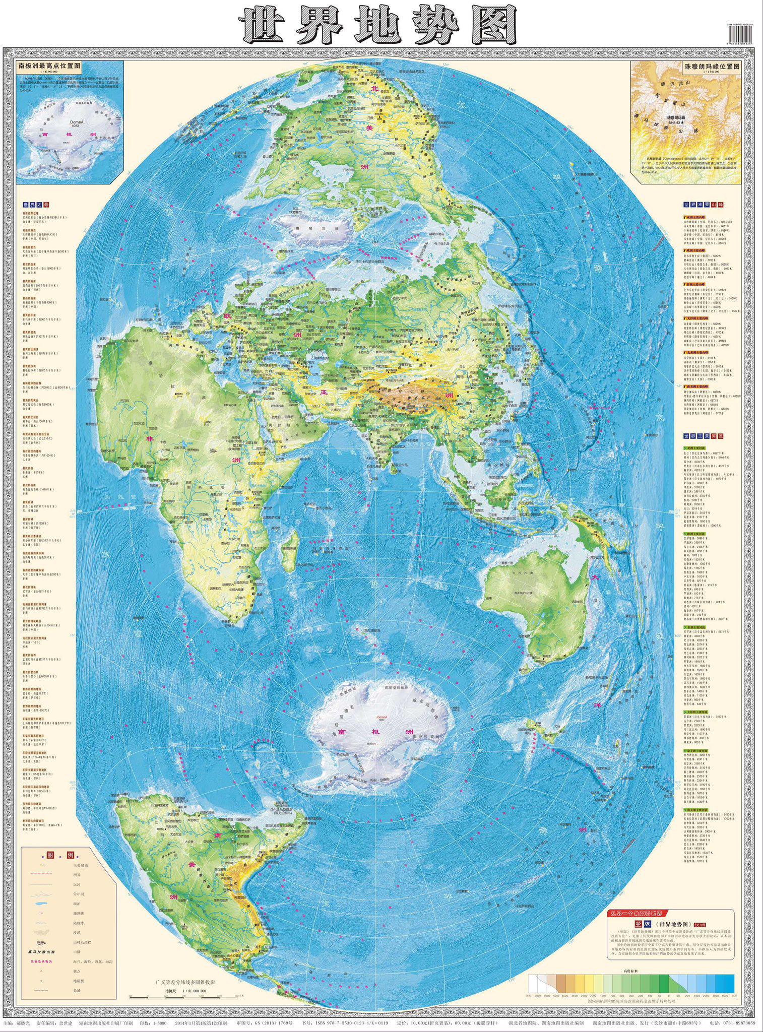
The "Chinese World Map" by Hao Xiaoguang presents a unique perspective on China's geographical influence and its place in the world. Unlike traditional maps that depict countries and borders, this visualization emphasizes China's historical and cultural connections across various regions. The map not only highlights China's territorial claims but also incorporates cultural, economic, and historical dimensions that shape its interactions with neighboring countries and beyond.
Deep Dive into China's Global Influence
China’s geographical and cultural influence is vast and multifaceted. It is the world's most populous country, with over 1.4 billion people, and its demographics play a crucial role in its global presence. The map reflects how China's population is concentrated in the eastern coastal regions, particularly in megacities like Shanghai, Beijing, and Guangzhou. These areas are not just urban centers; they are economic powerhouses that contribute significantly to China's GDP, which has seen rapid growth over the past few decades.
Interestingly, China's economic expansion has been accompanied by a rise in its global trade relations. From 2000 to 2020, China's exports grew exponentially, making it the world's largest exporter. The Belt and Road Initiative (BRI), which aims to enhance global trade networks and infrastructure development, is a perfect example of how China is asserting its influence. It establishes trade routes that connect China with over 60 countries across Asia, Europe, and Africa, illustrating the interconnectedness highlighted in Hao Xiaoguang's map.
Furthermore, China's historical influence is deeply rooted in its ancient civilizations. The Silk Road, which facilitated trade between East and West, is a significant aspect of this historical narrative. Have you noticed how the map hints at these ancient trade routes? The cultural exchanges that occurred along these paths laid the groundwork for modern diplomatic and trade relationships.
As we explore the environmental aspects, China's geography is incredibly diverse, with vast mountain ranges, plateaus, and river systems. The Yangtze and Yellow Rivers are pivotal in understanding the country’s agricultural patterns and population distribution. These rivers have historically supported agriculture, enabling dense human settlement in their basins. What’s fascinating is that water resources are becoming increasingly scarce due to urbanization and climate change, posing challenges for sustainable development.
Regional Analysis
When examining the map's regional elements, we can see stark contrasts between China's eastern and western regions. The eastern provinces, which include populous cities and industrial hubs, contrast sharply with the sparsely populated western regions, such as Xinjiang and Tibet. These areas are rich in natural resources but face challenges in terms of infrastructure and economic development. For instance, while cities like Shenzhen are thriving with technology and innovation, the western provinces often struggle with poverty and limited access to healthcare and education.
Moreover, the map illustrates the geopolitical tensions surrounding China, particularly in areas like the South China Sea, where territorial disputes with neighboring countries arise. This has significant implications for trade routes and regional stability. By comparing these regions, we can see how geography not only shapes cultural identities but also influences political dynamics and economic strategies.
Significance and Impact
Understanding the implications of Hao Xiaoguang's map is crucial for grasping contemporary global dynamics. China’s assertive stance on the world stage has led to significant geopolitical shifts. The rise of China as a superpower has implications for international relations, trade policies, and environmental sustainability.
Additionally, the ongoing impact of climate change on China's diverse geography cannot be overlooked. Rising sea levels threaten coastal cities, while desertification poses risks to agriculture in the northwestern regions. This intersection of geography and climate is increasingly relevant as global leaders strive to address environmental challenges.
In conclusion, the "Chinese World Map" by Hao Xiaoguang serves as a visual representation of China’s multifaceted influence on the world, highlighting its historical roots, economic power, and the geographical factors that shape its future. As we move forward, it’s essential to consider how these elements will evolve and influence global dynamics in the years to come.
Visualization Details
- Published
- August 17, 2025
- Views
- 172
Comments
Loading comments...