weather Maps
2 geographic visualizations tagged with "weather"

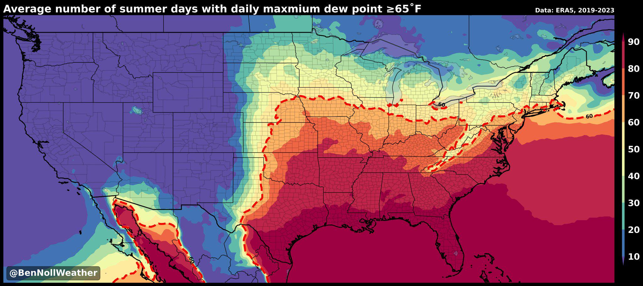
Humidity Belt Map of America
The "America's Humidity Belt" map visually represents the regions of the United States characterized by high humidity le...
👁 112📅 8/31/2025

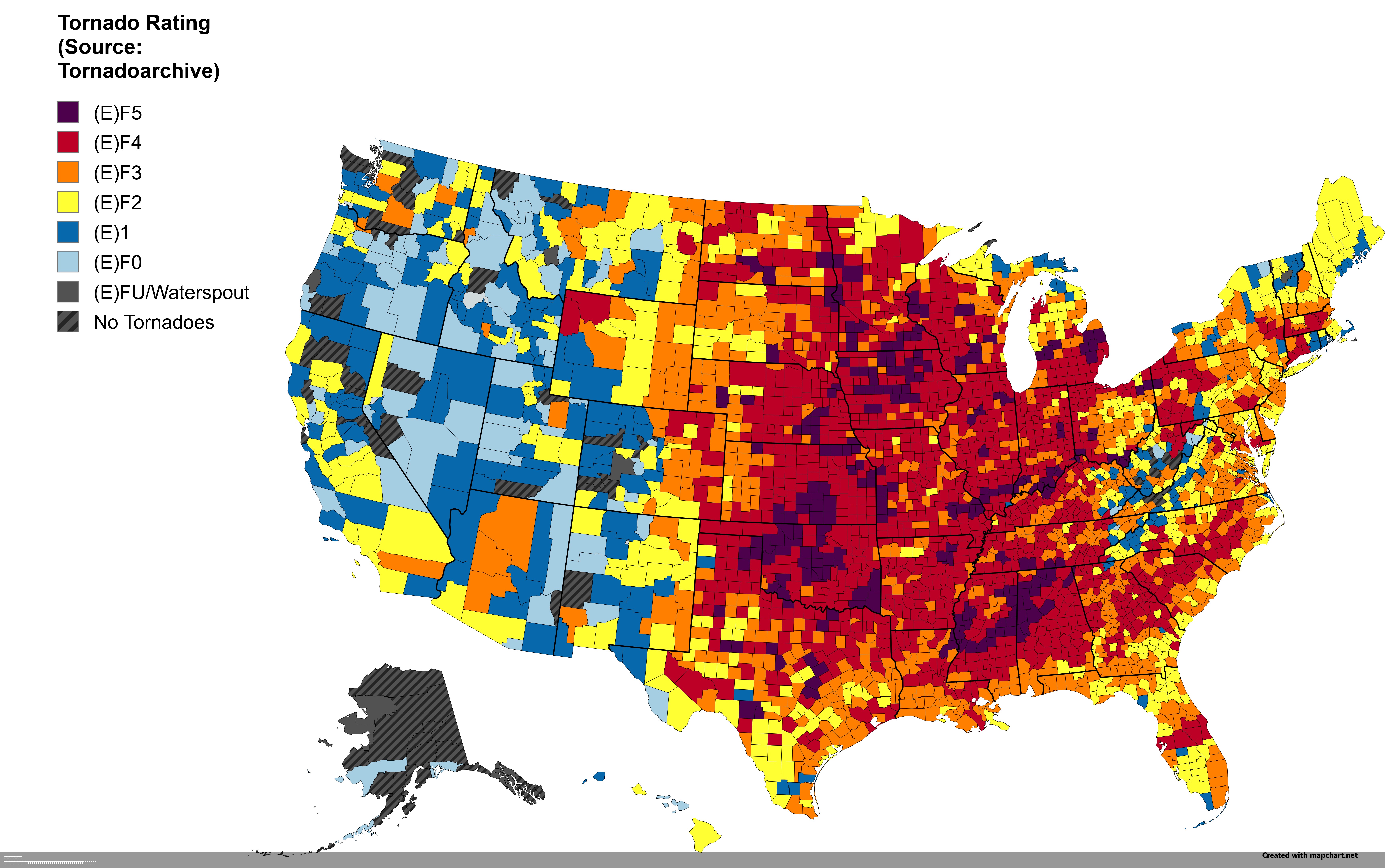
Strongest Tornado by US County Map
This intriguing visualization displays the strongest tornado recorded in each U.S. county. Tornadoes, nature's most viol...
👁 132📅 8/7/2025