waterways Maps
7 geographic visualizations tagged with "waterways"
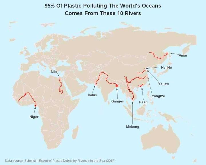
Map of Rivers Contributing to Ocean Plastic
The map titled "95% of Ocean Plastic Originates from These 10 Rivers" highlights the critical role that certain river sy...
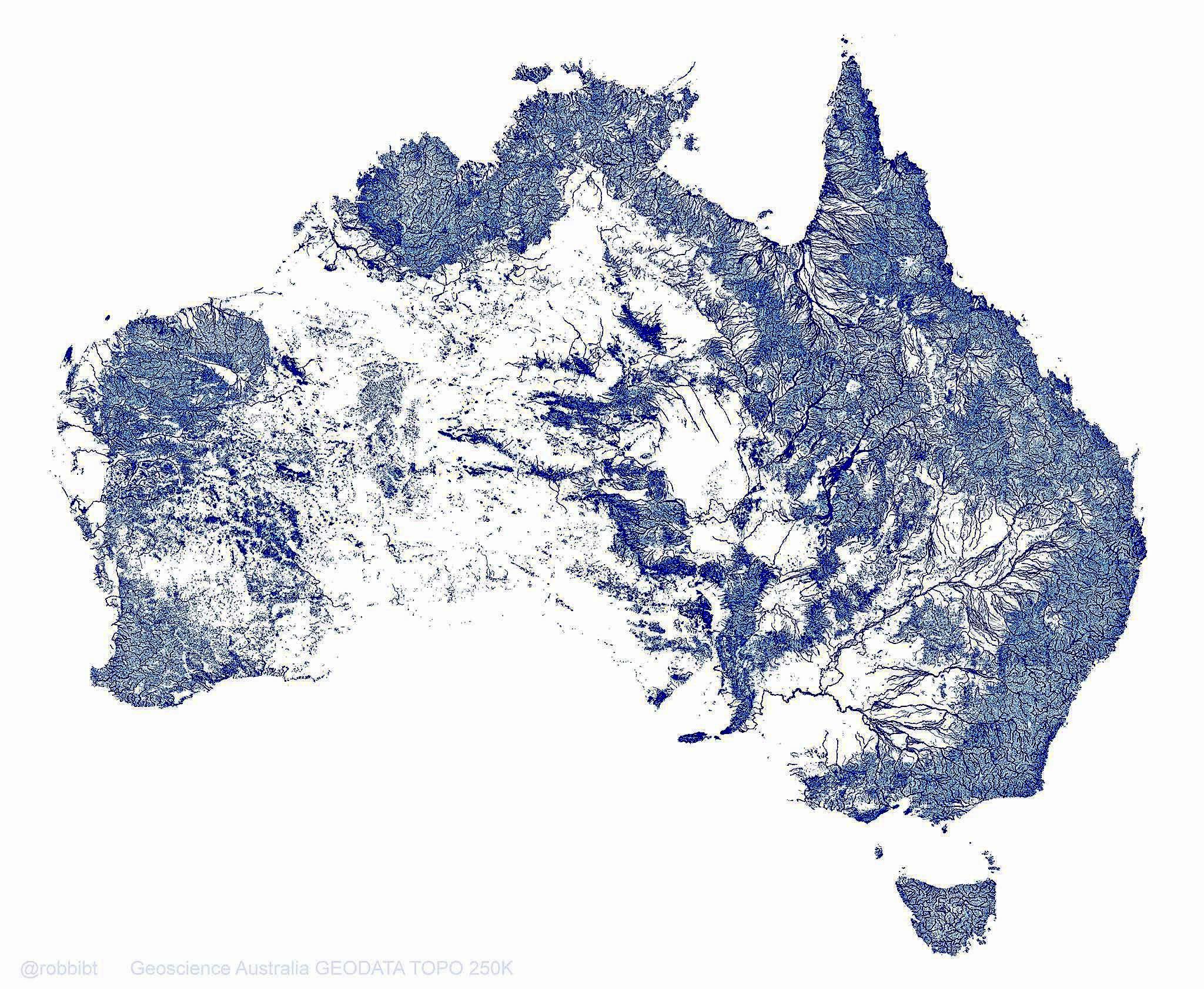
Australia Rivers Map: 1.3 Million Waterways
This map vividly illustrates Australia's extensive network of 1.3 million rivers, streams, and tributaries, which togeth...
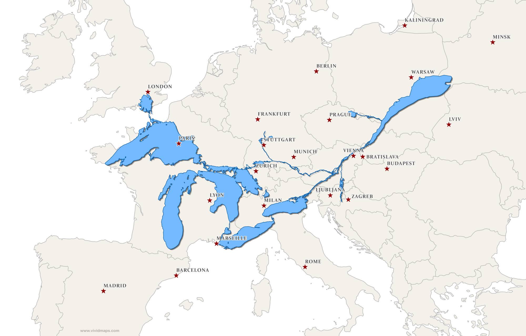
Great Lakes and St. Lawrence Seaway Map Over Europe
This fascinating map superimposes the Great Lakes and the St. Lawrence Seaway over Europe, providing a unique perspectiv...
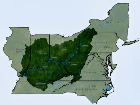
Ohio River Valley Map with State Boundaries
Interestingly, the Ohio River serves as a natural border between several states, impacting both the geography and the go...
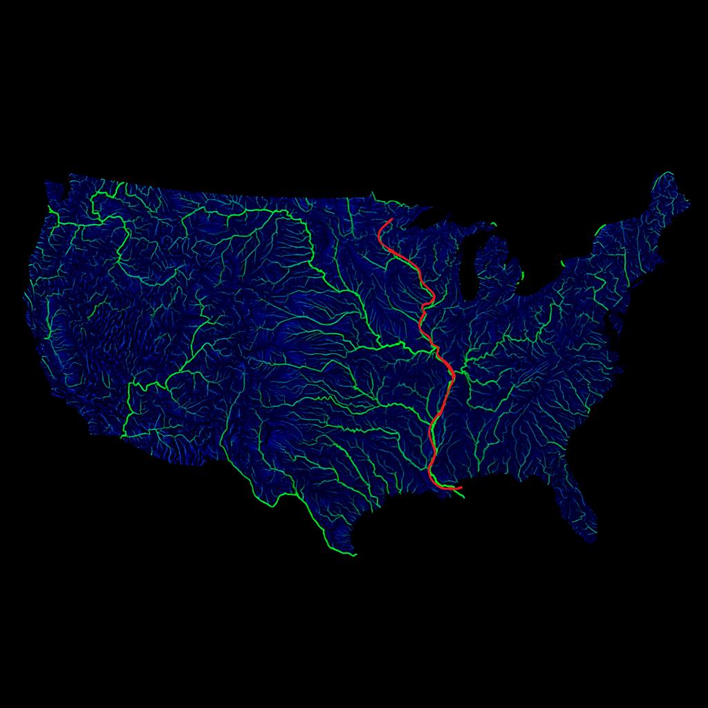
Mississippi River Main Channel Map
The visualization displays the main channel of the Mississippi River prominently highlighted in red, set against a backd...
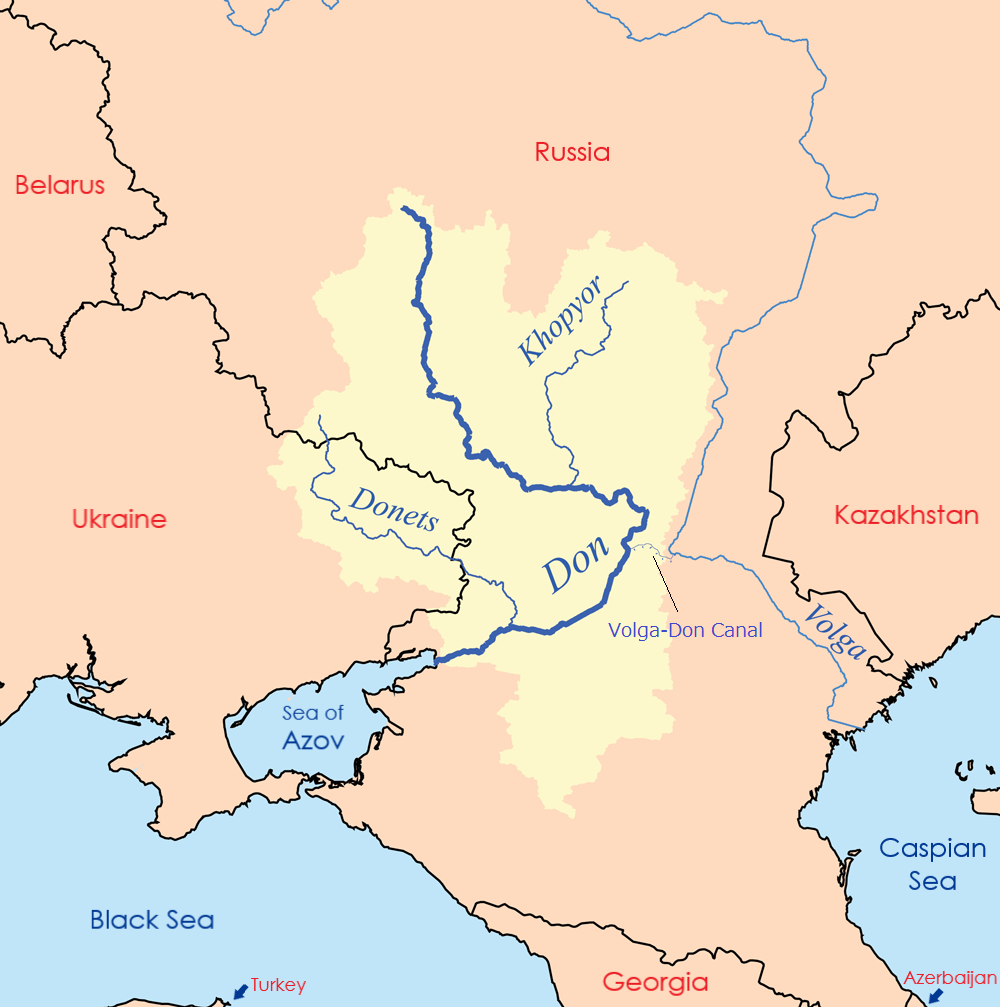
Volga-Don Canal Connection Map
The Volga-Don Canal Connection Map illustrates the crucial link between the Caspian Sea and the world’s oceans via the V...

Union Canal Transportation Route Map Pennsylvania
This map illustrates Pennsylvania's Union Canal Transportation Route, a vital waterway that facilitated trade and transp...