voting patterns Maps
19 geographic visualizations tagged with "voting patterns"
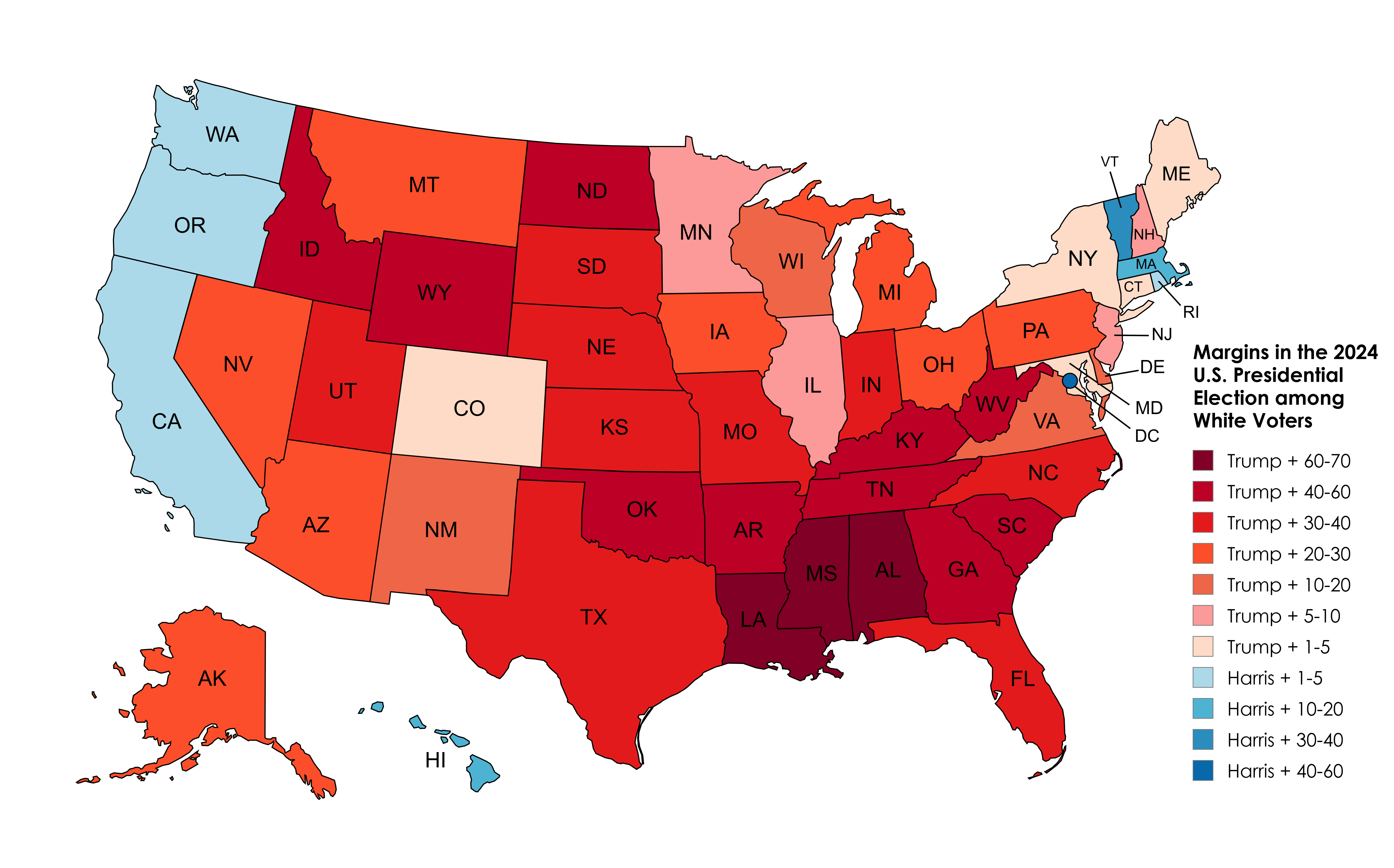
2024 Election Results Map Amongst White Voters
The 2024 Election Results Map Amongst White Voters offers a detailed representation of how this demographic voted across...
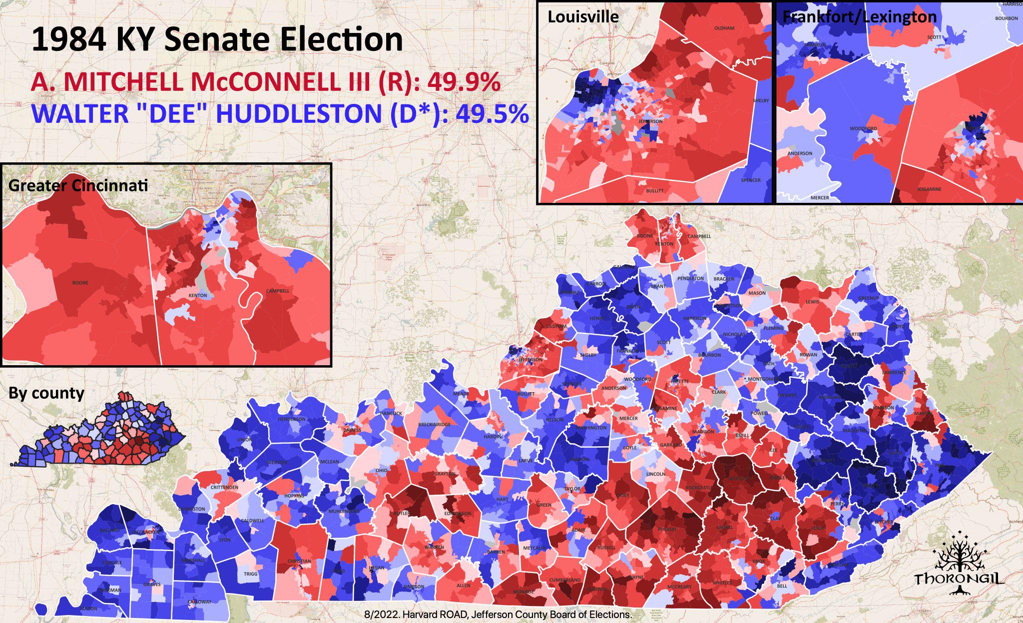
Map of Mitch McConnell's Senate Election
This map details the electoral landscape during the election in which Mitch McConnell first secured his seat in the U.S....
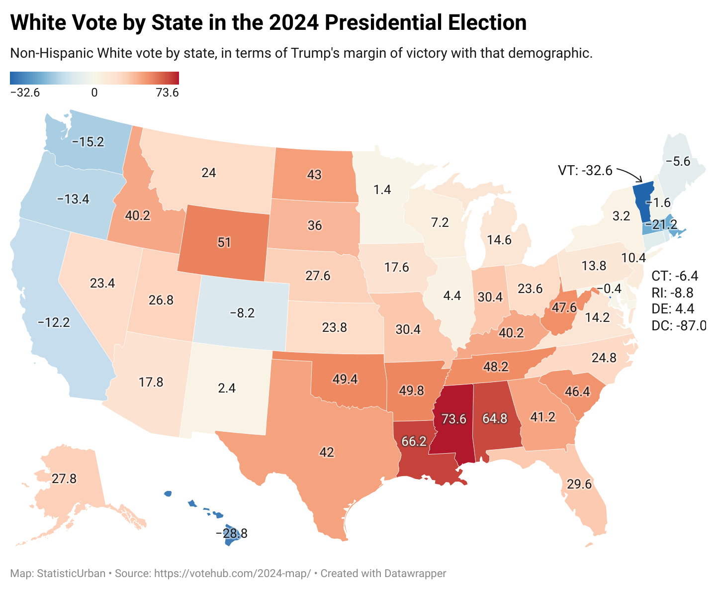
Voting Patterns Map of White Americans 2024
The map titled "How White Americans Voted in 2024" provides a detailed visual representation of voting behaviors among W...
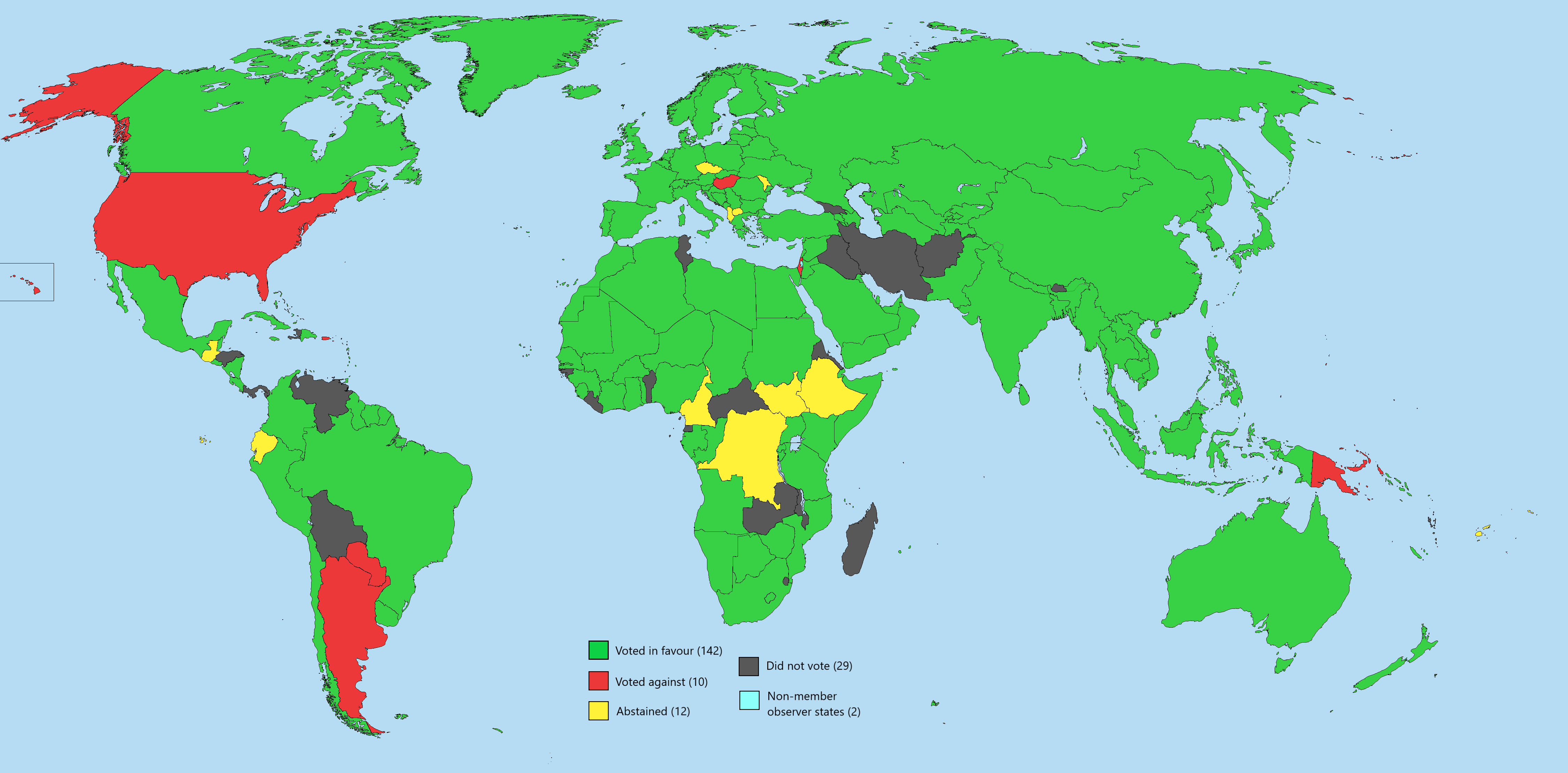
UN General Assembly Vote Two-State Solution Map
The map titled "UN General Assembly Vote on Implementing a Two-State Solution Free of Hamas" visually represents the vot...
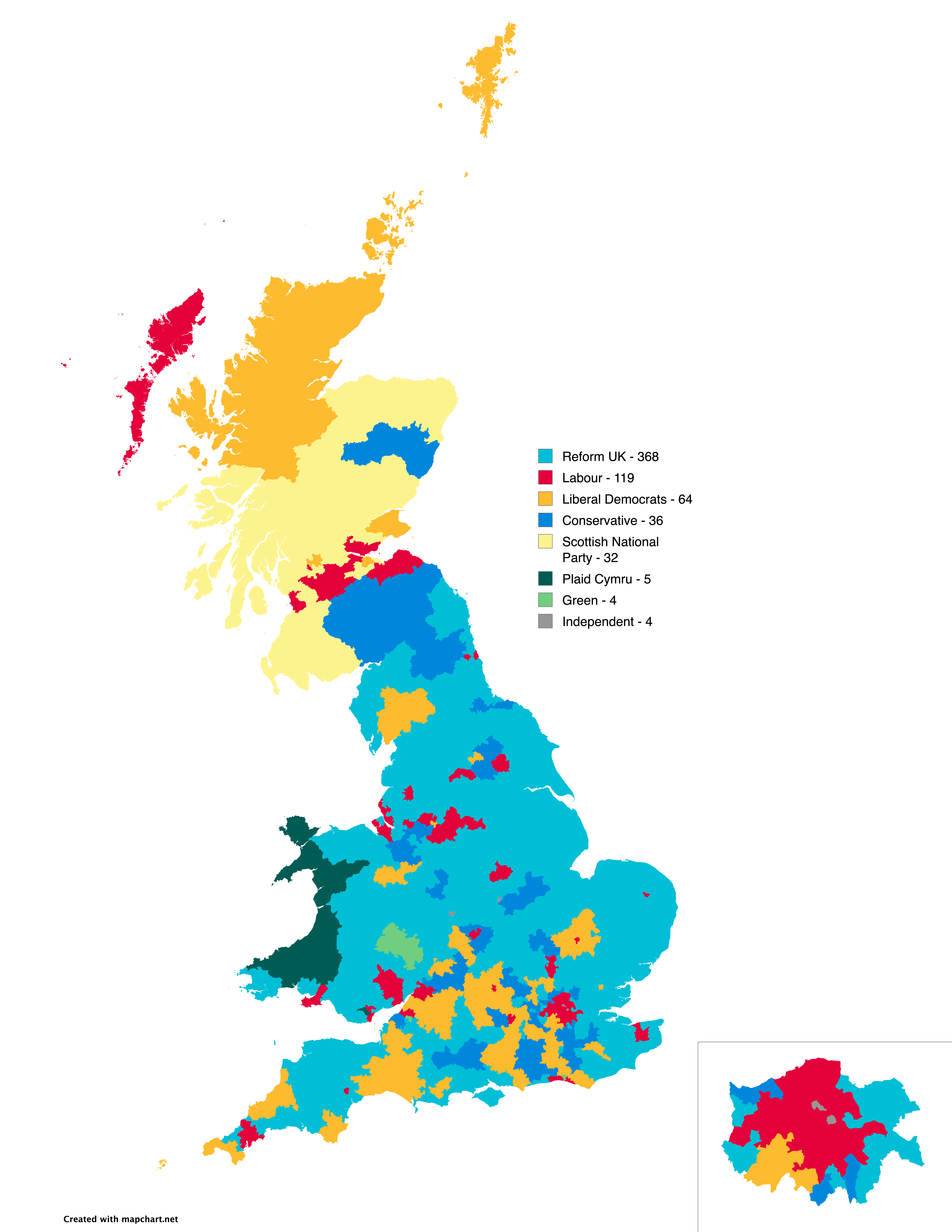
UK Election Prediction Map by Electoral Calculus
The "Predicted outcome of next UK election according to Electoral Calculus (NI excluded)" map offers a visual representa...
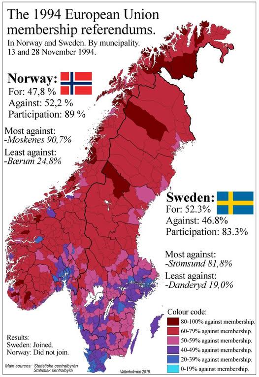
1994 Swedish and Norwegian EU Referendum Results Map
The "1994 Swedish and Norwegian EU Referendum Results By Municipality" map presents a detailed view of how different mun...

Change in Share of Registered Voters by Party Map
The visualization titled "Change in Share of Registered Voters by Party in 30 States, 2020-24" by the New York Times pro...
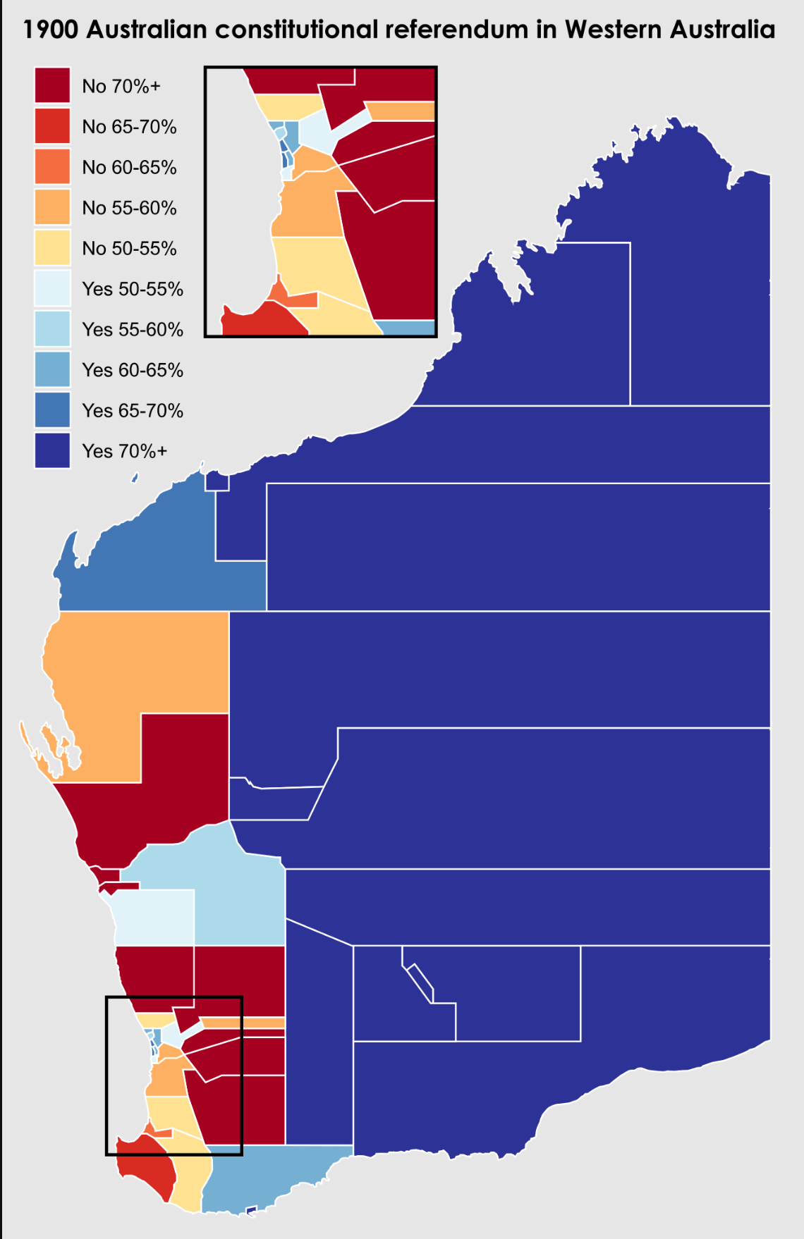
1900 Western Australian Referendum Results Map
Interestingly, rural areas, which made up a significant portion of the colony, tended to favor joining the Commonwealth....
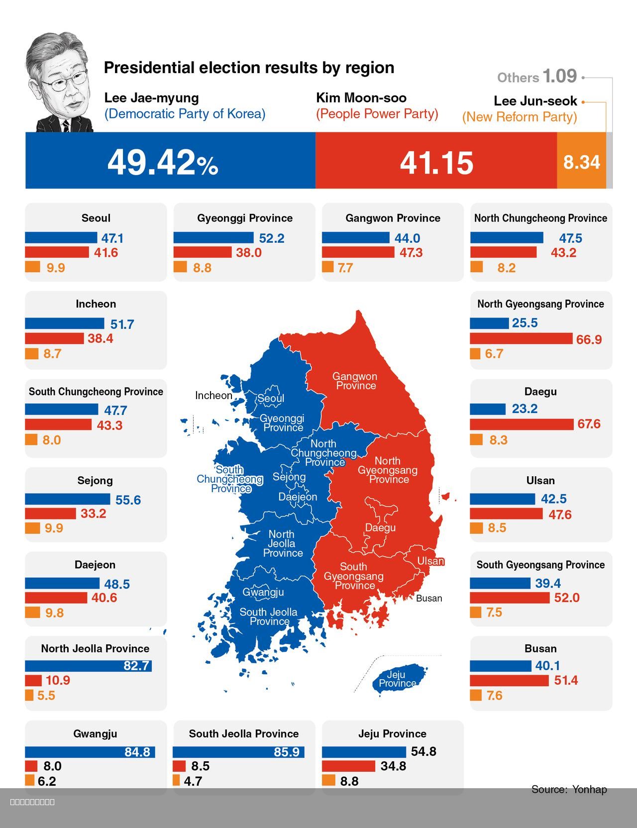
2025 South Korea Presidential Election Map
The 2025 South Korea Presidential Election Map illustrates the election results, focusing on the stark contrast between ...
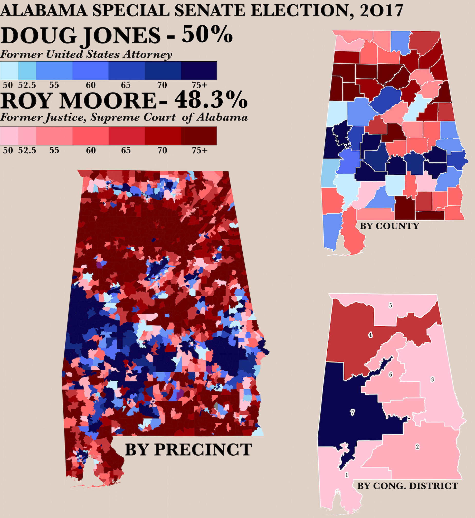
2017 Alabama Senate Race by Precinct Map
The "Poster of the 2017 Alabama Senate Race by Precinct Map" visually represents the voting patterns across various prec...
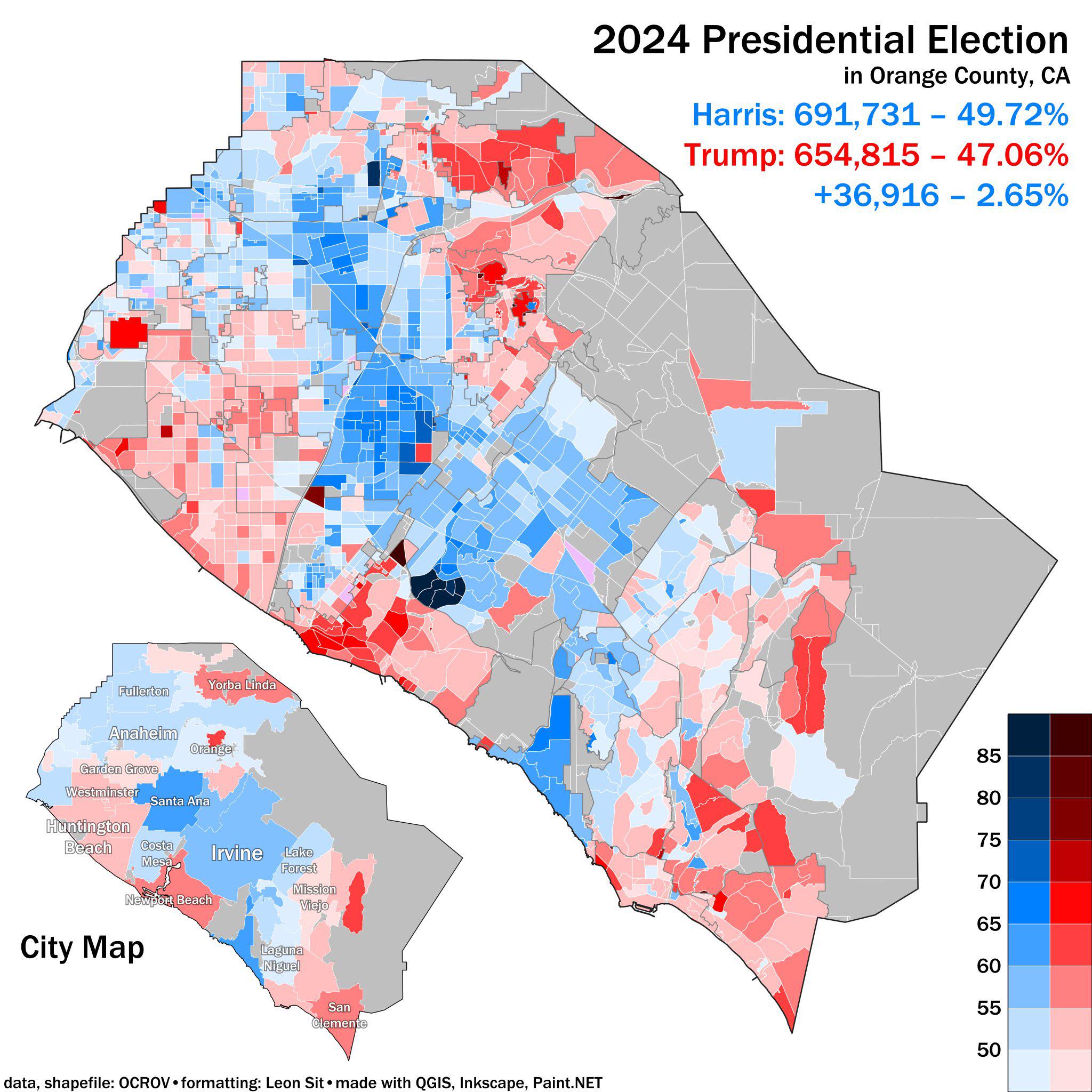
2024 Presidential Election Results Map Orange County CA
The 2024 Presidential Election Results Map for Orange County, CA, provides a detailed visualization of how residents in ...
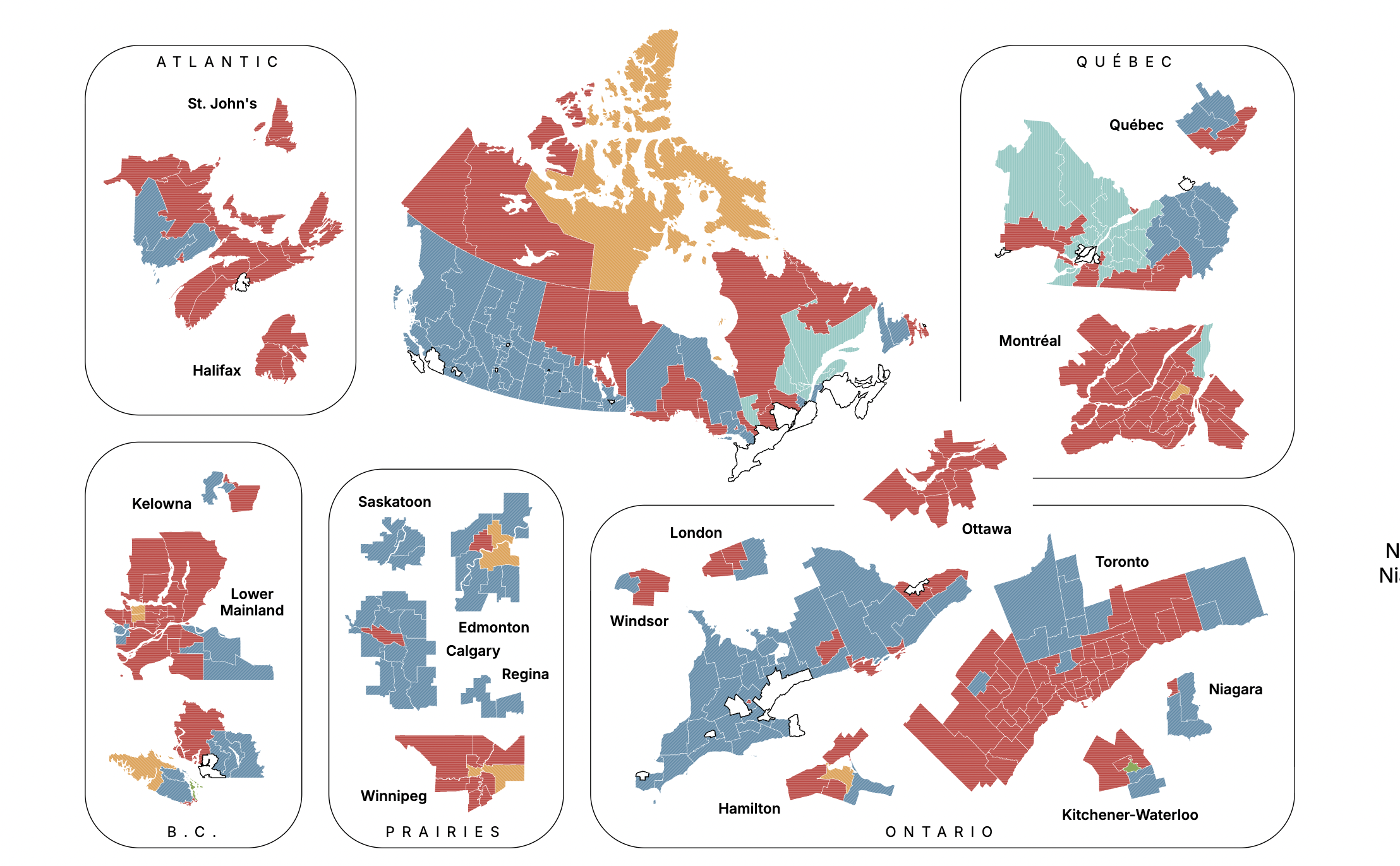
Canadian Federal Election Projection Map September 2025
The "Canadian Federal Election Projection - September 14, 2025" map provides a detailed forecast of the anticipated outc...
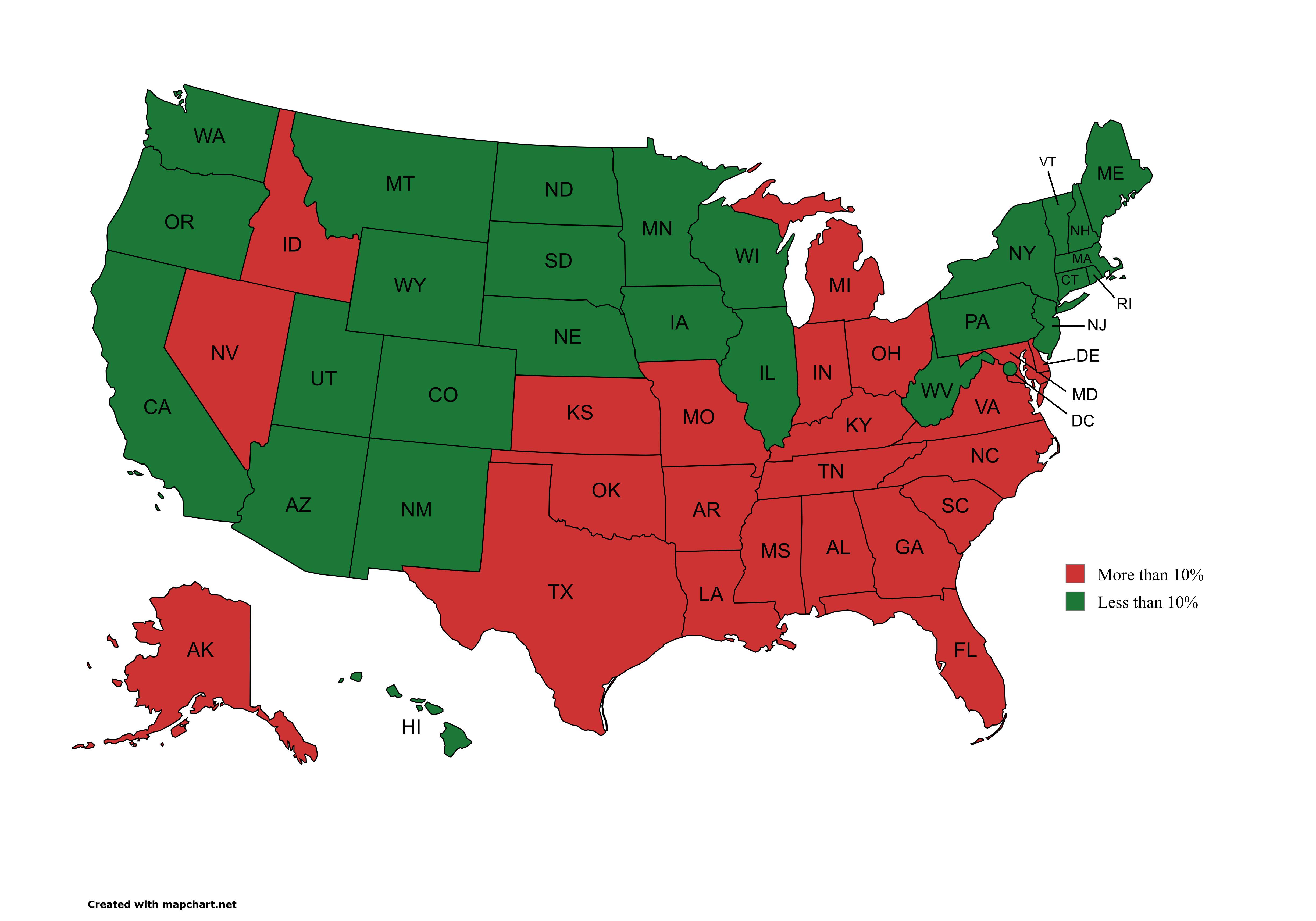
1968 Presidential Election Wallace Vote Percentage Map
This visualization highlights the U.S. states where George Wallace, a prominent third-party candidate in the 1968 presid...
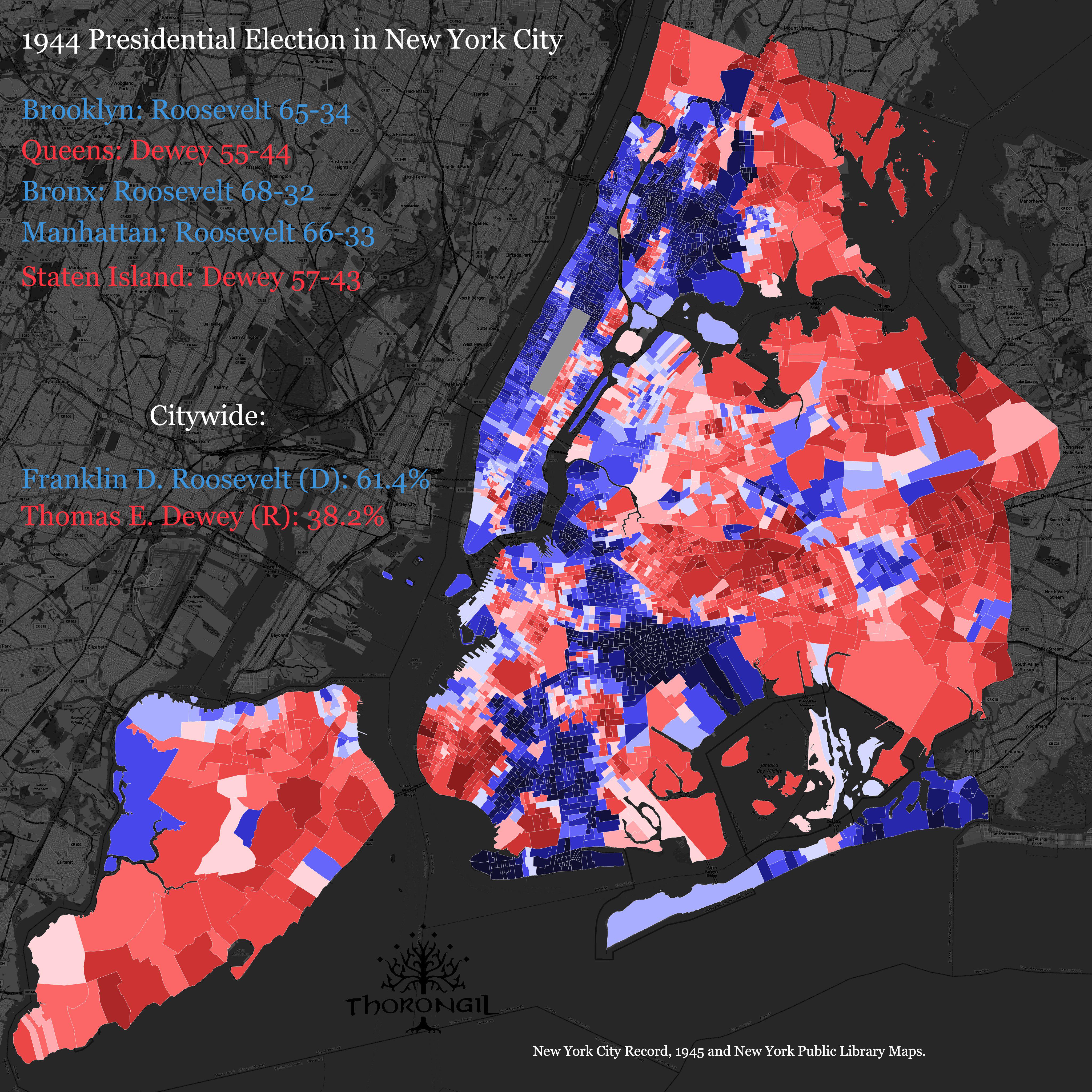
1944 Presidential Election Results Map of NYC
The "1944 Presidential Election Results Map of NYC" provides a visualization of how different neighborhoods and boroughs...
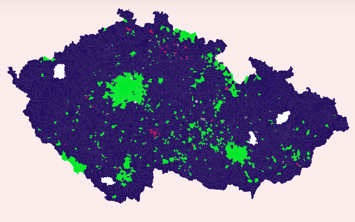
Czech Parliamentary Elections Voting Map
The map visualizes the voting patterns from the recent Czech Parliamentary elections held on Friday and today. It highli...
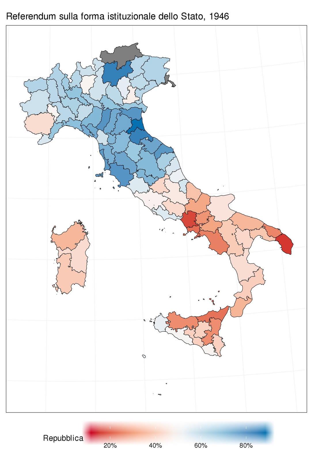
1946 Italian Referendum Voting Results Map
The map titled "How Italians voted in the 1946 referendum: Republic (blue) vs Monarchy (red)" visually represents the re...
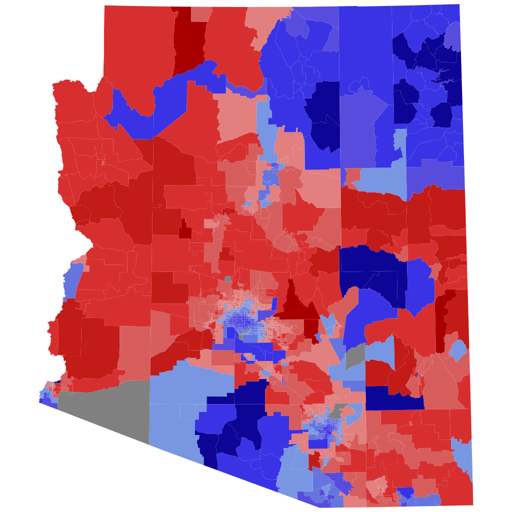
2022 Arizona Attorney General Election Precinct Map
The precinct map of the 2022 Arizona Attorney General election visually represents the voting patterns across the state,...

Mississippi Flag Vote 2001 Map
The "Mississippi Flag Vote 2001 Map" visually represents the outcome of a significant referendum on the state flag of Mi...
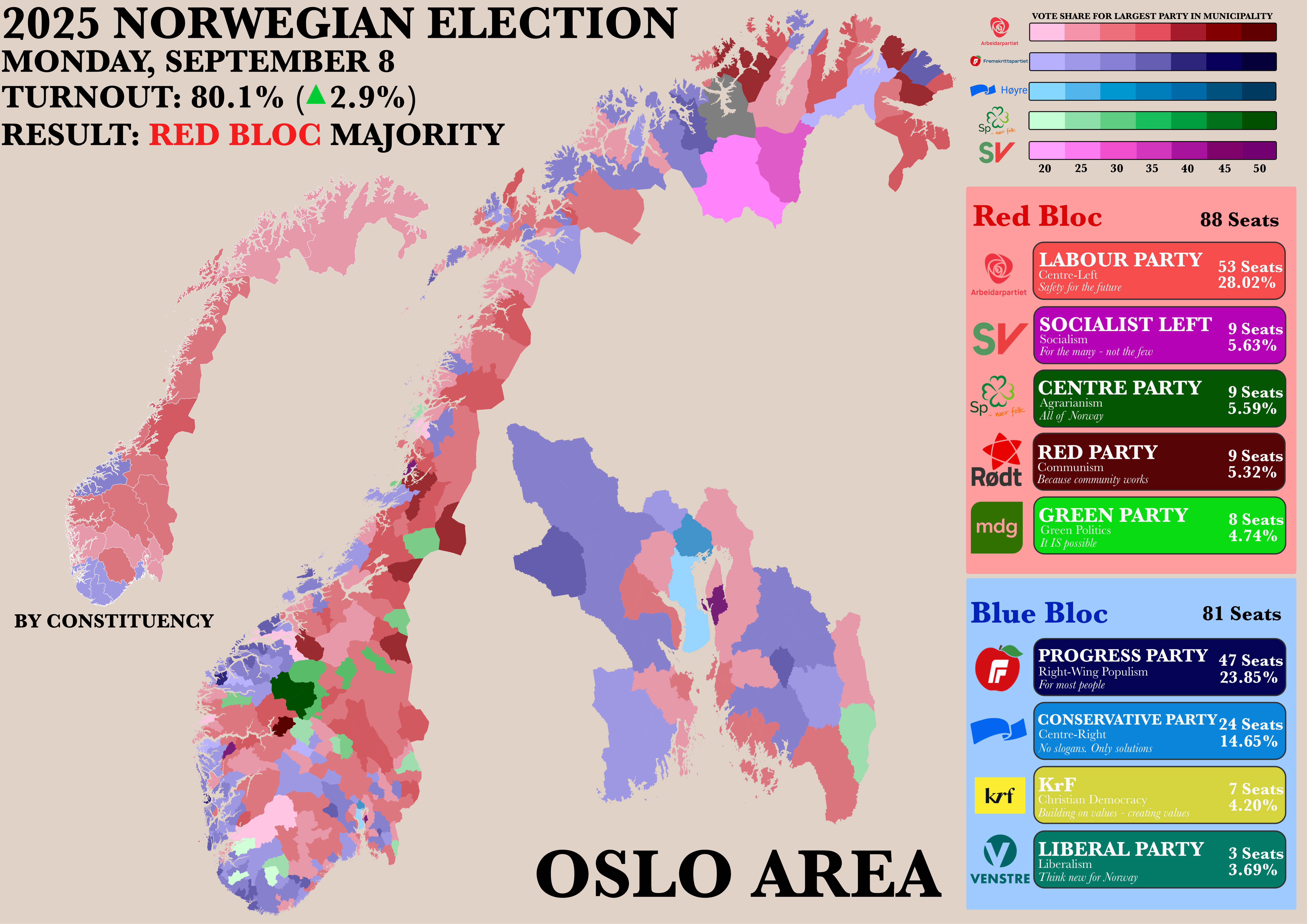
Norwegian Parliamentary Election Results by Municipality Map
The "Poster of the Recent Norwegian Parliamentary Election by Municipality" map provides a detailed visualization of the...