usa Maps
23 geographic visualizations tagged with "usa"
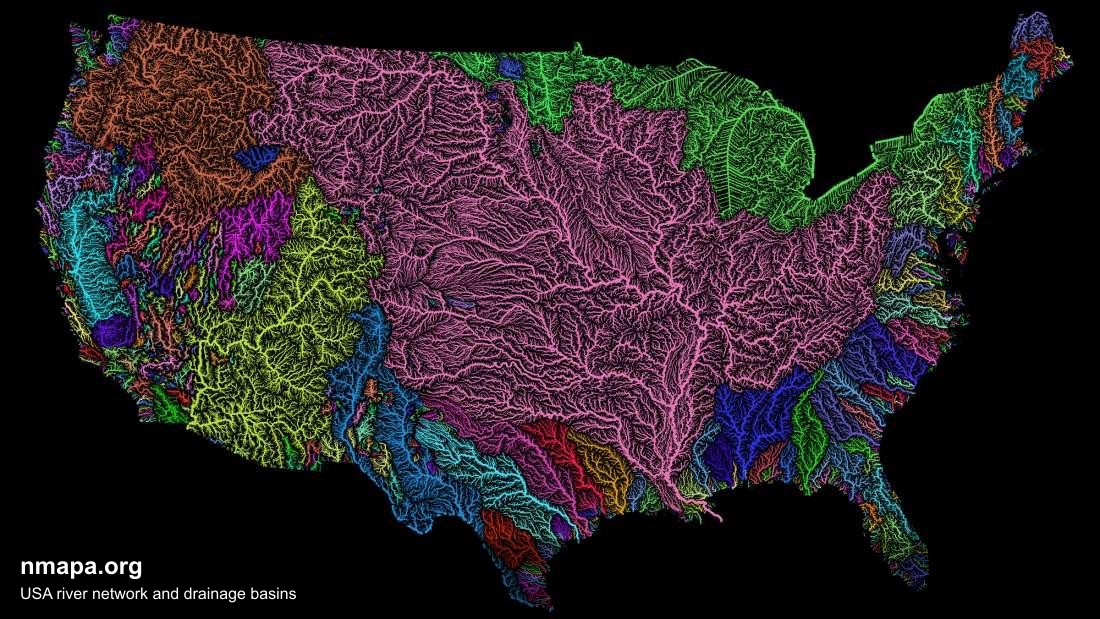
USA river network and drainage basins Map
This map displays "USA river network and drainage basins" and provides a clear visual representation of the geographic d...
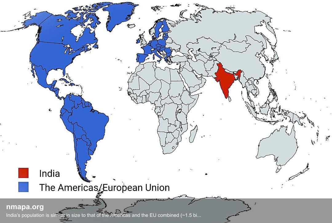
Population Map: India’s population is similar in size to that of the Americas and the EU combined (~1.5 billion)
This map displays "India’s population is similar in size to that of the Americas and the EU combined (~1.5 billion)" and...
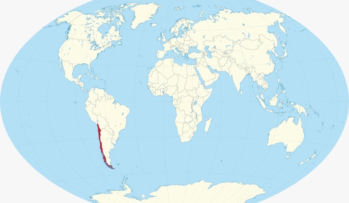
Visa-Free Access Map for USA, China, and Russia
This map highlights a unique geographical phenomenon: the only country that has visa-free access to the USA, China, and ...
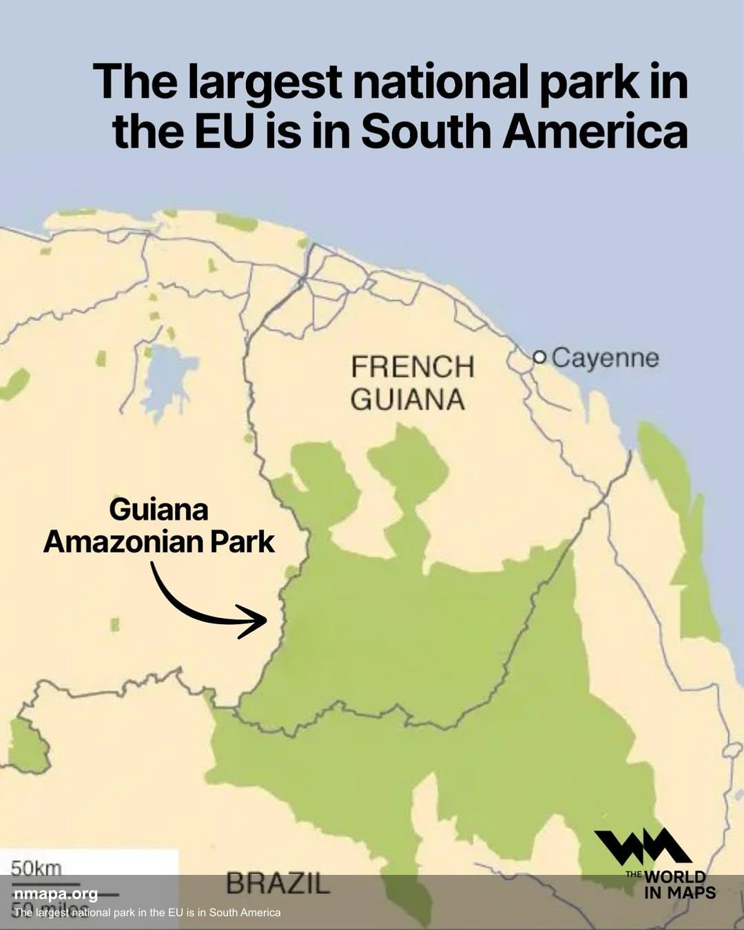
The largest national park in the EU is in South America Map
This map displays "The largest national park in the EU is in South America" and provides a clear visual representation o...
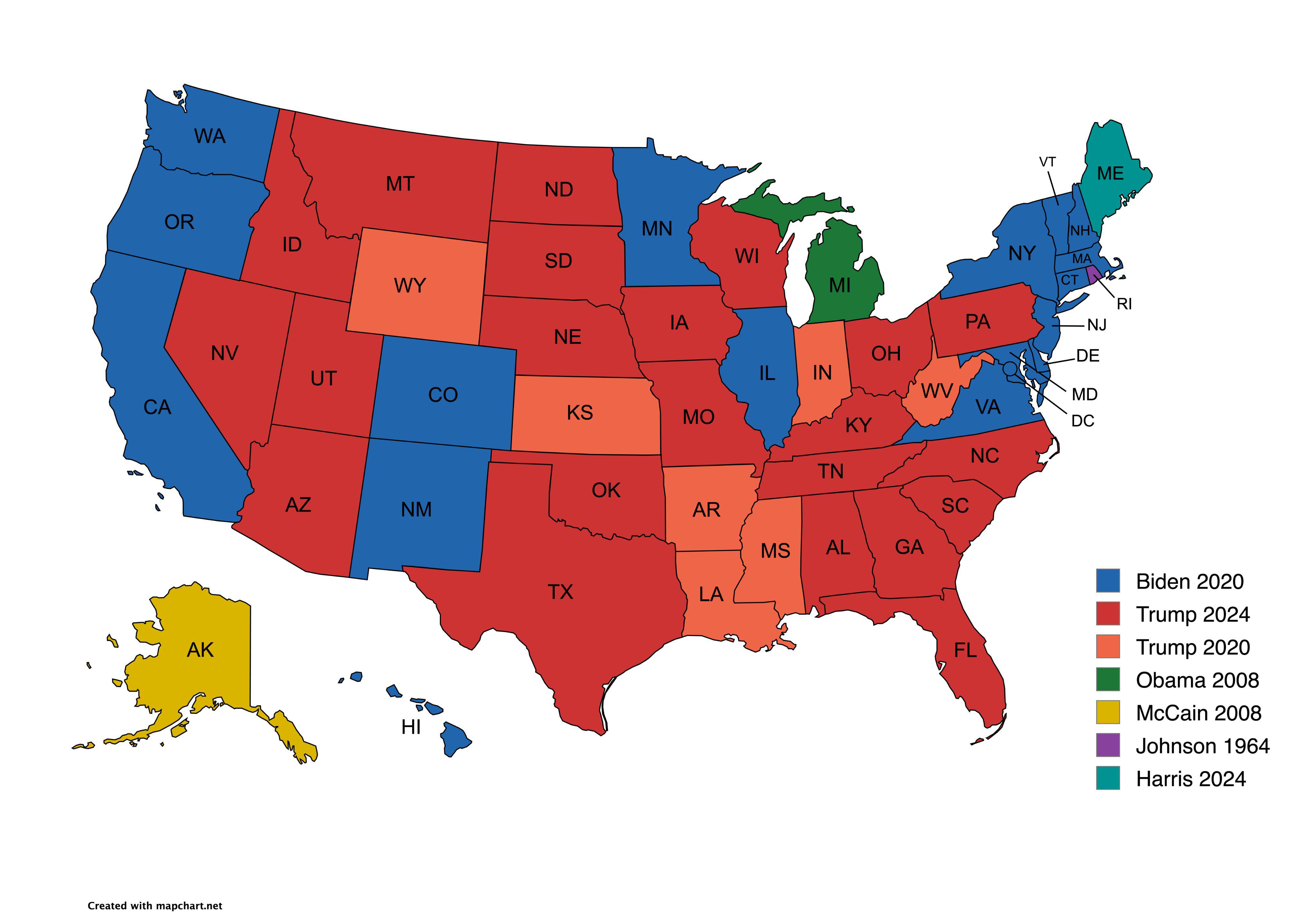
Presidential Candidate Vote Distribution by State Map
The map titled "Which Presidential Candidate Won The Largest Amount Of Votes In An Election By State" provides a visual ...
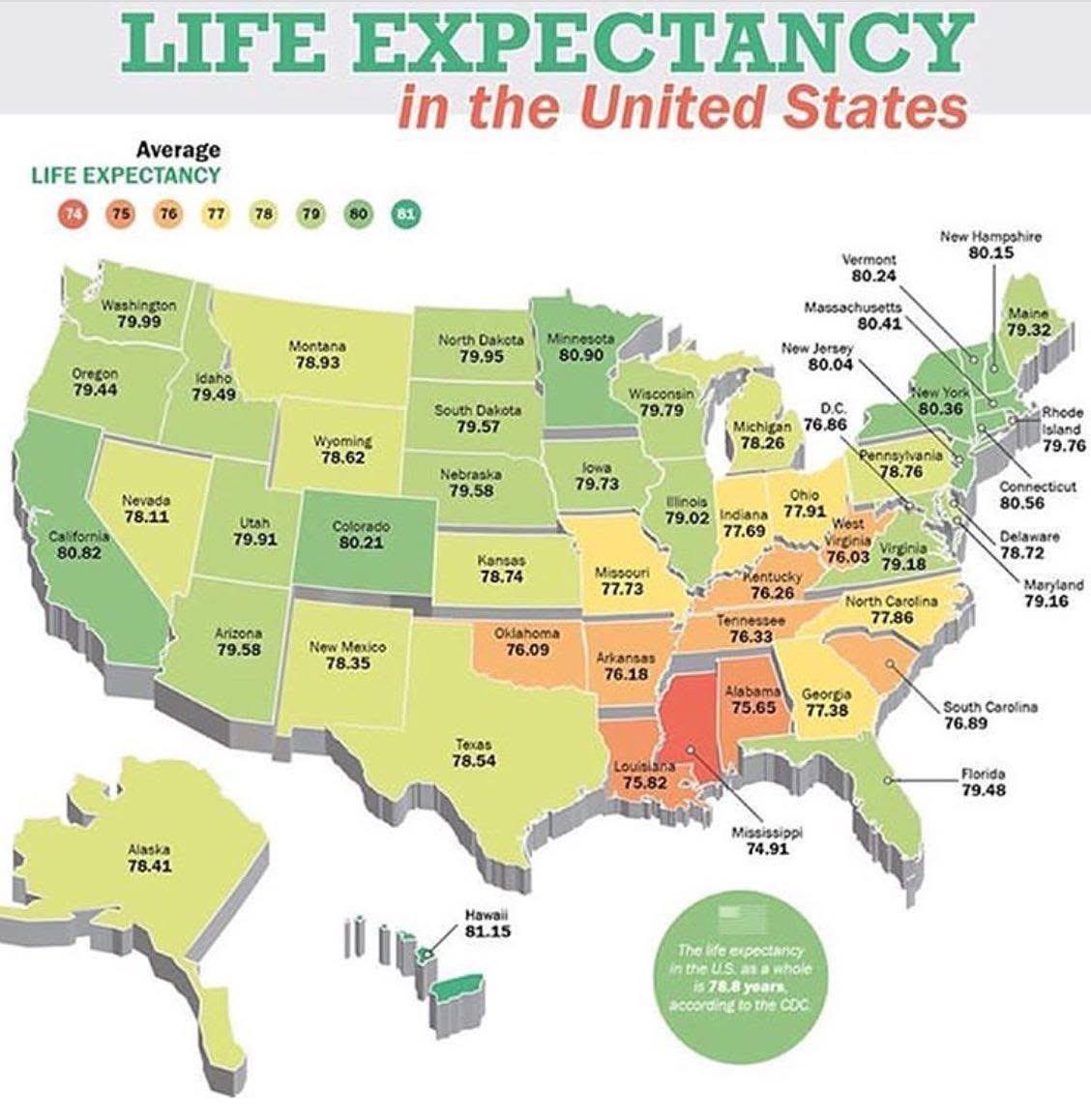
Life Expectancy by State in the USA Map
The \...
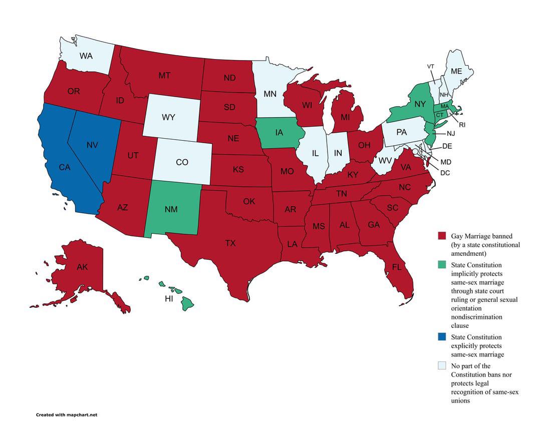
Map of USA Same Sex Marriage Protections in State Constitutions
This map provides a clear visualization of the current status of same-sex marriage protections across the United States,...
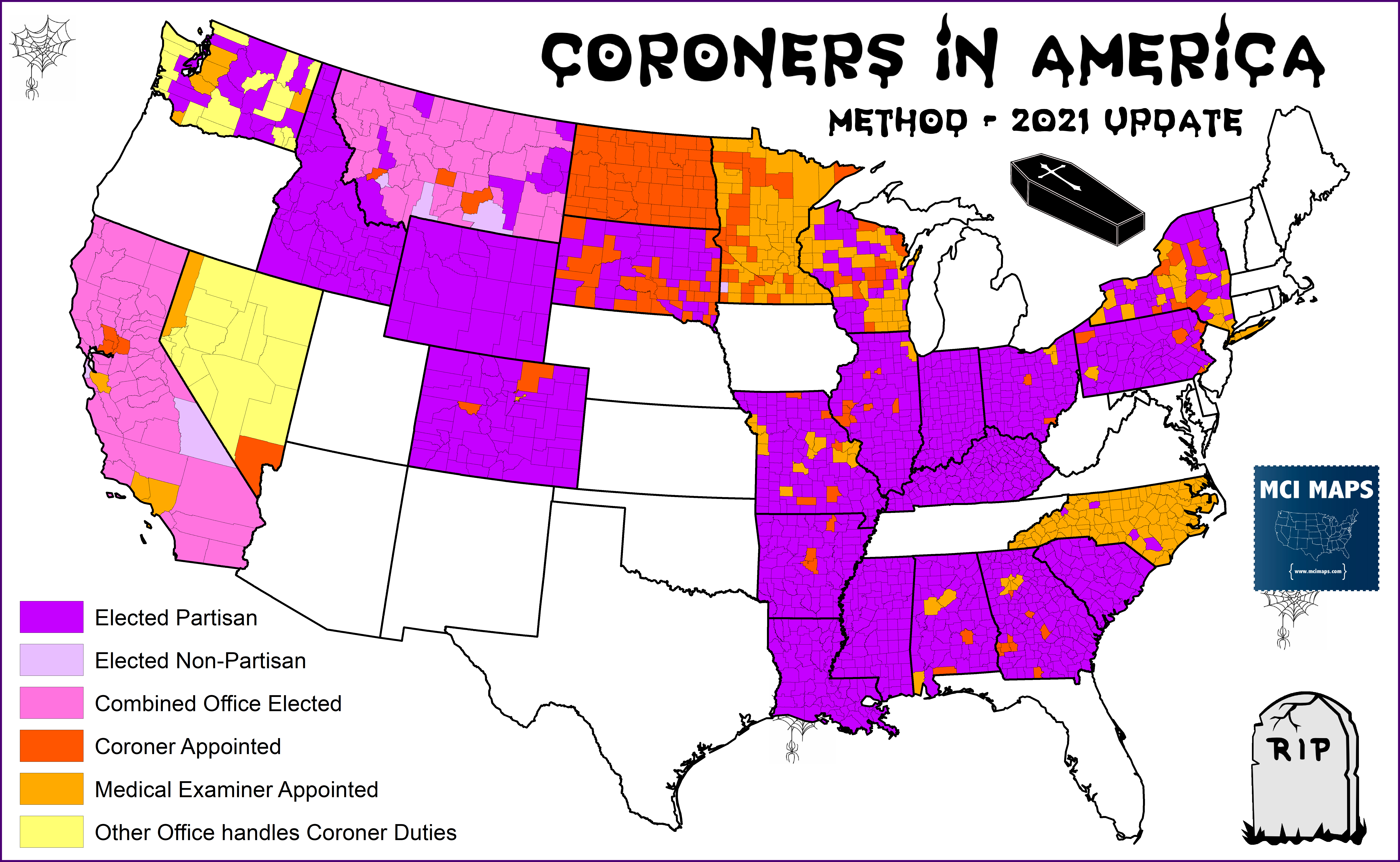
Map of Elected Coroners in America
...
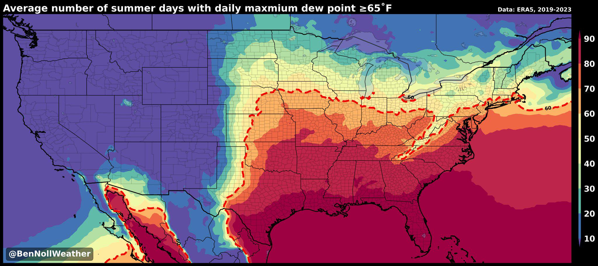
Humidity Belt Map of America
The "America's Humidity Belt" map visually represents the regions of the United States characterized by high humidity le...
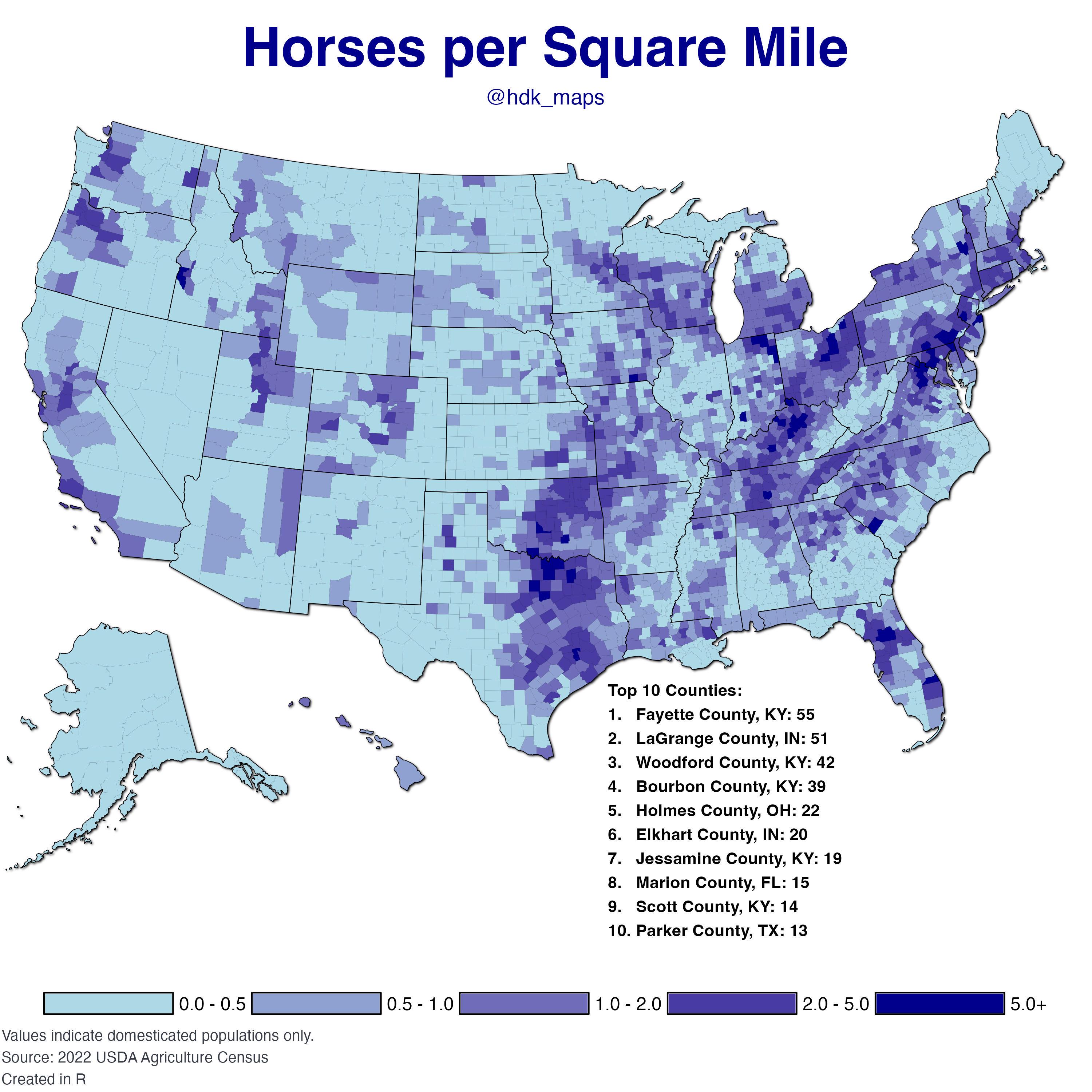
Horses per Square Mile in the USA Map
The "Horses per Square Mile in the USA Map" provides a fascinating visualization of the distribution of horses across th...
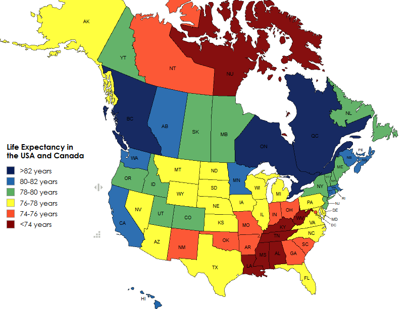
Life Expectancy in the USA and Canada Map
The 'Life Expectancy in the USA and Canada Map' provides a visual representation of the average life expectancy across v...
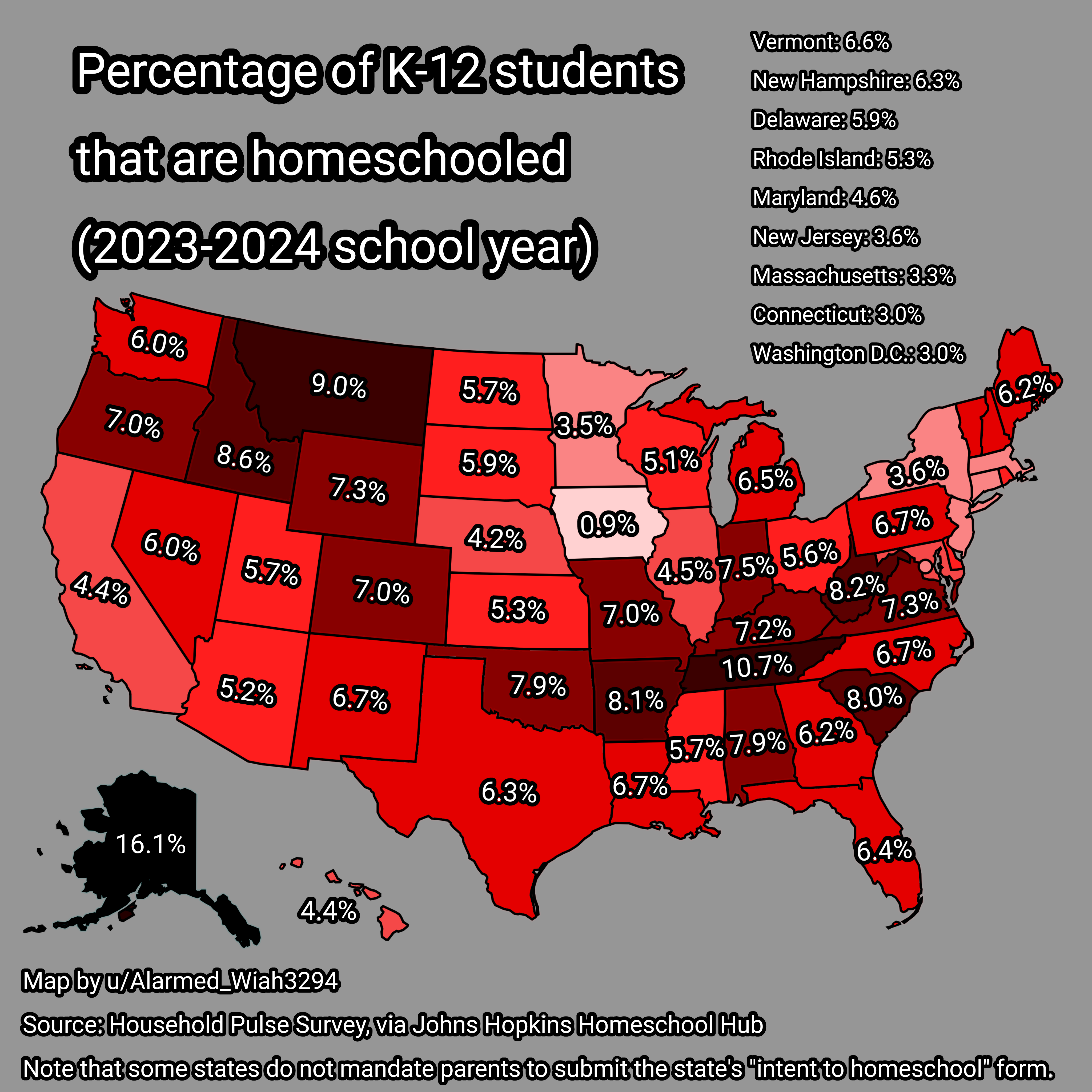
Homeschooling Rates Map for K-12 Students in USA 2023-2024
...
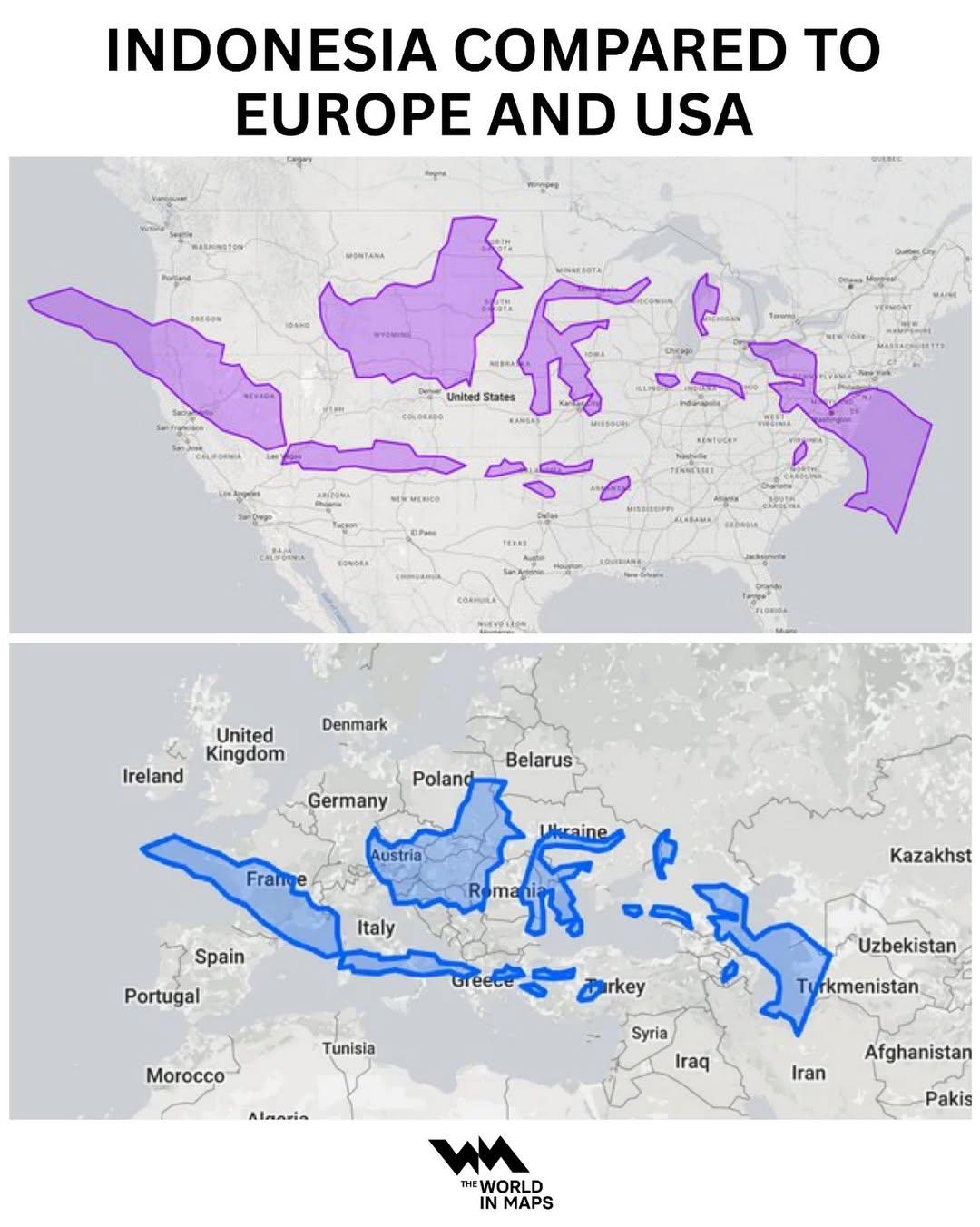
Indonesia Population Density Map Compared to Europe and USA
This map provides a comparative visualization of population density in Indonesia relative to Europe and the USA. By illu...
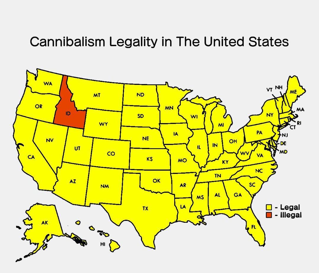
Legality of Cannibalism in the USA Map
This visualization displays the legality of cannibalism across the United States, highlighting the nuanced and often per...
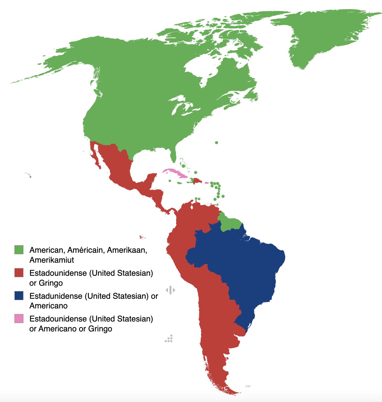
Map of How Americas Refer to USA People by Language
The map titled "Various countries in the Americas refer to people from the USA based on their language" provides a fasci...
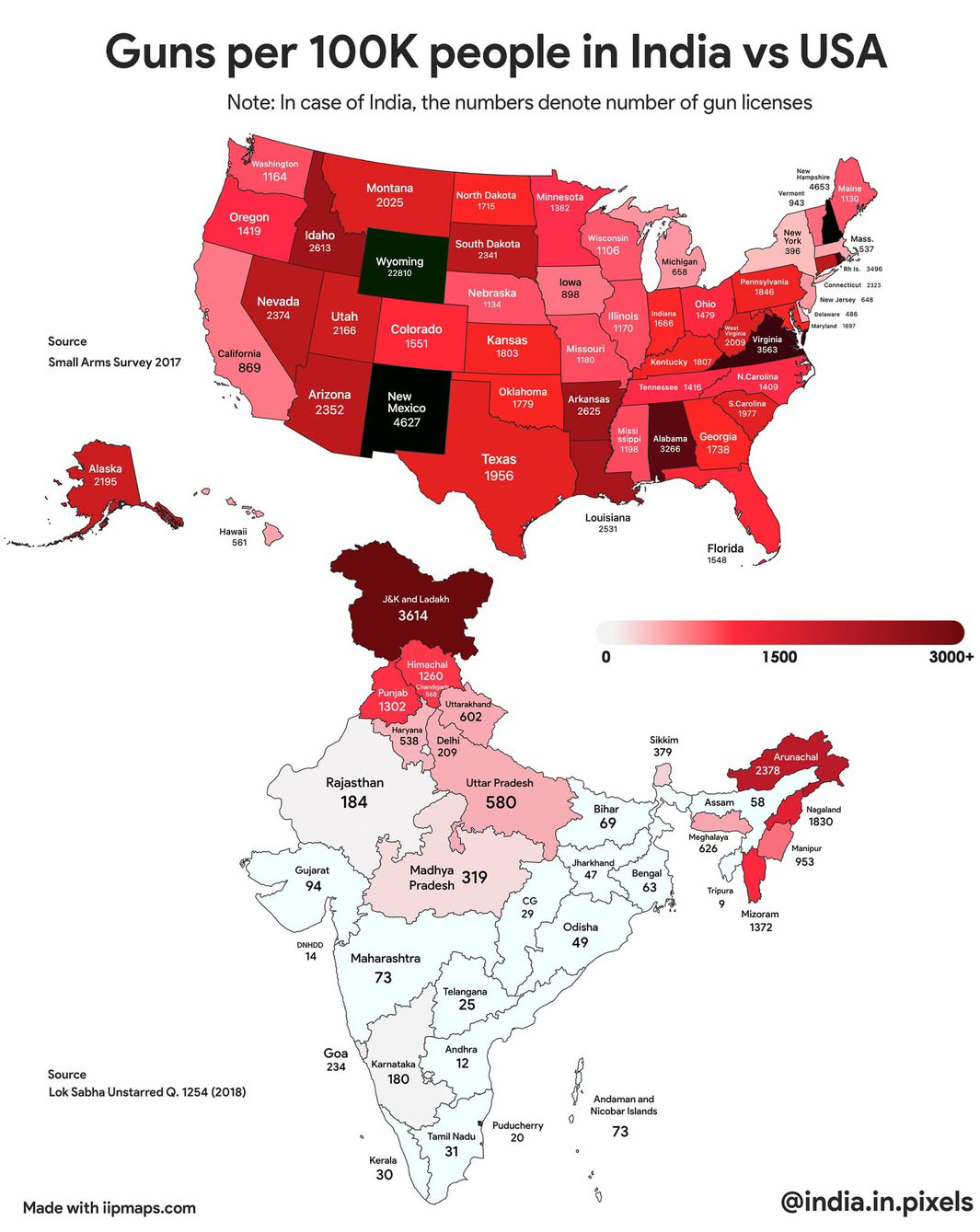
Guns Per 100K People Map: India vs USA
...
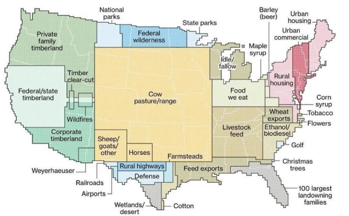
Land Use in the USA Map
This map provides a comprehensive visualization of land use across the United States, focusing on how land is utilized r...
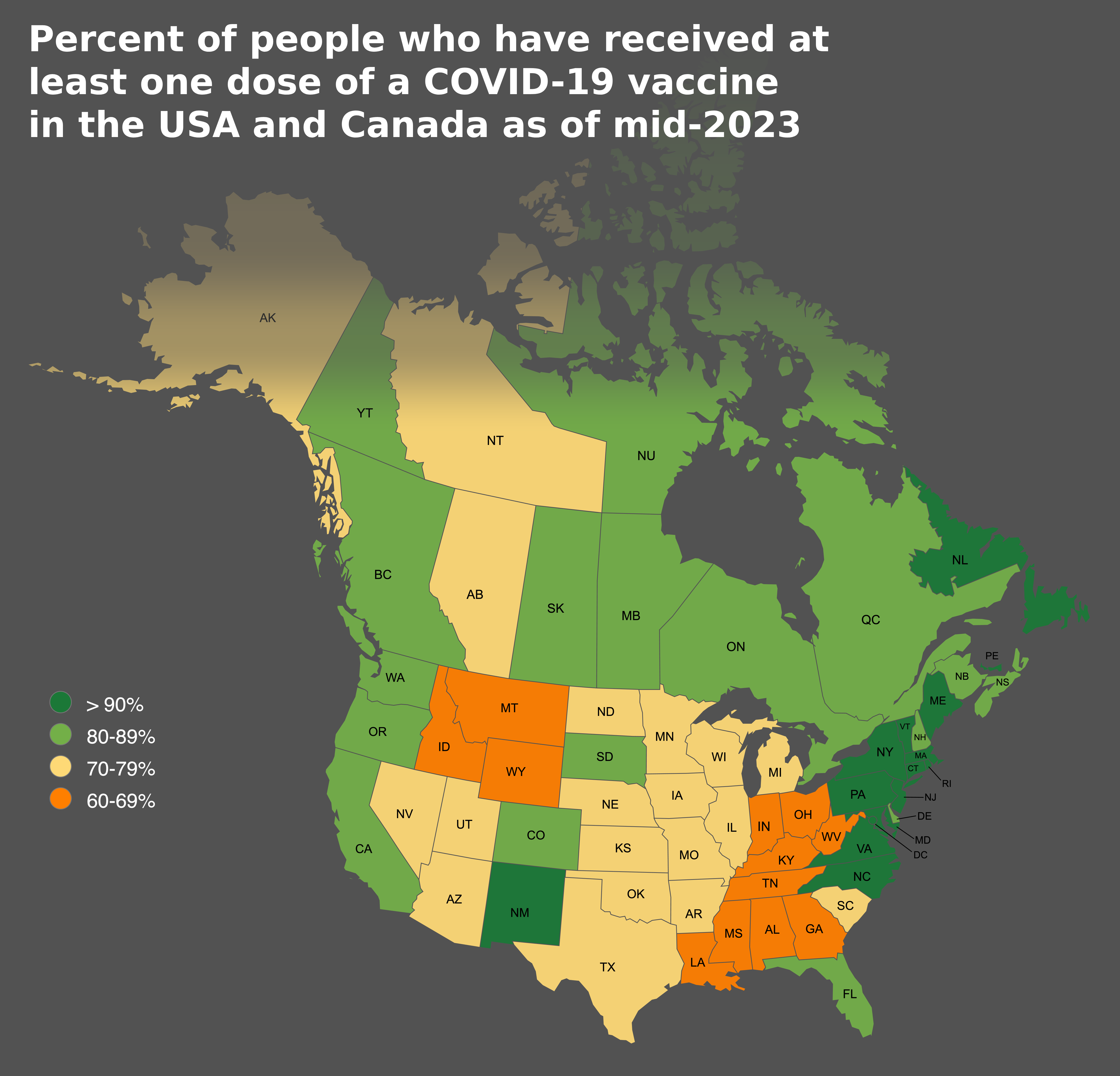
COVID-19 Vaccine Coverage Map USA and Canada
This map provides a clear visualization of the percentage of people who have received at least one dose of a COVID-19 va...

Tuberculosis Cases in the USA Map
...
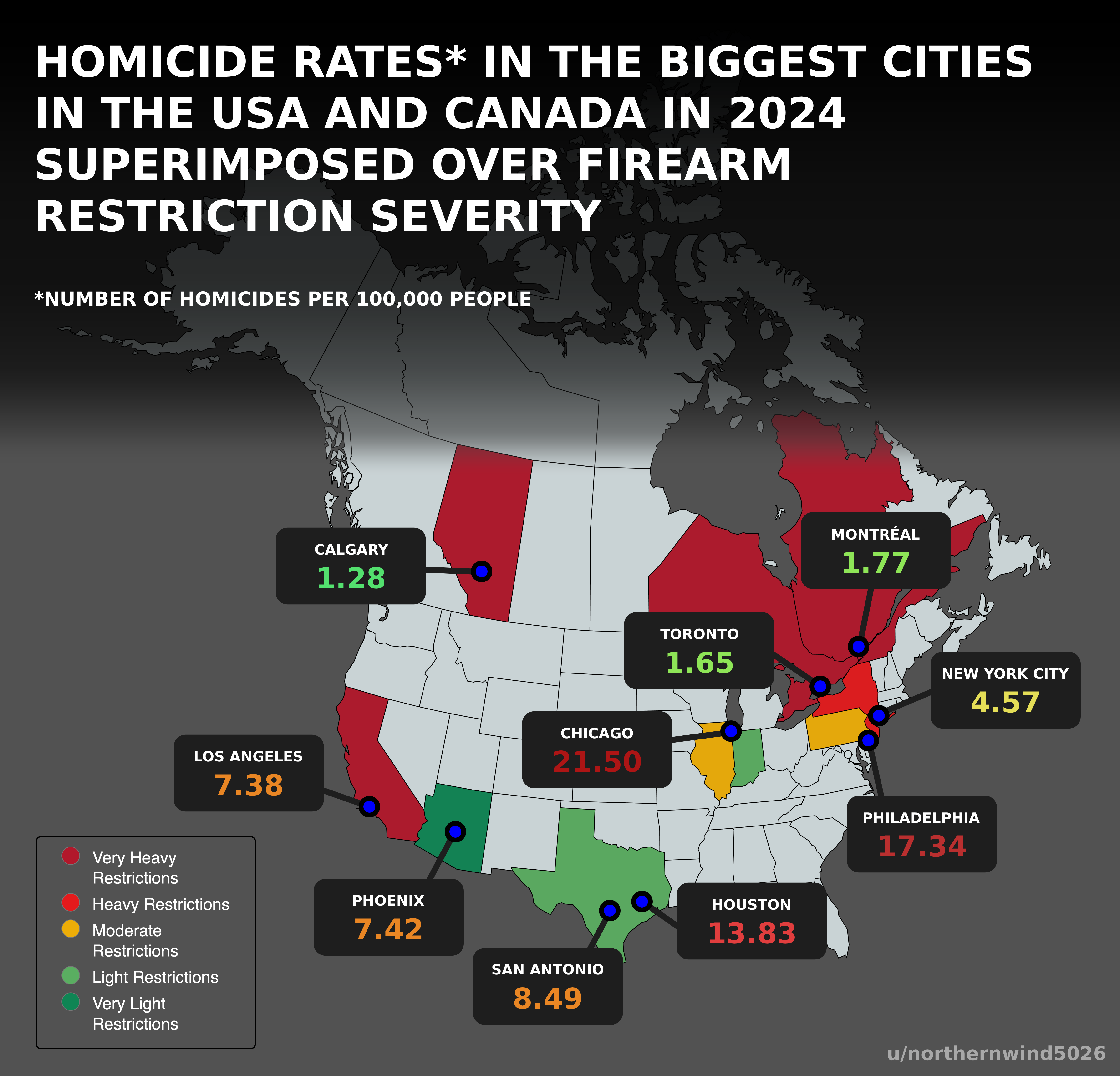
Homicide Rates and Firearm Restrictions Map USA Canada 2024
Interestingly, U.S. cities such as St. Louis and Baltimore are notorious for high homicide rates, while cities like New ...
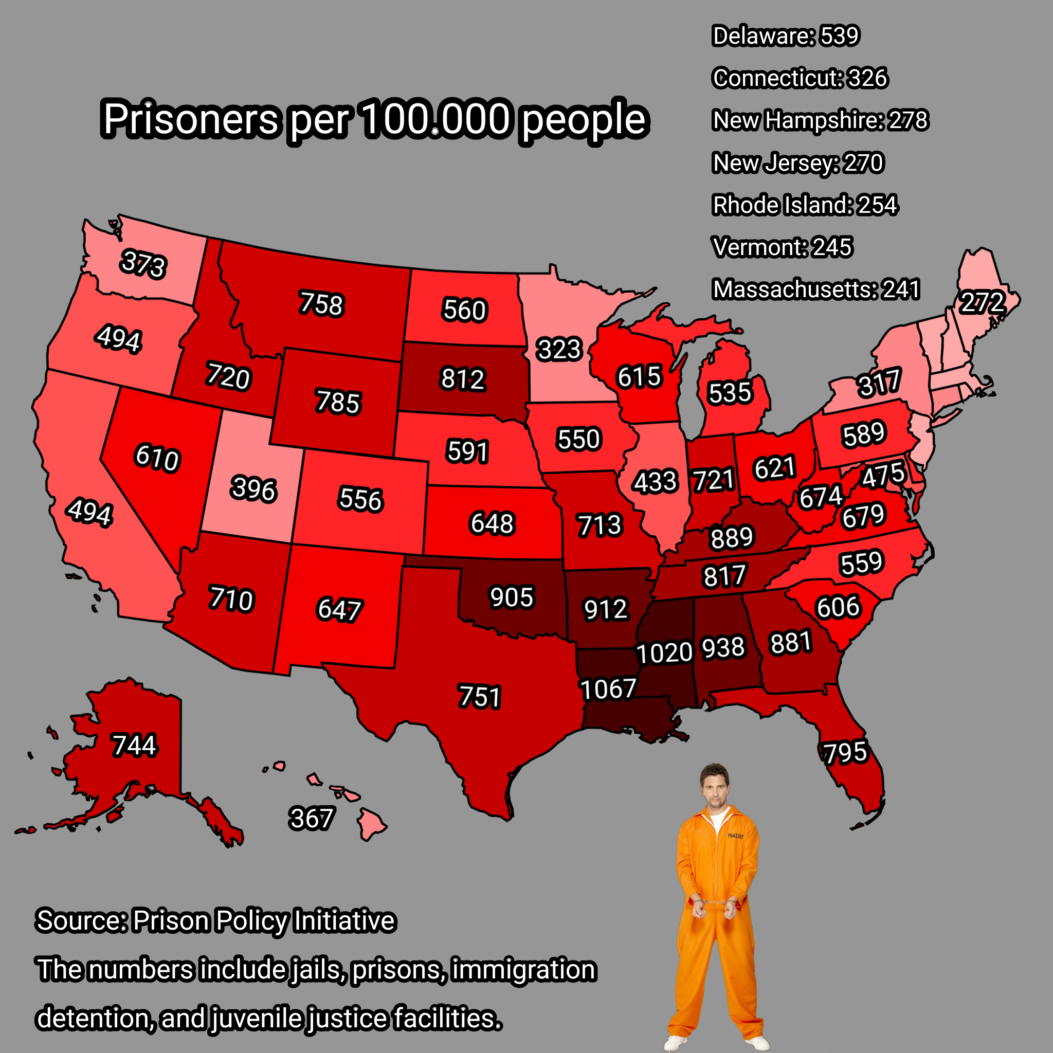
Prisoners per 100,000 People in USA Map
This map illustrates the number of prisoners per 100,000 people across various states in the United States. It provides ...
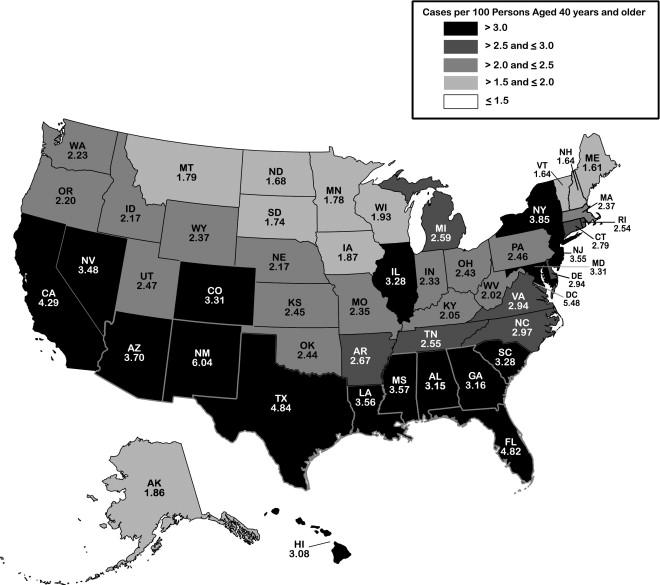
Glaucoma Prevalence Map in the USA
...
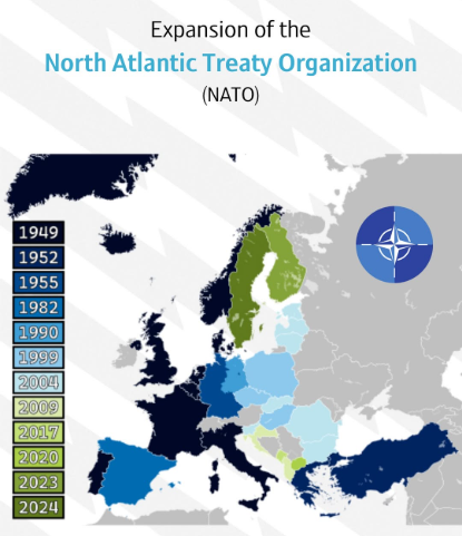
NATO Expansion over Time Map
This map provides a visual representation of the expansion of the North Atlantic Treaty Organization (NATO) over time, h...