u.s. geography Maps
13 geographic visualizations tagged with "u.s. geography"
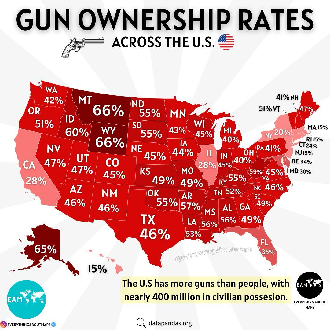
Gun Ownership in the U.S. Map
The "Gun Ownership in the U.S. Map" provides a compelling visual representation of firearm ownership across the United S...
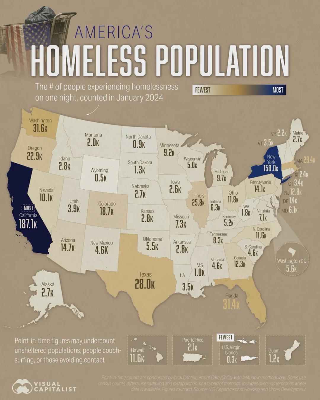
United States Homeless Population Map
The "United States Homeless Population Map" provides a visual representation of the homeless population across various s...
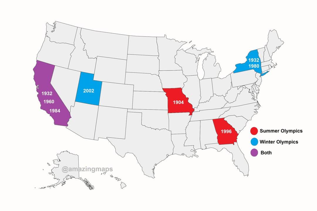
U.S. States That Have Hosted the Olympics Map
This map illustrates the U.S. states that have hosted the Olympic Games throughout history, showcasing a fascinating asp...
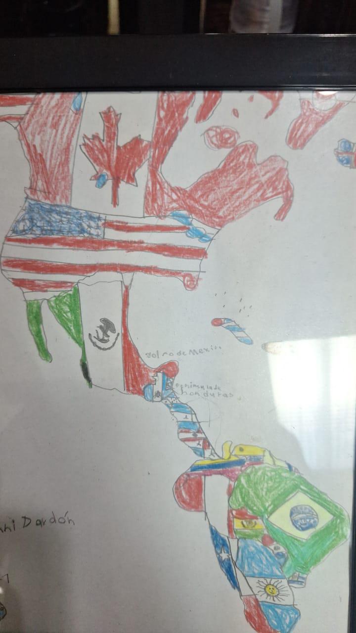
Childhood Drawing Map of America
This charming visualization, a drawing made by a six-year-old, represents a simplistic yet heartfelt interpretation of A...
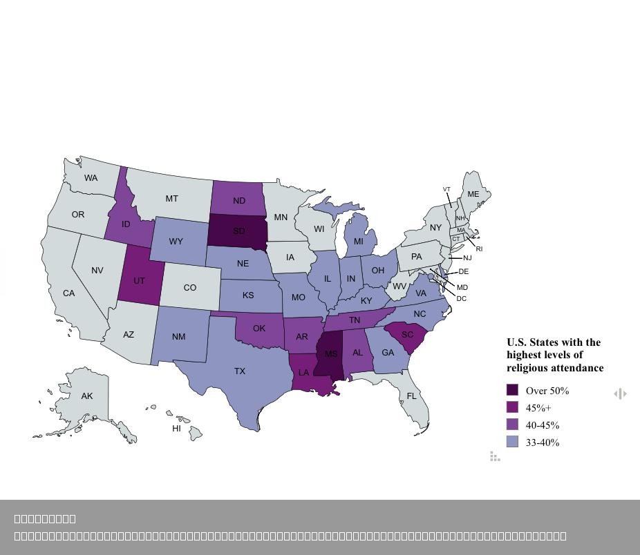
U.S. States Map with 33% Monthly Religious Attendance
This engaging visualization highlights U.S. states where at least 33% of the population attends religious services on a ...
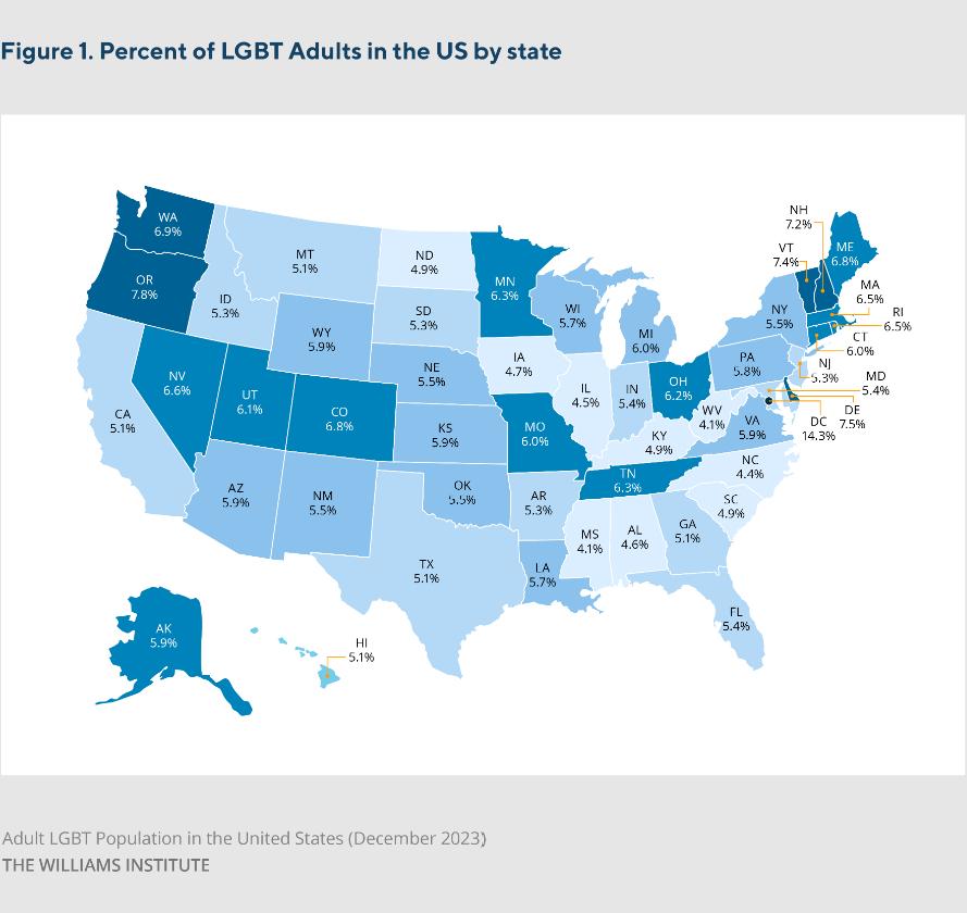
Estimated LGBT Population by U.S. State Map
The Estimated LGBT Population by U.S. State Map, developed by the Williams Institute, provides a visual representation o...
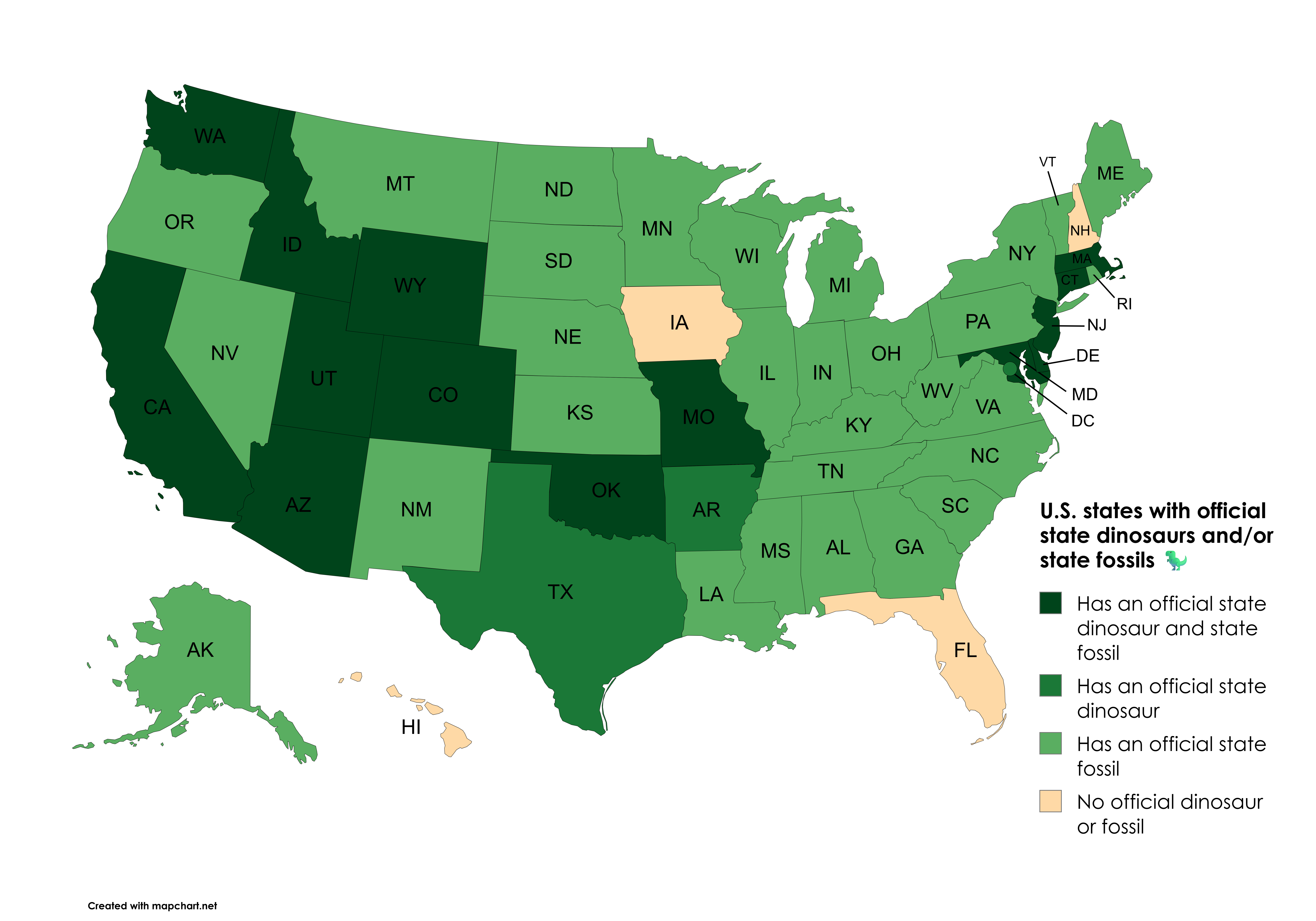
U.S. States with Official State Dinosaurs Map
This map illustrates the U.S. states that have designated official state dinosaurs and/or state fossils. Each state has ...
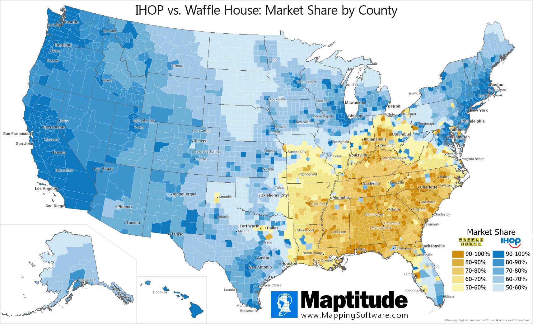
IHOP vs. Waffle House Market Share Map
Interestingly, IHOP has built its brand around a family-friendly atmosphere, offering a wide variety of pancake options,...
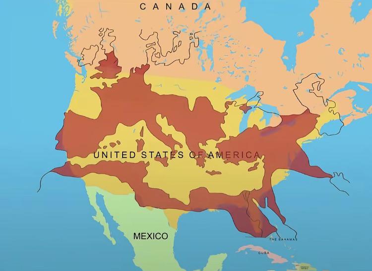
Map of the Roman Empire at its Peak Over the U.S.
This fascinating map overlays the boundaries of the Roman Empire at its zenith around 117 AD with the geographical layou...
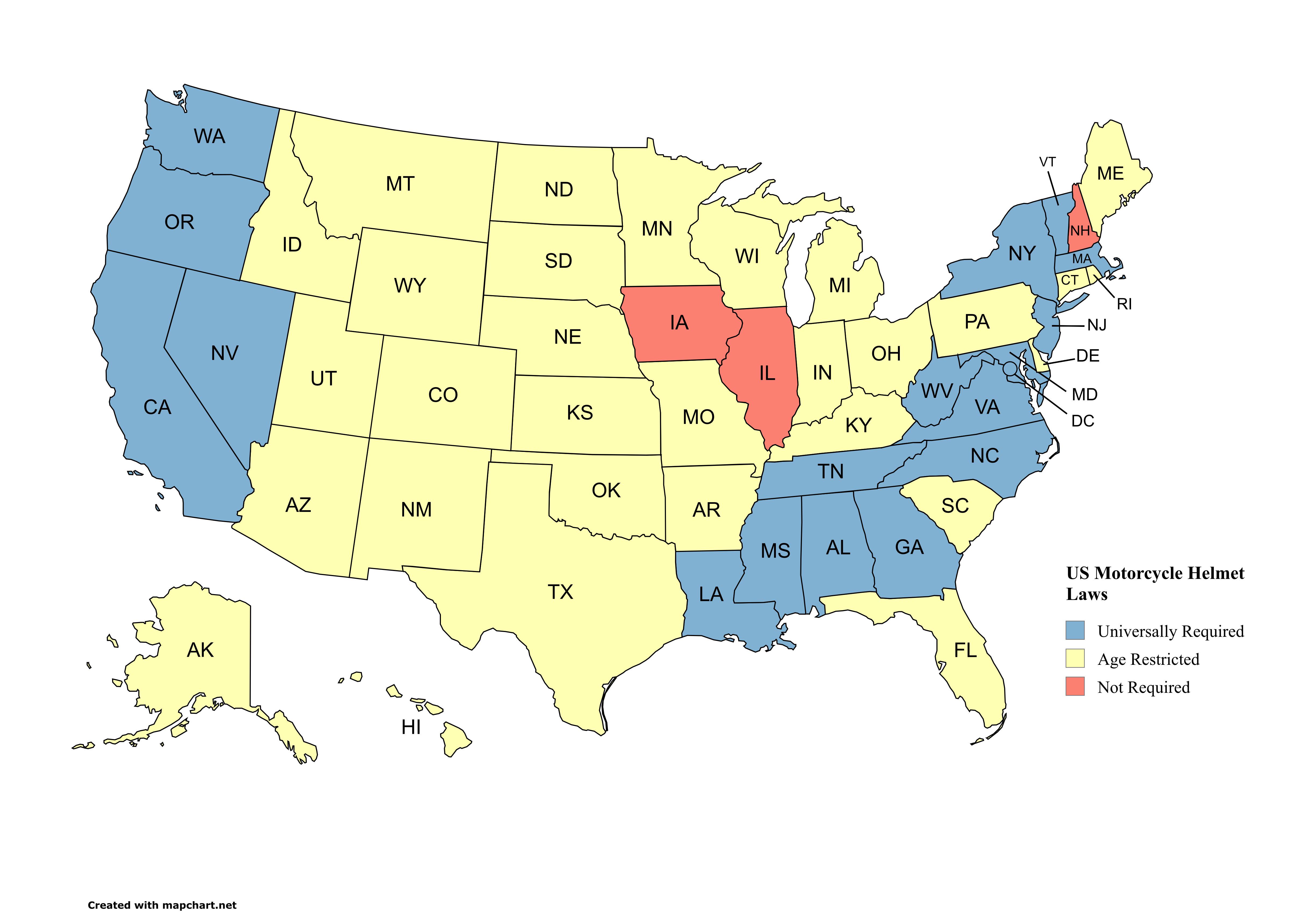
US Motorcycle Helmet Laws Map
This map provides a clear and informative overview of motorcycle helmet laws across the United States. It categorizes ea...
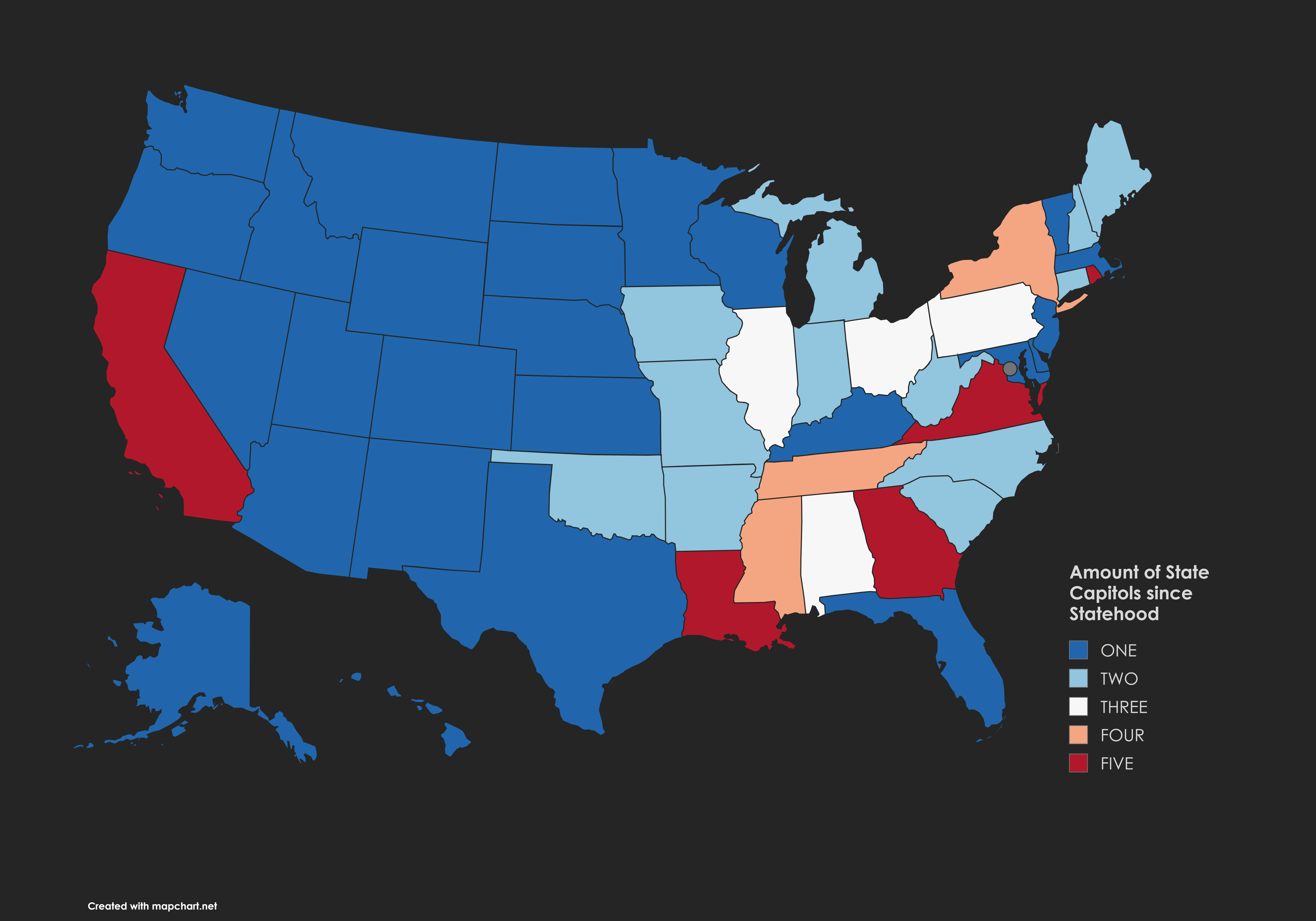
Map of State Capitols Since Statehood
The "Amount of State Capitols Since Statehood" map provides a visual representation of the number of state capitals that...
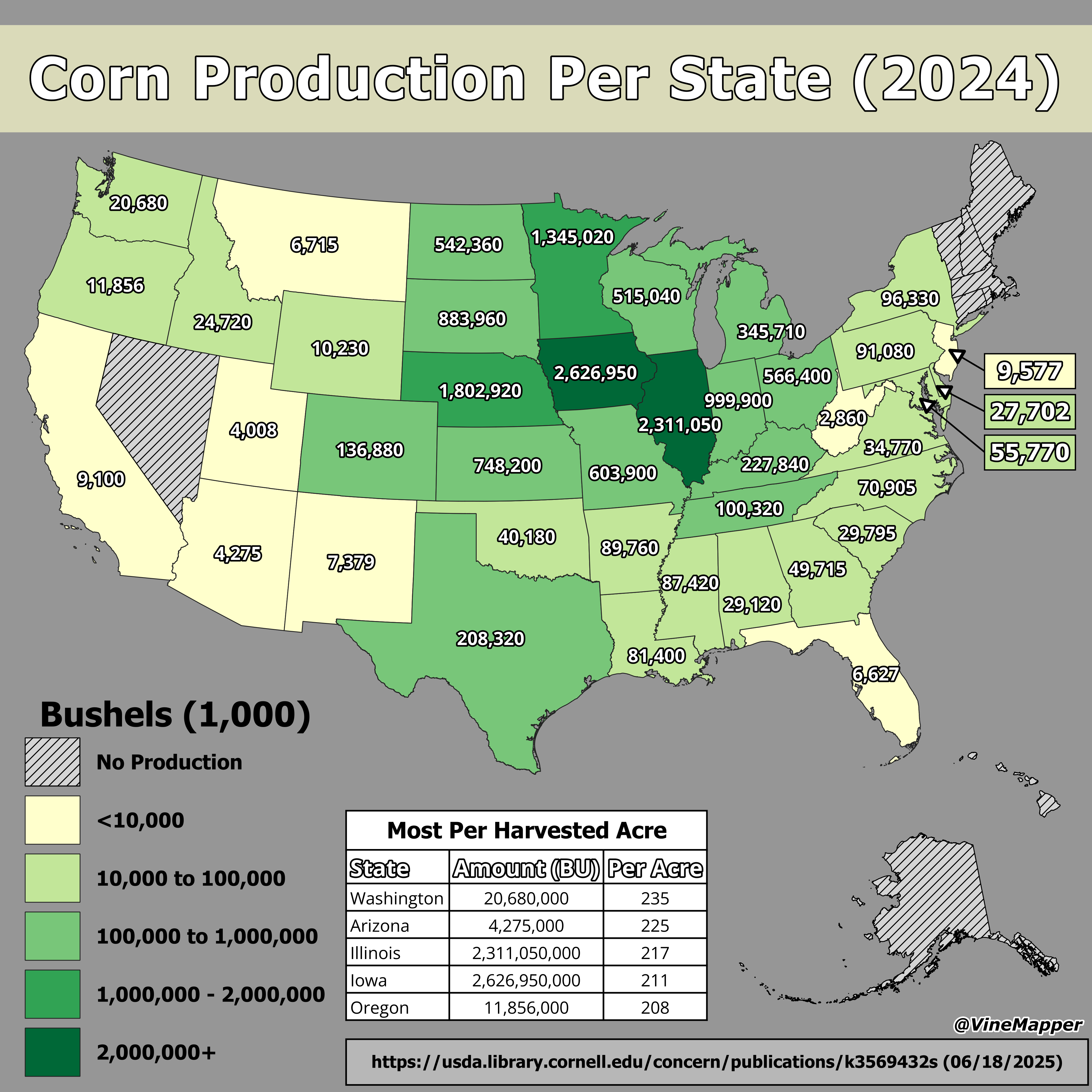
Corn Production Per State Map
This map illustrates the corn production levels across the United States, highlighting which states lead the nation in t...
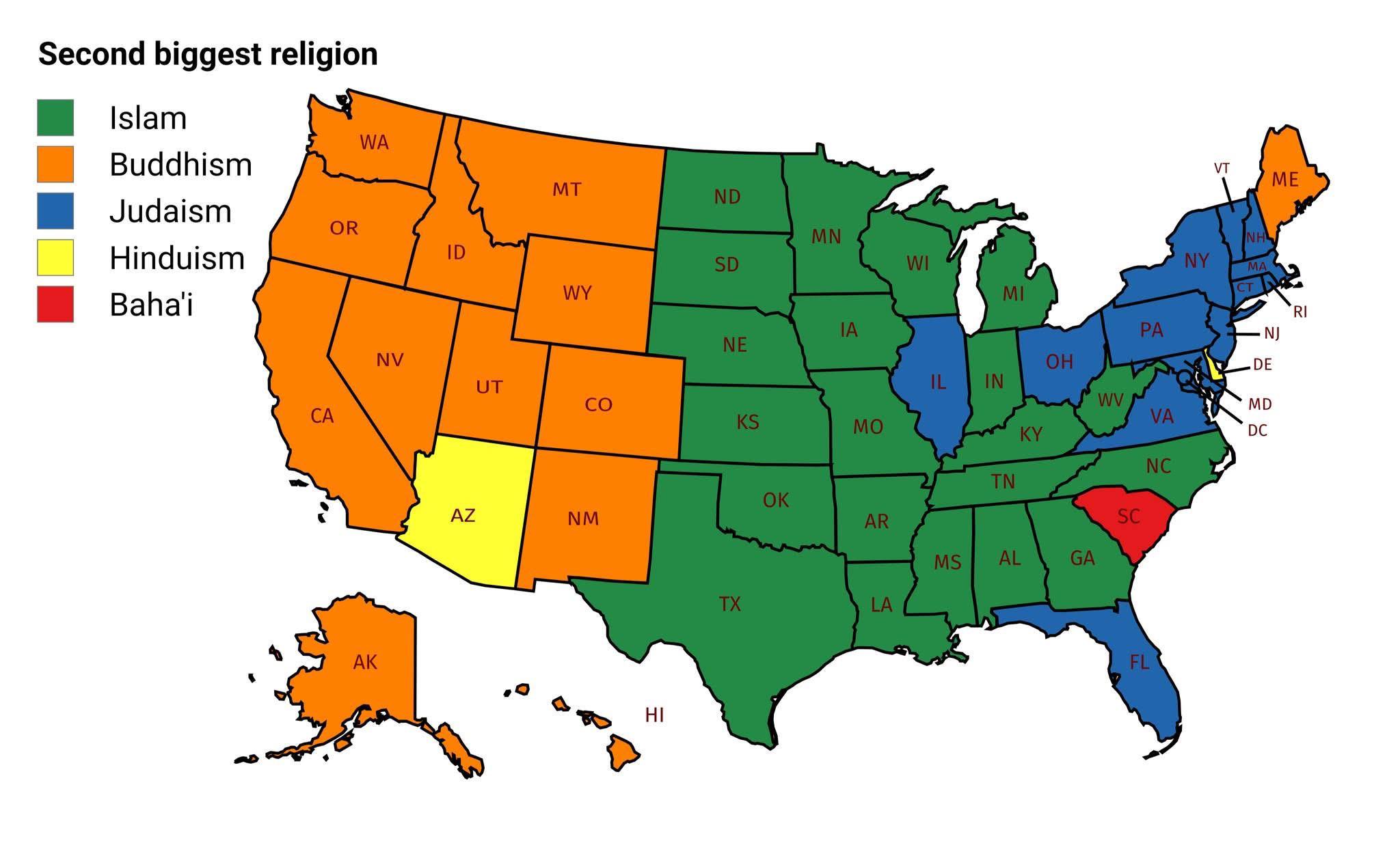
Second-Biggest Religion by State Map
The visualization titled "Mapping the Second-Biggest Religion in Every U.S. State" provides a fascinating glimpse into t...