texas Maps
3 geographic visualizations tagged with "texas"

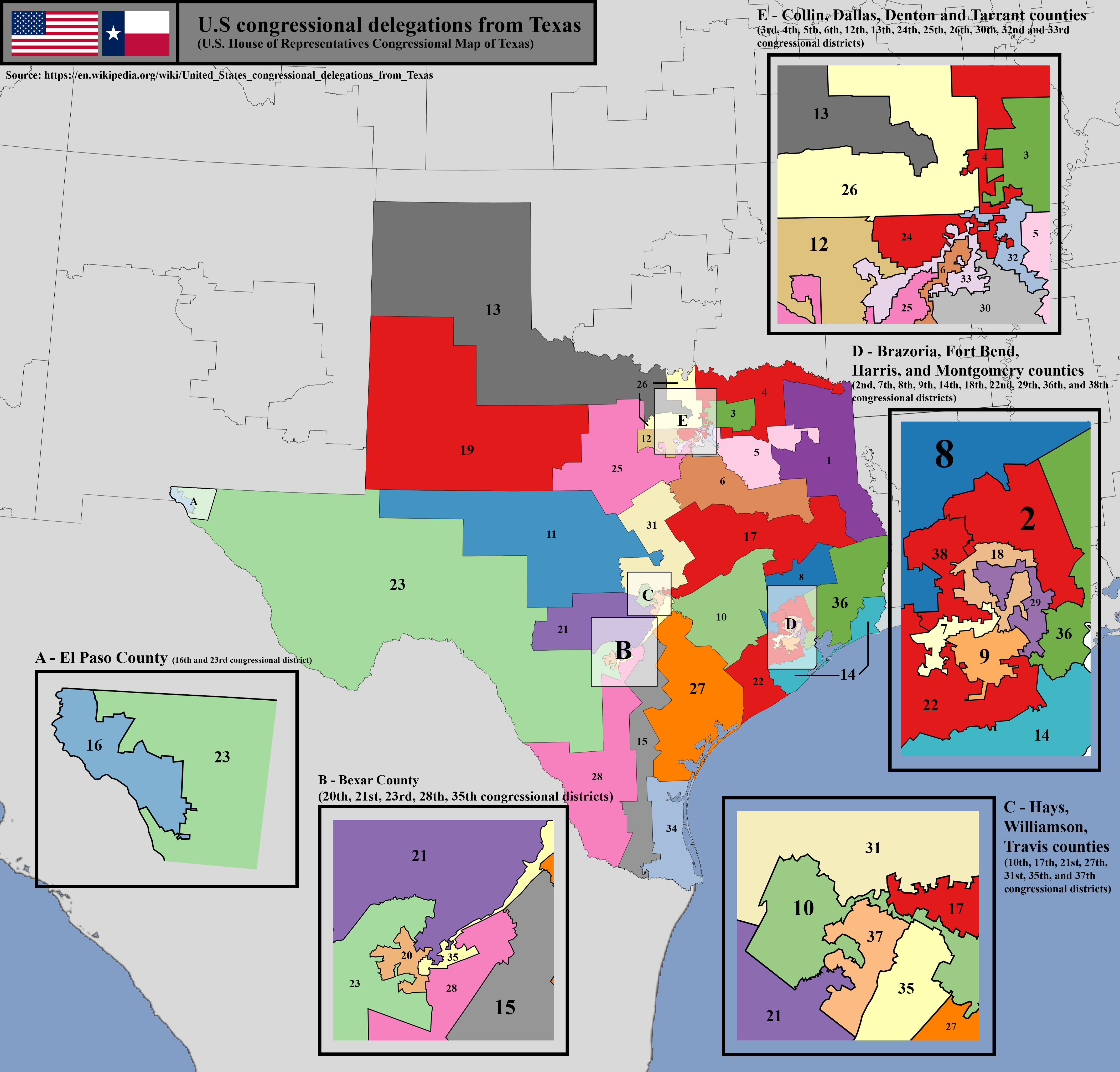
U.S. House of Representatives Congressional District Map of Texas
The U.S. House of Representatives congressional district map of Texas visually represents the boundaries of each congres...
👁 94📅 8/13/2025

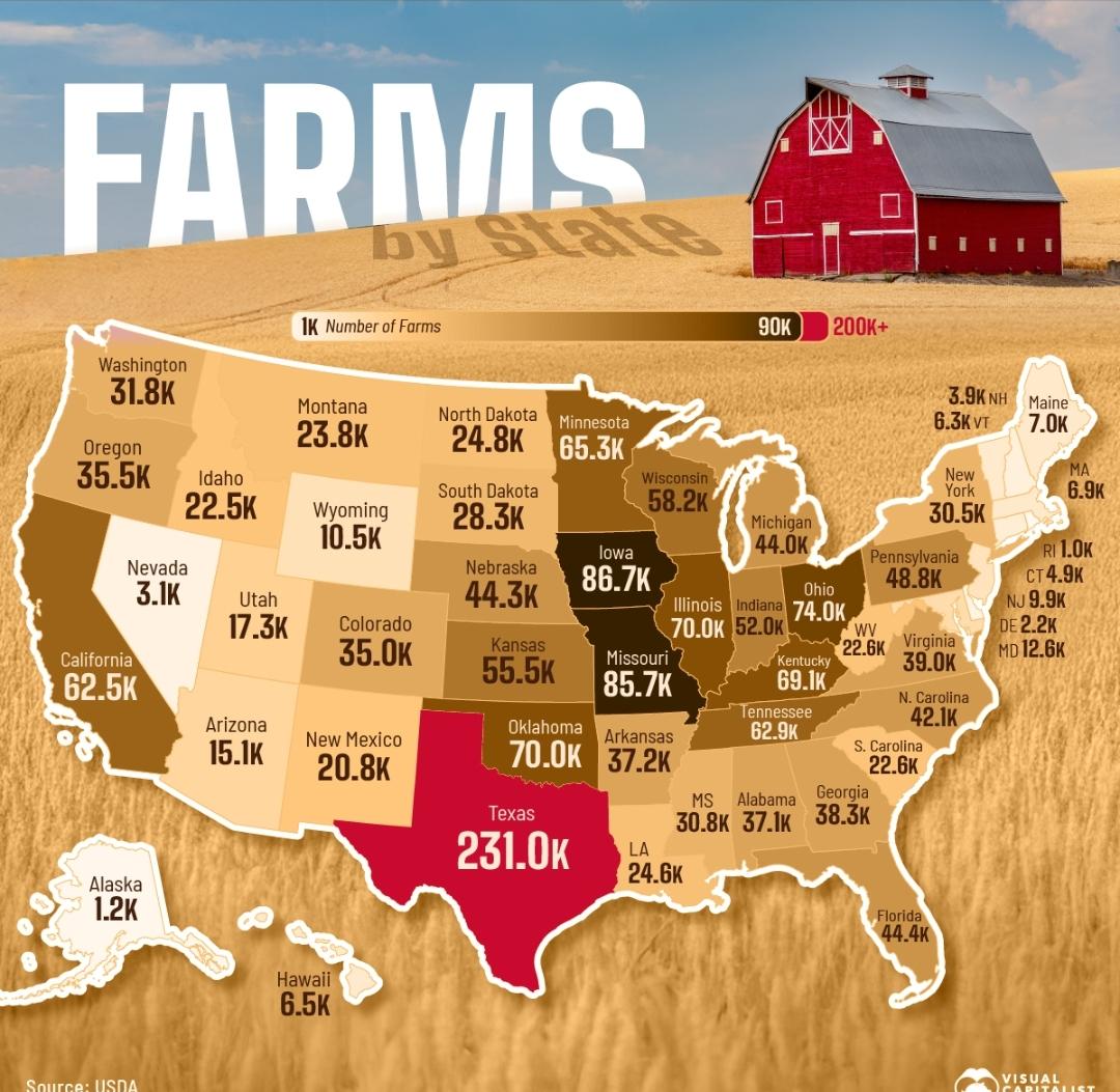
Farms in the USA Map
The "Farms in the USA" map provides a comprehensive overview of the agricultural landscape across the United States, hig...
👁 18📅 10/12/2025

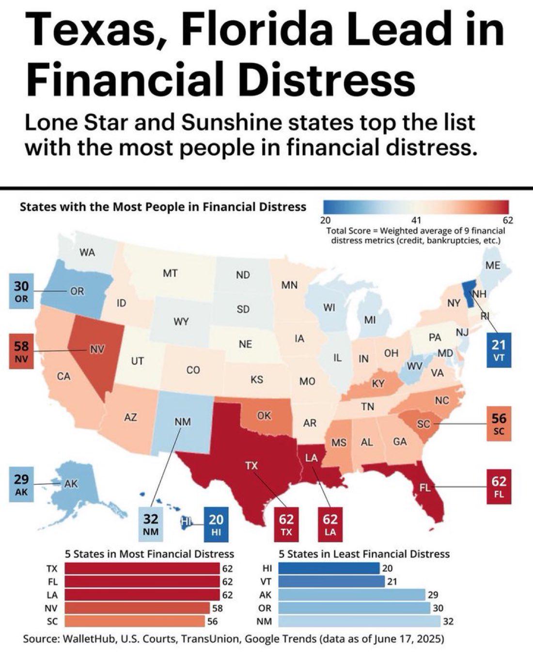
Financial Distress Map of Texas and Florida
The visualization titled "Texas, Florida Lead in Financial Distress" highlights the financial struggles faced by residen...
👁 74📅 9/8/2025