territorial disputes Maps
10 geographic visualizations tagged with "territorial disputes"
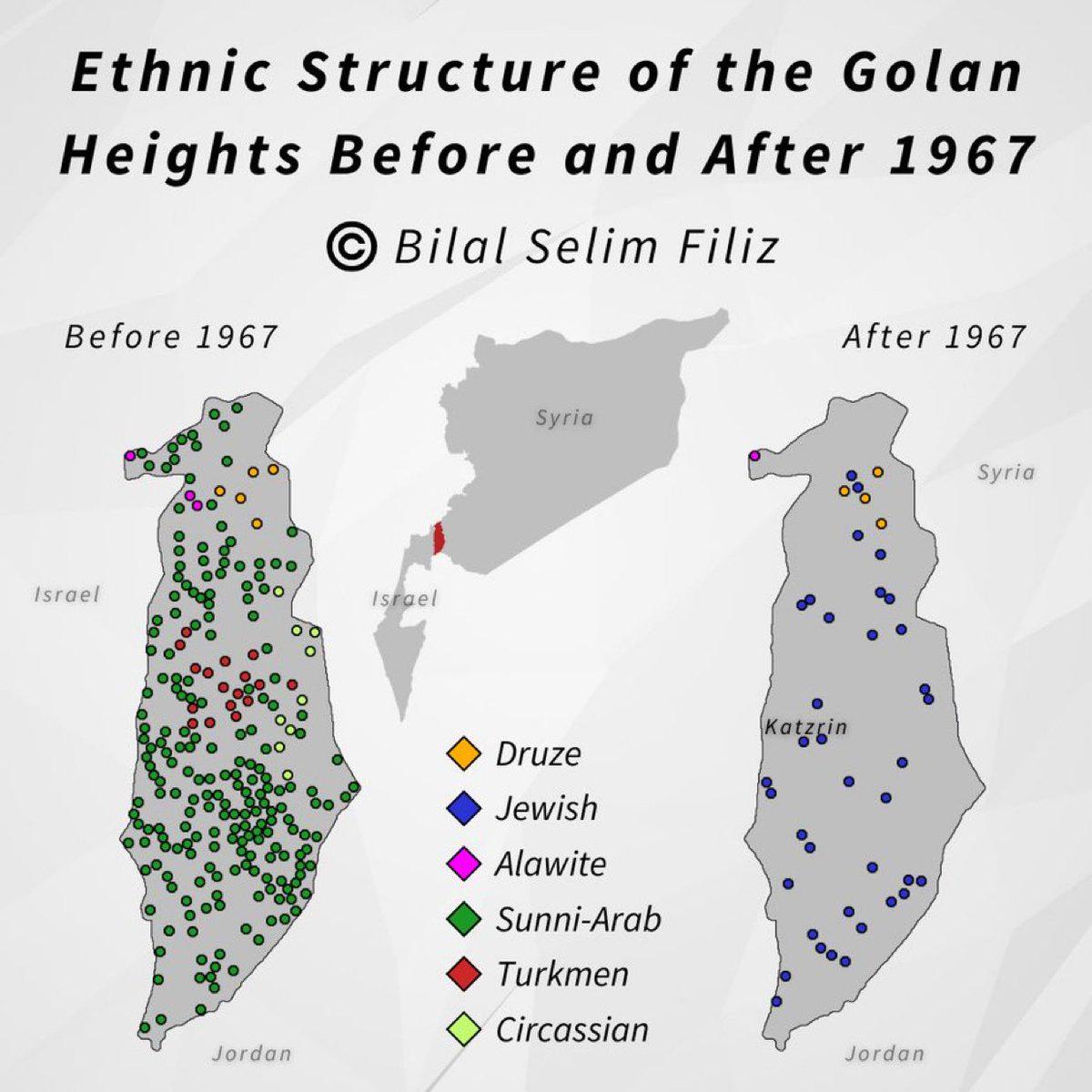
Golan Heights Historical Map Overview
The visualization titled "Golan Heights, then and now" presents a compelling comparison of the Golan Heights region, hig...
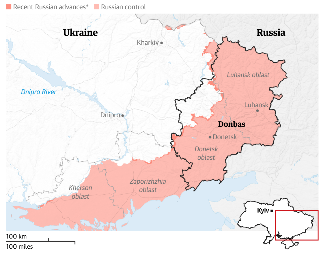
Map of Proposed Donbas Cessions by Putin
The map titled "Map of Proposed Donbas Cessions by Putin" visually represents the regions in eastern Ukraine that Russia...
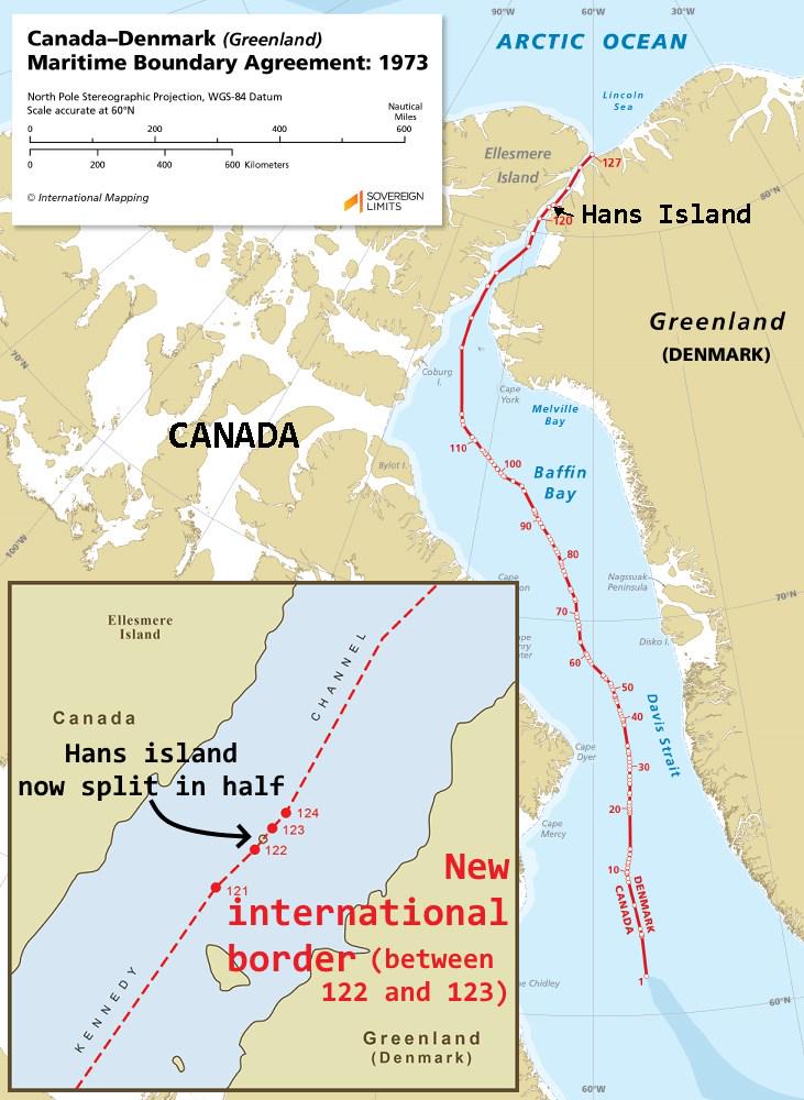
Hans Island Border Map Between Canada and Denmark
This map visually represents the unique land border established between Canada and Denmark in 2022, specifically splitti...
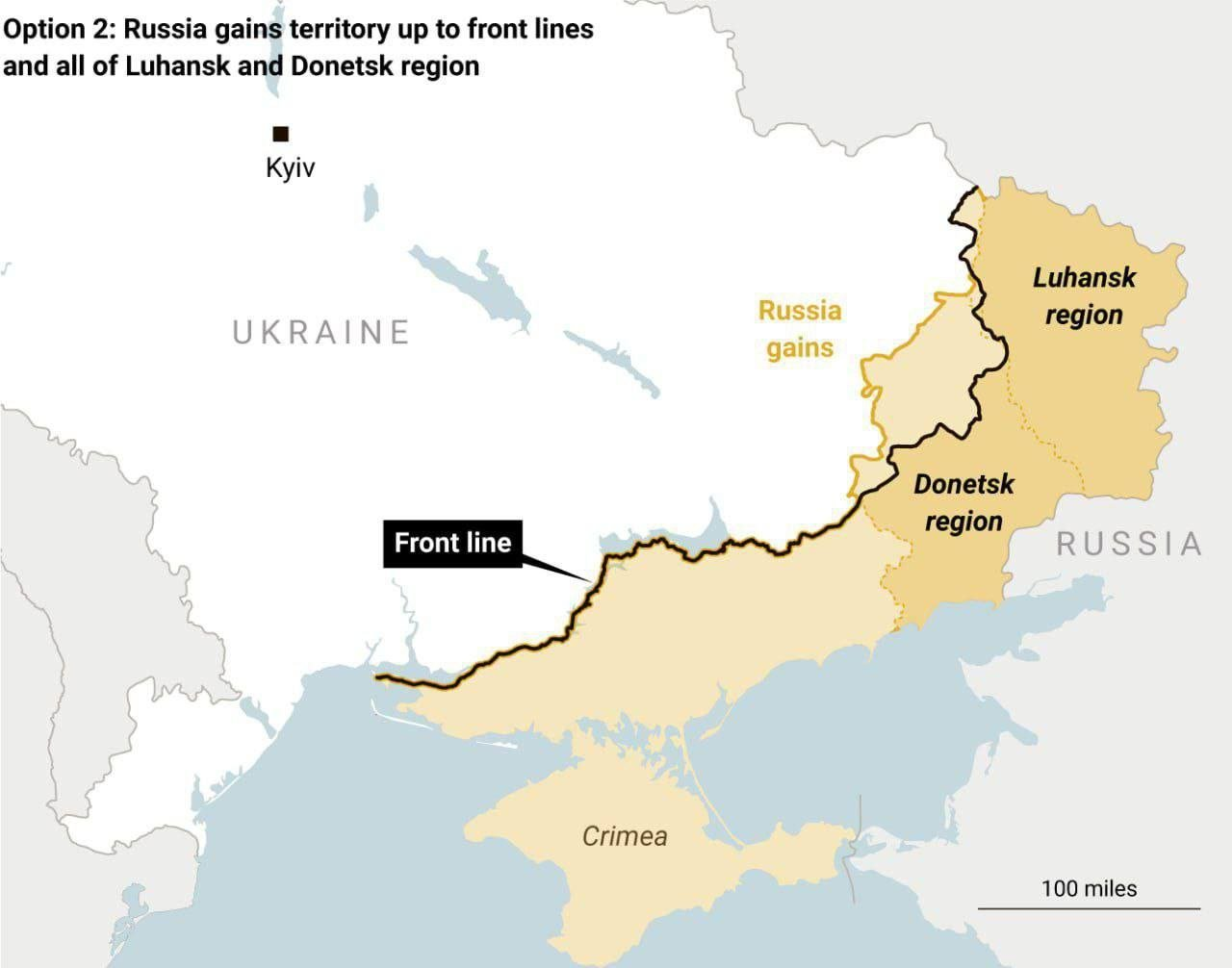
Proposed Peace Plan for Ukraine Map
The "Proposed Peace Plan for Ukraine Map" visualizes potential territorial adjustments and governance structures as part...
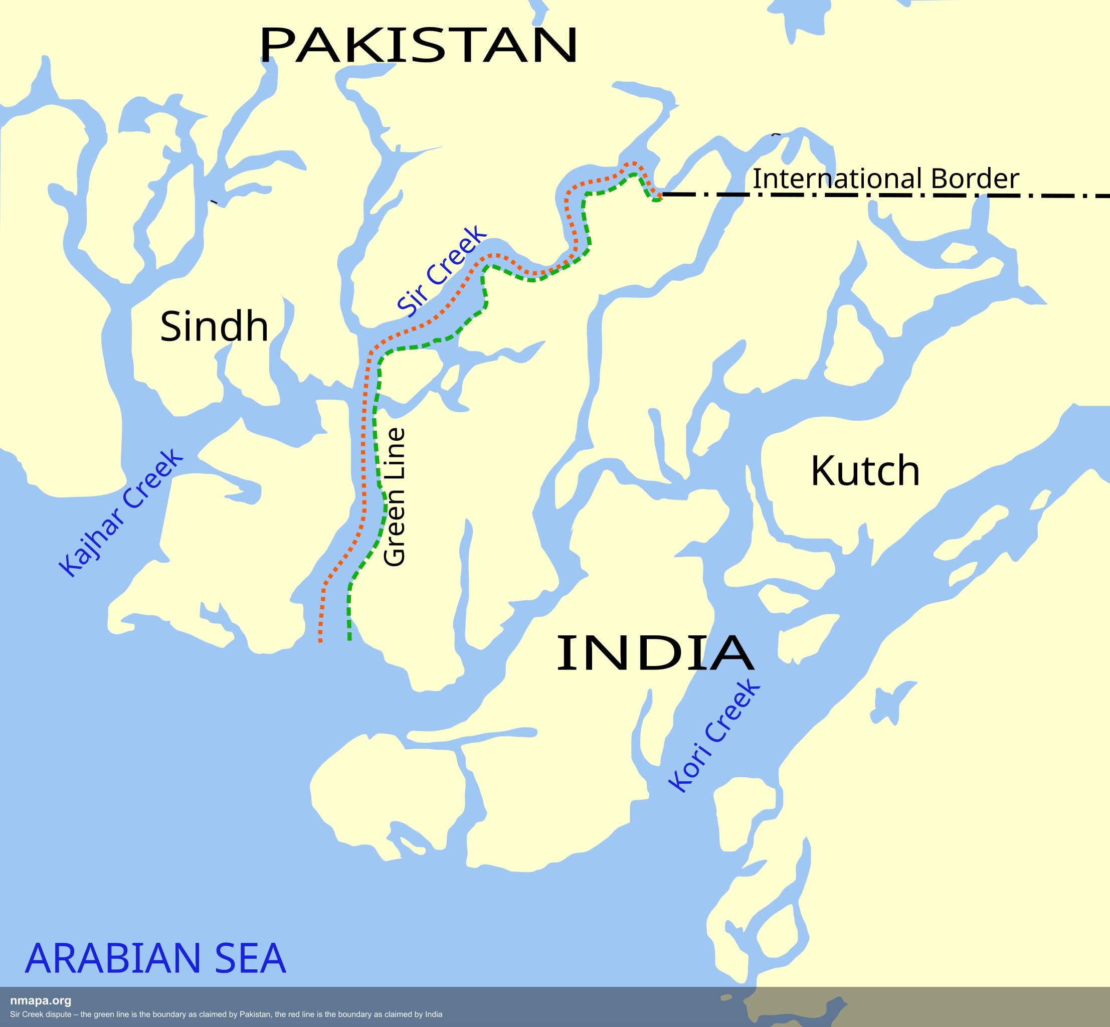
Sir Creek Dispute Boundary Map: Pakistan vs India
The Sir Creek dispute boundary map illustrates the contentious borders between Pakistan and India in the Sir Creek regio...
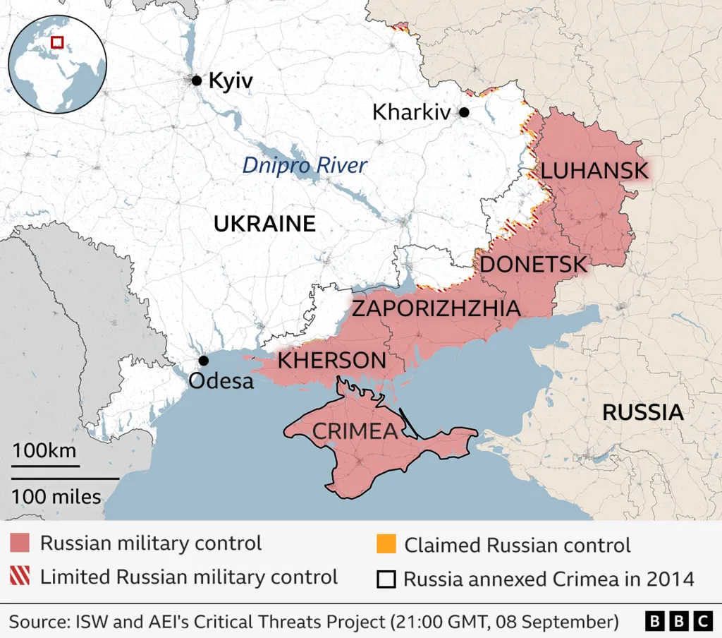
Extent of Russian Military Control in Ukraine Map
The visualization titled "Extent of Russian Military Control in Ukraine (as of September 8, 2025)" provides a detailed o...
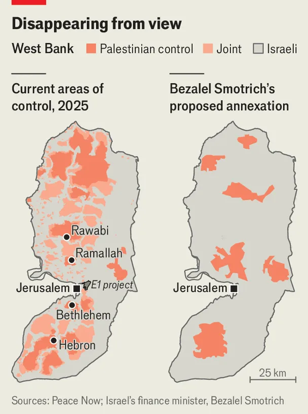
West Bank Proposed Annexation Map: Bantustans
The West Bank Proposed Annexation Map: Bantustans visualization showcases the complex geopolitical landscape of the West...
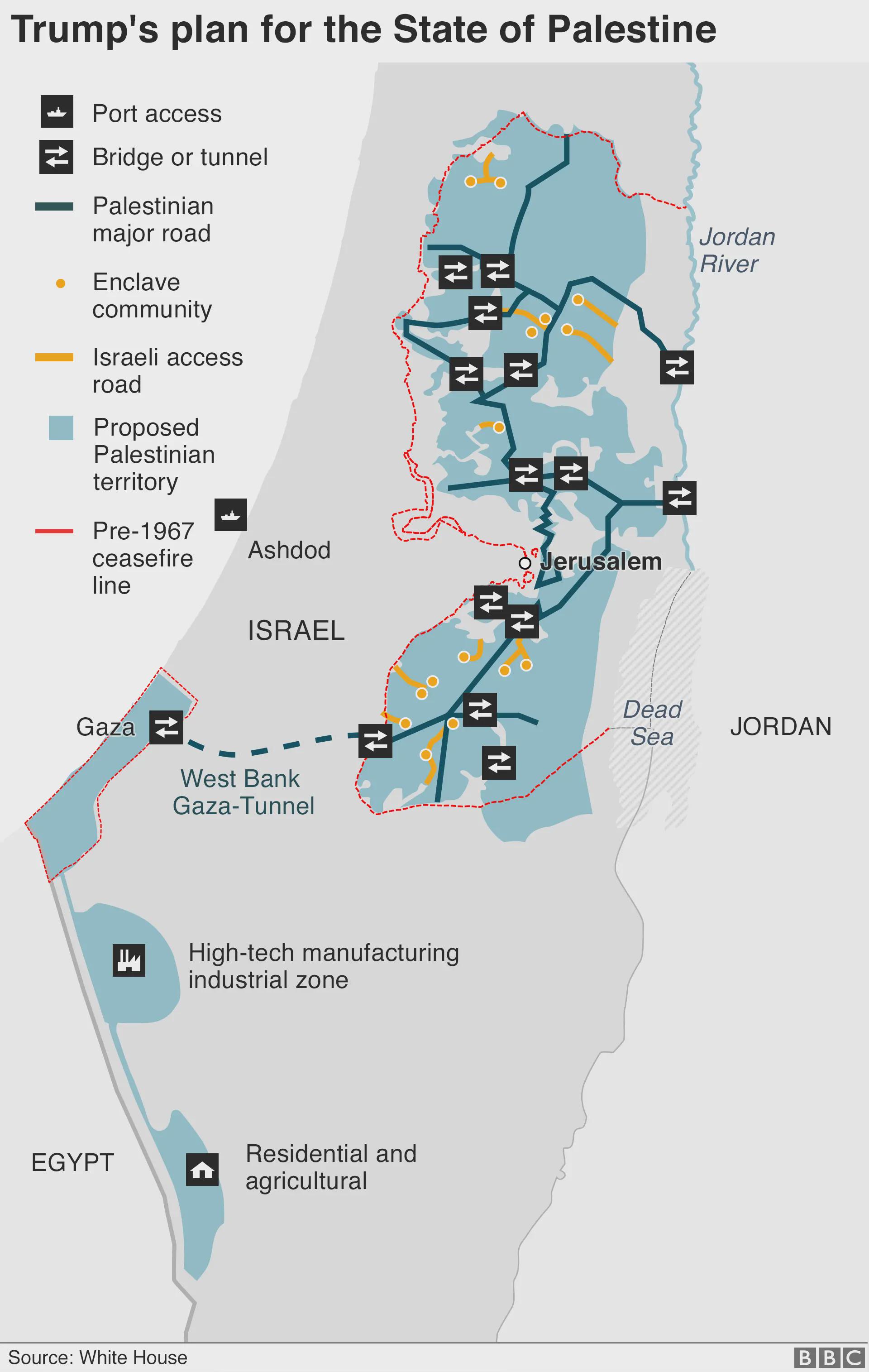
Trump's Plan for the State of Palestine Map
The map titled "Trump's Plan for the State of Palestine 2020" presents a proposed framework for the future of Palestine ...
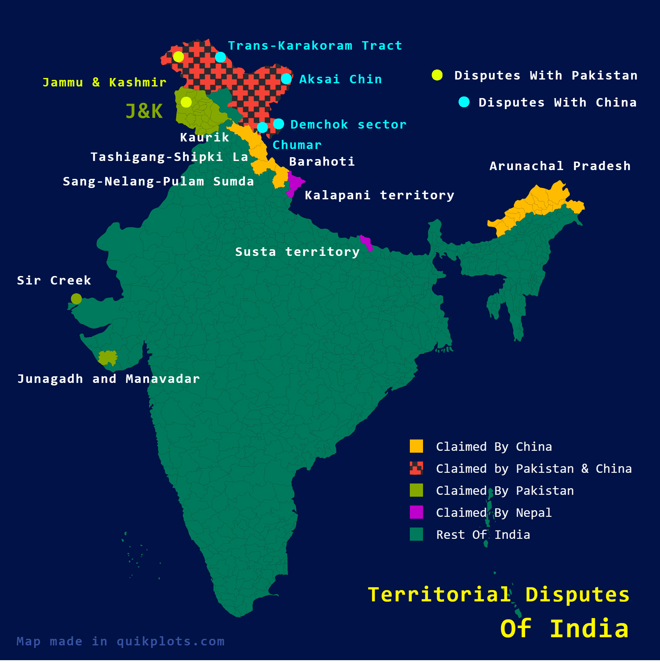
Territorial Disputes of India Map
The map titled "Territorial Disputes of India" provides a comprehensive visualization of the various territorial claims ...
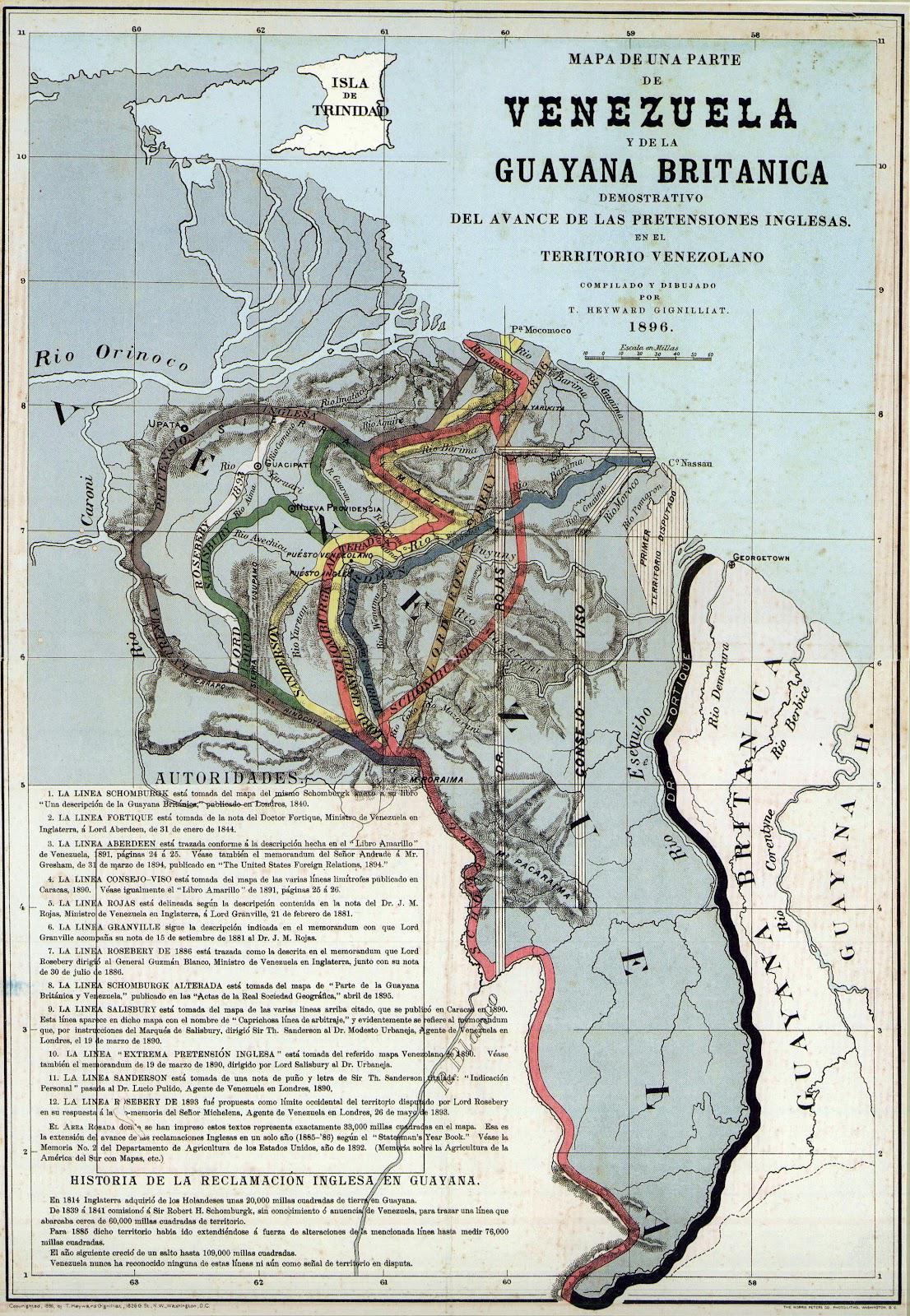
Proposed Boundaries for Guyana Map
The "Proposed Boundaries for Guyana Map" visualizes the various territorial claims and proposed administrative borders w...