sweden Maps
9 geographic visualizations tagged with "sweden"
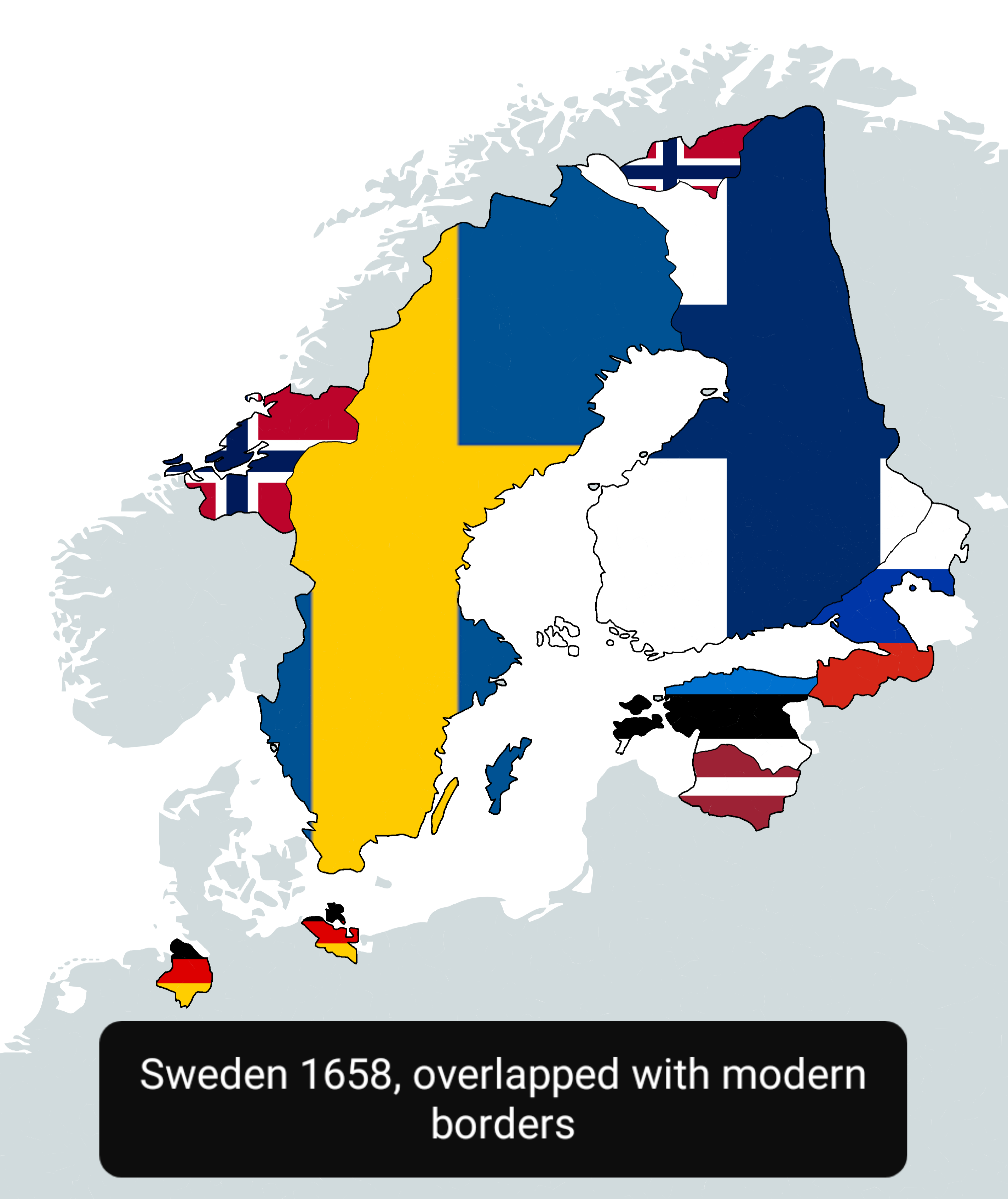
Sweden in 1658 Map Overlapped with Modern Countries
This map visually represents Sweden as it was in 1658, overlapped with the boundaries of modern countries. It allows us ...
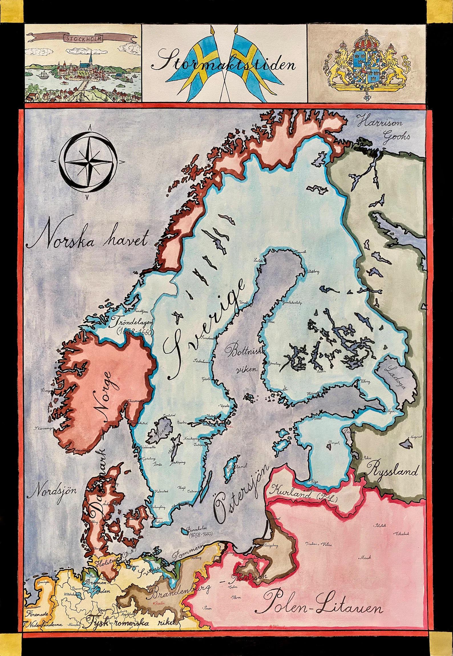
Map of Sweden in 1660
The "Map of Sweden in the year 1660" provides a fascinating glimpse into a pivotal time in the country's history. This h...
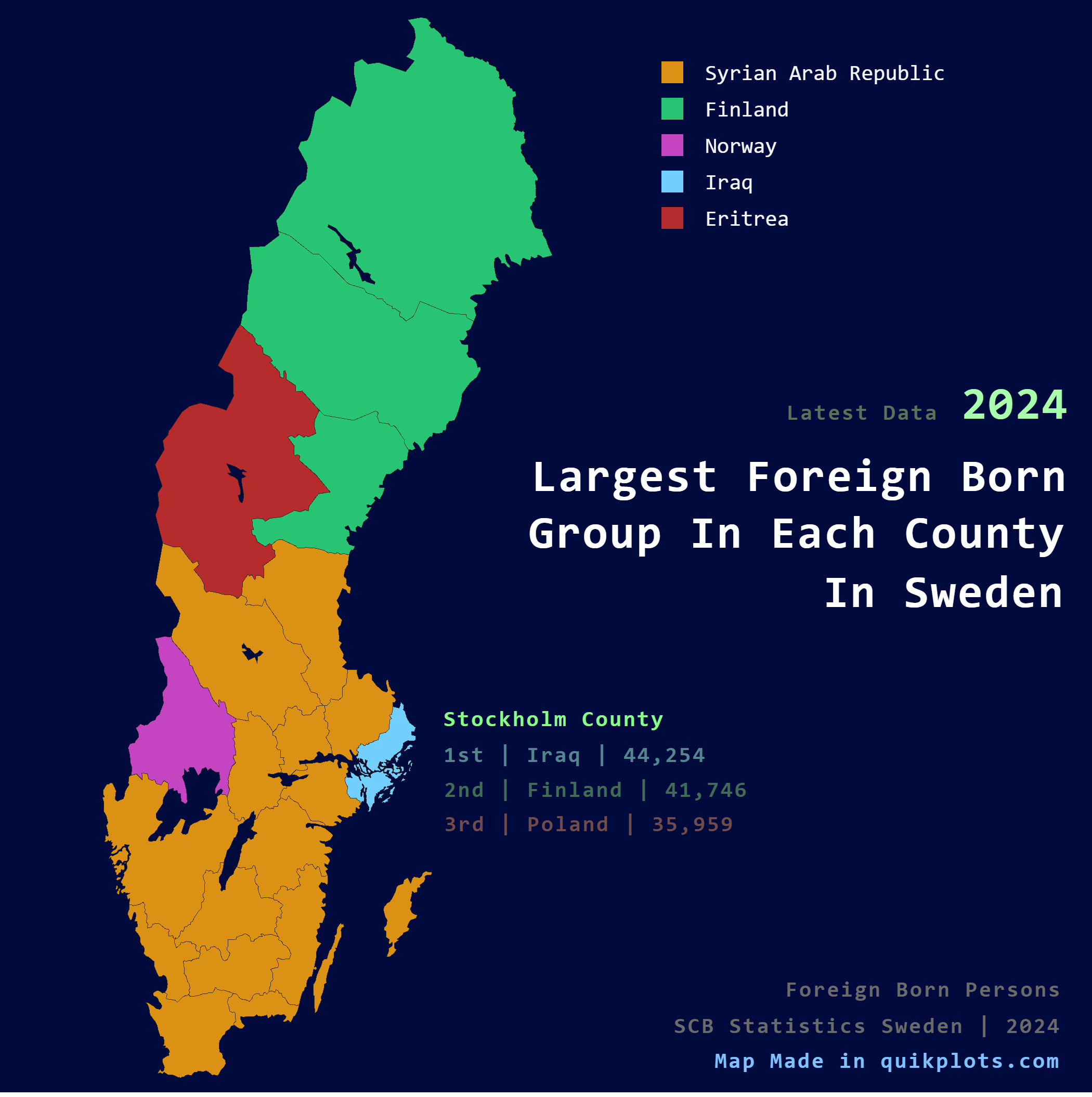
Largest Foreign Born Group per County Map in Sweden
The visualization titled "Largest Foreign Born Group per County in Sweden" presents a detailed breakdown of the predomin...
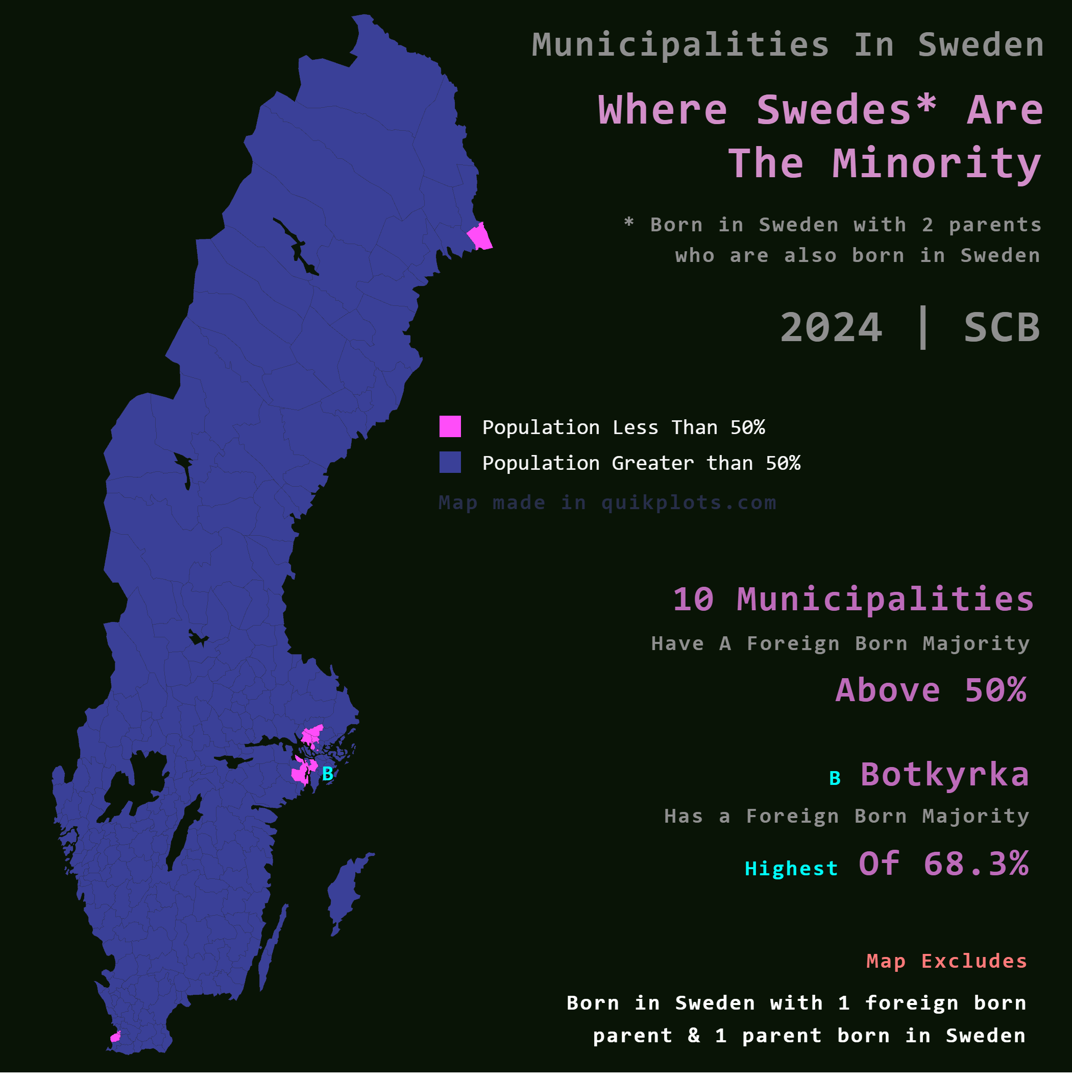
Map of Municipalities with Foreign Majority in Sweden
The map titled "Where Swedes are the Minority in Sweden" provides an intriguing look into the demographic landscape of t...
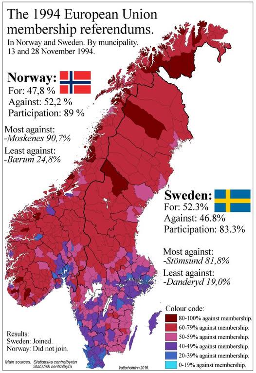
1994 Swedish and Norwegian EU Referendum Results Map
The "1994 Swedish and Norwegian EU Referendum Results By Municipality" map presents a detailed view of how different mun...
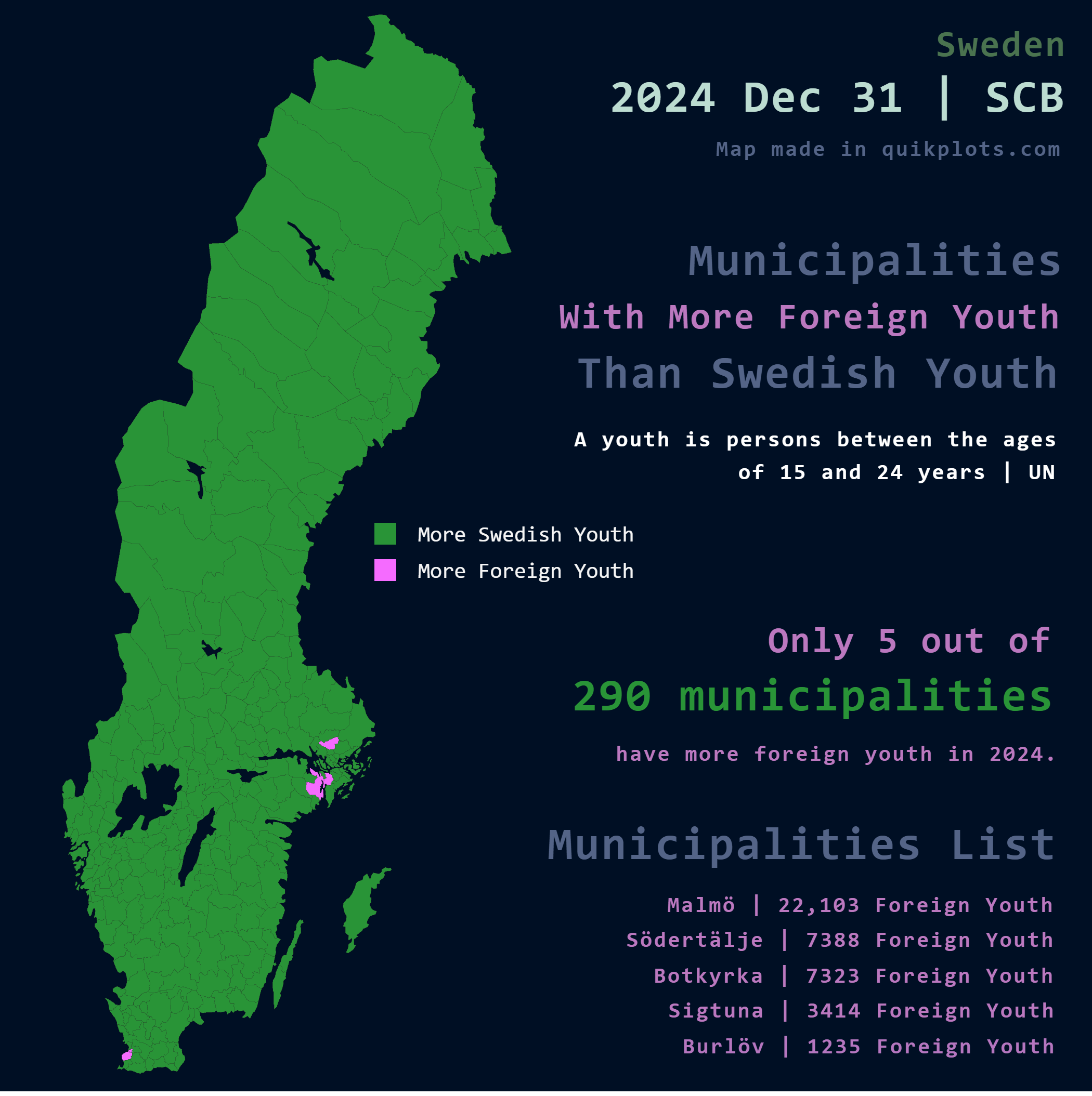
Map of Foreign Youth Population in Sweden
This map visualizes the distribution of foreign youth in Sweden, highlighting areas where individuals aged 15 to 25 with...
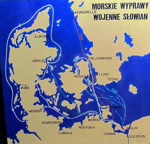
Map of Slavic Raids on Denmark Norway and Sweden
Interestingly, the motivations behind these Slavic incursions varied. While many were driven by the desire for plunder a...
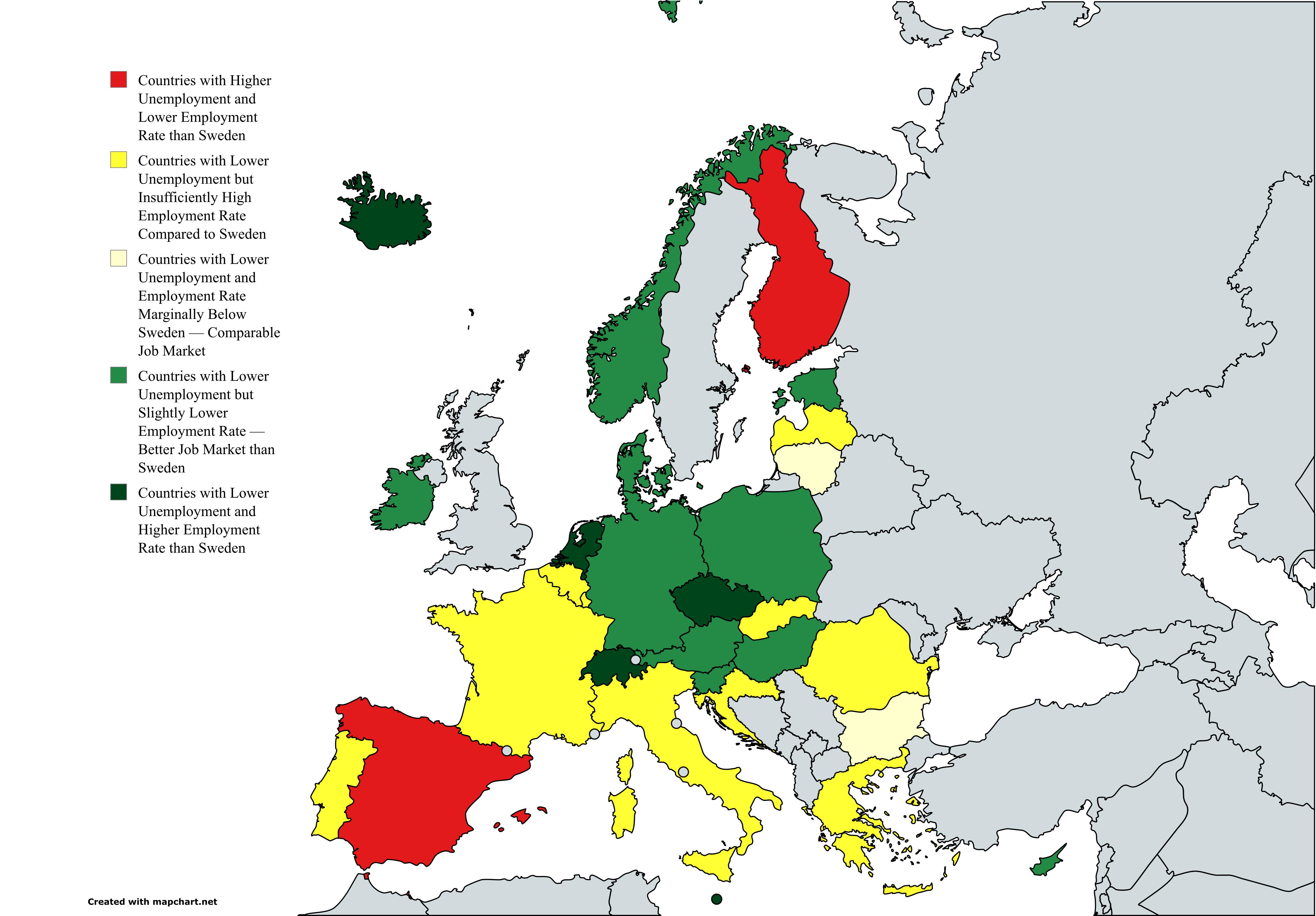
Employment and Unemployment Rates Map Relative to Sweden
This map provides a comprehensive visualization of employment and unemployment rates across various European countries, ...
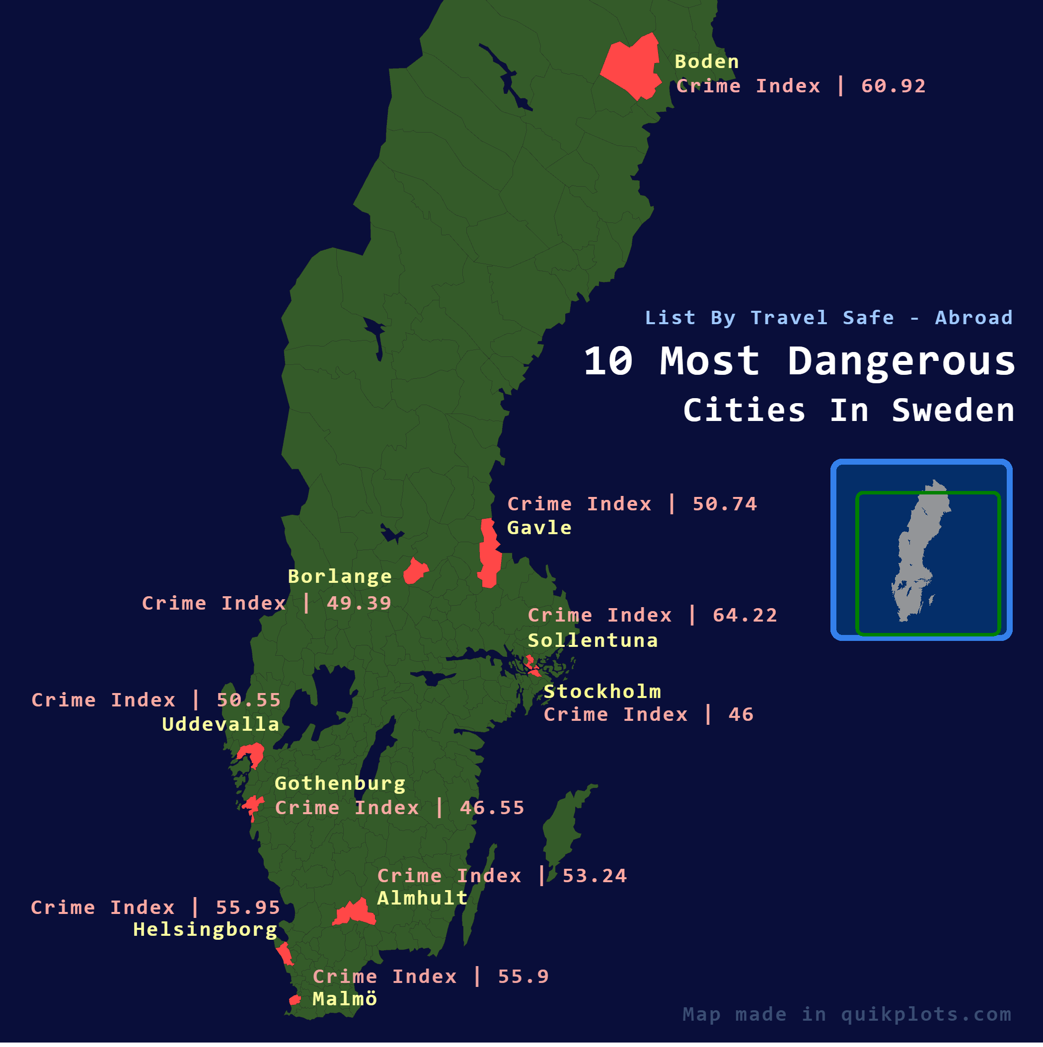
10 Most Dangerous Cities in Sweden Map
The map titled "10 Most Dangerous Cities in Sweden" provides a visual representation of urban safety across Sweden, high...