regional development Maps
12 geographic visualizations tagged with "regional development"
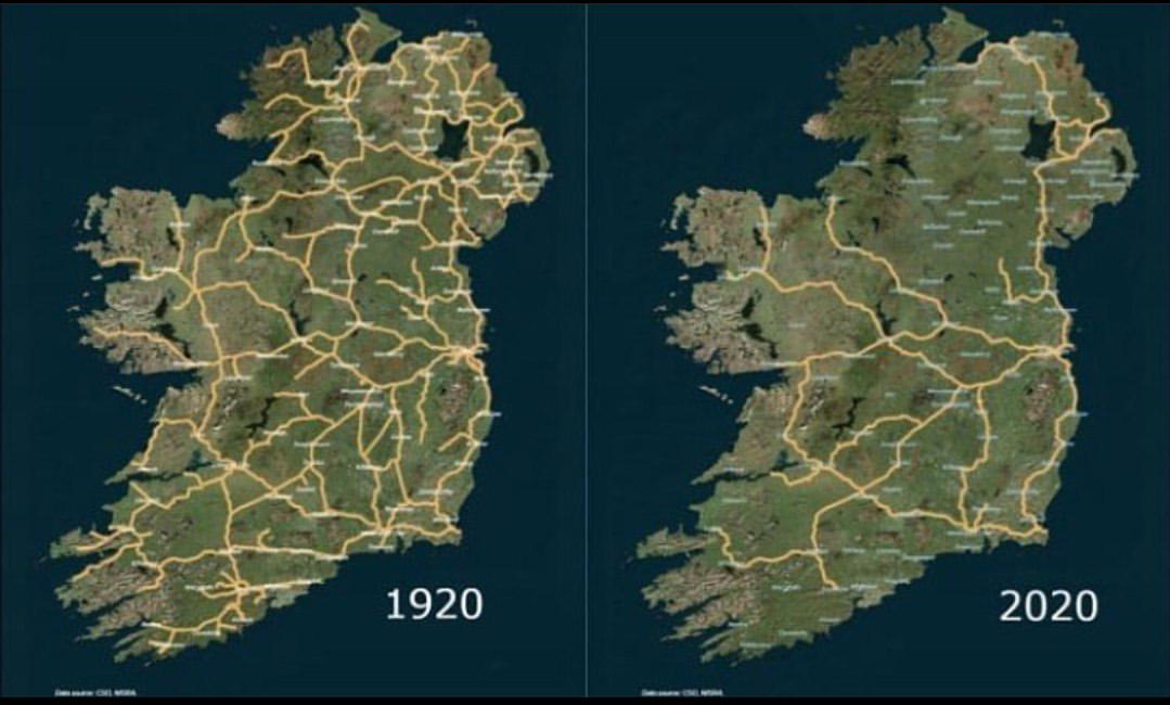
Irish Railway System Map 1920 to 2020
The map titled 'The Irish Railway System between 1920 and 2020' provides a comprehensive visualization of the railway in...
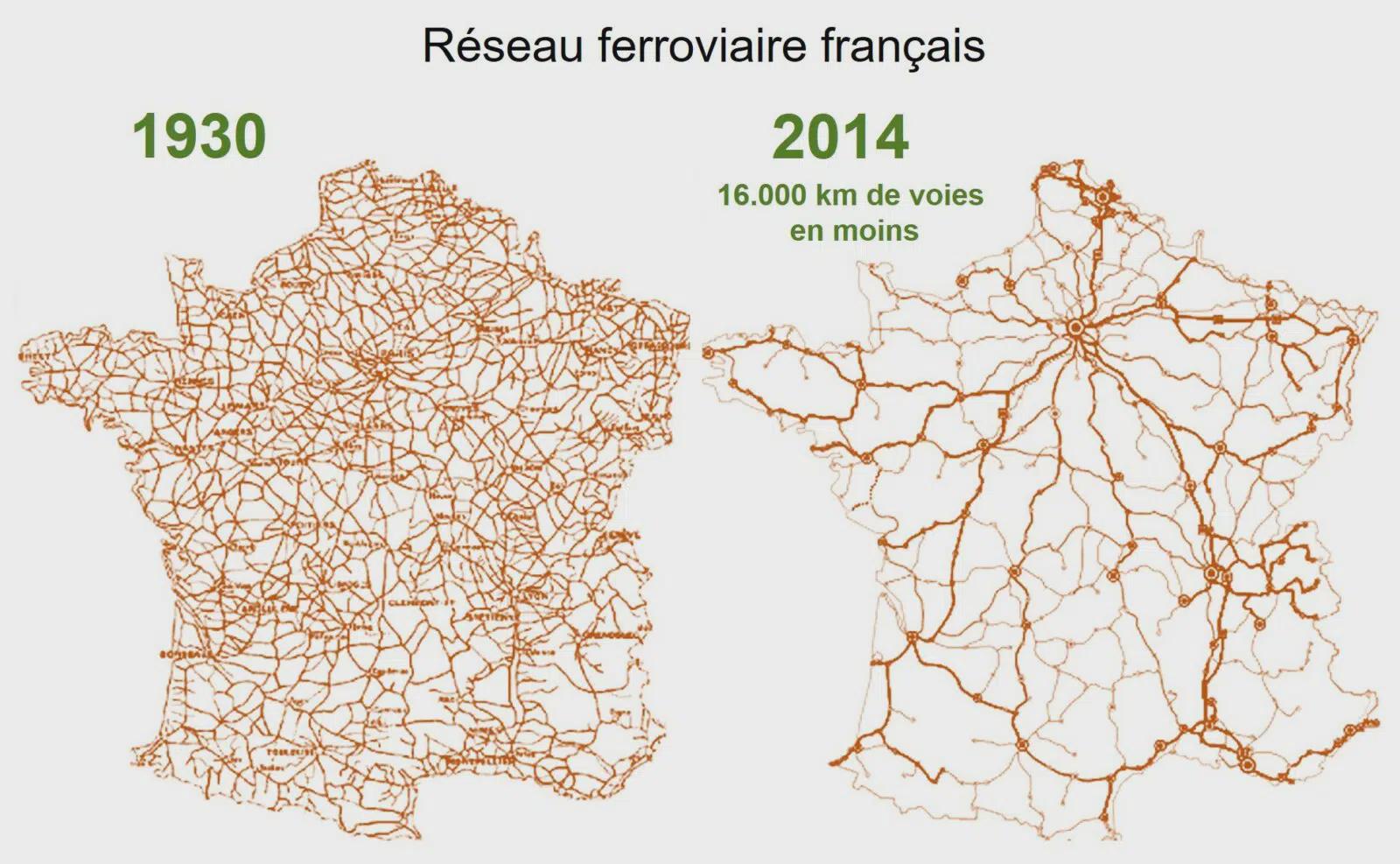
Map of the Declining French Railway Network
...
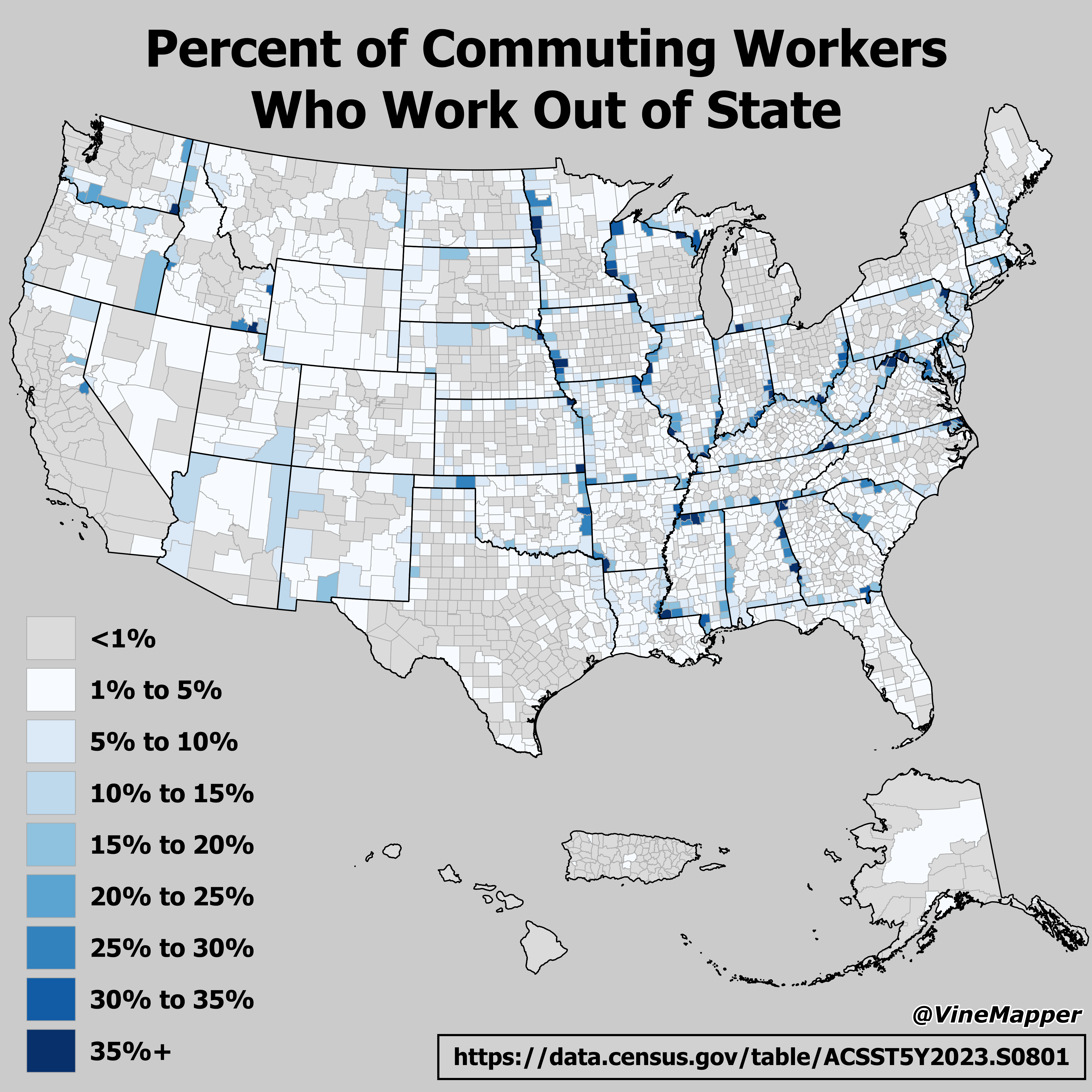
Map of Commuting Workers Who Work Out of State
The visualization titled "Percent of Commuting Workers Who Work Out of State" presents a detailed overview of the percen...
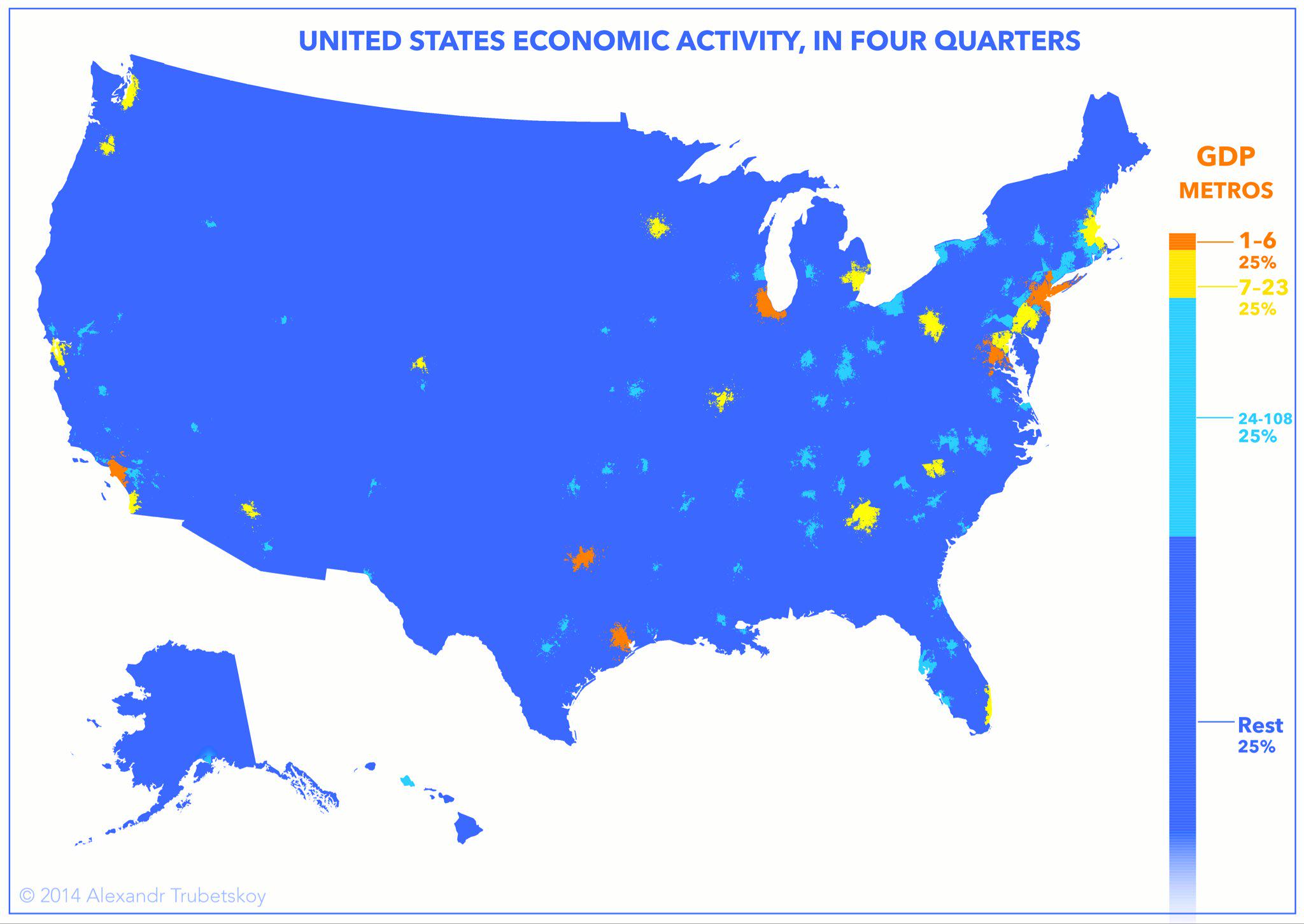
Economic Activity in Cities Map
The "Economies Live in Cities" map provides a visual representation of economic activity concentrated within urban areas...
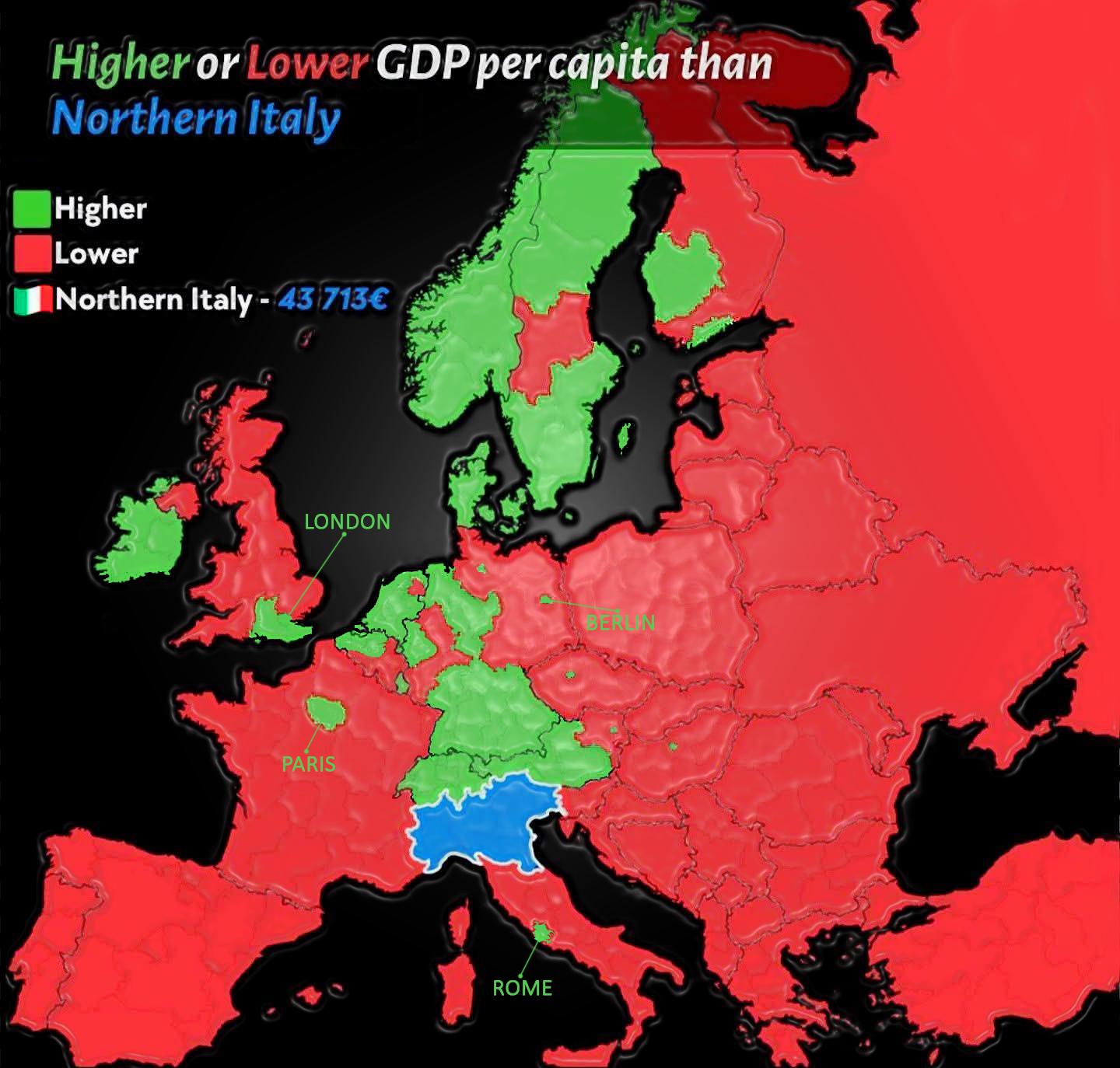
GDP Per Capita Map of Northern Italy vs Europe
The visualization titled "GDP Per Capita of Northern Italy vs GDP Per Capita of the rest of Europe" provides a compellin...
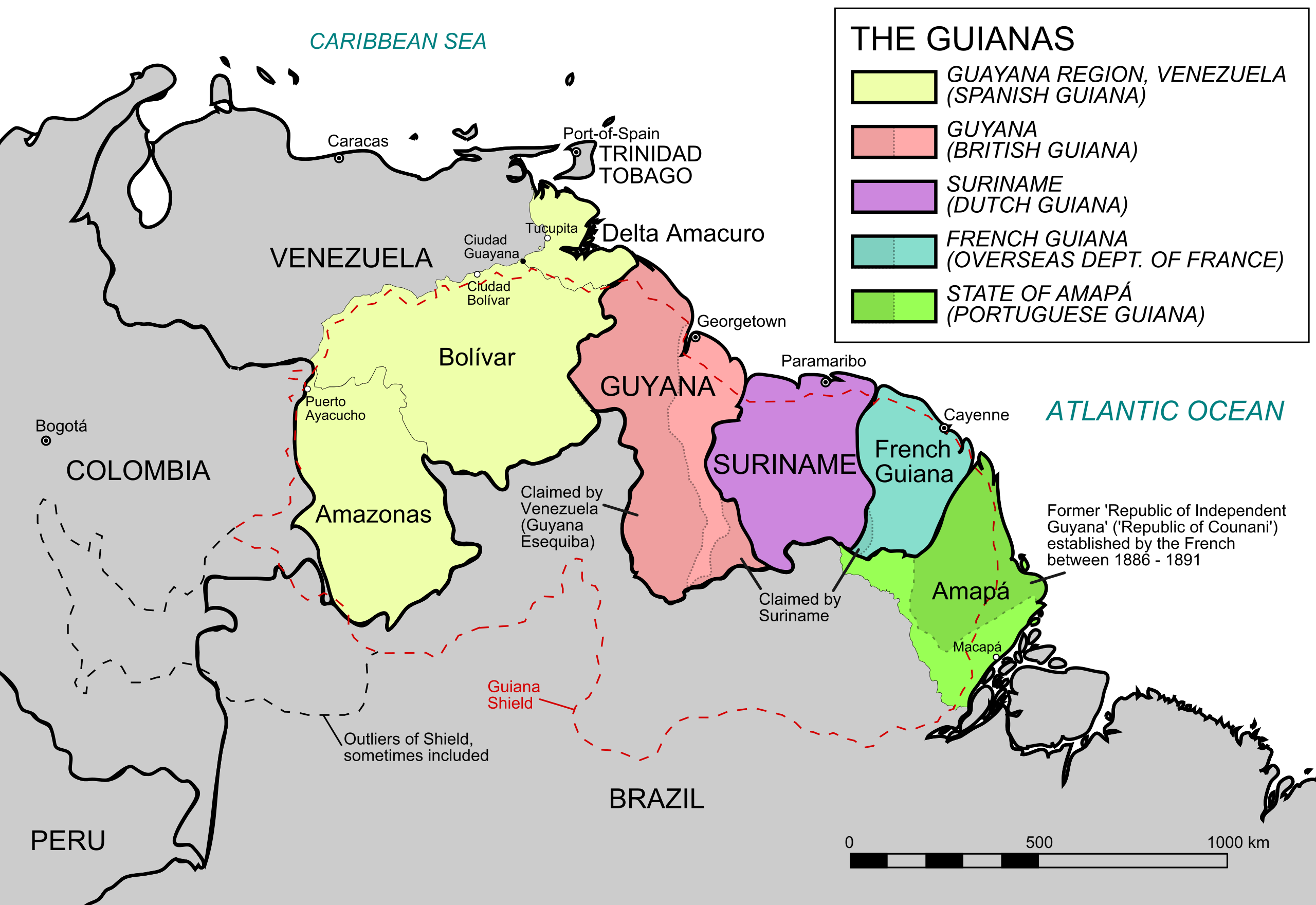
Geography Map of the Five Guianas
The map titled "The Five Guianas" highlights the unique geographical features and political borders of a region in north...
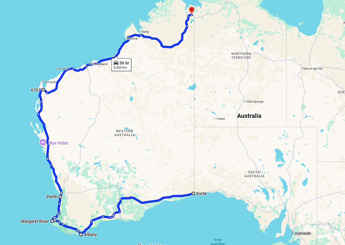
Longest One-Province Road Map
This map visualizes the longest one-province/state road in the world, stretching an impressive 5,363 kilometers and taki...
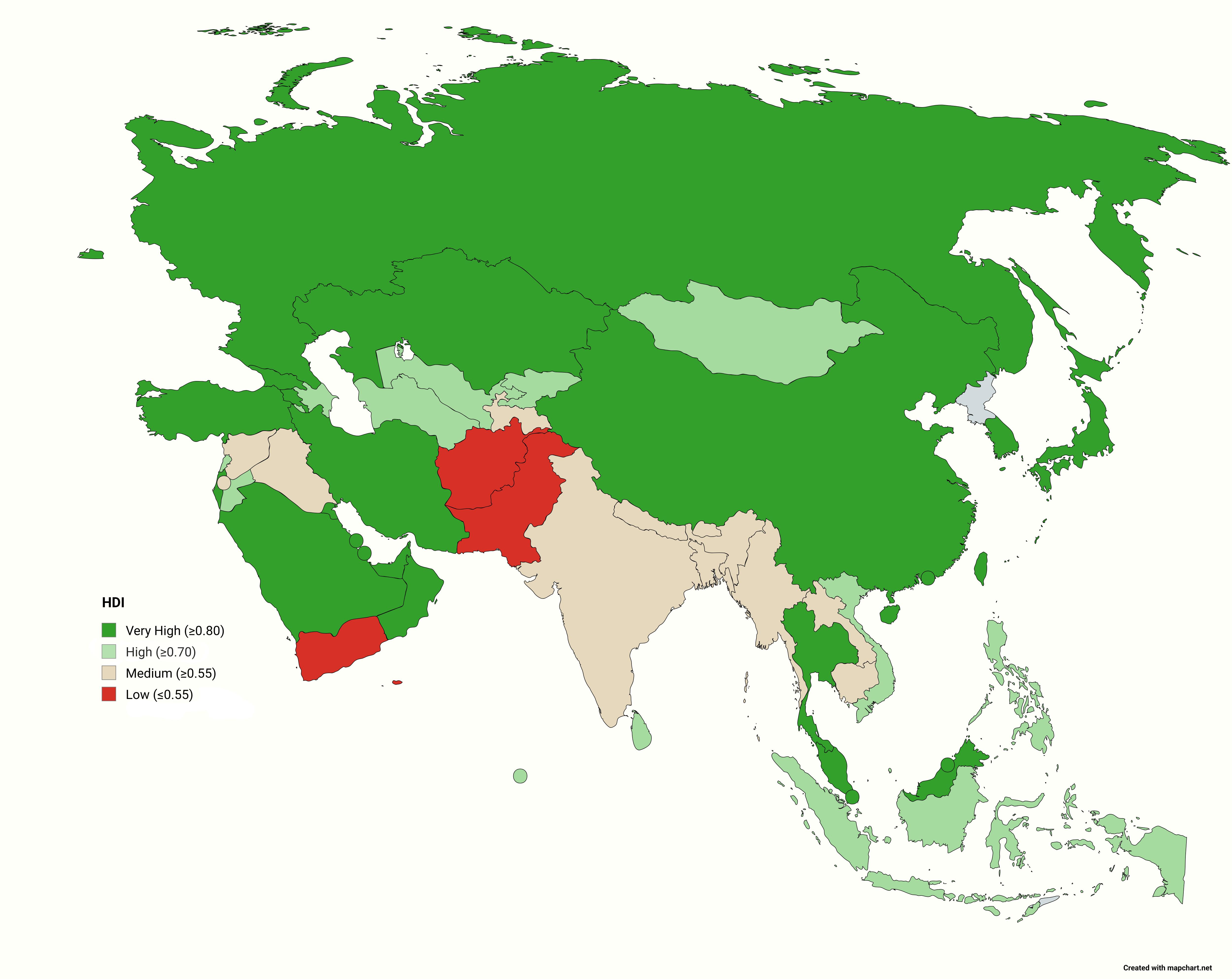
Asian Countries by HDI Class Map
Interestingly, the HDI is calculated using three essential dimensions: health (life expectancy at birth), education (mea...
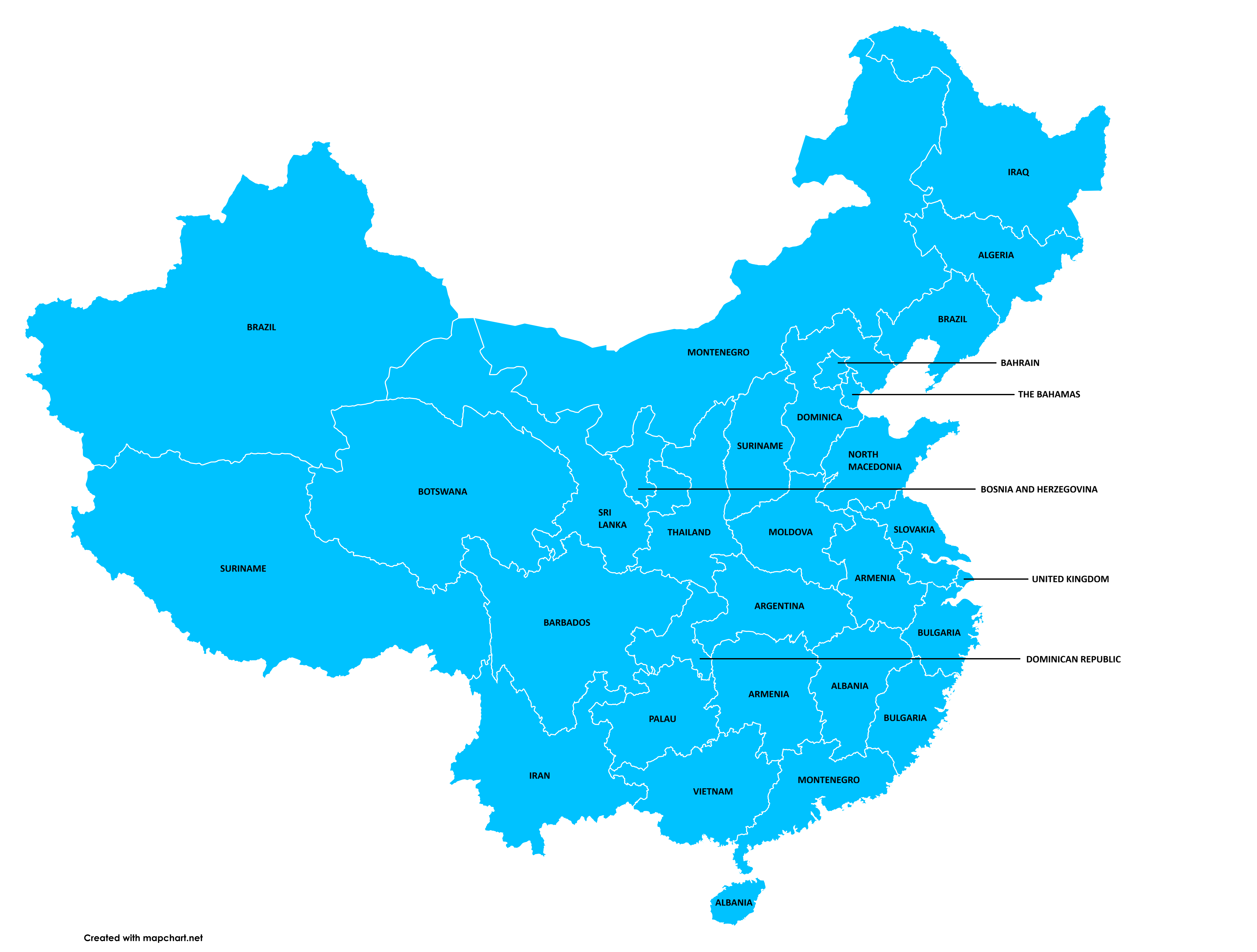
GDP Per Capita by Chinese Provinces Map
The visualization titled "Chinese Provinces Compared to Countries by GDP (PPP) Per Capita" provides a fascinating overvi...
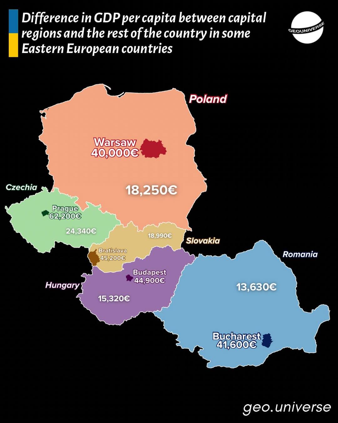
GDP Per Capita Gap Map in Eastern Europe
This map visually illustrates the disparities in GDP per capita between capital regions and the rest of their respective...
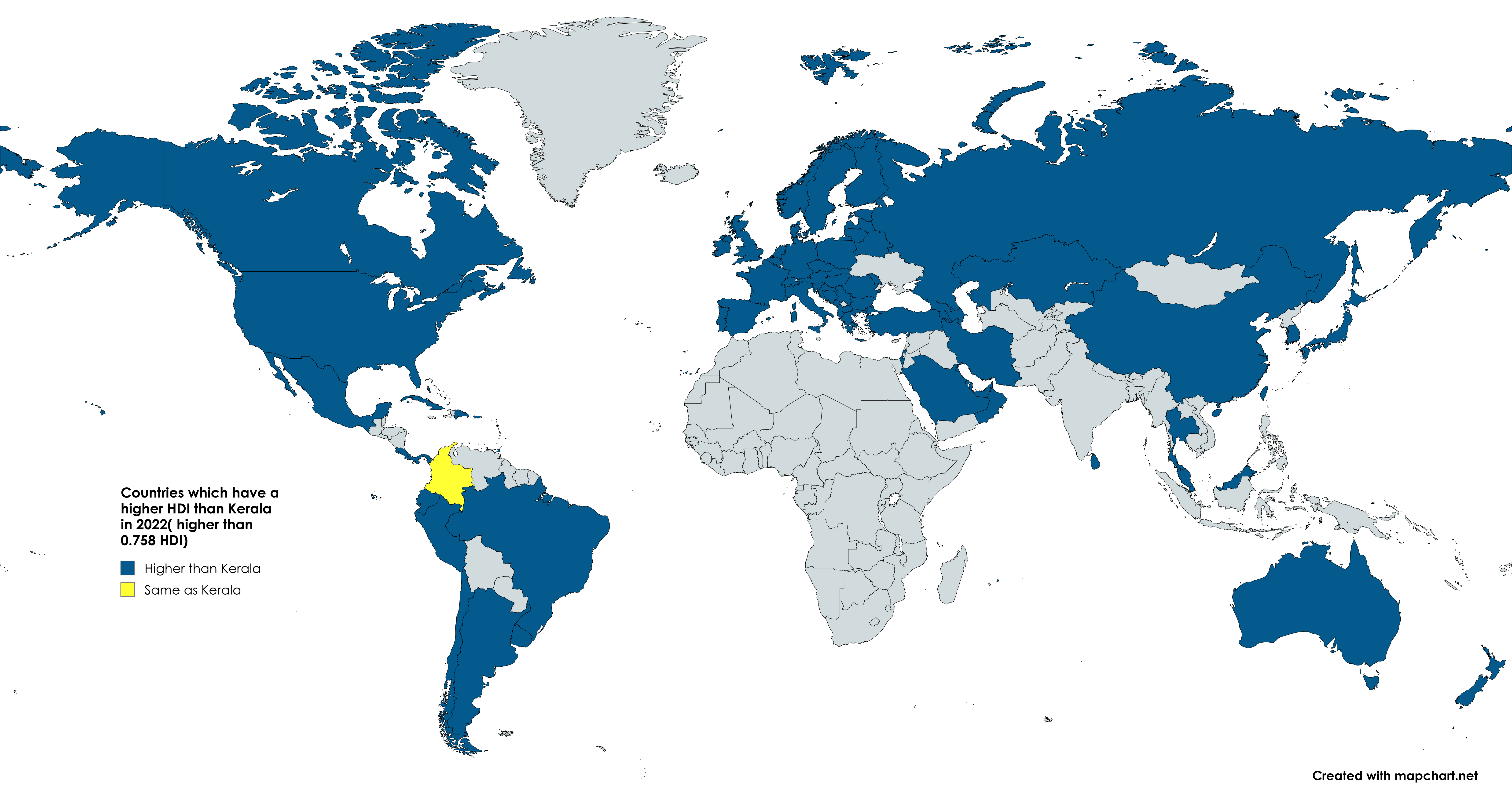
Kerala vs World HDI Map 2022
The map titled "Yesterday there was a post about Bihar. Now we will have the Indian state of Kerala vs the whole world" ...

GDP Per Capita by Italian Regions Map
Interestingly, regions like Lombardy, home to Milan, the financial capital of Italy, showcase a robust economy driven by...