prussia Maps
6 geographic visualizations tagged with "prussia"
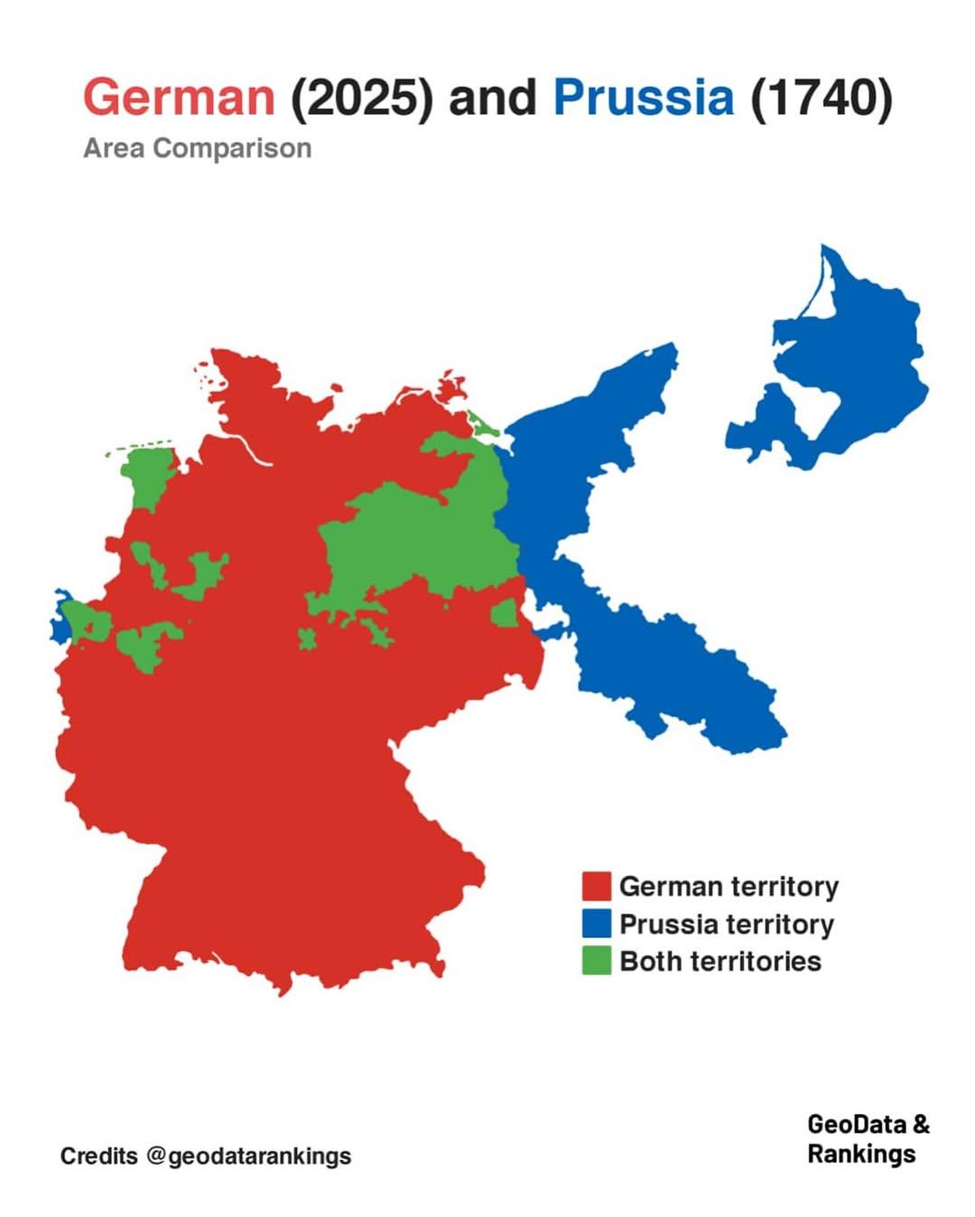
Germany and Prussia Area Comparison Map
The map titled "Germany in 2025 and Prussia in 1740 area comparison" visually represents the territorial extent of moder...
👁 260📅 8/8/2025
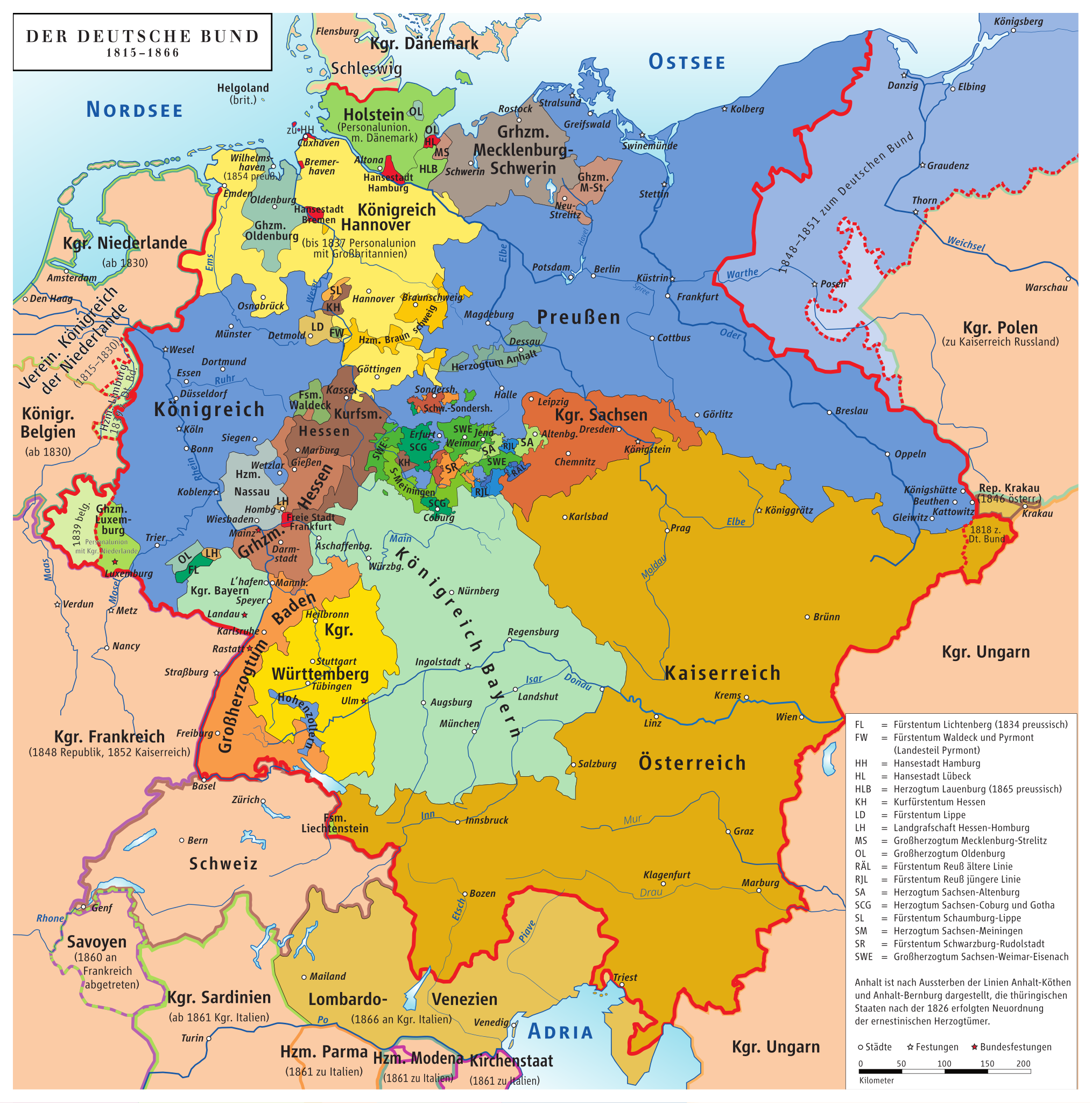
Map of Germany Before Unification (1815-1866)
This map titled "Germany Before Being Germany (1815-1866)" provides a detailed visualization of the political landscape ...
👁 48📅 9/24/2025
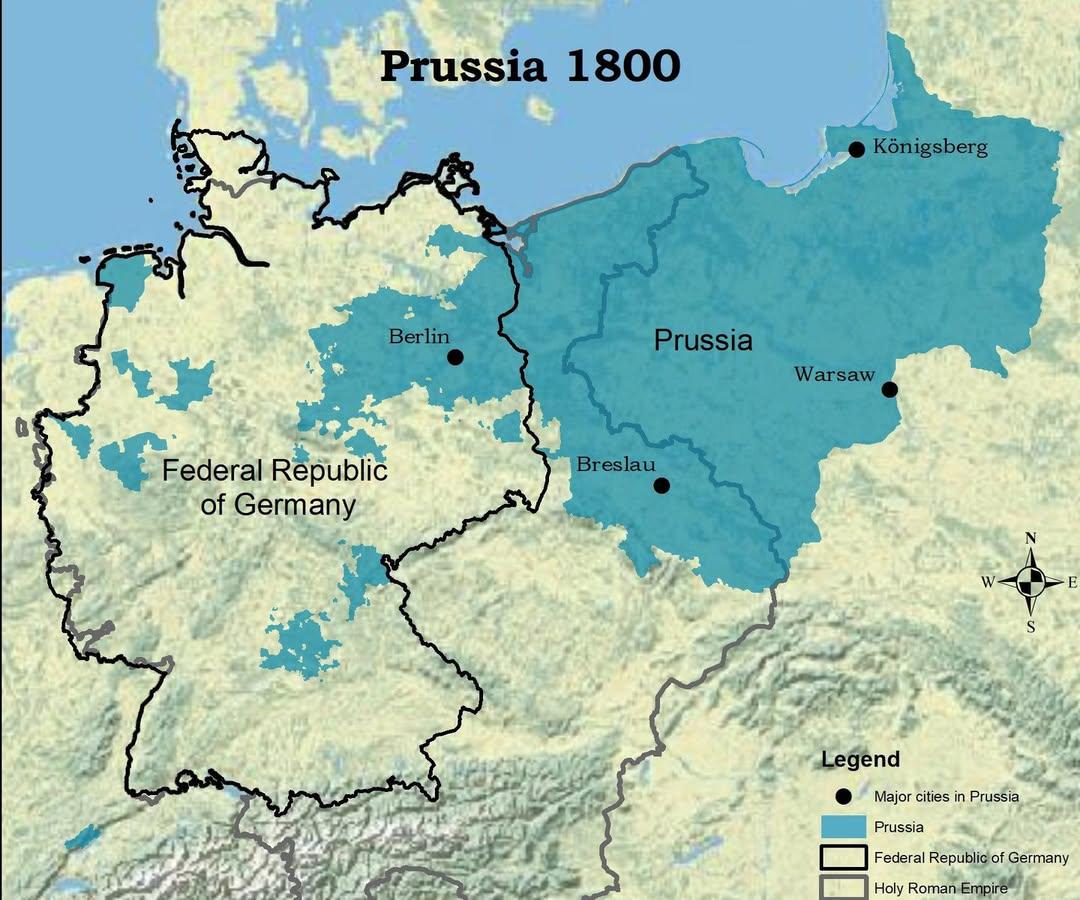
Map of Prussia in 1800 Compared to Modern Germany
The visualization titled "The Kingdom of Prussia in 1800 vs Modern Germany" presents a compelling juxtaposition of histo...
👁 40📅 9/25/2025
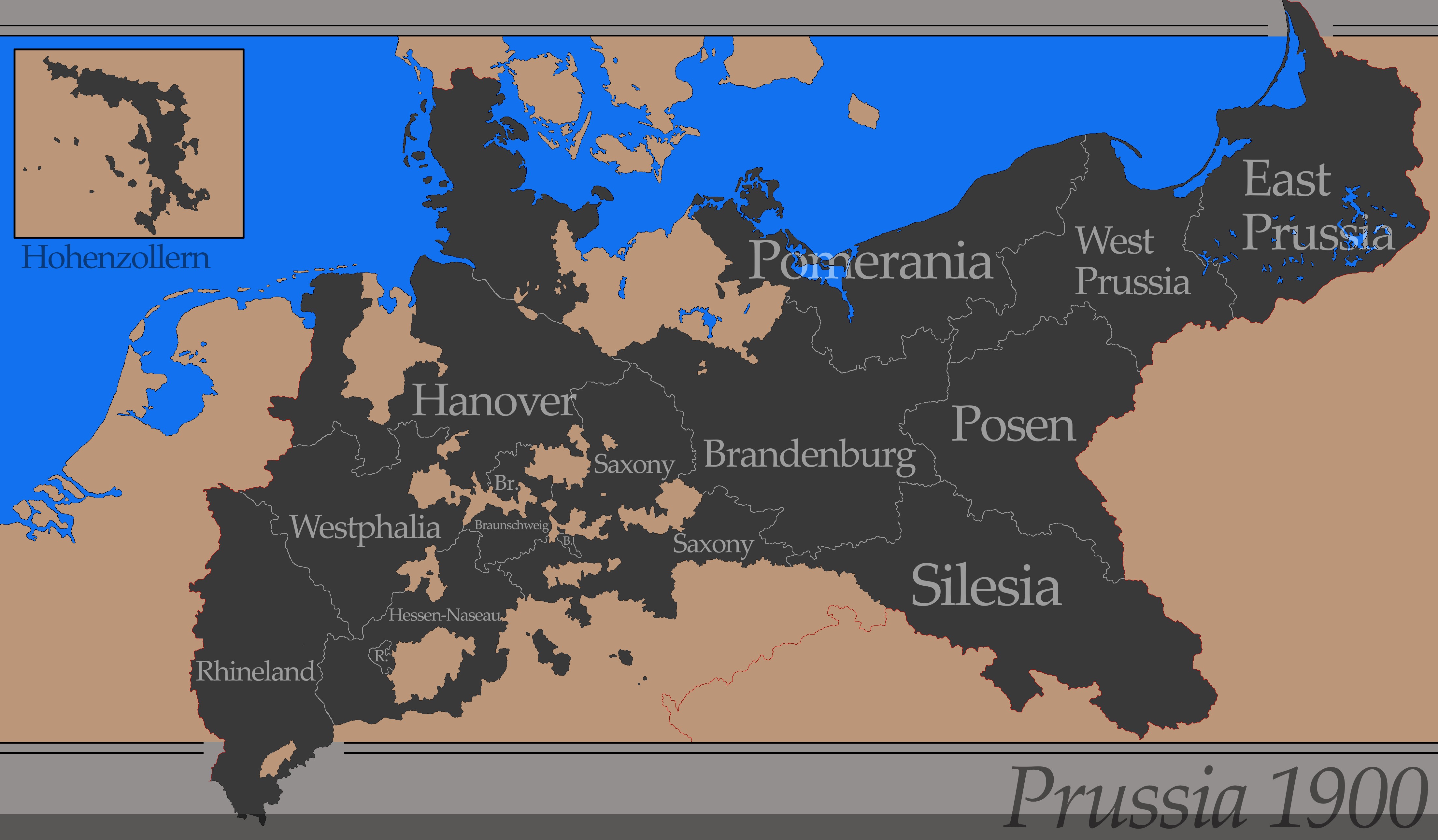
Political Map of Prussia in 1900
The "Simple Map of Prussia in 1900" visually represents the political boundaries and key geographical features of Prussi...
👁 112📅 8/6/2025
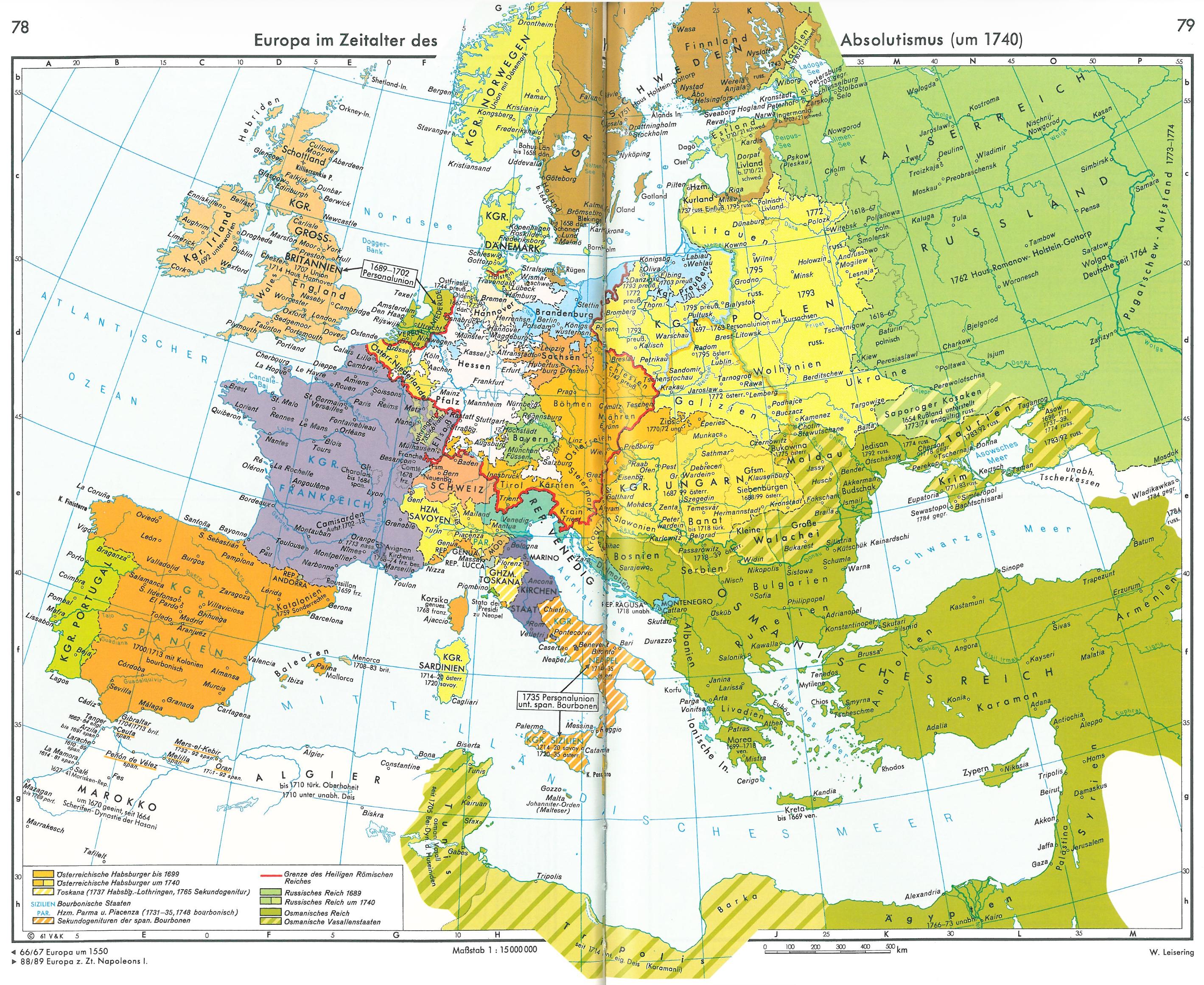
Europe in the Age of Absolutism Map
This visualization presents a detailed look at Europe as it existed in 1740, a pivotal period during the Age of Absoluti...
👁 14📅 10/5/2025
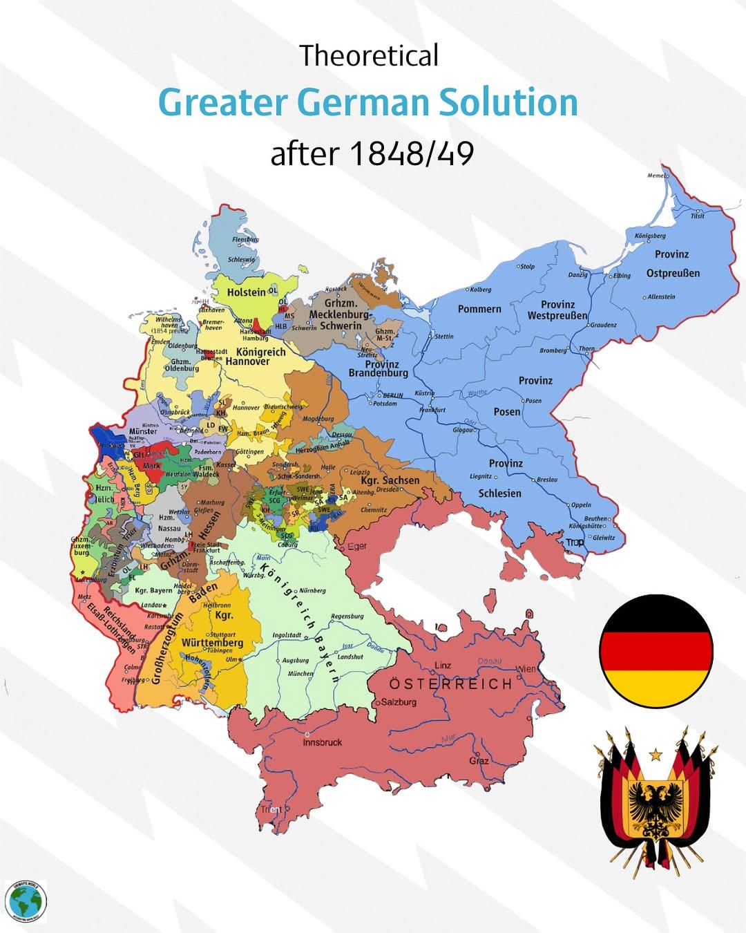
Greater German Solution Map 1848-1849
...
👁 108📅 8/23/2025