population statistics Maps
10 geographic visualizations tagged with "population statistics"
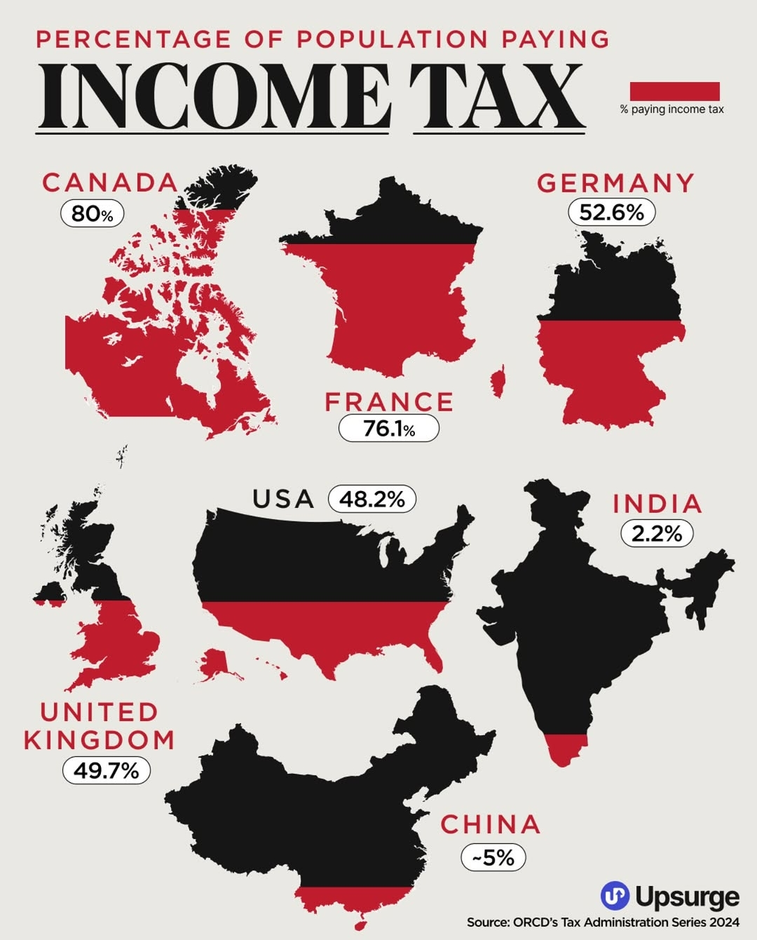
Income Tax Payment Percentage Map 2024
The "Percentage of Population Paying Income Tax Map 2024" offers a comprehensive overview of how many individuals in var...
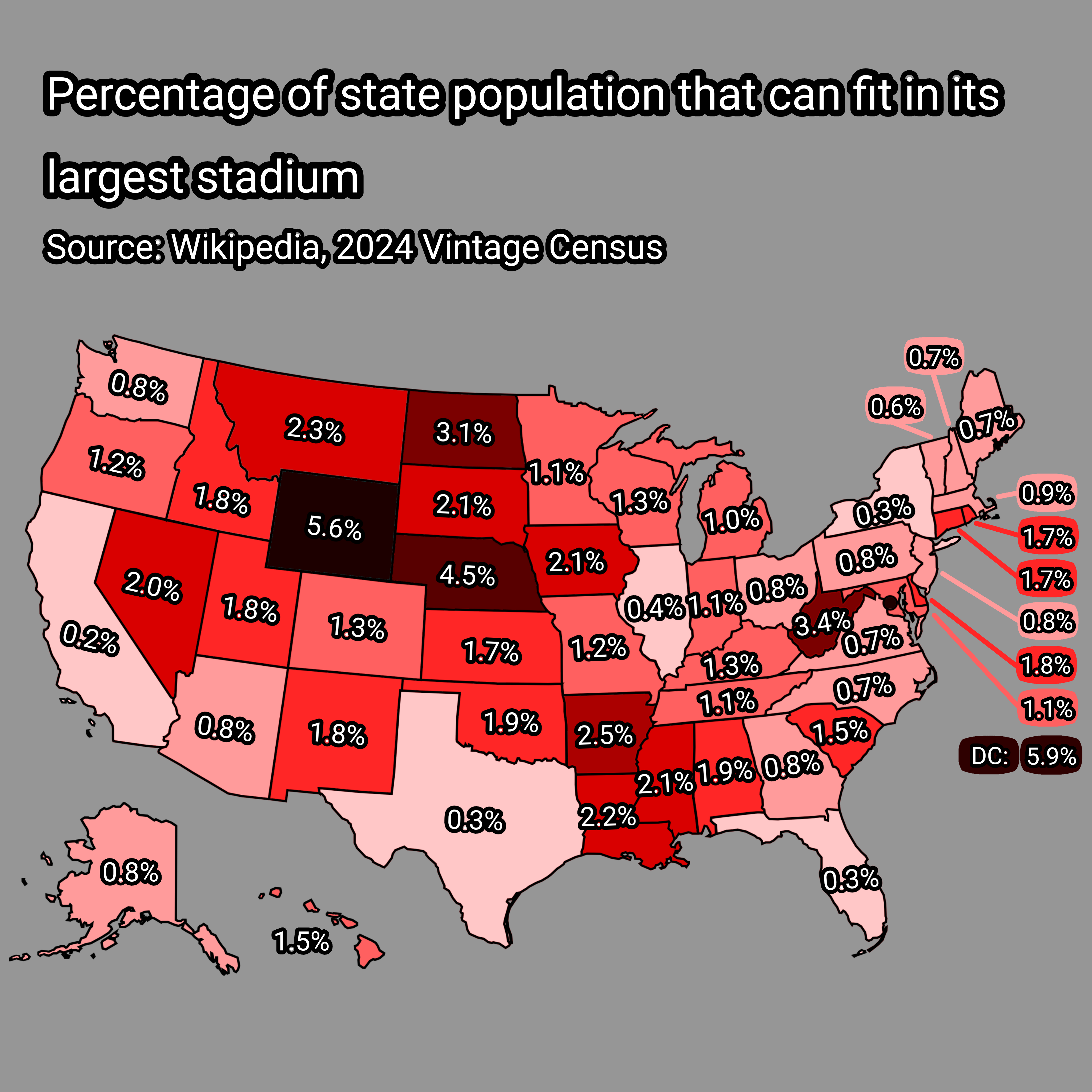
State Population vs. Largest Stadium Capacity Map
This visualization presents an intriguing perspective by illustrating the percentage of each state's population that cou...
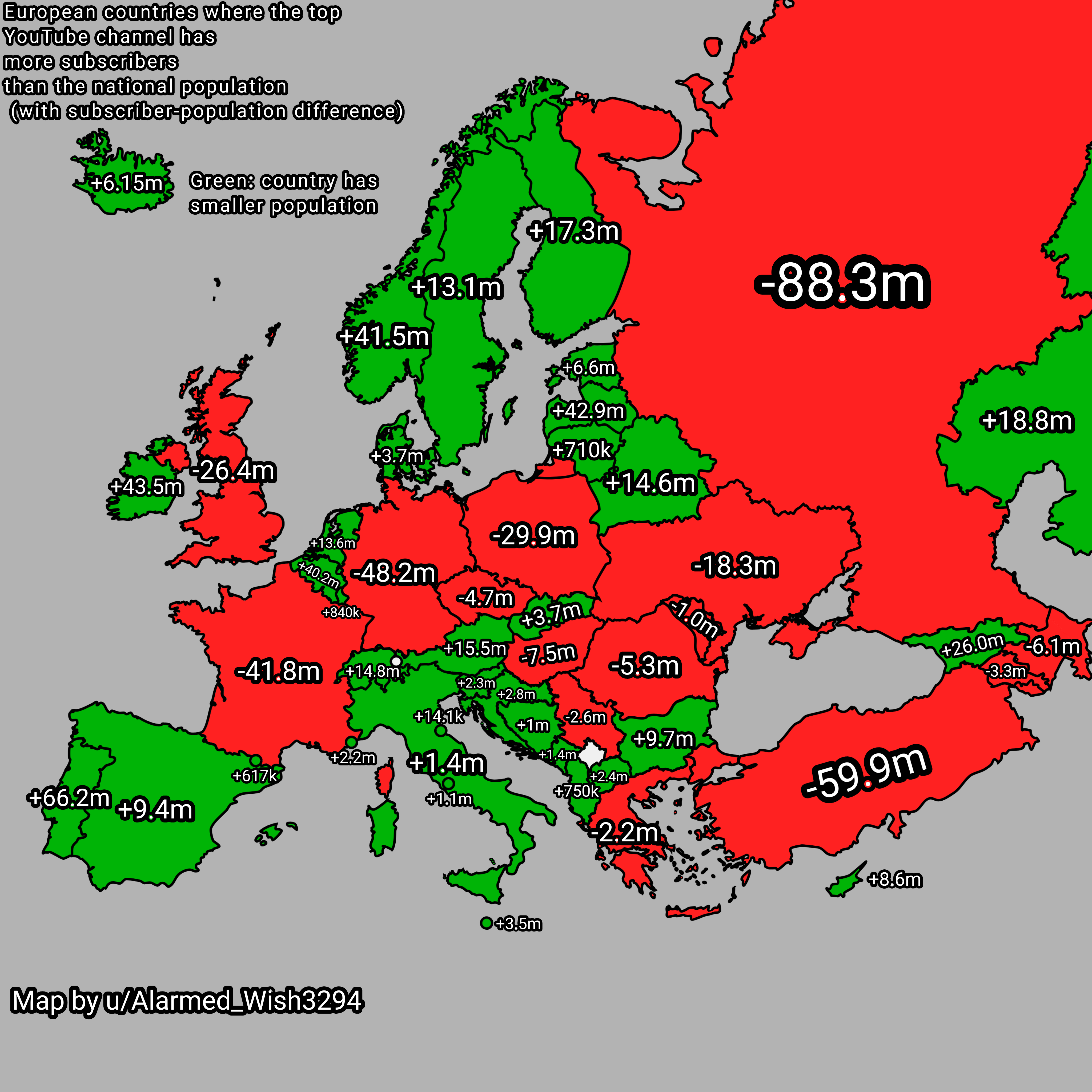
Map of YouTube Subscribers vs National Populations in Europe
This map highlights a striking phenomenon occurring in several European countries: the top YouTube channel in these nati...
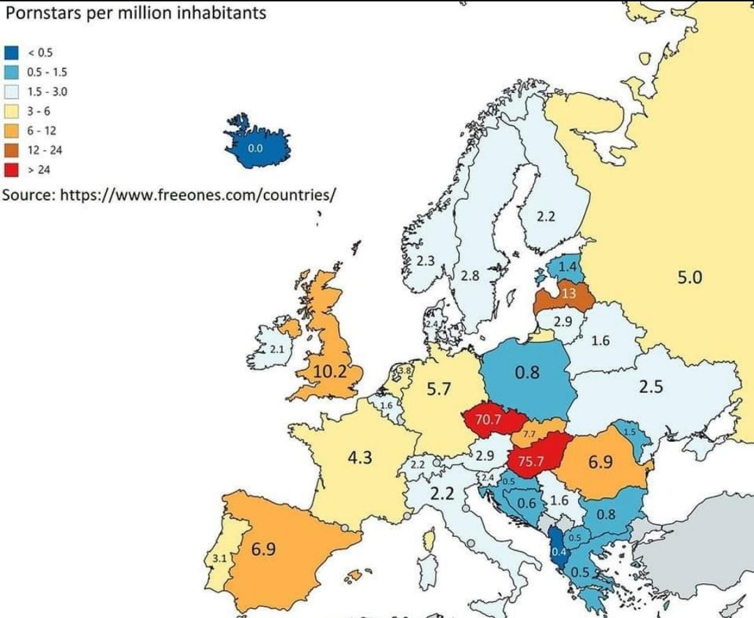
Pornstars per Million Inhabitants Map of Europe
The "Pornstars per Million Inhabitants Map of Europe" provides a revealing look at the adult film industry across variou...
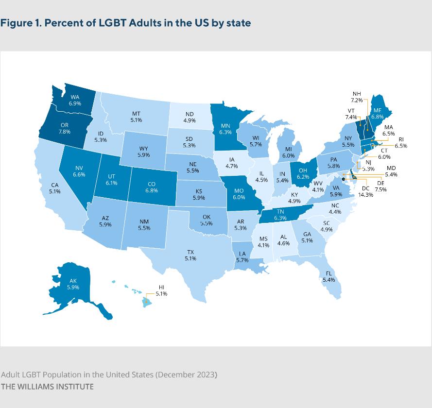
Estimated LGBT Population by U.S. State Map
The Estimated LGBT Population by U.S. State Map, developed by the Williams Institute, provides a visual representation o...
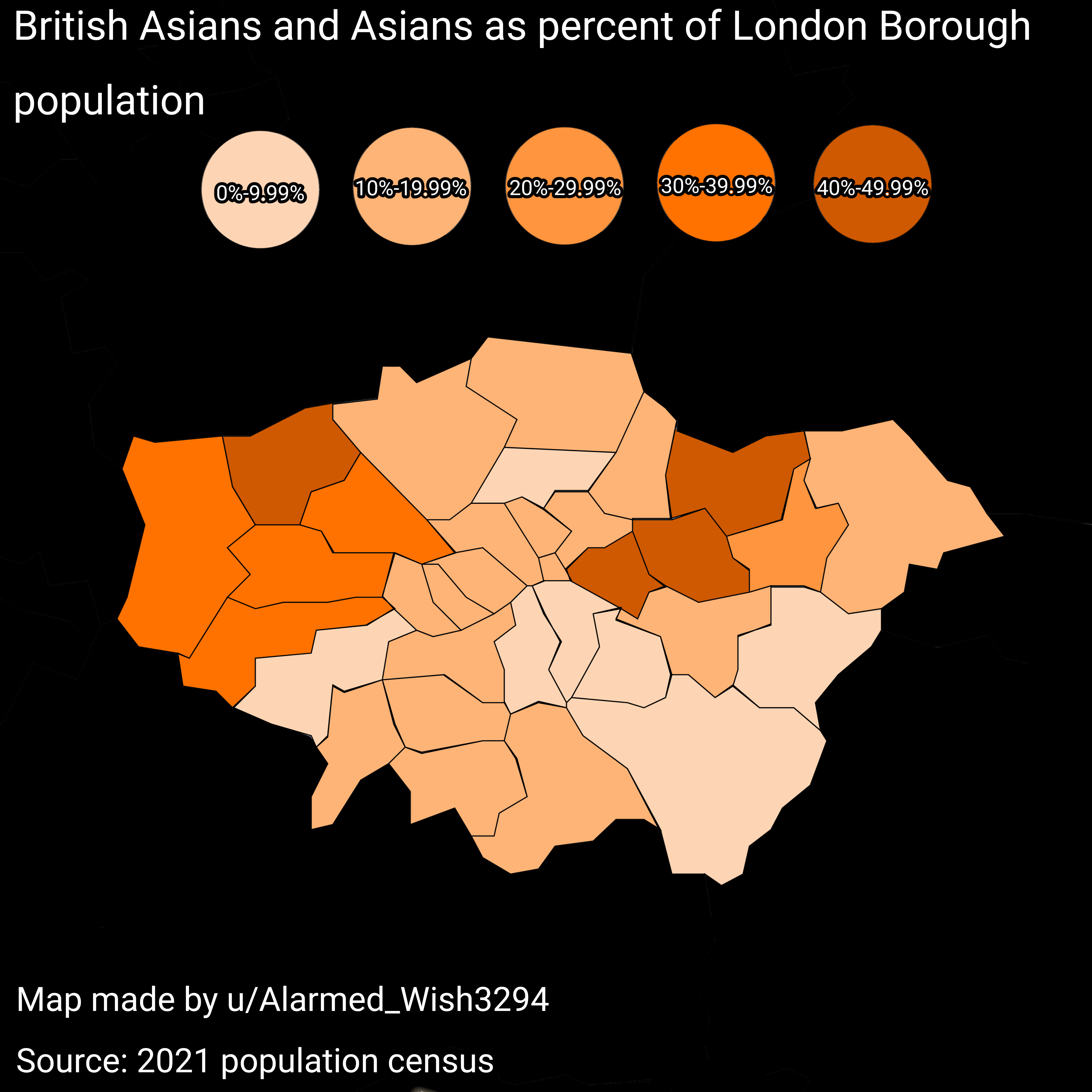
British Asian and Asian Population Percent Map
Interestingly, the concentration of British Asians is not uniform throughout London. Boroughs such as Tower Hamlets, New...
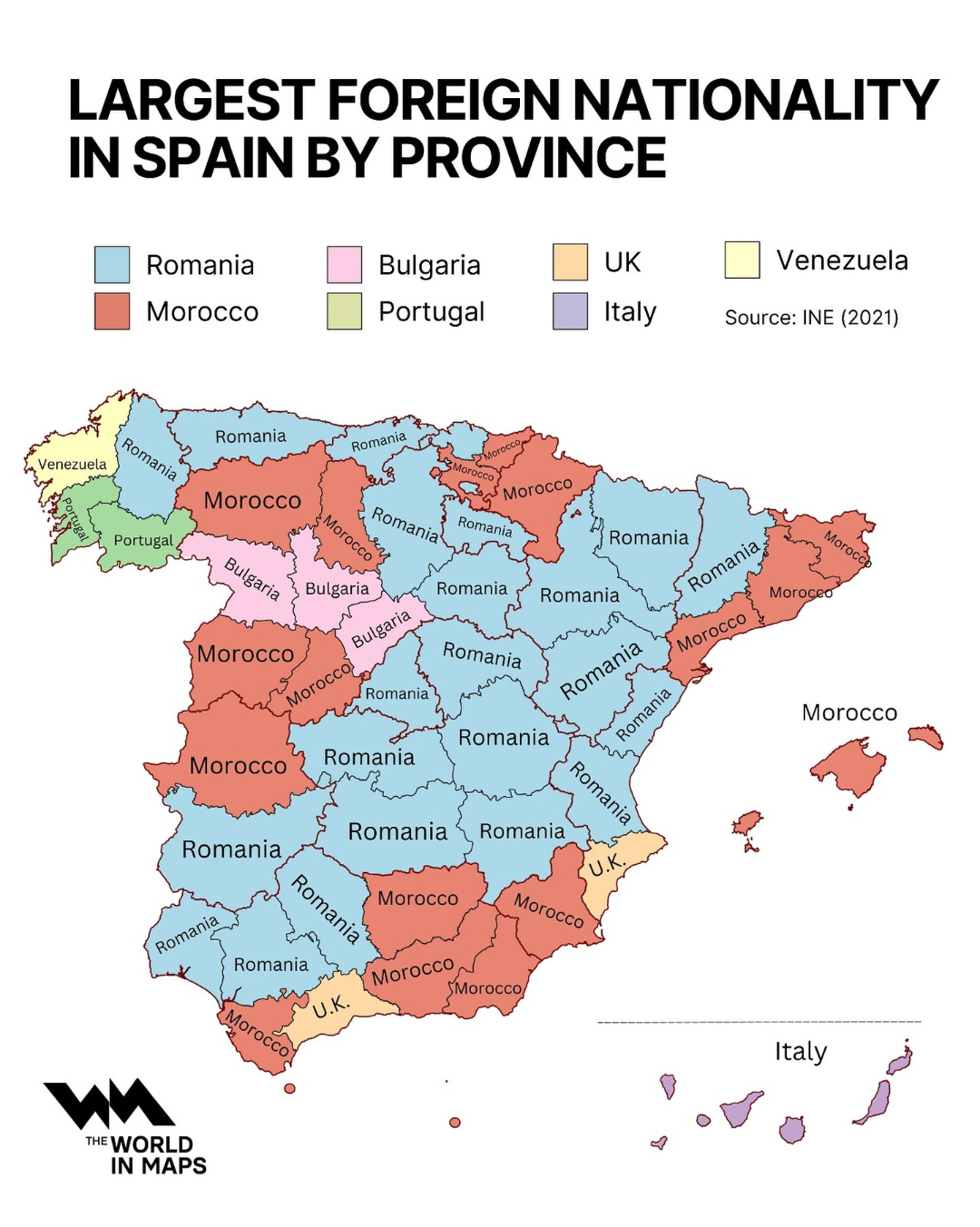
Largest Foreign Nationality in Spain by Province Map
The visualization titled "Largest Foreign Nationality in Spain by Province Map" offers a detailed look at the demographi...
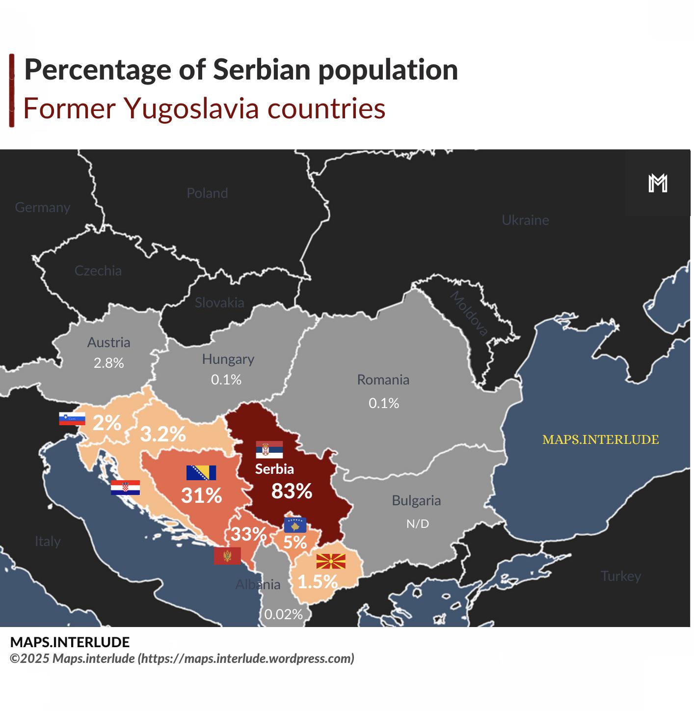
Percentage of Serbian Population Map
The "Percentage of Serbian Population Map" provides a visual representation of the demographic distribution of Serbians ...
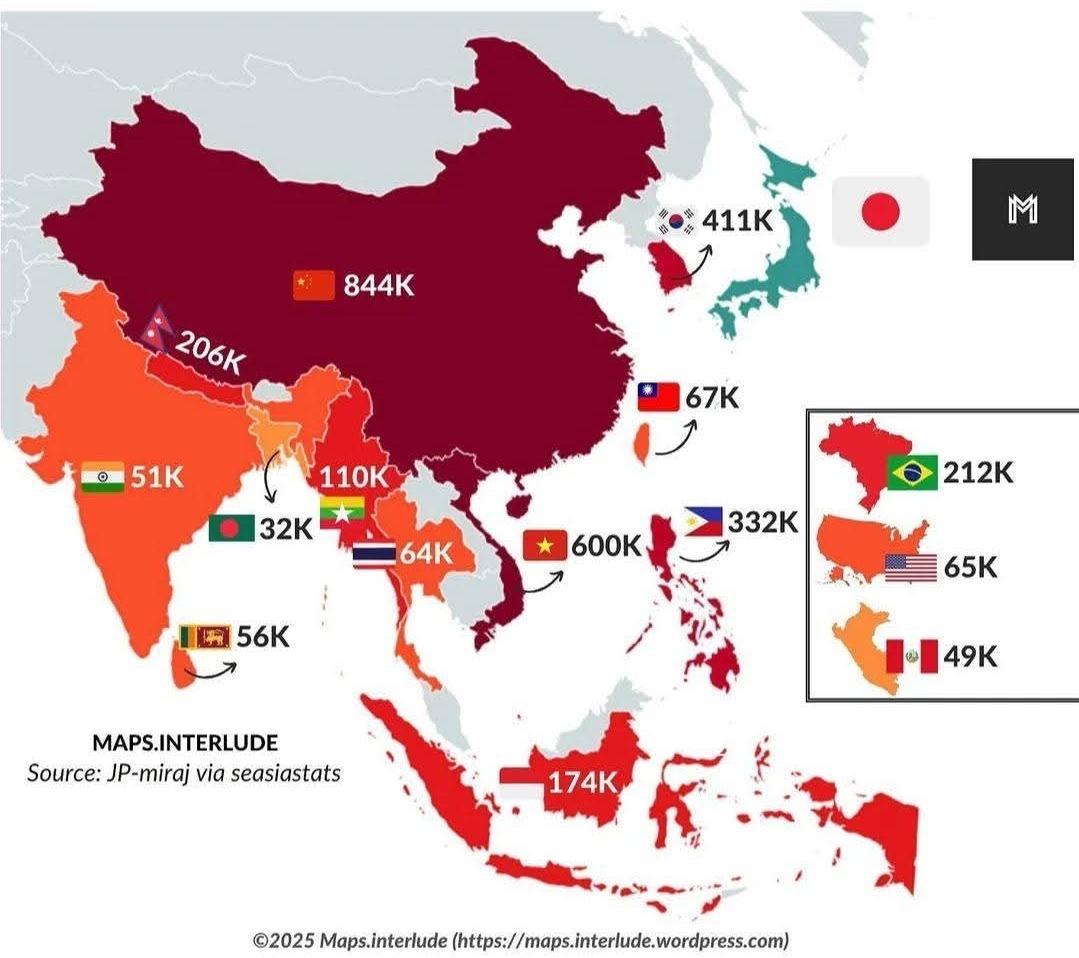
Top 15 Foreign Residents Nationalities in Japan Map
...
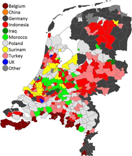
Most Common Foreign Country of Birth in the Netherlands Map
This map visualizes the most common foreign country of birth for residents in municipalities across the Netherlands. It ...