political landscape Maps
3 geographic visualizations tagged with "political landscape"

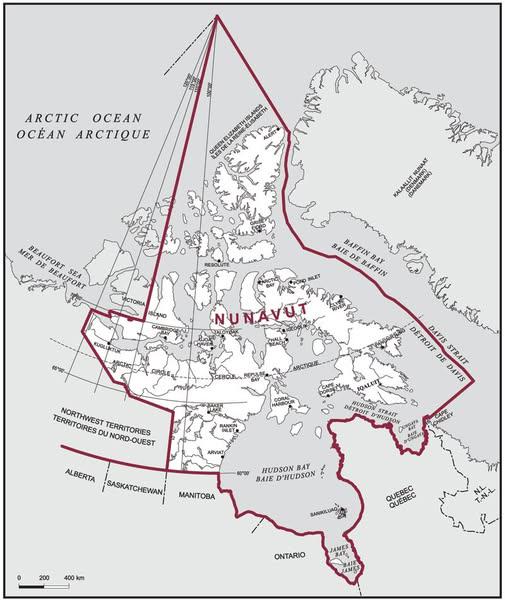
Nunavut Electoral District Size Map
The visualization titled "Nunavut is the Largest Electoral District On Earth (8 Times Larger Than The UK)" highlights th...
👁 74📅 9/6/2025

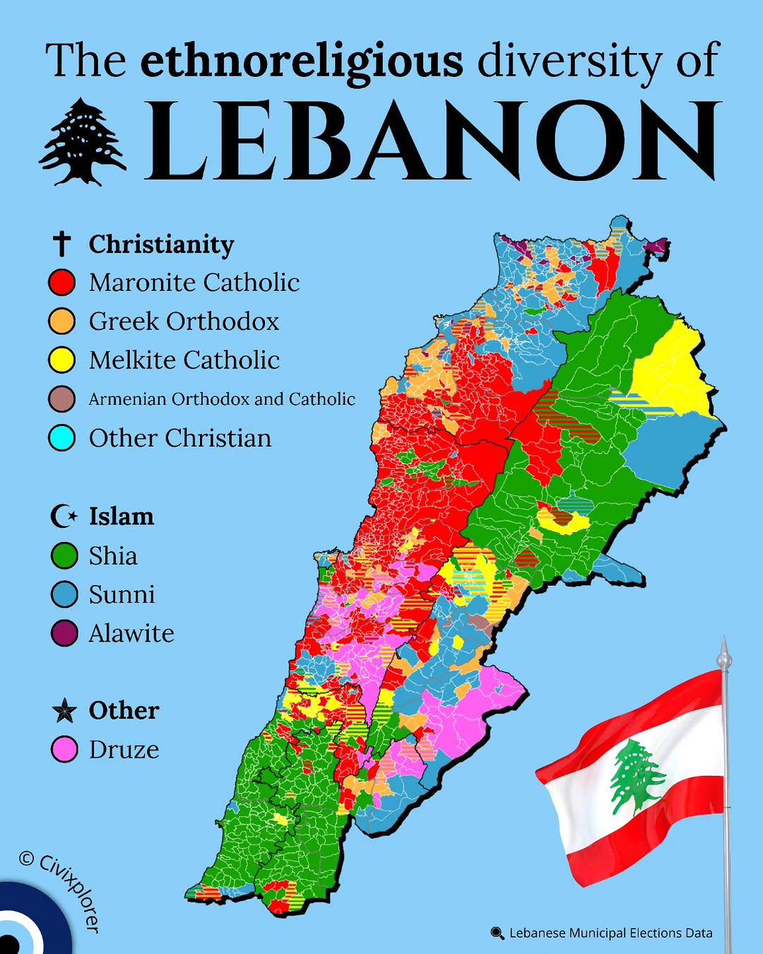
Ethnoreligious Diversity Map of Lebanon
This map illustrates the ethnoreligious diversity of Lebanon, highlighting the various religious sects and ethnic groups...
👁 78📅 9/16/2025

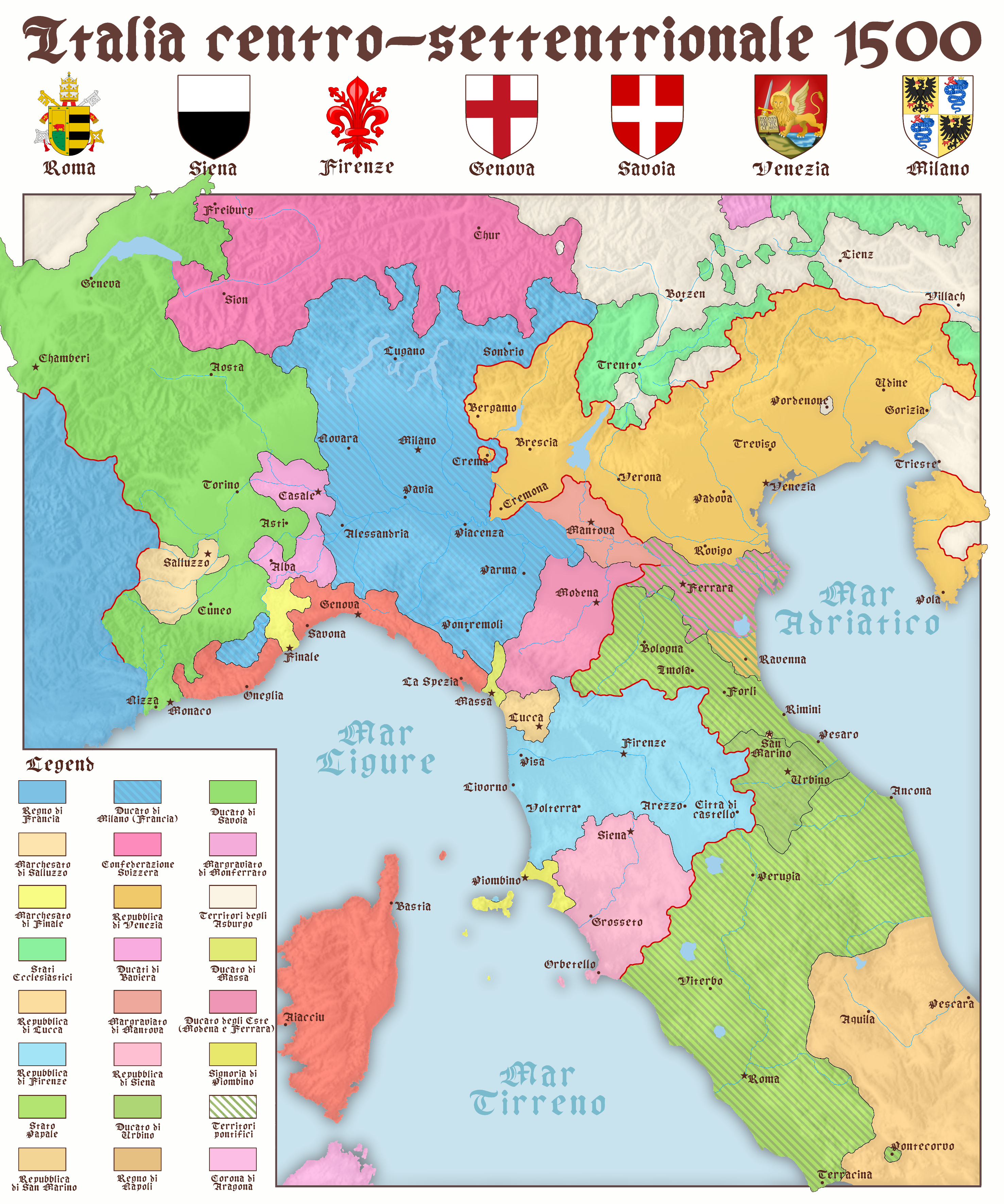
Map of North and Central Italy in 1500
The map titled "North and Center Italy in 1500" provides a detailed snapshot of the geographical and political landscape...
👁 84📅 8/30/2025