philippines Maps
7 geographic visualizations tagged with "philippines"
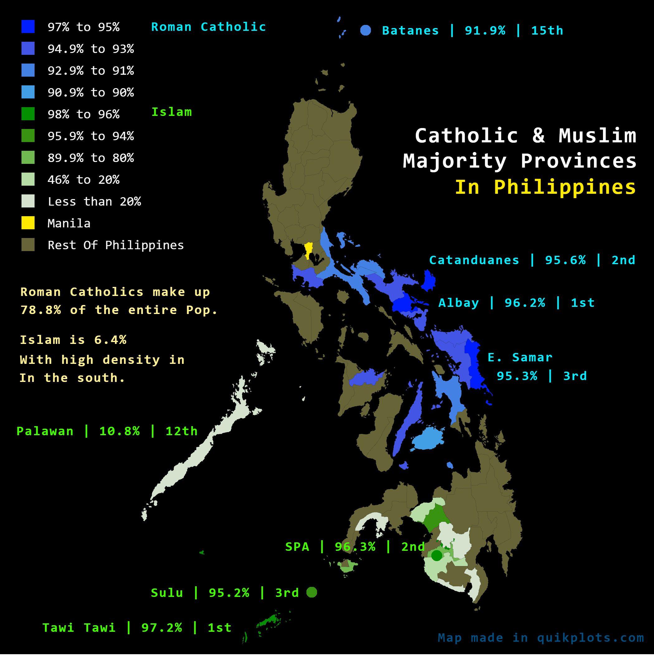
Catholic and Muslim Majority Provinces Map in the Philippines
The "Catholic & Muslim Majority Provinces In The Philippines" map visually delineates the religious demographics of the ...
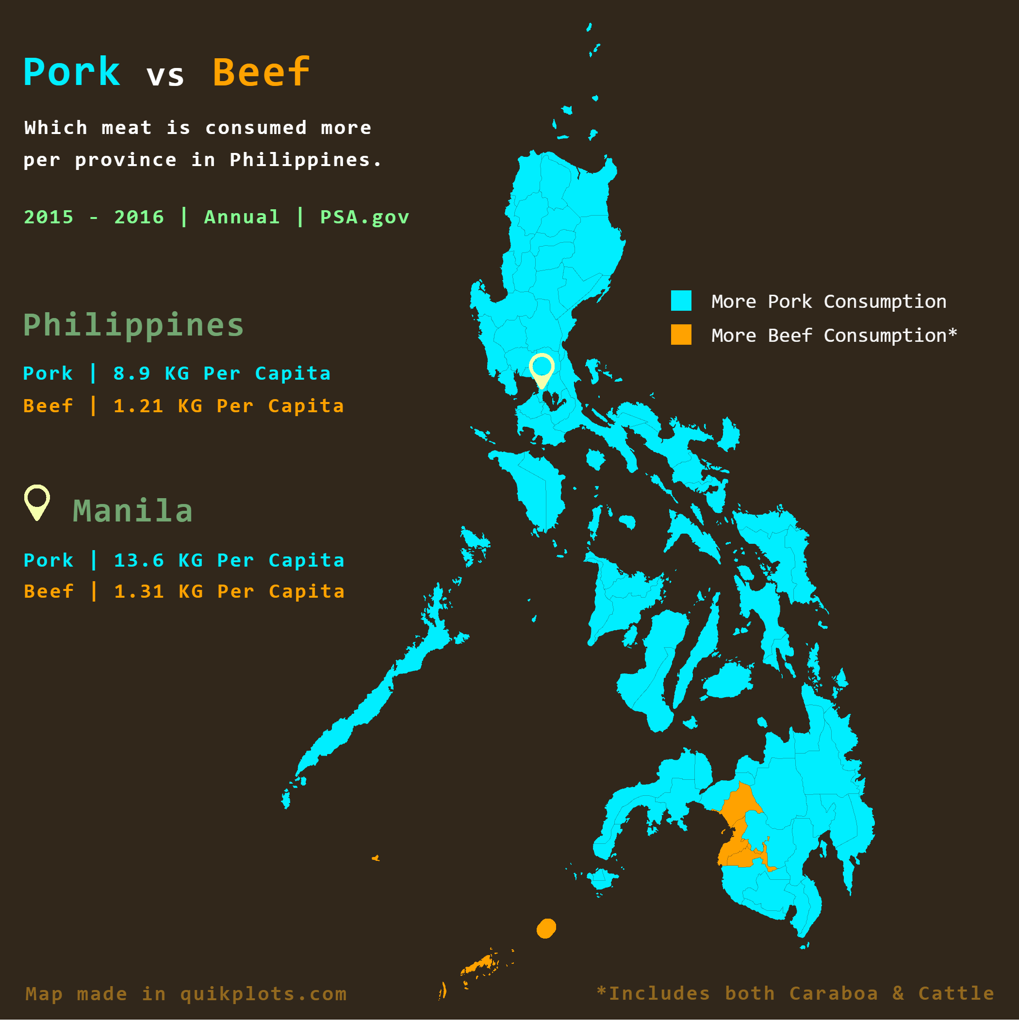
Pork Vs Beef Consumption in the Philippines Map
On the other hand, beef consumption is more prevalent in certain regions, particularly in the Bangsamoro Autonomous Regi...
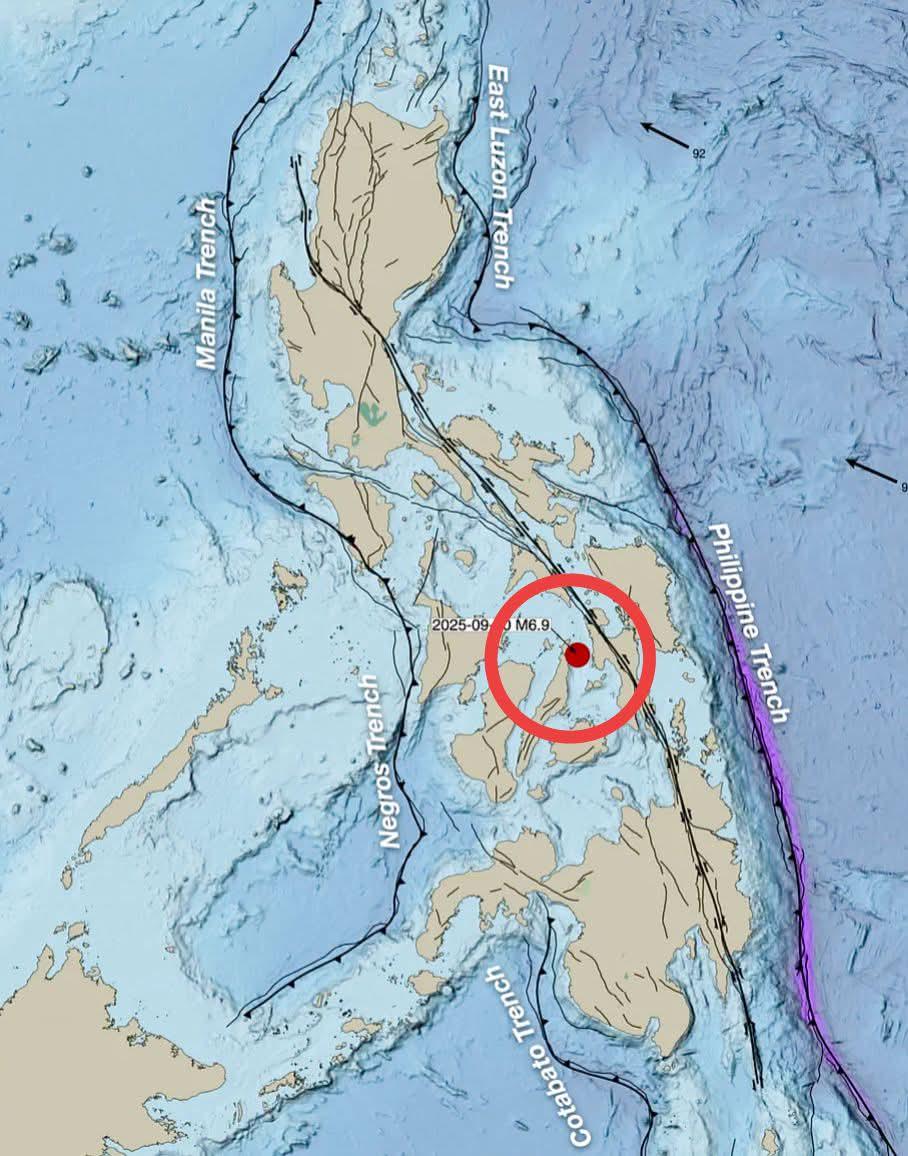
Major Fault Lines and Trenches Map of the Philippines
This map illustrates the major and active fault lines and trenches throughout the Philippines, along with the epicenter ...
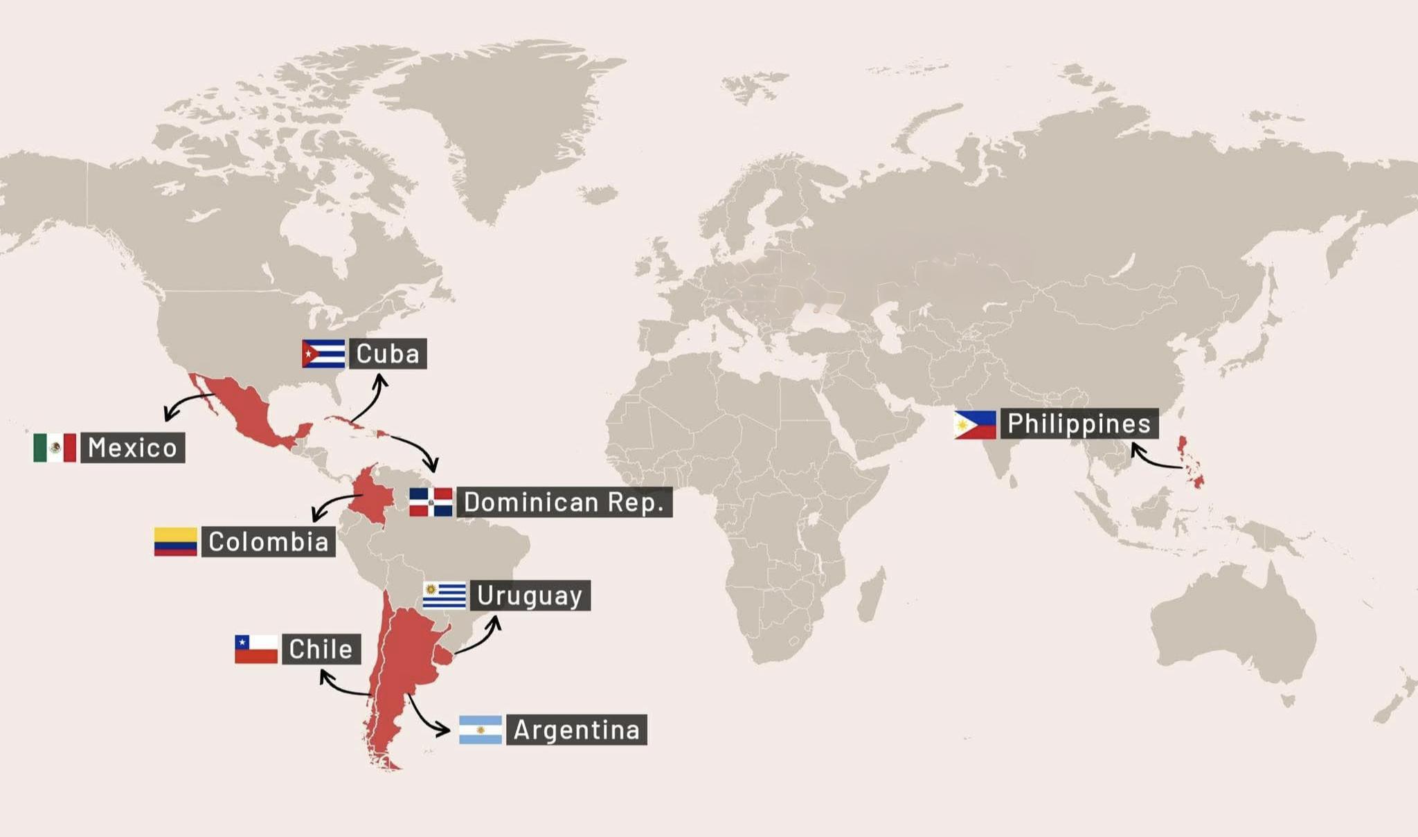
Countries Using Peso as Currency Map
This map displays the countries that utilize or refer to their currency as "Peso." The Peso has a rich history and is cu...
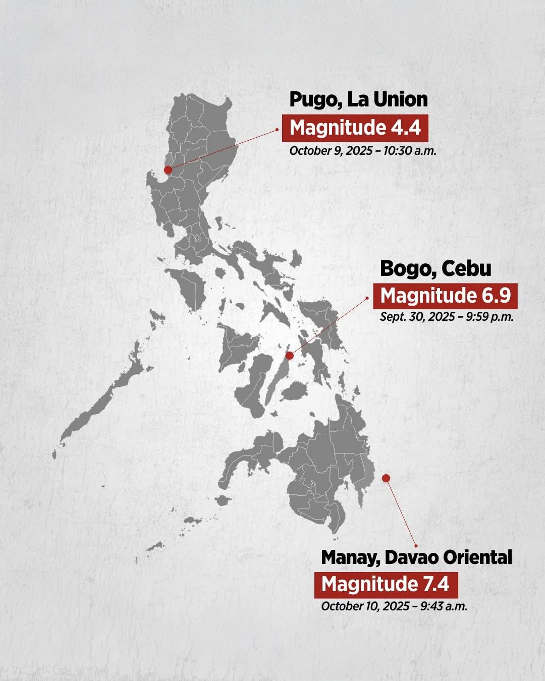
Recent Earthquake in the Philippines Map
The "Recent Earthquake in the Philippines Map" provides a detailed representation of seismic activity within the archipe...
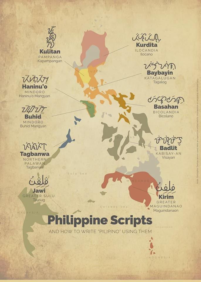
Indigenous Filipino Scripts Map
The "Indigenous Filipino Scripts Map" provides a visual representation of the various writing systems used by indigenous...
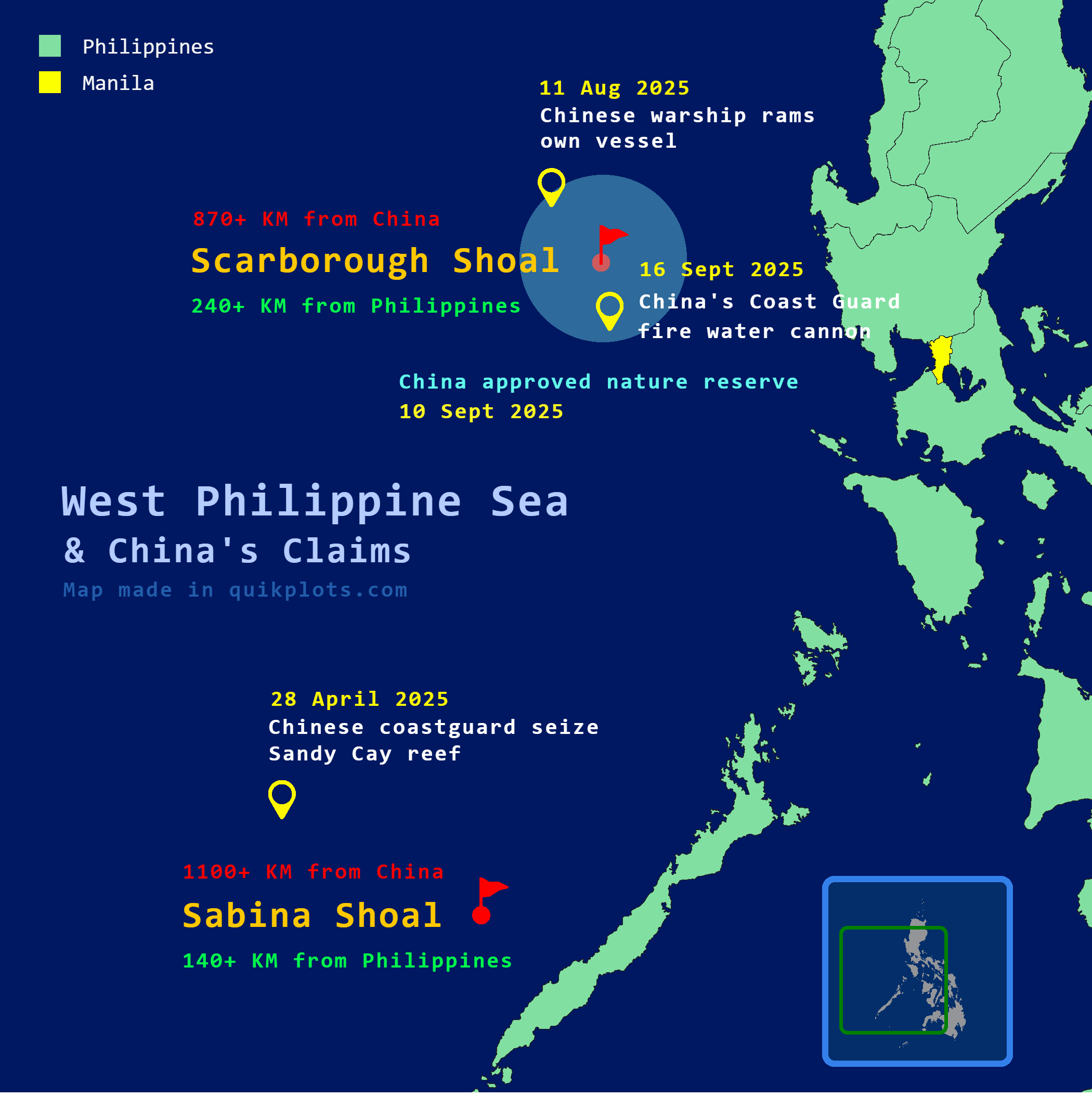
West Philippine Sea and China's Claims Map
The visualization titled "West Philippine Sea 🇵🇭 and China's 🇨🇳 claims [Mapped]" provides a detailed representation ...